

⚠️ Hiking and scrambling are inherently dangerous activities. Please read my Disclaimer. ⚠️
Sitting at roughly the same elevation as nearby Mount Backus and Burmis Mountain, Blue Mountain is the local name for this foothill situated on the edge of the Crowsnest Pass and the Castle Wilderness. I flagged it on the map a number of years ago, but had always assumed that it sat on private land. While researching my route up Burmis Mountain a couple of weeks ago, I discovered that Blue Mountain also sat on leased public land. After pulling the leaseholder information from the Government of Alberta, Environment and Parks, Recreational Access Internet Mapping Tool, I noticed that the conditions for foot access appeared to indicate that prior contact with the leaseholder was not required. Just to be sure, I phoned the leaseholder who confirmed this.
As the mountain does not have an official name, I was initially thinking of calling it “Screwdriver Mountain” after nearby Screwdriver Creek, but on a hunch, I asked the leaseholder if he knew of a local name. He said that the area ranchers call it, “Blue Mountain”, but he wasn’t sure why, other than to speculate that it might have something to do with the number of blue spruce found on its slopes. However, he volunteered to check with the other ranchers for his own curiosity and then get back to me. I’ll add this information when I get it.
To be honest, Blue Mountain surprised me. I knew it would be a quick mid-winter hike/snowshoe, but I was not expecting to find myself enjoying a narrow ridge walk or standing on a perky little summit. To add to my day, the weather was absolutely perfect – with no wind, blue skies, and temperatures around 0c. At the risk of sounding like a broken record, I love these little bumps in the winter!

To get to Blue Mountain, I drove west from Pincher Creek on Highway 507 to the hamlet of Beaver Mines. At the T-intersection on the edge of town, I turned right (north) and continued on Highway 507 for ~1.1km until I came to Township Road 6-2A. I then turned left (west) and followed the gravel road for ~2.8km until I came to a side road on the right that led to a Shell gas well. I drove ~70m up this road and parked on the side in front of a cutline. This was my starting point.
The cutline demarcates private land and leased public land. All the land to the north of the cutline is leased public land and the leaseholder does not require contact prior to access if you are on foot. Nevertheless, this land is the livelihood of the leaseholder and so a high level of respect is required. A barbed wire fence runs up the middle of the cutline and I stayed on the north side of it until I reached the SE ridge. From here, I followed what turned out to be a fun walk along the ridge until I came to where it intersects with the south ridge. The summit lies ~400m to the north. I returned the same way.
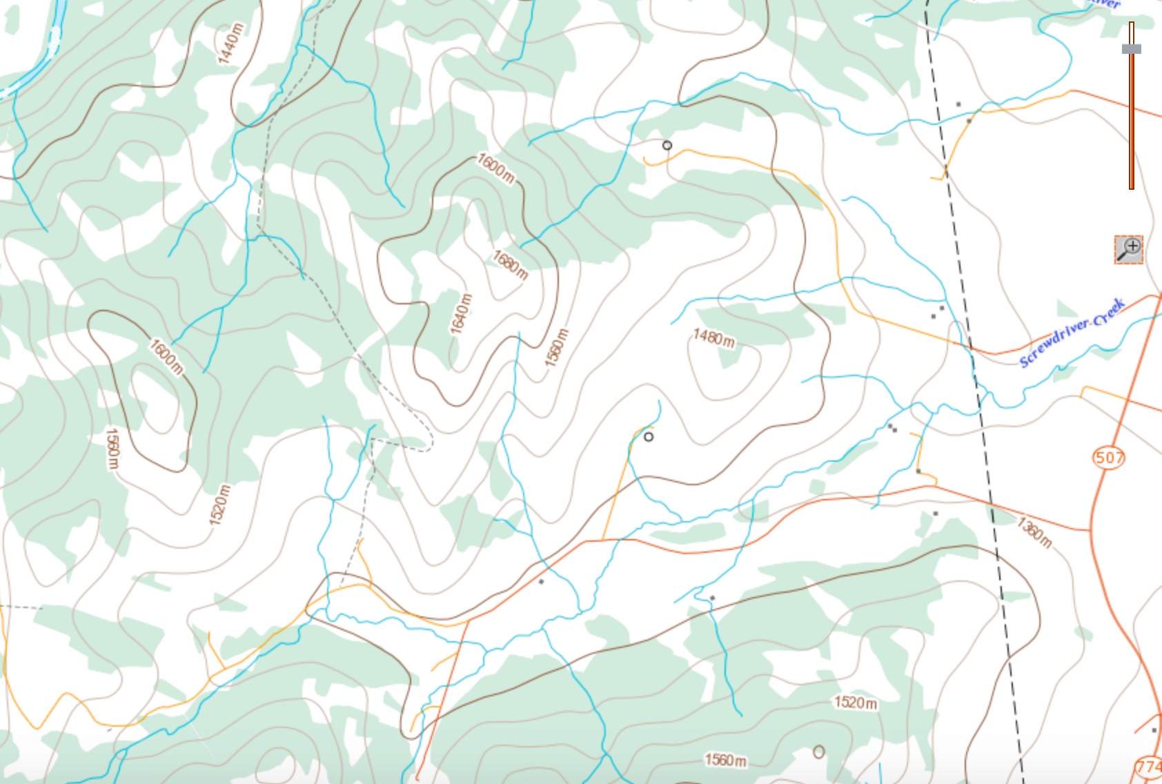
Blue Mountain is almost identical in height to nearby Burmis Mountain and Mount Backus. The smaller hill immediately to the west of Blue Mountain could make for a secondary objective as part of a loop if you drove further down Township Road 6-2A. However, ~900m past my starting point, Fish & Wildlife maintains a seasonal closure on the road, so a loop is perhaps best done in the spring unless you want to add on an extra ~1km, which when I think about it, isn’t that big of a deal.

From my 4Runner to the summit it was a quick ~2.3km. In total, this trip came in at ~4.9km with a total time of 2 hours and 20 minutes. The elevation gain to the summit was 341m.

Blue Mountain shortly after turning onto Township Road 6-2A. The summit is on the far right. Trust me, it looks a little more impressive if you view it from the north and the west…

The view from a little further down the road. The cutline that I used to gain the southeast ridge is on the far left. I had expected this to be a snowshoe, but by this point I could see that it would end up being a quick hike. In fact, it looked like it would be super easy.

The land to the north (right) of the fence is leased public land. The land to the south is private.

The only fence that I had to cross was next to the road, but thanks to the snow drifts, I could easily step over it. I only needed to use my snowshoes for the first part of the trip.

Looking down the cutline after snowshoeing to the crest of the ridge.

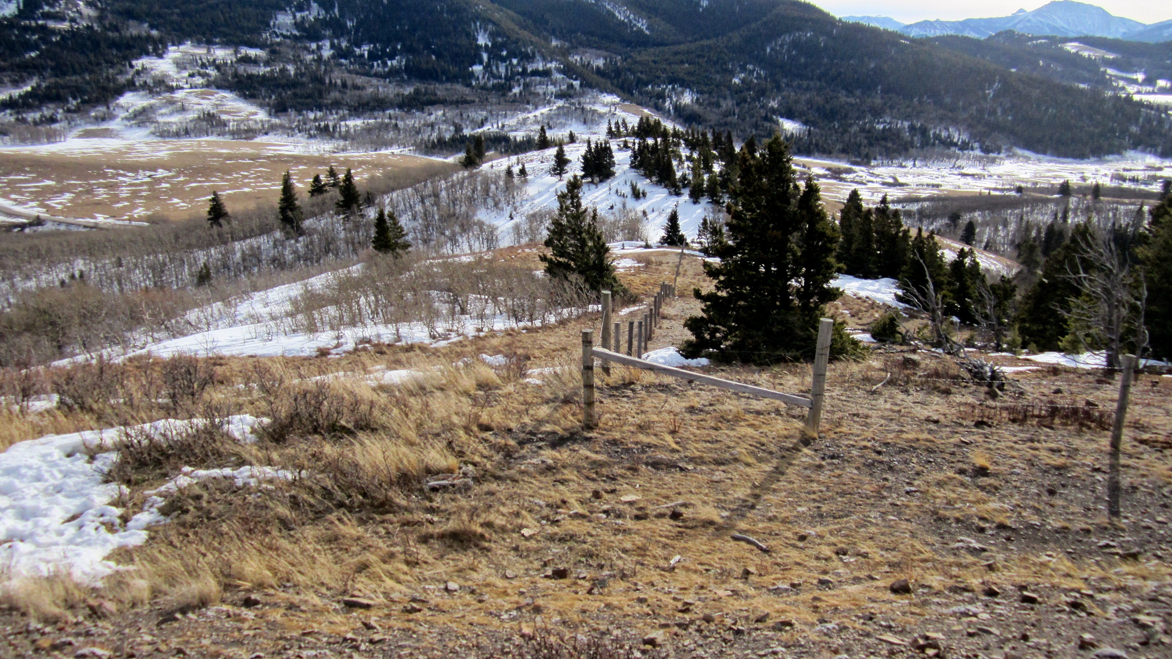
A fence follows the ridge crest for ~300m but there is no need to cross it.

The south ridge is on the left and the southeast ridge is on the right. They intersect at the bump just to the right of centre.

A cool little cliff face on the east side of the south ridge.

I was not expecting the southeast ridge to be such an enjoyable little ridge walk!
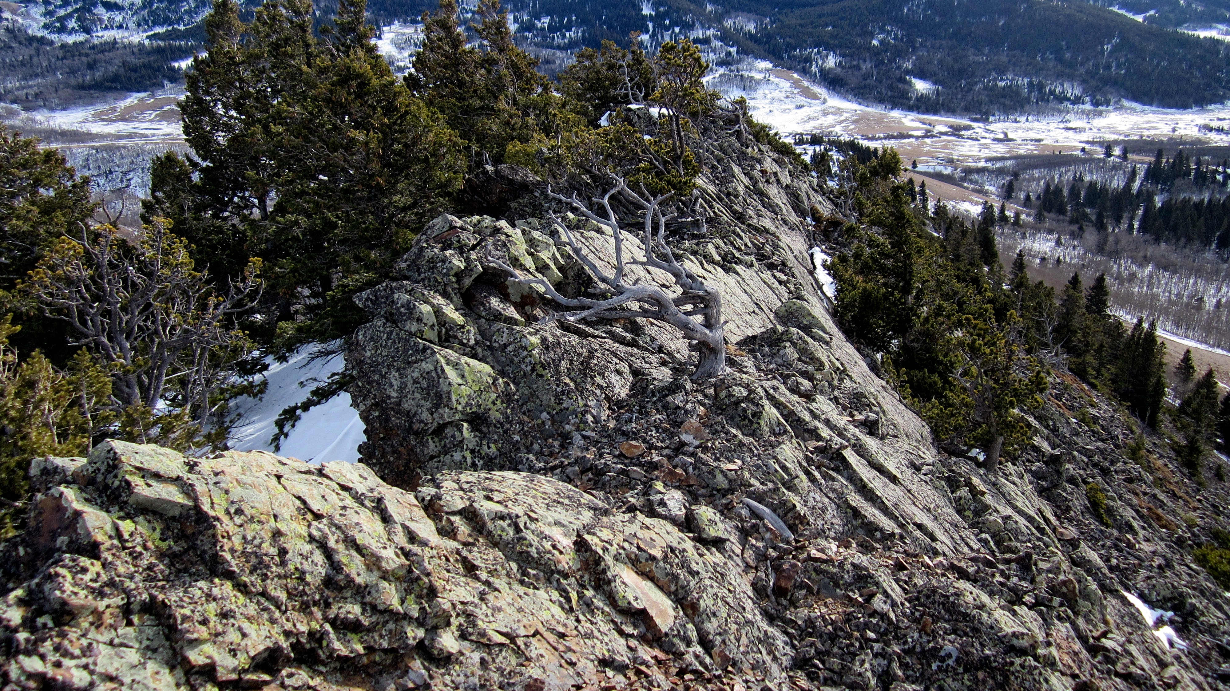
Looking back down the ridge. Once you are on it, you really don’t have much of a choice but to stick to the crest. This might be trickier when the rocks are wet.

The narrow ridge continues all the way to the top.
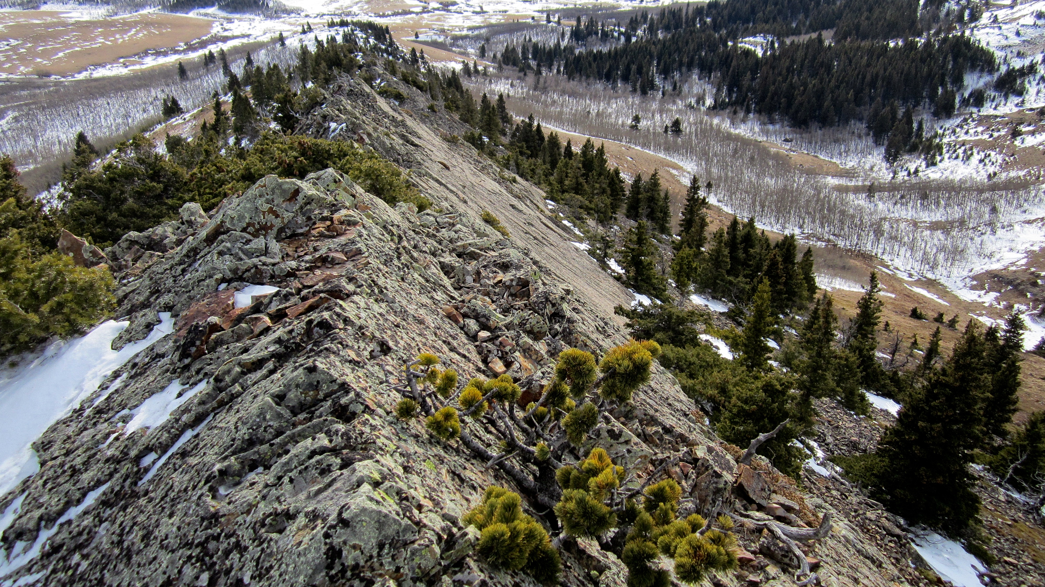
Another look back. In total, there is ~900m of ridge walking fun along the southeast ridge. I never would have guessed this by looking at it from the road!
Near the top of the ridge the views begin to appear.

The upper section of the southeast ridge.
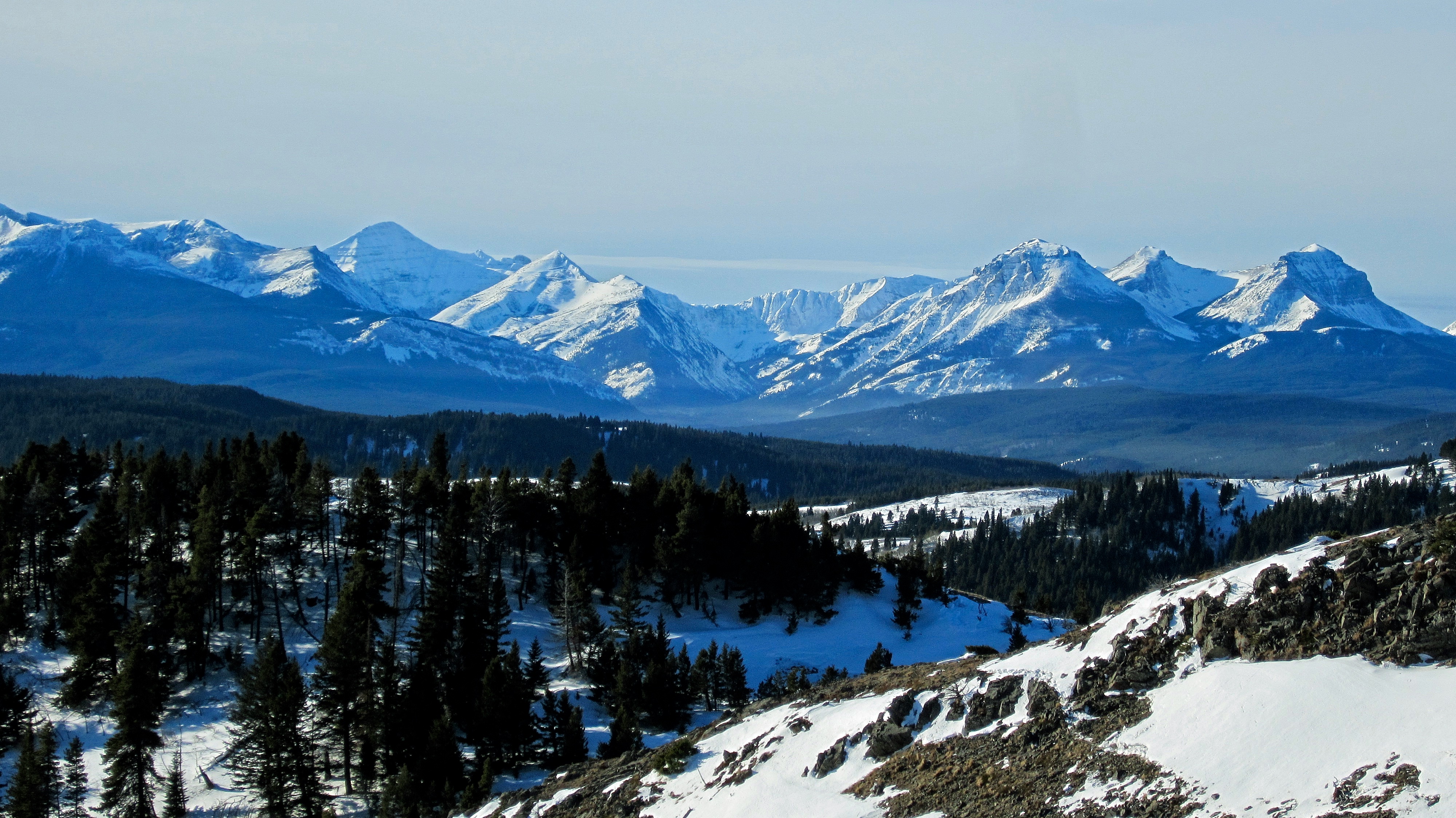
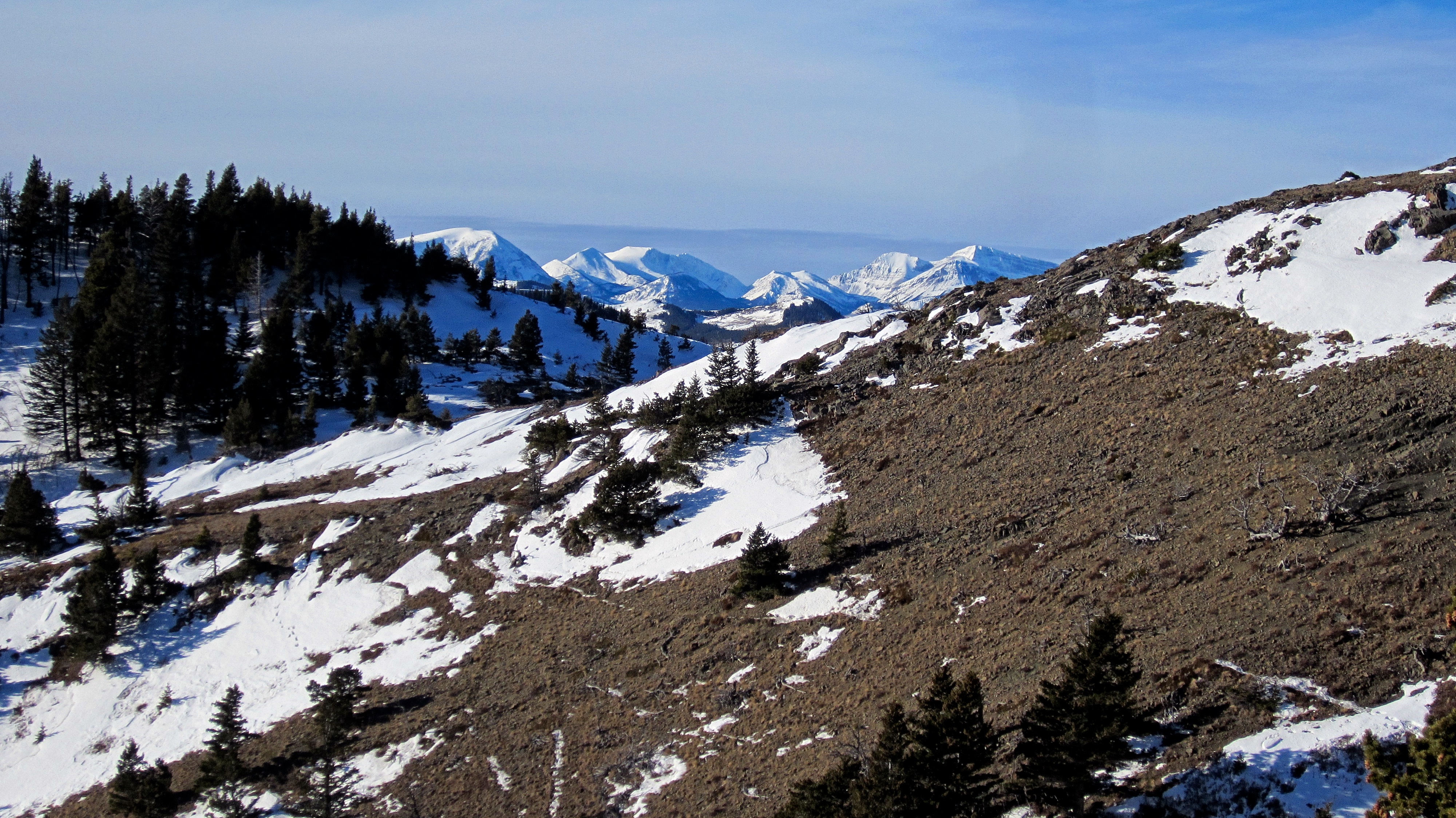
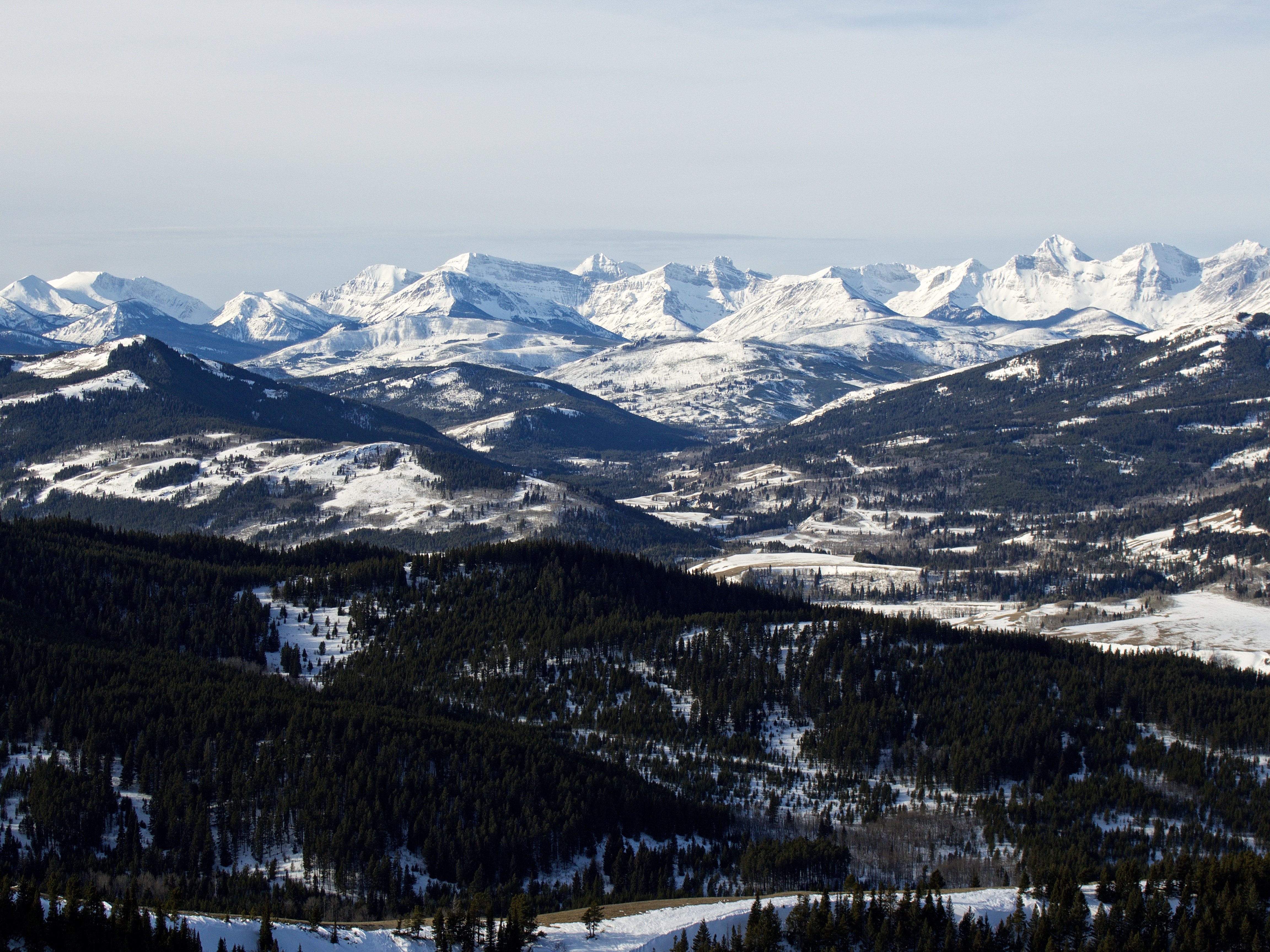
The view to the southwest from near the top of the ridge. From left to right: Mount Haig, Gravenstafel Ridge, and Syncline Mountain.

The summit sits ~400m from the upper portion of the ridge. I was pleasantly surprised to see that it had some character.

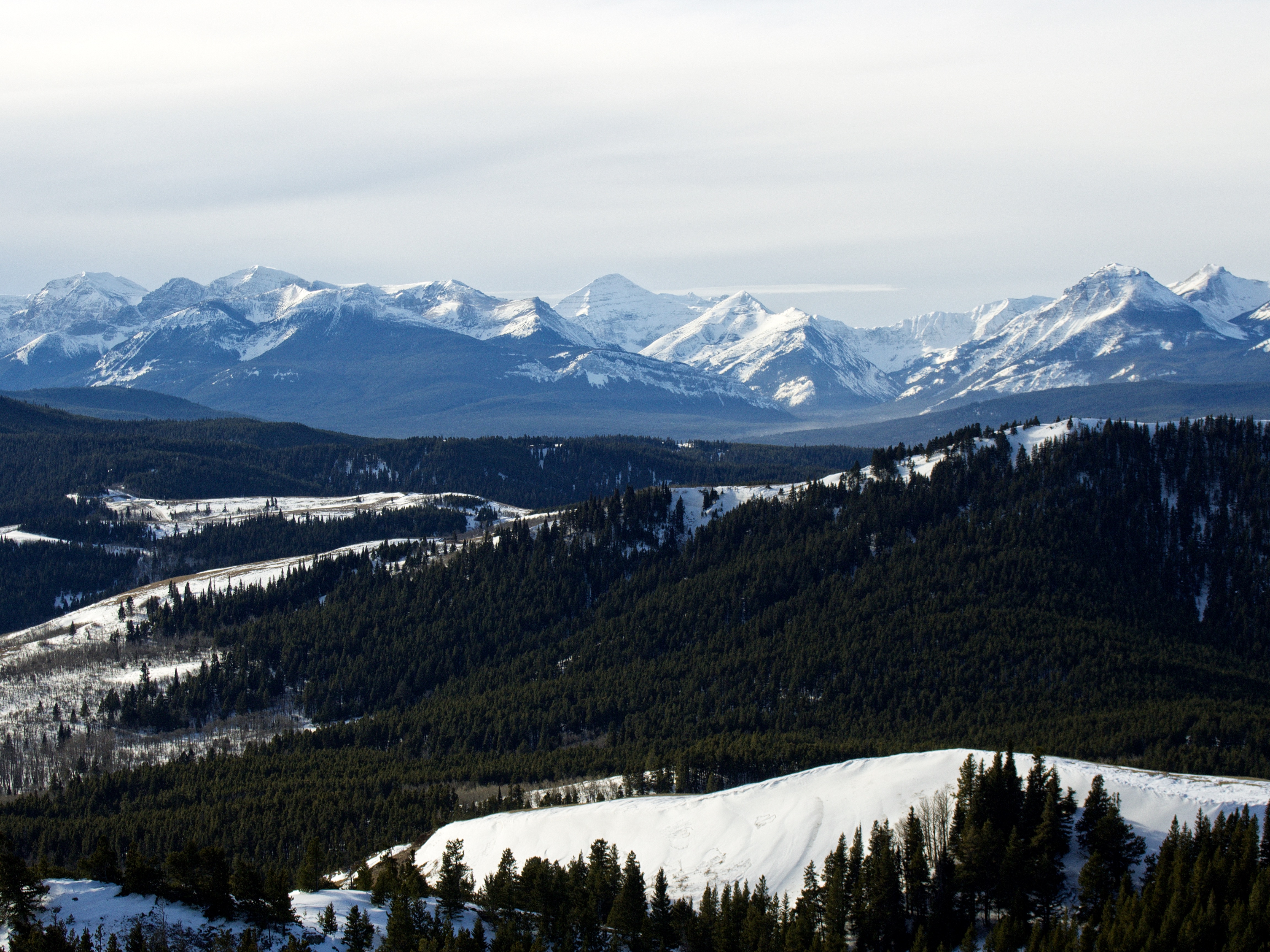
The view slightly to the northwest from the upper section of the ridge. Burmis Mountain is in the foreground centre. On the left, a fire creates a dark haze over Bluff Mountain.

Crowsnest Mountain rises above the smoke on the left. In the distant centre is Racehorse Mountain.

To reach the summit, I had to hike over to where the southeast ridge joins the south ridge.

Almost at the summit, though there was still some rock hopping left to do.

To my surprise, the summit of Blue Mountain (1715m my GPS) was quite perky.

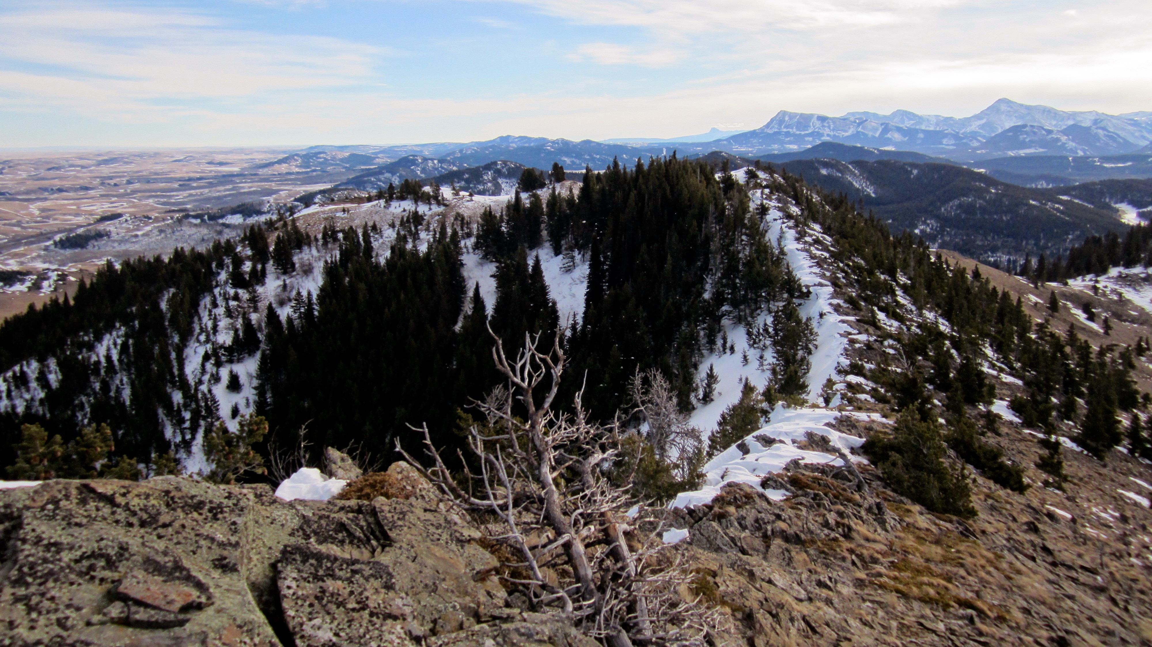
A pano to the south from the summit. The summit itself is part of a narrow ridge.

A pano to the southwest.

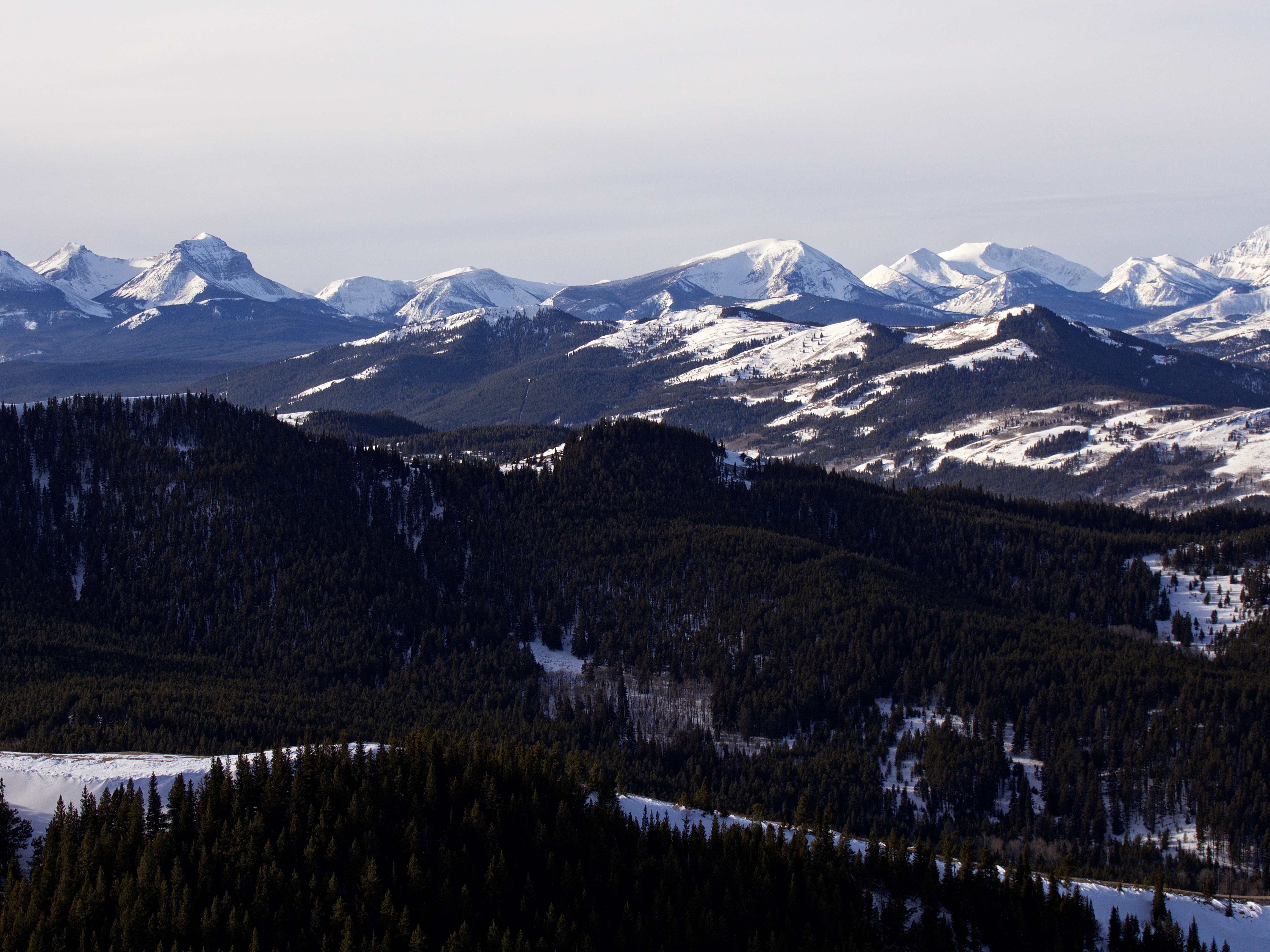
A pano to the west.

A pano to the northwest.

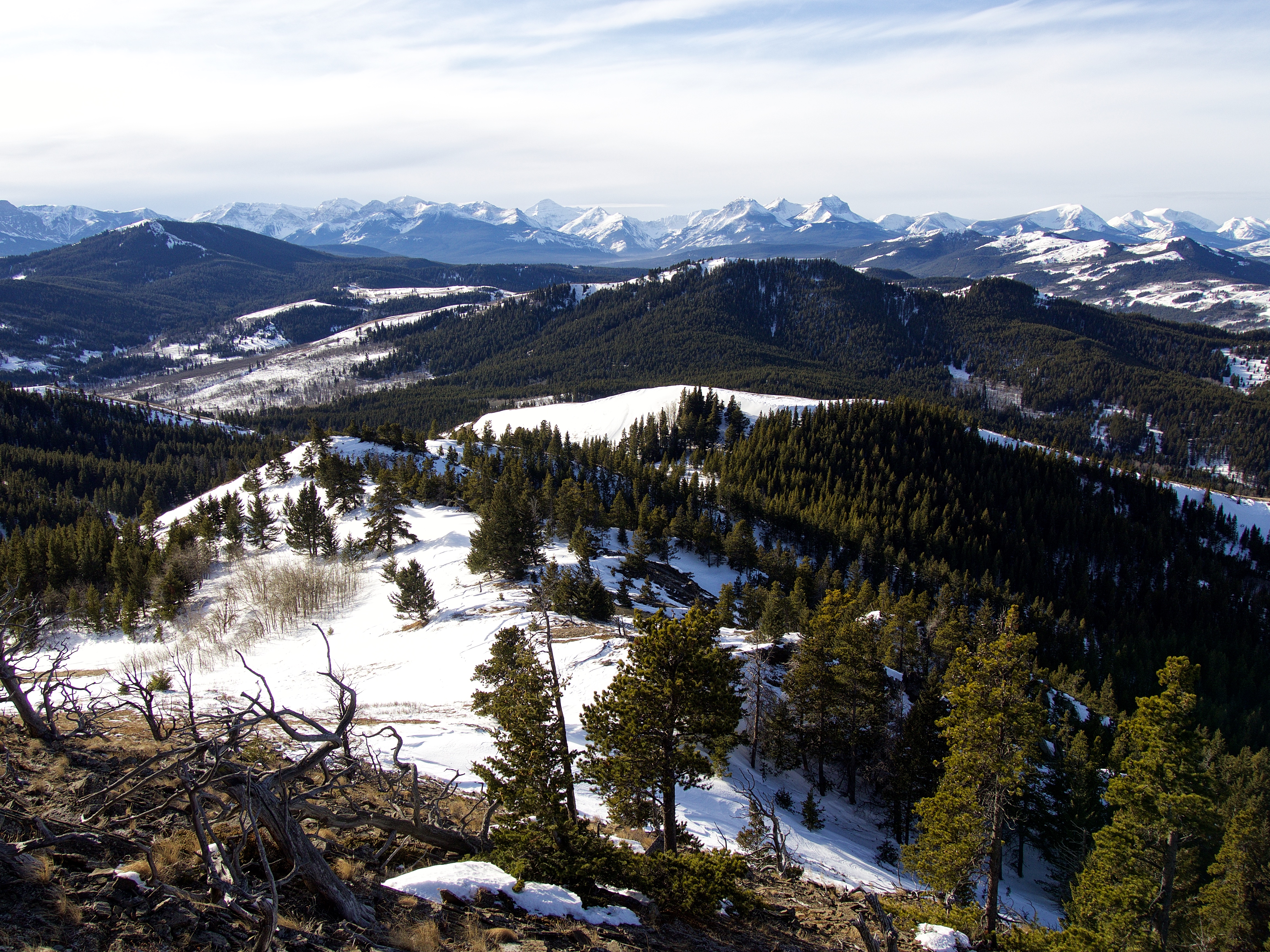
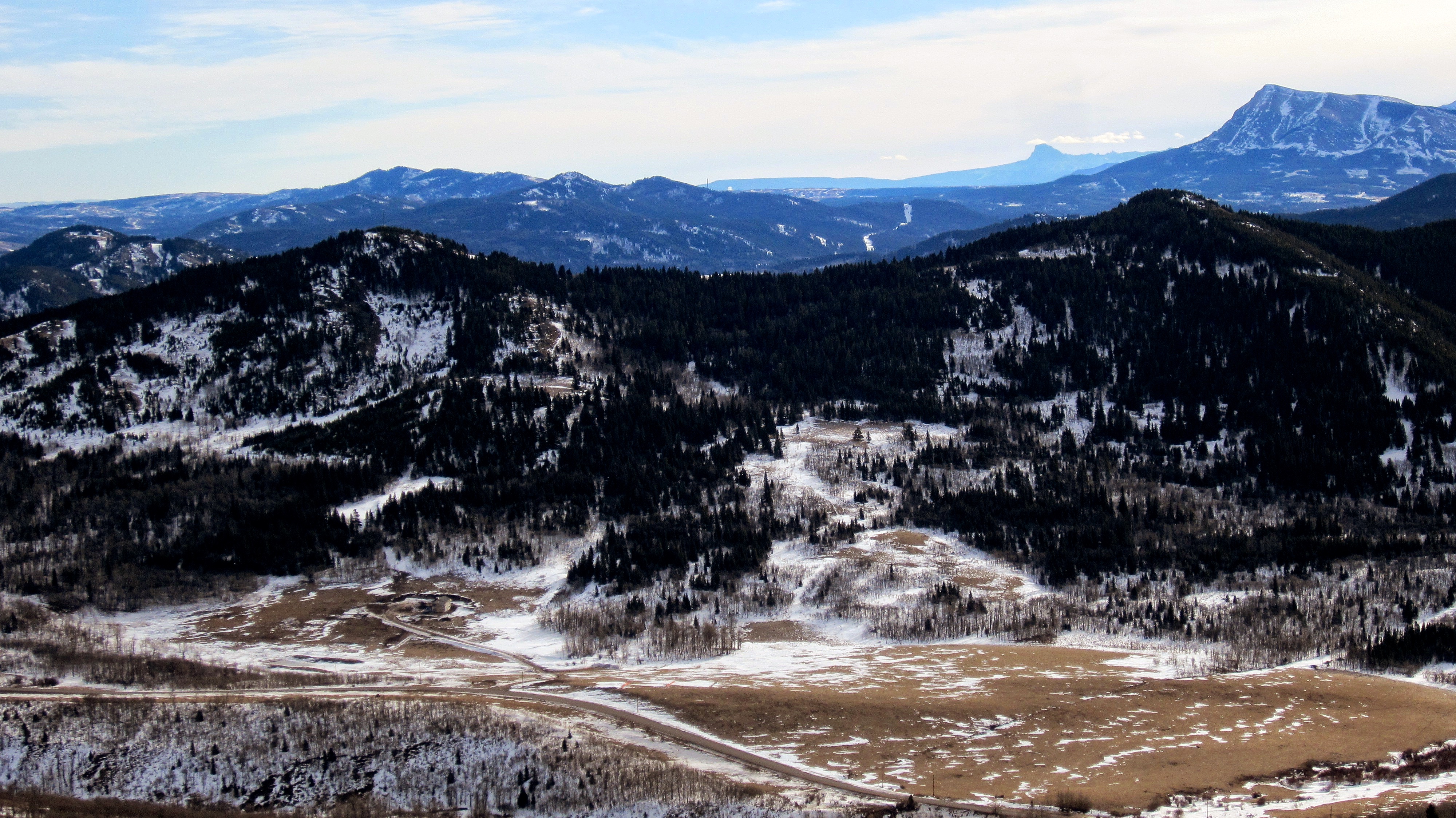
A pano to the north.

A pano to the east.
To the west of Blue Mountain sits a slightly smaller hill that I nicknamed, “Screwdriver Ridge”. It would be possible to connect both destinations as a loop via some bushwhacking, cutlines, and a few trails. To do this, I would approach Blue Mountain from the southwest along a cutline that starts just before reaching a cattle guard on Township Rd 6-2A (a further ~1.7km from where I started today). I would follow this cutline to the south ridge and then to the summit of Blue Mountain. I would then descend the gully on the left side of the picture above to reach another cutline that runs almost to the summit of “Screwdriver Ridge”. From the summit I would follow the ridge south until I intersected a trail just prior to the southern boundary of the leased land. I would then follow this trail all the way back to my vehicle. All of this could be done as a snowshoe, but a seasonal road closure on 6-2A would mean adding on an extra ~1km from the gate to the original cutline. Edit 30 May 2020: I returned today and completed a loop that incorporated “Screwdriver Ridge” – it was well worth my time, though I did not use the route outlined above.

The view south. From left to right: Ninastako (Chief Mountain), Prairie Bluff Mountain, Drywood Mountain, Pincher Ridge, Victoria Peak, and Victoria Ridge.

Mount Gladstone (left) and Table Mountain. The summit of Windsor Mountain can be seen just to the left of Gladstone.
From left to right: Barnaby Ridge, Southfork Mountain, Mount Haig, Gravenstafel Ridge, and Syncline Mountain.
Looking southwest at Mount McCarty, Hollebeke Mountain, and Carbondale Hill.
Centre Mountain and Mount Darrah are the prominent peaks in this section of the Flathead Range. Little Cherry Hill sits in the foreground centre, while Centre E3, Centre SE1, and “South Flathead Peak” are all on the left.

Looking west at Maverick Hill, Clubs Peak, and Poker Peak. In the foreground is tiny Ginger Hill and behind it, Mount Pengelly and Mount McGladrey.

Mount McGladrey is on the far left and Mount Coulthard is on the right. In the foreground is Spades Peak on Hastings Ridge.

Hillcrest Mountain and Turtle Mountain with Byron Hill in the foreground. In the distant centre is Mount Tecumseh.

Looking north at Bluff Mountain, “The Dog”, Morin Peak, South Peak, and Centre Peak. In the foreground is Burmis Mountain.

I hiked down the narrow summit ridge to the north end of the mountain. This is the view looking back towards the summit as I carefully picked my way along the ridge.

Mount Backus and behind it, the old Whistler Fire Lookout.

I didn’t find a cairn, so I took it upon myself to build one while I enjoyed the beautiful weather and scenery. I named it Steve.

Looking back at my mighty cairn as I leave the summit.
I would retrace my steps all the way back.

The southeast ridge that I used to ascend doesn’t look like much from this angle.

The small fence that ran from the top of the southeast ridge to the top of the south ridge was attached directly to the rock with an anchor.
Looking southeast at Mount Baldy, Mount Albert, Piney Point, and the Christie Mine Ridge.
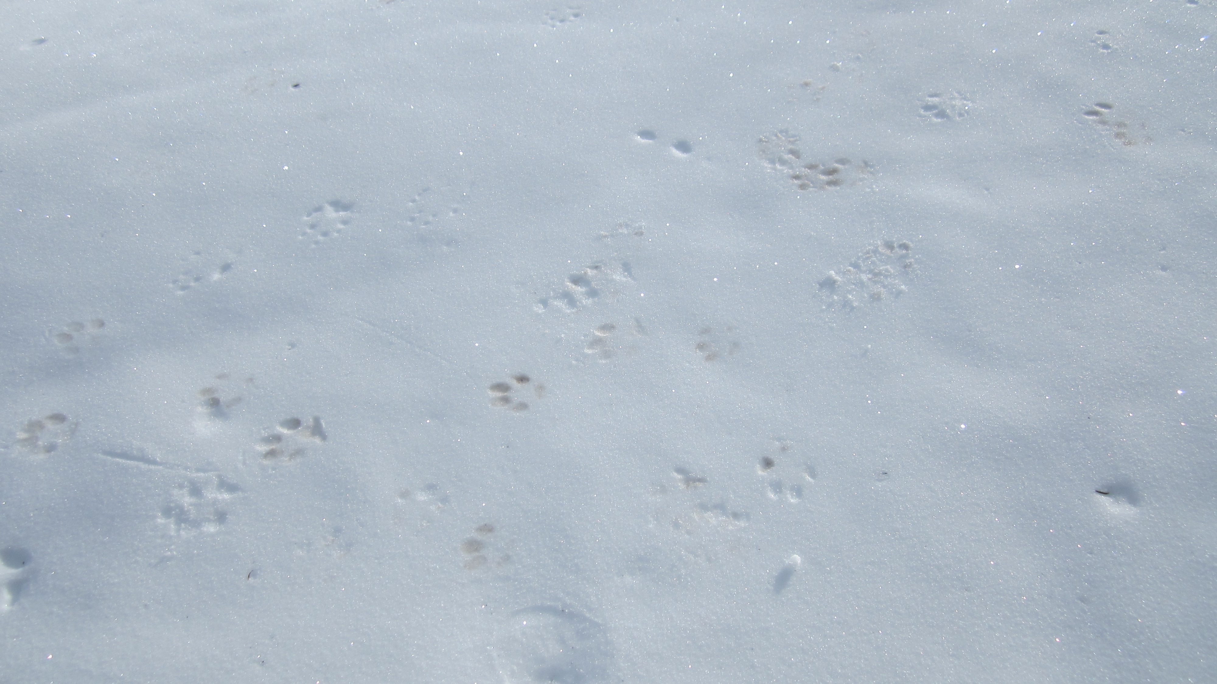
Someone didn’t wipe their paws…
The only fence that I had to cross was at the start. I would stay to the east of the fence along the lower section of the southeast ridge.

Arriving back at my 4Runner after a speedy 2 hours and 20 minutes over a total distance of 4.9km. If you are looking for a very quick, but interesting hike to do in the Beaver Mines area, this is definitely one to consider.


Leave a Reply