
⚠️ Hiking and scrambling are inherently dangerous activities. Please read my Disclaimer. ⚠️
I doubt “Kesler Lake Peak” (KLP) would pass even a basic cost-benefit analysis when it comes to trip planning. Located at the far end of “Rogan Peak’s” north ridge, it is debatable if KLP is even a legit destination, given its diminutive and unremarkable stature. In fact, the investment required to reach it is massively disproportional to what you receive in return. However, if you’re someone who appreciates the obscure and wants to explore a seldom visited corner of Waterton National Park, KLP offers an interesting value proposition.
Andrew, Brad, and I first noticed KLP (or “Horseshoe Hill” as we initially called it) when we were descending Rogan back in March. It stood out enough for the three of us to begin discussing an exploratory trip. A few weeks later, we were able to scope it out again, this time from the summit ridge of “Cloudy Junior”– determining (at least in our minds) that it was enough of its own entity to warrant a visit.
Perhaps most intriguing was the thought of utilizing the northernmost branch of the Horseshoe Basin trail on approach. Though we’d travelled the southern half on multiple occasions, we’d never completed the entire 20.8 km loop. Knowing that this section of trail sees few visitors made KLP seem worthwhile, even if it were just to say that we’d completed the loop. Getting a chance to check out tiny Kesler Lake – which sits half inside the Park and half on private land – was also a carrot.
As it was Andrew’s turn to pick the day’s destination, KLP was the obvious choice and though Brad was unable to come, we were delighted to be joined by Sonny Bou and Zosia Zgolak, who graciously endured our repeated ‘upselling’ of KLP. In fact, I felt a bit like a used car salesman as I tried to project my own enthusiasm onto unsuspecting victims, especially after the approach was much longer than anticipated.
Fortunately, Sonny and Zosia were fantastic sports and when we finally arrived at KLP, we opted for the challenge of the northeast slope where we treated to some scrambling and some extremely colourful rock. After enjoying lunch on the summit, we continued along the ridge with the goal of reaching the Lakeview / Rogan col and returning via the southern half of the Horseshoe Basin trail.
However, after reaching the col, Sonny suggested tagging the summit of Lakeview and then following the south ridge back to the trail. This ended up being an excellent idea as we were able to add another summit onto the day and avoid a snow-covered section of trail. Finally, after 24 km and close to 10 hours, we completed the loop by arriving back at the trailhead and our vehicles.
I doubt most hikers will find KLP worth the time, but for those looking to explore an interesting area of Waterton, it may fit the bill. Personally, I’m grateful to have had the chance to spend the day with three, kind and wonderful people who share my passion for the mountains.
Be sure to read Andrew’s trip report [link coming] and Sonny’s trip report!

To get to KLP from Lethbridge, drive north from the Waterton Park gate on Highway 6 for ~2 km until you come to the Bison Paddock Road on your left. If it is closed, park off to the side (but on the pavement) and hike the ~1.4 km to the trailhead. If it isn’t closed, you’re already winning the day, so cheerfully drive and park at the trailhead.
From the trailhead, hike the first ~280 m to the junction of the north and south branches of the Horseshoe Basin trail. Keep to the right to stay on the north branch. Approximately ~800 m from the junction, you will come to an unbridged creek crossing and shortly afterwards, another junction where you will keep to the right to stay on the north branch.
The trail is easy to follow as it parallels the perimeter fence of Waterton for most of the way. Approximately ~5.6 km from the trailhead, the trail reaches the northern Park boundary and makes a sharp turn to the west. Another ~2.6 km of hiking (~8.2 km from the trailhead) will bring you to the point where the trail diverges from the boundary fence as it begins to head towards Lakeview Ridge.
Getting to KLP required us to leave the trail at this point and continue following the fence. However, things soon turned to muskeg and had it not been frozen, it would not have been pleasant. I would recommend staying on the trail to avoid this and then cutting back to the fence once you reach the flats.
The base of KLP sits ~10 km from the trailhead (~340 m of total elevation gains to this point) and the mountain itself can be tackled in numerous ways. We chose to explore the northeast face to check out the exposed rock and maintain our views of Kesler Lake. Using this route was steep but enjoyable with a ~345 m elevation gain to the first of its twin summits.
From the summit, we then followed the ridge for ~4.3 km towards the Lakeview / Rogan col, side-sloping where we could to avoid unnecessary elevation gains. This also involved a ~83 m loss to the low point on the ridge which serves to demarcate KLP as its own entity at the end of the ridge.
After reaching the col, it was a ~155 m elevation gain over ~750 m to reach the summit of Lakeview Ridge. We then followed the south ridge for ~2.2 km until we reached the end, where we descended to the creek (~274 m elevation loss) and crossed it before regaining ~50 m of elevation on the other side to reach the trail. Once on the trail, it was a ~3.1 km hike back to the trailhead and our vehicles.

Our total distance travelled was 24 km with total elevations gains of 1316 m. Our total roundtrip time was 9 hours and 56 minutes.

The road to the trailhead is now open! Unlike our earlier trips to the area, we could now avoid adding an extra ~1.4 km onto the day.

The junction of the north and south branches of the Horseshoe Basin trail where we will keep to the right to take the north route. The east summit of Lakeview Ridge is in the background.

Looking back towards Vimy Peak (centre) and Sofa Mountain (left) as we follow the easy trail.

Approximately 800 m from the junction, we came to an unbridged creek crossing. (Photo by Andrew Nugara)

Shortly after crossing the creek, we came to another junction (not pictured) where we kept to the right. The trail soon rejoins its parallel path alongs the Park boundary.

The colourful east summit of Lakeview Ridge.

Let’s play, ‘Spot the Grouse’!

Passing by Horseshoe (Burton) Lake.

The area around the lake is protected by the Nature Conservacy of Canada.

Approximately 5.6 km from the trailhead, the trail (and the Park boundary) make an abrupt turn to the west. Zosia and Andrew lead the way as the distance to our objective looks WAAAY longer than I had anticipated. 😳

Sonny checks out the north summit of Lakeview Ridge.

Gazing back along the trail as we gain some elevation.

Finally getting our first look at KLP (foreground) and noting that it is absolutely dwarfed by “Cloudy Junior”.

Approximately 2.6 km (~8.2 km from the trailhead) from where the trail turned west, it begins to veer towards Lakeview Ridge (far left) while the boundary cutline continues straight ahead.

Andrew goes old school as he utilizes a paper map (which you should always carry as a backup).

Instead of following the trail, we remained on the cutline. However, the area soon turned to muskeg and had it not been frozen, it would’ve been messy. I’d recommend staying on the trail for a bit longer.

Crossing a small stream inside the muskeg. (Photo by Andrew Nugara)

Thankfully the snow was firm enough to walk on. (Photo by Andrew Nugara)

Arriving at some cool flats just prior to KLP (right).

A closer look at “Rogan Peak” from the flats. If you were to remain on the trail, it would ascend the small ridge in the foreground and connect with Lakeview / Rogan col on the far left.

Mount Dungarvan is definitely on my list for 2021. Edit: done! 😊

Drawing closer to the base of KLP. We would ascend the northeast slope (right) solely to check out the exposed rock and Kesler Lake.

Zosia displays some ‘backbone’. 😂

Starting up the northeast side of KLP. The cutline on the left was our approach route.

I thought this prominent formation looked like Starbuck from the original Battlestar Galatica series. Can you see his face looking out and across the landscape from his helmet? Humour me by nodding in agreement… 😂

Our first good look at Kesler Lake which is half in Waterton and half on private land.

Andrew scrambles a short section of rock. The rest of us avoided this by sticking to climber’s left.

Getting closer to Starbuck, but not seeing a drive thru… 😂

Like most celebrities, Starbuck is quite different when you meet him in person.

Zosia with the north summit of Lakeview behind her.

Sonny navigates the steep terrain.

Posing on top of Starbuck. The toy vipers and Cylon ships from the original BSG series were awesome and could shoot spring-loaded plastic missiles across a room. (Photo by Andrew Nugara)

Arriving at some interesting and colourful rock near the summit.

The group follows close behind.

This colourful formation was the crown jewel of the trip.

A closer look at those amazing Waterton / Castle colours!

Looking up at the argillite overhang. Too bad the sun wasn’t at a better angle!

Colourful layers on the same formation…

Followed by even more layers. This type of discovery always transports me into a state of wonder and awe. We live in such a cool place!

Sonny gazes down at Kesler Lake.

One more look at the colourful rock formation.

While Sonny and Zosia went to climber’s left of the formation, Andrew and I continued to climber’s right.

More interesting terrain.

The final cliff band beneath the summit.

My turn to scramble up… (Photo by Andrew Nugara)

Followed by Sonny. (Photo by Andrew Nugara)

Zosia is the first to reach the summit…

And this is her view back… (Photo by Zosia Zgolak)

Sonny and Andrew follow close behind me.

The twin summits of KLP. As far as I can tell, both are ~1849 m in height, though Sonny suspects the second (left) may be slightly higher.

A pano to the west. KLP definitely offers some immersive views.

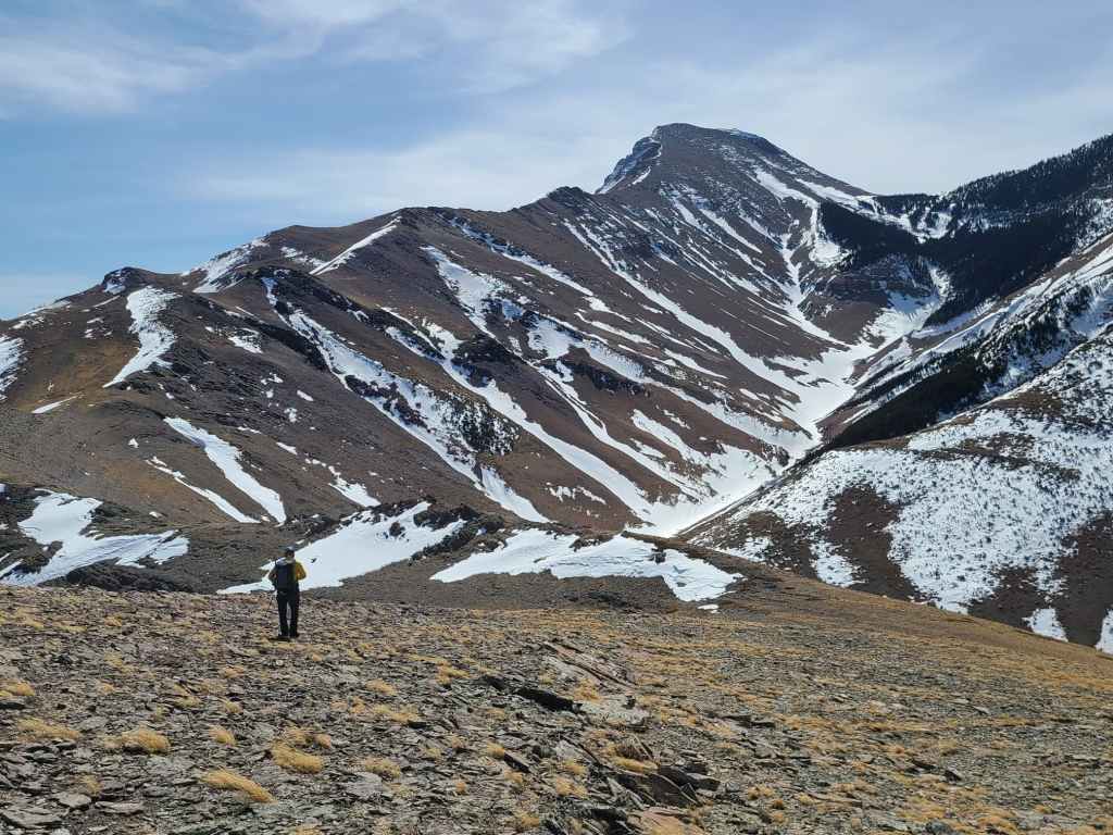
A closer look at “Rogan Peak”.

Could there be a route up the northeast face Mount Dungarvan? I know of some Lethbridge peeps who have probably done it..

A telephoto of “Cloudy Junior” with Cloudy Ridge behind it to the left.

Gazing to the northwest at Mount Yarrow and Spread Eagle Mountain.
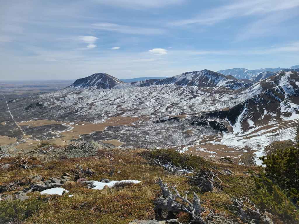
The view east shows the interesting flats between KLP and Lakeview Ridge.

A closer look at Lakeview’s north summit.

A telephoto of the summit of Lakeview – which is our next destination for the day.

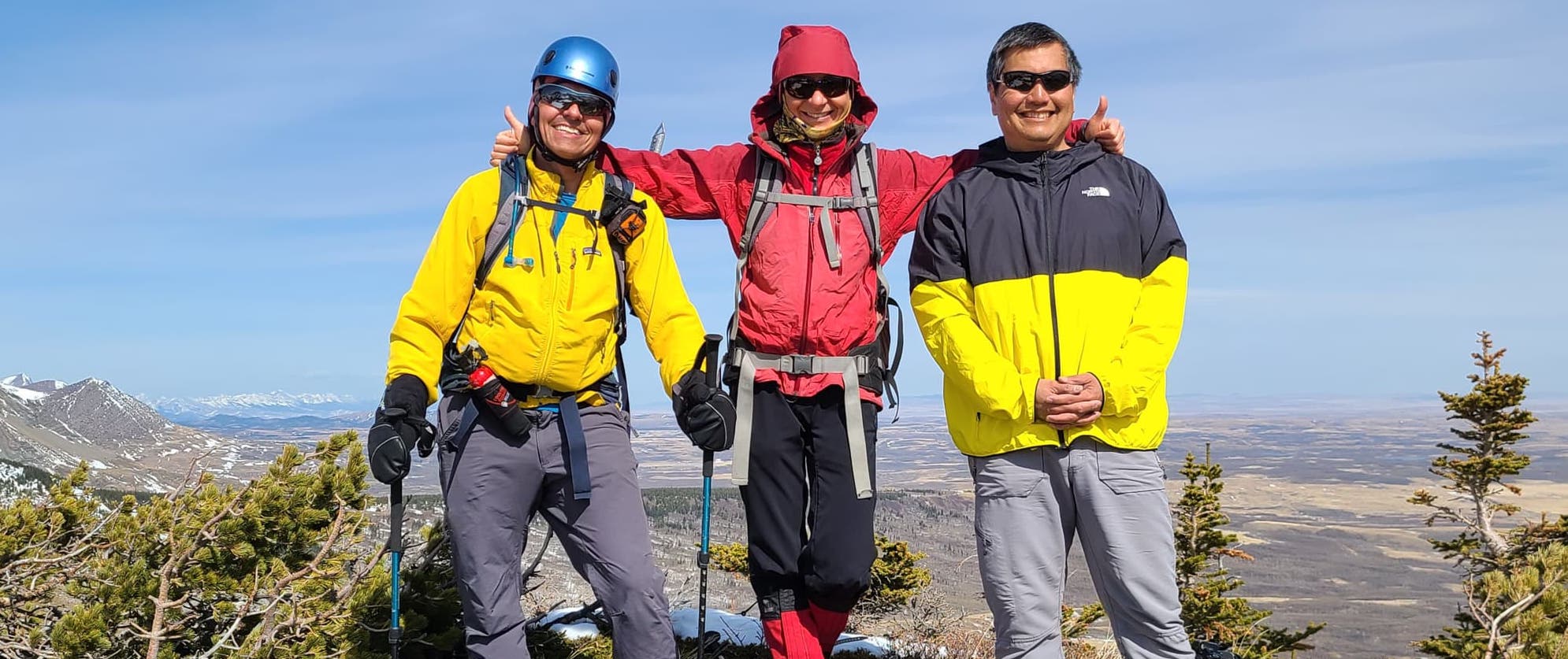
Andrew, Zosia, and Sonny on the summit.

And a full group shot courtesy of Sonny!

A special salute to Mark “Fireball” Klassen and our recent trip to “Cloudy Junior”. Note that I’m now down to my last pair of sunglasses after losing two pairs already this year. These are my Oscar Goldman specials. 😂 (Photo by Andrew Nugara)

I didn’t see a cairn so I made one and named it, ‘Dirk’, after Dirk Benedict who played Starbuck in the original Battlestar Galatica series.

Andrew heads toward KLP’s twin summit.

A neat snow bowl beneath Cloudy Ridge.

The view back to the first summit from the twin.

A pano to the northwest from the twin. The valley between Dungarvan and KLP is interesting and appears to have a trail running through it.

A pano to the south as Zosia heads toward the next high point. (Photo by Andrew Nugara)

I scrambled this high point head-on, but you can easily avoid it by sticking to climber’s left. (Photo by Andrew Nugara)

Sonny and Andrew tackle the same high point. (Photo by Andrew Nugara)

My view of Sonny and Andrew descending the high point.

A super cool strip of vertical argillite.

A closer look at the vertical layers. It looked like a miniature model of a mountain range – or Tiny Town from Arrested Development. 😂

Andrew does his best Arrested Development ‘Mole Monster’ impersonation as he wanders through Tiny Town. 😂

Still more views of the vertical formations. This is definitely not the place to trip and fall… 😳

The view back to the twin summits of KLP.

Yet another interesting rock formation along the ridge.

One more look at the vertical formations.

Zosia finds another casualty of winter.
Andrew leads us onto the ~83 m elevation loss to the col that demarcates KLP from the rest of the ridge. Click to continue on towards Lakeview Ridge.


Leave a Reply