⚠️ Hiking and scrambling are inherently dangerous activities. Please read my Disclaimer. ⚠️
After a long approach to the summit of “Kesler Lake Peak” (KLP), we decided to return by following the ridge south and then east towards the Lakeview / “Rogan Peak” col. Here, Sonny suggested that we tag the summit of Lakeview Ridge and then follow its south ridge back to the trail. This ended up being an excellent idea as we were able to add another summit onto the day and avoid a snow-covered section of the Horseshoe Basin trail.
Though this would be my second time on the summit of Lakeview in four months, I was more than happy to try the traditional route from the col. Besides, this was Sonny’s first trip to Lakeview and I bet few have taken such a circuitous approach for their initial ascent. 😳 I should note, that I’m still in awe of Brad, who, during our descent off Rogan, made it from the col to the summit of Lakeview and then back again, in only 25 minutes. I tried to set a quick pace for myself, but there was no way that I could match his speed.
Finally, I’ll reiterate that for me, hiking is as much about companionship and the journey as it is about the summits. I find immense satisfaction whenever I see a colourful or unique rock formation, but this is made even more special when I’m surrounded by great company. So a huge thank you to Andrew, Sonny, and Zosia for a fabulous day of conversation and exploration!
Be sure to read Andrew’s trip report [link coming] and Sonny’s trip report!

To get to KLP from Lethbridge, drive north from the Waterton Park gate on Highway 6 for ~2 km until you come to the Bison Paddock Road on your left. If it is closed, park off to the side (but on the pavement) and hike the ~1.4 km to the trailhead. If it isn’t closed, you’re already winning the day, so cheerfully drive and park at the trailhead.
From the trailhead, hike the first ~280 m to the junction of the north and south branches of the Horseshoe Basin trail. Keep to the right to stay on the north branch. Approximately ~800 m from the junction, you will come to an unbridged creek crossing and shortly afterwards, another junction where you will keep to the right to stay on the north branch.
The trail is easy to follow as it parallels the perimeter fence of Waterton for most of the way. Approximately ~5.6 km from the trailhead, the trail reaches the northern Park boundary and makes a sharp turn to the west. Another ~2.6 km of hiking (~8.2 km from the trailhead) will bring you to the point where the trail diverges from the boundary fence as it begins to head towards Lakeview Ridge.
Getting to KLP required us to leave the trail at this point and continue following the fence. However, things soon turned to muskeg and had it not been frozen, it would not have been pleasant. I would recommend staying on the trail to avoid this and then cutting back to the fence once you reach the flats.
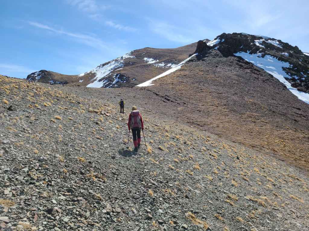
The base of KLP sits ~10 km from the trailhead (~340 m of total elevation gains to this point) and the mountain itself can be tackled in numerous ways. We chose to explore the northeast face to check out the exposed rock and maintain our views of Kesler Lake. Using this route was steep but enjoyable with a ~345 m elevation gain to the first of its twin summits.
From the summit, we then followed the ridge for ~4.3 km towards the Lakeview / Rogan col, side-sloping where we could to avoid unnecessary elevation gains. This also involved a ~83 m loss to the low point on the ridge which serves to demarcate KLP as its own entity at the end of the ridge.
After reaching the col, it was a ~155 m elevation gain over ~750 m to reach the summit of Lakeview Ridge. We then followed the south ridge for ~2.2 km until we reached the end, where we descended to the creek (~274 m elevation loss) and crossed it before regaining ~50 m of elevation on the other side to reach the trail. Once on the trail, it was a ~3.1 km hike back to the trailhead and our vehicles.

Our total distance travelled was 24 km with total elevations gains of 1316 m. Our total roundtrip time was 9 hours and 56 minutes.
Andrew leads us onto the ~83 m elevation loss to the col that demarcates KLP from the rest of the ridge. It would be a ~5 km ridgewalk from the summit of KLP to the summit of Lakeview.
Gazing back to the first of KLP’s twin summits (right) as we ascend the opposite side of the col.

Zosia’s perspective of the previous photo – except with an extrovert talker in the foreground. 😂 (Photo by Zosia Zgolak)

Nothing complicated, but it’s never fun to gain elevation so far into a trip.
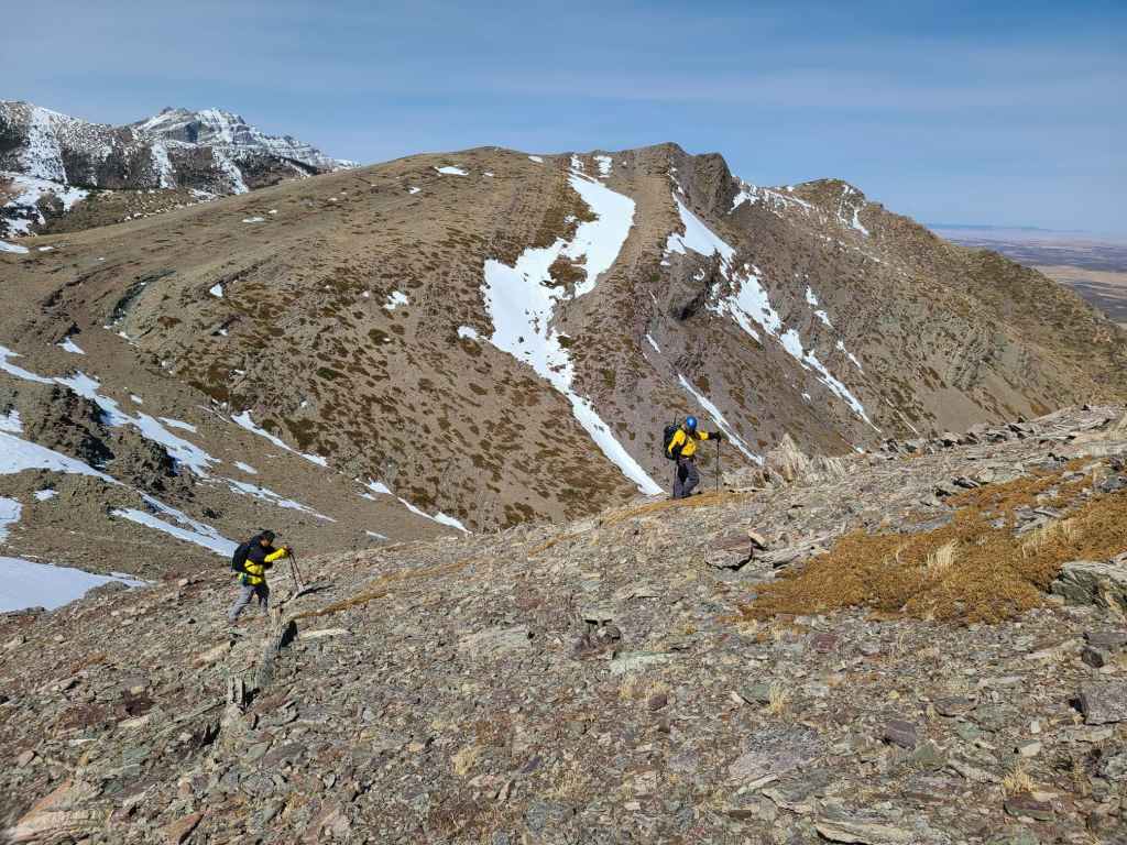
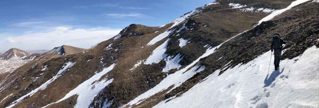
Following a goat trail onto a small col. We would side-slope the remainder of the high points to conserve energy.

Andrew checks out Lakeview Ridge from the top of a small formation inside the col; however, he should be looking at down at the rock…

Because it turned out to be full of fossils.

This was a great day for finding unique and interesting rocks. 😁

A great closeup by Zosia captures both a fossil and some colourful lichen. (Photo by Zosia Zgolak)
I lead the way as we head toward a series of goat trails. (Photo by Andrew Nugara)

My view back.

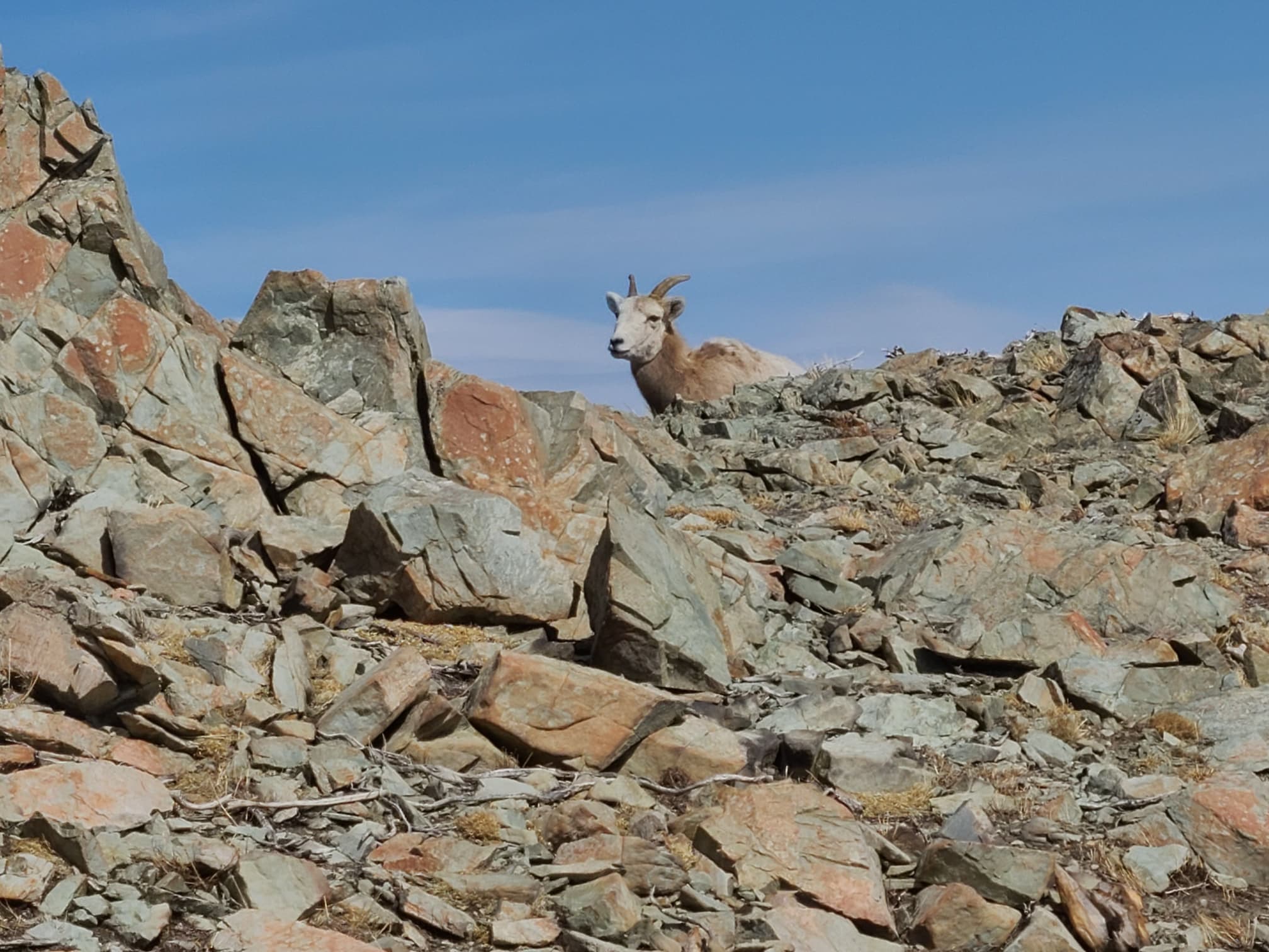
The sheep said, “Ewe’ve got to be kidding! Ewemans are baaaad and gross. We’ll move for ewe this one time only!” 😂

Now this would be an interesting glissade!

Almost at the end of the goat trail.
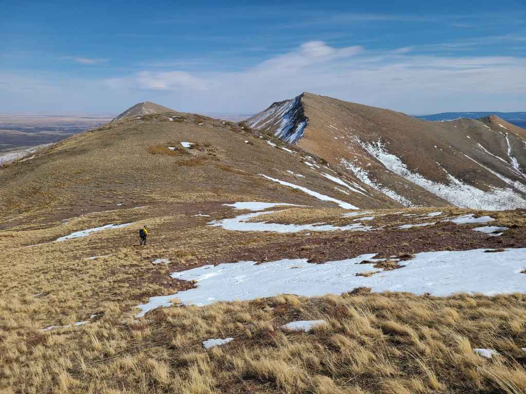
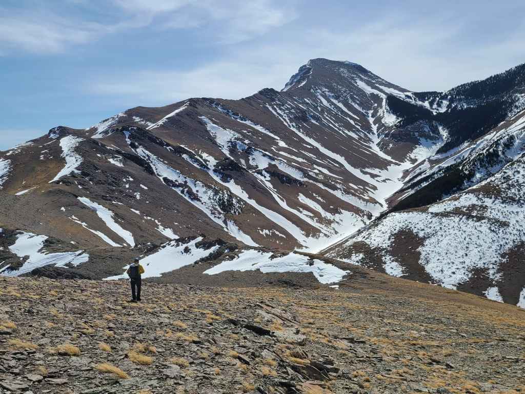
Andrew approaches the final high point before the Lakeview / Rogan col.

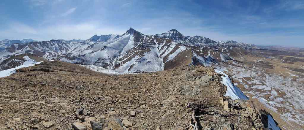
Mount Dungarvan provides a dramatic backdrop. (Photo by Andrew Nugara)
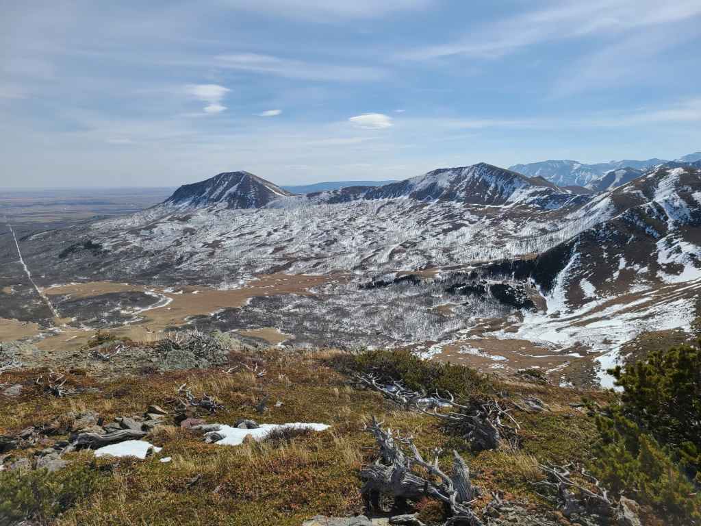
Gazing down to the Lakeview / Rogan col which functions as both the halfway, and the highest point on the Horseshoe Basin trail. Note the incredibly long switchbacks that I assume were built with horses in mind.

Glancing back at “Rogan Peak” (left) and Mount Dungarvan. (Photo by Andrew Nugara)
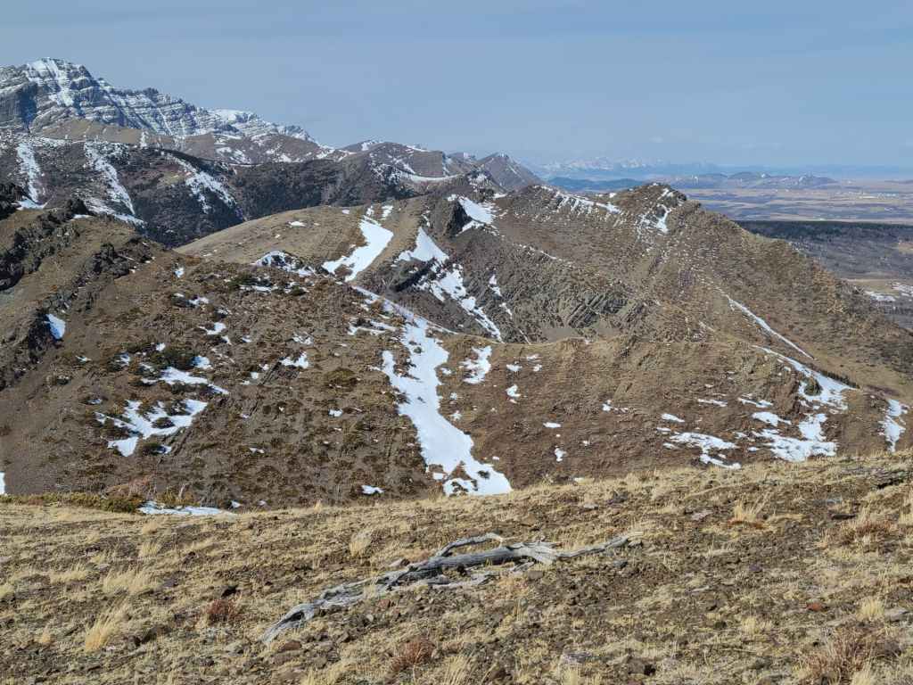
A telephoto of KLP (right). It sure doesn’t look like much from here!

Our sheep friends make good on their promise not to move again. We made sure to give them a wide berth.

“What ewe lookin’ at Willis?” 😂

Arriving at the col. The true summit of Lakeview is above me, while the slightly lower north summit is on the far left. (Photo by Andrew Nugara)

I tried, but there was no way that I could even come close to Brad’s amazing ascent time where he made it from the col to the summit of Lakeview and back again in only 25 minutes – and this was after we had climbed Rogan. 😳 (Photo by Andrew Nugara)

Looking back as I arrive on the summit.

Zosia sticks close to the edge as she makes her way up. (Photo by Andrew Nugara)

The rest of the group soon joins me on the summit. For reference, it is a ~155 m elevation gain over ~750 m from the col to the summit.

My second time on the summit of Lakeview Ridge (1945 m).

I always wonder which surveyor drew the short straw and had to carry the bags of concrete? 🤔
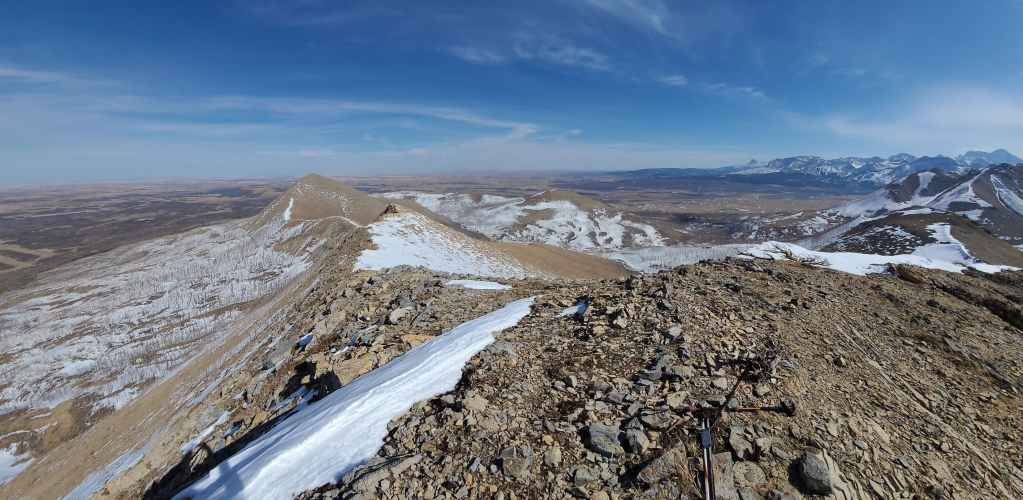
A pano to the east…

A pano to the south…
And finally a pano to the west.

The view across to “Rogan Peak” (left)and Mount Dungarvan.

The north summit may look higher, but it is actually ~28 m lower.

Looking to the northwest at KLP (centre left foreground) and Kesler Lake.

All of us on the summit. (Photo by Sonny Bou)

Sonny and I do some UFO spotting while Andrew plays Tetris. 😂 (Photo by Zosia Zgolak)

After a brief summit stay, we set off along the south ridge.

Bellevue Hill is directly in front of me. (Photo by Andrew Nugara)

Sonny takes advantage of easier travel along the snow. (Photo by Andrew Nugara)
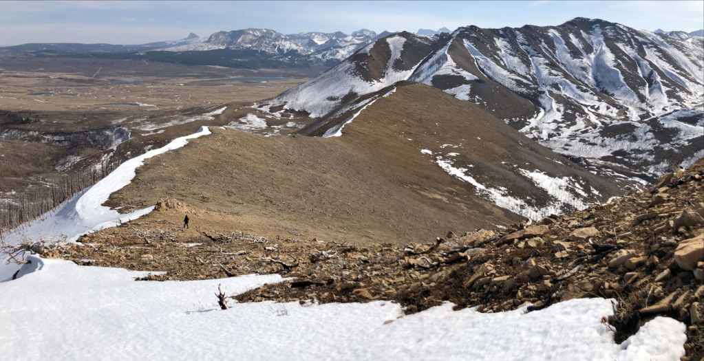
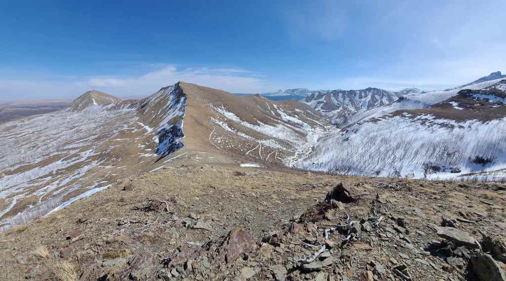
The south ridge of Lakeview is ~2.2 km long and served as our ascent route back in January.

A telephoto of Sofa Mountain from the end of the ridge. (Photo by Andrew Nugara)

From here, we would descend to the creek before rejoining the trail (far right).

Nearing the bottom of the ridge. (Photo by Andrew Nugara)

Glancing back at our descent route from the trail.
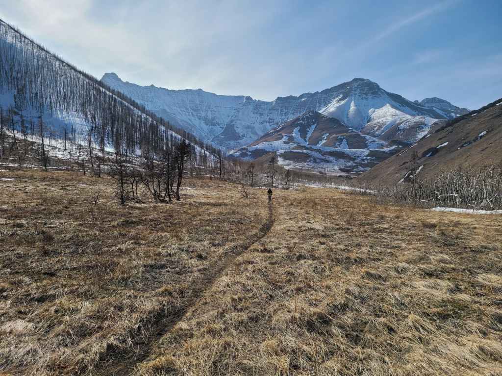
A familiar view of Mount Galwey (far left) and “Rogan Peak”. This was my fourth time here since the beginning of the year. I think I’m done now…

Mercifully, it was all downhill from here.

Andrew and Zosia arrive back at the junction of the north and south branches of the Horseshoe Basin trail.
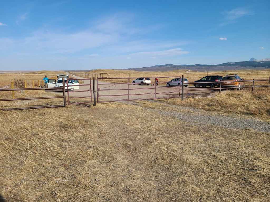
Almost 10 hours and 24 km after starting, we arrive back at the trailhead. Thankfully, the Bison Paddock road is now open and we no longer have to hike out to the highway. I’m not sure if many will see KLP as a worthwhile objective given the length of approach and its diminutive stature. However, it is located in a less visited area of Waterton and this alone may be enticing for some. That it offers some good views of Mount Dungarvan and “Cloudy Junior” may also be in its favour. Regardless, I feel fortunate to have paid it a visit and to have done so with some great companions. Peace.


Leave a Reply