
⚠️ Hiking and scrambling are inherently dangerous activities. Please read my Disclaimer. ⚠️
Last week, as smoke from major forest fires in Washington and BC filled the air, health officials in southern Alberta issued an alert recommending that people (and pets) limit their outdoor activities to avoid prolonged exposure. At one point the air in Lethbridge was so bad, that it reminded me of the thick haze that lived inside the teacher’s lounge at my junior high school, escaping every so often into the hallway and forcing even the hardiest of head bangers to run for cover. When people in these parts begin to openly pray for wind, then you know things are bad.
Thanks to a brief, but stiff breeze on Friday night, the air on Saturday morning was clearer than it had been for quite some time. After debating whether we should go hiking or not, Jeff and I finally decided around 1 pm to head to Waterton and attempt Mount Galwey and Bellevue Hill. However, by the time we reached the base of Galwey, the smoke was so thick that it was pointless to even start. I’ve never been a smoker, but I’m sure that had we tried, we would’ve come out of it looking like we’d been to pipe night at Cosmo Kramer’s (view this classic Seinfeld scene).
So we returned to Lethbridge where I discovered the very handy, firesmoke.ca, which is an experimental site that forecasts forest fire smoke hour by hour. After it looked like the next day would be relatively smoke free, Jeff and I decided to return along with Mark, who’d always wanted to climb Galwey. The air was clear all morning thanks to a chinook arch that brought with it 100 km wind gusts. Unfortunately for us, but of vital need to the land, it also brought rain in the early afternoon which forced us to abandon our planned ridge walk from Mount Galwey to Bellevue Hill. All in all though, it ended up being an awesome scramble.

Our route was taken straight from Alan Kane’s, Scrambles in the Canadian Rockies, and since this is Waterton, there are also many excellent trip reports available online. Kane rates this scramble as difficult because of a short, but exposed traverse over narrow ledges near the summit.
Getting to Galwey is easy, just follow the Red Rock Canyon Parkway until you come to the Coppermine Creek picnic shelter across from the Crandell Lake campground. This is the starting point. Our original plan was to summit Galwey and then descend along the trail until we could traverse over to the connecting ridge between Galwey and Bellevue Hill. From here we would summit Bellevue and then drop down to the Red Rock Canyon Parkway and walk back to the car. However, the wind-whipped rain showers that began as we left the upper slopes of Galwey made such an excursion seem less appealing, so we continued with our descent back to the vehicle.

Our total distanced travelled was 7.9 km with total elevation gains of 1064m. Our round trip time was 4 hours and 37 minutes.
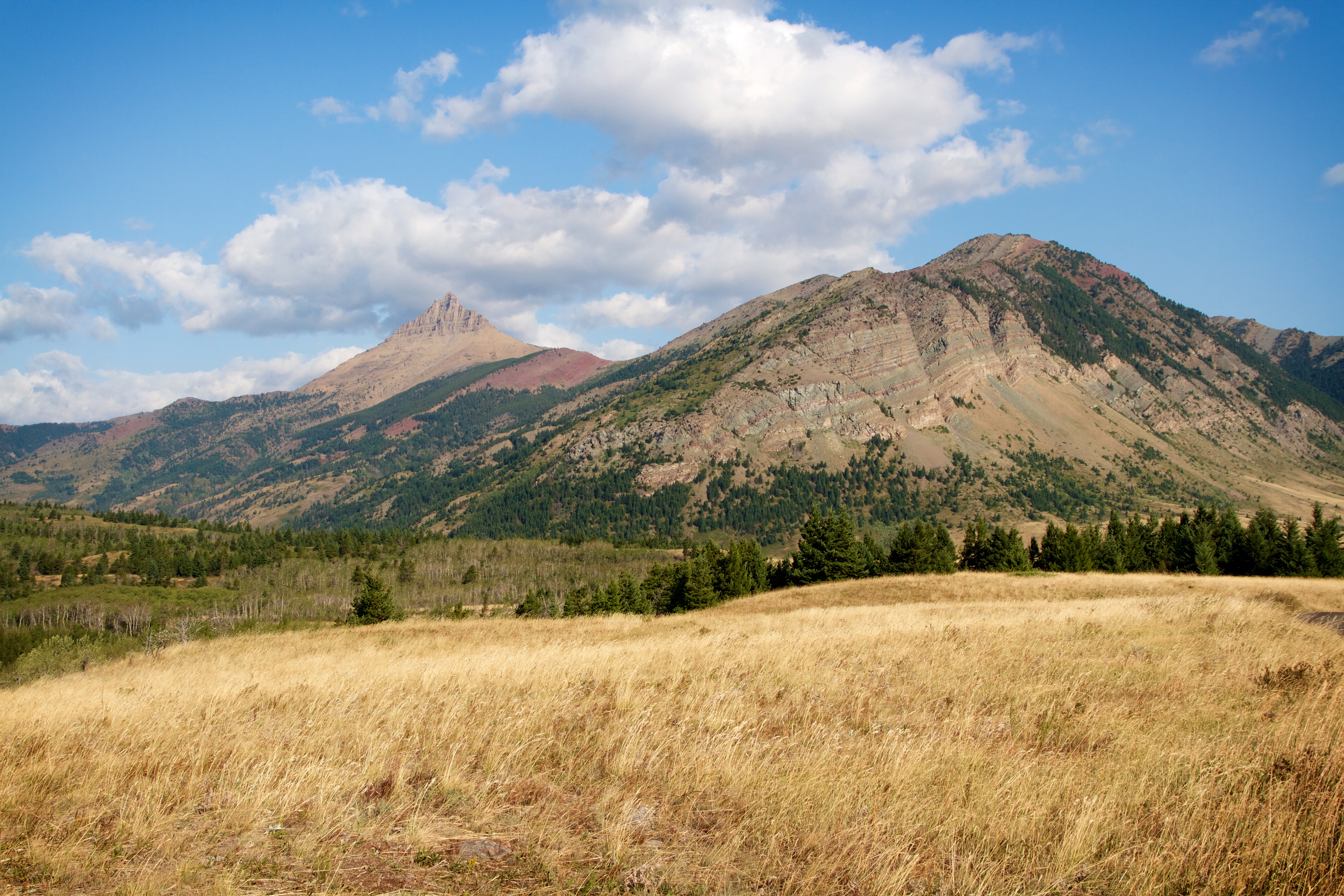
Mount Galwey (left) and Bellevue Hill from the Red Rock Canyon Parkway.

Finally! A morning free of smoke as Jeff and Mark gear up at our starting point at the Coppermine Creek picnic shelter. The summit of Mount Galwey is visible in the distance.

This is what Mount Galwey looked like the day before – and this was at its best.
There is a well worn trail that leads up from the parking lot. In some places the trail was almost 60cm deep and could possibly double as a luge track in the winter.

One of the perks of hiking in Waterton and the Castle Crown – an abundance of red argillite.

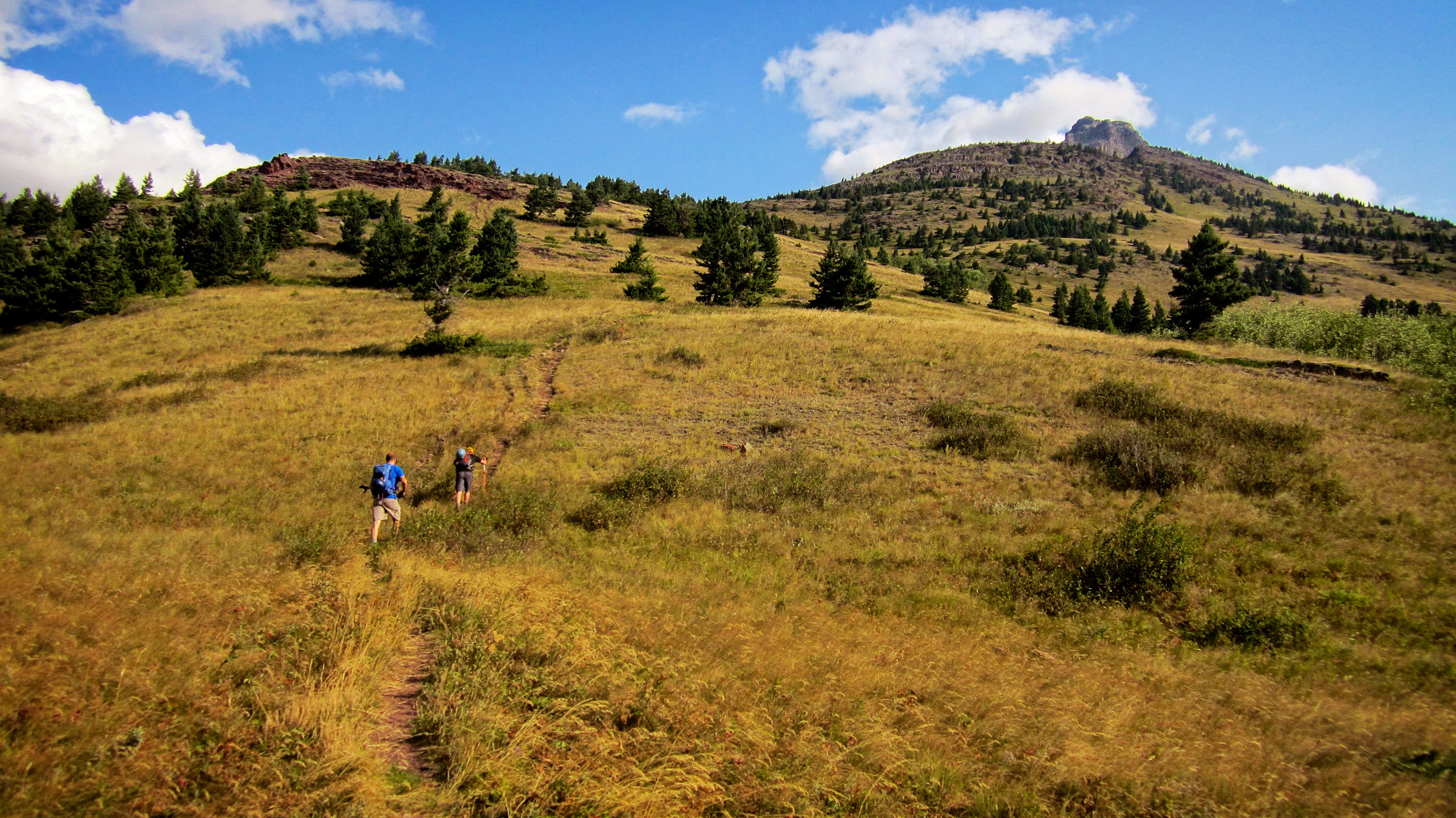
It was a pleasant, albeit, windy hike to gain the adjoining ridge.

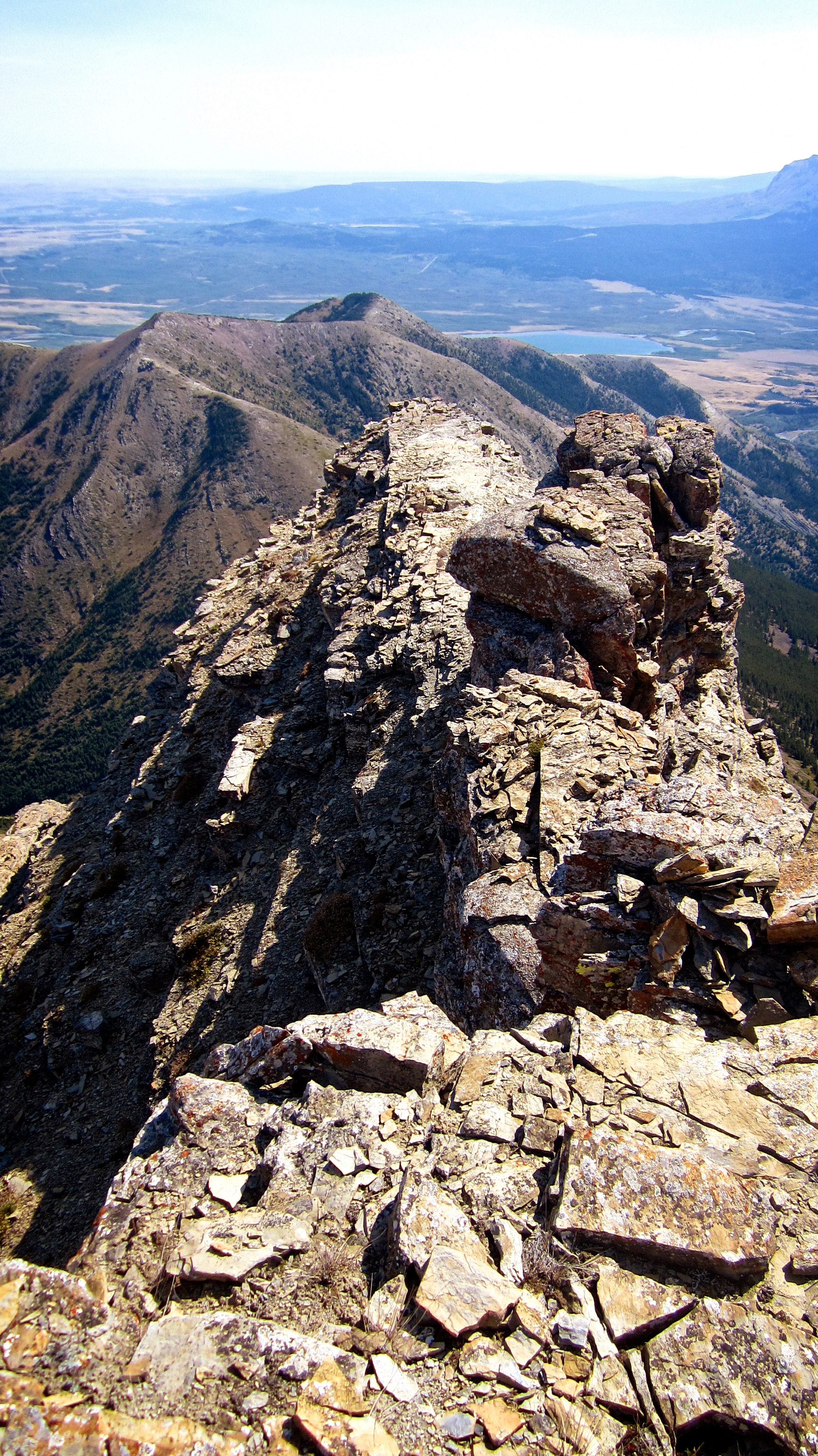
Our first real views of Galwey came shortly after we gained the ridge.
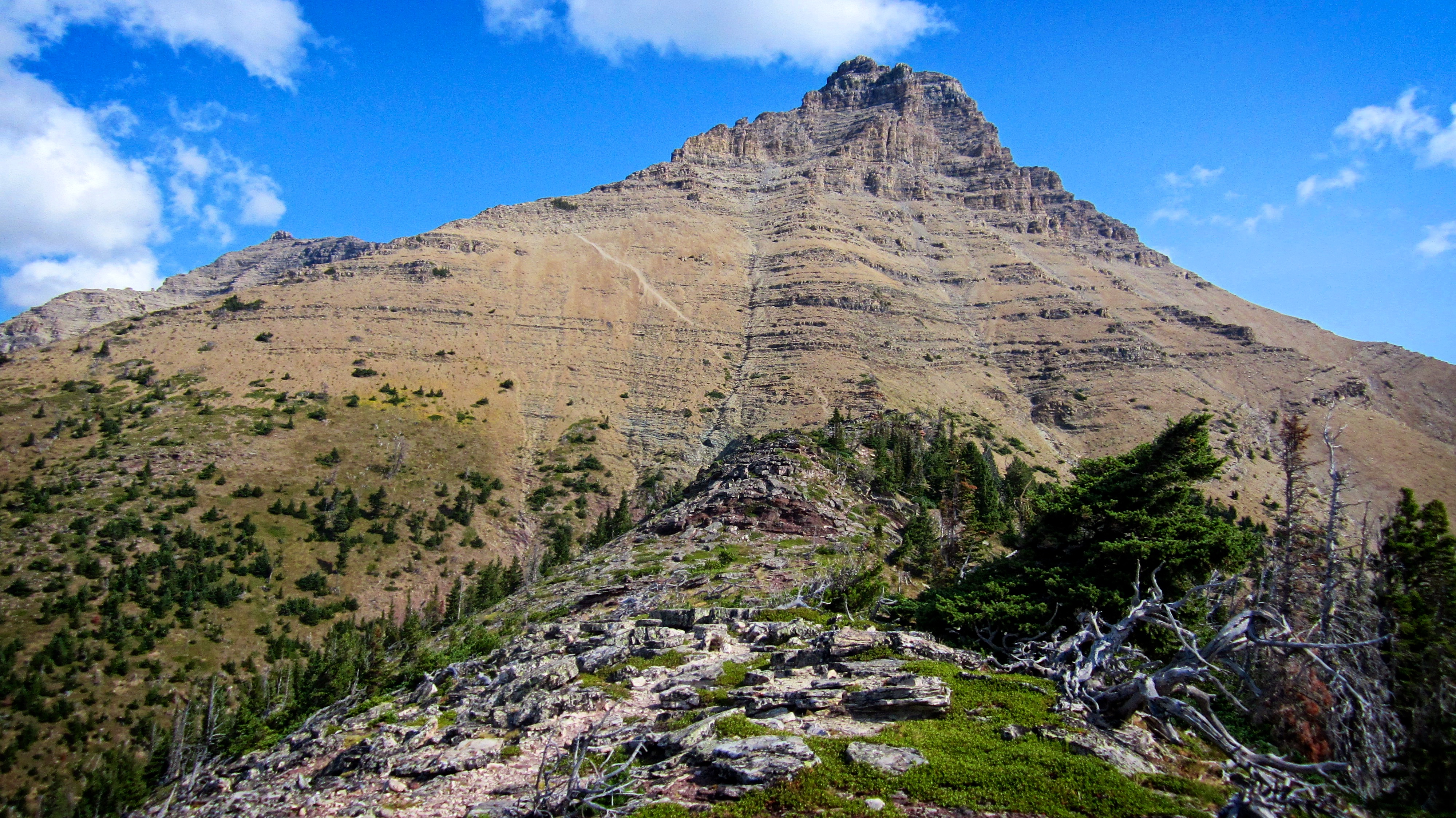
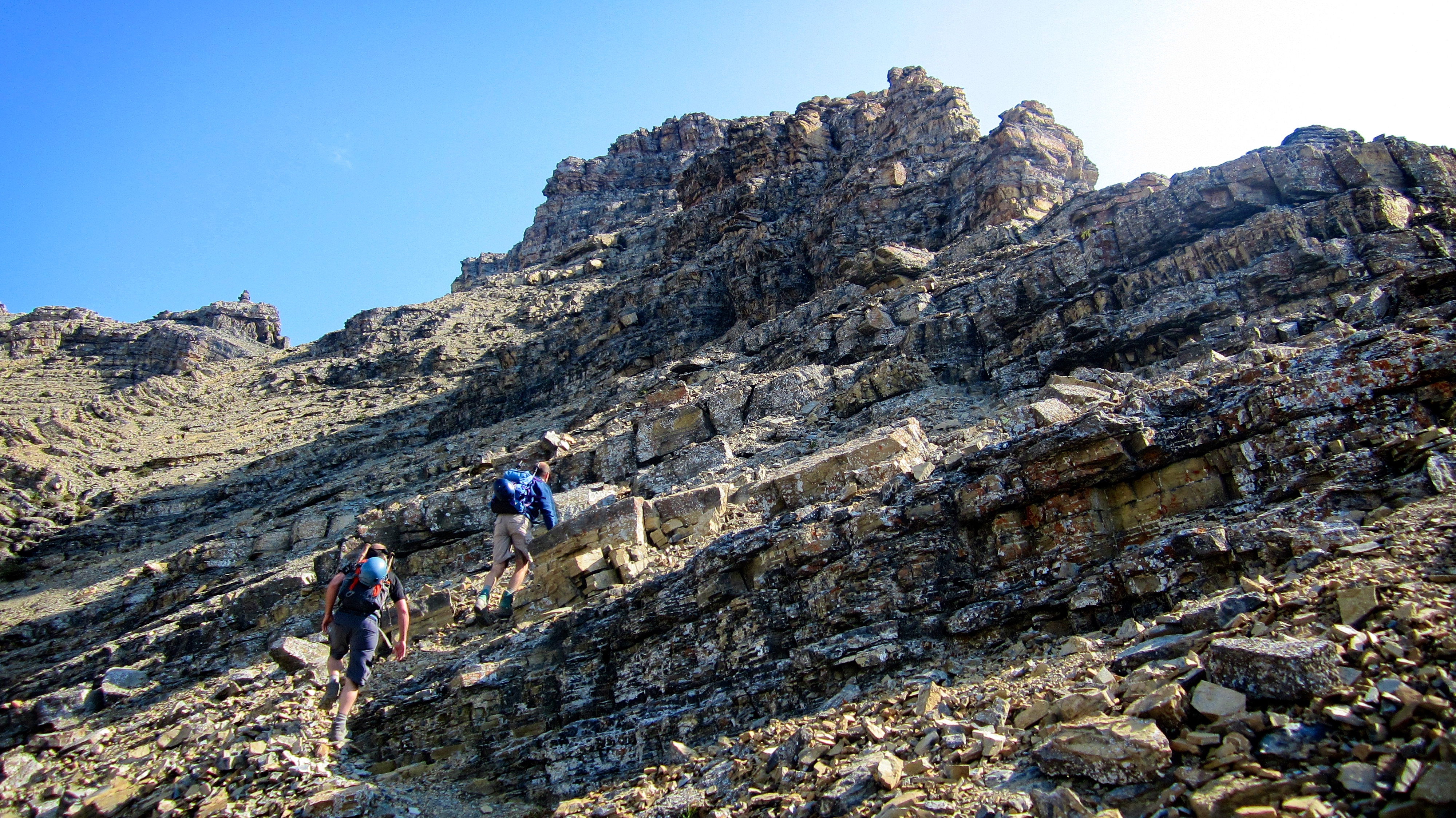
The trail is clearly etched onto the slopes of Galwey.

Jeff and Mark wait patiently as I put on my toque to give my ears some relief from the wind. I found the whistling of the wind as it passed from one ear through to the other and then out the other side, to be somewhat annoying 😉

Looking across the valley at Mount Crandell. Despite the intensity of the wind, a slight haze still lingered.

Scrambling in the wind can sometimes lead to hairy situations!

The entire route is marked with numerous cairns, so keeping on track was not difficult. Mount Lineham and Piinaquiium / Ahkoinimahstakoo (Mount Blakiston) are in the background.

This was the view towards the summit after we had passed through a section of mild scrambling. Kane’s famous mushroom rock is circled in red. Do not aim for the cairn that is visible in the skyline centre of the picture.
Jeff and Mark pass another cairn as they make their way up the trail.

Jeff looks at the connecting ridge between Mount Galwey and the slightly higher, but unnamed north peak. According to peakfinder, Mount Galwey received its title in 1943 when it was named after Lt. Galwey who was, “the Assistant Astronomer with the International Boundary Survey” from 1872 to 1876.
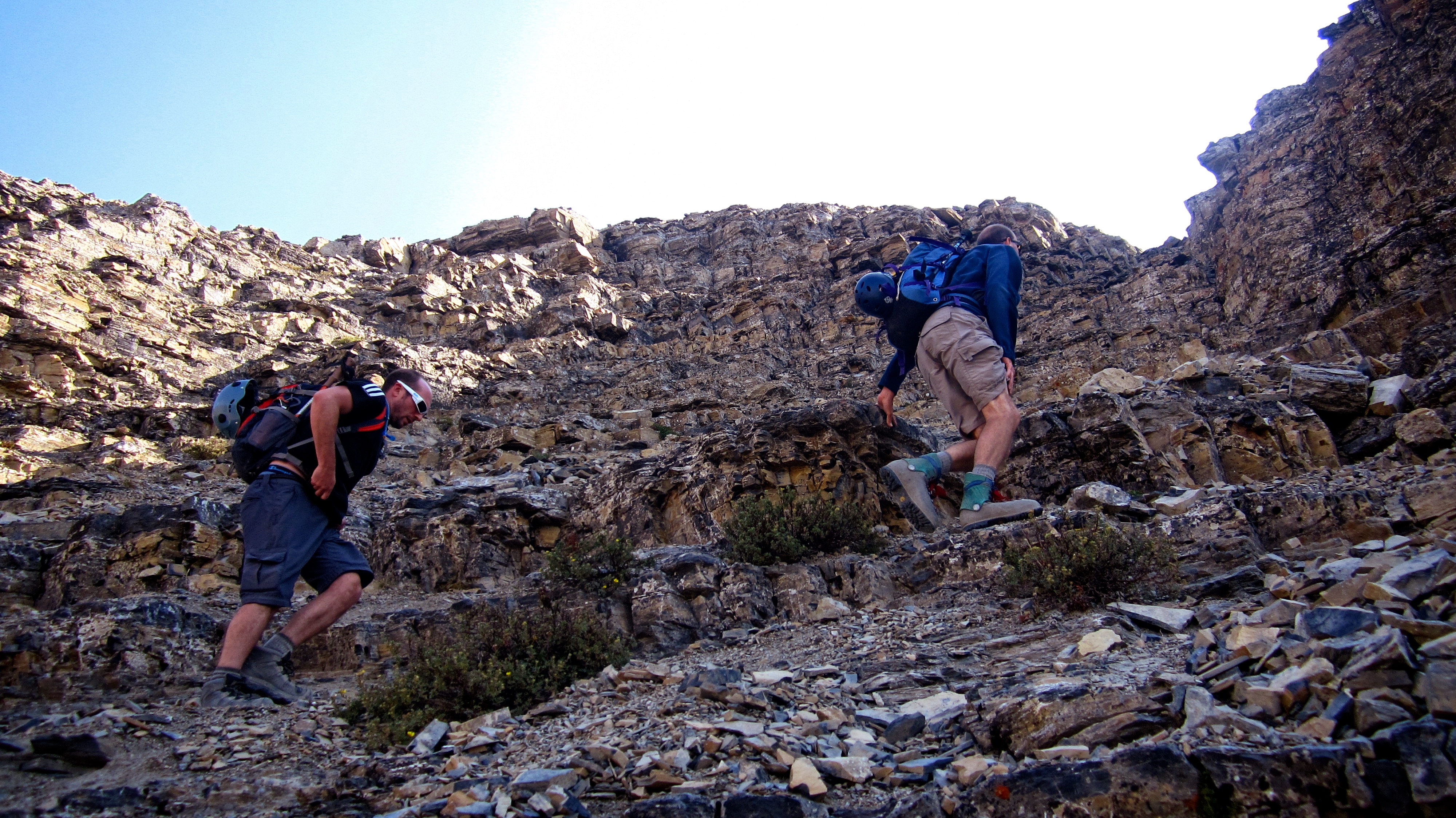
Jeff and Mark head towards the second section of scrambling.

As per Kane’s description, the mushroom rock is visible on the skyline to the right of centre and the black band of rock covered in yellow lichen is directly in front of us. Amazingly, they were still where Kane had left them! 😉

I learned this sweet move from watching reruns of The Karate Kid. I went up the left side… (Photo by Mark Kadijk)

…and Jeff and Mark went up the right side.

In the gully above the rock band we encountered a group of 4 hikers who had made it to the crux but had turned back because of its difficulty.

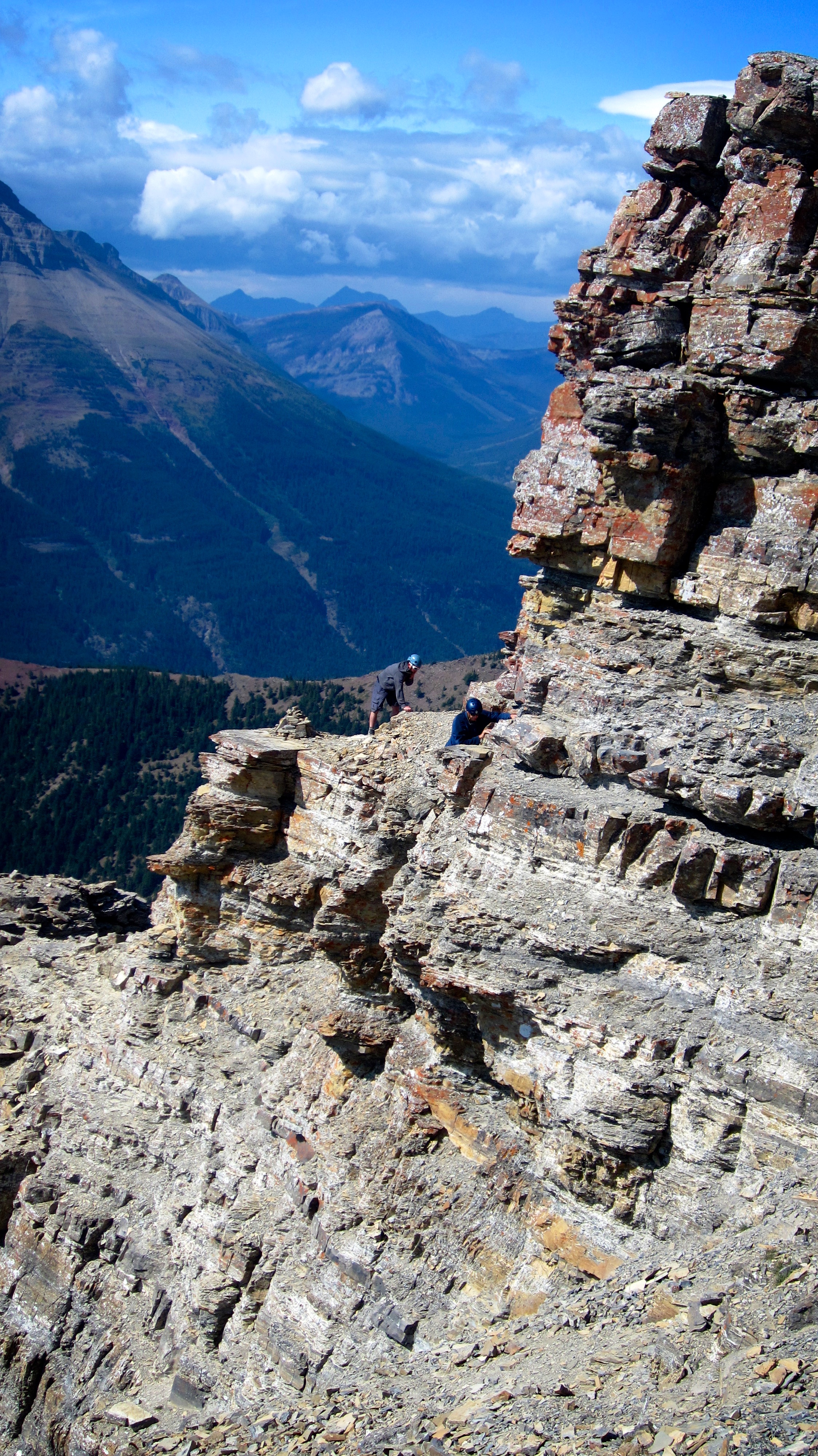
Arriving at the crux – an exposed traverse across small ledges towards the window on the right. The mushroom rock is directly above Jeff.

This image was taken just seconds after the preceding picture and captured the moment when a wind gust almost knocked Jeff and Mark to the ground. While Mark and I were definitely worried about being blown off the mountain, Jeff appeared to be more concerned that his head would somehow detach. At this point the wind was getting ridiculous and we wondered how safe it would be to tackle the crux. We then decided to ditch our packs before advancing any further.

The crux. I crossed first and found that I only had to endure the wind for a couple of metres before rounding a small corner. After this, the wind became a non-factor as the remainder of the traverse was sheltered from fierce gusts. (Photo by Mark Kadijk)
Mark begins to cross the crux as Jeff, with his head still attached, braces himself to withstand the wind.

Mark nears the end of the traverse while Jeff continues to brace himself.

Jeff rounds the corner and will soon be sheltered from the fierce gusts. (Photo by Mark Kadijk)

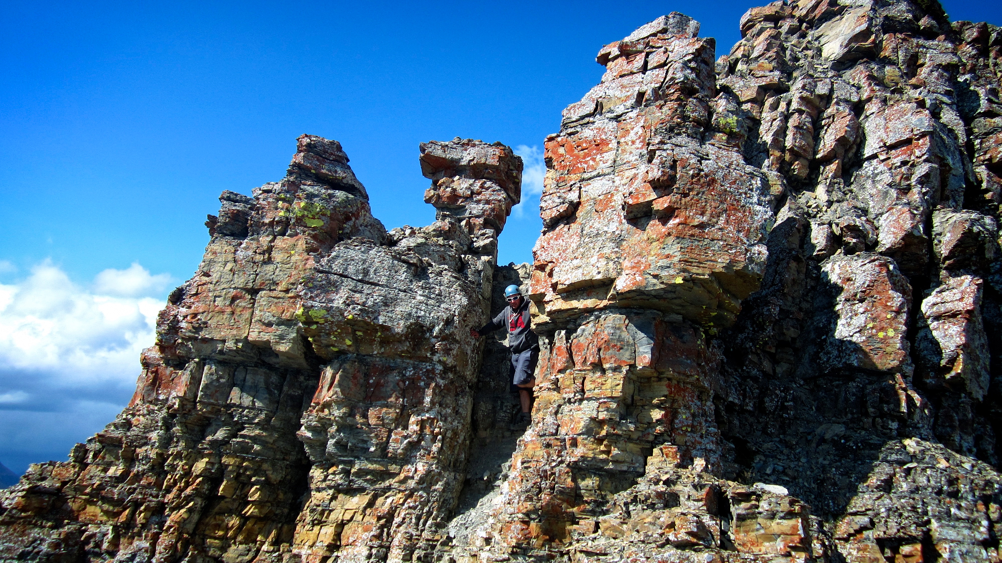
Looking east through the famous window on Mount Galwey.

Jeff pauses on the crux to take a picture of Mark and I, while simultaneously, Mark takes a picture of me and I take a picture of Mark and Jeff. Synchronized scrambling at its best!

Here is Jeff’s picture of Mark and I from his vantage point on the crux. (Photo by Jeff Lang)

Here is Mark’s picture of me from his vantage point next to the window. (Photo by Mark Kadijk)

Mark snapped this picture of Jeff from the inside the window. (Photo by Mark Kadijk)

A pane-ful situation. 😉 (Photo by Mark Kadijk)

The view from the other side.

Looking at the summit after crawling through the window and walking a short distance to the south. The mushroom rock can be seen just left of centre and the summit cairn is visible, well, on the summit.

Exploring the dark side. Some people ascend by scrambling across the top of the window, but on this windy day, that may not have been wise. Instead, we would use the popular chimney route that is located at the end of the crux. (Photo by Jeff Lang)

Jeff and Mark enjoy a window view.

Looking across the valley at little Crandell Lake.

Looking at the chimney (centre) that leads to the summit from the crux.

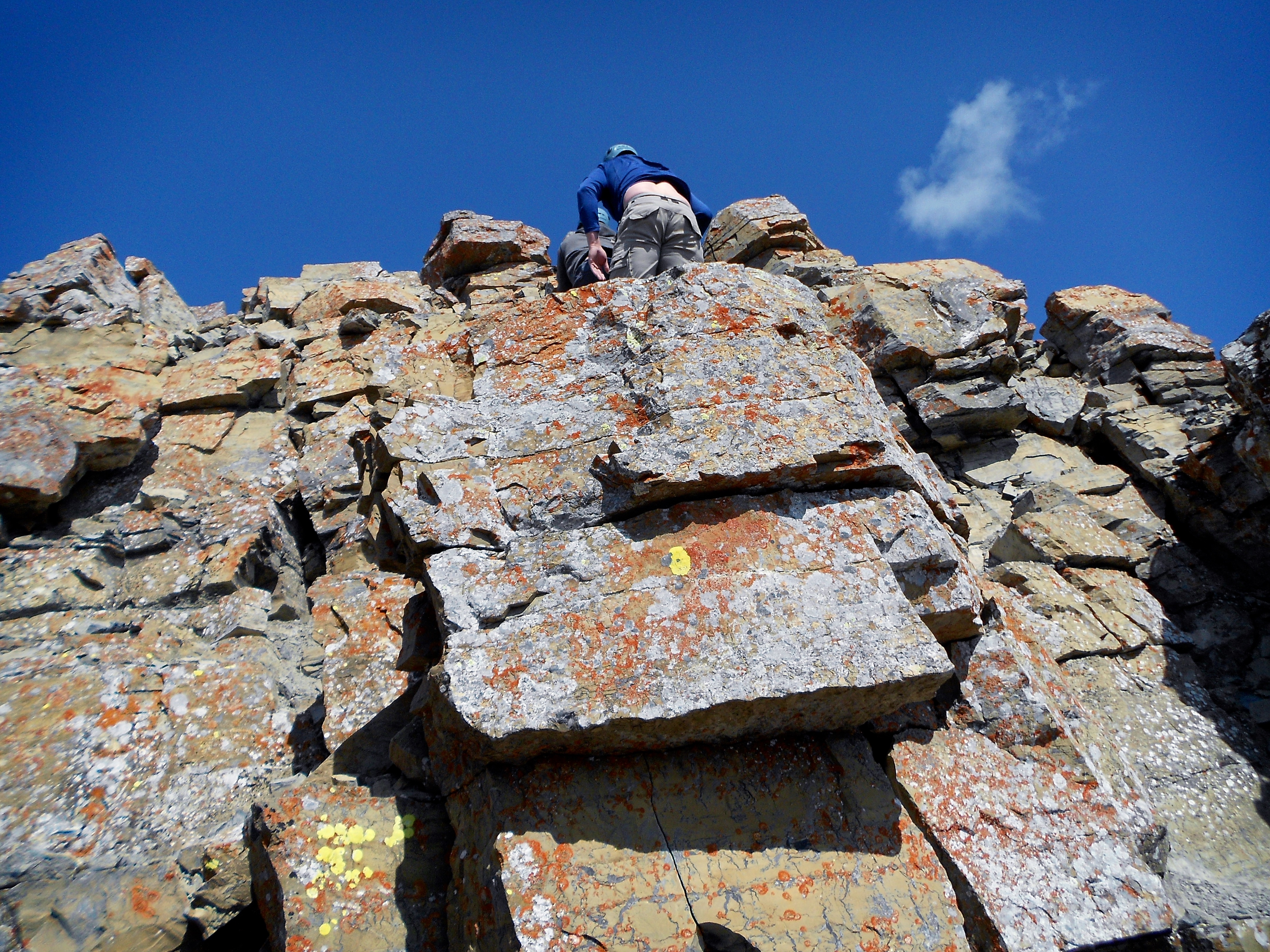
Mark watches as I start up the chimney. The trickiest part was the first series of moves – after that, it was not too difficult. As you can see, I’m once again using my highly technical, Karate Kid move. (Photo by Jeff Lang)

The scramble up the chimney was short but extremely fun.

Mark leads the way…

…and Jeff and I follow. The section immediately above the window can be seen behind me. (Photo by Mark Kadijk)
The angle of this picture makes the chimney look more dramatic than it really was – and no, I am not mooning the campers at Crandell Lake Campground. (Photo by Mark Kadijk)

Looking down the chimney as Mark makes his way past the mushroom rock.

The summit cairn. We emerged cautiously from the confines of the chimney because we were expecting to be hit by severe gusts.

We were glad however, that the gusts on top were not as severe as the gusts we encountered prior to crossing the crux. Jeff and Mark on the summit of Mount Galwey (2374m).

Jeff and I on the summit. The slightly higher, but unnamed north peak is visible directly behind us.

Looking southwest from the summit at Ruby Ridge and Piinaquiium / Ahkoinimahstakoo (Mount Blakiston) (centre). Anderson Peak is on the right.

Looking south at Mount Crandell, Ruby Ridge, and Piinaquiium / Ahkoinimahstakoo (Mount Blakiston).

The view to the northwest. The unnamed north peak is in the foreground and Mount Dungarvan and Cloudy Ridge are in the distance just to the right of centre. “Rogan Peak” is on the far right while Ruby Ridge, Piinaquiium / Ahkoinimahstakoo (Mount Blakiston), and Anderson are left of centre.

Looking northeast and onto the prairies. Lakeview Ridge is in the centre and “Rogan Peak” is on the left.

Looking southeast from the summit. Bellevue Hill is on the left, Sofa Mountain and Vimy Peak are directly behind Jeff and Mark, and Mount Crandell is on the right.

The Red Rock Canyon Parkway and Crandell Lake Campground from the summit.

A closer look at Bellevue Hill. At this point, we were still planning to include Bellevue as our next destination for the day.

After repeatedly mentioning it, I thought it appropriate to include a close up of Kane’s famous shroom.

Looking up at Jeff as we leave the summit.
A closer look at the terrain immediately above the window.
Jeff passes by the mushroom as he descends from the summit. Hmmm… I think I’ll call this picture, Jeff and the Giant Shroom – a title which might be a hit on the west coast.

Holy cow! While I was preoccupied with the down climb, Mark captured this image of Jeff’s head after it had separated from his body! Now I feel silly for questioning why Jeff had held onto his head during the wind gusts at the crux. (Photo by Mark Kadijk)

Nearing the bottom of the chimney. (Photo by Mark Kadijk)

Jeff scrambles down the final few metres. As with going up, the trickiest part of the chimney was down climbing the initial bottom step (centre).

Mark explores the section beneath the crux. He would end up circumventing the crux by ascending a small chimney that was located directly in front of him in the shaded area. Jeff and I would also use this route.

Mark waits for me as I ascend the chimney on the other side of the crux.

Looking down at Jeff as he climbs the same chimney.

Colourful lichen on Mount Galwey. (Photo by Mark Kadijk)

When you’re 6’6″, peering over rock bands can be quite easy.

Jeff looks for a place to down climb.

A rapidly approaching storm contrasts the sunlit north peak.

The rain came in fast and furious from the west.

Heading into the rain. At this point we were still open to the idea of traversing over to Bellevue Hill.

Did I mention that the wind never let up even when it was raining? When it looked like it would be more than just a passing shower, we made the call to forego Bellevue Hill.

Following a wet trail trail back to our vehicle.

A cloud envelops the summit of Mount Galwey as we look back from the Coppermine Creek picnic shelter. These were also the last remnants of blue sky.

Mark pauses to take one last photo of Galwey before capping off yet another excellent day in the mountains.


Leave a Reply