
⚠️ Hiking and scrambling are inherently dangerous activities. Please read my Disclaimer. ⚠️
What’s interesting about the Hawkins Horseshoe, is that each peak contributes to the historical narrative of the area, and by hiking the loop, you progress through the story. Here’s what I mean: beginning with Piinaquiium / Ahkoinimahstakoo (Mount Blakiston) we have a mountain that has been embedded into Siksikaitsitapi culture for thousands of years as a source of sustenance, power, and song. Then in the mid-nineteenth century, along comes Thomas Blakiston and Lt. Col. John Hawkins – Europeans exploring the land with an agenda – categorizing, classifying, and demarcating boundaries to assert control and ownership. Why? Well, that question is answered by venturing onto Mount Lineham.
John Lineham was born in Upper Canada in 1857, the same year that Thomas Blakiston and the Palliser Expedition started exploring the area around Mount Lineham. An entrepreneur by nature, Lineham moved west in search of opportunity and by 1883, was working as a horse breeder in Calgary. (source) Not stopping there, Lineham found success in owning a brewery, lumber companies, cattle ranching, and through various ventures in real estate and construction. He also served in the North-West Territories Legislature and was Mayor of Okotoks. (source) Truly instrumental to the development of southern Alberta, Lineham is perhaps best known as Canada’s first “oil man”. (source) One of three co-owners of the Rocky Mountain Development Company, in 1901 Lineham began drilling for oil along Cameron Creek next to what is now the Akamina Parkway. (source) One year later, oil was discovered at 1024 ft and western Canada’s first oil well was born; though it only produced until 1904 when it was shut down. (source)
Nevertheless, Lineham’s success in capitalizing on the regions natural resources was the ultimate purpose behind the exploration and survey work done by Blakiston and Hawkins. Of course, Lineham’s entrepreneurial success carried over to others and the west burgeoned with more settlers, while the Siksikaitsitapi simply struggled to exist, losing their culture and identity. This then, is the underlying story behind the Hawkins Horseshoe and knowing it, does not negate the achievements made by Blakiston, Hawkins, or Lineham, but it does put them into context – and context frames the need for decolonization.
In terms of the hiking side of things, I will say that getting past Mount Hawkins was the psychological turning point for me. Once on Lineham Ridge, I had more energy in my step and though Mount Lineham was still a ways off, the end goal was in sight. Of course, the incredible view down to the Lineham Lakes didn’t hurt when it came to motivation. 😊
The only cause for hesitation, were the increasing dark clouds overhead as we stood on the Lineham col. However, once these moved further to the east, we made the decision to continue our ascent. I’m going to say that while it’s technically an easy hike to the top, it was a bit of a grind as we’d already been hiking for 8+ hours, covering ~18 km to the col. That the ~1.6 km trip (272 m elevation gain) was foreshortened, didn’t help. Nonetheless, we had no trouble making the summit and despite cloud cover limiting our views to only the south and west, it felt fantastic to have finally completed the famous Horseshoe. 😁

To get to Mount Lineham, we drove from the Waterton townsite along the Akamina Parkway (Cameron Lake Road) for ~9 km until we reached the Lineham Falls trailhead. This was our starting point.
We then hiked down the trail for ~2.9 km until we came to a very obvious drainage. Here is where we left the trail to follow the drainage into the bowl beneath “Igneous Peak” and the southeast ridge of Piinaquiium / Ahkoinimahstakoo (Blakiston). Continuing along the drainage, we came to where it splits into two. Here, we chose the one to climber’s left and enjoyed excellent scrambling all the way up to the limestone band that guards the southeast face. Indeed, though the elevation gain from the trail to the band was ~730 m, it felt easy.
Once at the band, we followed it climber’s left and around a corner where we promptly found a small crack that we could use to scramble above limestone band and onto the crest of the southeast ridge. From here it was a delightful combination of views and scrambling (with minimal loose scree) until we were beneath the summit block. We then followed Kane’s moderate couloir onto the upper slopes of the block and then the summit (2910 m). For reference, it took us 4 hours and 41 minutes with an elevation gain of 1396 m over 9 km from the trailhead to the summit.
From Piinaquiium / Ahkoinimahstakoo (Blakiston), the remainder of the horseshoe is obvious and we set off for our next objective, Mount Hawkins (2683 m), which sits ~4.7 km away via the ridge. After bypassing a highpoint above the lakes, we arrived at the col with Mount Hawkins. From here it was a easy scramble over ~905 m with a 175 m elevation gain to reach the summit.
After enjoying the views, we continued along the ridge for ~1.6 km to highpoint of Lineham Ridge, where we were treated to more great views of the Lineham Lakes. From here, we followed the Lineham Ridge trail for ~ 3 km to the col with Mount Lineham. The route to the top is not hard, but is foreshortened with a 272 m elevation gain over ~1.6 km.
From the summit of Lineham (2730 m), we descended directly down the open south slope to the Rowe Lakes trail. Once on the trail, it was a ~4 km hike to reach the Rowe Lakes parking lot and then another ~1.3 km walk along the Akamina Parkway to reach my vehicle at the Lineham Falls Trailhead.

Our total roundtrip time was 11.5 hours and our total distance travelled was 28 km. Total elevation gains came in at 2070 m.

With the weather holding and feeling psychologically recharged, we leave the summit of Mount Hawkins.

Approaching a small highpoint prior to Lineham Ridge.

Heading up and over the highpoint. (Photo by Andrew Nugara)

The view back to the summit of Hawkins. That Hawkins is comprised of bright red argillite is fitting, given this story as told by Lt. Anderson: “(While in Rock Creek) I heard that while I had been away Colonel Hawkins had passed thro’ the town dressed in a most ridiculous way, having a large red shirt on outside everything, which however is intended to be worn under the waistcoat. But he was determined to be peculiar and ridiculous so he put it on outside everything, as a sort of pin-a-fore, and a painfully new looking belt round his waist with a grand Sheffield hunting knife, which of course has never been used. The people all imagined he had his red soldier’s coat on, so they all give him credit for more folly then he was actually guilty of. And to make up for the inconvenience of having no pockets at all anywhere, and which I have found indispensable, he carries about a multiplicity of bags and reticules strapped round his body, and in fact got-up entirely for show. I believe he is going to have his portrait taken in that costume to send his wife, telling her that that is the dress of the country.” (source)

Arriving at the first bend in the Horseshoe.

Andrew’s perspective from the previous photo. (Photo by Andrew Nugara)

Getting a good look at Festubert Mountain (centre).

Here’s where the views begin to take off.

This is one of many reasons why you want to save the Horseshoe for good weather and haze-free skies.

Hiking is easy when you have views like this!

This looks like the same photo from before – and it’s close! But why not?

Easy hiking along Lineham Ridge.

Standing on the highest point of Lineham Ridge. (Photo by Andrew Nugara)

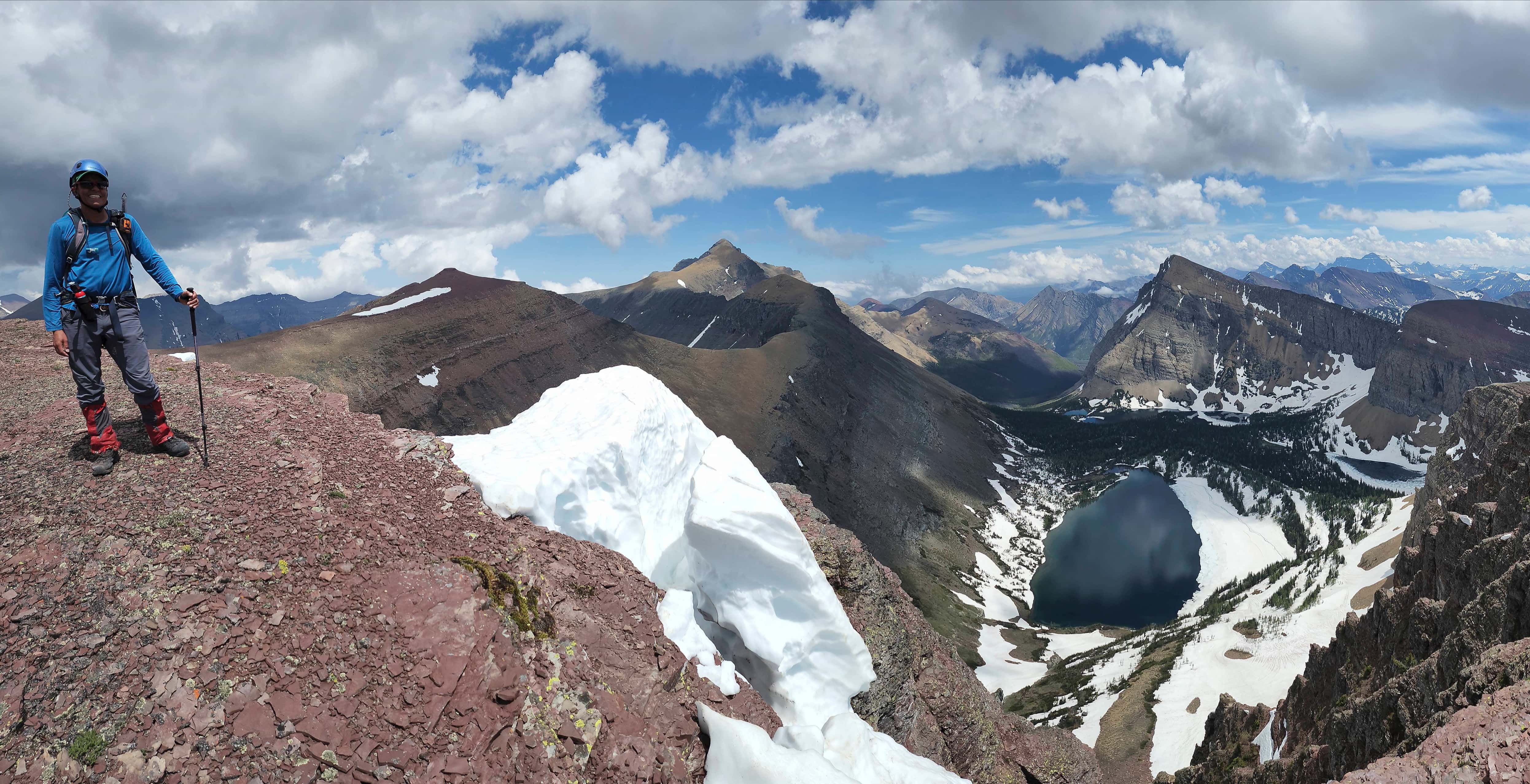
Looking back towards Mount Hawkins and Piinaquiium / Ahkoinimahstakoo (Mount Blakiston).

In the centre of the Horseshoe with all three peaks looking good – prettay, prettay, prettay good. 😂

This is such a cool place! (Photo by Andrew Nugara)

Continuing to snap photos as we work our way along the ridge.

Heading towards the next highpoint. (Photo by Andrew Nugara)

Looking back at what we’d done… (Photo by Andrew Nugara)

And what was to come.

Looking along the ridge to Mount Lineham.

Gazing over to Hawkins and Piinaquiium / Ahkoinimahstakoo (Mount Blakiston).

New views begin to emerge. In the background are “Senator Peak” (a.k.a Buchanan the Middle Child) (left), Buchanan Ridge (left of centre), and Mount Carthew (right of centre).

Mount Rowe (left of centre) and the “Peak of Despair”. 😂

Still enjoying the views. (Photo by Andrew Nugara)

Navigating some snow across the trail.

Heading towards the col.

The trip up Lineham gave us some great views of Mount Rowe and the Rowe Lakes.

Approaching the col. (Photo by Andrew Nugara)

At the col and checking on the weather. (Photo by Andrew Nugara)

The view from the col shows dark clouds gathering.

The route up Lineham is easy but foreshortened.

Andrew follows me up.

Dark clouds settle over Lineham. Thankfully, there was no hint of thunder or lightning. (Photo by Andrew Nugara)

Hmmm, could it be that the clouds are lifting?

The summit is clear for now!

Hiking the last stretch before the summit.

Gazing back to the col.

A friendly group of hikers enjoys the summit (2730 m).

Looking south from the summit. Due to clouds, this was the only view we’d get – but I’ll take it!

A good look at Cameron Lake (left) along with the Rowe Lakes.

Zooming in on Mount Rowe and the lakes. Note the waterfall into Lower Rowe Lake.

After years of putting it off, I’ve finally completed the Hawkins Horseshoe! 😁 (Photo by a friendly Calgary-based hiker)

Andrew’s fourth time on Mount Lineham and his second time completing the Horseshoe! 👏😁

This is why we could only see to the south. (Photo by Andrew Nugara)

Heading down Lineham’s south slope.

Following a beaten path.

Passing beside a massive boulder. (Photo by Andrew Nugara)

Entering the gully and avi slope that will lead us directly to the Rowe Lakes trail.

A closer look at the waterfall.

Taking advantage of the snow…

And some impromptu glissading. (Photo by Andrew Nugara)

This little path will lead us through the vegetation and onto the main trail.

On the Rowe Lakes trail. From here it will be a ~4 km downhill hike to reach the Rowe Lakes parking lot and then another ~1.3 km walk along the Akamina Parkway to reach my vehicle.

Looking back at our route off Lineham.

This is the type of hiking you want at the end of the day. Downhill and easy. 😁

Clouds settle over Buchanan Ridge (centre) and “The Senator” (left).

Late afternoon sunlight and long shadows.

The switchbacks mean we’re almost at the parking lot.

Rowe Creek was a torrent!

A super cool photo by Andrew!

Arriving at the Rowe Lakes parking lot…

And making the ~1.3 km walk back to my vehicle at the Lineham Falls lot. In the background is Ruby Ridge.

Rain-ready clouds darken Mount Crandell as we arrive back at my truck 11.5 hours after starting. I’ve waited a long time to hike the Hawkins Horseshoe and it feels ever so satisfying to finally complete it. The route up the southeast ridge of Piinaquiium / Ahkoinimahstakoo (Mount Blakiston) ended up being a fantastic scramble, with minimal loose scree and dramatic views. The long ridge walk around the Horseshoe was super colourful and the constant views of the Lineham Lakes was motivating. My left foot felt like hamburger by the time we reached my truck, but undoubtedly, this was an exceptional day in the mountains! Thanks Andrew!! 😁


Leave a Reply