

⚠️ Hiking and scrambling are inherently dangerous activities. Please read my Disclaimer. ⚠️
As with many mountains in the area, Mount Hawkins is named after a surveyor. Having previously served in Tasmania, Royal Engineer Lt. Col. John Summerfield Hawkins was promoted to Commander of the British North American Boundary Commission in 1858, a position he held until 1863. (Source 1; Source 2) Far from living off the land, government surveyors such as Hawkins, brought with them British aristocratic values and culture. They also brought the cooperative tension of having to work with their American counterparts to establish an international border through the Rockies.
An amusing snippet into this British-American working relationship, comes from one of Hawkins’ officers, Lt. Samuel Anderson, for whom nearby Anderson Peak is named. In a letter to his brother Jack, Anderson recounted when some American officers arrived at a large gala hosted by the Boundary Commission. The Officers “brought 3 or 4 of their soldiers down with them. One of their men was intoxicated when he arrived and in the course of the evening he found his way into Col. Hawkins’ Quarters, locked the door, sat down in the arm chair in front of the fire, pulled off his boots and lit his pipe. So the Colonel after coming out of the Ball Room, on trying his own door was astonished to find it locked. After a good deal of shouting the soldier unlocked the door and allowed the Colonel to come into his own room, and then there was a tremendous explosion. I never heard the Colonel in such a rage in my life, and the whole thing was so absurd that even now I can’t help laughing when I think of it.” (source 3)
Still buzzing but not intoxicated from our ascent up the southeast ridge of Piinaquiium / Ahkoinimahstakoo (Mount Blakiston), Andrew and I quickly checked the sky for impending signs of a storm, and though clouds continued form, nothing alarmed us. Based on this observation, we then committed ourselves to the ~4.7 km ridge walk to Mount Hawkins, knowing that if the sky suddenly began to rage, we’d be vulnerable until we could bail off Lineham Ridge.
Thankfully, we continued to enjoy great weather, with an ideal temperature and little to no wind. The only regret I have is bypassing the highpoint immediately prior to the col with Mount Hawkins – and I only say this because I’m sitting well-rested at my computer. At the time, the thought of tagging the highpoint was exhausting, and so we bypassed it using a sometimes visible trail; hoping that we’d saved enough energy to slog our way up Hawkins. However, after a quick lunch on the col our energy picked up as we enjoyed some easy scrambling to the summit. It’s amazing how some hands-on climbing – combined with a litre of Gatorade – can revive your legs. 😂

To get to Mount Hawkins, we drove from the Waterton townsite along the Akamina Parkway (Cameron Lake Road) for ~9 km until we reached the Lineham Falls trailhead. This was our starting point.
We then hiked down the trail for ~2.9 km until we came to a very obvious drainage. Here is where we left the trail to follow the drainage into the bowl beneath “Igneous Peak” and the southeast ridge of Piinaquiium / Ahkoinimahstakoo (Blakiston). Continuing along the drainage, we came to where it splits into two. Here, we chose the one to climber’s left and enjoyed excellent scrambling all the way up to the limestone band that guards the southeast face. Indeed, though the elevation gain from the trail to the band was ~730 m, it felt easy.
Once at the band, we followed it climber’s left and around a corner where we promptly found a small crack that we could use to scramble above limestone band and onto the crest of the southeast ridge. From here it was a delightful combination of views and scrambling (with minimal loose scree) until we were beneath the summit block. We then followed Kane’s moderate couloir onto the upper slopes of the block and then the summit (2910 m). For reference, it took us 4 hours and 41 minutes with an elevation gain of 1396 m over 9 km from the trailhead to the summit.
From Piinaquiium / Ahkoinimahstakoo (Blakiston), the remainder of the horseshoe is obvious and we set off for our next objective, Mount Hawkins (2683 m), which sits ~4.7 km away via the ridge. After bypassing a highpoint above the lakes, we arrived at the col with Mount Hawkins. From here it was a easy scramble over ~905 m with a 175 m elevation gain to reach the summit.
After enjoying the views, we continued along the ridge for ~1.6 km to highpoint of Lineham Ridge, where we were treated to more great views of the Lineham Lakes. From here, we followed the Lineham Ridge trail for ~ 3 km to the col with Mount Lineham. The route to the top is not hard, but is foreshortened with a 272 m elevation gain over ~1.6 km.
From the summit of Lineham (2730 m), we descended directly down the open south slope to the Rowe Lakes trail. Once on the trail, it was a ~4 km hike to reach the Rowe Lakes parking lot and then another ~1.3 km walk along the Akamina Parkway to reach my vehicle at the Lineham Falls Trailhead.

Our total roundtrip time was 11.5 hours and our total distance travelled was 28 km. Total elevation gains came in at 2070 m.

Andrew leads us off the summit of Piinaquiium / Ahkoinimahstakoo (Mount Blakiston).

Approaching a bump along the ridge.

A wider angle of the previous photo.

Easy hiking.

I could tell already, that we were in store for some great views.

Clouds continue to form but then thankfully, move on.

Approaching Parks Canada’s new ‘Death Ray’ device. 😂

Looking back to the summit of Piinaquiium / Ahkoinimahstakoo (Mount Blakiston).

Dang! The cold beer fridge is locked! 😂

Gazing towards the highpoint that we bypassed.

Mount Lineham is still a long ways off. 😳

Finally! The clouds clear and we get a great look at Mount Hawkins.

The remaining route along the Horseshoe is clearly spelled out.

Most of the scrambling before the highpoint can be avoided by sticking to climber’s right.

A gap-toothed guy in a gap. These gaps are the reason why it’s best to bypass this section – though I’m glad my wife didn’t bypass me all those years ago. 😂

Andrew leads the way.

Engaging in some minor down-climbing.

Sometimes we were on the trail, and sometimes we were on treadmill scree. Sounds a lot like life. 🤔

Rounding the corner to the col with Hawkins.

The views towards Mount Lineham keeps getting better and better.

From the col, the entire Horseshoe is ultra clear, with Lineham on the left and Hawkins on the right.

Sweet! Now we could see even more of the Lineham Lakes. Get ready for a whole bunch of photos…

Gazing back from the col.

Mentally preparing ourselves for the impending elevation gain. (Photo by Andrew Nugara)

The first few metres over scree were depressing; however, once we came to some optional scrambling, our spirits and energy picked up.

The view from partway up.

More optional scrambling…

That I take advantage of. (Photo by Andrew Nugara)

It didn’t take long before we could see the summit.

And yet another view back.

The east face of Hawkins sports a variety of colour. (Photo by Andrew Nugara)

A pano of the previous photo. (Photo by Andrew Nugara)

The summit of Mount Hawkins (2683 m).

A pano to the southeast…

And then to the south.

Looking southwest…

And finally to the north.

Lone Mountain is aptly named.

Looking over the top of Lone Mountain at Kishinena Peak.

Starting along the Anderson Ridge with Mount Bauerman…

Then to “Kootenai Brown Peak” (left) and Lost Mountain (right)…

And last, but not least, Anderson Peak itself.

Looking past Anderson to “Cloudowan Peak”.

Next to “Cloudowan” sits Cloudy Ridge (left of centre) and “Cloudy Junior” (centre).

Continuing along to “Dundy Peak” (left) and Mount Dungarvan (centre).

Where we just came from: Piinaquiium / Ahkoinimahstakoo (Mount Blakiston). The highpoint we bypassed is in the foreground.

Looking across at our next peak for the day, Mount Lineham.

Mount Kinnerly (centre) with Mount Peabody and Numa Peak on the far left

Hawkins offers great views of King Edward Peak (centre) and Starvation Peak (right).

Another shot of Long Knife Peak (left) and King Edward Peak (right).

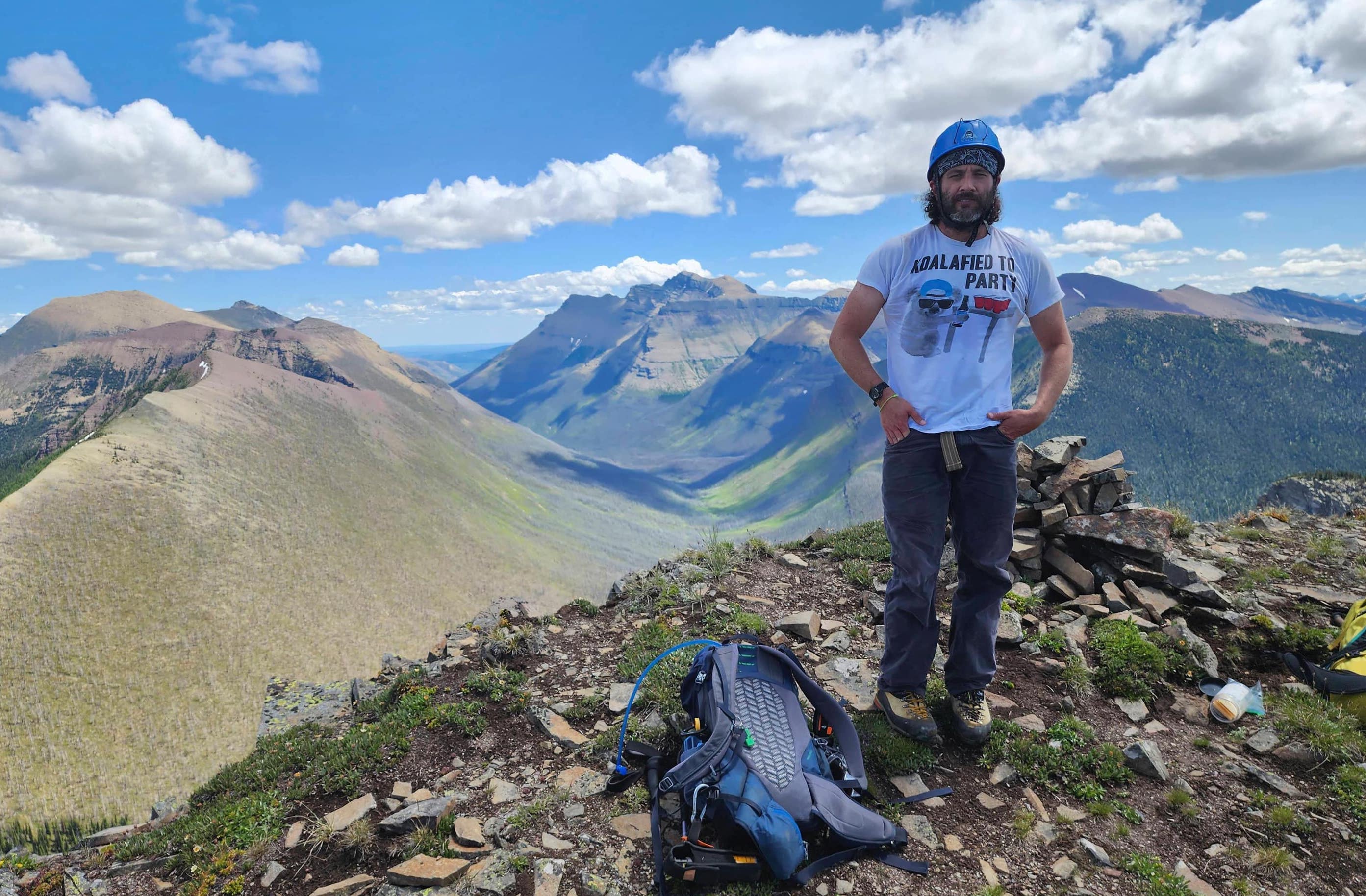
Me on the summit. (Photo by Andrew Nugara)

And now Andrew.

Leaving Hawkins to complete the loop. Click to follow us to Mount Lineham.


Leave a Reply