

⚠️ Hiking and scrambling are inherently dangerous activities. Please read my Disclaimer. ⚠️
The organization of the British North American Boundary Commission in 1872, along with its counterpart, the United States Northern Boundary Commission, initiated the formal demarcation of the 49th parallel as the border between Canada and the United States from the Lake of the Woods to the Rocky Mountains. Previous work had been done from 1860 to 1861, when the British Royal Engineers surveyed the boundary eastward from the Pacific to “a point in the Rocky Mountains not far from Waterton Lakes…”. (‘Walter George Boswell: Veterinary Surgeon for the British North American Boundary Commission of 1872-76’ by Jay M. Isa and Clifford A.V. Barker, 715) The Convention of 1818 had set the 49th parallel as the transcontinental border from the Lake of the Woods to the Rocky Mountains, but it was only with the Oregon Treaty of 1846, that the remainder of the border was established from the Rockies to the Pacific.
Headed by Captain Donald R. Cameron, a British artillery officer, the Boundary Commission included Captain S. Anderson, who had been the Chief Astronomer on the 1860-61 survey. A large undertaking, the Commission also included a number of Canadian civilians, including Veterinary Surgeon, Walter George Boswell.
Born in Cobourg, Ontario in 1843, little is known of Boswell’s formal education though the Ontario Veterinary College in Toronto had been established in 1862, and by 1872, had graduated 54 veterinarians. (Ibid, 719) In a letter of appointment by Captain Cameron, it would appear that Boswell was a bank clerk turned veterinary student when he joined the Commission as the Veterinary Surgeon and Zoologist, though he did not “pretend to any knowledge or experience of zoology…” (Ibid, 718). When Boswell joined the Commission at Fort Dufferin, Manitoba in 1873, he was responsible for 91 draft horses, 16 riding horses, 32 draft ponies, 7 pack horses, 32 yoke of oxen, and 15 ponies supplied by local labour. (Ibid, 719)
The sheer logistics in caring for this amount of livestock was enormous and when coupled with various diseases, prairie fires, and insects, Boswell had a difficult job. Notably, he accompanied Captain Anderson and tended the team of oxen and pack horses needed to push through from Upper Waterton Lake to the boundary marker that had been left by Anderson and the Royal Engineers in 1861. (Ibid, 719)
For his work on the British North American Boundary Commission, Boswell was commended fourteen times in the final report and was the only Canadian to be honoured. (Ibid, 722) In 1917, Mount Boswell was officially named after him (50 Roadside Panoramas by Dave Birrell); though according to Summitpost.org, the mountain was originally referred to as ‘Street Mountain’, after Jack Street, who was a friend of Kootenai Brown.
As for today’s trip, Brad and I simply followed Andrew’s accurate description of Mount Boswell in, More Scrambles in the Canadian Rockies, 3Rd Edition. I’m going to say however, that while there is nothing that I would consider difficult when it comes to ascending Boswell, when Andrew says it’s “an exercise in planning and logistics”, he means it! Being ever conscious of the hard deadline we were under to get up the mountain and then back to the boat, sapped some of our enjoyment as we pretty much functioned in high gear throughout the day. To complicate things, the forecast was off and instead of predominantly sunny skies, we spent most of our time under drizzle and intermittent rain showers. This made the rock slippery which required extra care while ascending and descending.
Nevertheless, we succeeded with time to spare and were elated that we reached the summit during a brief break in the weather. Throughout the hike in, we had discussed the possibility of continuing on to the unofficial highpoint, “Wilson Ridge” (see Cornelius & Raff’s Crypt Circuit report), but the weather and not knowing how long our descent over wet rock would take, diminished this notion well before we reached the summit of Boswell. Once on the summit, the sight of a wall of rain approaching from the south, entirely killed the idea. As heavy rain had recently chased us off Festubert Mountain prior to reaching the summit, we were more than satisfied to tag Boswell under the current conditions. 🙂
I’m sure at some point, we’ll return via the Wishbone trail and complete “Wilson Ridge” and “Crypt Peak”, but for now, I’m simply glad that I don’t have to repeat Boswell under the time constraints. Finally, and as always, a huge thank you to Brad for yet another awesome day in the mountains!
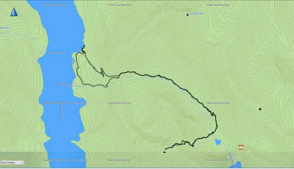
The route for Mount Boswell is accurately described by Andrew Nugara in, More Scrambles in the Canadian Rockies, 3Rd Edition and I don’t think that I can add much more. One thing I will note, is that the boat fee was $32 per person and since we weren’t within the peak summer schedule, the boat’s departure time was 9:00 am with two return times of 5:00 pm and 5:30 pm. I was also glad that we got to ticket office early because the boat was full to capacity.
For reference, it took us 1 hour and 30 minutes to reach the point where we left the trail (~6.5 km), and then after crossing the creek – which required wading – another 1 hour and 45 minutes to reach the summit. In total, it took us 3 hours and 30 minutes to get from Crypt Landing to the summit of Mount Boswell.
After spending only 10ish minutes on the summit, we descended the way we came and it was only after we had reached the base of the first cliff band and determined that we had plenty of time left, that we took a 15 minute lunch break. Including this break, it took us 1 hour and 30 minutes to reach the creek from the summit. Again, we were hiking under less than ideal conditions, so I won’t speculate how quick we would have been under dry conditions. Once on the trail and with time on our side, we decided to return via the Hell Roaring Canyon trail.

Our total round trip distance was 20 km (not sure why the graph says different) and our total roundtrip time was 7 hours even. Our total elevation gain was 1462 m.
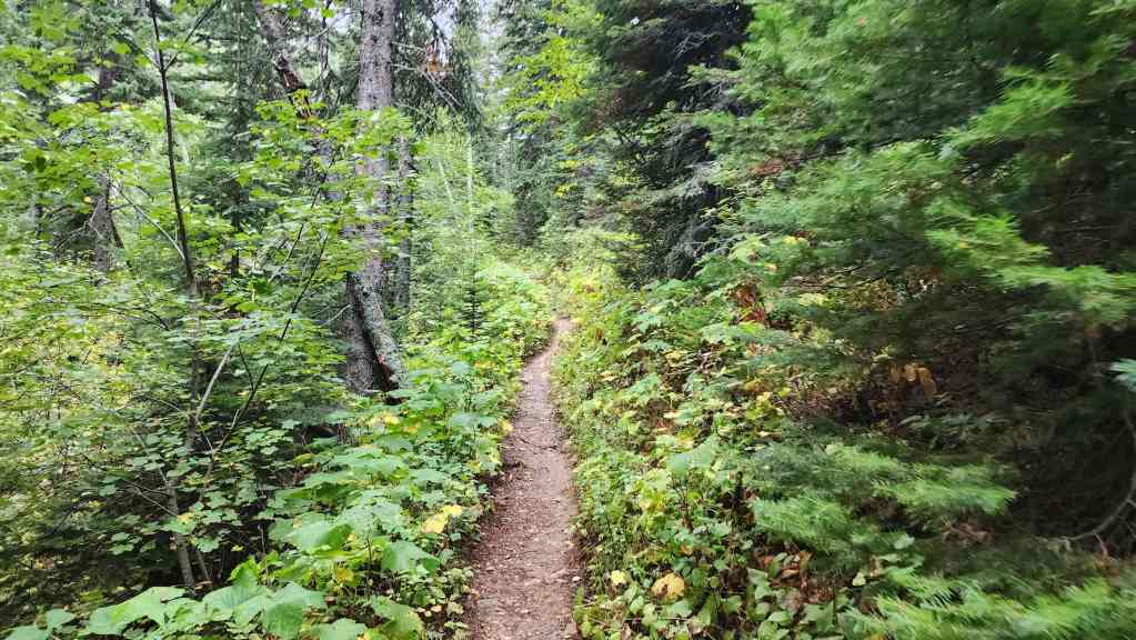
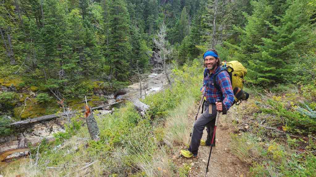
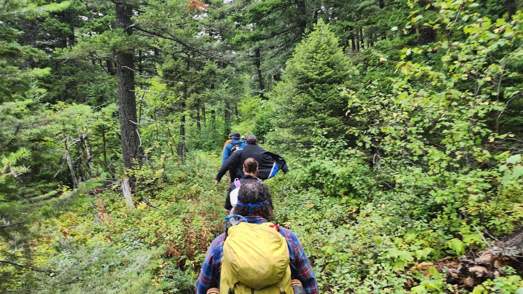
After getting off the boat at Crypt Landing, we set off along the trail at a rapid pace until we had passed all other hikers. The last person we came to was, Paula, a delightful American who asked to join us as she was making a solo trip to Crypt Lake. We told her we were leaving the trail after Burnt Rock Falls, but until then, she was more than welcome and together, the three of us set a brisk pace.
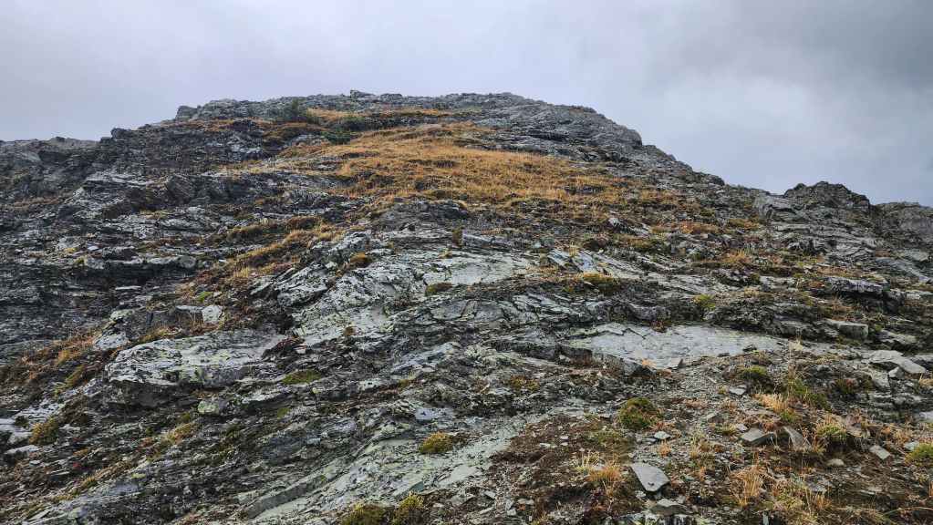
Our first look at one of Boswell’s outliers.
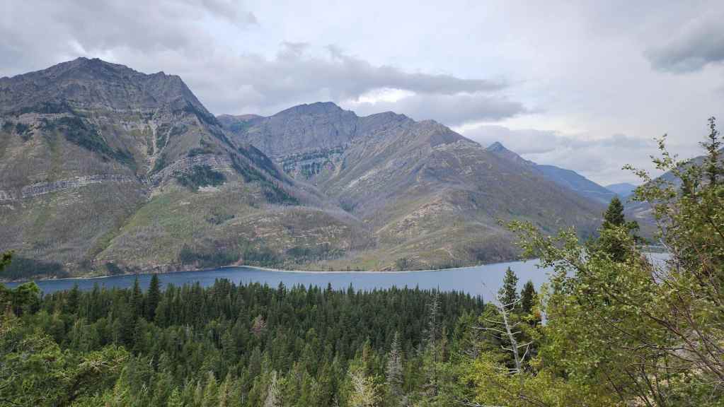
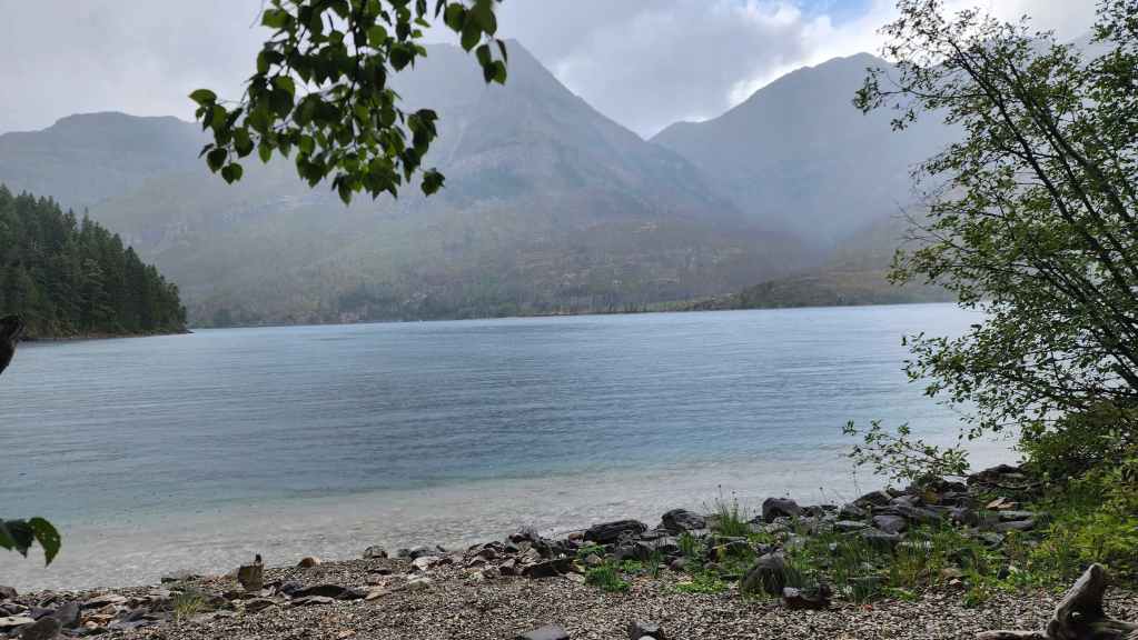
Looking back and across Upper Waterton Lake at Akiiohtaikiistakoo (Bertha Peak) (centre) as we near the top of the switchbacks.
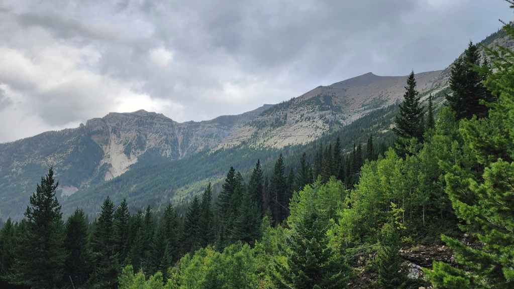
Gazing over at Mount Campbell (centre).
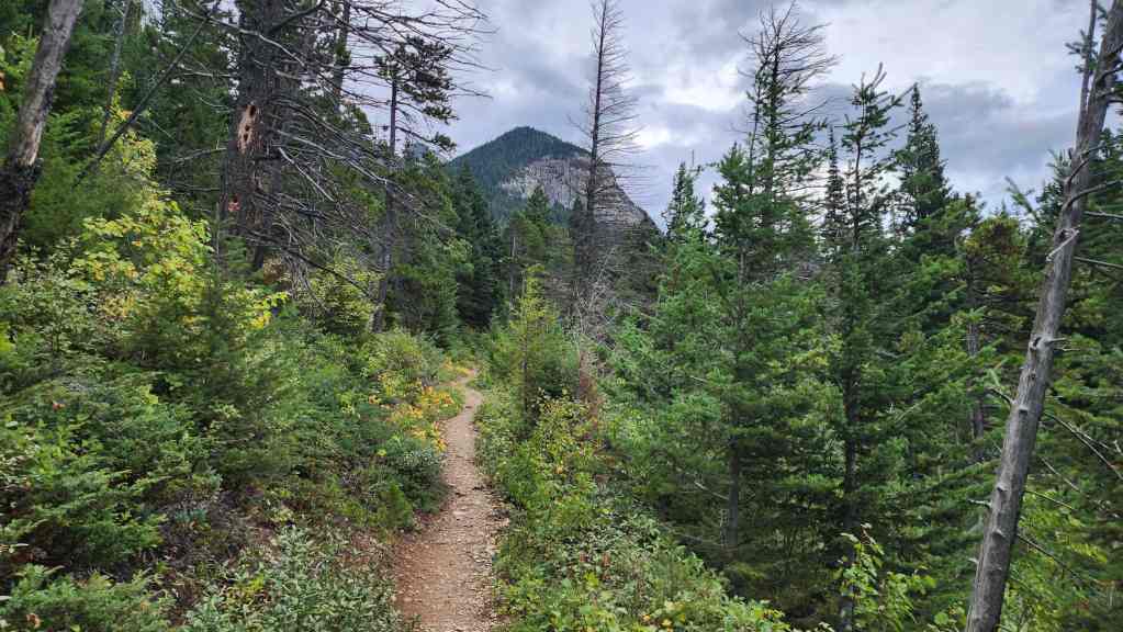
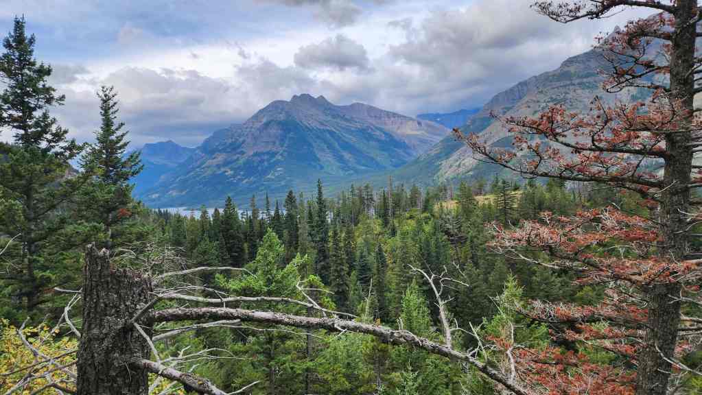
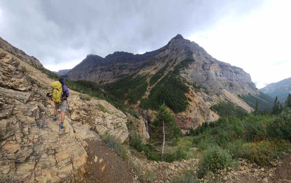
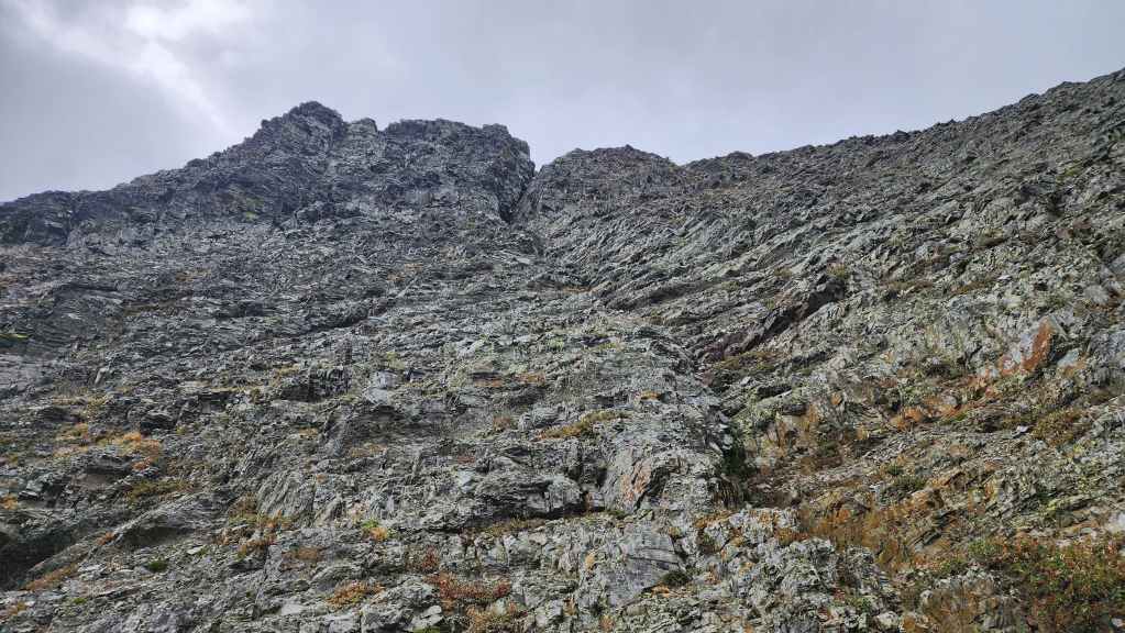
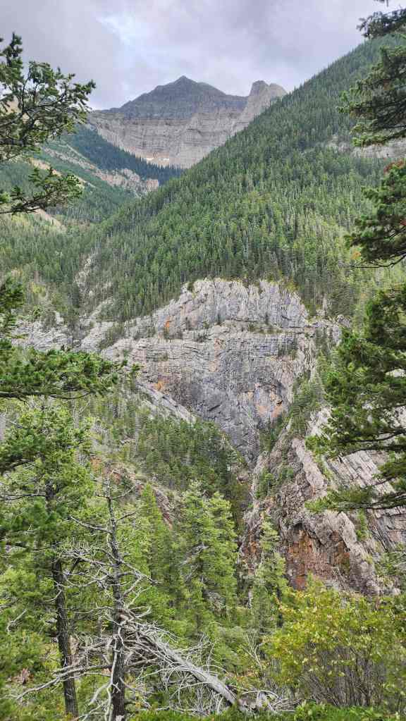
Our first good look at Mount Boswell.

Gazing up the valley towards Maisstooinastáko (Arras Peak) (right).

From further up the trail, we could see “Crypt Peak” (centre) that sits directly above Crypt Lake.

Back into the trees.

Passing a small waterfall off the side of Maisstooinastáko (Arras Peak).
Looking back at Saakiimaapi / Maisstooinastáko (Vimy Peak) (left).
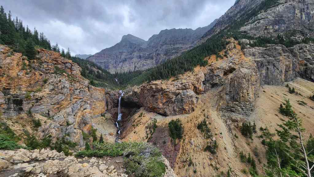
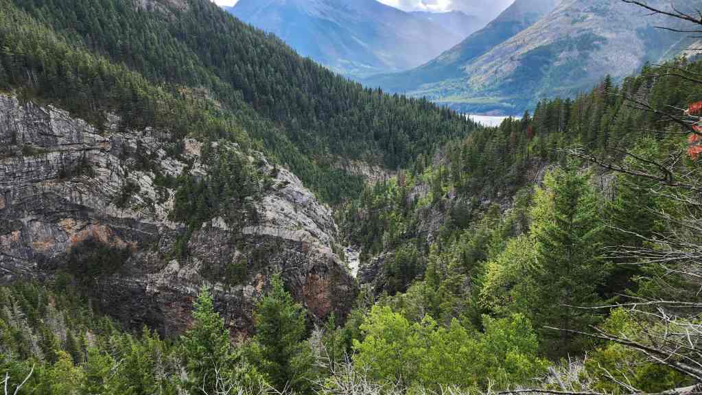
Arriving at Burnt Rock Falls.

As it was later in the year, Hell Roaring Creek didn’t have the volume of water that can make Burnt Rock Falls so dramatic. Nonetheless, it was still impressive.
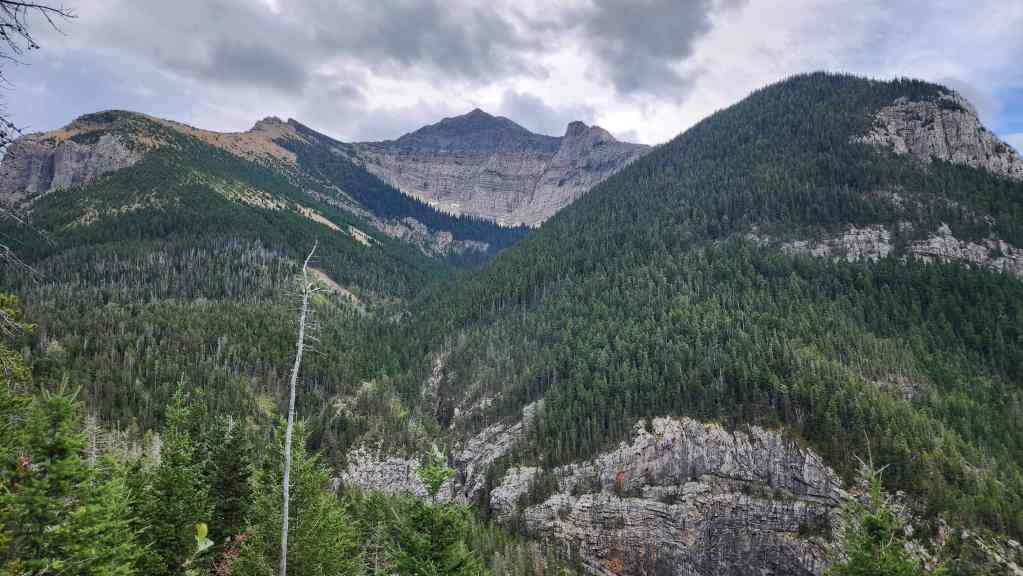
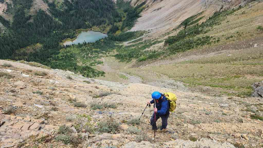
Brad eyes our ascent slope (centre) up Mount Boswell.

Another look at Burnt Rock Falls.

Approximately, 6.5 km from Crypt Landing, we came to a small spur that led off the main trail. This is where we said goodbye to Paula as we set off for the base of Mount Boswell. For reference, it took us 1 hour and 30 minutes to reach this point from Crypt Landing.
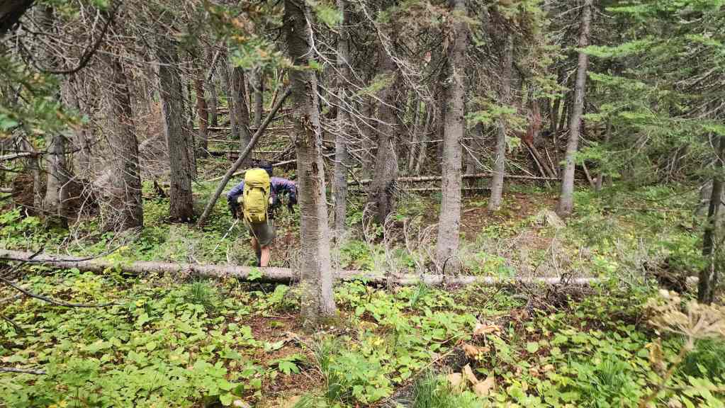
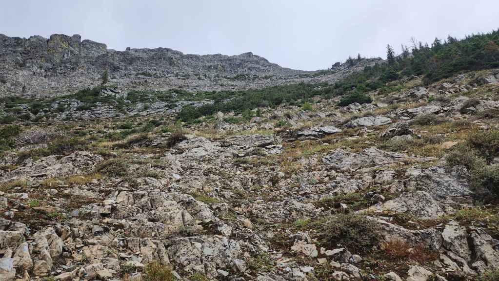
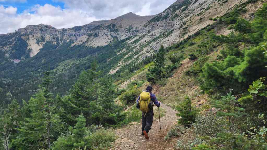
The trail soon became faint as we followed it into the forest.

Still following the faint trail.

Looking back after crossing Hell Roaring Creek, which thankfully wasn’t hellish. 🙂 It did however, require us to remove our boots to wade across. From the other side, it would then take us 1 hour and 45 minutes to reach the summit.

Heading towards the base of Boswell. Any semblance of a trail disappeared soon after crossing the creek.

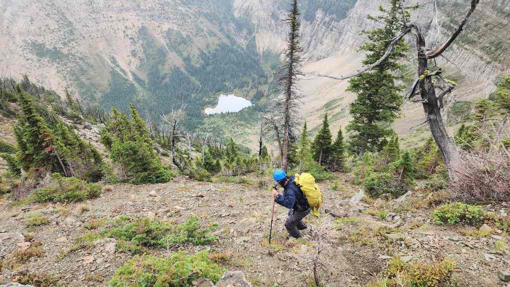
We would follow a small avi slope / boulder field as we made our way up and through the trees. By heading up sooner rather than later, we avoided a lot of bushwhacking.

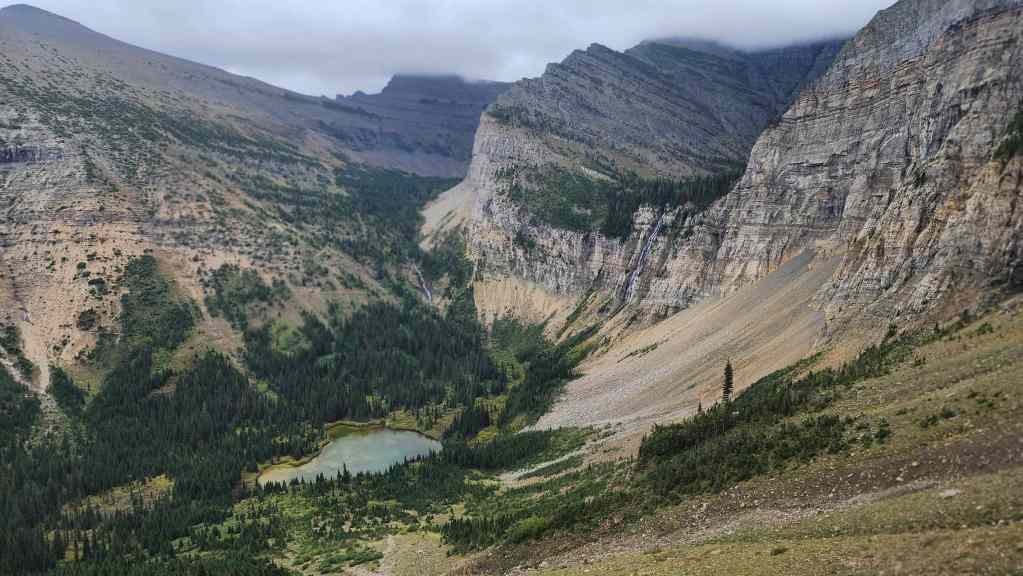
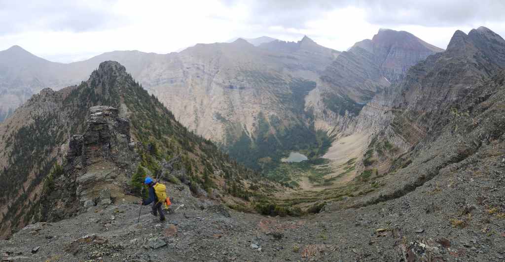
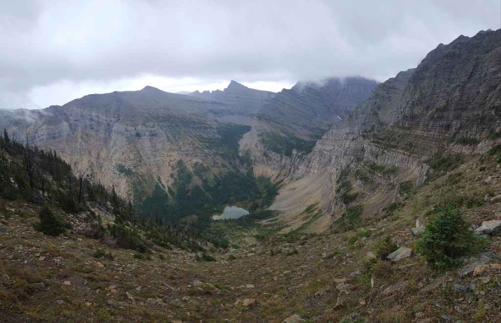
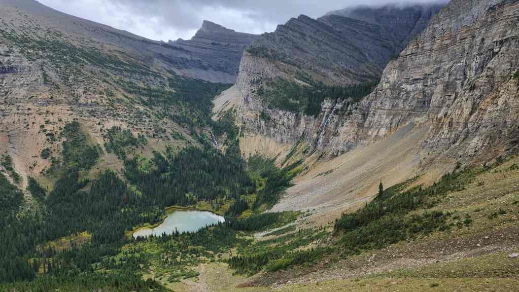
Looking over at the small tarn that sits beneath Crypt Falls (right). Crypt Lake is located above the headwall.

Nearing the base of Boswell’s northeast outlier.

From the base of the outlier, we would traverse over to the east slope of Boswell where Nugara’s ascent route begins.
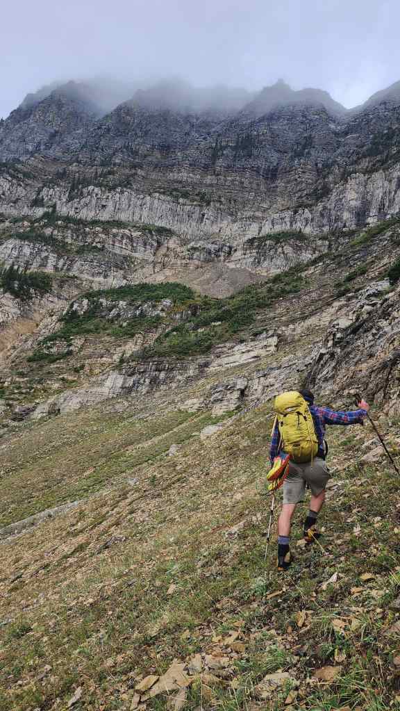
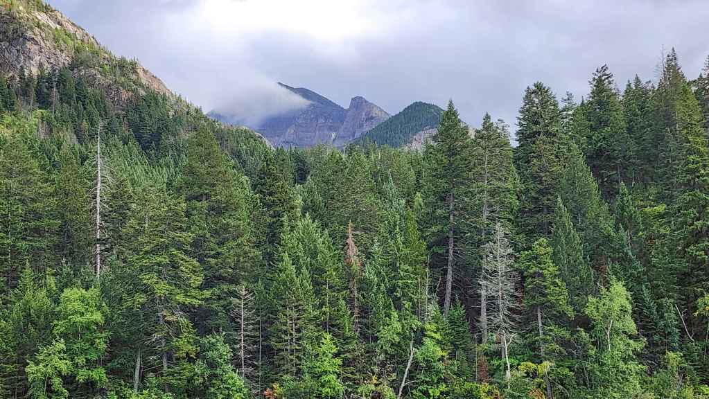
Though the forecast called for mostly sunny skies, we found ourselves under cloud, drizzle, and intermittent rain throughout the day.

Looking back and over at Maisstooinastáko (Arras Peak) (right).
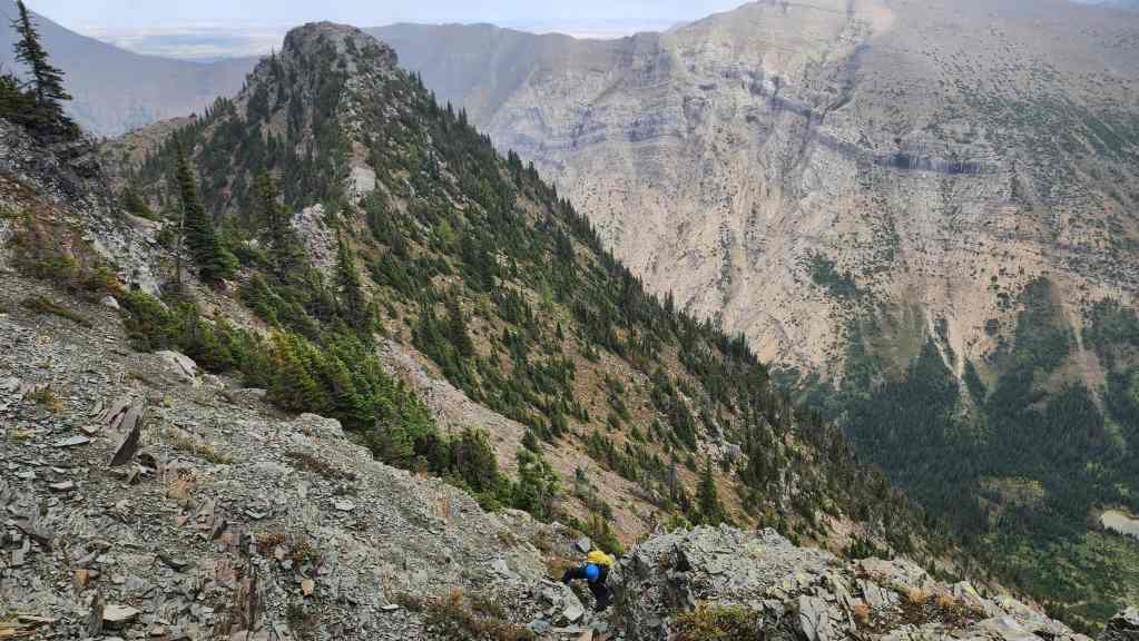
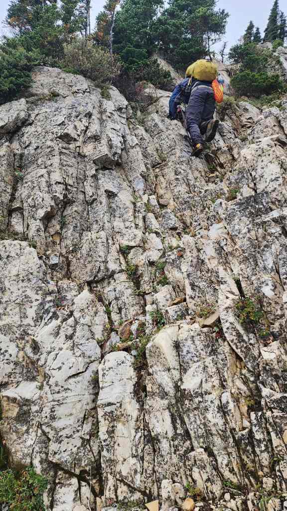
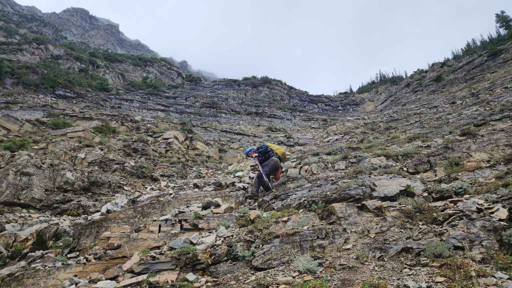
Starting up the gully Nugara describes on the east slope of Boswell. The wet rock made things a bit tricky and we would eventually make our way over to the trees where the footing was better. (Photo by Brad Wolcott)
Another look back as we gain elevation.
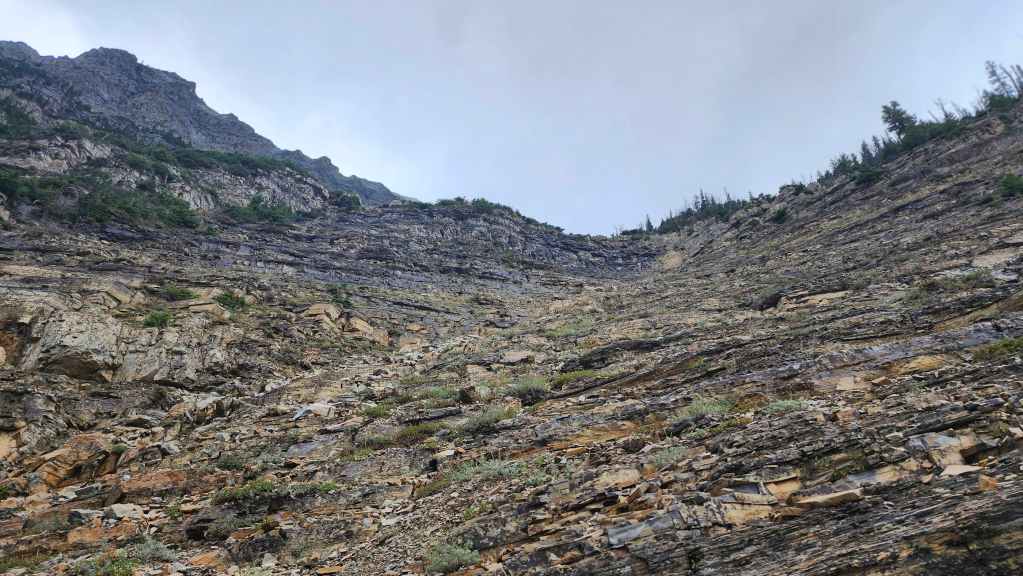
In dry conditions, the gully (centre) would have been the natural choice.
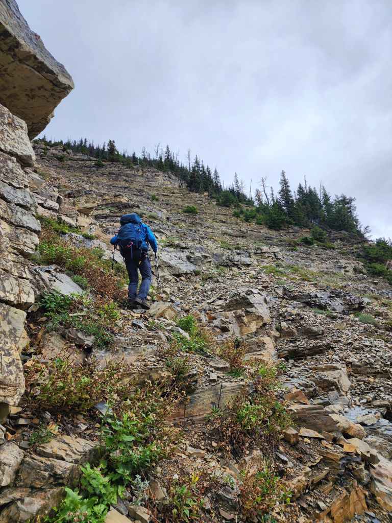
Crossing a ledge as we head towards the trees.

Ascending through the trees proved to be much easier.

Enduring intermittent bouts of rain.

The view up. We would trend left until we crossed the top of the gully.
Across the gully and looking up at the false summit. (centre)

Zooming in on Crypt Lake and Crypt Falls.
Standing beneath the false summit. We would follow the small gully in the centre a short distance before using a wide ledge to reach the ridge on the right.
Making our way up the small gully.
Finally on the ridge with Saakiimaapi / Maisstooinastáko (Vimy Peak) in the background.
The view from the ridge.
Making the short – but slippery – hike onto the false summit.

The view over to Boswell’s northeast outlier.
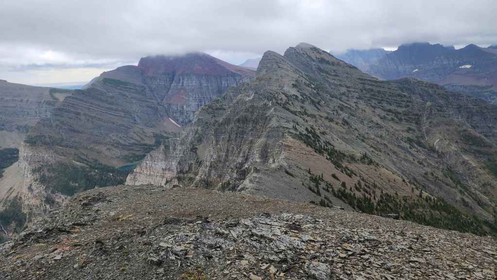
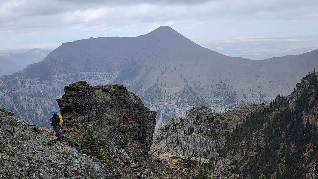
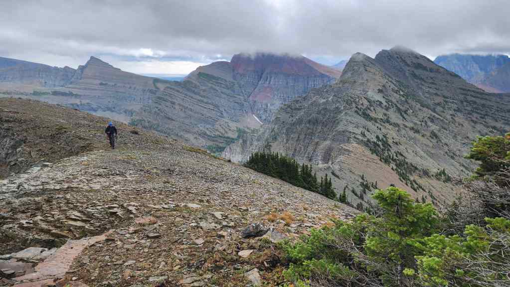
On the false summit and looking towards “Crypt Peak” (left of centre) and “Wilson Ridge” (right of centre). The pressure of making back to the boat in time combined with the rain, nullified any thought of venturing over to Wilson.
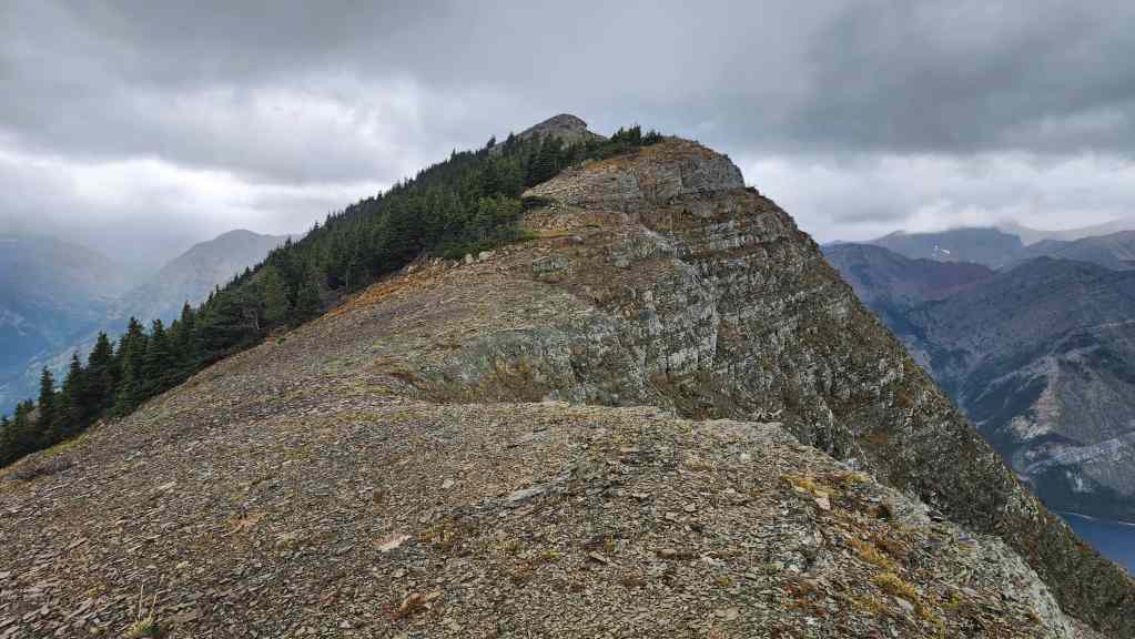
The summit is a short distance away.
Making our way along the summit ridge.

With the rapidly changing weather, we lucked out in that we weren’t inside a cloud.
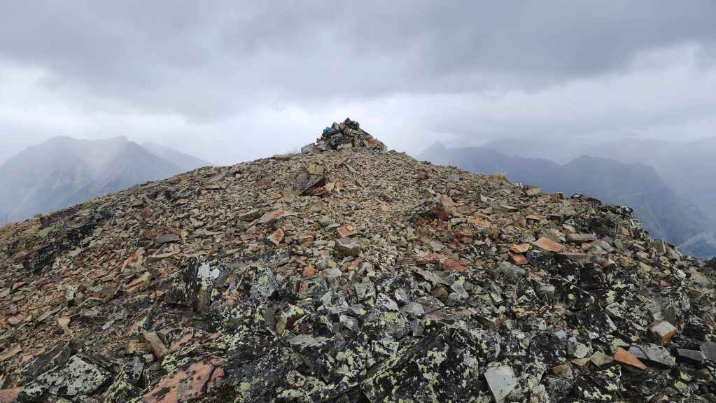
The summit of Mount Boswell (2454 m). For reference, it took us 1 hour and 45 minutes after crossing Hell Roaring Creek and 3 hours and 30 minutes from Crypt Lake landing.
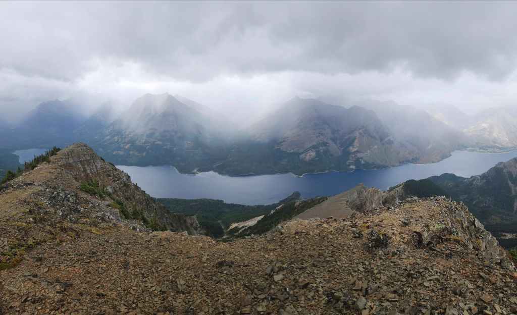
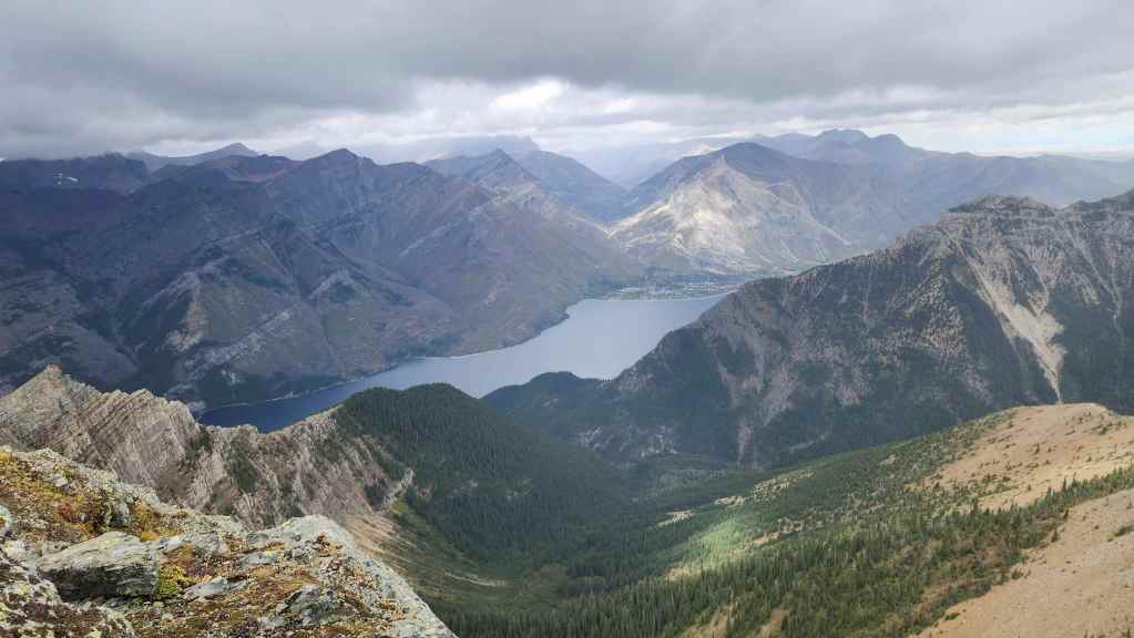
A pano to the west…

And then to the northwest.

Looking to the north…

And then to the east.
Finally, a pano to the southeast.

We were very conscious of the wall of rain that was approaching from the south.

A sliver of sunshine illuminates Mount Crandell (right).

Zooming in on the Waterton townsite.

Gazing over to Saakiimaapi / Maisstooinastáko (Vimy Peak).

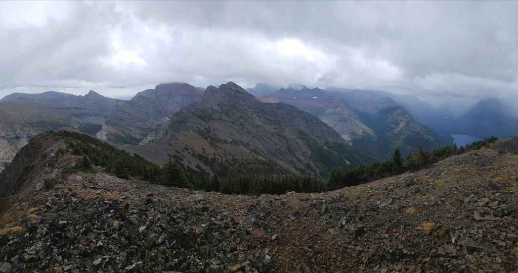
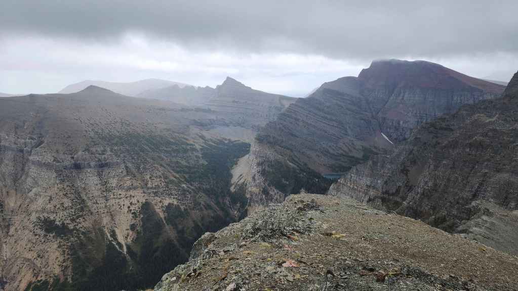
It’s a mystery why “Crypt Peak” (centre) doesn’t have an official name, as it’s the highest peak in the immediate area. “Wilson Ridge” (right) is also an unofficial summit along the ridge. For further information on “Crypt Peak”, I’d definitely recommend Andrew’s trip report.
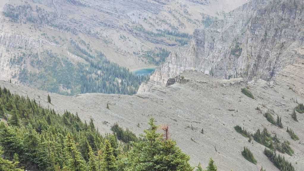
A telephoto of Crypt Lake (centre).

The view across Upper Waterton Lake to Mount Richards.

Me on the summit. (Photo by Brad Wolcott)
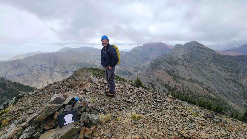
Brad on the summit. With the wind and the rain, we didn’t bother opening the registry.
With a heavier bout of rain approaching, we spent only 10 minutes on the summit before retreating.

The peak on the left also does not have a name, though some consider it the unofficial high point of Maisstooinastáko (Vimy Ridge). I think a good nickname for this peak is Maisstooinastáko (“Hill 145”) which was the highest point on the actual Vimy Ridge in France and is where the Canadian Vimy Ridge Memorial is located.
Back on the false summit with Maisstooinastáko (Arras Peak) on the left.

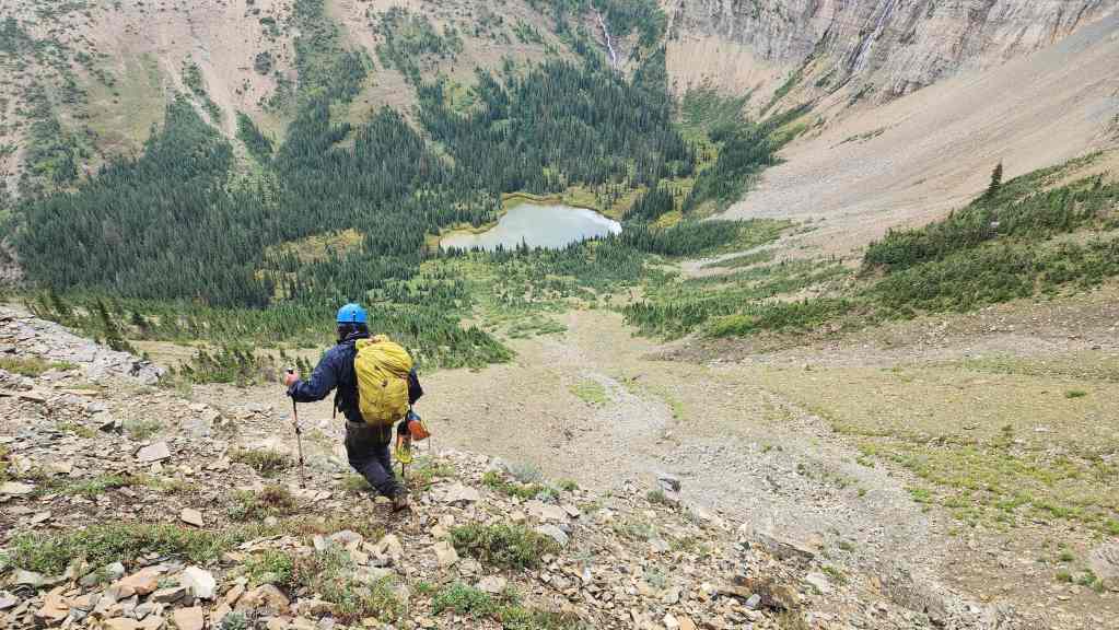
Descending from the false summit.
Due to the rain, we would try and stick to the trees where there was better footing.
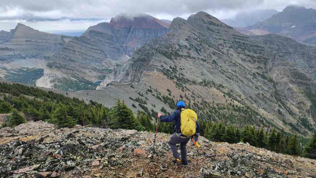
Heading down the east slope.
Under dry conditions, there is nothing tricky about Boswell. The crux is making sure you don’t miss the boat at the end of the day. Otherwise, it is very straightforward.

Looking back to the false summit.

Clouds begin to roll in and the rain gets heavier.
We ventured slightly off our ascent route and found ourselves having to make a small down-climb. Again, not a big deal under dry conditions, but a higher level of caution was required in the rain.
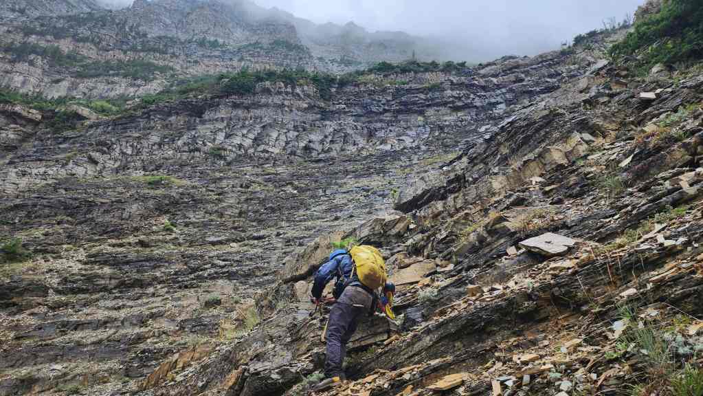
Descending from the trees and back towards the gully.
Another look back and we begin to descend next to the gully.
Despite the weather, this view was always inviting.
Arriving back at the first cliff band…

And starting our traverse underneath Boswell’s northeast outlier. Now in the clear, we’d stop for about 15 minutes at the base of the cliffs for a quick lunch.

Yet another look over at Crypt Falls (right).

Heading down the small avi slope / boulder field. (Photo by Brad Wolcott)

Including our 15 minute lunch break, it only took us an hour and a half to make it back to the creek from the summit.
Back on the Crypt Lake trail with lots of time left to catch the boat. Whew!

Looking back at our route up Boswell.
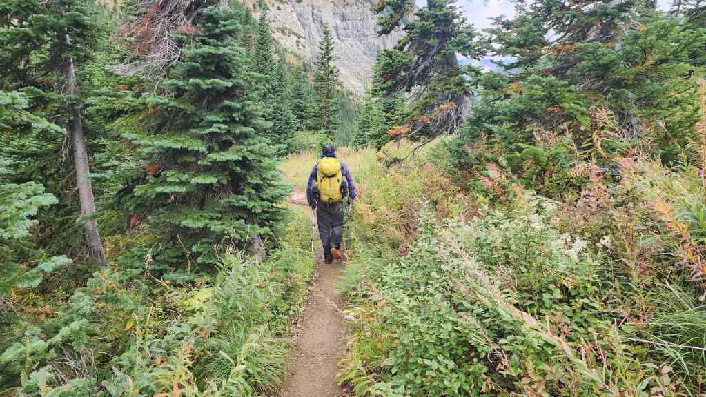
Enjoying the hike back.

Passing Burnt Rock Falls.

Making excellent time.

As we had time to spare, we decided to return using the Hell Roaring Canyon trail.
Looking down to Hell Roaring Canyon.
The view back to Mount Boswell.

Easy hiking.
The sun making its first appearance of the day was definitely a reason to smile.

A deep pool in Hell Roaring Creek.

Arriving where the trail levels out as it follows the lake back to Crypt Landing.
Unfortunately, we ran into a traffic jam of seven people just as it started to rain.

Stuck in traffic. 😂

Arriving back at Crypt Landing exactly 7 hours after starting.
Sheltering under some trees while we wait for the boat. It rained hard for a good 45 minutes.
Thankfully the rain stopped just as the boat arrived. Otherwise, we’d have been soaked on the open top deck while heading back. The break in the rain also allowed us one final look at Mount Boswell. I think Brad would agree, that the weather in combination with the fact that we were working under a hard deadline to not miss the boat, diminished our overall enjoyment of the trip.
Though we arrived back in plenty of time, the only times we really stopped moving were to take our boots off and on when crossing the creek, the 10ish minutes we spent on the summit, and then 15 minutes we took for lunch after we knew we were in the clear for time. I’m not going to speculate if we could have included “Wilson Ridge” if it wasn’t raining, but perhaps the extra 30 minutes that you get with the 8:30 am departure time for the boat during the summer months might help. Other than the time crunch, Mount Boswell is a straightforward ascent that presents no difficulties. A huge thanks to Brad for the awesome company – and the Limoncello that we enjoyed while sitting by the dock on the bay. 😂
Fantastic level of detail! Thanks for posting this. One day I will get there… just need to combine it with multiple other ascents to make the 5 hr driving palatable. 😀
Thanks Doug! I’d definitely use Cornelius & Raff’s route if you want to combine it with the other peaks on the ridge. Vern used their loop and also has a trip report on it. Otherwise, you are under a time crunch and though we finished with lots of time to spare, I’m still unsure if that was enough to tag Wilson and return in time. It’s too bad the backcountry campground is no longer there, as that would have been a good option…
Also, I totally forgot to get your email from Andy so I could send you my .GPX from Andy Good. He was away and then I forgot, so huge apologies. Do you still want it?
Best,
Dave