
⚠️ Hiking and scrambling are inherently dangerous activities. Please read my Disclaimer. ⚠️
Merry Christmas! Today’s trip was a blast from the past as I returned to complete some unfinished business on the extreme north end of Mount Gladstone. A couple of years ago, as Brad and I were scouting out a number of shoulder season trips in the Castle, we eyed up the north end of Gladstone from the summit of “Whitney Creek Mountain” and noted that its most northerly high point, HP 1, would provide some great views. I remember joking that it was so far removed from the foot of Gladstone, that it was essentially the ‘toe’ of the mountain. Hence, the weird nickname, “Gladstone’s Toe”. 😉 Though as I always note, if anyone knows a local or Indigenous name, I would love to use it as my appellations are by no means definitive, and in this particular case, rather tongue-in-cheek. When Brad, Lance, and I ascended “Gladstone’s Toe” in September 2018, it was done under less-than-ideal conditions and it was so cloudy, that we altogether missed HP 1, instead mistaking HP 2 for HP 1; HP 3 for HP 2; and HP 4 for HP 3. We then endured one of the worst bushwhacking descents that I’ve ever experienced. So yes, this toe has some ‘jam’ if you’re not careful! 😉
When Andrew and I began talking about a destination for today, he suggested “Gladstone’s Toe” because I’ve been encouraging him to do it for the last year or so, and because, Calgary-based hiker (and great guy!), Matthew Clay, recently completed an ascent that secured a ‘toe hold’ in Andrew’s mind. 😉 Personally, I was game to return and ‘nail’ HP 1 and finally see some of the views that I missed on our 2018 trip. HP 1 may be the lowest of the four high points, but it does have the best views given its location, so by no means, did Andrew have to ‘toe’ me along.
Thus, under beautiful blue skies and a wind that was significantly muted from what had been forecast, Andrew and I ‘enjoyed a quick and fun ascent using my previous ascent route. We didn’t require our snowshoes until just prior to the ridge, and even then, we probably could have gone without as the snow was mostly firm and largely avoidable. Unlike my previous trip, we did not visit HP 3 and HP 4 even though they are the higher, ‘hairier’ knuckles of the toe. Given my past experience trying to descend from HP 4, we decided to forego repeating the elevation gains and losses required to backtrack to our ascent route. Therefore, this trip was essentially a ‘pedicure’. However, I would still recommend visiting them if you get a chance because it is a neat little ridge walk that gets you up close and personal with Mount Gladstone.
On a more personal note, I’m hoping to get in one more trip before I undergo surgery in the New Year to remove my cancerous thyroid. Otherwise, it may be late February or March before I can get out to the mountains again. In case I don’t get out before my surgery, Happy New Year and happy trails everyone! 🙂
Make sure to read Andrew’s trip report!
To get to “Gladstone’s Toe” from Lethbridge, turn onto the Gladstone Valley Road off of Highway 507 west of Pincher Creek. Follow the road for 13.3km keeping left, and in the process, you will cross two bridges over Mill Creek. At ~13.3 km from Hwy 507 or .6 km from the 2nd bridge, turn right. Follow this road for 1.4 km and then make another right turn. Follow this road for 1.4 km to reach the gas well next to Mill Creek. This is also the starting point for Andrew’s route for Mount Gladstone, in More Scrambles in the Canadian Rockies.
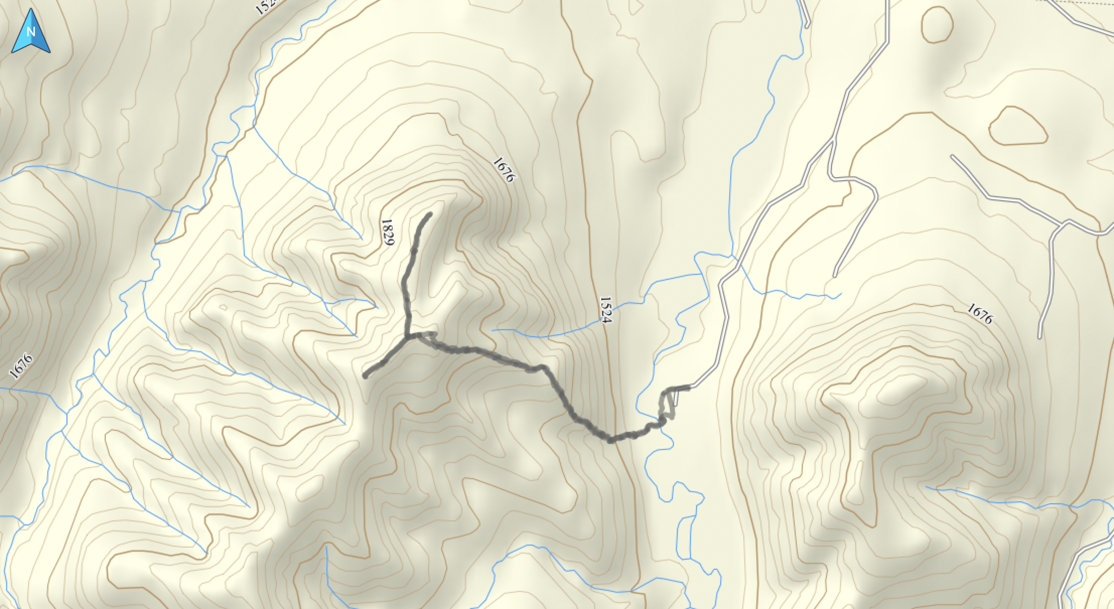
After parking, we immediately crossed Mill Creek (it was very low and easy to cross, but this may not always be the case) and started up the east side of the ridge alongside a small drainage – aiming for the open slopes that we could see above us. This was the same route we used in 2018 and like last time, we had to negotiate a steep slope covered in nasty deadfall for the first ~100m. Afterwards however, it was a pleasant but steep hike through light forest to reach open slopes and from there, a more or less, easy ascent over ~1.3 km to the ridge between HP 2 and HP 1. In total, from the car to the ridge it was 2.6 km with an elevation gain of 512 m.
From the ridge, we lost an initial ~45m in elevation as we followed it north for ~740m towards HP 1. I should note that I used a different GPS than the one used on my 2018 trip and furthermore, the weather conditions were markedly different. My new GPS ended up pinging HP 1 at 1981 m and HP 2 at 2004 m, which is a 27 m difference from the 1973 m that I recorded for HP 2 in 2018. So either the mountain has a growing case of foot fungus, or one set of my readings is highly skewed. 😉 For this trip, I did calibrate my GPS to the topo map (or ‘toe topo map’ if you will), so it may be closer to the actual elevations.
After tagging HP 1, we followed the ridge back for ~914 m to the summit of HP 2. We then walked another ~127 m further south until we were above the col with HP 3. We contemplated continuing, but as I’d already visited the other two high points, and Andrew was satisfied with the views from HP 1 and 2, we decided to head back using our ascent route – something that I wish I’d done back in 2018!

Our total roundtrip time ended up being 3 hours and 38 min. In fact, we made it from Andrew’s car to HP 1 in just 1 hour and 52 minutes. Our total round trip distance was 7.1 km with total elevation gains of 636 m. If you want to add in HP 3 and HP 4, add on more time and distance, but please, for the sake of all that is good, do not use our 2018 route off the mountain unless you really love dense bush and giant logs. 😉 I would recommend returning using the ascent route as there is a ton of deadfall on the lower sections of this mountain.

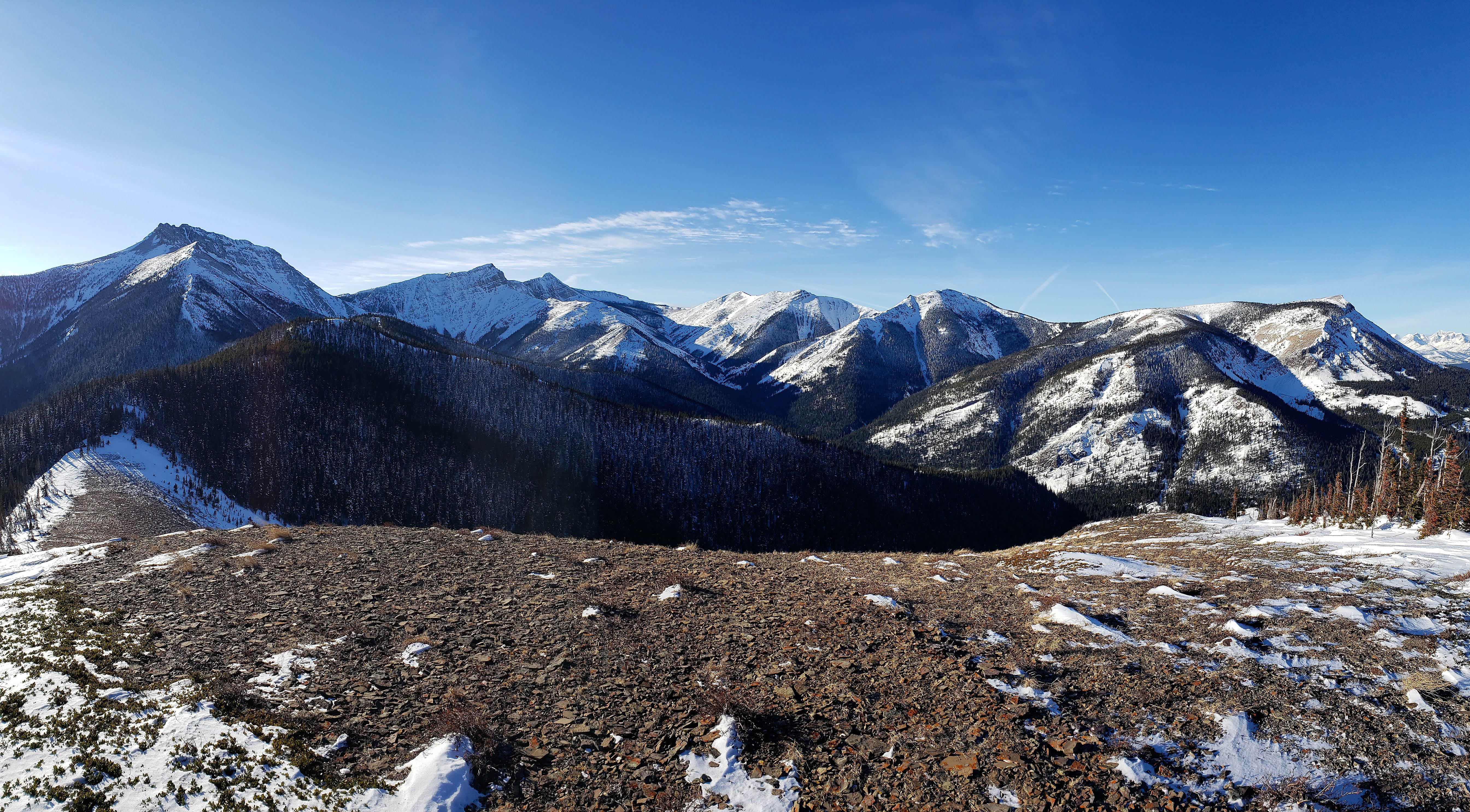
A fine day for a pedicure! 😉 HP 1 (centre) as viewed from the Gladstone Valley Road. HP 1 is the lowest of the four high points that comprise “Gladstone’s Toe”, but it arguably offers the best views. Mount Gladstone itself is on the left and “Larry Mountain” and “Frankie Peak” are on the right.

Andrew gears up at the parking area. Our ascent slope is in the background to the left.

Gazing south towards another repeat destination: “Mill Creek Peak” (centre). I’ve been up this little peak twice and it, along with its higher counterpart, “Mill Creek Mountain” are cool objectives for those who like the obscure.

A rough approximation of our ascent route. It is that same one that I used in September 2018, except this time, I could actually see where we were going. 😉

Andrew easily steps across Mill Creek. Depending on the time of year, this could be much more involved than it was today.

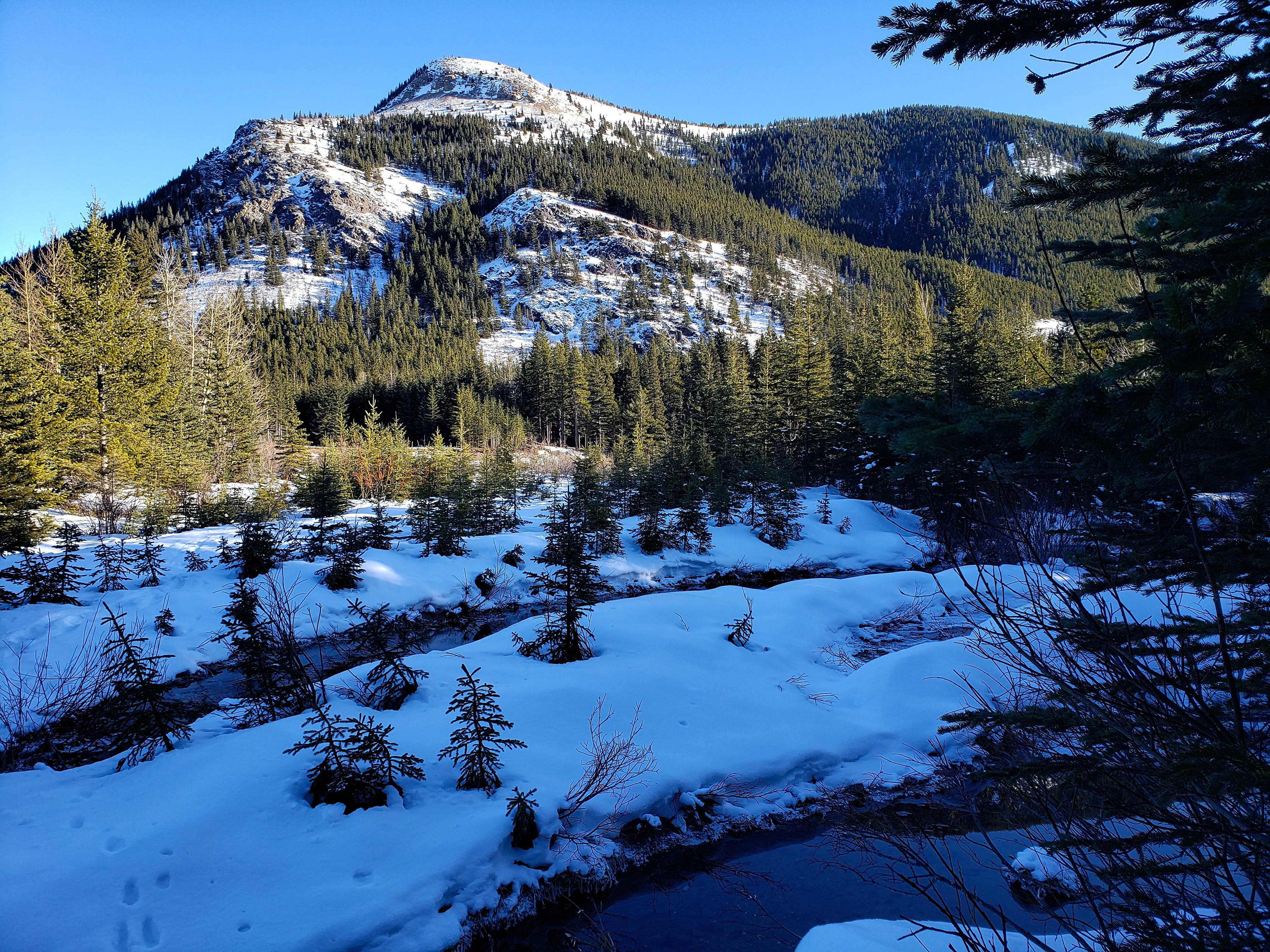
Approaching the ascent slope after crossing Mill Creek (and a few tributaries) followed by a brief walk through the trees. This route is not long, but it pretty much goes from flat to steep in the blink of an eye. (Photo by Andrew Nugara)
The end of a small drainage can be seen to the right of centre. The route starts alongside the northern bank (far right). I sometimes worry that I write ‘far right’ and ‘far left’ so many times in my trip reports, that internet bots have pegged me as a political radical. 😉
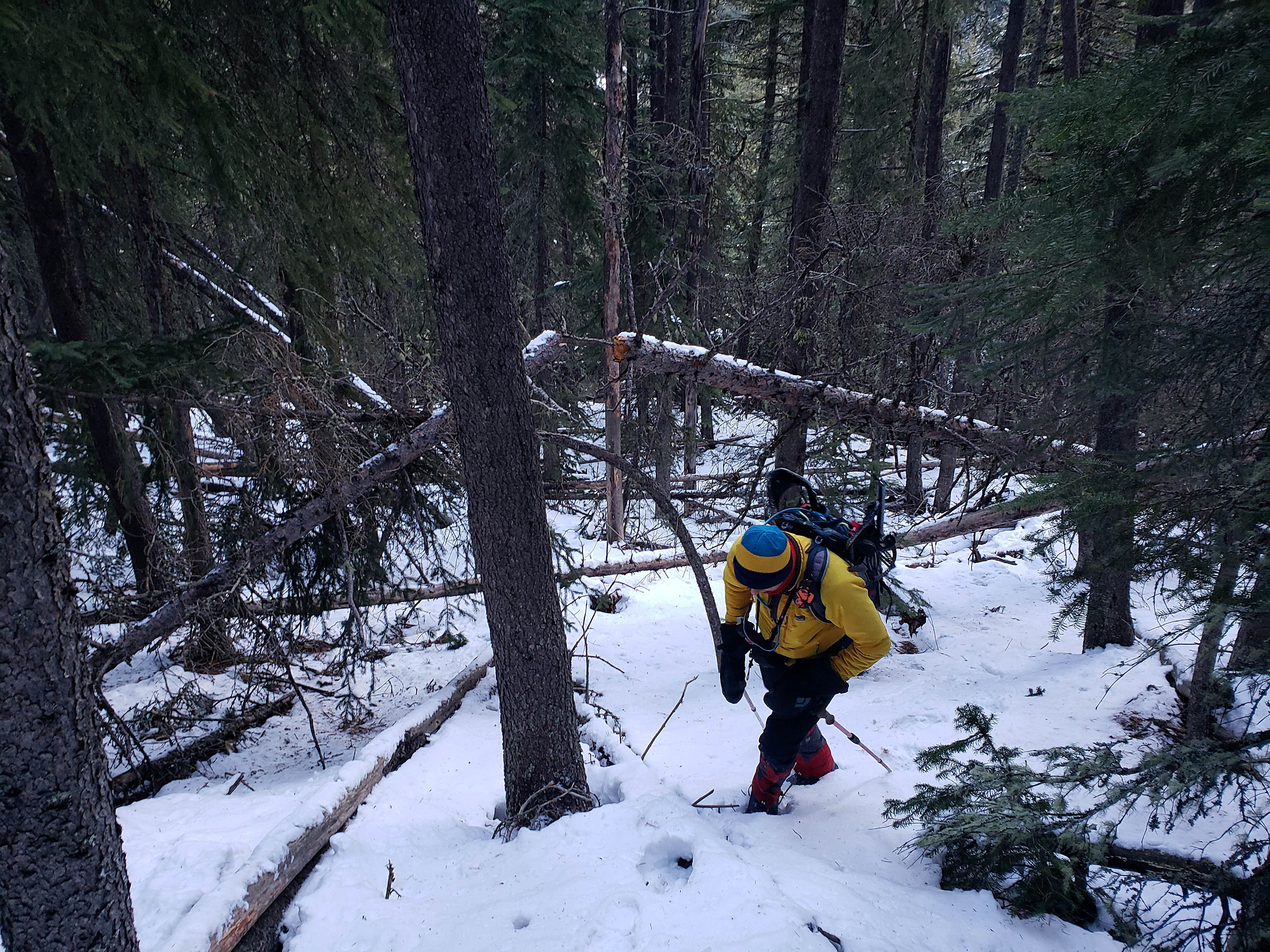
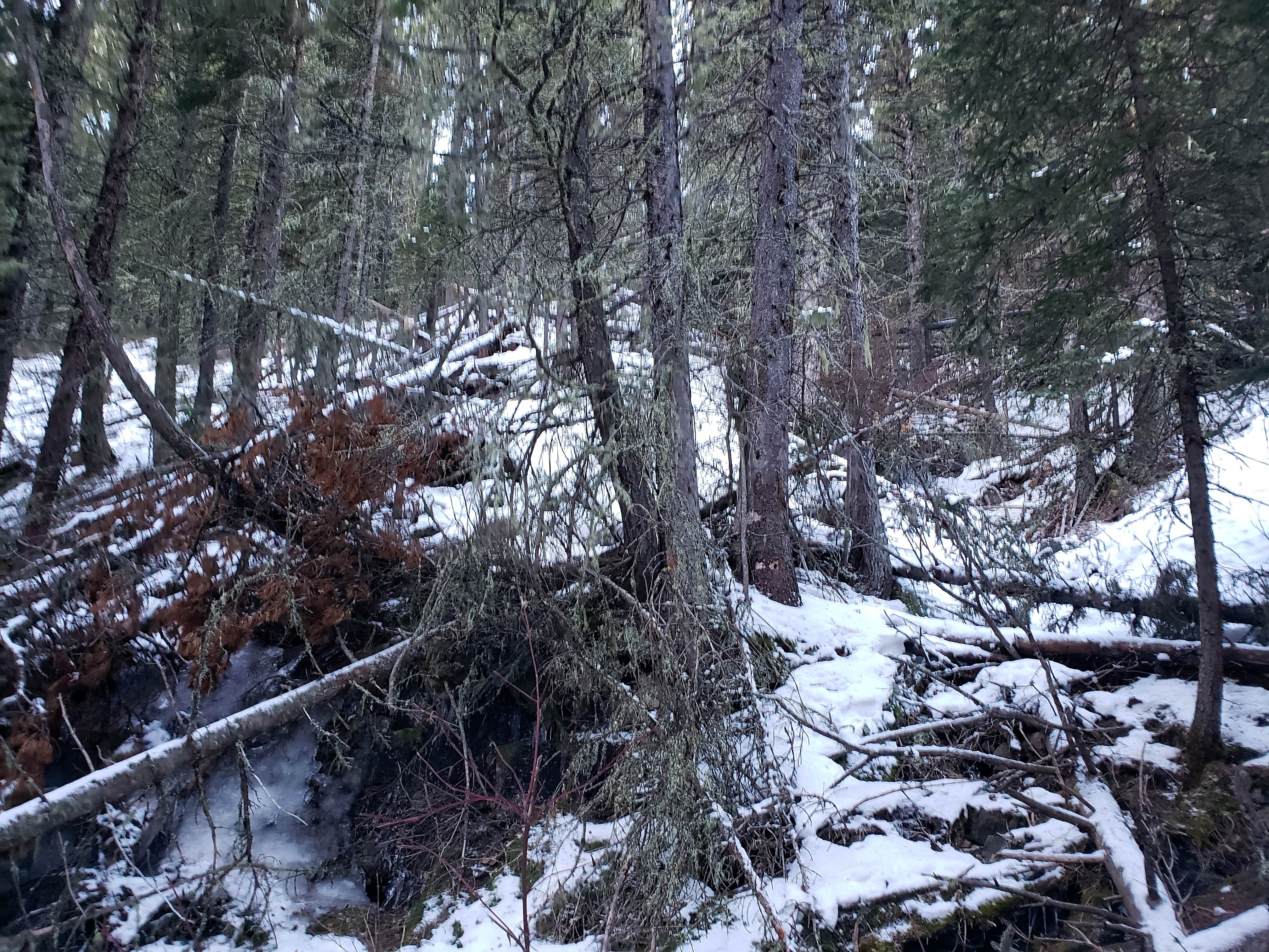
The first ~100 m involves negotiating some deadfall. This is nothing however, compared to what we experienced when we tried to descend off of HP 4 back in 2018!

Making our way up through light forest. The drainage is on the far left.

Approximately 200 m after starting out near the drainage, we arrived on more open slopes. (Photo by Andrew Nugara)

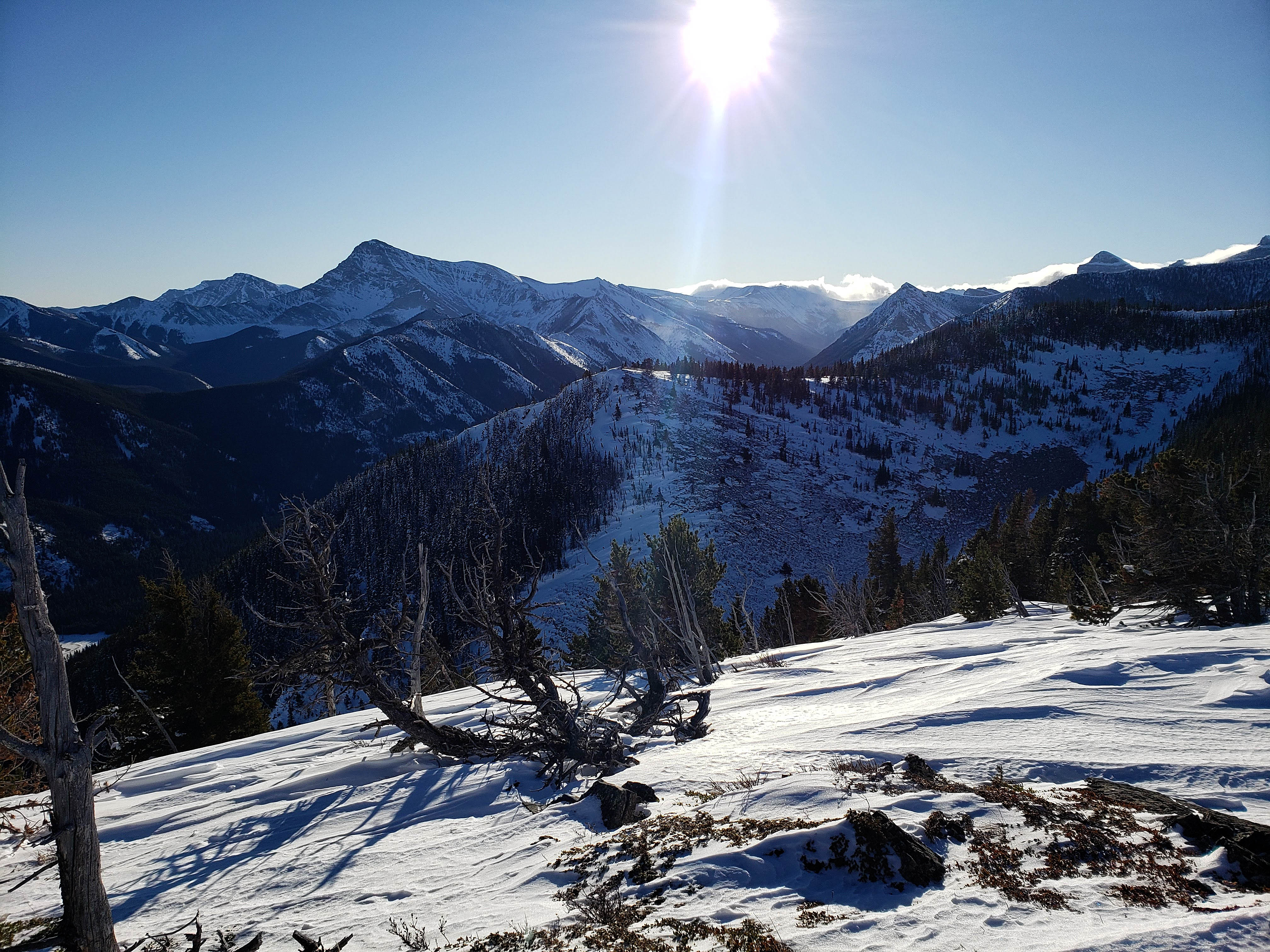
The snow was firm enough that we didn’t need to put on our snowshoes. In the background is “Whitney Creek Mountain”.
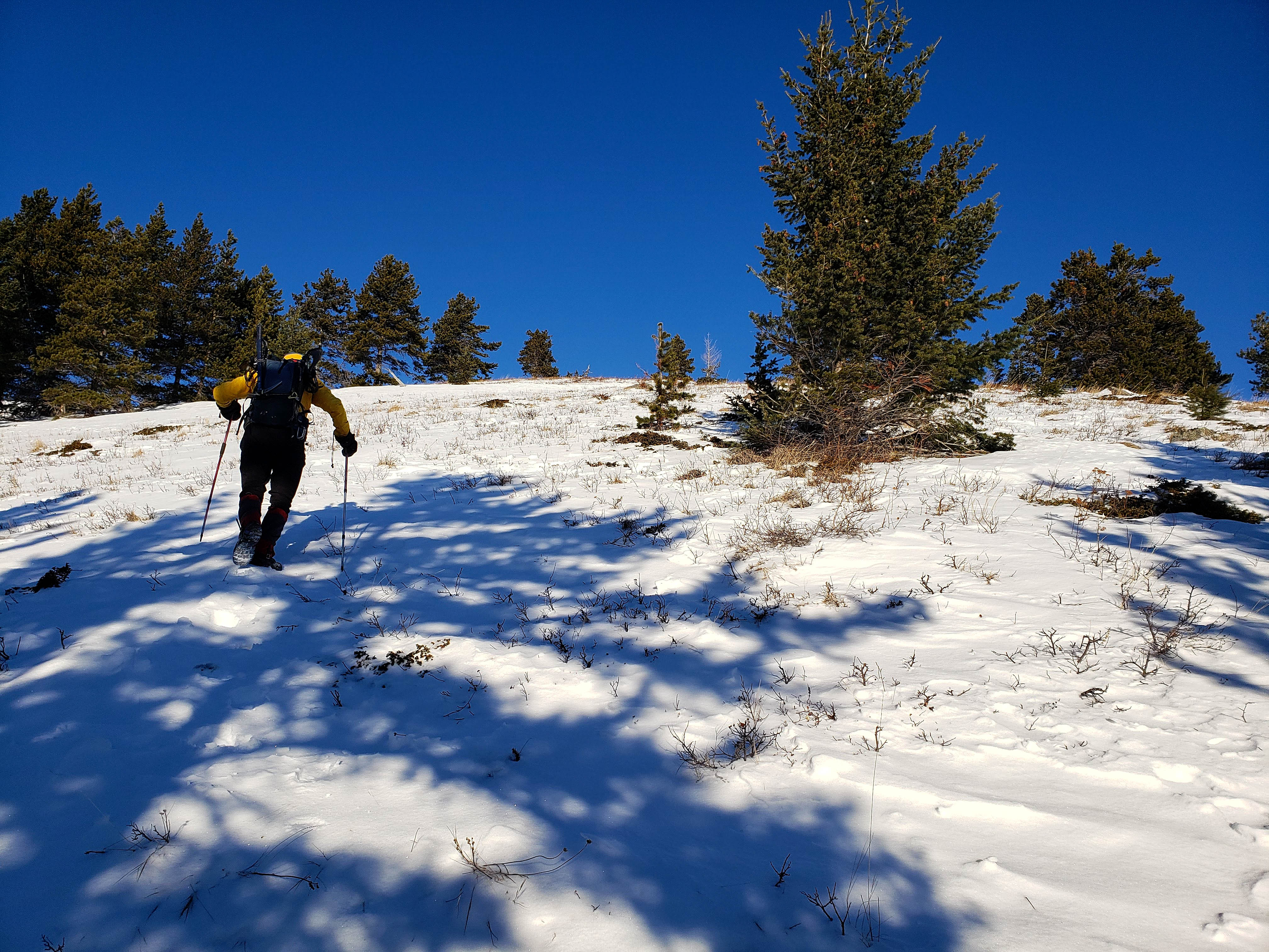
Andrew arrives at the beginning of wide open slopes that we followed all the way to the top. The first open section heads to the north and ends where the ridge curves west.

Andrew ascends a surprisingly snowless slope. The ridge connecting HP 2 and HP 1 is in the background.

A pano looking back to southeast with Victoria Peak and “Whitney Ridge” in the centre and ‘Whitney Creek Mountain” on the left.

A pano to the south highlights “Mill Creek Peak” (left), Mount Gladstone (centre), and HP 3 and HP 4 on the far right.
Arriving at the top of the first open slope. Here, we will enter enter a brief section of trees (foreground) as we follow the ridge as it curves to the west. The second open section is in the background. (Photo by Andrew Nugara)

A beautiful carpet of snow waits for us in the trees.

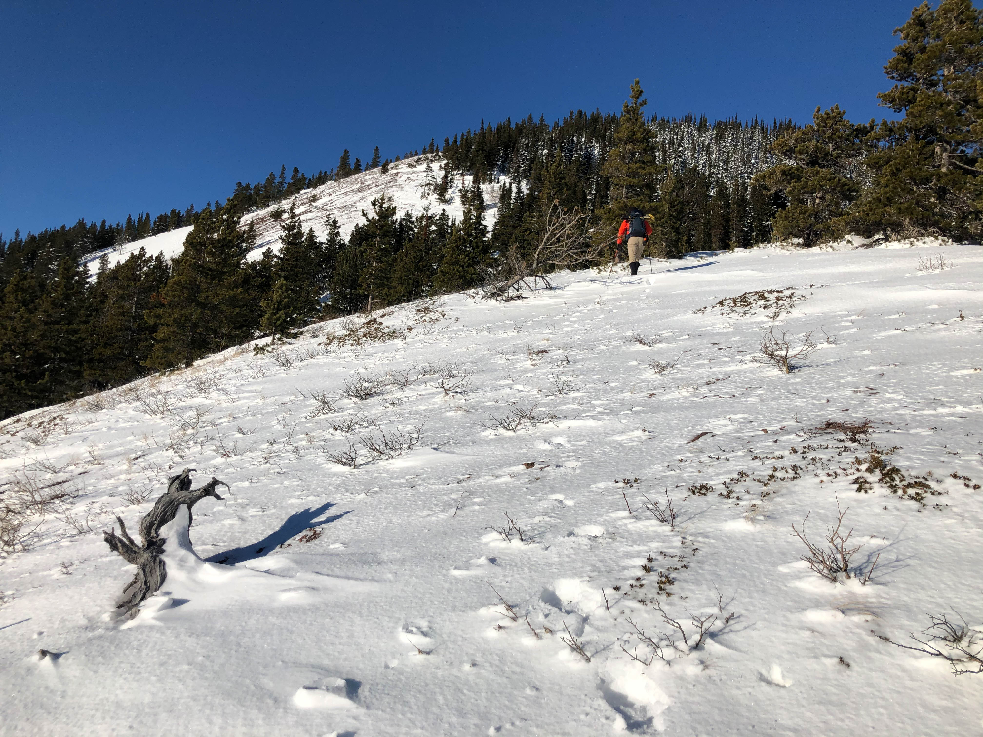
Andrew begins hiking up the second open section.

The view back shortly after leaving the trees.

Time to put on the snowshoes.

Ah! Much better! (Photo by Andrew Nugara)

Another look back shows the north/south open section (centre) and then our current east/west section.

Arriving at the ridge with HP 2 on the left.

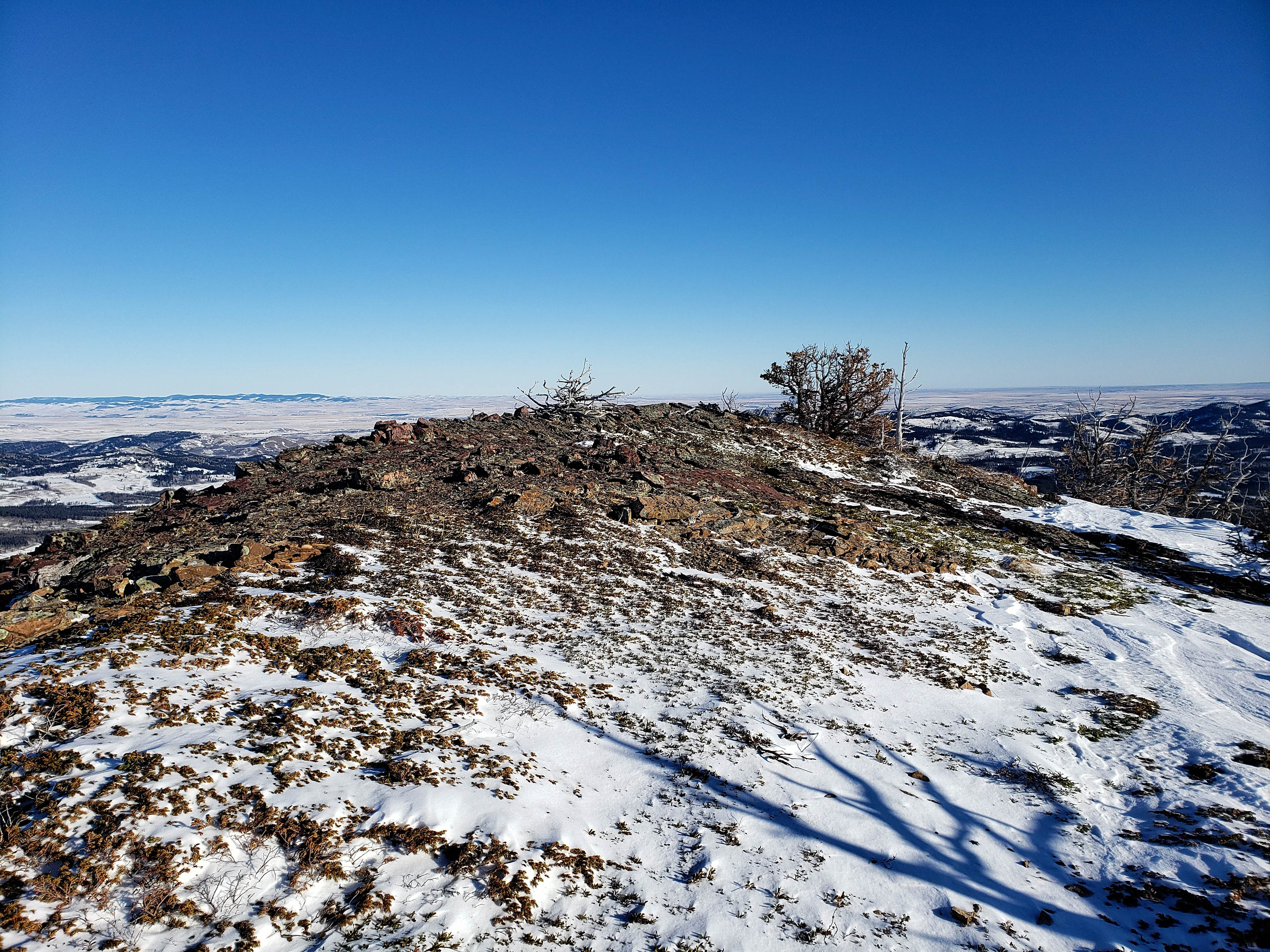
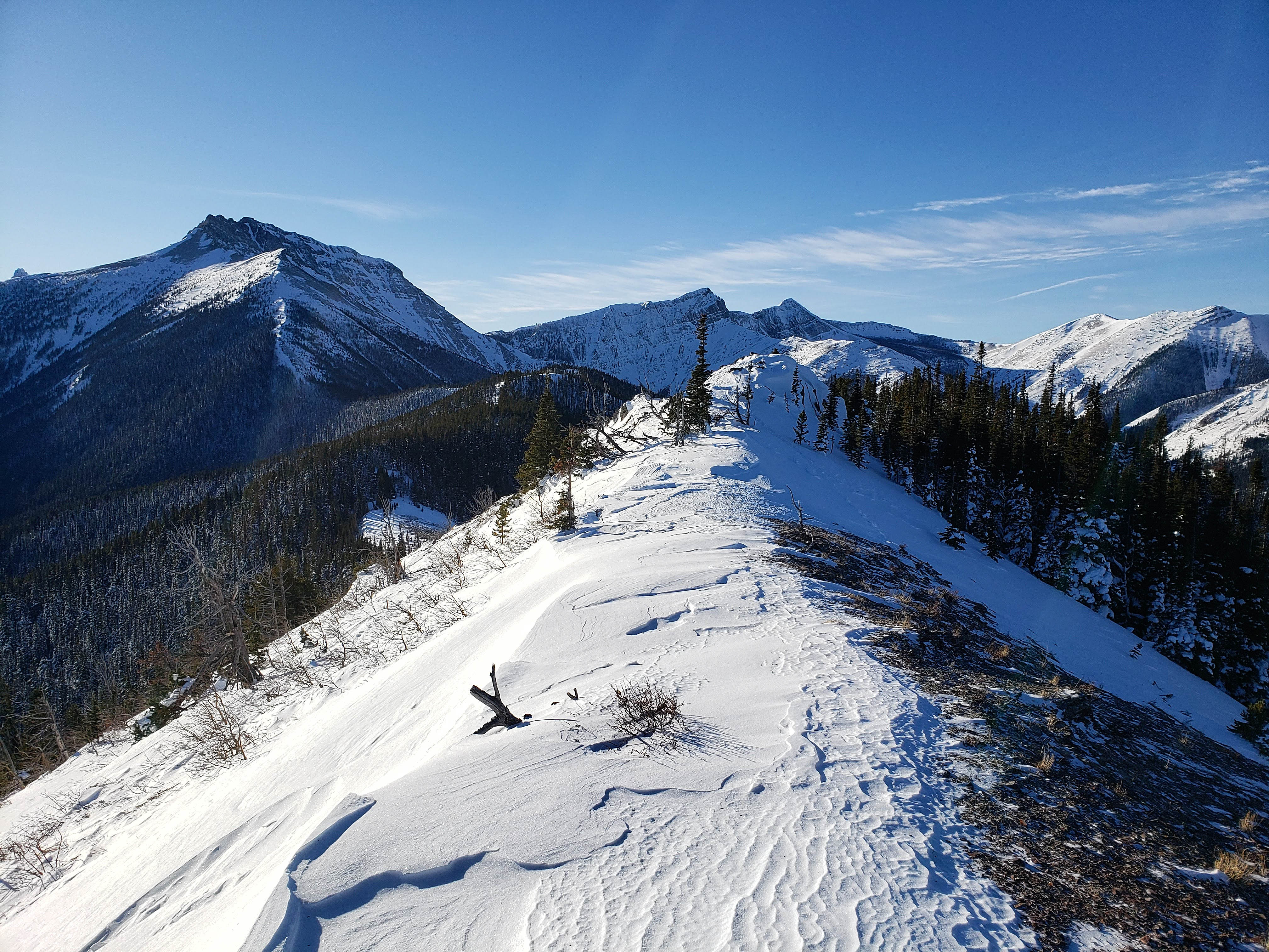
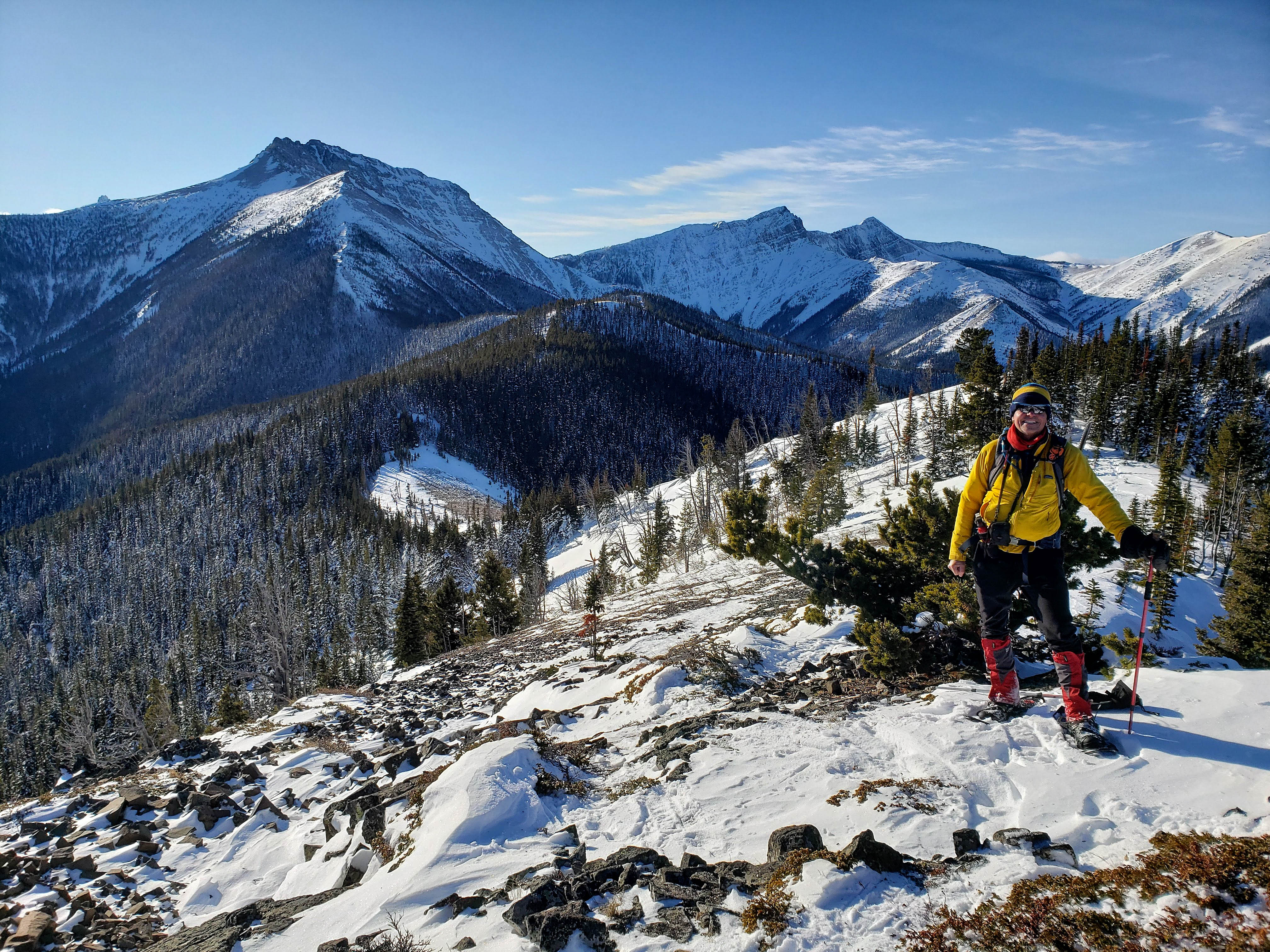
HP 1 sits by itself to north. Though it’s the lowest of the four high points, it offers the best views.

Well, now we know where all the snow is…

My last hike for 2019 is a good one! I used to avoid repeat trips, but I’ve come to appreciate them – especially when there’s some unfinished business involved, but even when there’s not. There are certain locales and mountains that become like old friends and returning to them provides a connection to the land that is felt deeper than the rush of the ‘one and done’ peaks. Don’t get me wrong, I still love the adventure of those, but in the familiar ones, you find permission to slow down and linger among wonder and awe. Hmmm… I must be making that transition into my philosophical fifties… 😉 (Photo by Andrew Nugara)

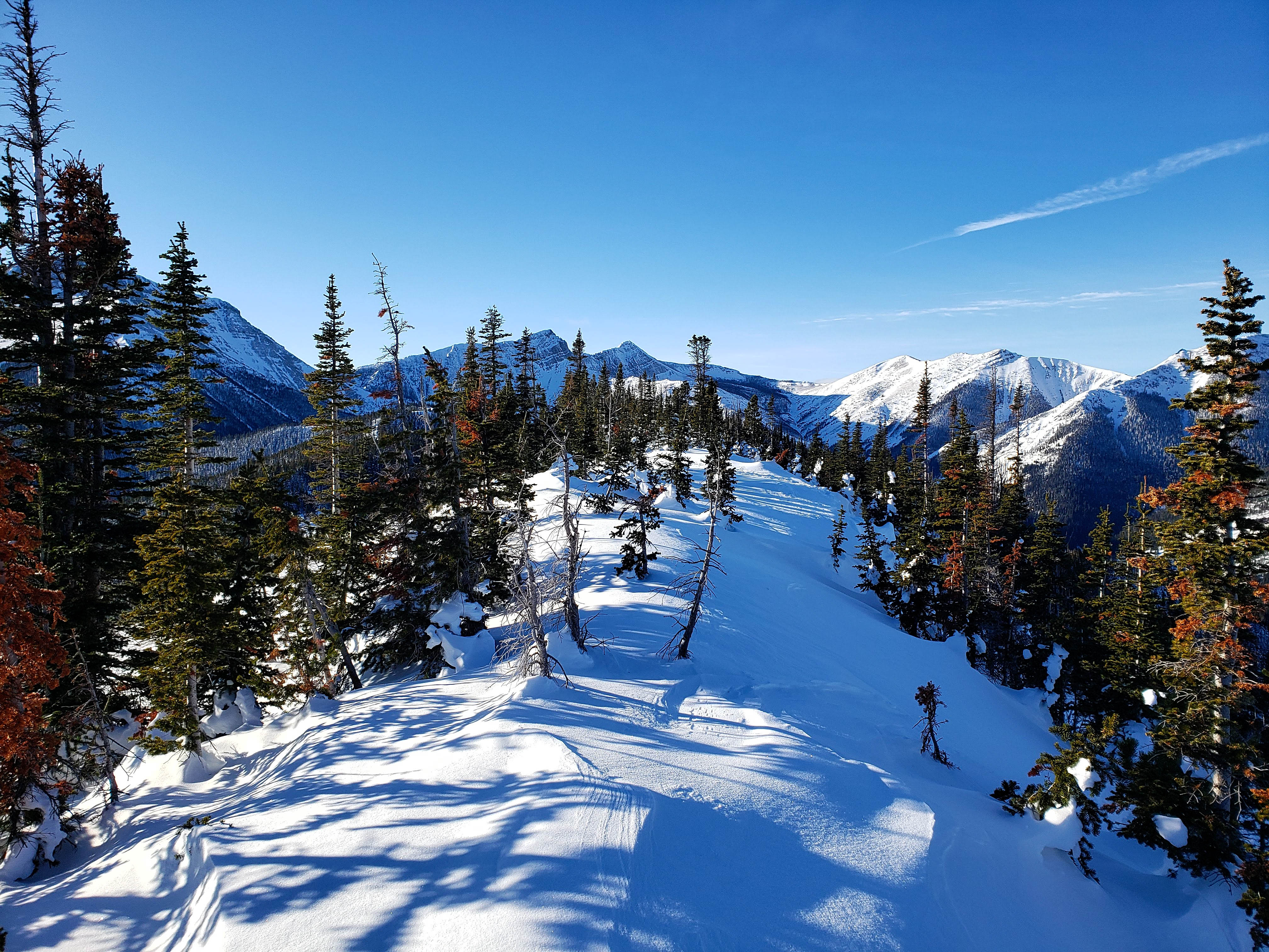
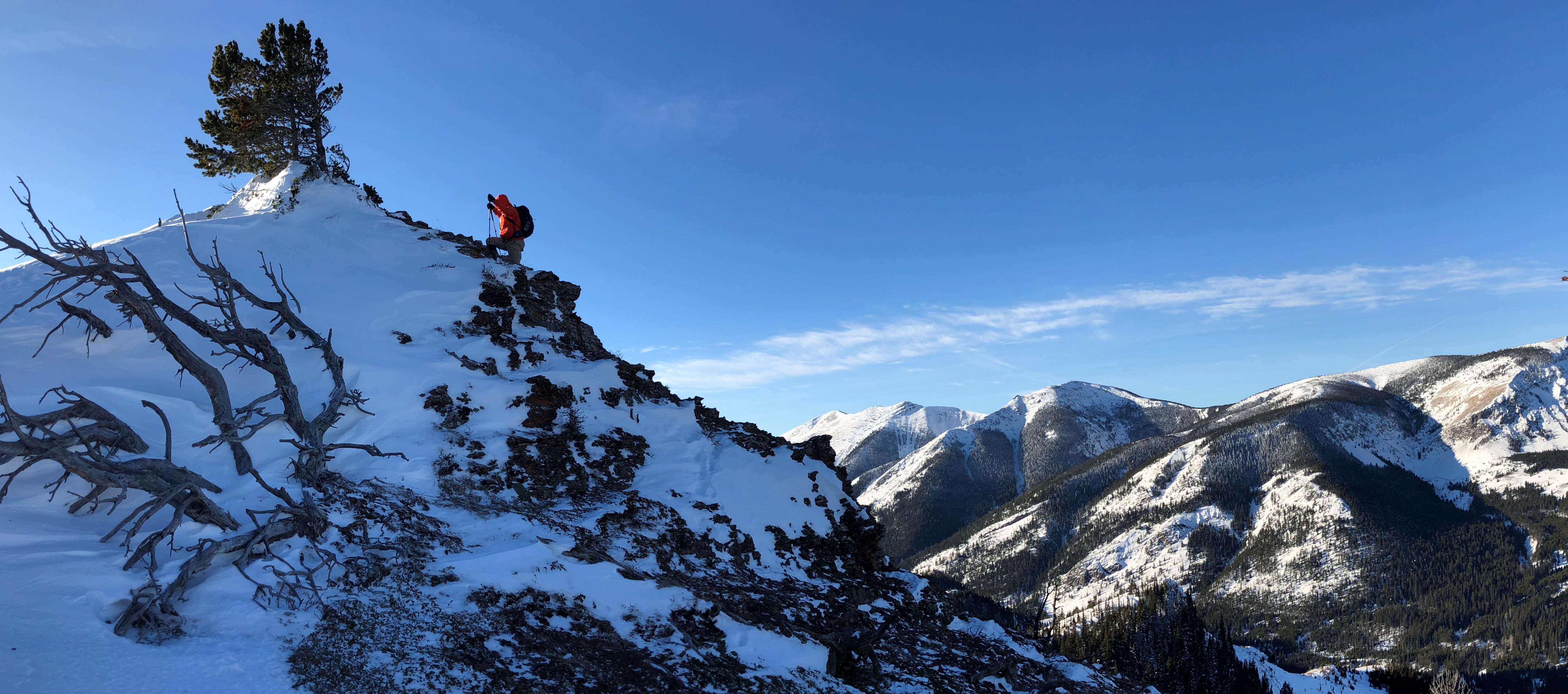
Andrew follows me along a beautiful cornice.

Sheep: “Wait! Not you again! Didn’t you almost get lost the last time you were here?” Me: “Ummm… it was really cloudy…and Lance was distracting us…” 😉

From this point on the ridge between HP 2 and HP 1 (right) it’s an easy ~740 m walk with an initial elevation loss of ~45 m to reach HP 1.
The view down the ridge towards HP 2 (not shown) from the same point in the previous picture.

Andrew takes advantage of firm snow to expedite travel along the ridge. At this point, I joked that the little outlier in the background should be called, “The Pinky”, as in Gladstone’s pinky toe. Now you can see how disturbed my sense of humour really is…

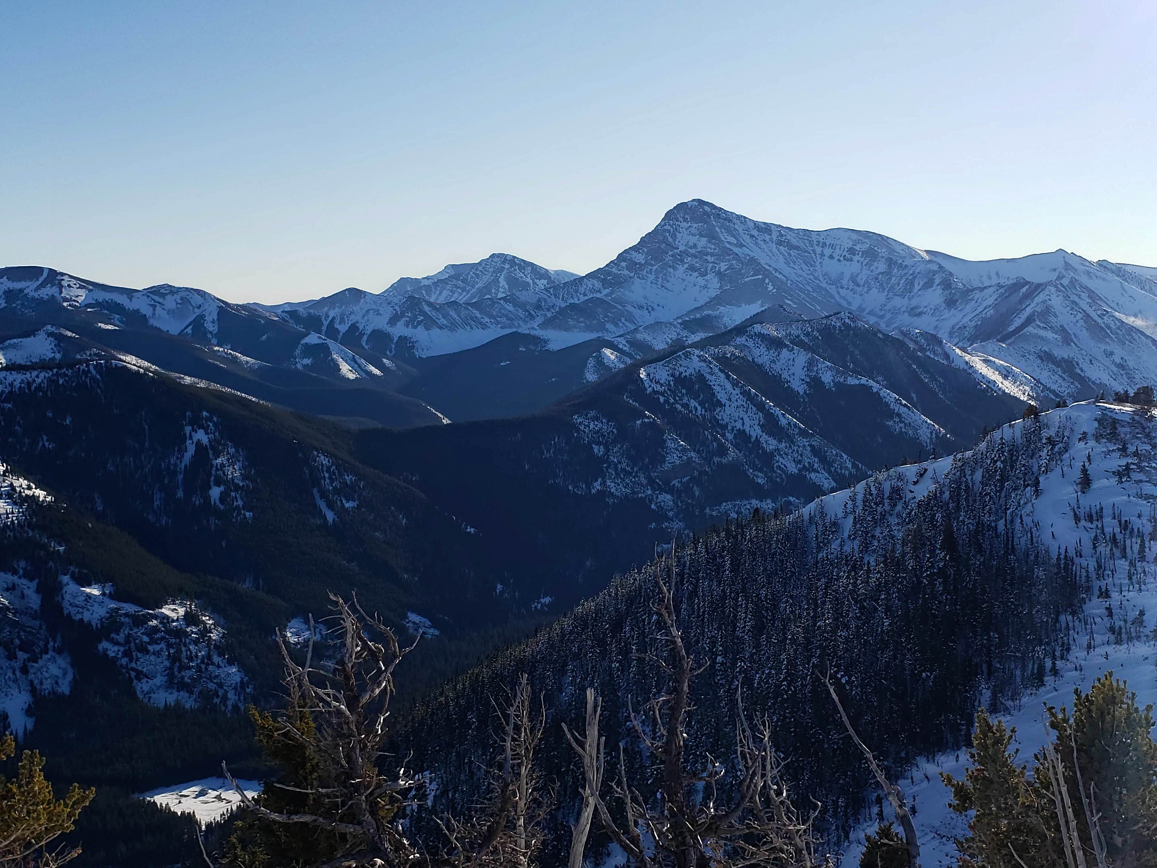
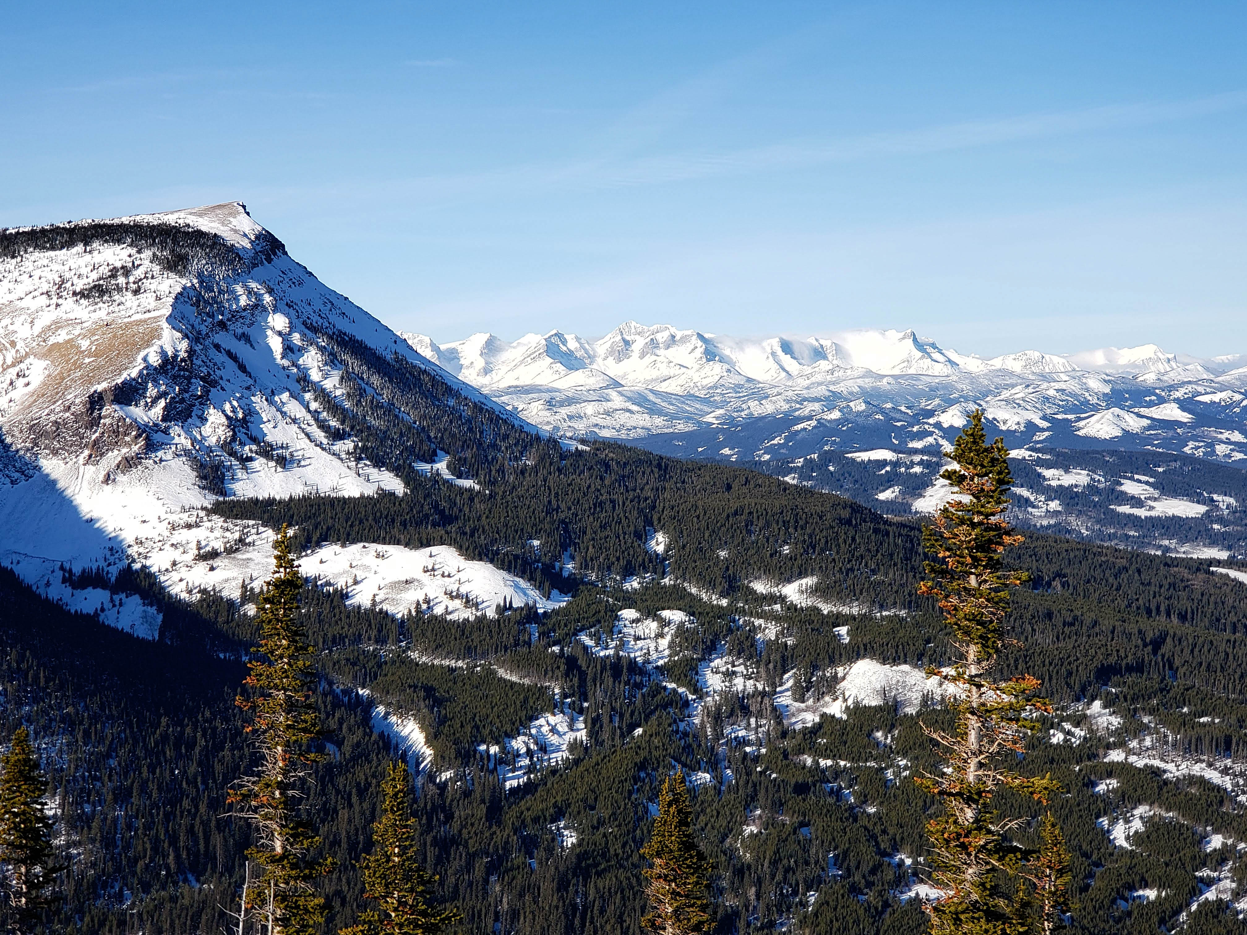
The hike over to HP 1 offers some great views of Table Mountain. Just for fun, a trip up Table from the intervening valley might be worth exploring someday.

The view of Table soon gives way to a spectacular view of the Flatheads.

Almost at the summit of HP 1.

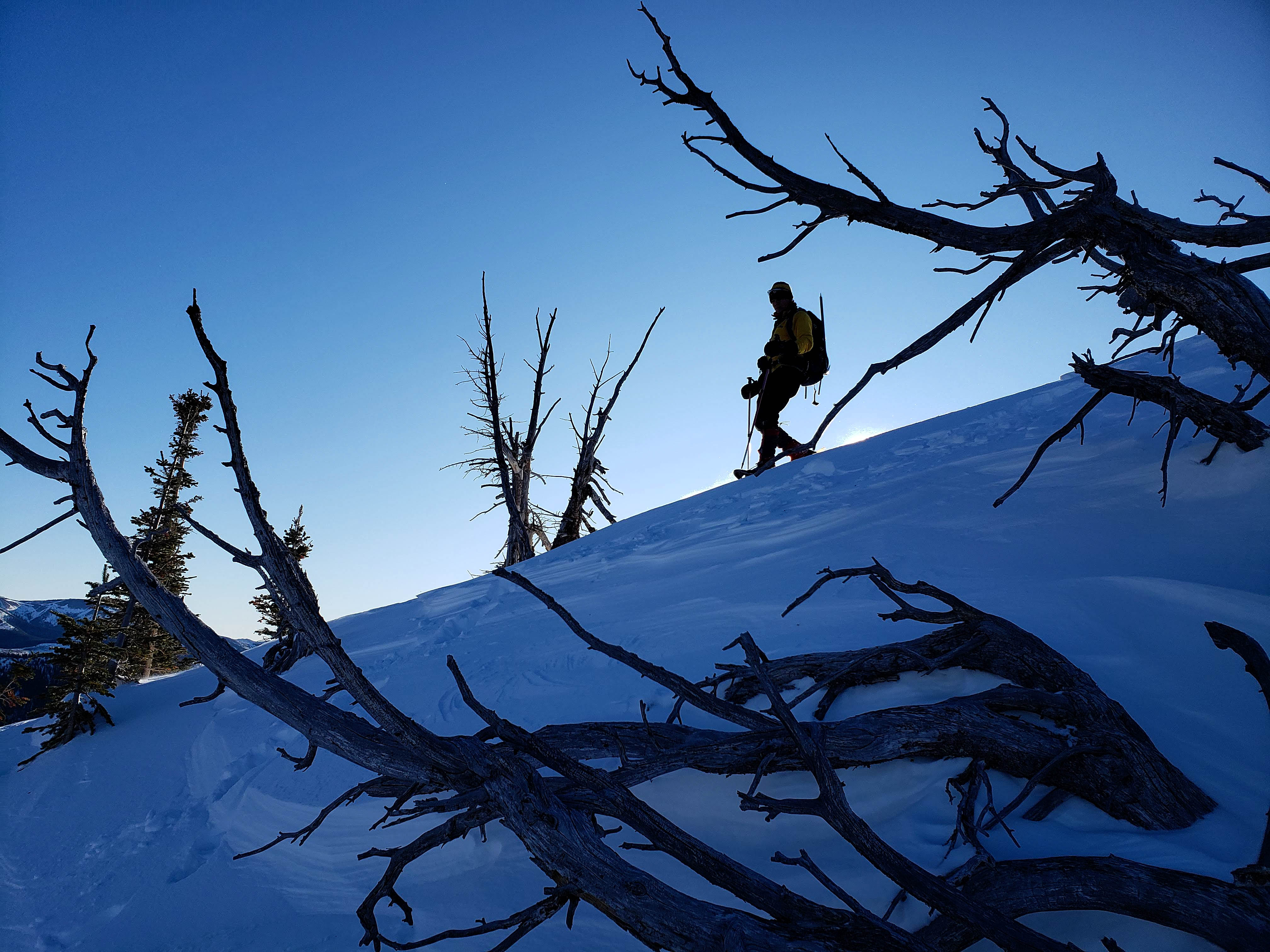
Andrew is silhouetted against the sky as he descends a small cornice.
The summit of HP 1. As noted before, in 2018 I was using my old GPS and the weather was horrid. On this trip, my new GPS ended up pinging HP 1 at 1981 m and HP 2 at 2004 m, which is a 27 m difference from the 1973 m that I recorded for HP 2 in 2018. So either the mountain has a growing case of foot fungus, or one set of my readings is highly skewed. 😉 At the start of this trip, I calibrated my GPS to the topo map (or ‘toe topo map’ if you will), so it may be closer to the actual elevations.

Andrew arrives on the summit of HP 1 amidst unprecedented fanfare. 😉

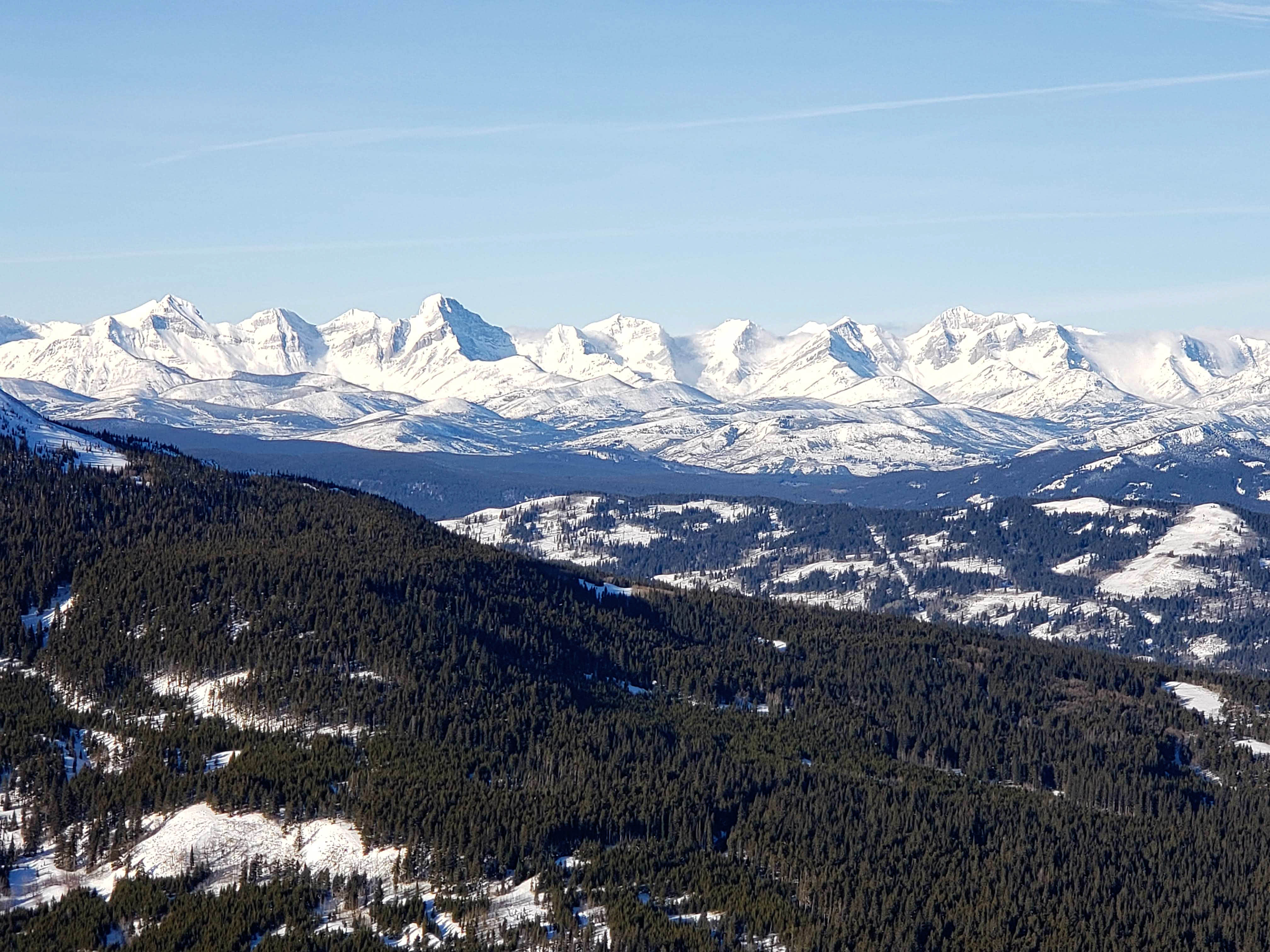
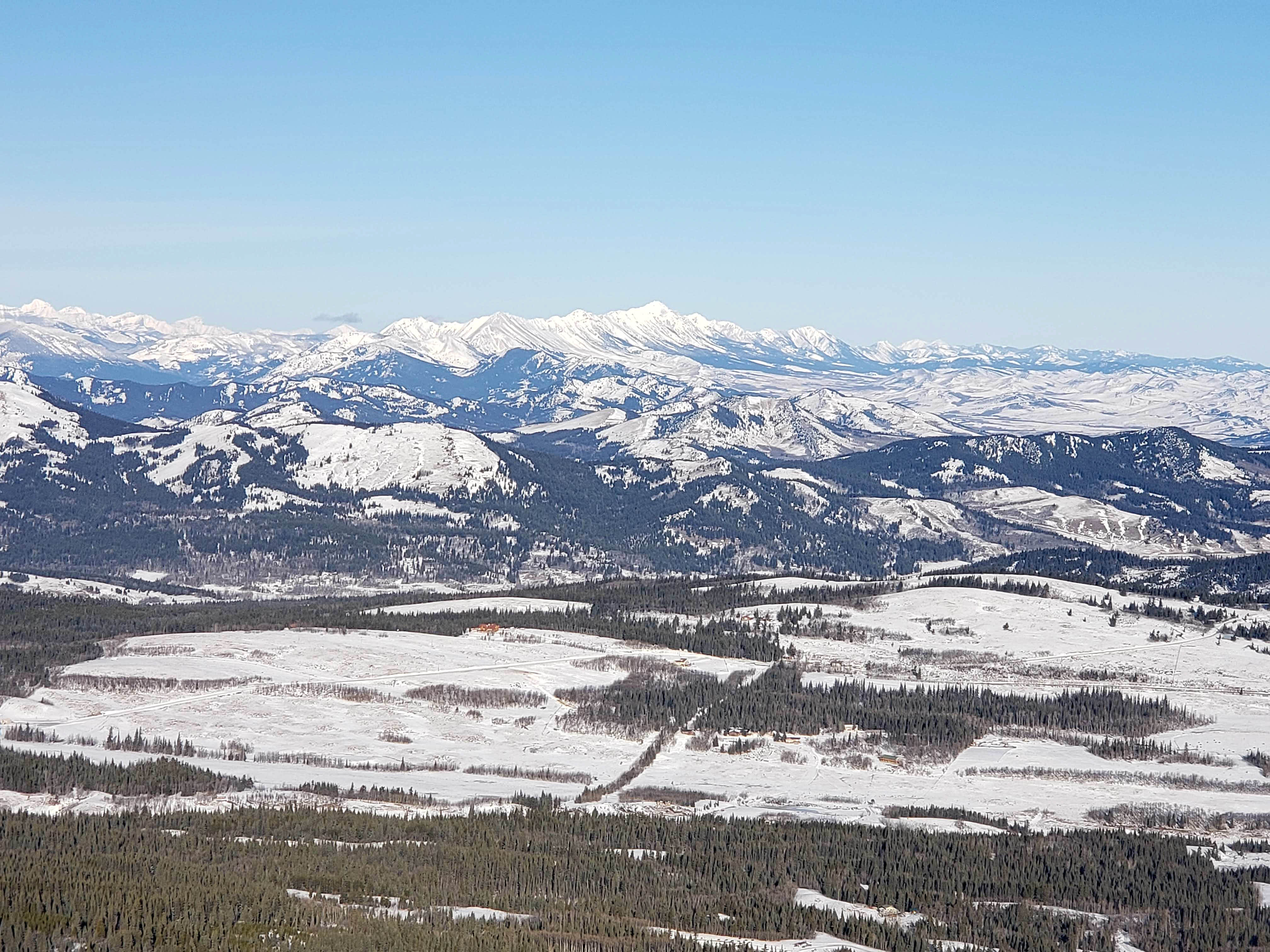
A pano that encompasses the views to the south and southeast.

A pano to the south, southwest, and west.

A pano to the northwest.
A telephoto of the Flatheads featuring Darrah S2 (far left), Mount Darrah (left of centre), Mount Pengelly (right of centre), Mount McGladrey (right of centre), and the unnamed enigma, Ptolemy SE5 (right). Why SE5 -and for that matter Darrah S2 – do not have an official names given their prominence is just weird.

A second telephoto of the Flatheads but slightly more to the north. Mount Coulthard is on the far right. Little Cherry Hill (centre) and Carbondale Hill (right of centre) are middle distance.
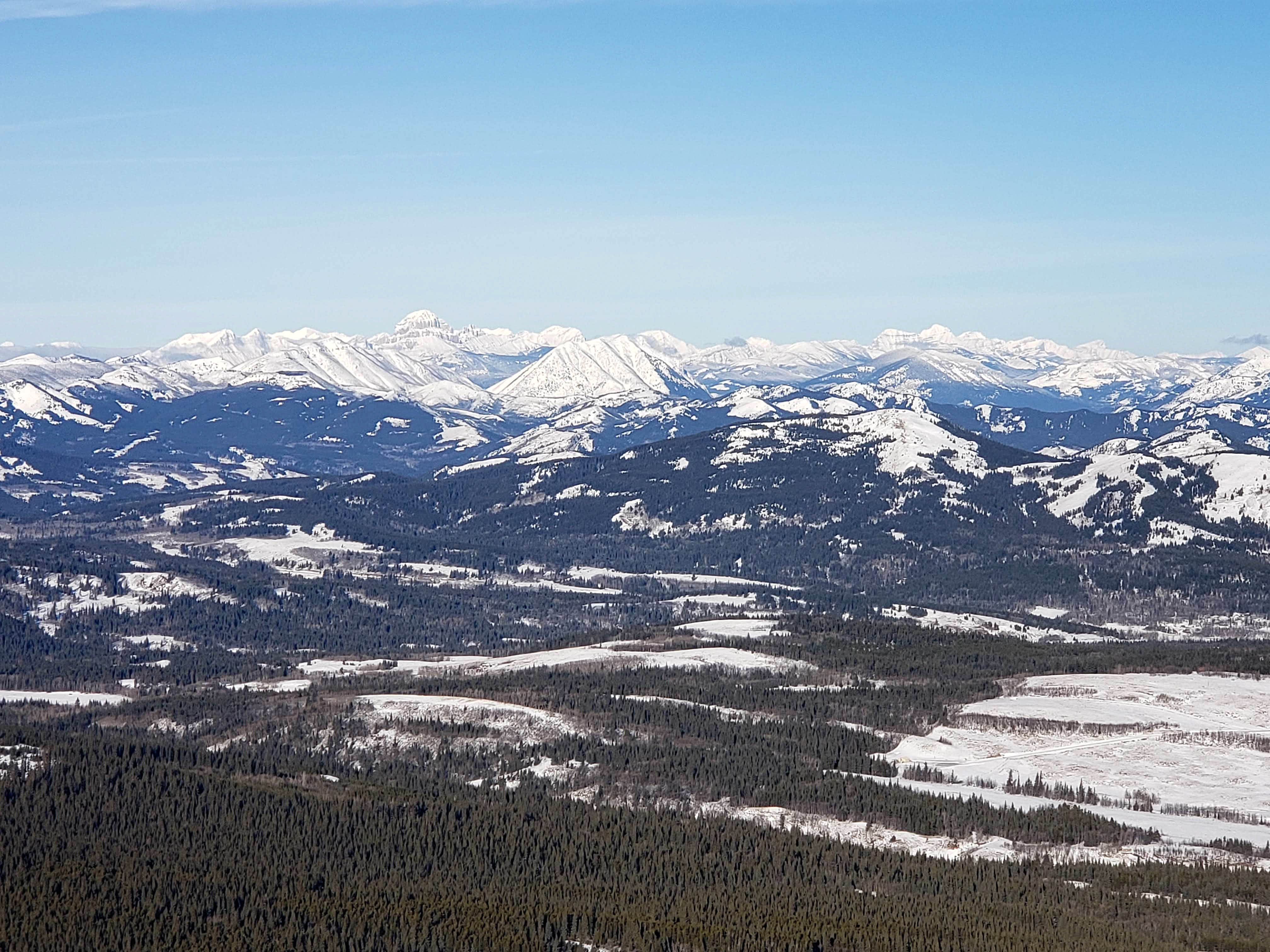
There is so much fun to be found in this telephoto to the northwest! Of note in the distance are: “Deadman Peak” (far left), Allison Peak (far left), Crowsnest Mountain (left of centre), the Seven Sisters (left of centre), and Tornado Mountain (right). Middle distance are Spades Peak (far left), Poker Peak (far left), Hearts Peak (far left), Hillcrest Mountain (left of centre); Turtle Mountain (centre), and Bluff Mountain (right). Byron Hill (right of centre) and Mount Backus (right of centre) are in the foreground.
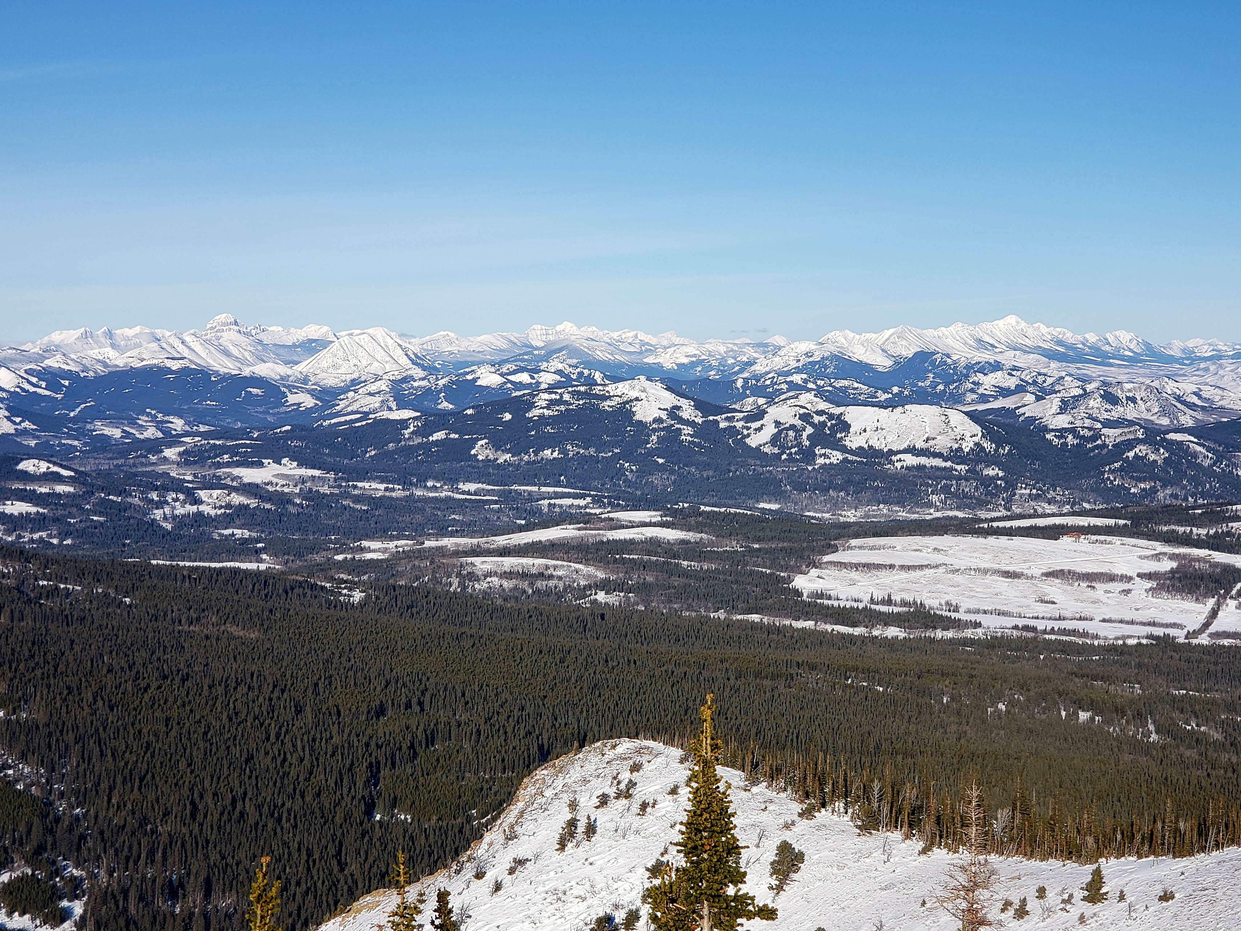
A telephoto to the north features the Livingstone Range with Centre Peak (centre) being its highest point. This is another one of those peaks that I should’ve visited a long time ago but for some reason haven’t. Same for Caudron Peak (centre) next to it. I will have to make these a priority for 2020. Also on the Livingstone are: “The Dog” (left of centre), Morin Peak (left of centre), the South Peak (left of centre), “Lightning Peak” (right of centre), and Thunder Mountain (right of centre). Middle distance in the centre are Robertson Peak and Tallon Peak. In the foreground centre are Burmis Mountain and one of those old friends that I was talking about earlier, “Blue Mountain”.
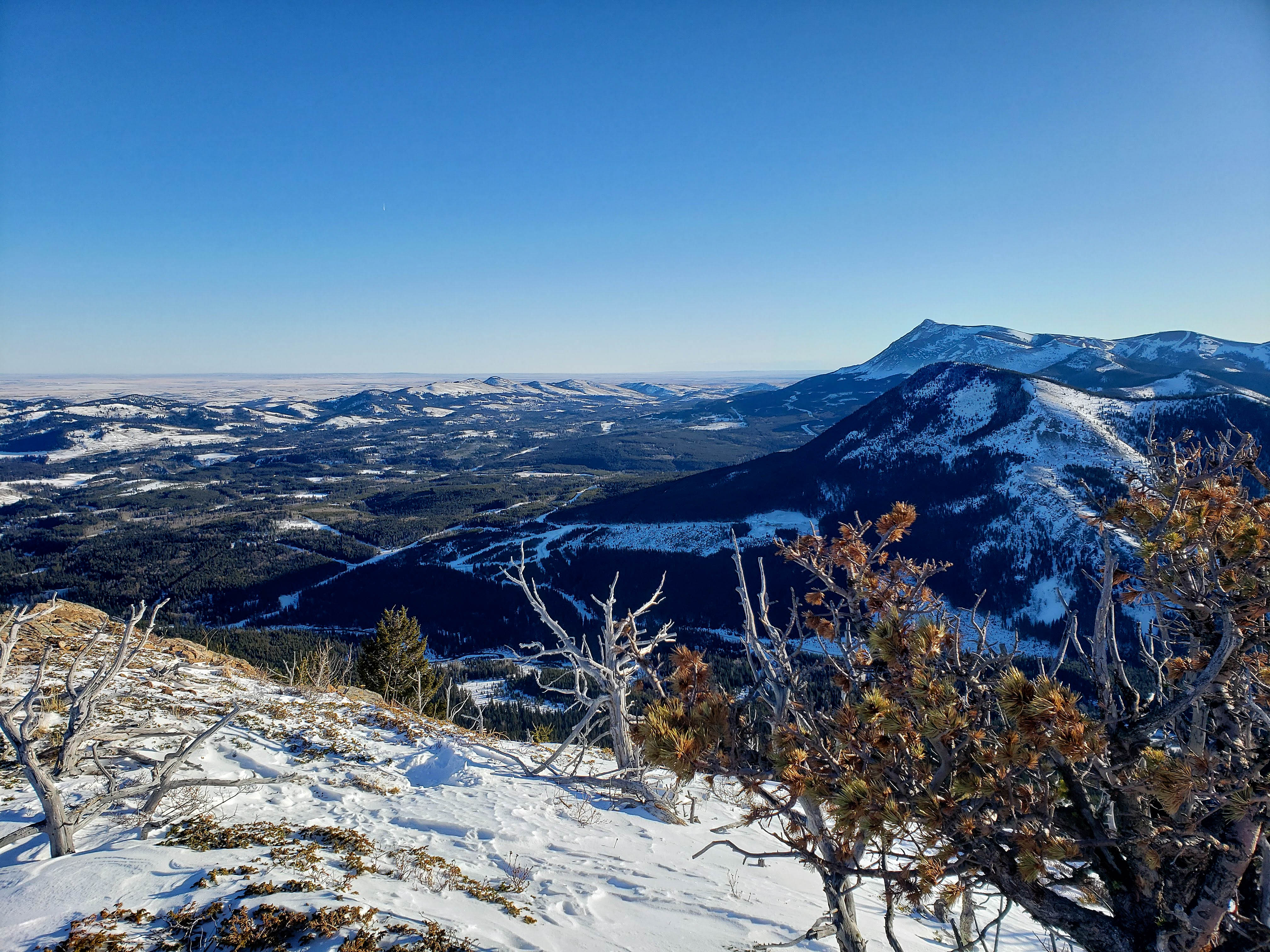
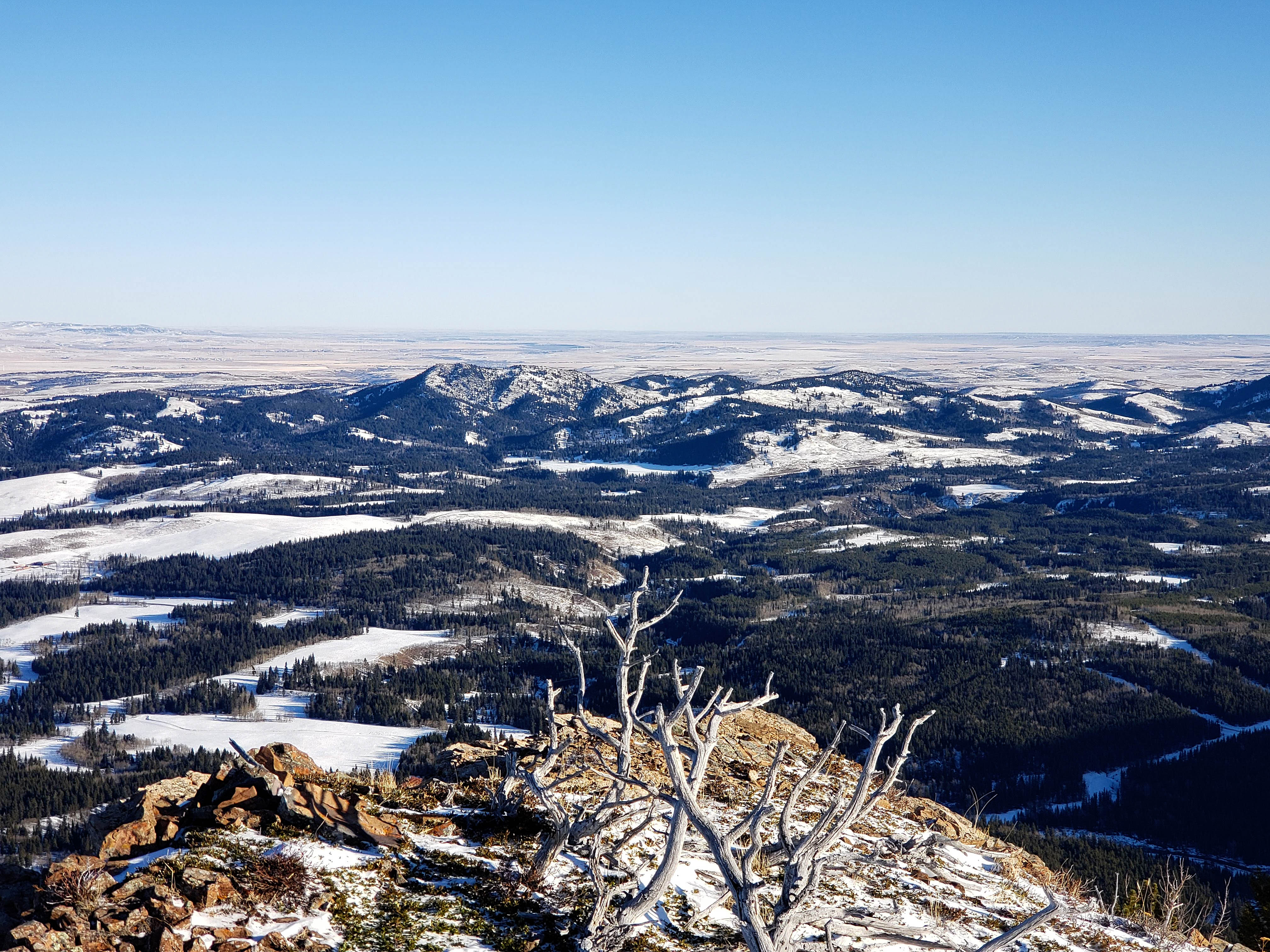
Gazing east with Beauvais Lake Provincial Park on the far left, Christie Mine Ridge in the centre, Prairie Bluff Mountain on the right, and “Prairie Fire” on the far right. “Whitney Creek Mountain” in in the foreground on the right.
A closer look at Beauvais Lake Provincial Park with Mount Baldy on the far left and Mount Albert just to the left of centre. The historian in me laughs every time I see Mount Albert because whoever named it, must really not have liked the guy. I get the colonialist narrative of naming Victoria Peak given its prominence, but relegating poor Albert to a small foothill when there were so many other choices is quite damning. Victoria did after all, go into several decades of mourning for him when he died.

A closer look at Christie Mine Ridge. The summit and most access points sit entirely on private land. If I can get landowner permission, I think I might consider this for one of my first, post-surgery objectives. EDIT: Done! I hiked Christie Mine Ridge in the spring of 2021, but have never published a trip report because I want to respect the privacy of the owner who gave me permission to access his land.

A telephoto slightly to the northeast of Ky-es-kaghd-oghsuyiss (the Porcupine Hills). Two fun snowshoe objectives here are the Porcupine Fire Lookout and Sand Bluff.

Man I took a lot of pics on this trip! This is looking to the southeast at more old friends.

A closer look at Prairie Bluff (centre), “Prairie Fire” (right of centre), and “Prairie Sky” (far right). “Whitney Creek Mountain” is in the foreground.
A telephoto of “Prairie Storm” (left of centre), Pincher Ridge (centre), and Victoria Peak (right of centre). “Whitney Ridge” is directly in front of Victoria Peak.
Glancing south down the Mill Creek Valley.

A crappy telephoto of two cool destinations: “Mill Creek Peak” (left) and Windsor Mountain (right).

Andrew on HP 1.

Yours truly on HP 1. (Photo by Andrew Nugara)
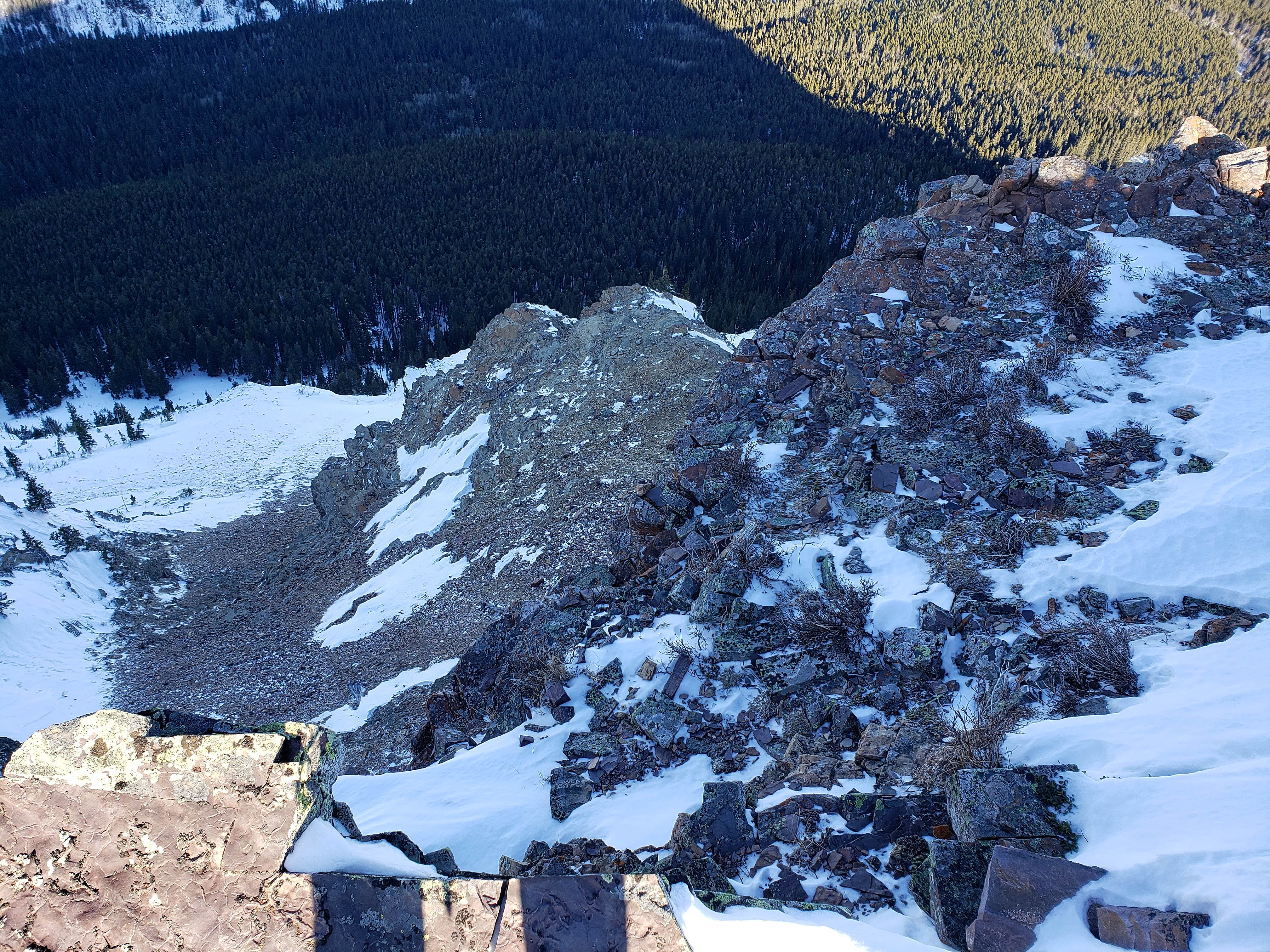
The drop off from the summit is quite severe.

The north end of the ‘Toe’ starts gradually but then drops off suddenly… like a ‘hang nail’. 😉

Castle Peak (far left) can be seen poking up behind Mount Gladstone.

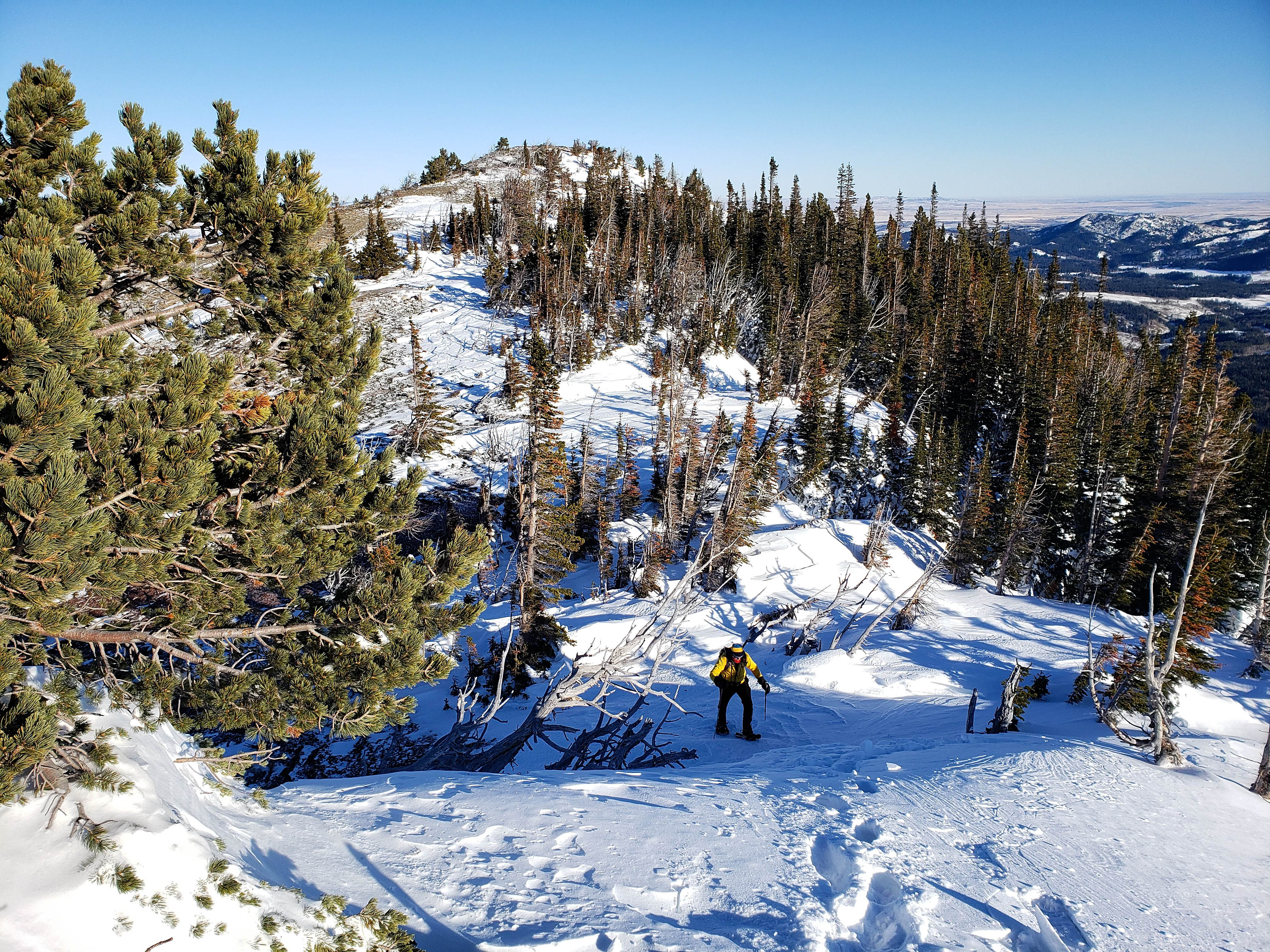
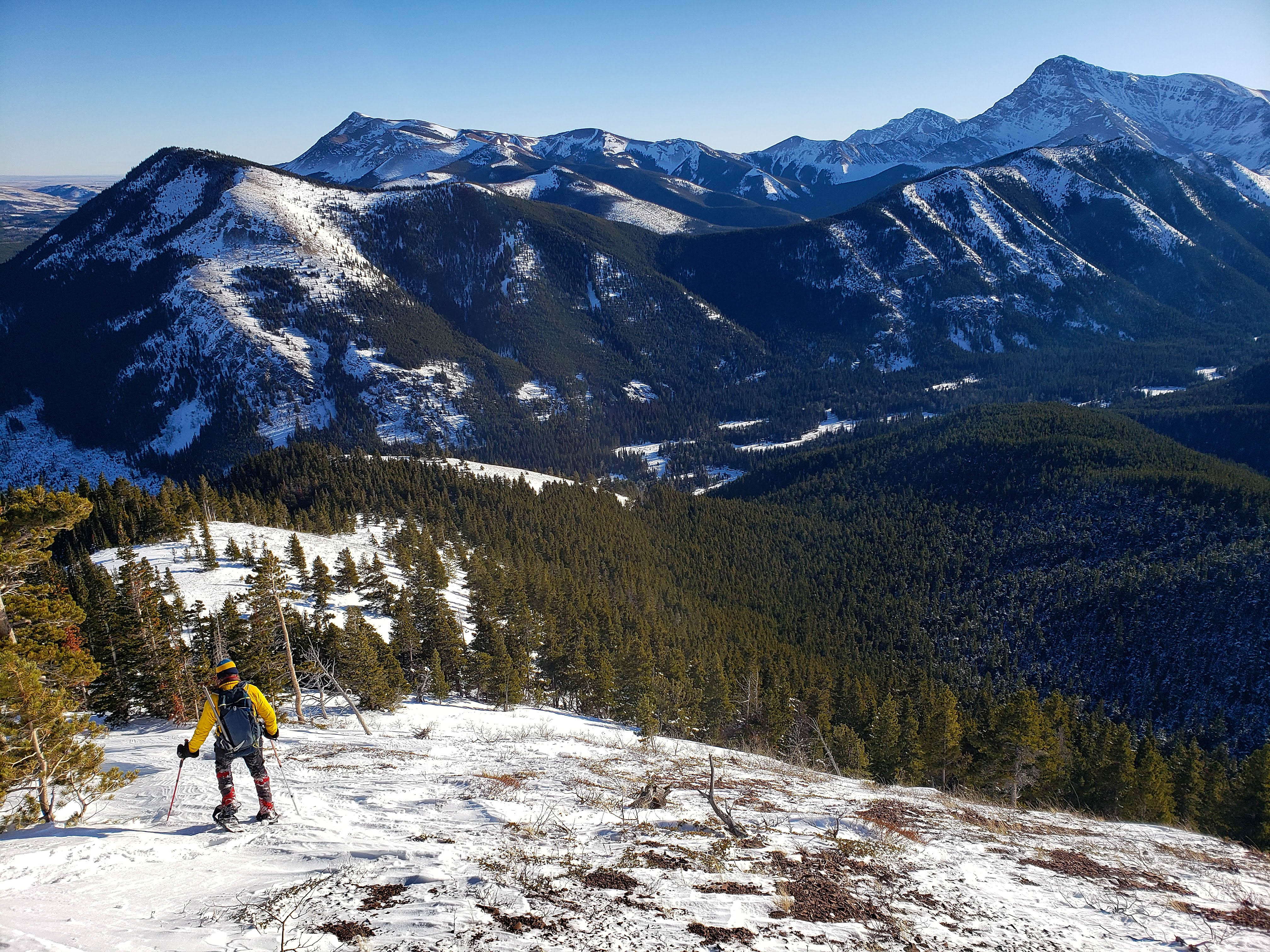
Heading over to HP 2.
A neat shot by Andrew as I elect to ‘scramble’ a short section on the way back. (Photo by Andrew Nugara)
Looking back to HP 1.

Making our way up to the ridge that connects with HP 2.

The little ridge walk was fun back in 2018 and it was still fun today. 🙂

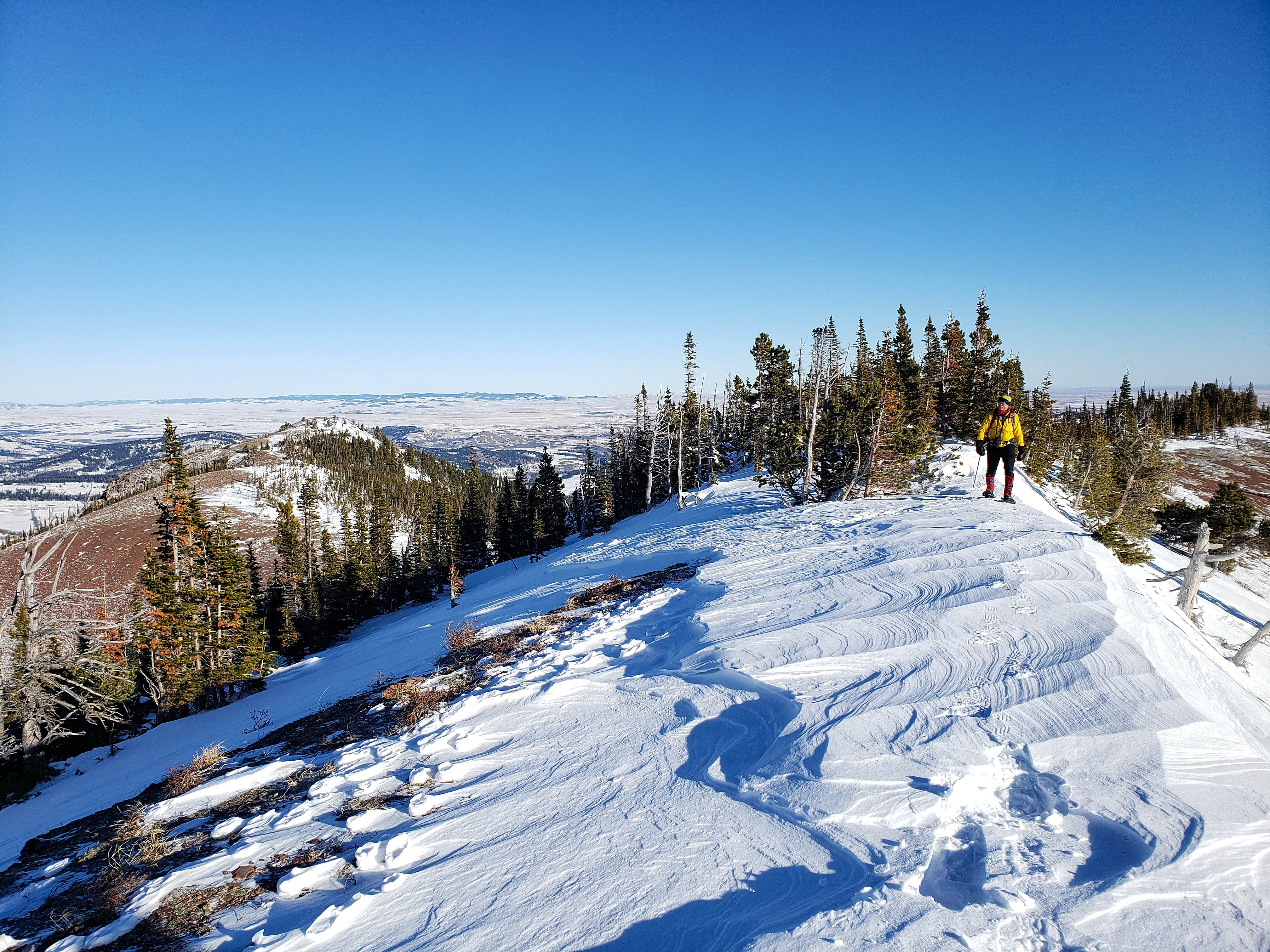
Andrew pauses to check out the stunning views.
Glancing back along the ridge with HP 1 on the left.

Same as the previous picture but with a more easterly perspective. I probably should’ve done a pano instead of two pics…
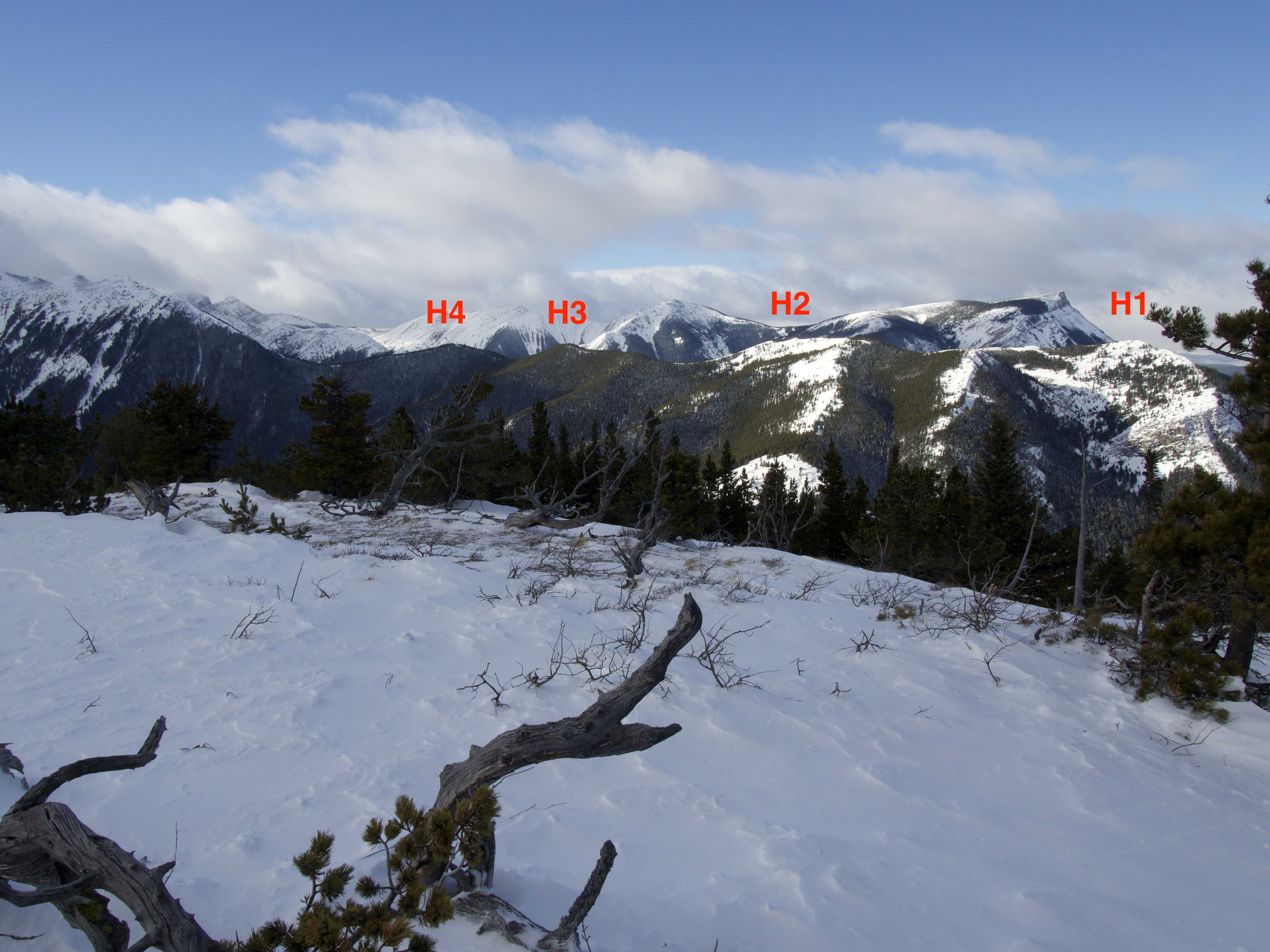
HP 2 (centre) is an interesting little bump. Behind it is HP 3 – one of the hairy knuckles of the ‘Toe’. 😉

Arriving at HP 2. In 2018, we amused ourselves by making a short scramble up the rocks on the right. (Photo by Andrew Nugara)

Everything is still where I left it. 😉 . (Photo by Andrew Nugara)

The view to Mount Gladstone (left) with “Larry Mountain” and “Frankie Peak” on the right. HP 3 and HP 4 are in the foreground.

The views from HP 2 are a little more immersive.

Ah, memories. The little valley and drainage in the foreground look like a great place to descend… it’s not. Trust me.

Looking southwest with “Larry Mountain” and “Frankie Peak” on the left, “Eagle Peaks 1& 2” in the centre, and “Table Top” on the right.

Glancing over to “Table Top” ( far left) and Table Mountain (right of centre).
And back to the Flatheads…

And yet another telephoto of the Flatheads with Pengelly and McGladrey on the far left and Coulthard on the far right.
And back to the northwest…

With another telephoto…

Andrew on the summit of HP 2 with HP 1 in the background.

Those snowshoes look like they really serve a purpose. 😉

A closer look at HP 3 and HP 4, with HP 4 claiming victory as highest, and hairiest point on “Gladstone’s Toe”.

Heading over to the col with HP 3. (Photo by Andrew Nugara)

Another cool area of snow collection.
A pano from above the col. As I’d already visited HP 3 and HP 4, and Andrew was content with HP 1 and HP 2, we decided to turn back at this point. I still would recommend following the ridge and visiting 3 and 4, but if you do, backtrack along the ridge and use the ascent route to descend. Have I mentioned this before?

Andrew heads back to HP 2.
I like this picture of Andrew because he is standing in front of “Larry Mountain” which is named after his stepdad and “Frankie Peak”, which is named after his late mum.

A nice pano by Andrew from the top of HP 2. Every time I write HP in this post, I start thinking about the sauce… 😉

We decided to revisit the giant cornice on the way back.

We also chose to descend through some of the fluffy stuff.
Back on the main ascent route.

Starting down the north/south open slope.

Arriving back in the trees and a much steeper slope.

Andrew checks out the small drainage that we paralleled on ascent. Surprisingly, there was still water flowing though it.

Navigating our way through the brief section of deadfall…

Before arriving back at at the base of the mountain.

Checking out some frozen snowmelt at the base.
Early afternoon sunlight illuminates “Whitney Creek Mountain”.

Arriving back at Andrew’s car after a very quick ~7.1 km and 3 hours and 38 minutes. I’m so glad that Andrew suggested “Gladstone’s Toe” for today’s trip! It was nice to revisit this fun destination and actually be able to see something this time – as evidenced by the boatload of pictures that we came back with. As usual, it was great to spend the day with Andrew, who is truly a fantastic human and who graciously puts up with my terrible, in situ puns. 😉 Both of us love this area of the world and hopefully, I can get in one more trip out here before I undergo surgery next week.


Leave a Reply