⚠️ Hiking and scrambling are inherently dangerous activities. Please read my Disclaimer. ⚠️
Looking for a short trip to round off the long weekend – and recover from Centre Mountain – Andrew suggested we try, “Igneous Peak”, which is an unofficial summit located in Waterton on the connecting ridge between Piinaquiium / Ahkoinimahstakoo (Mount Blakiston) and Ruby Ridge. Andrew had already ascended it twice this year, with the first being a solo trip back in March. As the weather was somewhat iffy and the wind annoyingly strong, an approach up a semi-sheltered drainage sounded perfect to me.
The peak’s nickname comes from a striking band of black igneous rock that cuts across its east face. Most noticeable from Ruby Ridge, “Igneous Peak” could easily be overlooked as an objective because it is absolutely dwarfed – no, consumed – by the east face of Piinaquiium / Ahkoinimahstakoo (Mount Blakiston), making “Igneous” appear as a mere bump when in fact, it is slightly higher than Ruby Ridge. Moreover, it doesn’t stand out if you view it from south; either from the Lineham Falls Trail or from the drainage we used on approach. However, once on the summit it’s easy to see why it is its own entity and why Andrew has chosen to visit it three times this year. 😁
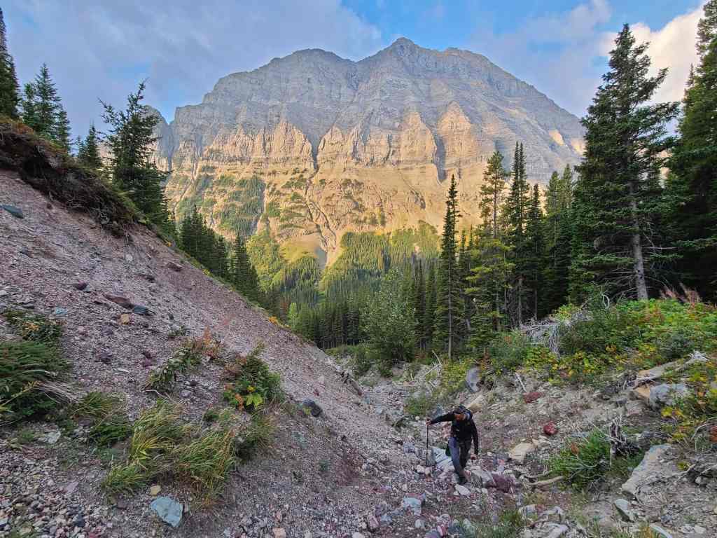
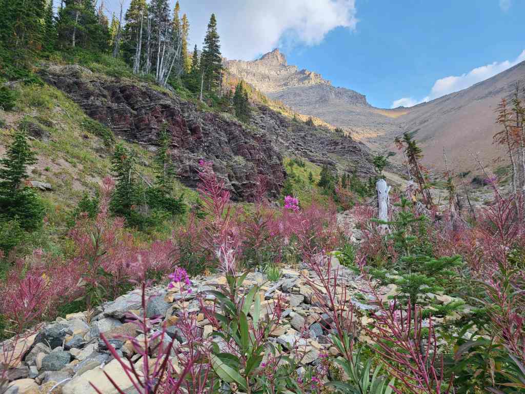
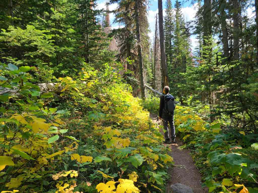
For me, one of the most enjoyable aspects of this trip, was the approach along the drainage from Lineham Falls Trail. Not only were the colours spectacular, but it was the one of the most subtle, unassuming elevation gains that I’ve experienced. Indeed, I could hardly believe that we’d gained close to 600 m in elevation after leaving the trail with seemingly such little effort. You simply have to love those argillite staircases!
The other plus, was taking the time to explore the southeast ridge of Piinaquiium / Ahkoinimahstakoo (Mount Blakiston). I know, I know… I’m sloth for never having ascended Blakiston or completing the Hawkins Horseshoe. Though in all fairness, that is not a trip that you want to do when the air is choked with wildfire smoke, which has been the case all summer. I am however, contemplating it for later this fall, especially after the terrific time we had on Blakiston’s southeast ridge. It may look terribly fierce from Ruby Ridge and even “Igneous Peak”, but the slope is way more relaxed that it lets on. If a beast of a limestone band had not stood in our way, I have a feeling we would’ve continued right to the summit. So much for a short trip! 😁 EDIT: We returned in July 2022 and completed the Hawkins Horseshoe using the information from this trip. It worked perfectly!
Perhaps the most shocking moment came after I had returned to Lethbridge and opened Google Earth, only to discover that this area of Blakiston had been labelled as, “Wrong Turn Ridge”. I’m not sure how things get named on Google Earth, but I’m guessing that over the years, parties ascending Blakiston have mistakenly used this route instead of venturing further down the Lineham Falls Trail to the second drainage which is Alan Kane’s recommended route. Though to be fair, ending up on this side of the mountain is not an unrecoverable error, as you could still get back on track quite easily. No matter. I’ve incorporated this presumably ‘locally-inspired’ name into the day’s narrative.
Be sure to read Andrew’s trip report! [link coming]
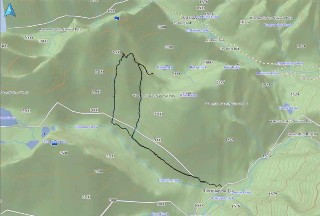
To get to “Igneous Peak”, we drove from the Waterton townsite along the Akamina Parkway (Cameron Lake Road) for ~9 km until we reached the Lineham Falls trailhead. This was our starting point.
We then hiked down the trail for ~2.9 km until we came to a very obvious drainage. Here is where we left the trail to follow the drainage all the way up to the southeast ridge of Piinaquiium / Ahkoinimahstakoo (Mount Blakiston) – a distance of ~2.7 km with an elevation gain of 570 m. We then traversed over to the connecting ridge and made the quick ~600 m hike (23 m elevation gain) to the summit of “Igneous Peak”. For reference, it was an 854 m elevation gain from our cars to the summit.
After enjoying the views, we then traversed back to the southeast fridge of Blakiston, where we enjoyed some great scrambling until an immense limestone band blocked our progress at approximately 2570 m. We then began to circle the mountain, before deciding to descend using Kane’s ascent drainage. Once back on the Lineham Falls Trail, it was an easy ~3.6 km hike back to our cars.

I’m not sure how things get named on Google Earth, but there it is on the lower left: Wrong Turn Ridge. 🤔
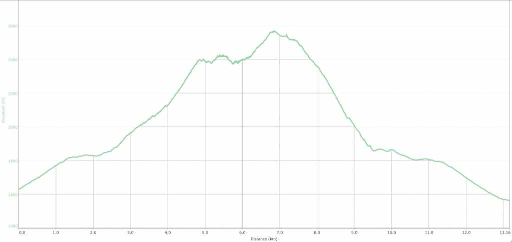
Our total roundtrip distance was 13.2 km with total elevation gains of 1131 m. Our total time came in at 6 hours and 7 minutes.

Andrew took this photo in March 2021 as he approached “Igneous Peak” (right) from Ruby Ridge. The black band of igneous rock that inspired the nickname is as obvious as it is stunning. (Photo by Andrew Nugara)
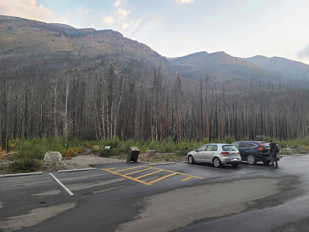
Gearing up at the Lineham Falls trailhead with Ruby Ridge in the background.
Despite the intense wind, it was a great morning for a hike.

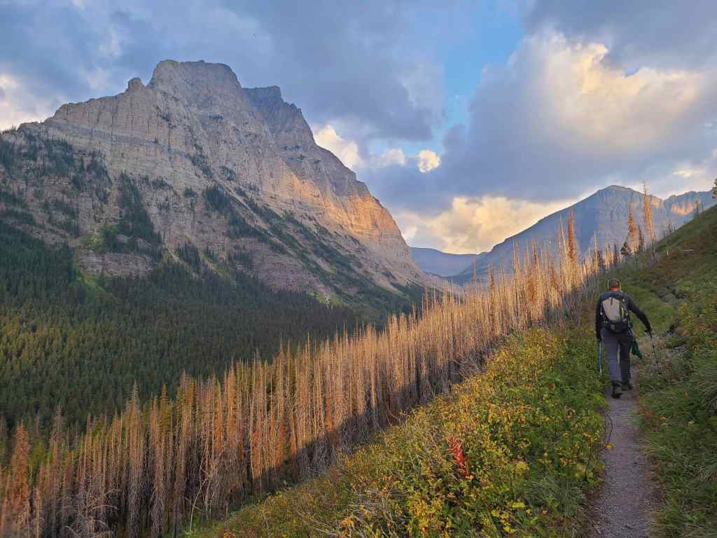
Telltale signs that autumn is around the corner.
Enjoying the easy approach.
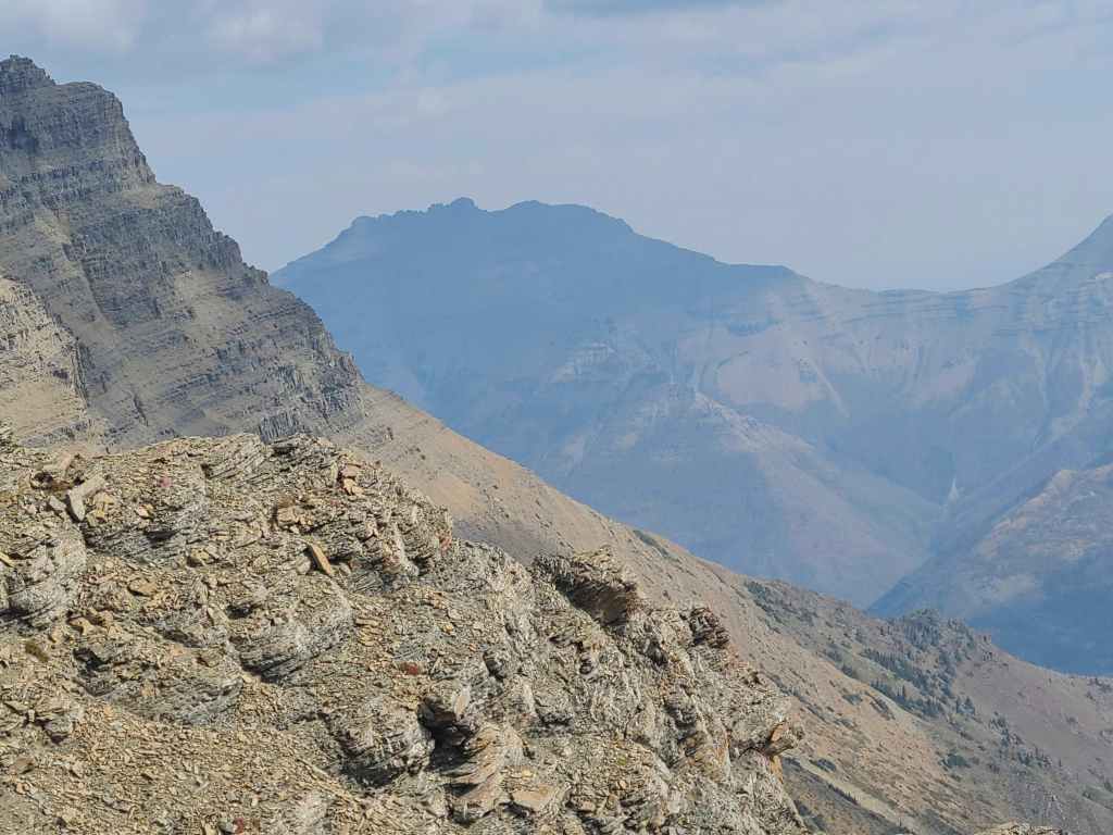
Gazing back to Buchanan Ridge (right) and “The Senator” (left).
Mount Lineham was stunning from every angle.
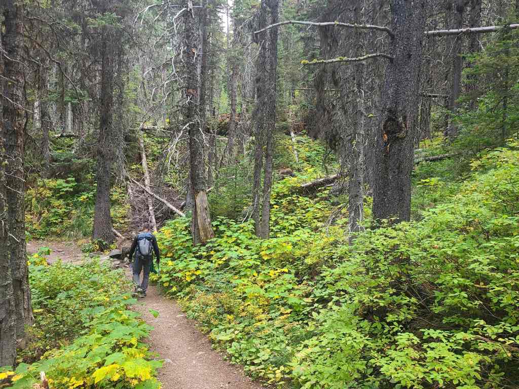
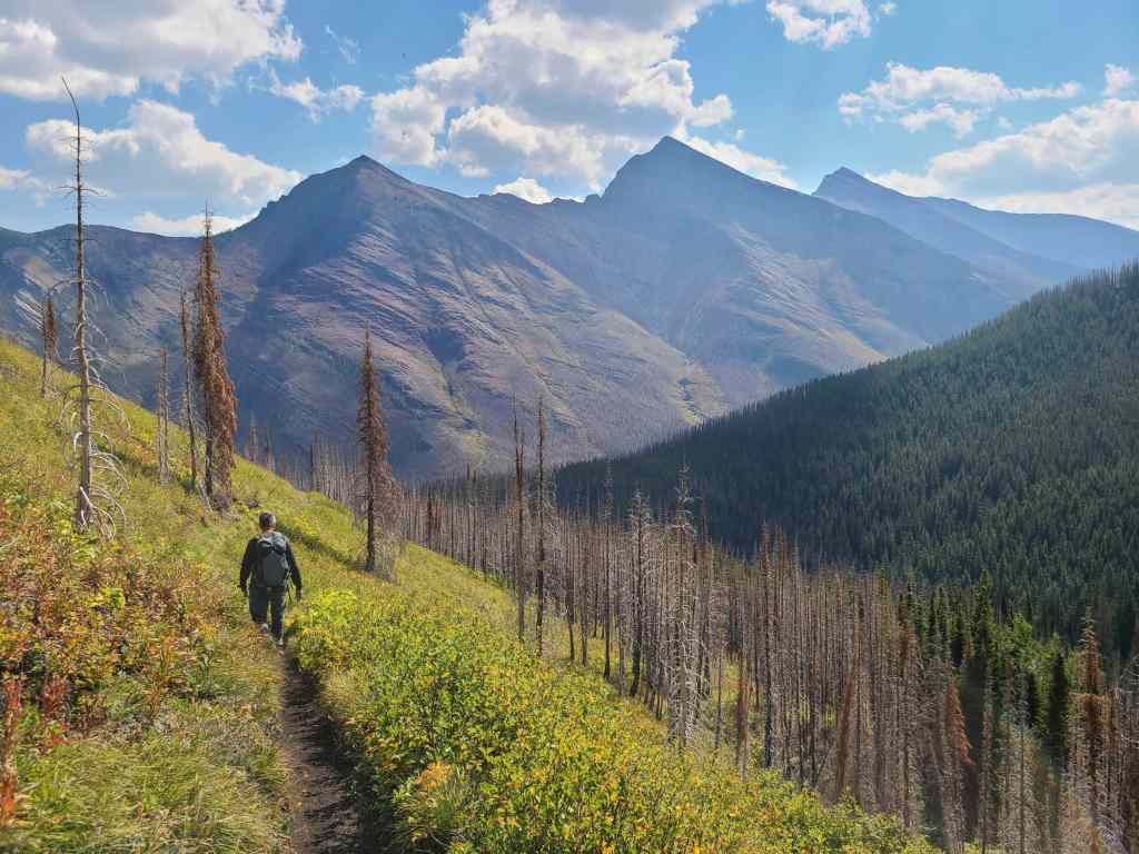
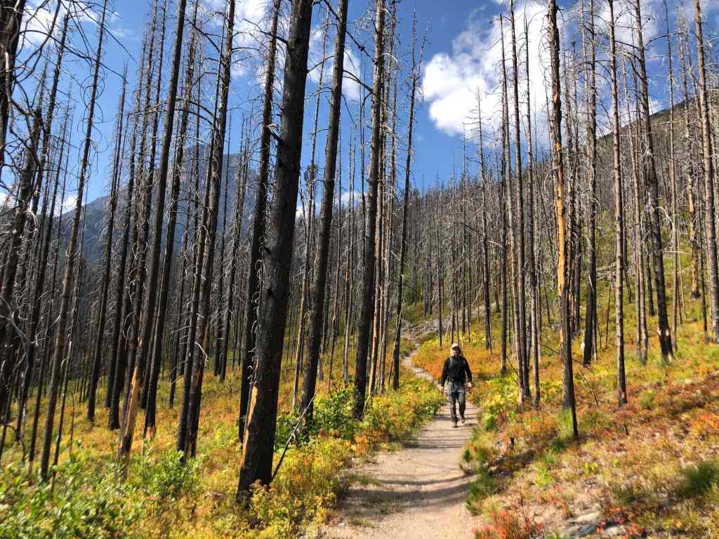
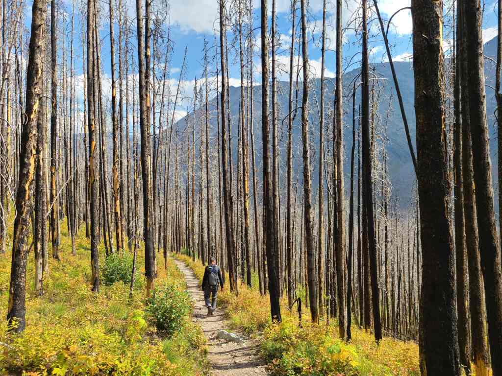
Entering a section of forest that went untouched during the 2017 Kenow Wildfire.
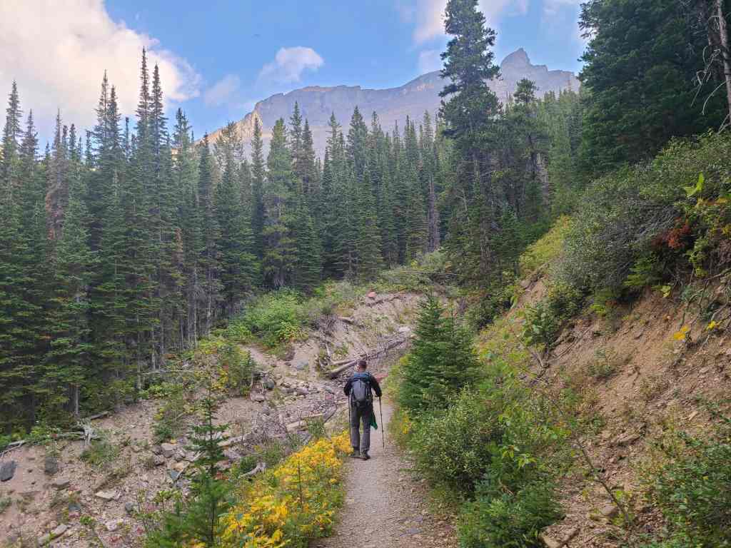
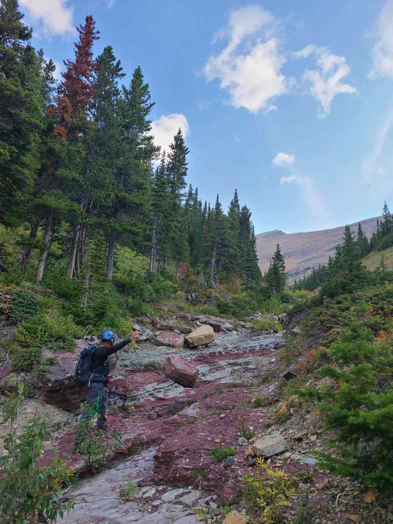
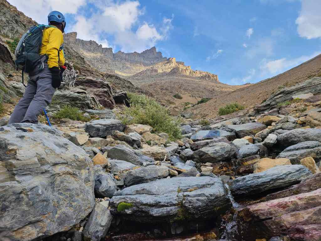
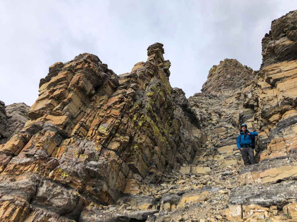
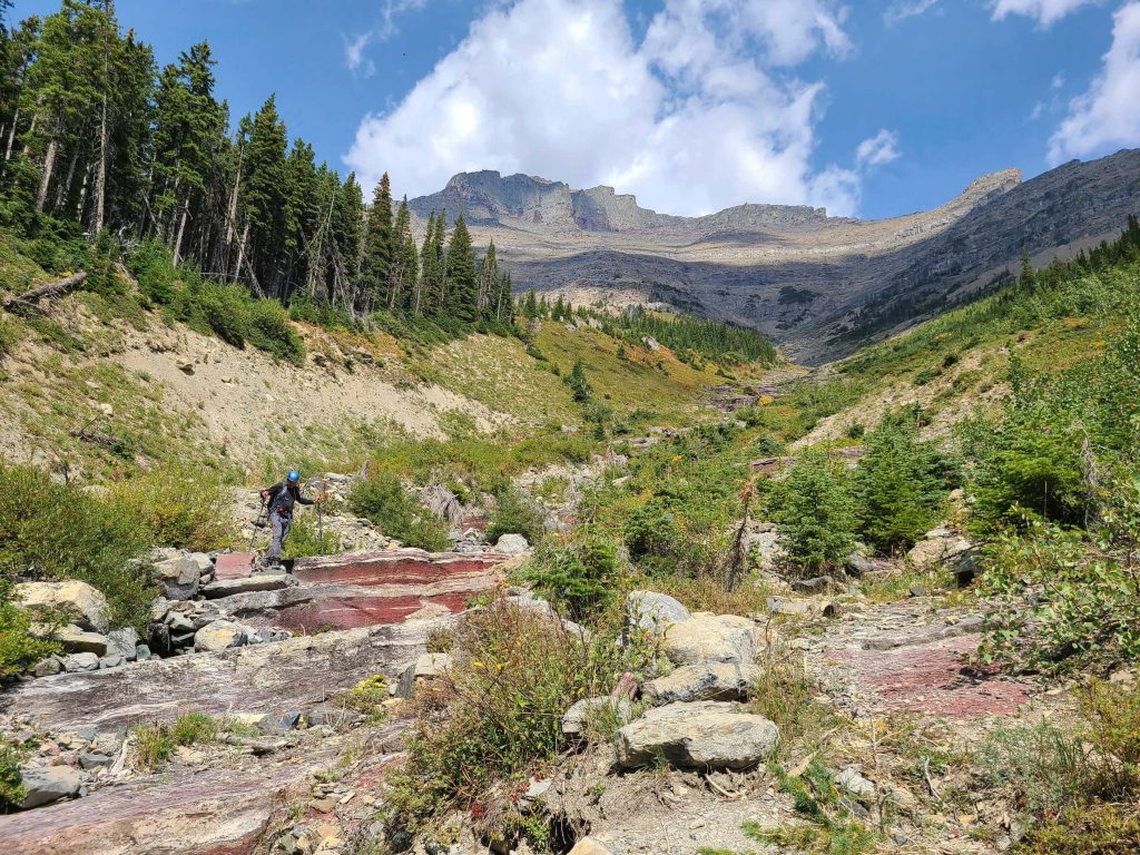
Approximately 2.9 km from the parking lot, we arrive at the ascent drainage.
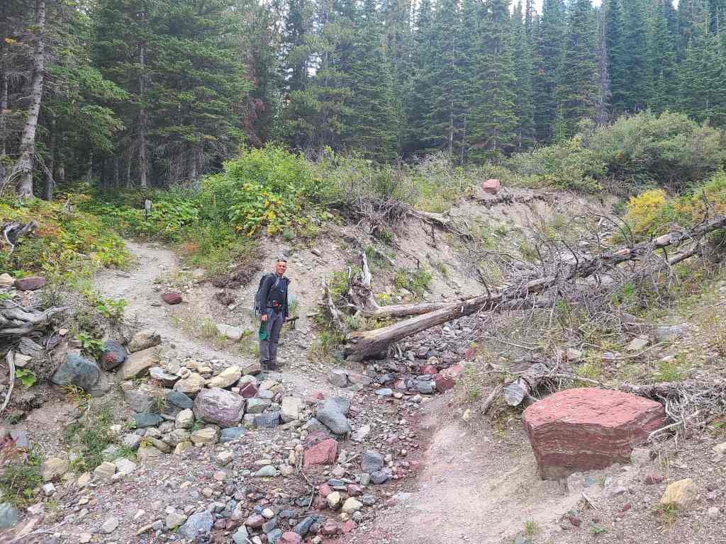
Andrew stands at the entrance to the drainage. It was kind of hard to miss…

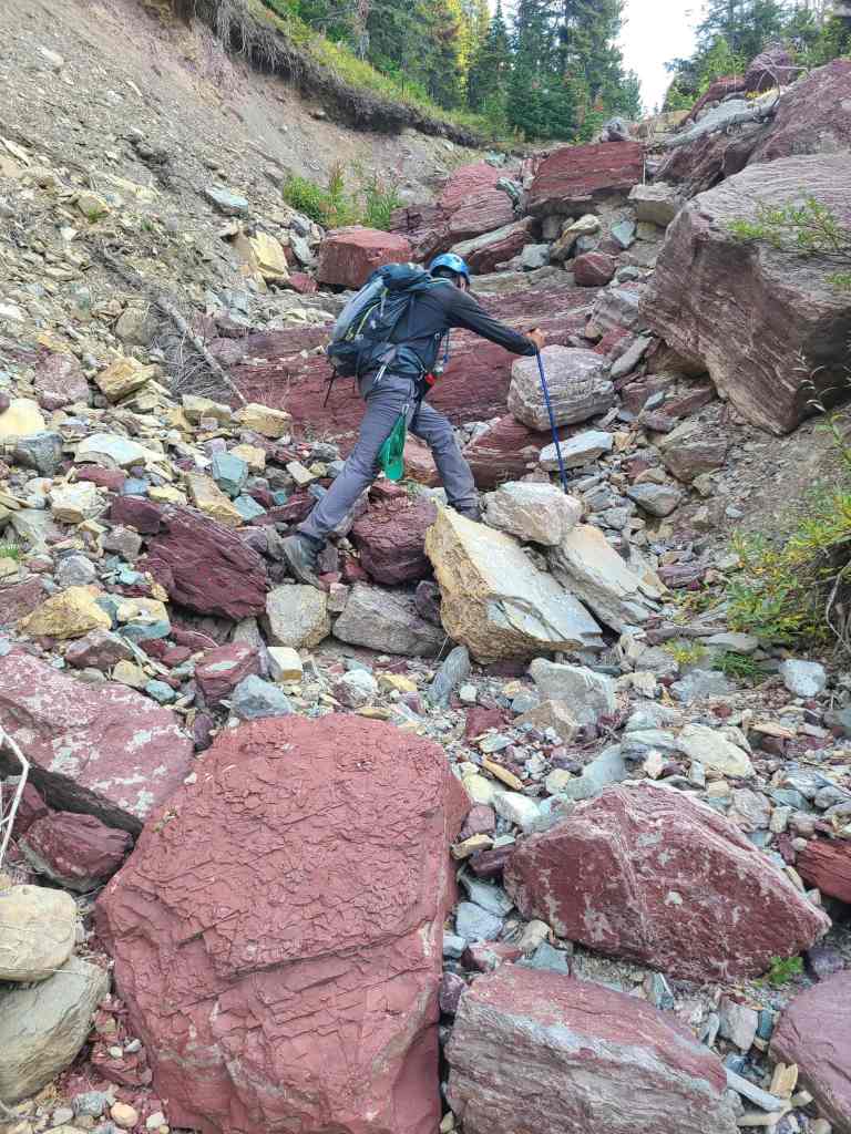
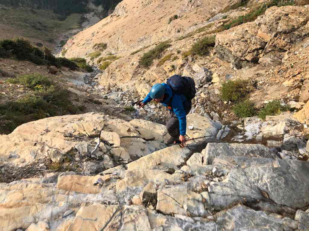
I take the lead on the lower section. (Photo by Andrew Nugara)

It was too bad that it was so early in the day, because sunlight would’ve made all of the colours pop. (Photo by Andrew Nugara)
Looking back to Mount Lineham.
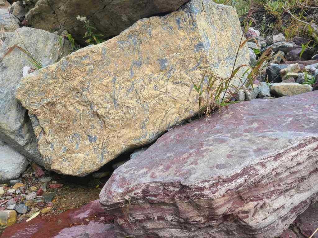
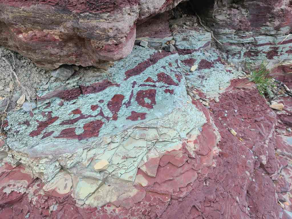
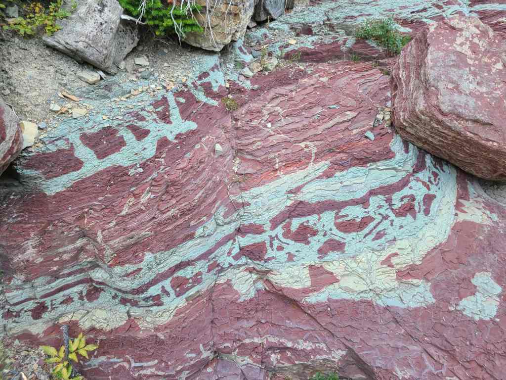
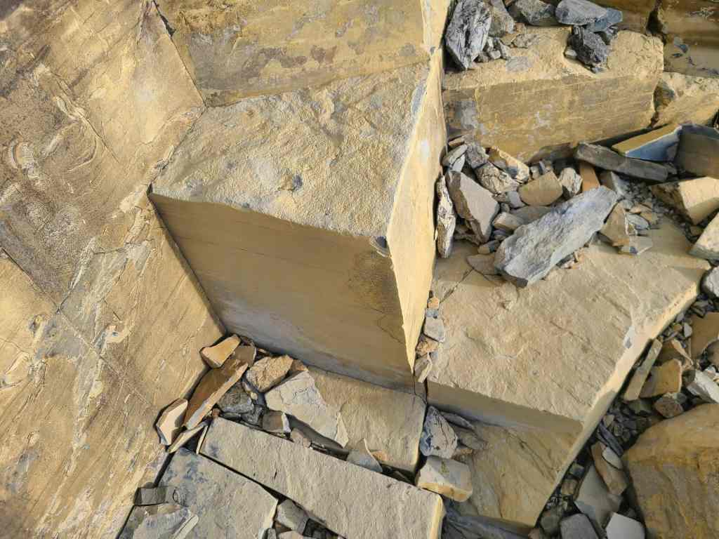
More interesting rock…
Followed by even more. This drainage was a delight to ascend!
Andrew takes the lead.
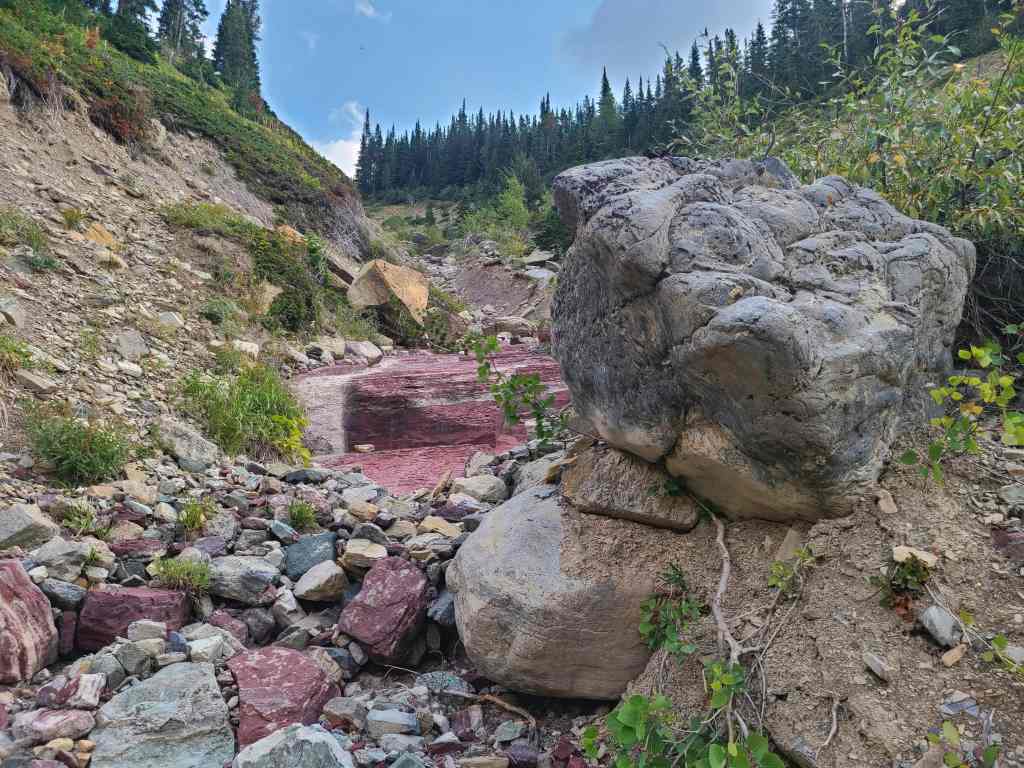
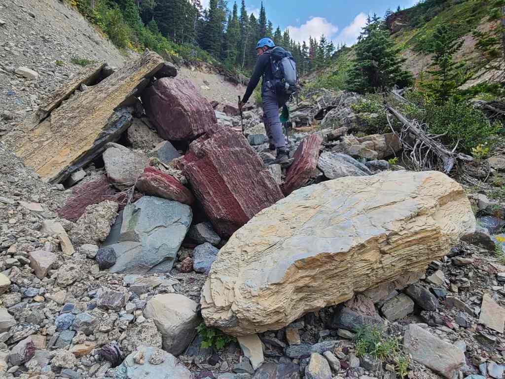
A gorgeous section of red argillite.
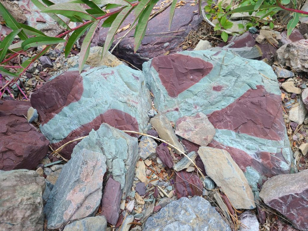
Bi-colour argillite.
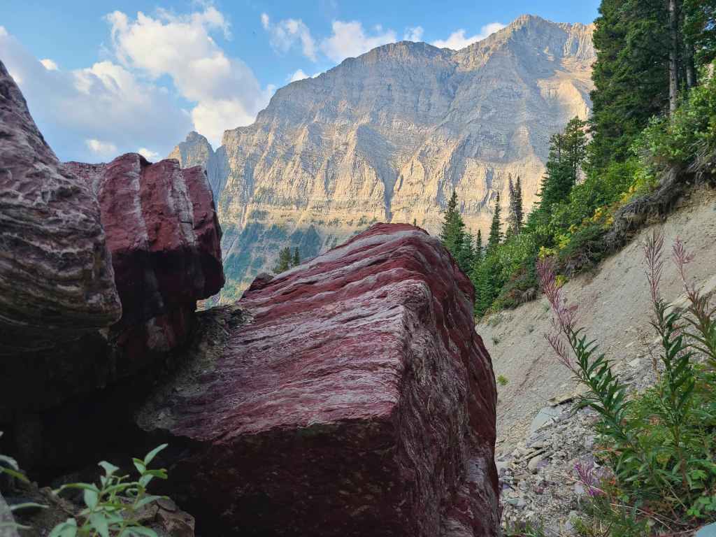
Yet another look at Mount Lineham, this time from behind a chunk of crimson argillite.
Andrew performs a Vulcan mind meld with the rock. 😂
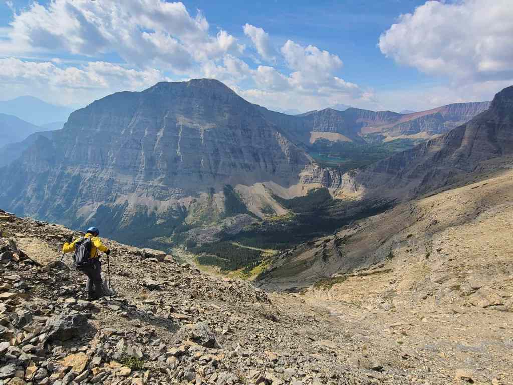
Our first look at the summit of “Igneous Peak” (centre).
Entering a section of intense colour.
This would look amazing with water flowing over it…

And so would this! 😁
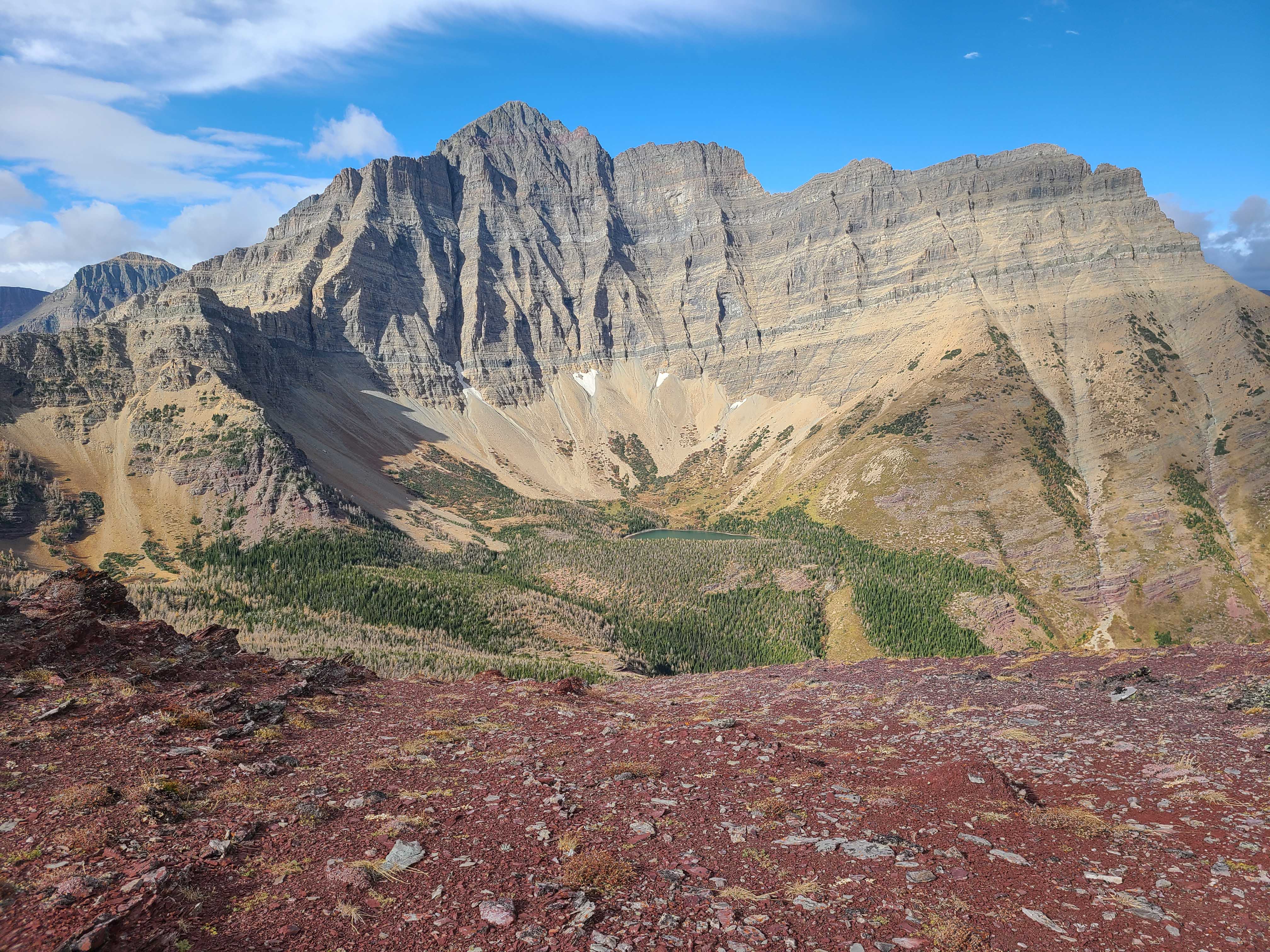
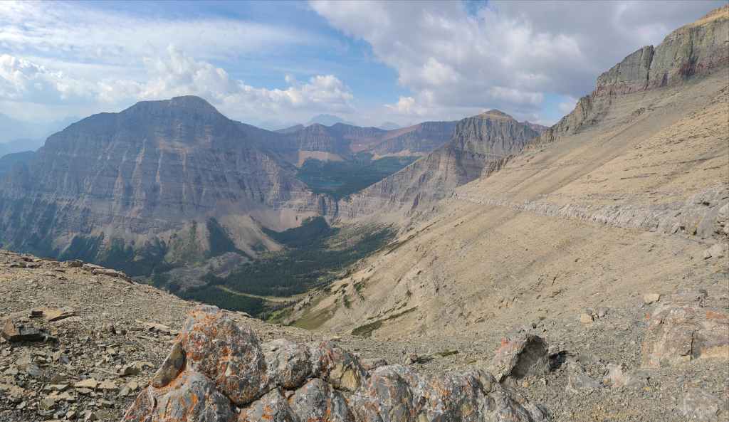
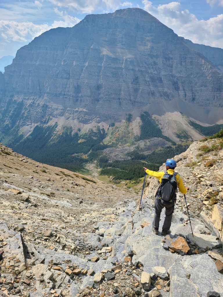
Entering the bowl beneath “Igneous” (right) and the east face of Mount Blakiston, which as we later discovered, has been labelled as, “Wrong Turn Ridge” on Google Earth.
More autumn colours.
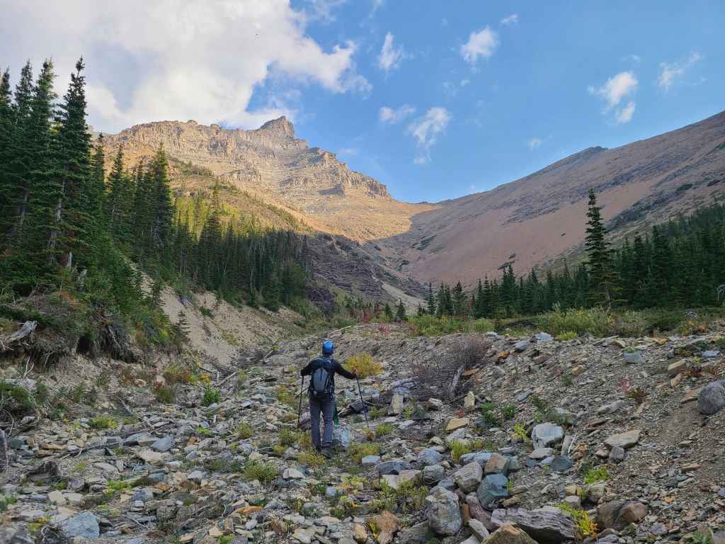
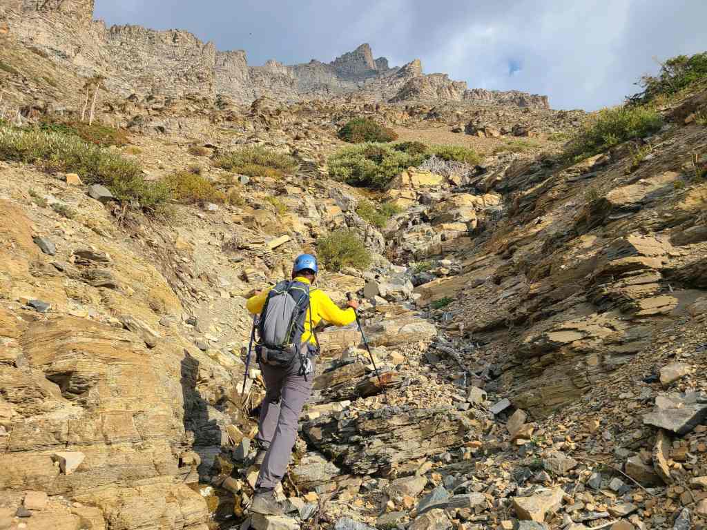
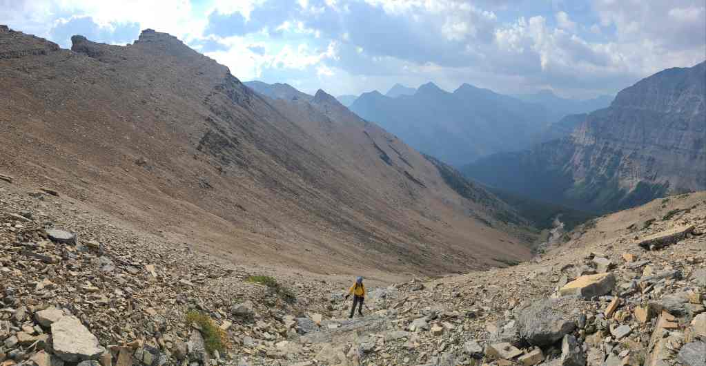
We will follow the drainage all the way to the base of the southeast ridge of Piinaquiium / Ahkoinimahstakoo (Mount Blakiston) (centre).

I seemed to have picked up a hitchhiker… (Photo by Andrew Nugara)
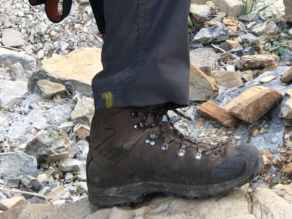
Say hello to my little friend! This won’t be our last insect encounter of the day.
I still can’t get over how effortless the elevation gain felt inside the drainage. Sign me up for more mountains like this!
Getting closer.
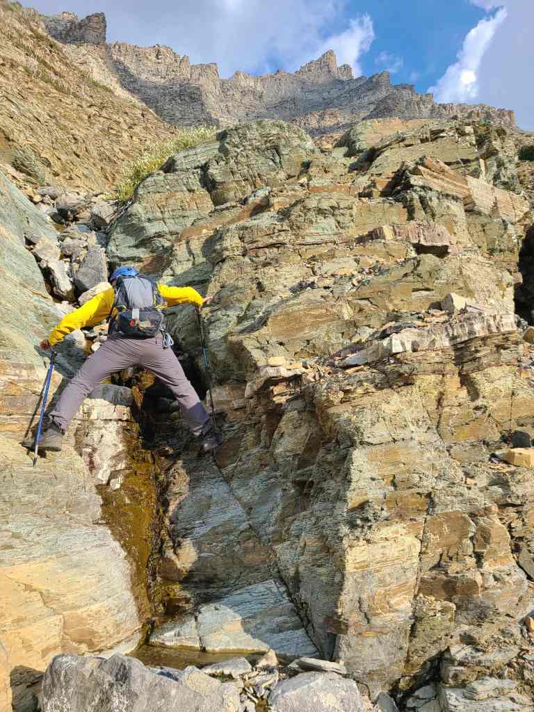
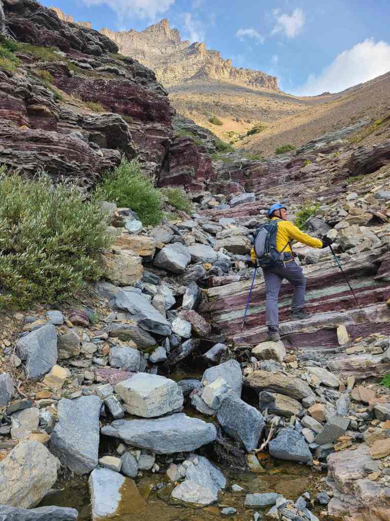
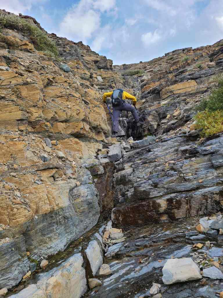
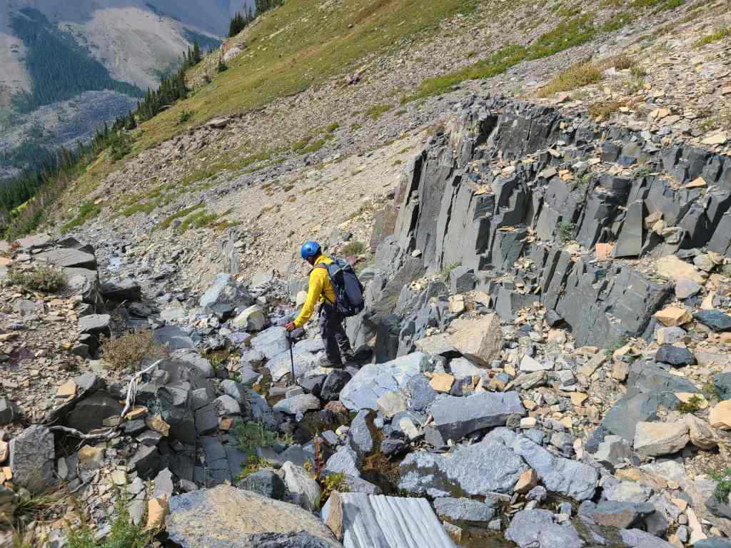
Andrew scrambles his way up a small waterfall…
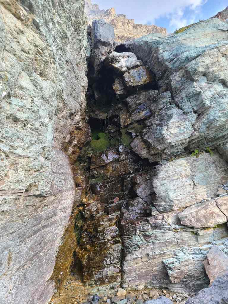
While I continue around a corner to find another VERY cool waterfall.
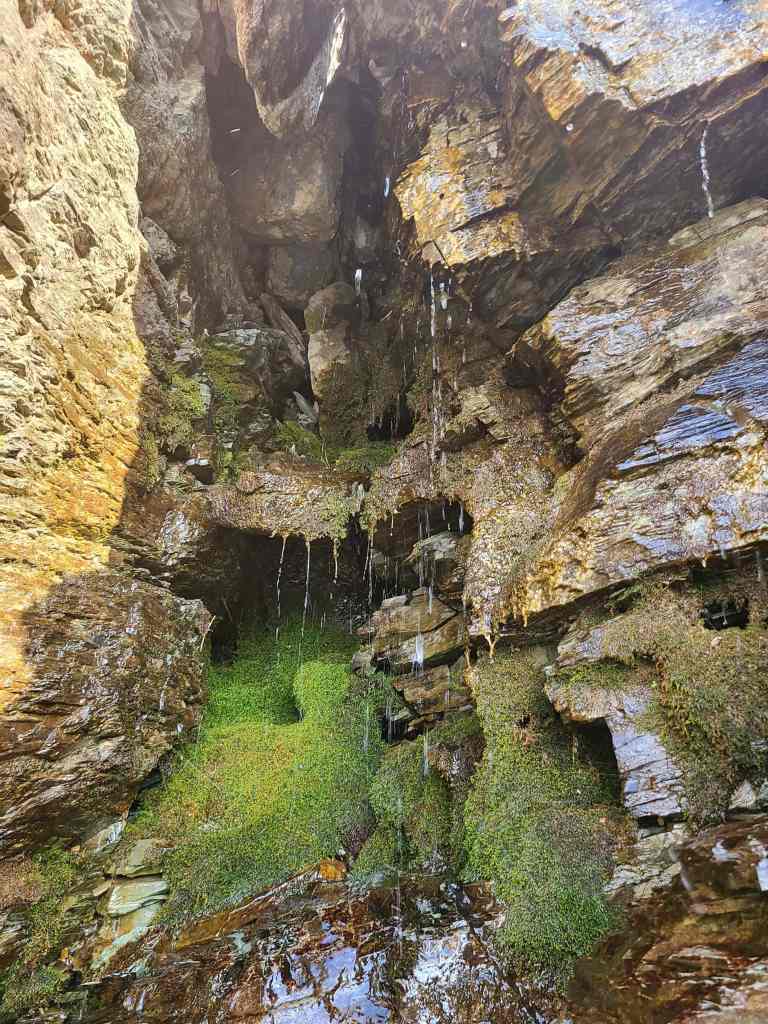
It’s too bad that my camera couldn’t capture it properly, because it was its own micro-world.
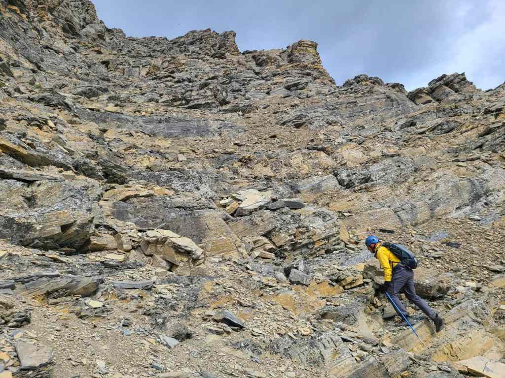
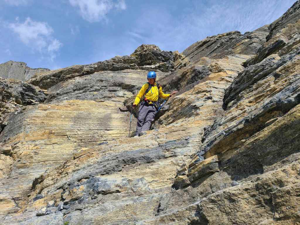
More easy scrambling. (Photo by Andrew Nugara)
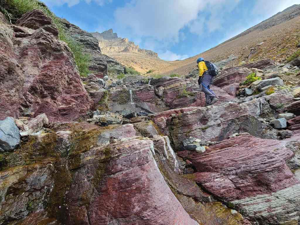
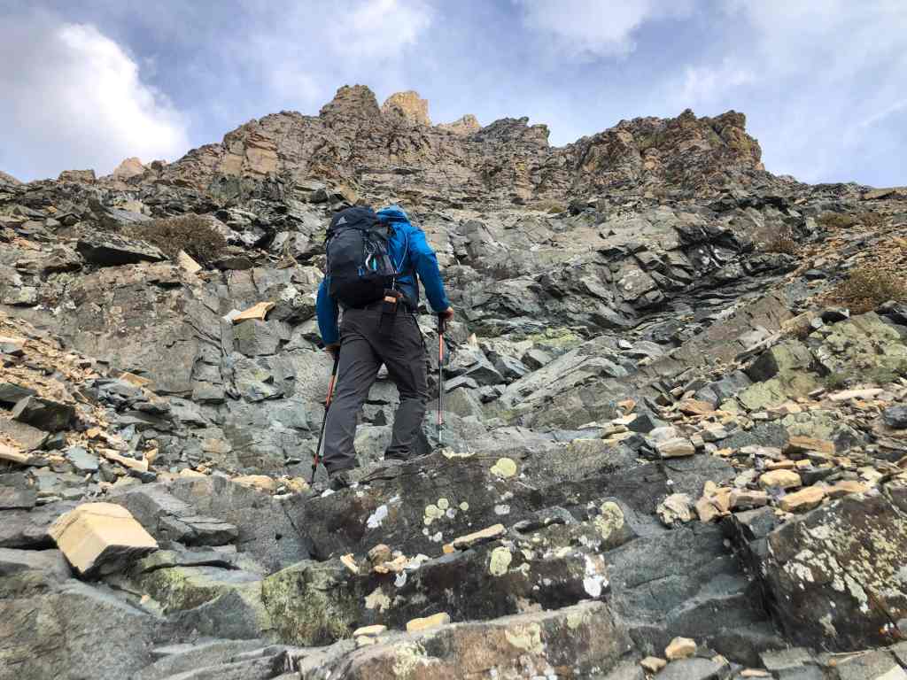
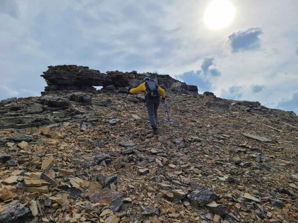
Ascending nature’s staircase.
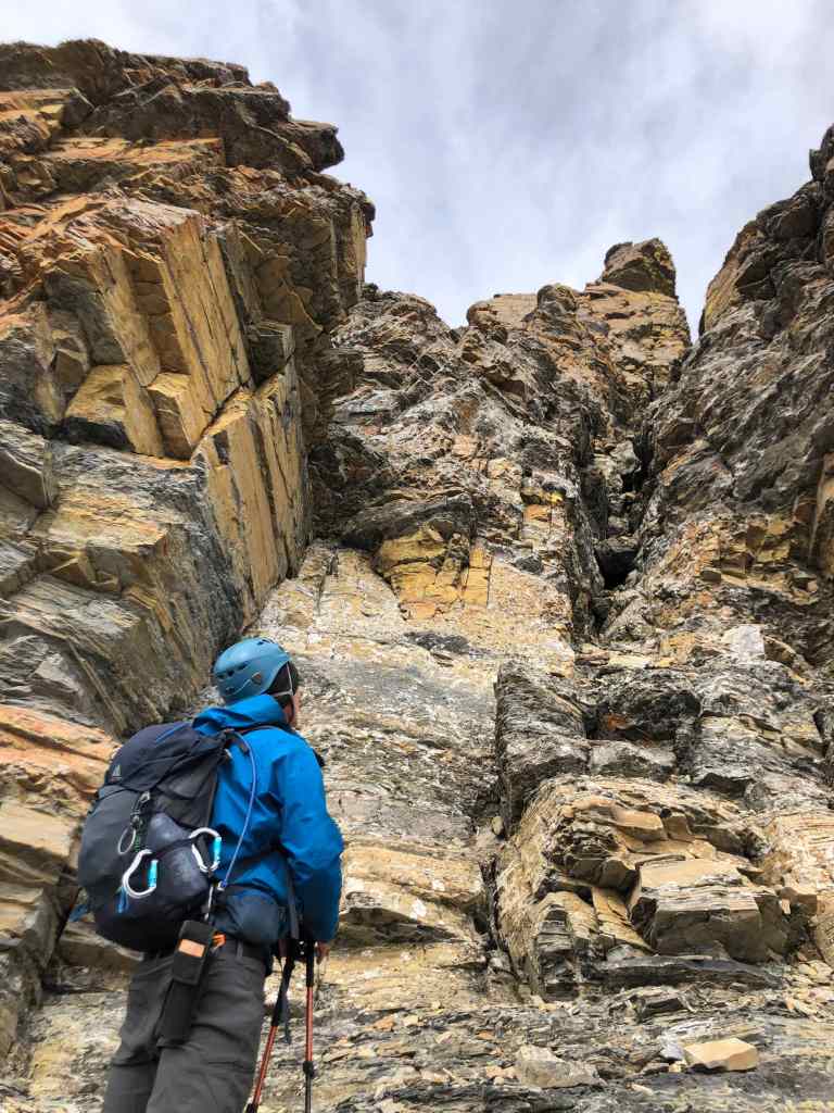
This was about as tricky as things got.
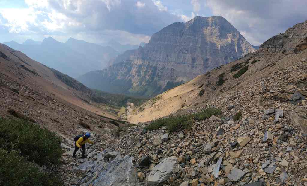
Gazing back as we near the top. Again, I couldn’t believe it when I looked at my GPS and saw that we had gained almost ~600 m in elevation since leaving the trail.
Near the top, the drainage curls toward Piinaquiium / Ahkoinimahstakoo (Mount Blakiston). Instead of leaving it to pursue a direct line to the ridge, it was much easier and much more enjoyable to keep following the drainage. (Photo by Andrew Nugara)
“Igneous Peak” is on the left.

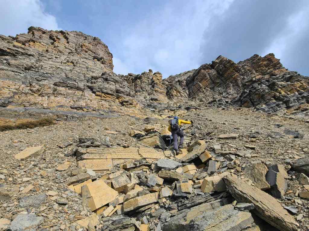
We often talk about using natural staircases…
But this one looked like someone had used a saw to cut the steps. Hmmm, must be aliens… 😂
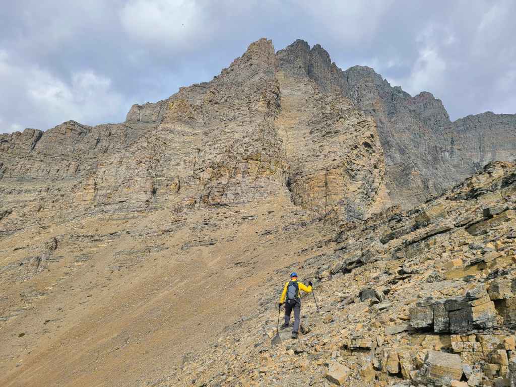
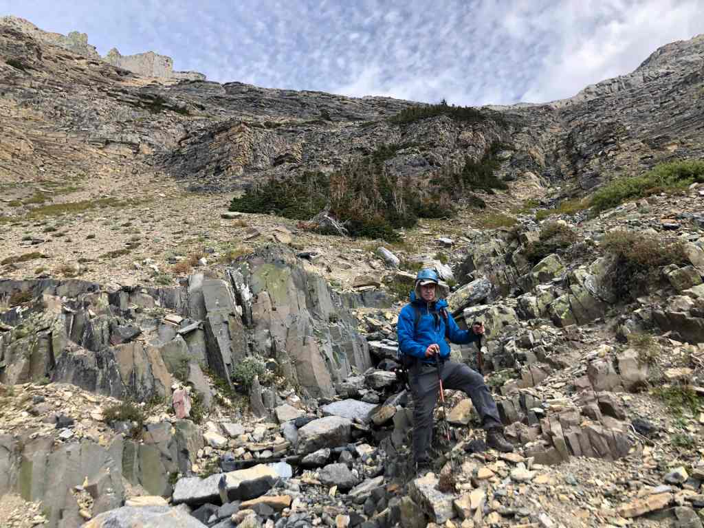
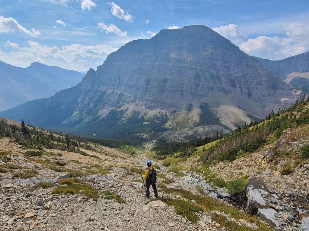
Andrew arrives at the base of Piinaquiium / Ahkoinimahstakoo (Mount Blakiston). We will explore this later…
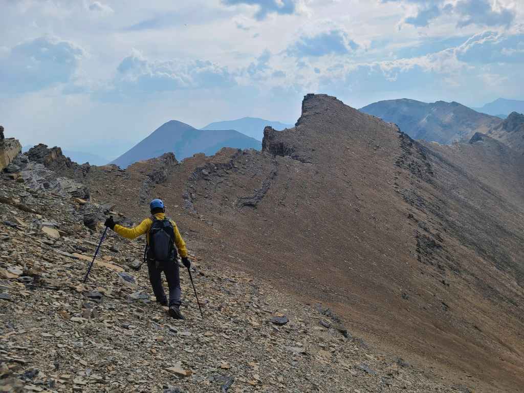
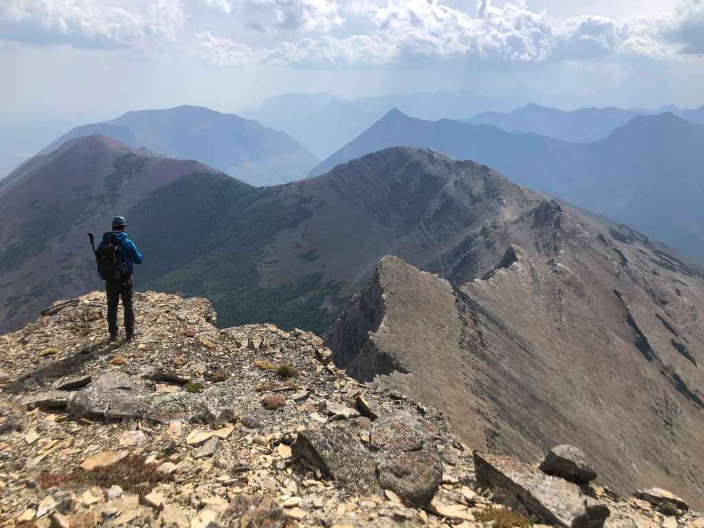
But first, we will make the easy hike over to “Igneous”.
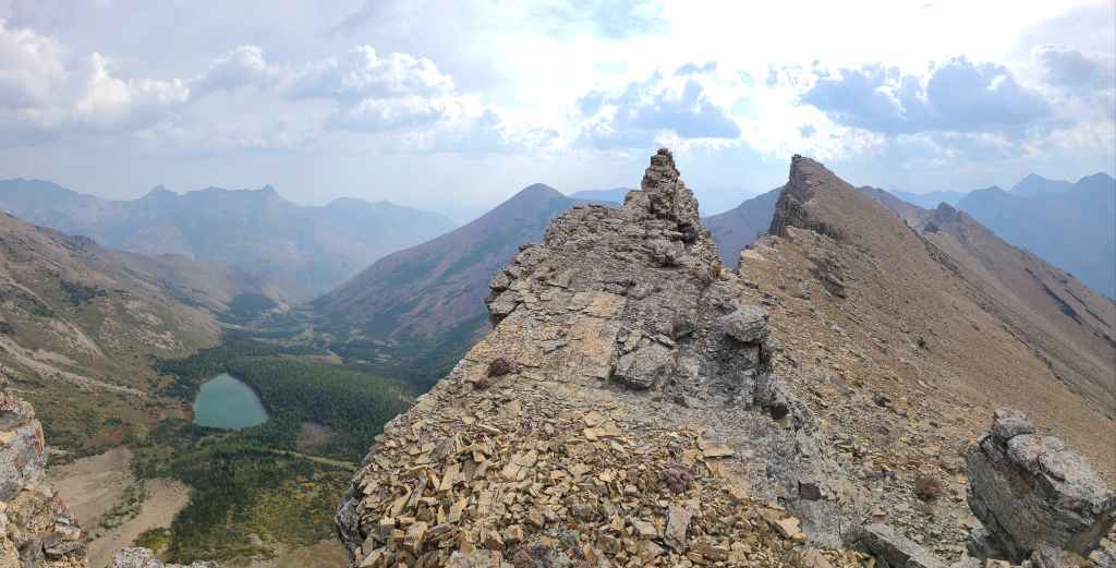
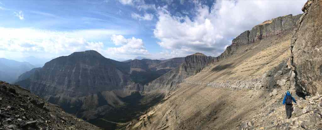
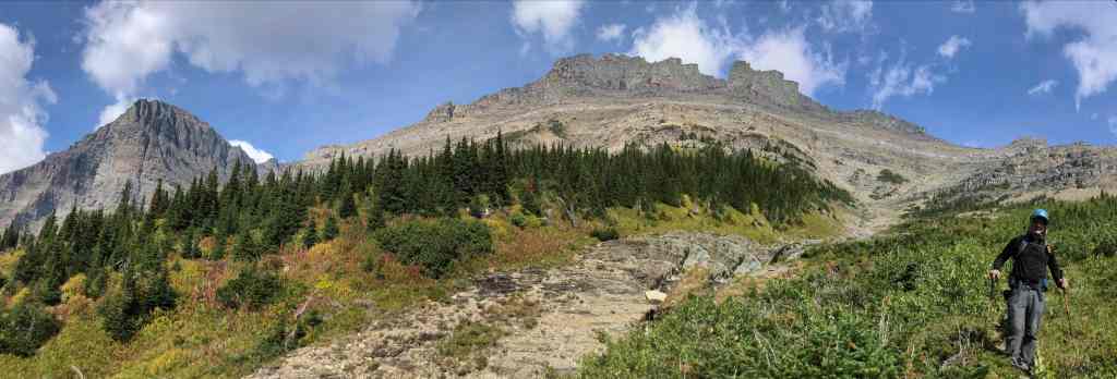
The ridge offers some great views!
Andrew’s view back. (Photo by Andrew Nugara)
Intense wind ensured that we stayed well back from the edge.
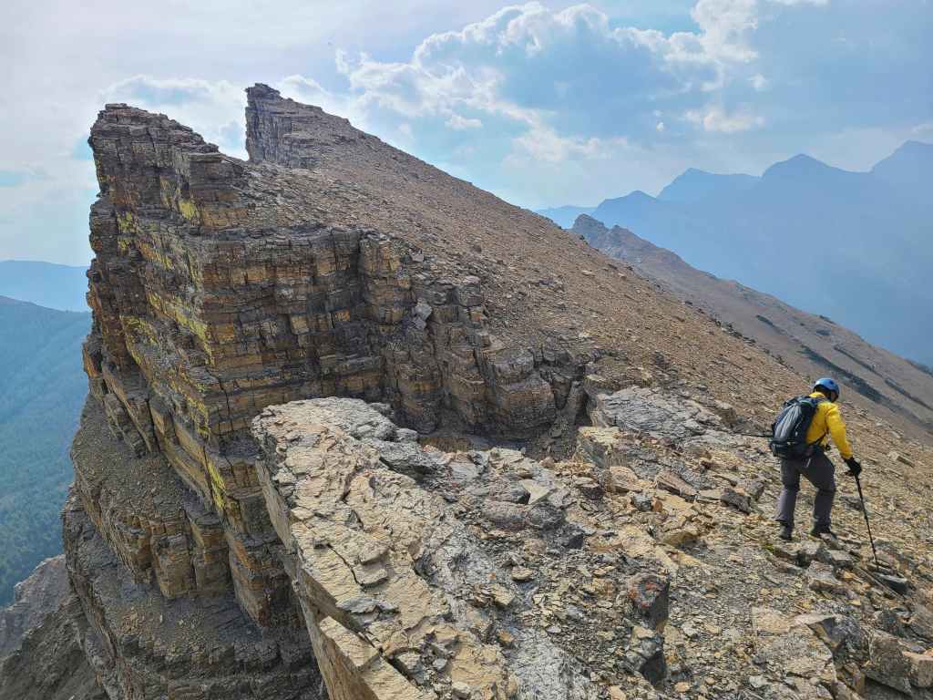
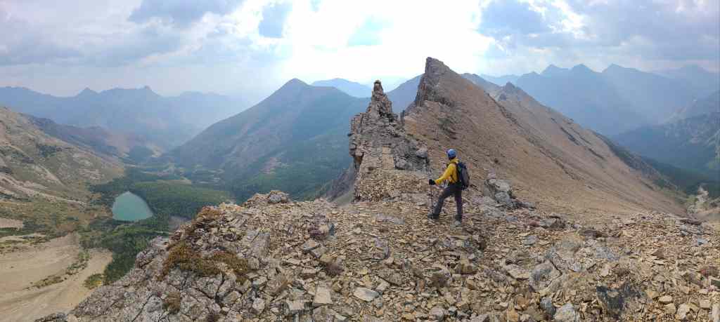
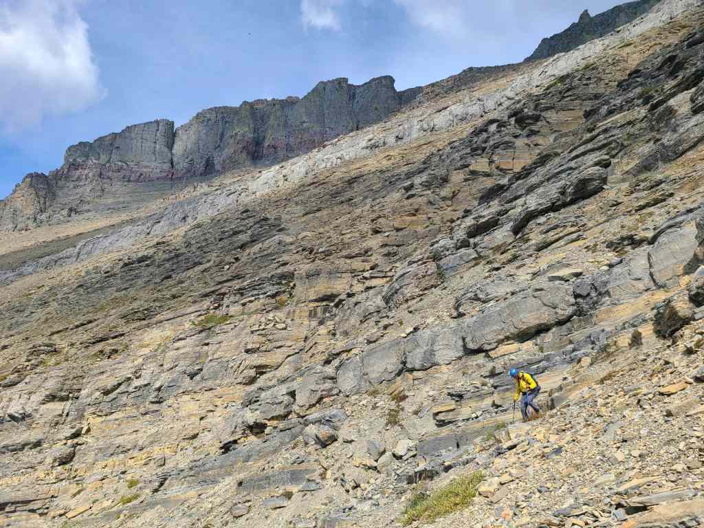
Drawing closer to the summit.
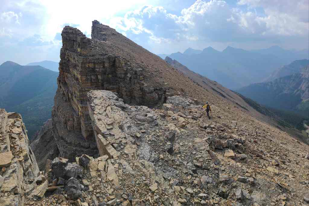
A wide angle of the previous photo. The angle of the slope shows why it was much easier to stay inside the drainage as opposed to scree-bashing directly to the summit.
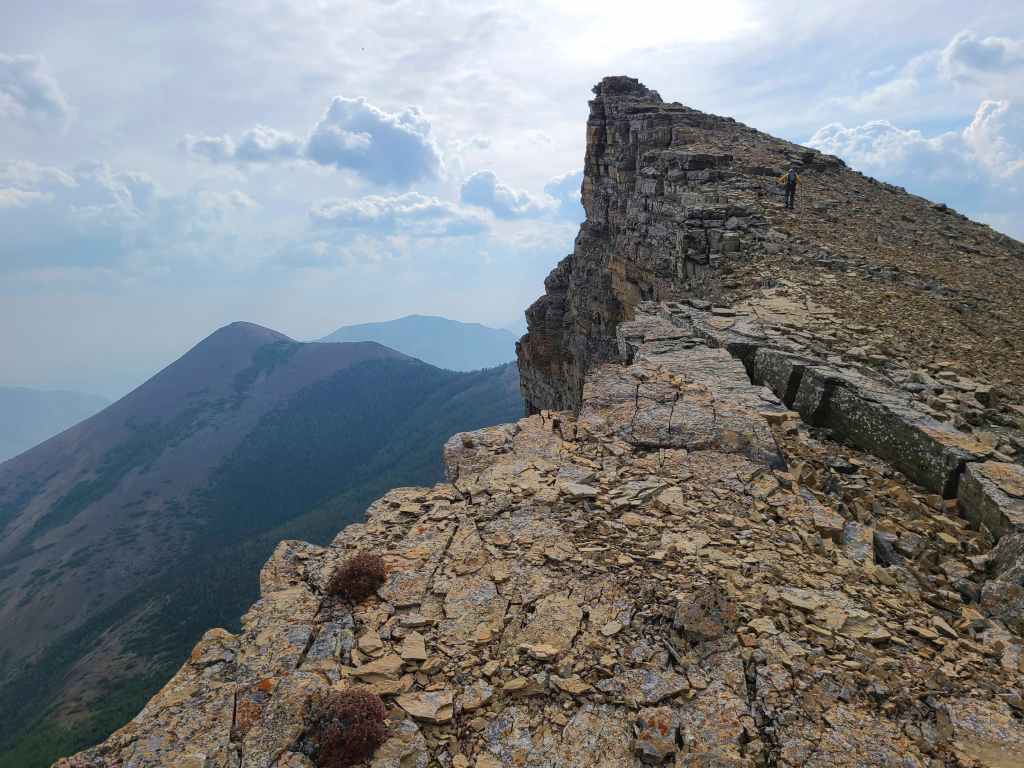
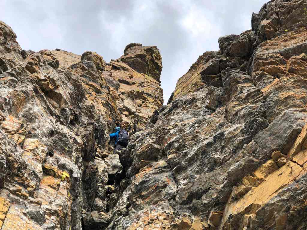
Almost there!
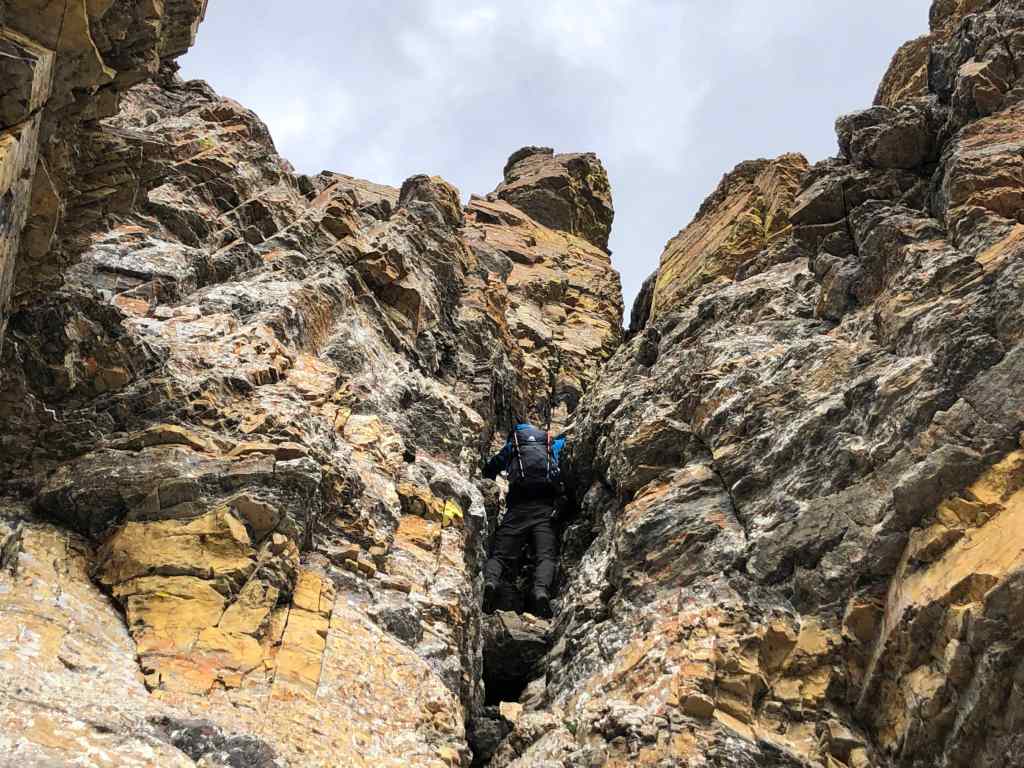
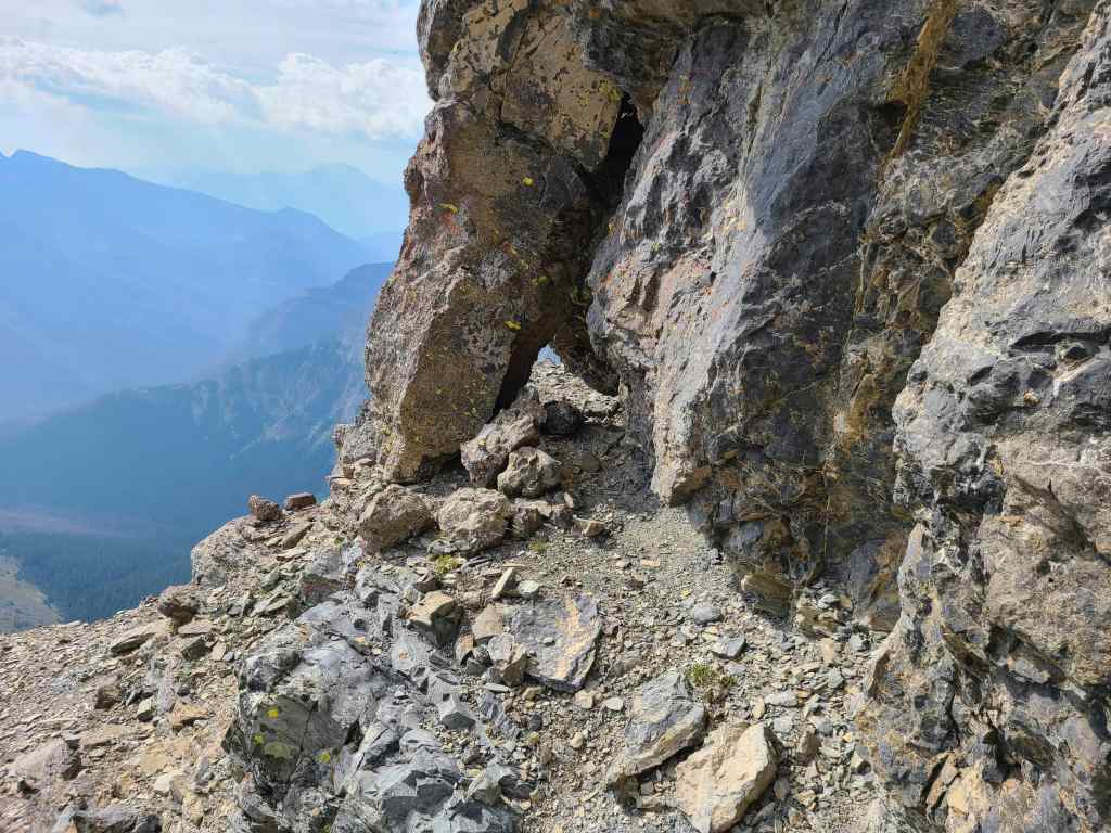
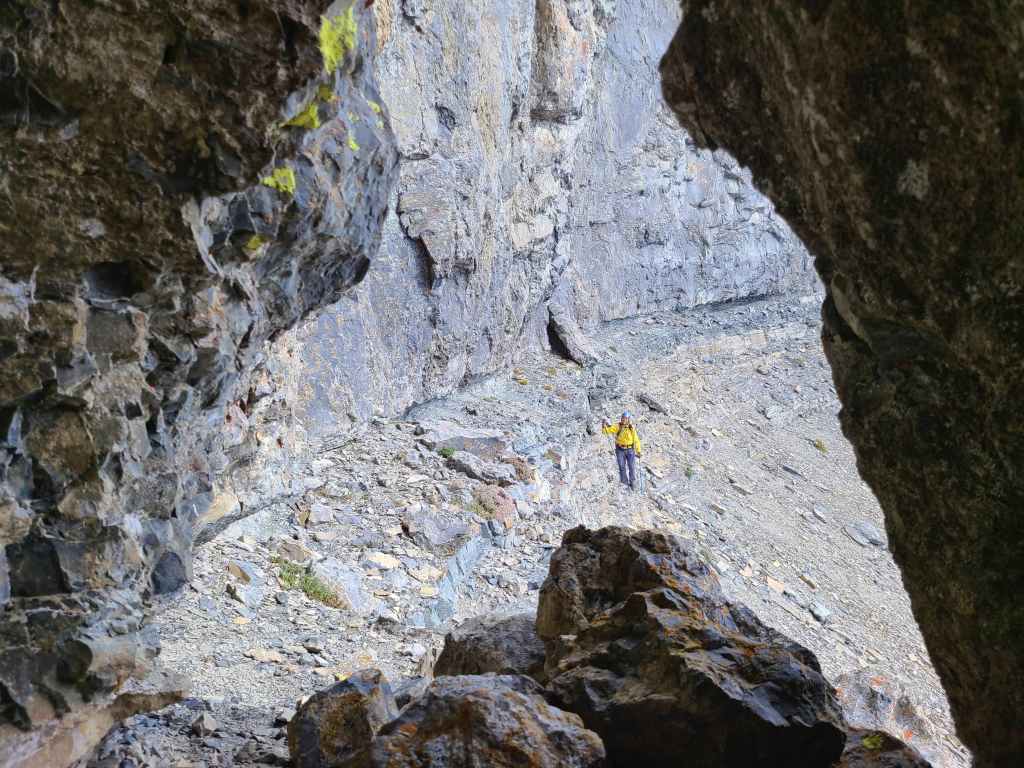
From this angle, it looked like there was a decent window through the rock, but it was only a gap. We did discover a window, but it was only a small slit.
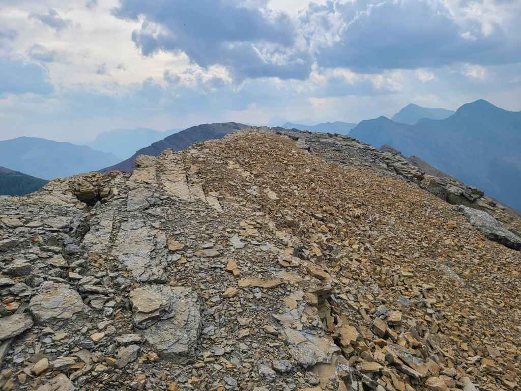
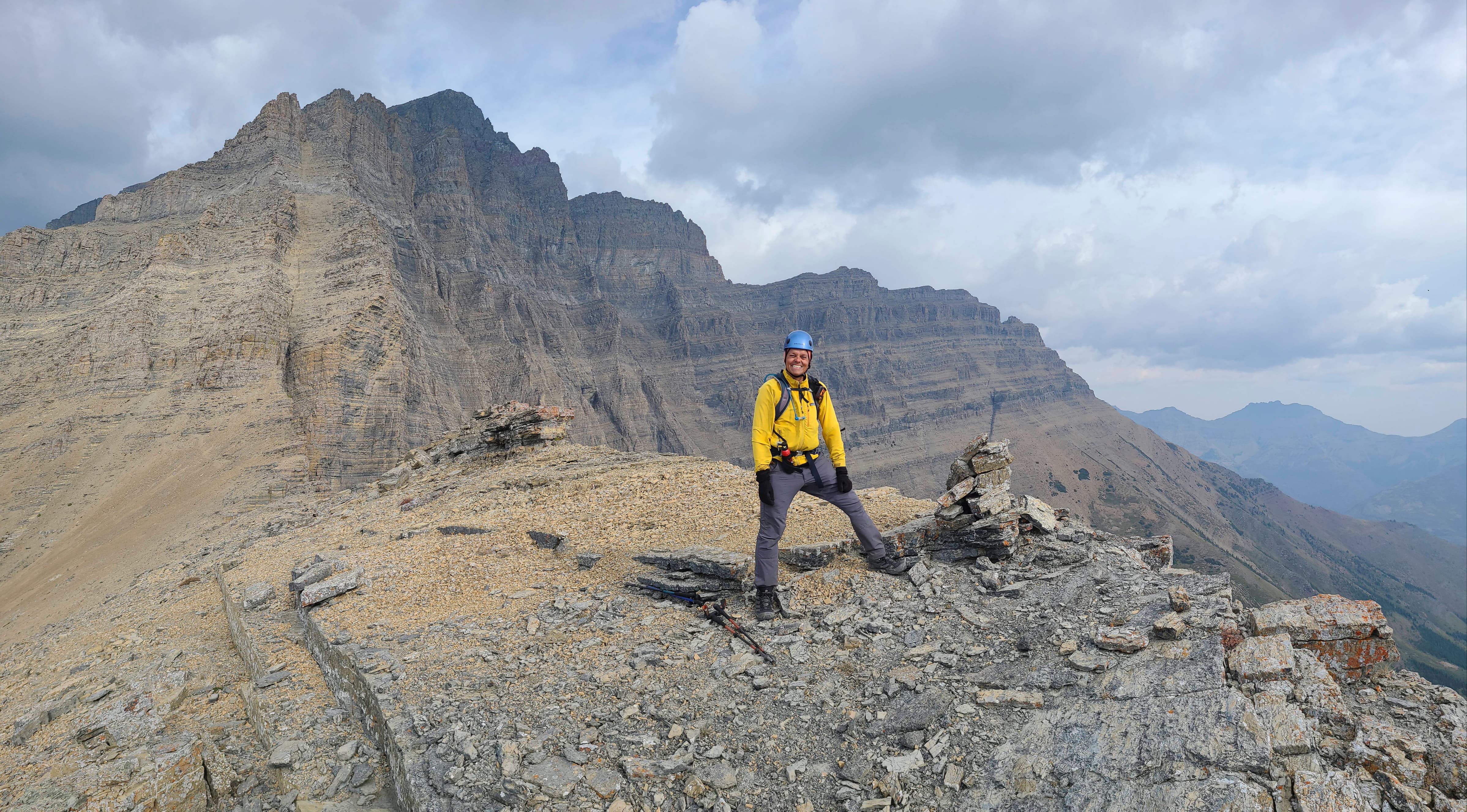
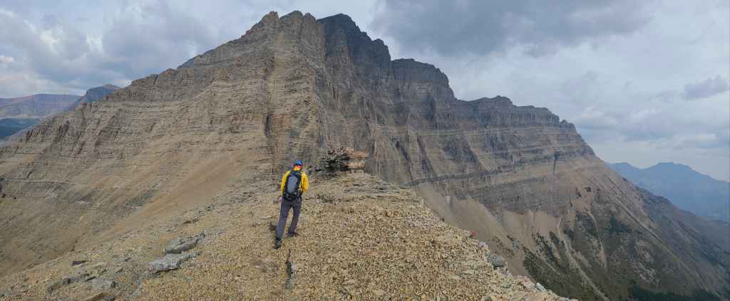
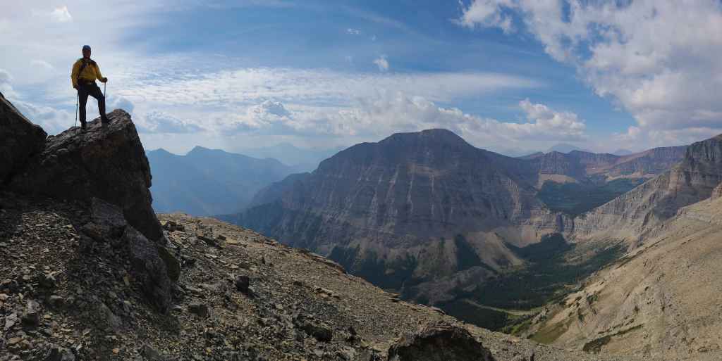
The summit of “Igneous Peak” (2420 m)
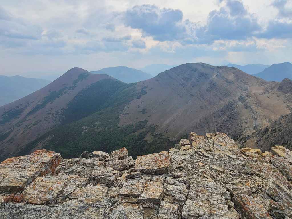
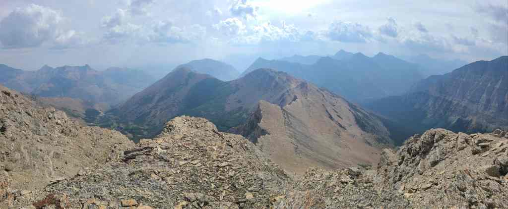
A pano to the northeast…
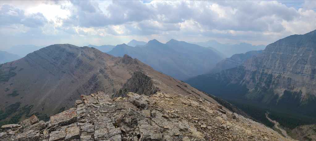
And now to the southeast.
Looking southwest…
And now to the west.
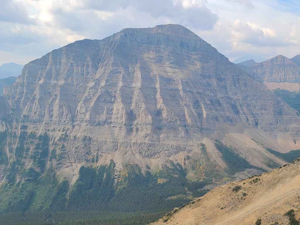
A closer look at the band of igneous rock as it presents on the side of Blakiston.
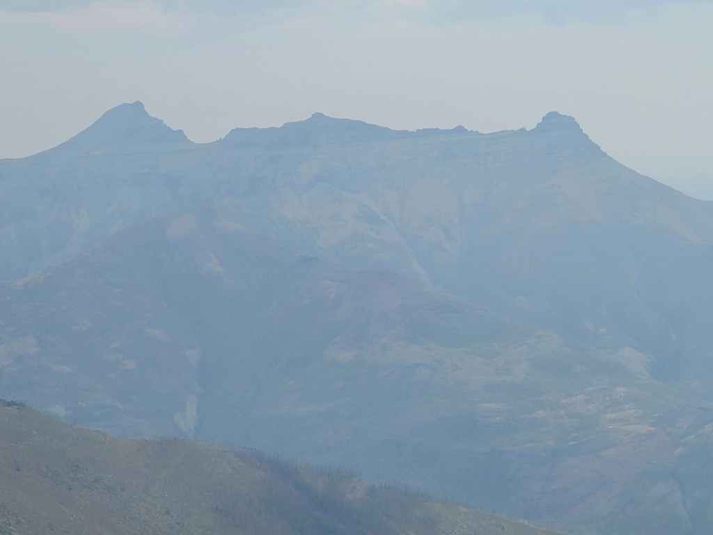
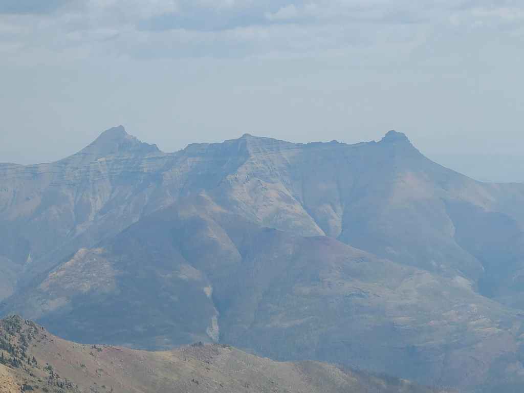
A telephoto of “Dundy Peak” (left) and Mount Dungarvan (centre).
“Rogan Peak” on the left and Mount Galwey on the right.
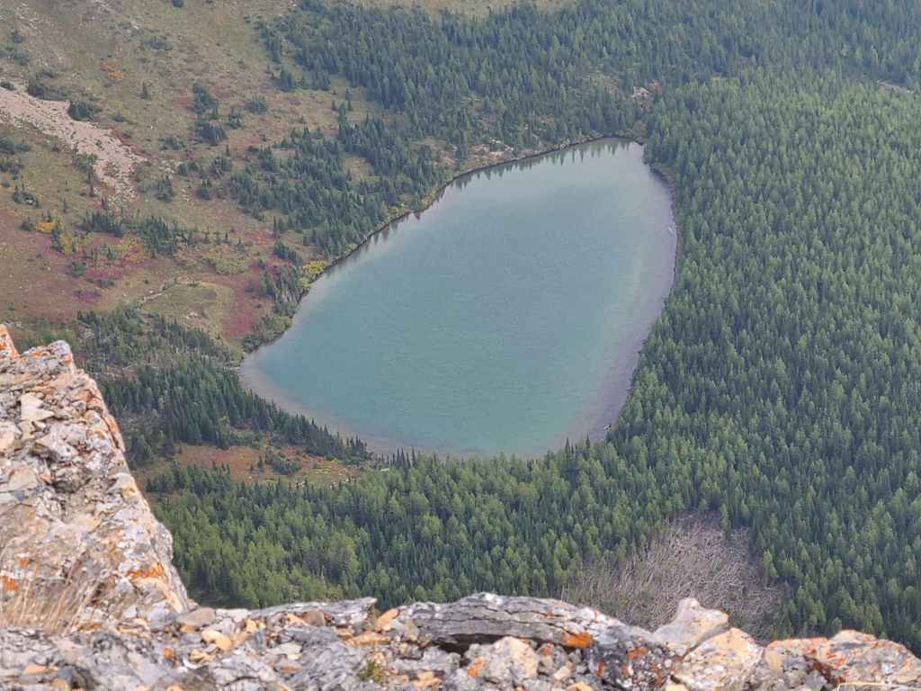
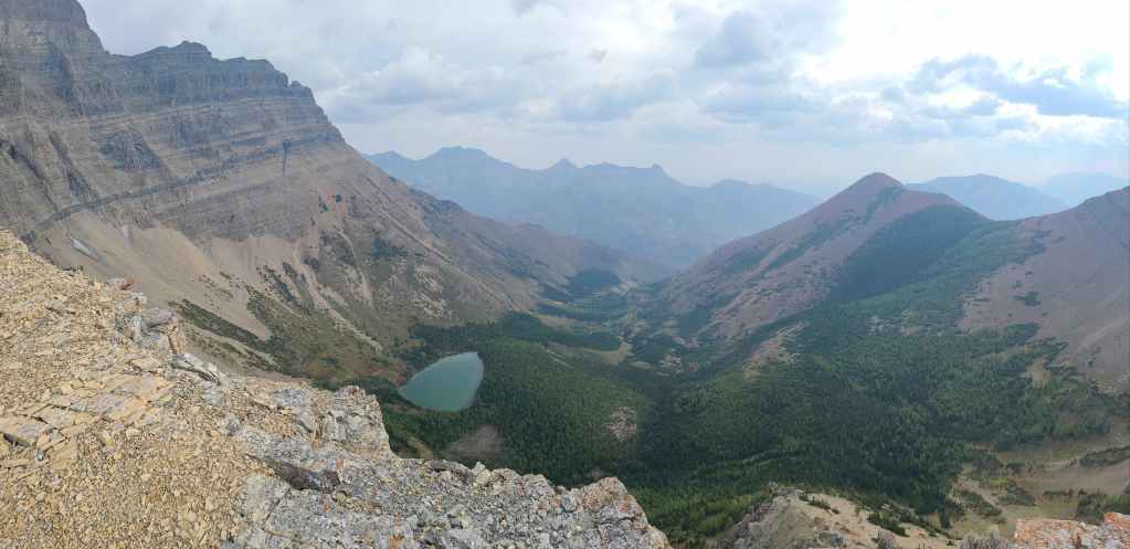
Gazing down to Ruby Lake.
Ruby Ridge is one of the most colourful mountains in the area.
A telephoto across the col on Ruby to Mount Crandell, with Sofa Mountain on the distant right.

The view across the Akamina Parkway to Buchanan Ridge (centre) and Mount Carthew (right). In the distance on the left is Mount Alderson and directly in front of it, is Buchanan Peak. On the far left is “The Senator”, that I nicknamed after Senator William Buchanan.
Mount Lineham is impressive!
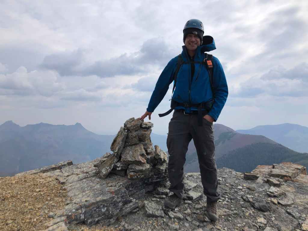
There wasn’t a cairn at the top, so I built one and named it, “Jarome” after Jarome Iginla, the HoF winger for the Calgary Flames whose nickname was “Iggy”. Get it? We are on “Igneous Peak” hence, “Iggy” ergo “Jarome”… 😁 (Photo by Andrew Nugara)

Andrew’s third time this year on “Igneous Peak”. 😁
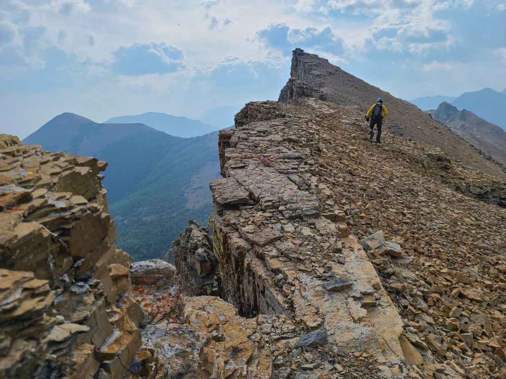
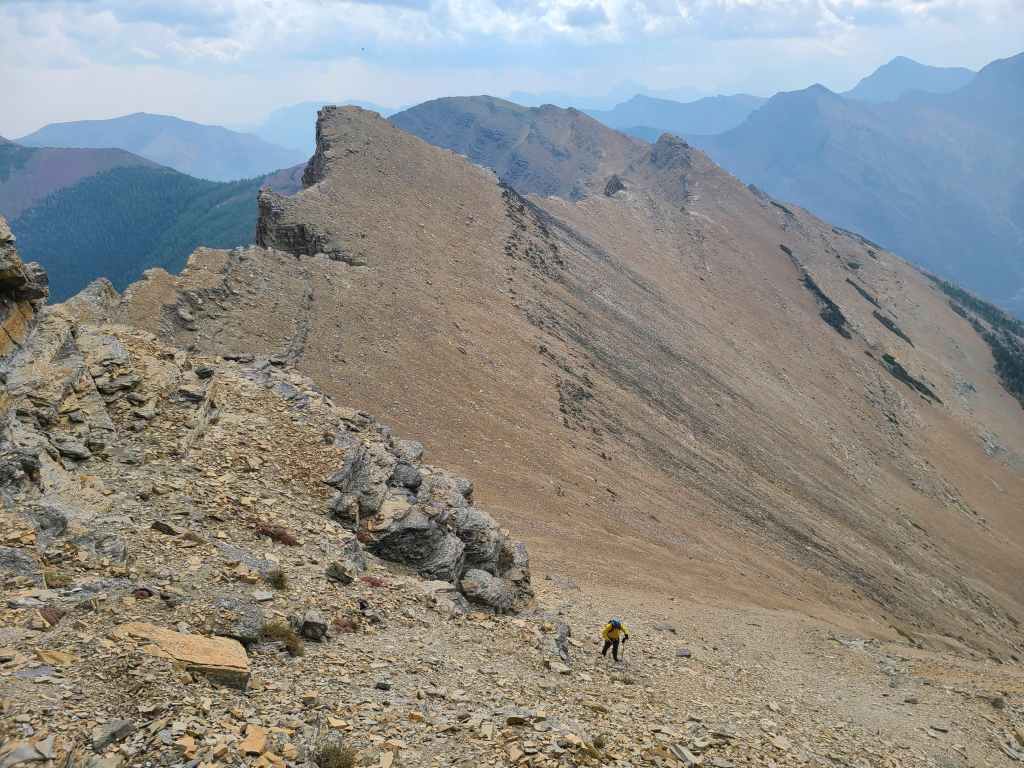
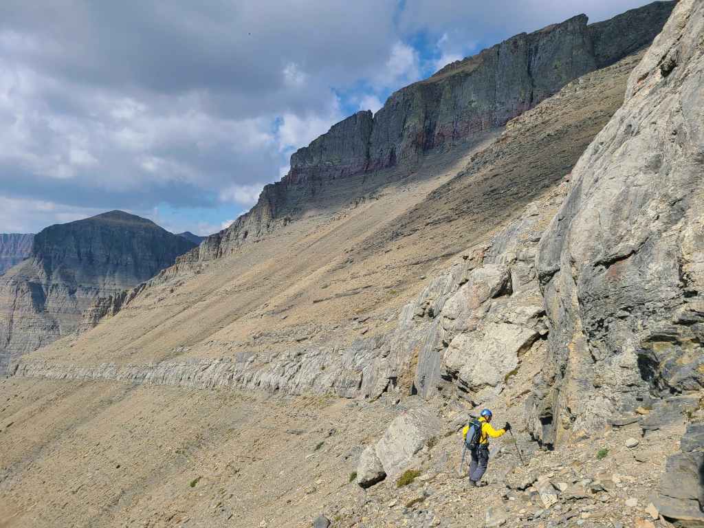
Andrew leads us back to the southeast side of Piinaquiium / Ahkoinimahstakoo (Mount Blakiston).
Glancing back and along the ridge towards “Igneous Peak”.
The southeast face has so many options!
I spot a small chimney… (Photo by Andrew Nugara)
Which naturally means that I’m game to explore it. 😁. (Photo by Andrew Nugara)
I will eventually end up on top of that overhanging rock to my left. (Photo by Andrew Nugara)
My view down to Andrew as I begin to traverse to climber’s left.
An inviting staircase leads us on… (Photo by Andrew Nugara)
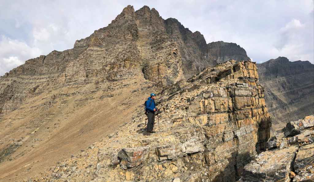
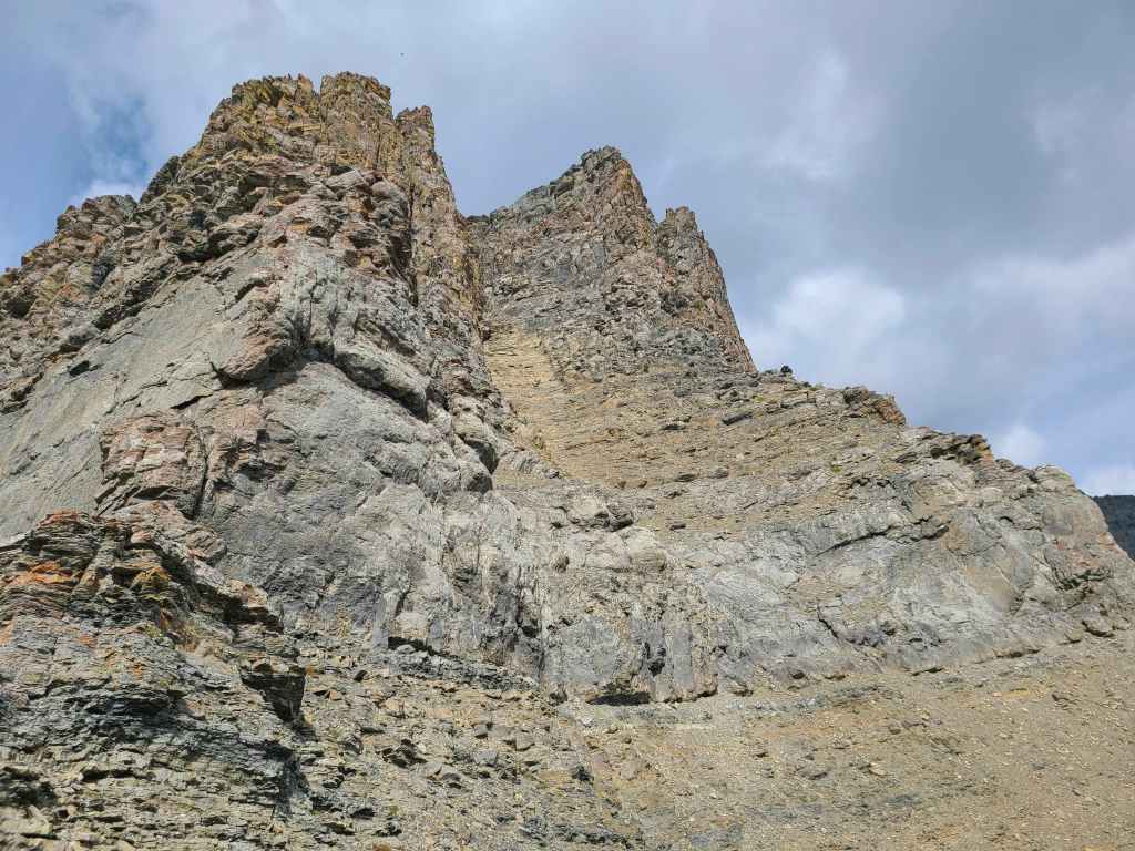
It’s remarkable how the southeast face of Piinaquiium / Ahkoinimahstakoo (Mount Blakiston) looks entirely unassailable from “Igneous”, yet once you are on it, it is an entirely manageable slope.

It did not take long until we were high above “Igneous Peak”.
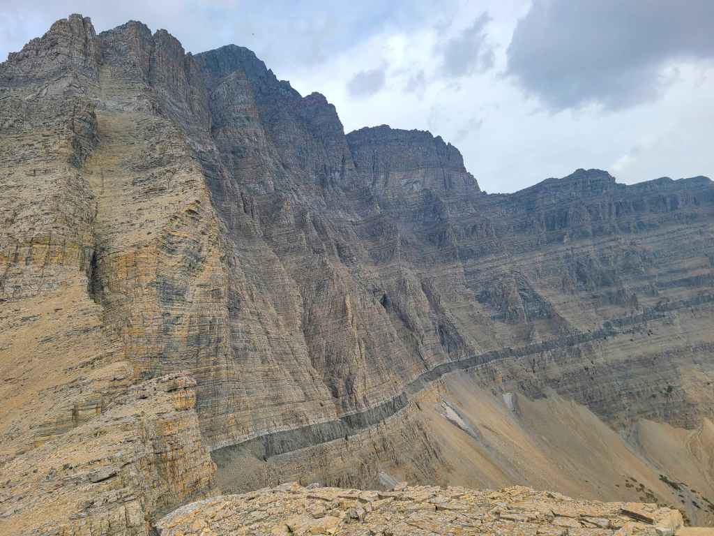
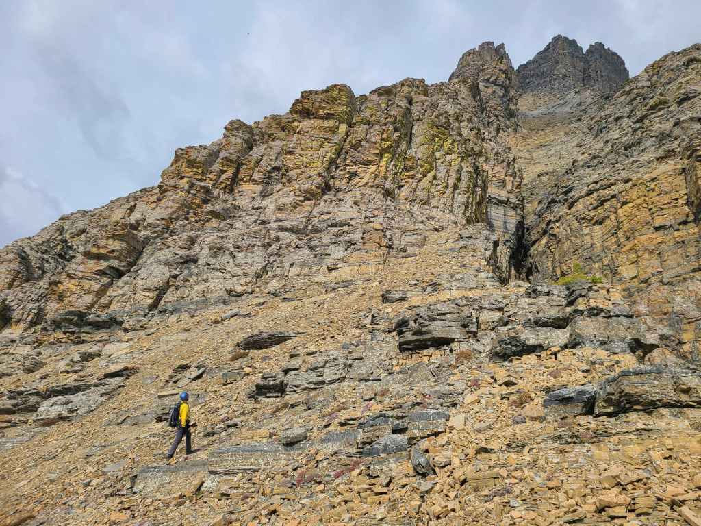
Coming to the massive limestone band.
At this point, I think we are well above and further to the north of “Wrong Turn Ridge” – at least where it is labelled on Google Earth.
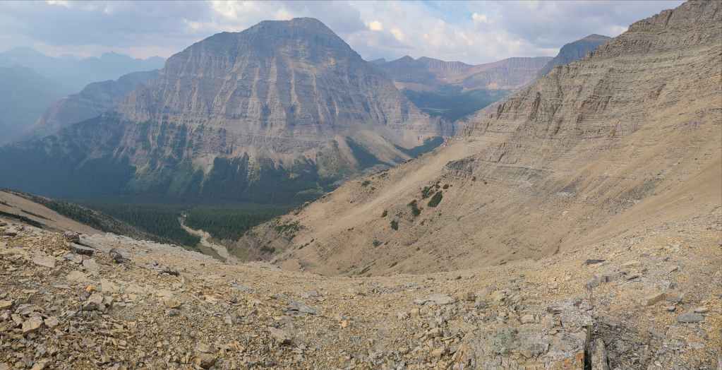
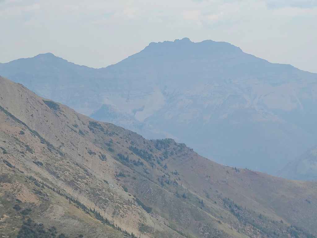
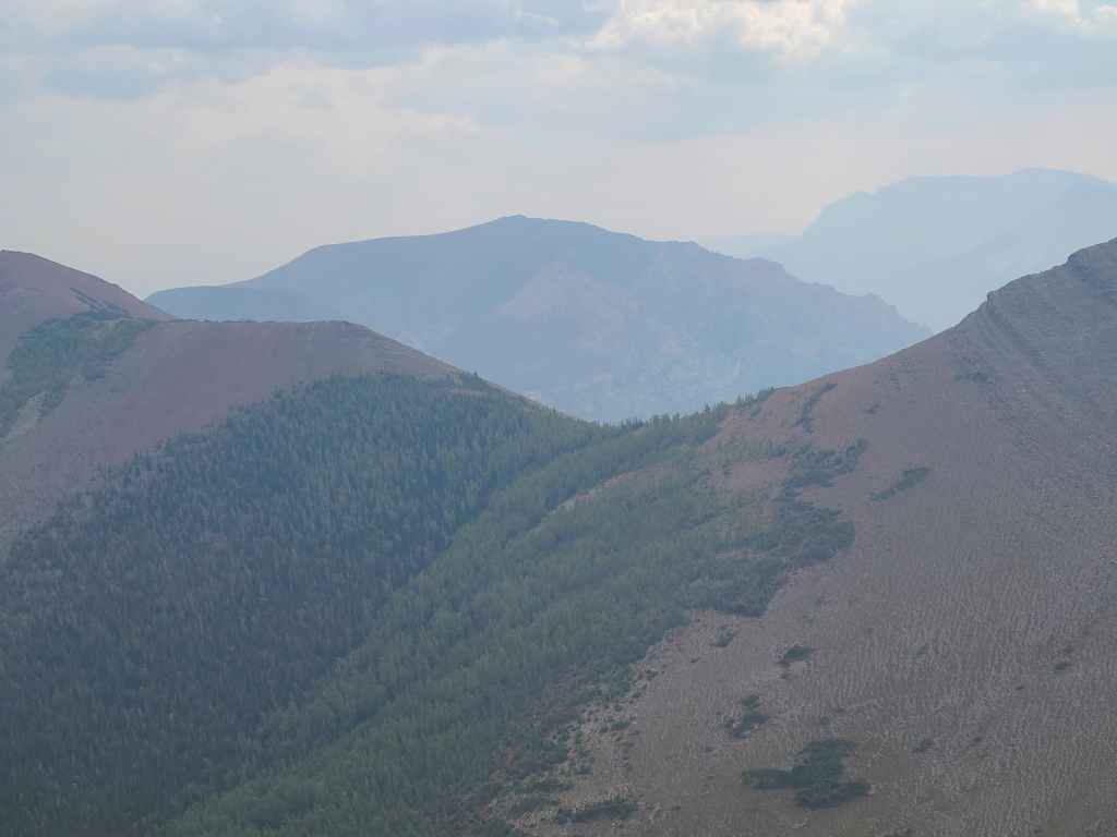
Some of the haze had lifted, allowing for better views of Mount Dungarvan.
Likewise for “Rogan Peak” (left) and Mount Galwey (right).
Taking in some great views! (Photo by Andrew Nugara)
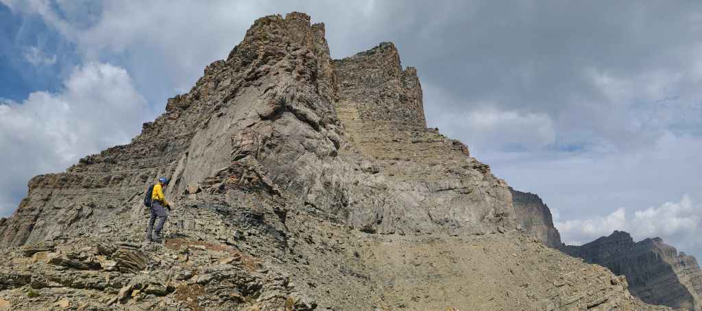
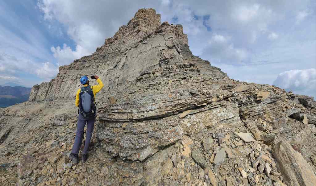
Andrew hikes up to the imposing wall of limestone.
There appeared to be a way past it to climber’s right; however, the upper portion was not scrambling terrain.
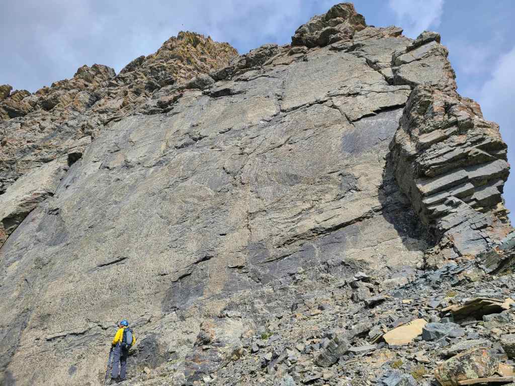
Andrew is completely dwarfed by the limestone wall.
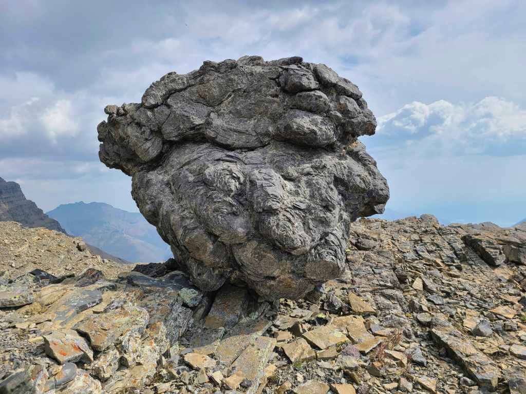
An interesting boulder beneath the limestone.

We decided to follow the band further to the west.
The section to my left has been labelled, “Wrong Turn Ridge” on Google Earth. (Photo by Andrew Nugara)
Collapsing rock had created a small window.
So naturally I had to look through it. 😂

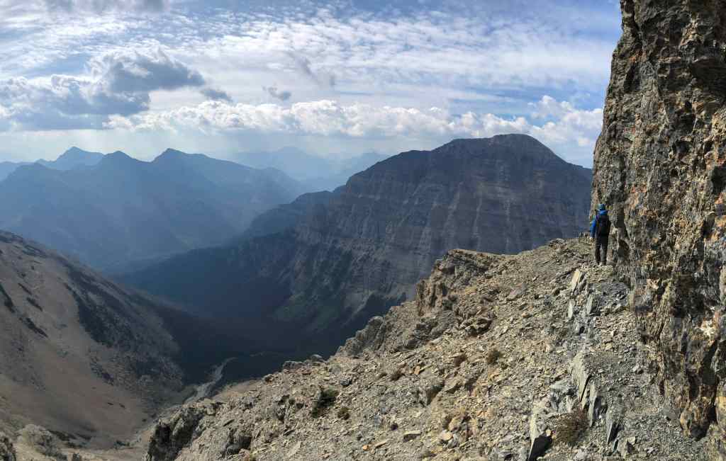
A pano from the top of “Wrong Turn Ridge”. (Photo by Andrew Nugara)
Rounding the corner brings us close to Kane’s ascent drainage for Piinaquiium / Ahkoinimahstakoo (Mount Blakiston). (Photo by Andrew Nugara)
There aren’t many places in Waterton where Andrew hasn’t been, but “Wrong Turn Ridge” was new for him. 😊
Our lunchtime view over to Lineham Falls and the Lineham Lakes. Kane’s ascent drainage is on the right.
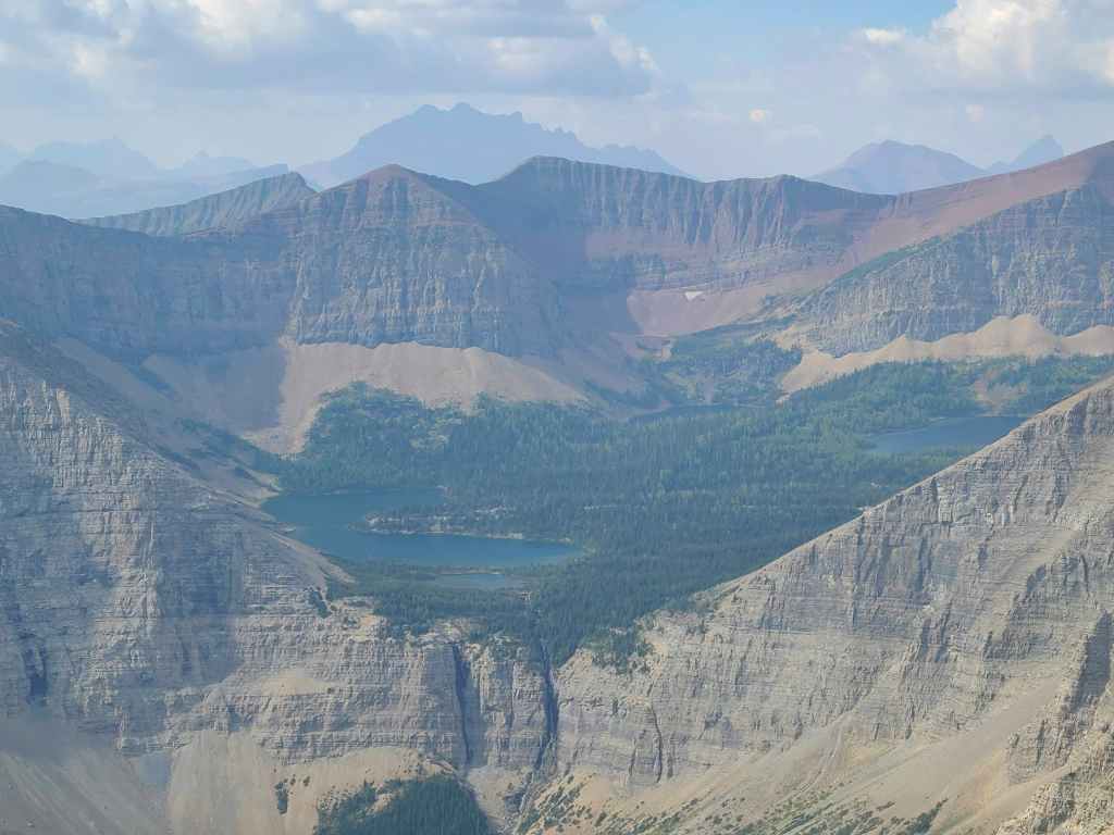
Lineham Falls are but a trickle.
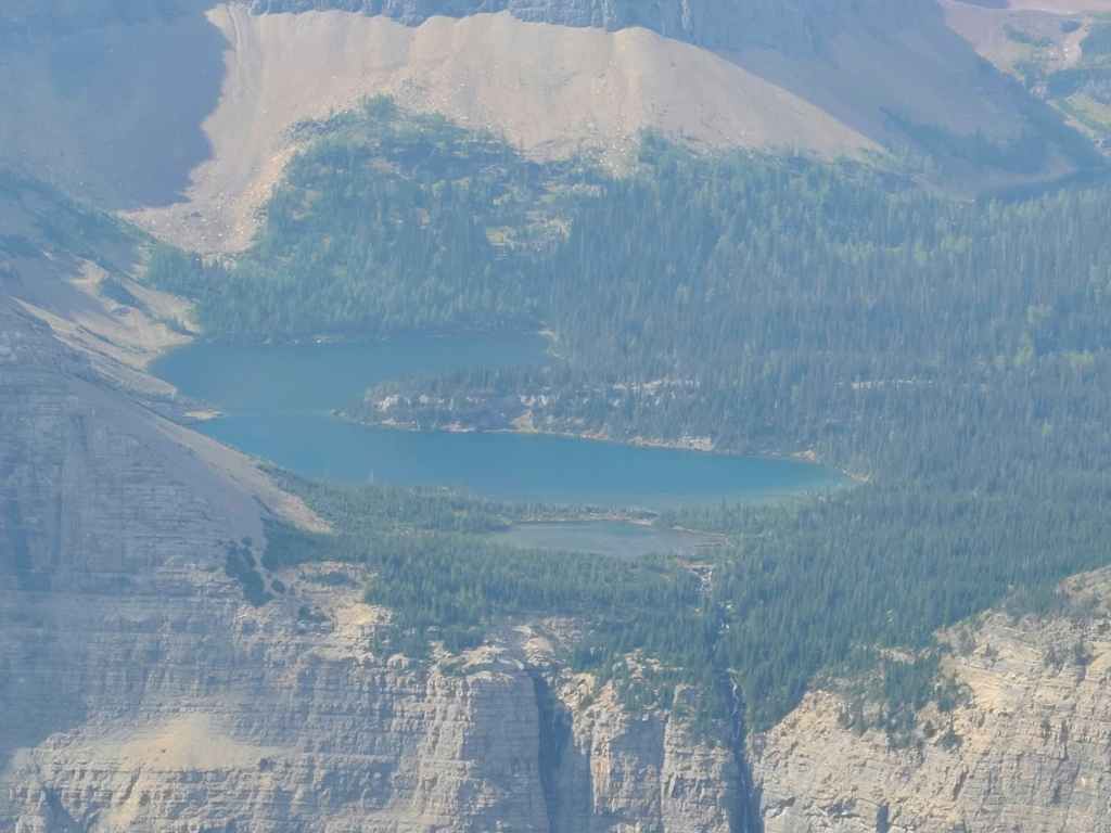
A closer look at the lower lakes.
As time was running out, we decided against continuing on to the summit even though there was an inviting path through the limestone directly above Andrew. When I come back, I may consider using this route again…
Beginning our descent.
Steppy terrain. (Photo by Andrew Nugara)
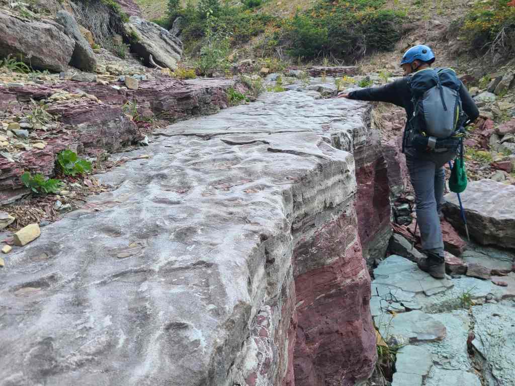
Some colourful rock.
Descending alongside Kane’s drainage.
We decided that given all of the small shelves and rock bands, it was easier to stay inside a subsidiary drainage alongside of Kane’s.
Andrew crosses the same band of black igneous that runs through “Igneous Peak”.
Now alongside Kane’s ascent drainage.
Looking up to the summit of Piinaquiium / Ahkoinimahstakoo (Mount Blakiston). The limestone band is noticeable where it cuts across the mountain. (Photo by Andrew Nugara)
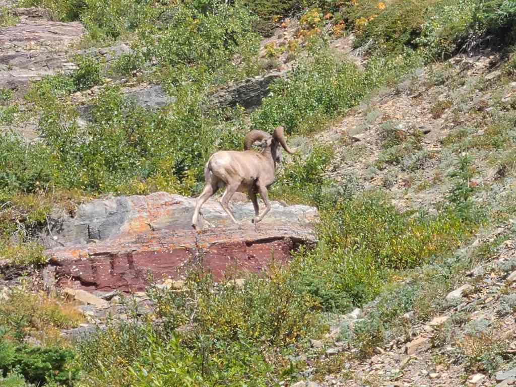
While we were coming down, this sheep was going up. I would suspect that he will make short work of the ascent. 😂
Another look back to the summit.
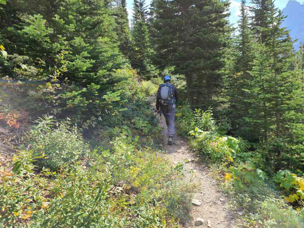
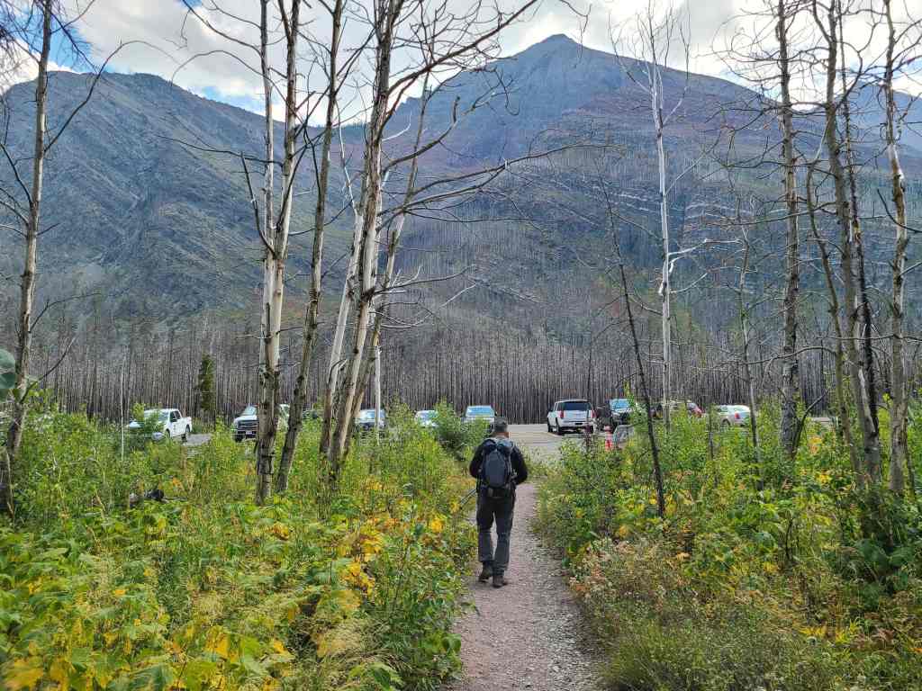
Back on the Lineham Falls Trail. From here it was an easy ~3.6 km hike back to our cars.
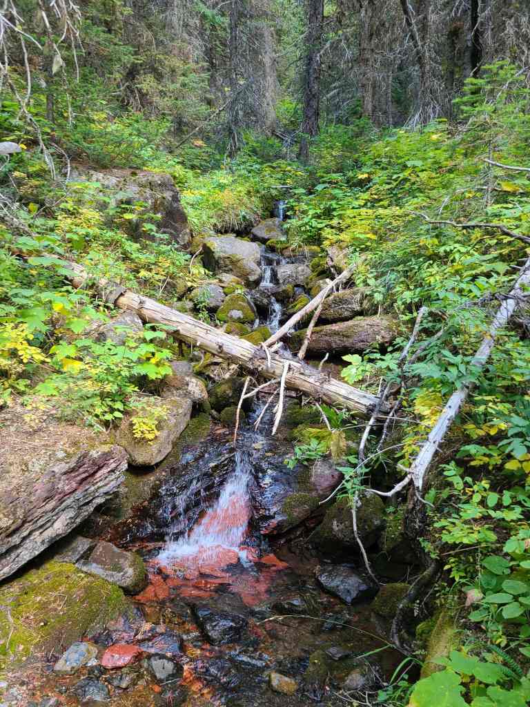
A pretty stream next to the trail.
Back into the changing autumn foliage.
Having a great trail with great views at the end of the day, makes Waterton a fantastic place to play!
For Labour Day Monday, there were surprisingly few people on the trail….
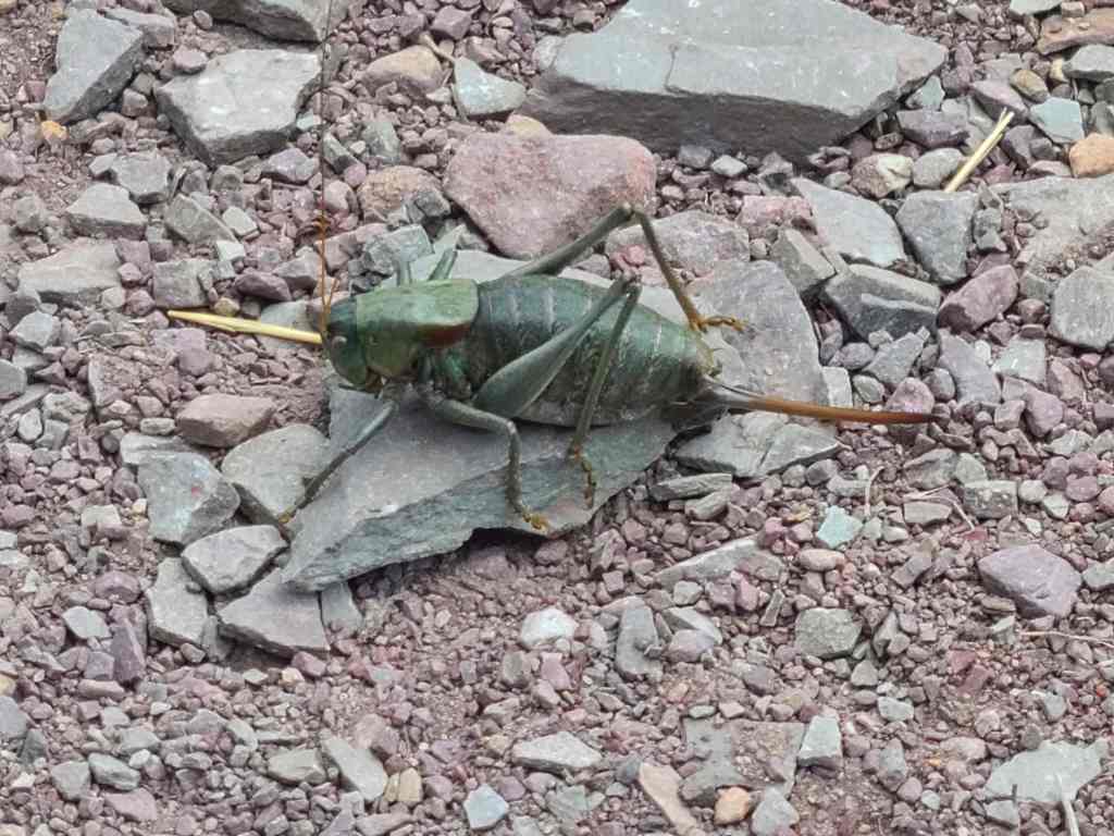
Perhaps this is why… Remember when I said that the caterpillar wouldn’t be our only insect encounter for the day? Take a look at this impressive Mormon Cricket that was guarding the trail.
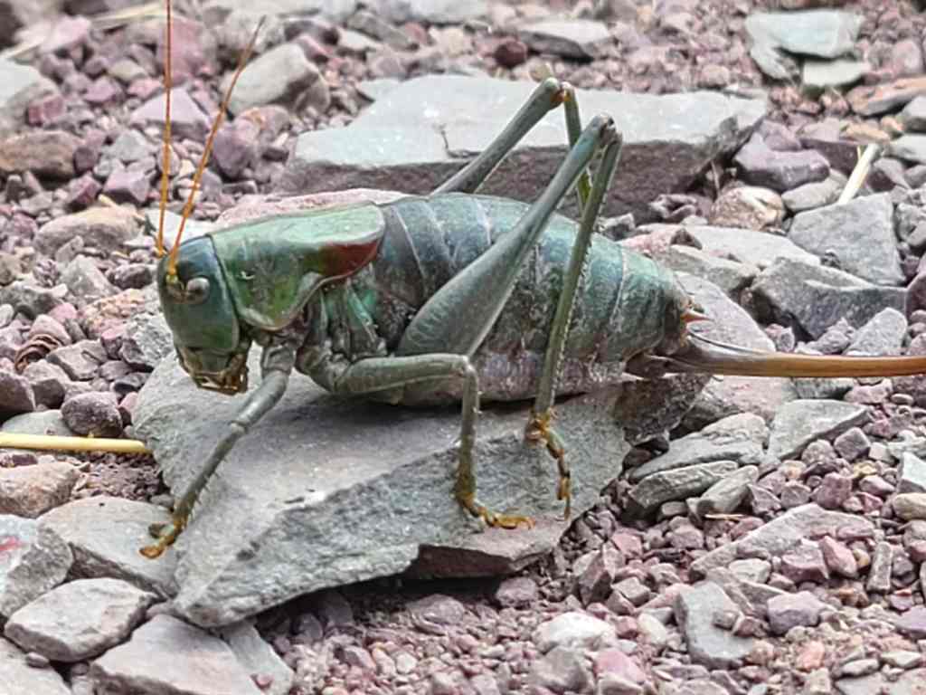
A closer look at the green trail boss. At this point he began to taunt us, while somewhere, off in the distance, the Star Trek battle theme began to play…
After an epic battle to defeat the cricket boss, we regain our composure and carry on with the mission. 😂
Arriving back at our cars after a roundtrip distance of 13.2 km over a time of 6 hours and 7 minutes – 1 hour of which was spent in mortal combat with the cricket. 😂 Once again, this was another great day in Waterton with a fantastic friend. I’m not sure that many will rush to visit “Igneous Peak”, but on days when the wind is blowing and the time is short, obscure destinations such as this, can be just the ticket. For me, one of the biggest allures of scrambling and hiking is the element of exploration. I absolutely love it and thanks to Andrew and his suggestion of “Igneous Peak”, I was able to get my fill for the week.


Leave a Reply