
⚠️ Hiking and scrambling are inherently dangerous activities. Please read my Disclaimer. ⚠️
Ever since Jeff and I climbed Mount Tecumseh in 2013, I’ve wanted to return to ascend Phillipps Peak, a second, official summit located on the same massif. Why are there two named summits? As Dave Birrell notes in, 50 Roadside Panoramas in the Canadian Rockies, the mountain “has a complex history in terms of its name”, beginning with its original name of Mount Wilson, which the Boundary Survey changed to prevent confusion with the other Mount Wilson located near the Icefields Parkway. (139) Birrell further states that “the mountain was known locally as, ‘The Sleeping Giant’, as its profile was thought to resemble one.” (139) He concludes by observing that for a brief period of time, the mountain possessed the awkward name of, “Phillipps Peak and Mount Tecumseh”, until Tecumseh was adopted as the official name in 1960 while “the slightly lower southwest shoulder was named, Phillipps Peak.” (139) As I’ve opined many times before, I’m sure Indigenous peoples have had their own name for the mountain for centuries, but the colonial names are the ones that have been officially recorded.
So where does the appellation Phillipps Peak come from? In honour of a colourful nineteenth-century individual, named Michael Phillipps, who was originally an HBC clerk at Fort Kootenay and later, an Indian Agent. He was also the first white homesteader in the district. In his biographical record in the HBC Archives, it notes that Phillipps was dismissed in 1869 as the region’s Postmaster for incompetence and his “inability to adapt to changing circumstances in the Kootenay trade.” The record continues by referencing G.P.V. and Helen B. Akrigg’s, 1001 British Columbia Place Names, which in an unflattering manner states that, “He [Phillipps] prospected along the Elk River in 1873 and was disgusted to find nothing but coal. He may have discovered the Crowsnest Pass from the west in 1873, ignorant that it had already been found by the Palliser Expedition.” Phillipps died on his ranch near Cranbrook in 1916, though a more positive biographical article in Cranbrook’s The Townsman, records his death as 1919. Regardless, whether he was the first European to ‘discover’ the Pass or not, he is largely responsible for laying out the route “that would become the present day Crowsnest Pass.” (The Townsman)
In terms of hiking, I don’t believe that Phillipps Peak receives as much attention as Mount Tecumseh given the lack of online trip reports – which is perhaps understandable since it requires a separate approach and entails some tricky scrambling that Alan Kane rather understatedly describes as, “a short section of difficult scrambling on the ridge before the highest point.” (Scrambles in the Canadian Rockies, second edition, reprint 2011, p. 53) Indeed, Phillipps Peak is almost included as an afterthought by Kane, couched in a few sentences near the end of his route description for Mount Tecumseh. However, the one detailed report that I relied heavily on, was Sonny Bou’s successful 2008 trip, which somewhat prepared me for the crux we encountered just before the summit. Thanks Sonny!

We started our trip from the BC side of Phillipps Pass which we reached by driving west along Highway 3 until we reached the BC/Alberta border at Summit Lake. A short distance beyond Summit Lake (~300m) we turned right off of the highway and into a Rest Area at Crowsnest Provincial Park. This is where we parked. From the Rest Area we biked up the well-used road towards Phillipps Pass for ~2.6km until it began to lose elevation shortly after coming to the clearing described by Sonny. The clearing is easily recognizable because it overlooks a large drainage that comes off of the SW end of the mountain.
After stashing our bikes in a grove of trees located well off to the lefthand side of the road, we continued on foot in a northeasterly direction through sparse forest and meadows to gain the mountain’s southern ridge (which also doubles as the BC/AB border). Once on the ridge, we enjoyed a relatively uncomplicated hike to reach the false summit. We found that staying on the ridge crest and enjoying the brief section or two of scrambling, was more enjoyable than keeping to the scree ramps on climber’s right. We would however, use this scree to make our descent easier.
The section between the false summit and the summit is where things get interesting. After an initial section of moderate scrambling, we gained the summit ridge and promptly came to the crux – a large gap in the ridge which Sonny describes as “uncomfortably narrow and exposed.” Indeed, just before the gap, the ridge narrows roughly to about 1 metre in width with extreme exposure on either side. A small ledge (also somewhat exposed) to climber’s right runs beneath this section allowing you to bypass it if you so desire. It does not however, let you bypass the climb you must make on the north side of the gap. Here you must use a small chimney to scramble up the ~5 metres to the top of the ridge. Once beyond this, the summit is a short distance away, but to reach it, you must negotiate an additional section or two of exposure.
After enjoying the views from the summit we returned the same way we ascended, except this time we could effortlessly coast down the road on our bikes.

A topo of the above Google Earth image. The southern ridge that we used to reach the false summit is fairly gradual and is marked by the BC/AB border. I suspect that given the two large cairns on the false summit, many people perhaps enjoy the hike to this location and then turn around.

Our total roundtrip distance was 11.2km with total elevation gains of 1180m. It took us exactly 6 hours and 18 minutes to complete this trip.
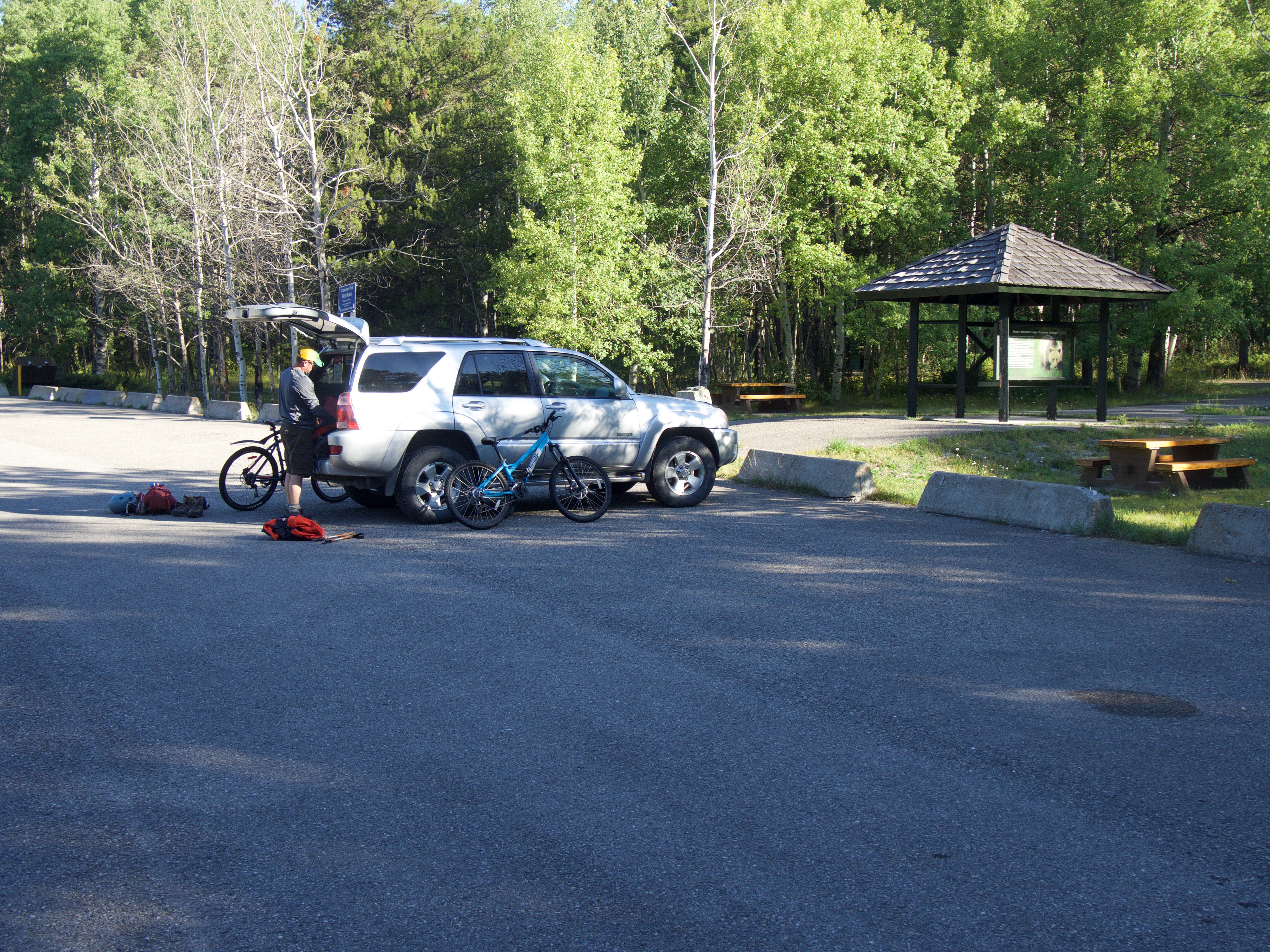
Jeff gears up in the rest area at Crowsnest Provincial Park. The road leading to Phillipps Pass can be reached via the gate at the north end of the parking lot or by following a road down a cutline from the entrance. Both of us were feeling rather low on energy to start the day and at the last minute, changed our original plans to summit Allison Peak via Racehorse Pass in favour of the short approach offered by Phillipps Peak.
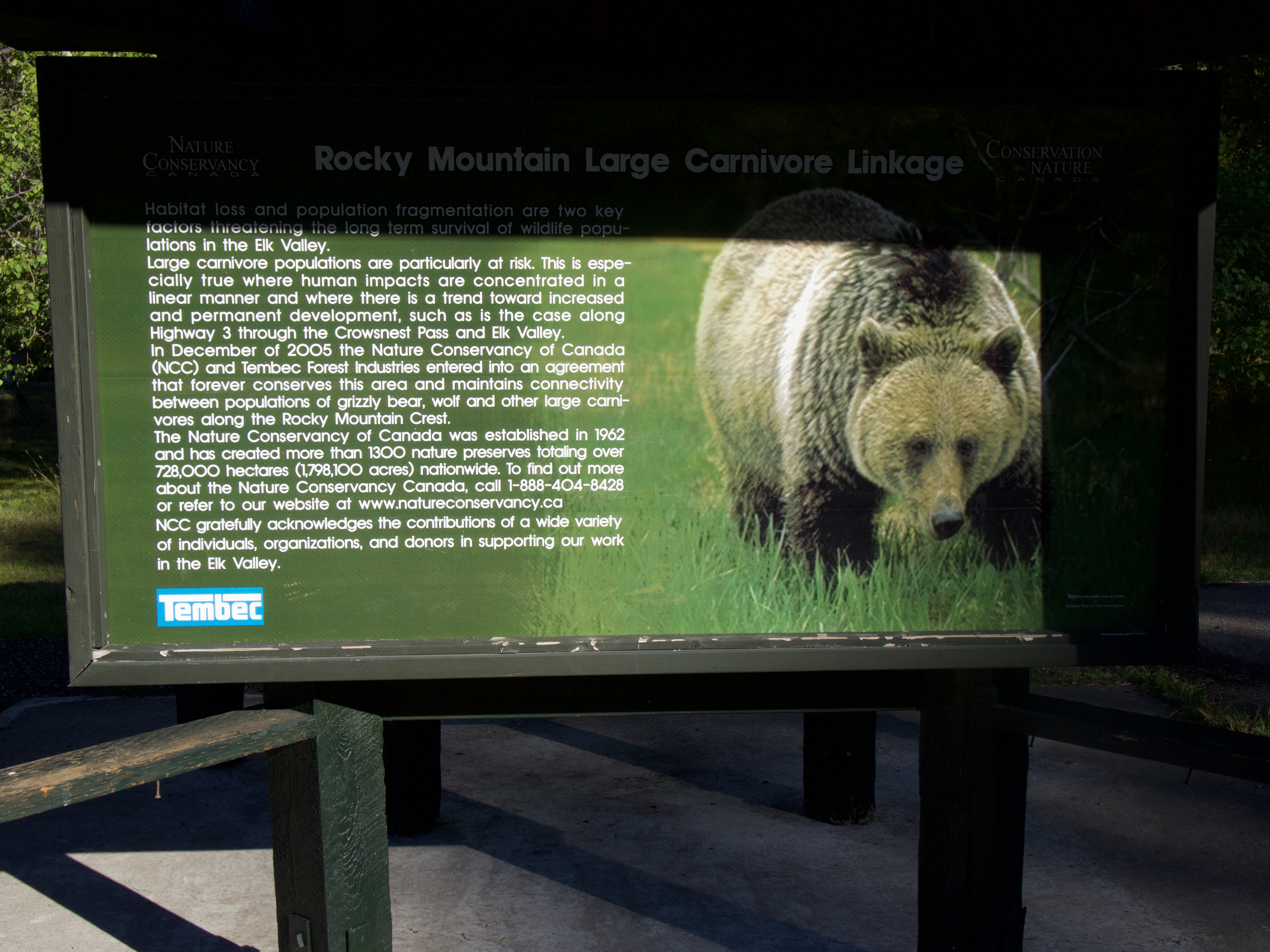
The sign located in the rest area. As always, we hoped to avoid running into the furry critter on the right.

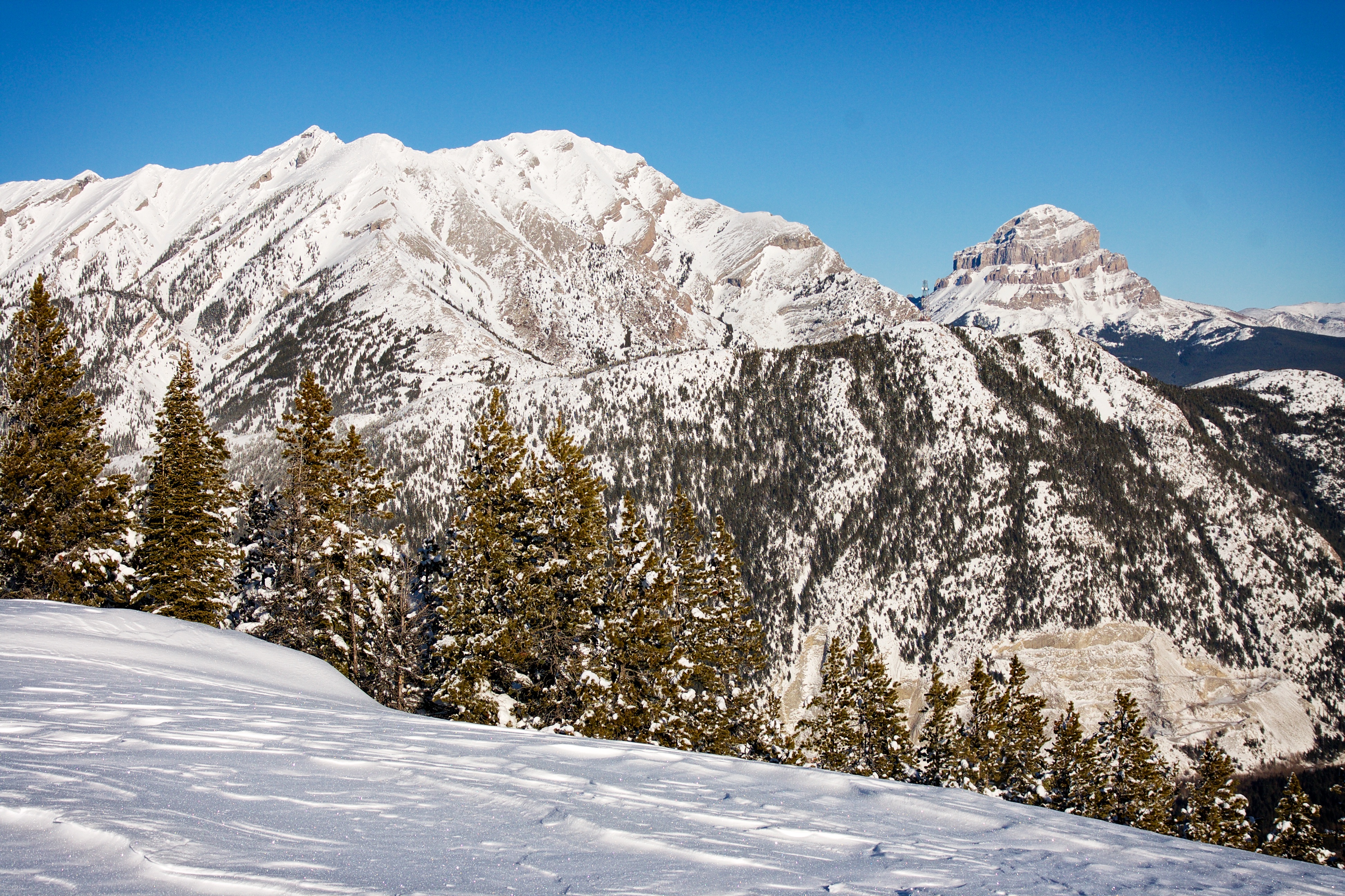
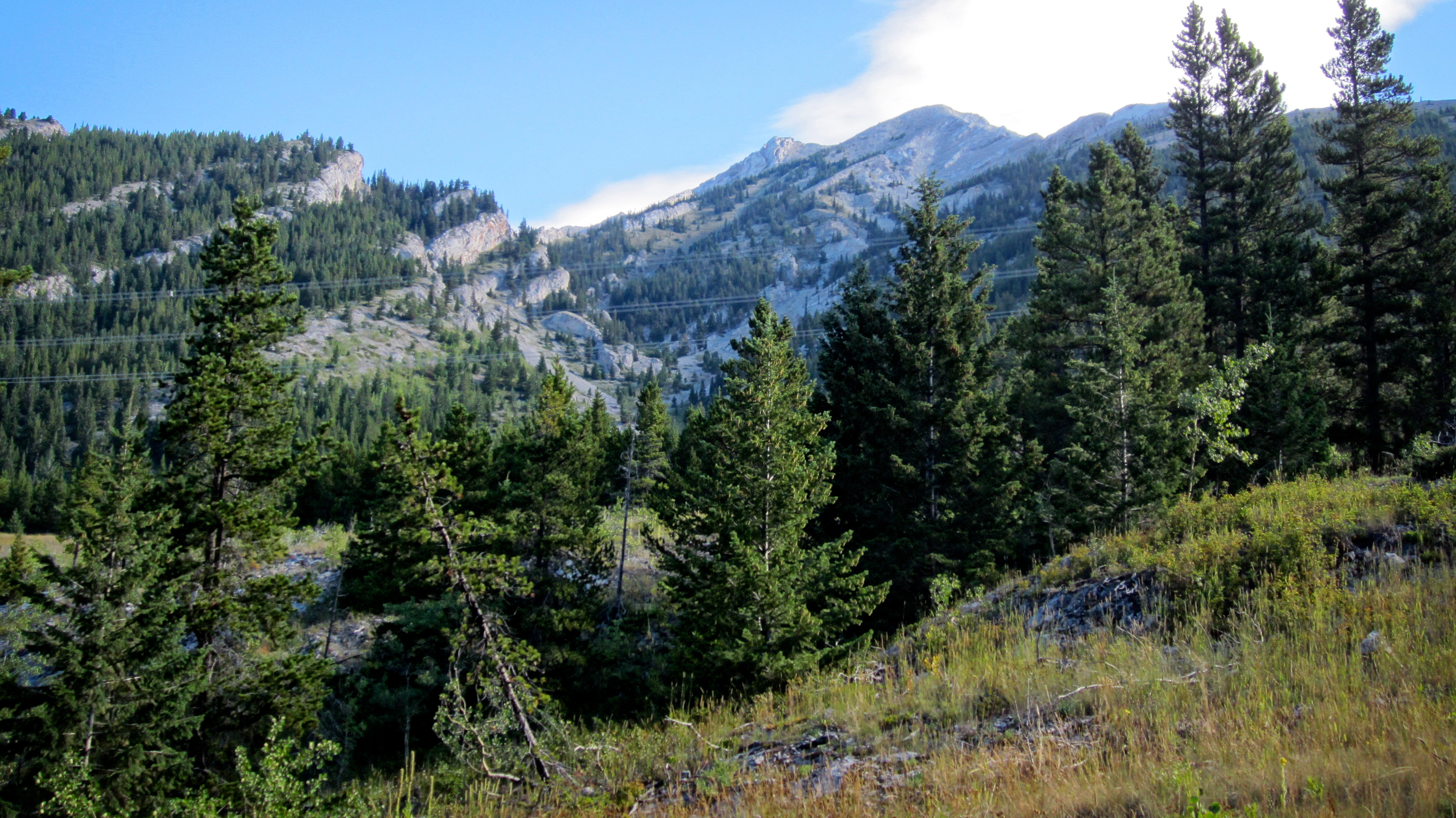
Phillipps Peak (second bump from the right) from the rest area. It was a beautiful, but hot Sunday morning.
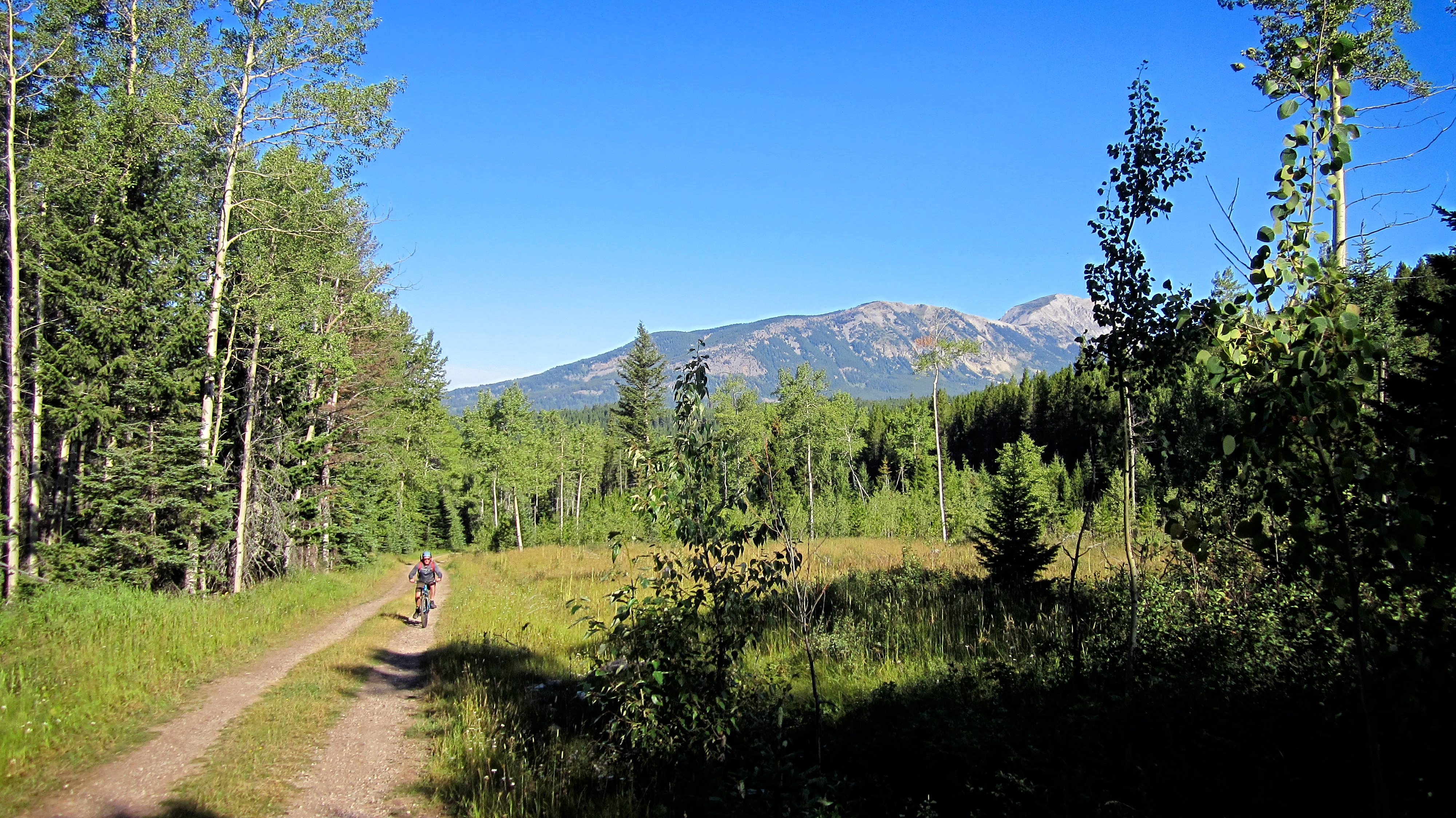
Jeff bikes along the road towards Phillipps Pass. After the first kilometre or so, the road steepened considerably and we ended up pushing the bikes the rest of the way, however, they were awesome to have on the way back. In the background is Mount Erickson.

When we came to a side road that led up Crowsnest Ridge, we stuck to the main road by keeping to the left.
After biking/hiking for ~2.6km we came to the clearing identified by Sonny Bou where we would leave the road. The false summit is in the foreground and the true summit is in the background.

The spot where we left the road can also identified as the place where the road begins to lose elevation. We would stash our bikes in the trees located in the upper left of the picture.

After hiding the bikes, we enjoyed a short walk through the forest to a cutline.
Jeff stands in the middle of the cutline that led through the small grove of trees to where we stashed the bikes – a rather convenient landmark to ensure that we would return to the right spot.

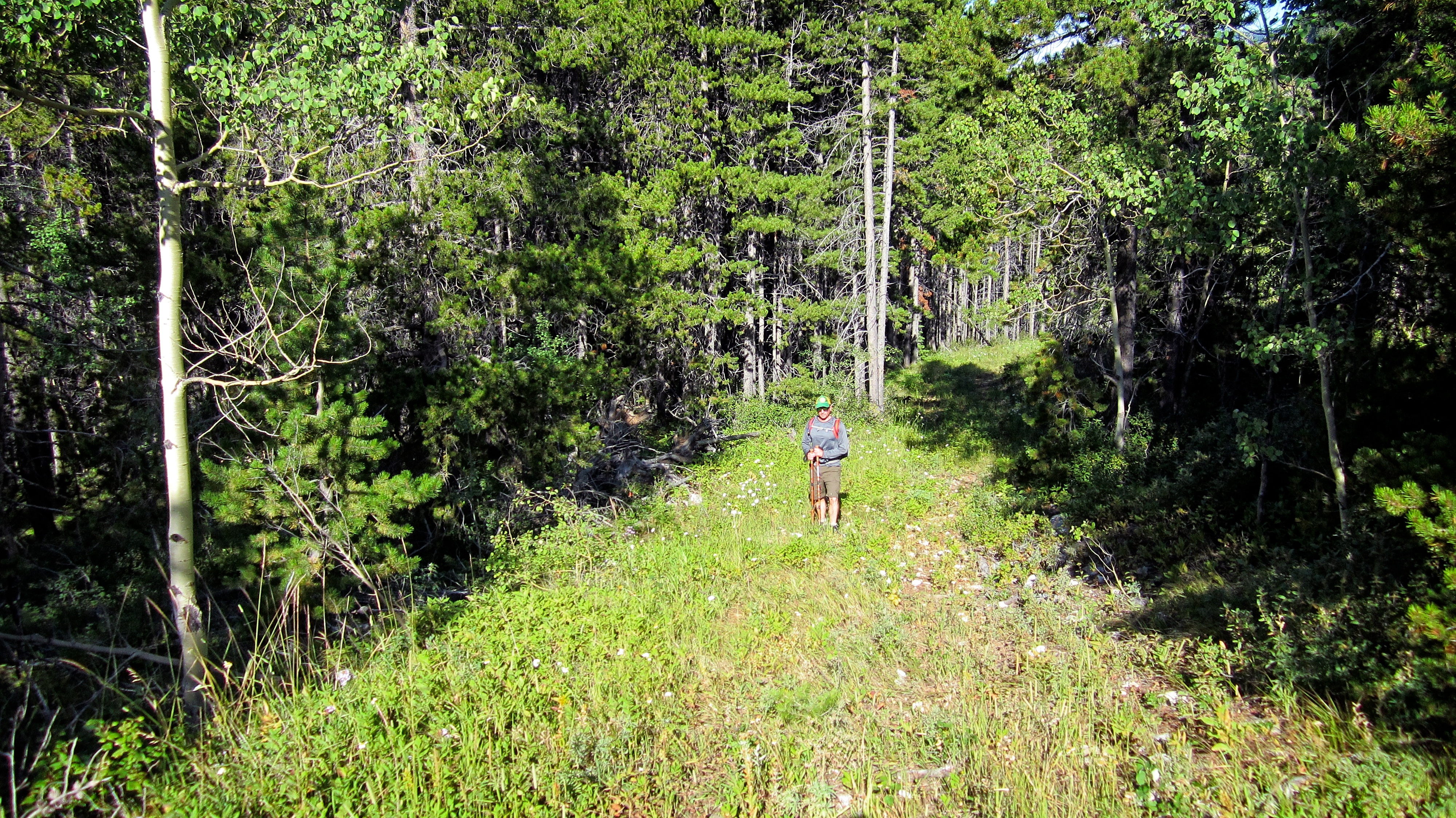
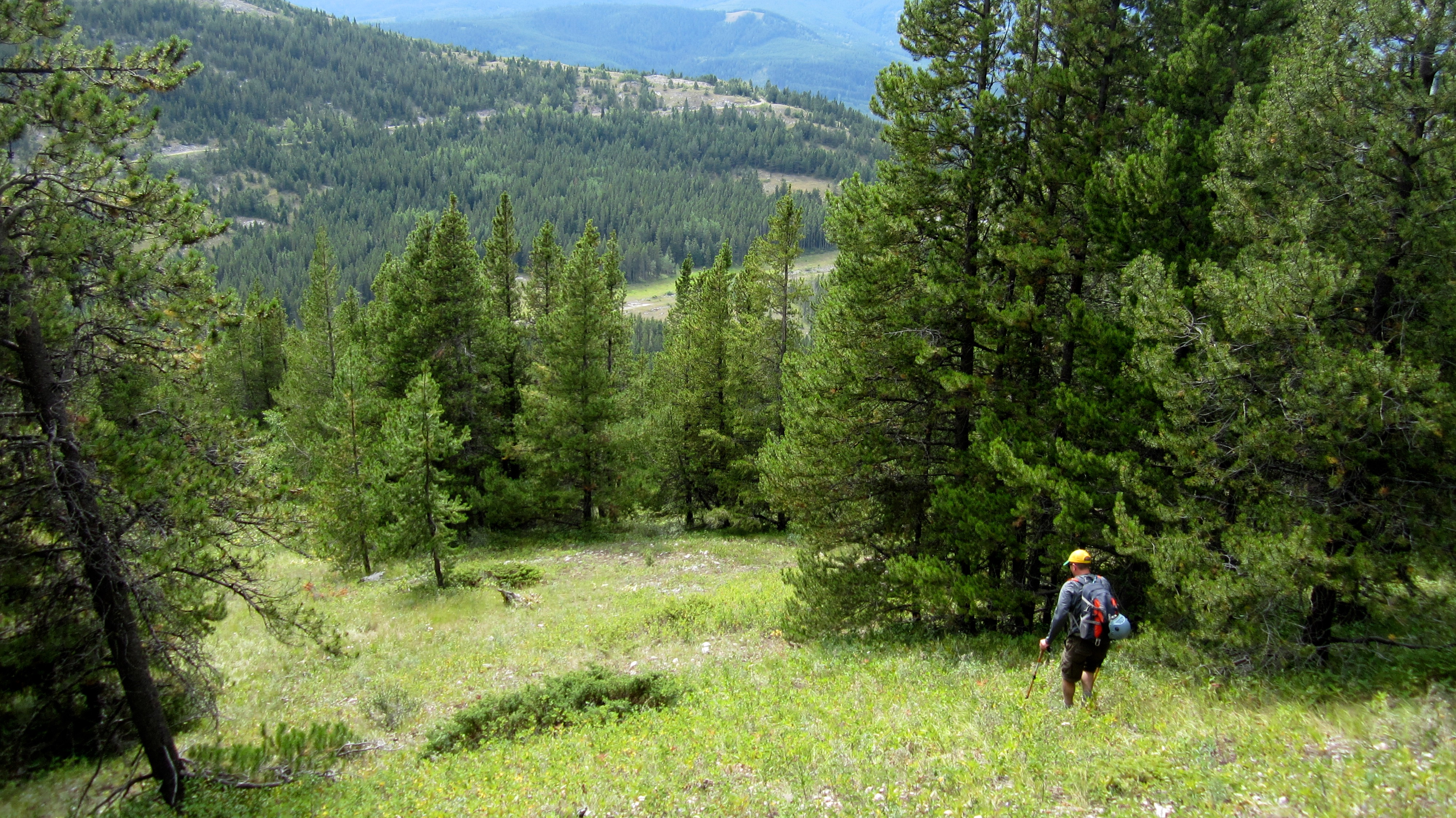
From the bikes, we hiked in a northeasterly direction through sparse forest and meadows to gain the southern ridge. It was so hot that we tried to stick to trees as much as we could. In the background is Loop Ridge.
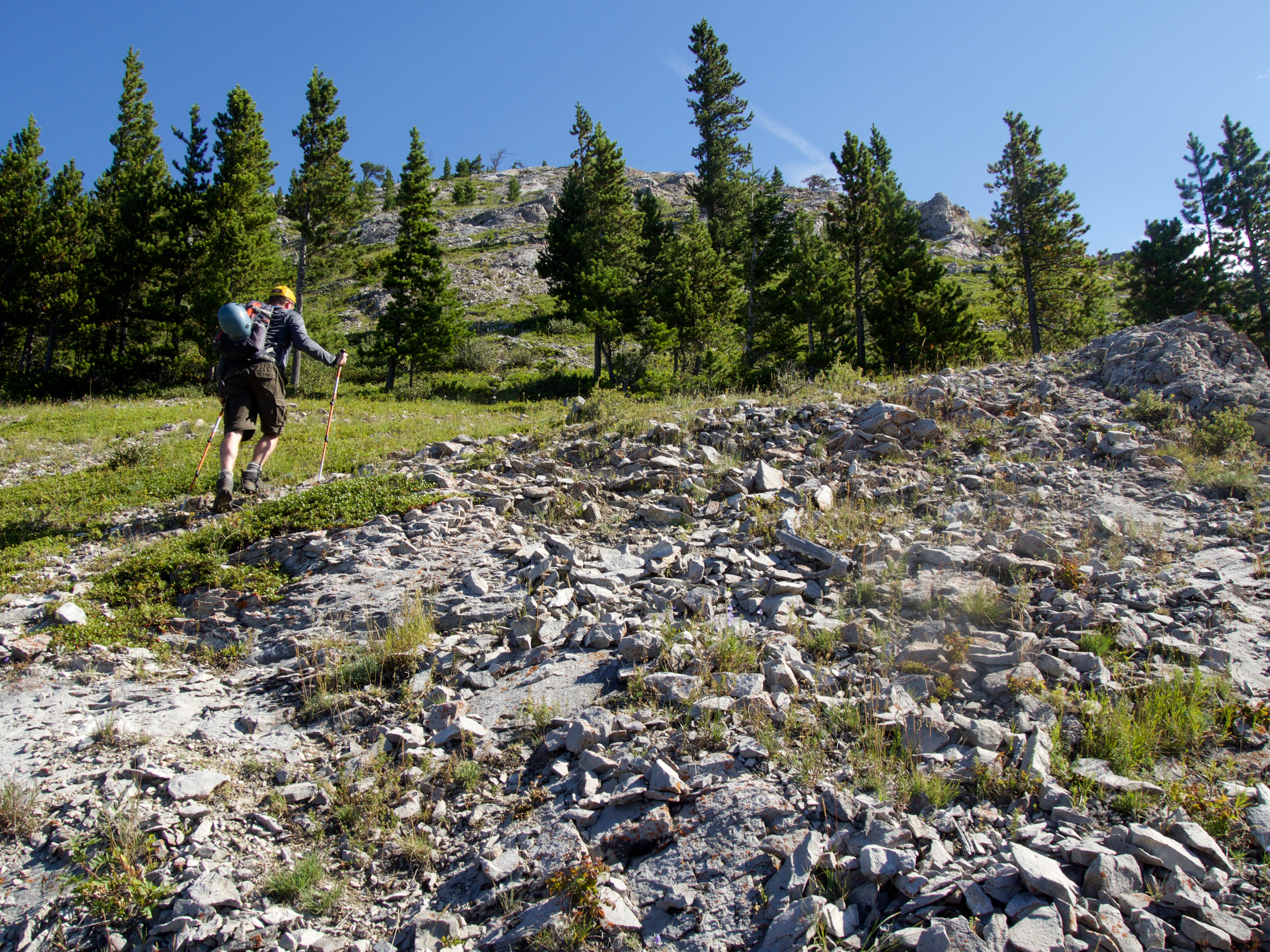
The terrain became rockier as we approached the crest of the ridge.
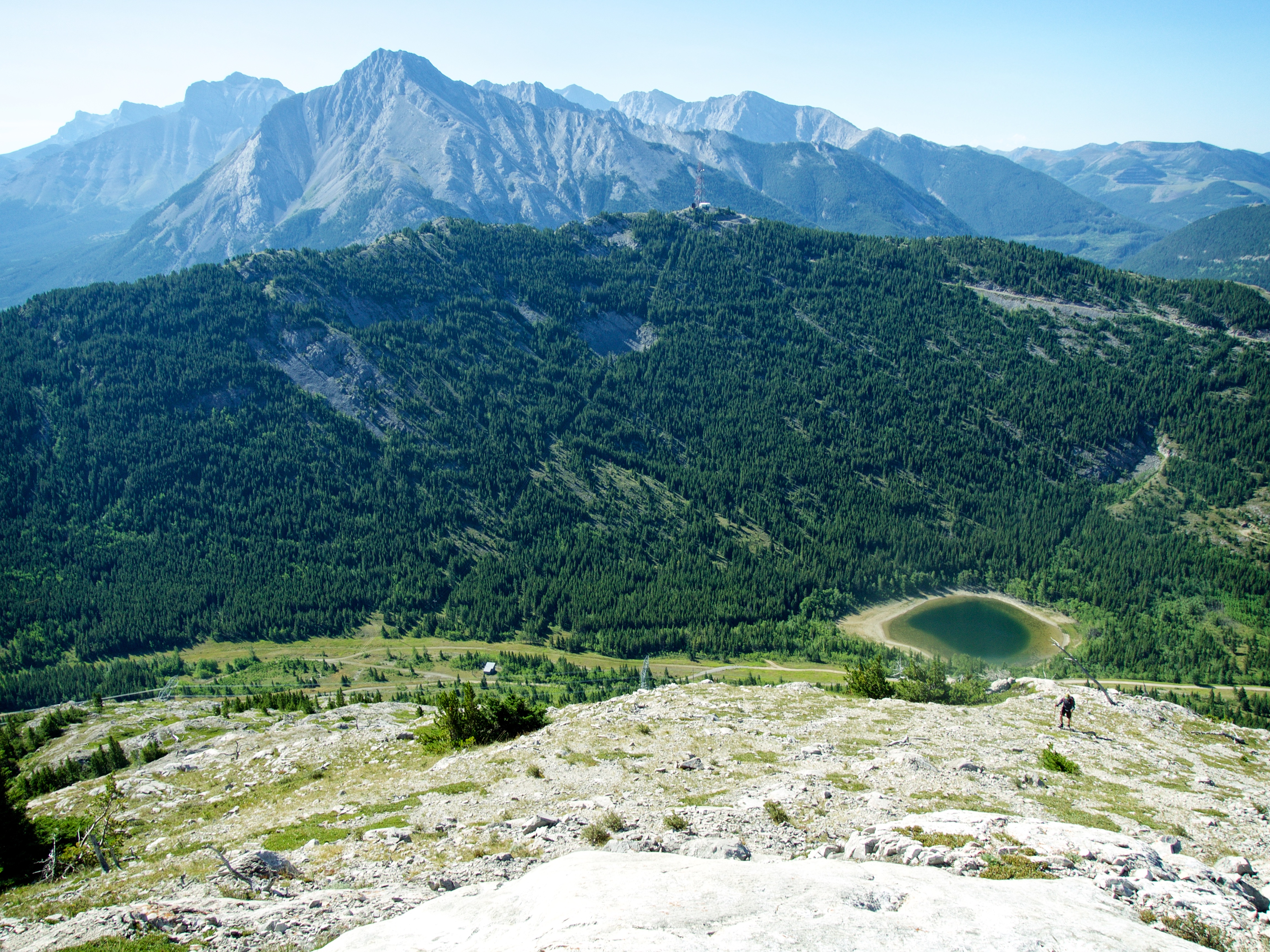
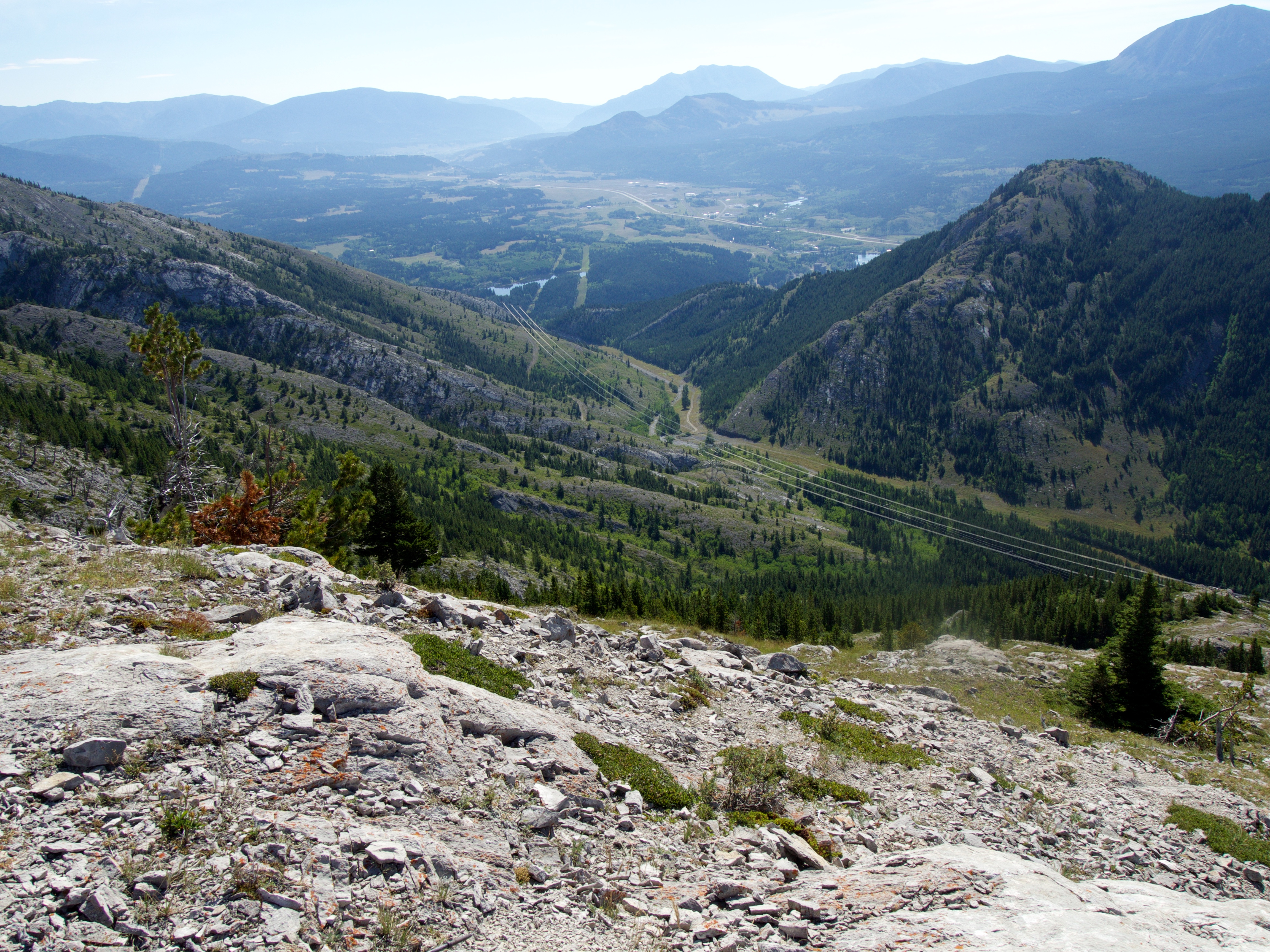
On the ridge and looking south towards Crowsnest Ridge and Phillipps Lake. Sentry Mountain is in the background.
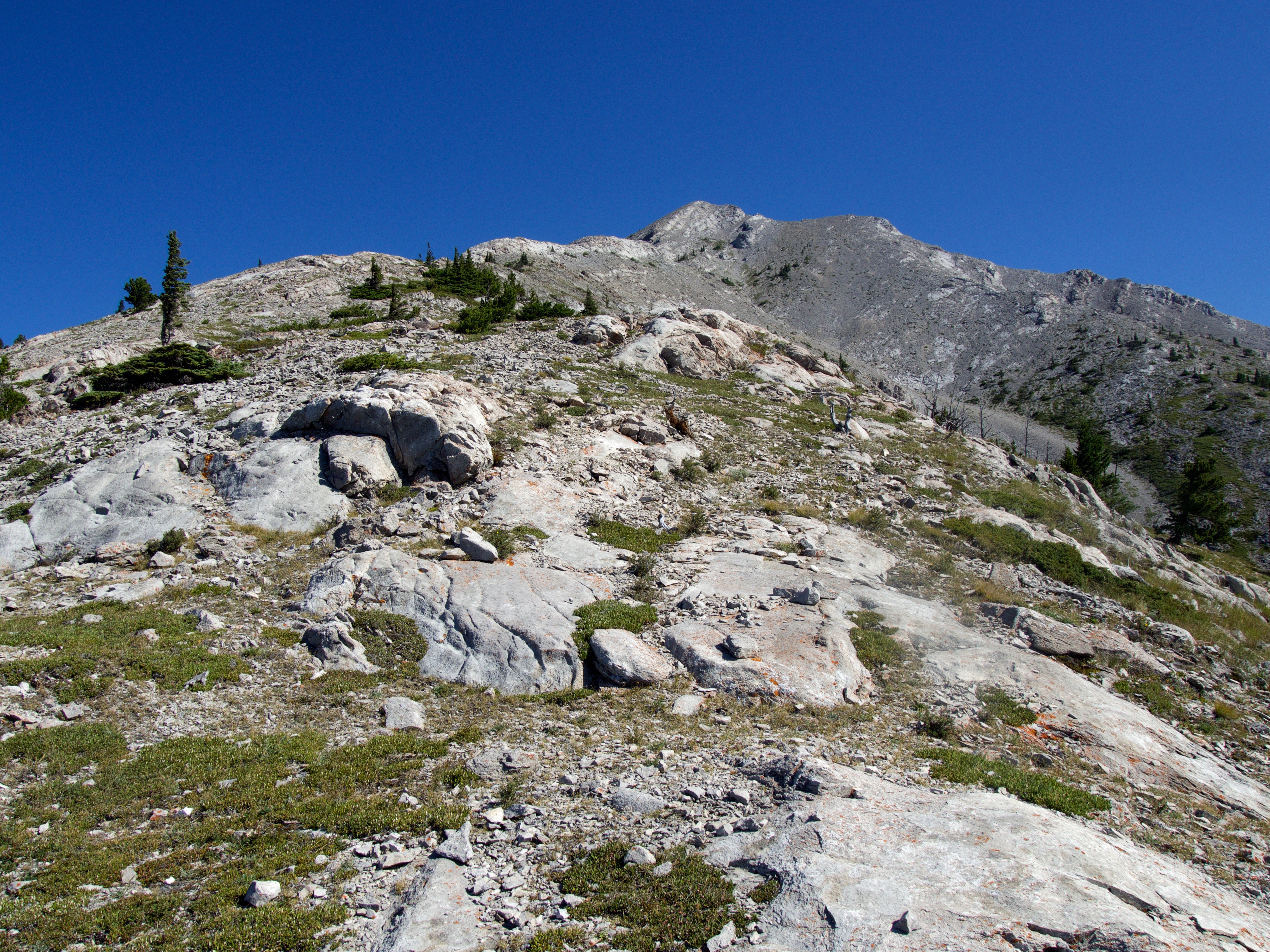
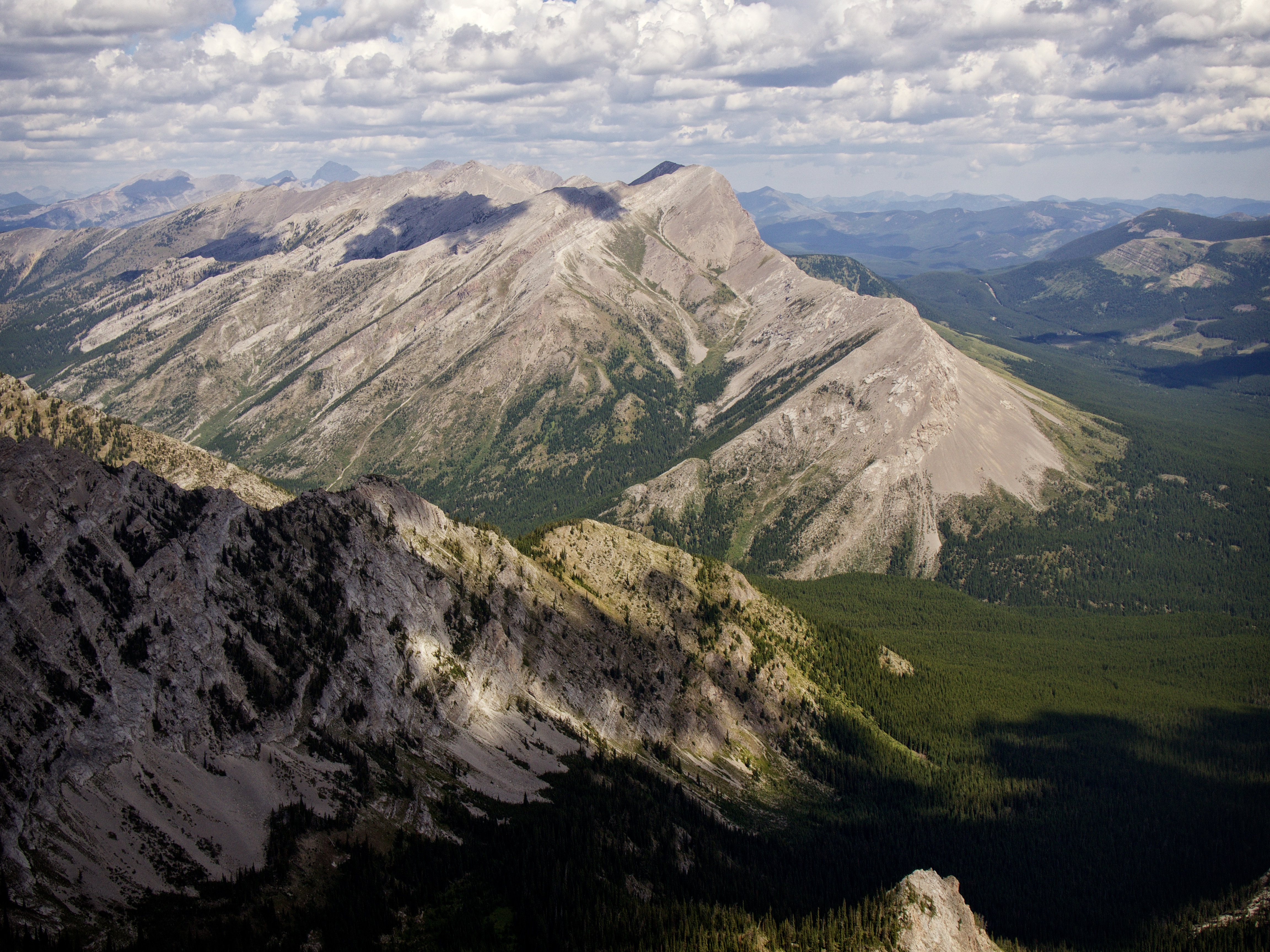
The view towards the false summit from the ridge. The elevation gains were fairly gradual and travel was straightforward.
Looking east at the entrance to the drainage used to reach Mount Tecumseh. The scenery found inside this drainage is amazing.
We found that staying on the ridge crest was easier than using the scree ramps located to climber’s right. While this required a small amount of scrambling, it also made the ascent more interesting. However, on descent we would bypass these sections using the aforementioned scree.

Gazing down the ridge from the false summit. It didn’t take us too long to reach this location from the road.
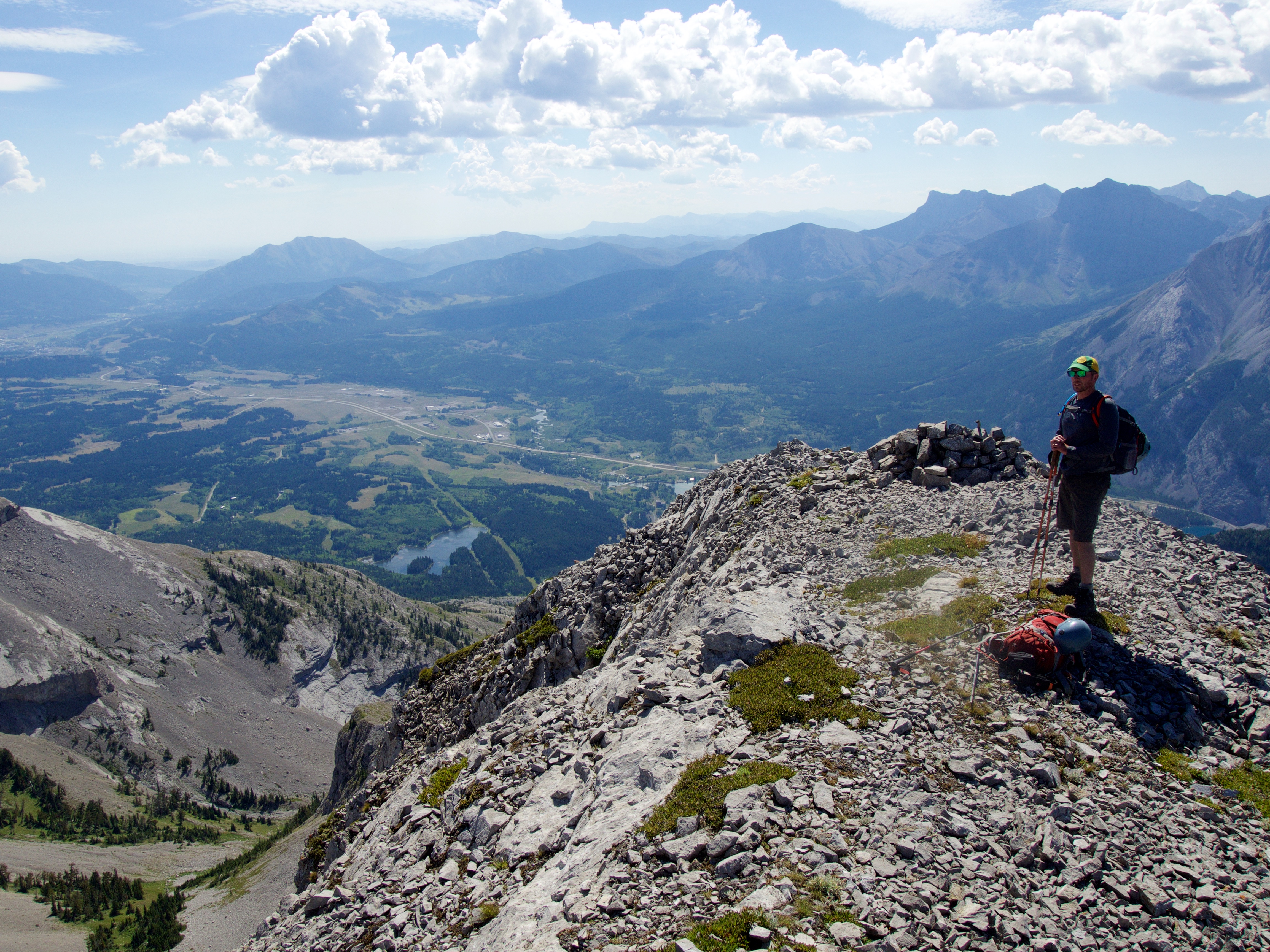
Jeff stands near the first of two cairns on the false summit. I’ll save the surrounding mountain descriptions until we get to the actual summit shots 🙂 Highway 3 can be seen in the valley far below.
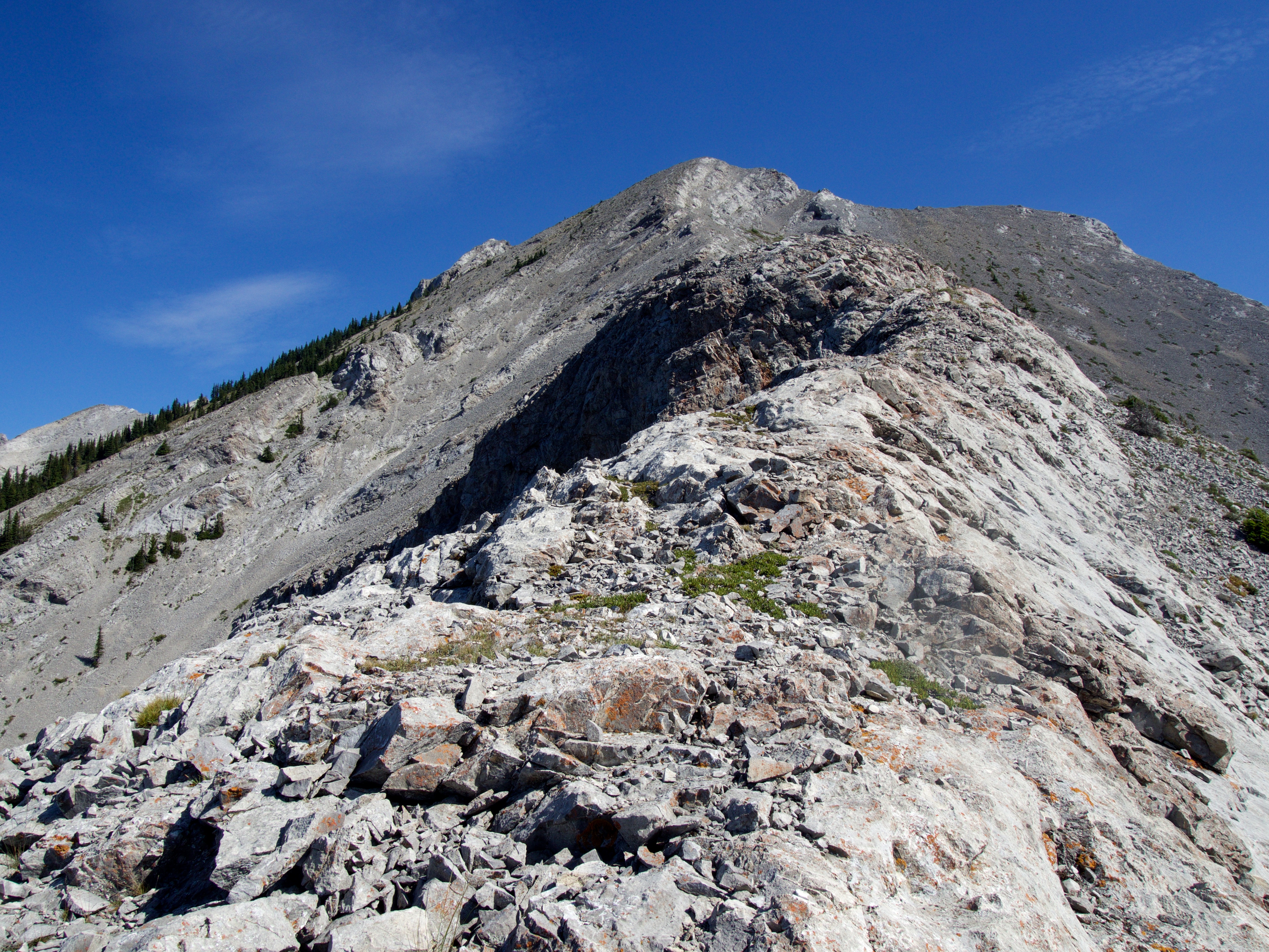
Looking north from the false summit at Phillipps Peak (left) and Mount Tecumseh (right). Our ascent route from the bowl to the summit ridge on Tecumseh is in the centre.

The section between the false summit and the true summit is where things get interesting.
Jeff is silhouetted against the clouds as we leave the false summit.
Some moderate scrambling is needed to gain the summit ridge. We found a way up that was hidden behind the outcrop on the right.

The view back towards the false summit after gaining the summit ridge.

The crux. Here, the ridge narrows (right) before descending into a gap (not shown). The small chimney leading to the ridge from the gap, can be seen to the right of centre.

A closer view of the crux from on top of the exposed section of ridge. The base of the gap is situated about 2m beneath the start of the chimney (centre).

I found that you could bypass the short section of exposure before the gap by using a ledge (also somewhat exposed) located to climber’s right. You could not however, bypass the climb up from the gap. This picture is looking up at the gap from the ledge.

Peering at Jeff from the bottom of the gap and across the exposed section of ridge.

This narrow chimney is the only route out of the gap to reach the summit. We had to be careful because some of the rocks were loose.

Jeff negotiates the exposed section of ridge just prior to the gap (lower centre). The false summit is in the background. We wisely decided to leave our packs on the ridge (right) before tackling the crux.

Jeff takes his time – constantly checking his holds – as he makes the climb out of the gap.
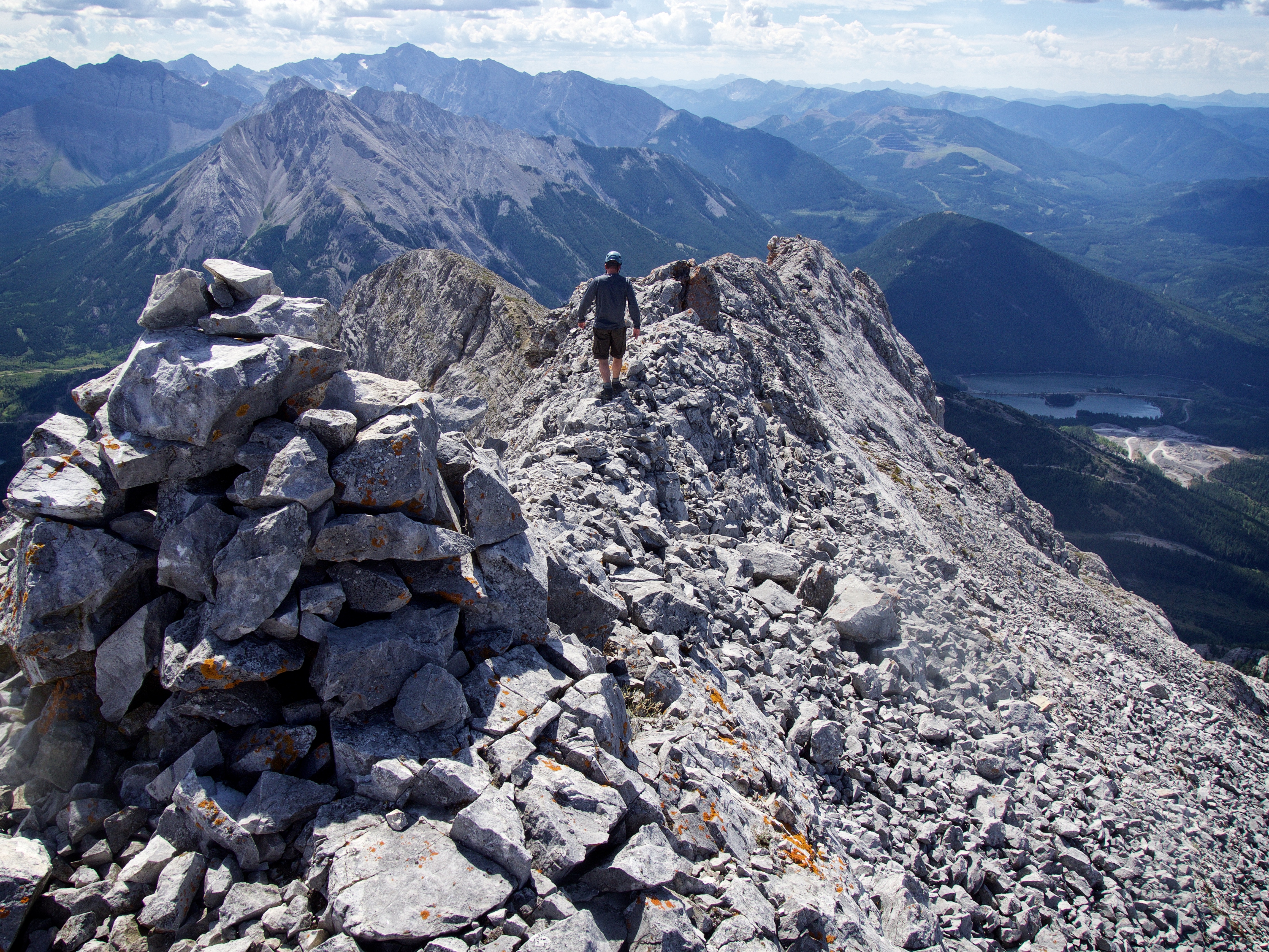
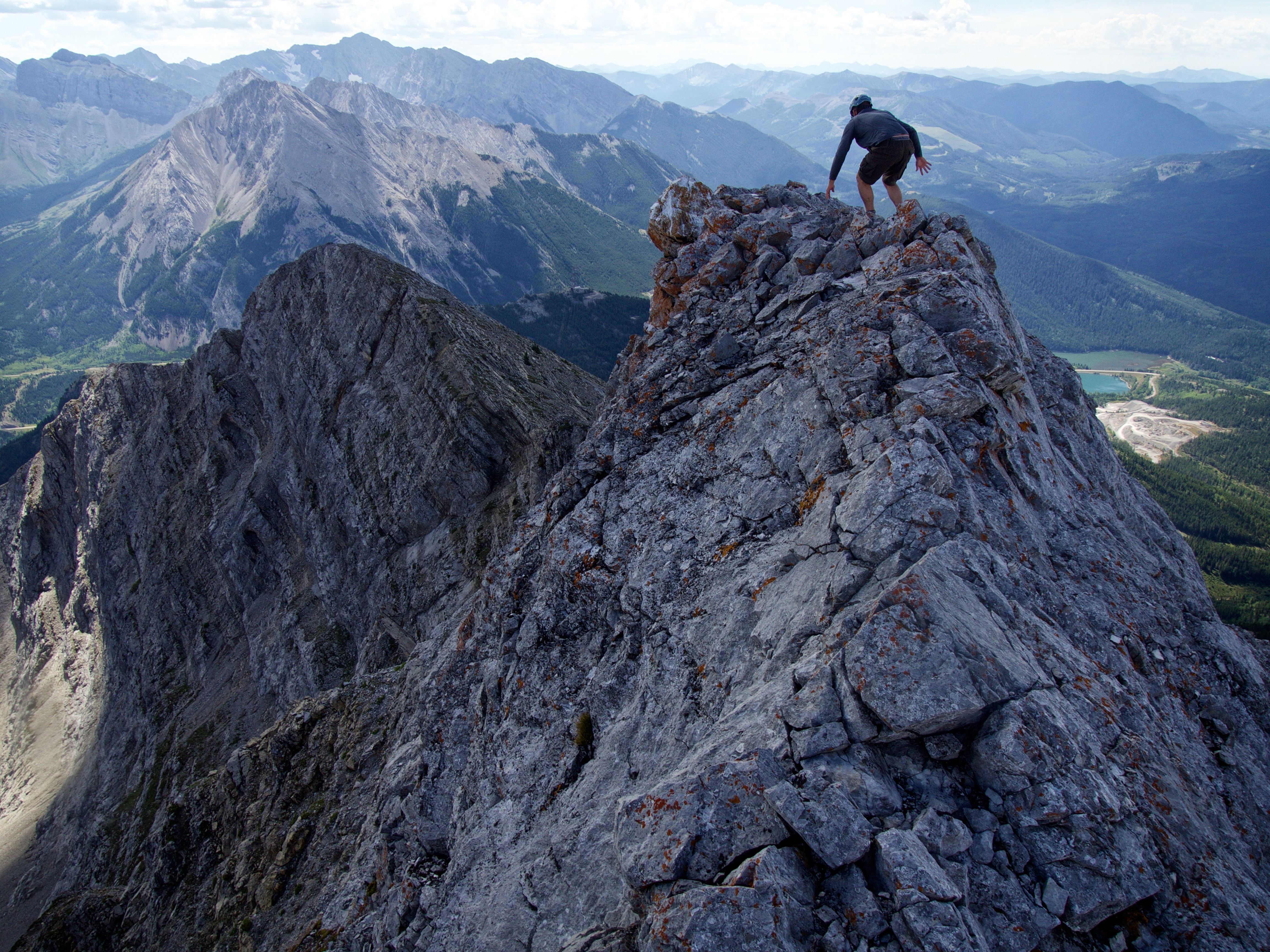
Once we had passed the crux, the summit finally came into view – though there were still a couple sections of exposure that we had to negotiate before reaching it.
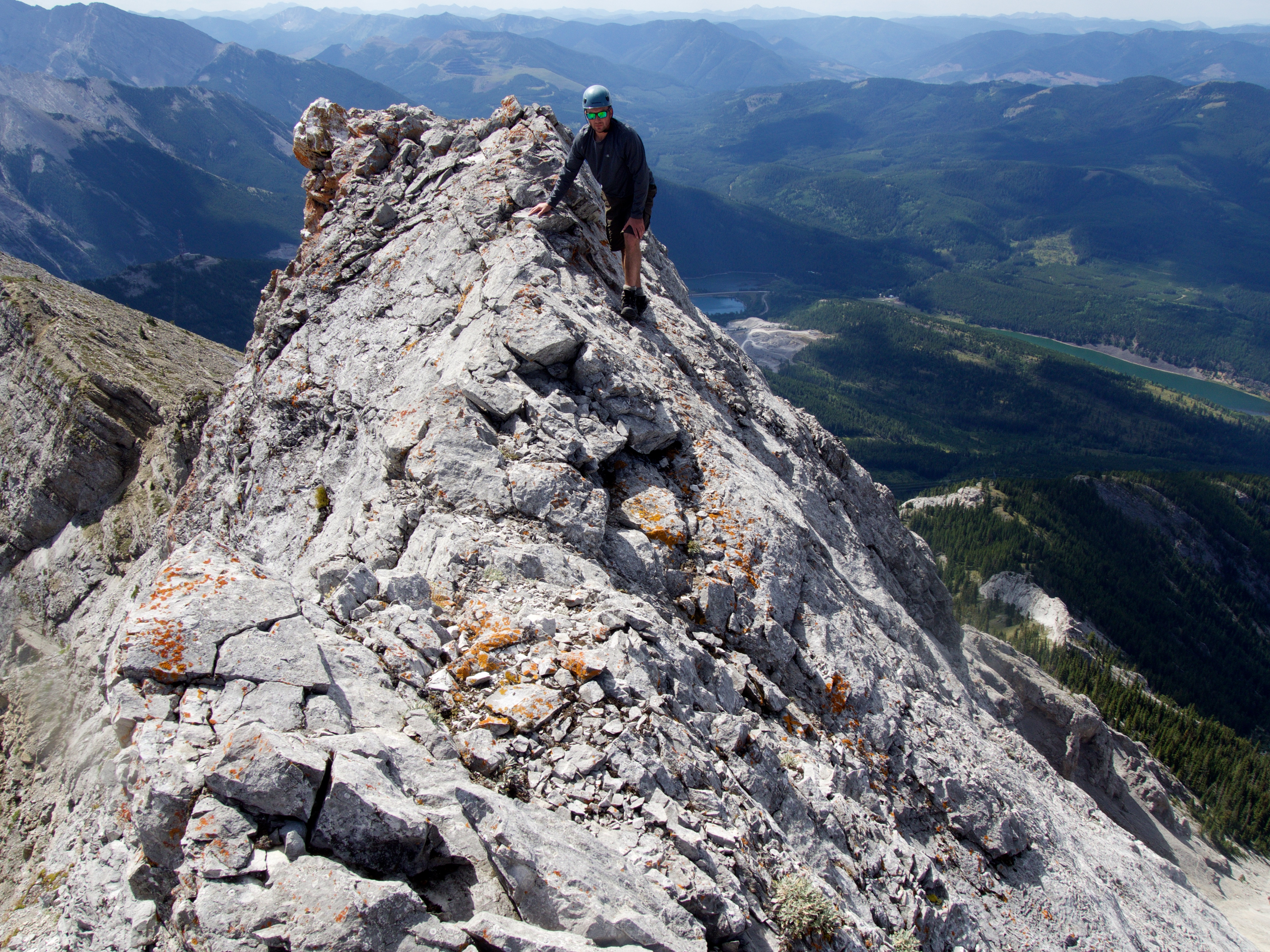
Jeff makes his way past a particularly narrow section of the ridge just prior to reaching the summit.

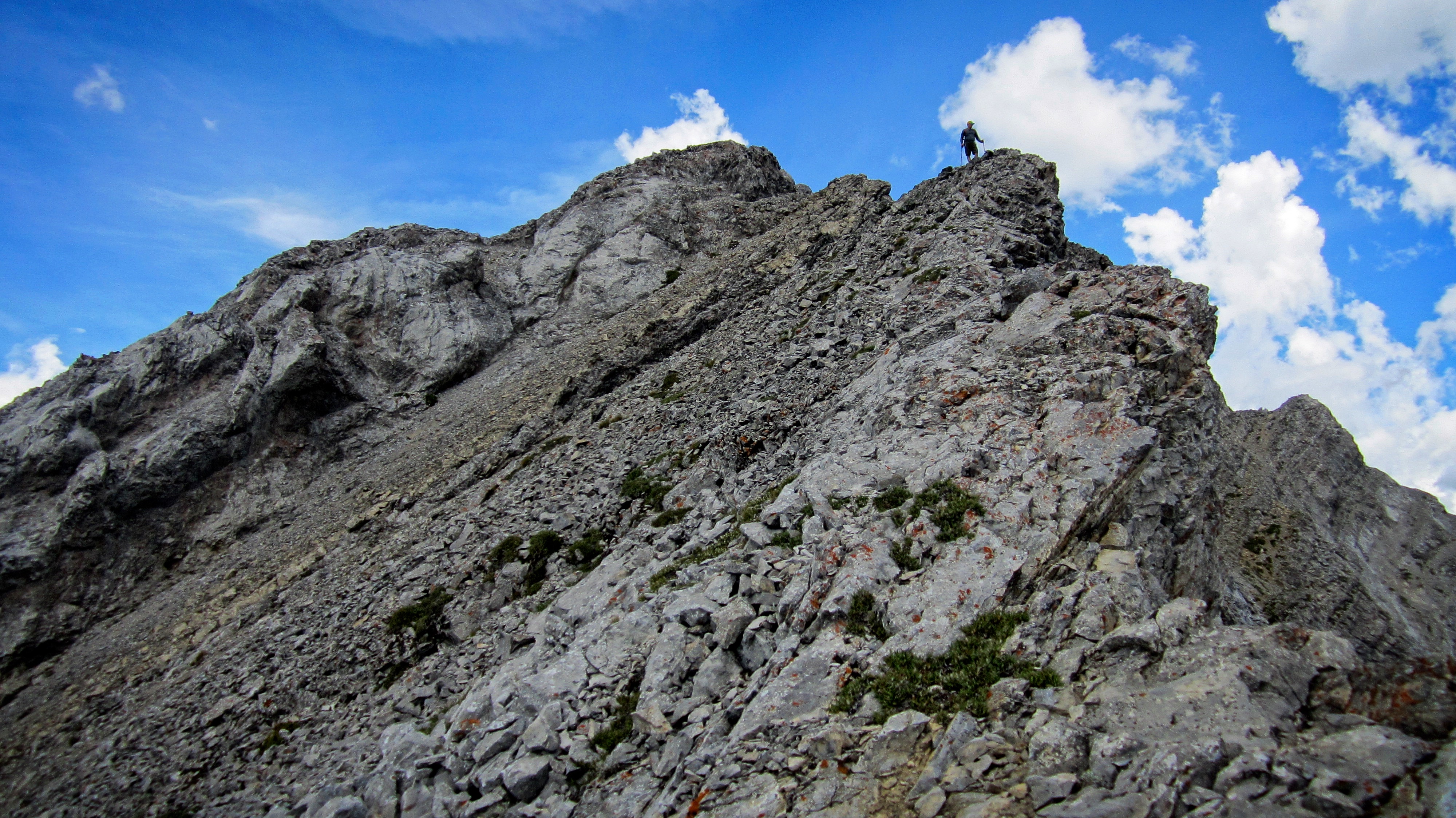
Looking back along the summit ridge.

The summit of Phillipps Peak (2500m). The cairn looks like it has been added to since Sonny posed next to it in his 2008 trip report.
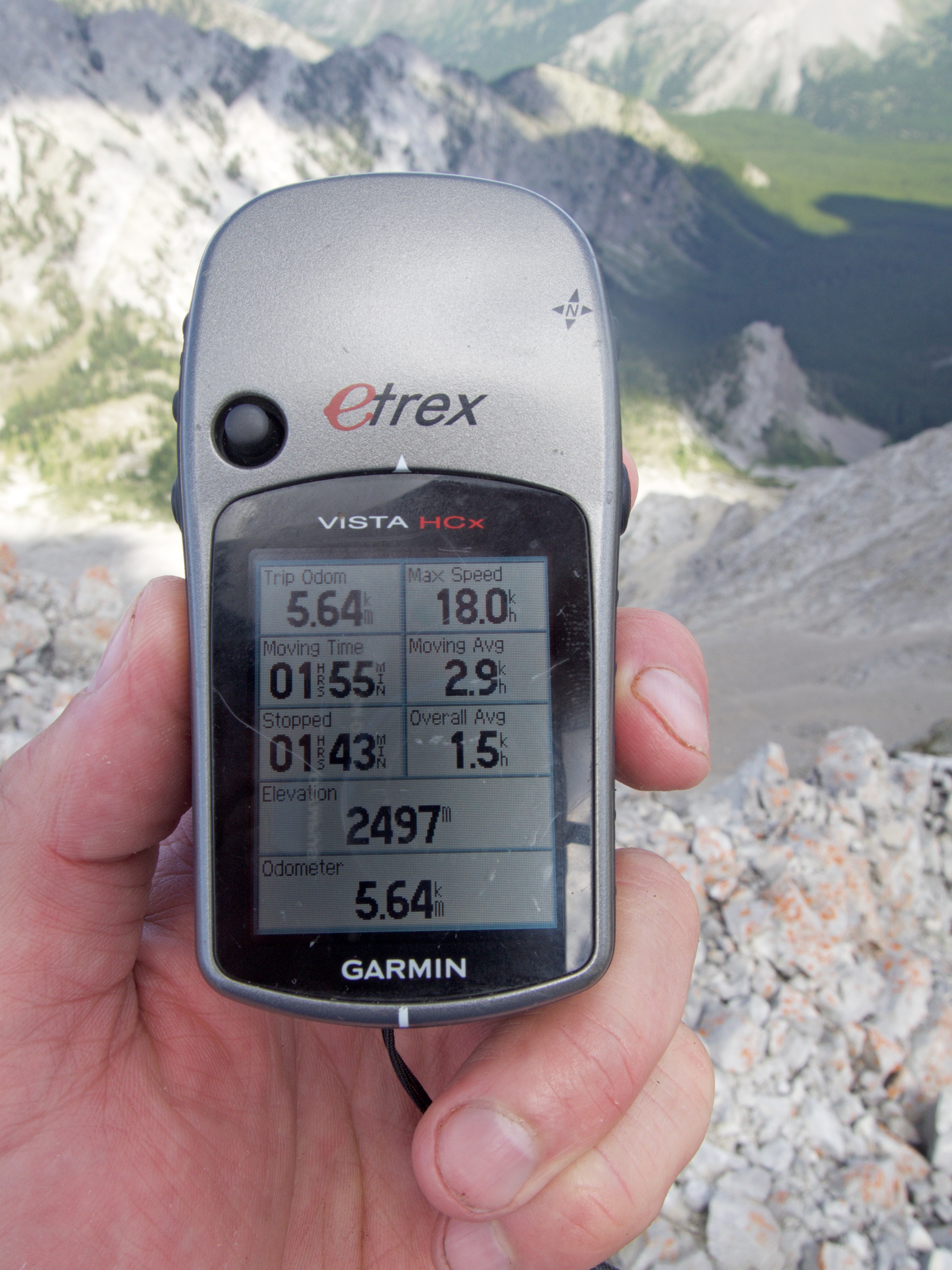
My GPS readings on the summit. The books say it is 2500m so my GPS is not that far off.
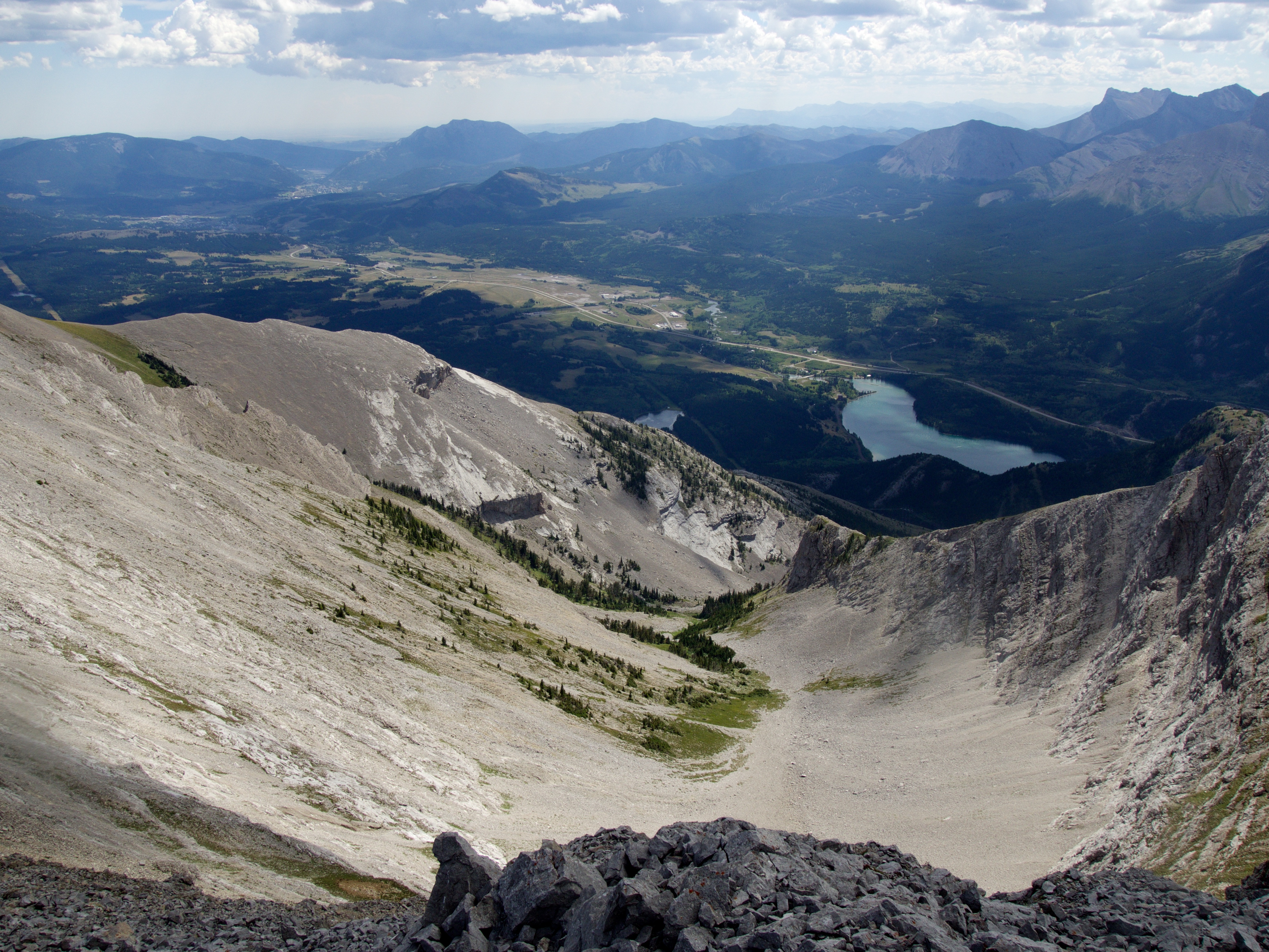
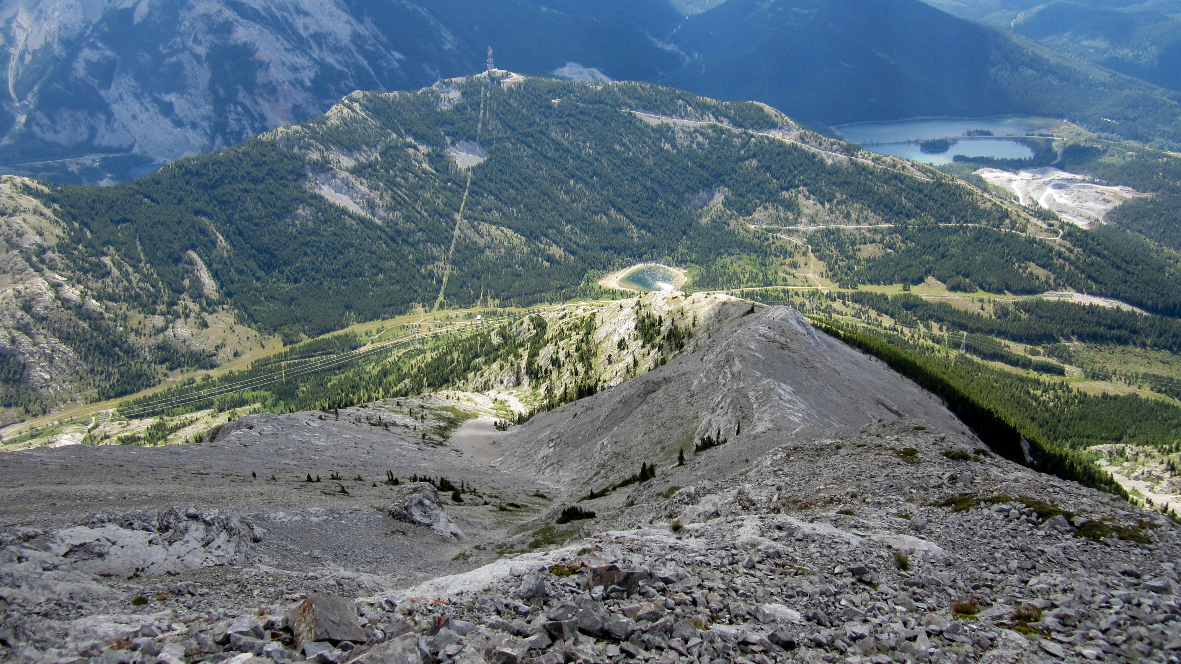
The view to the northwest from the summit. Mount Erickson is on the left, Gaff Peak, Sheep Mountain, and Mount Salter are on the right.

Looking north at ‘Deadman Peak’ and Allison Peak (which was our original destination for the day). In the foreground on the left is “Alexander Creek Mountain“.

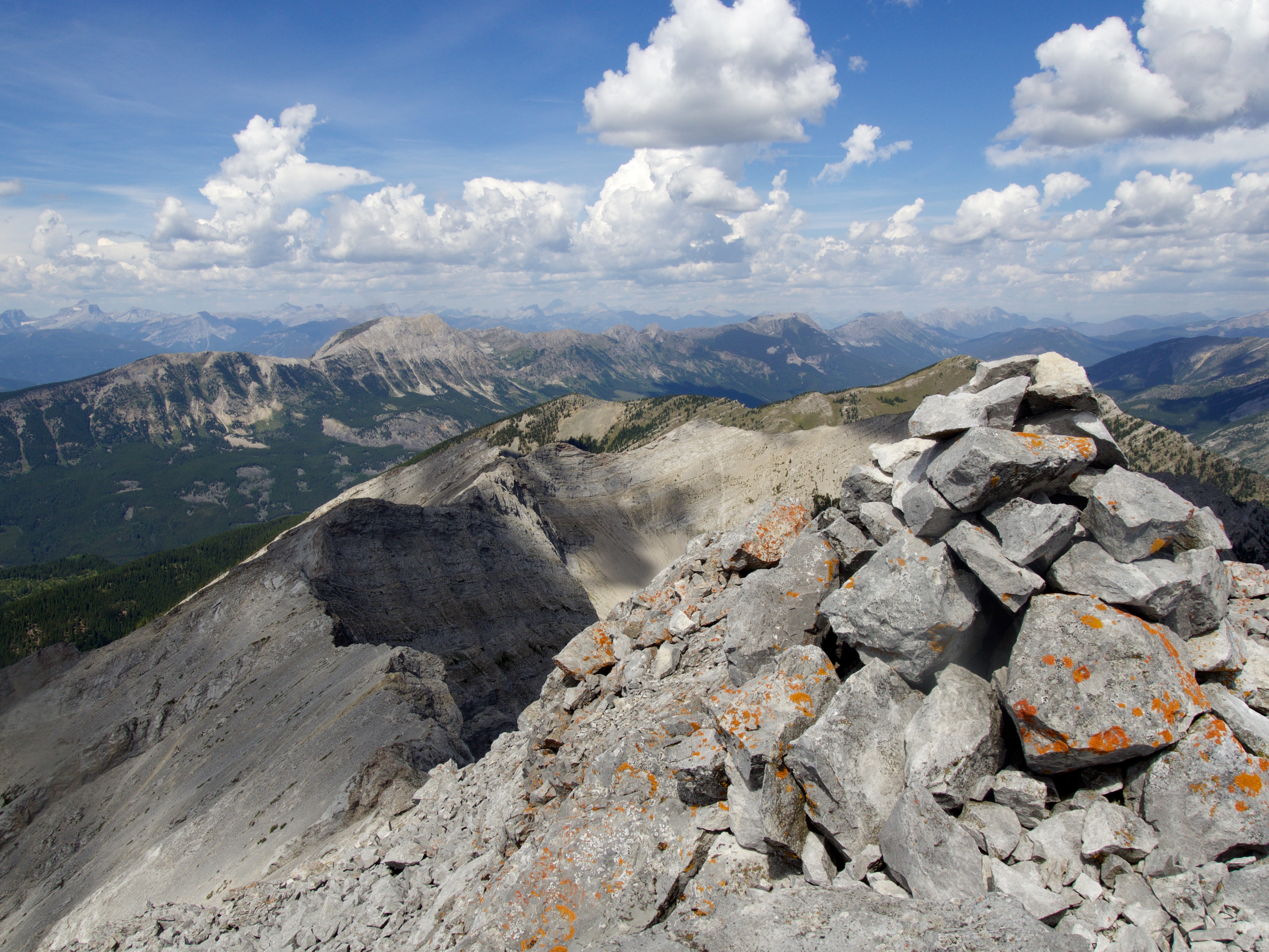
The view to the northeast is gorgeous as the summit of Mount Tecumseh is flanked by Crowsnest Mountain and the Seven Sisters.
The view to the southwest highlights the expansive bowl which sits beneath the summits of Tecumseh and Phillipps.

Looking south at the northern end of the Flathead Range. From left to right: Mount Coulthard, Mount Parrish, Andy Good Peak, Mount McLaren, Chinook Peak, Sentry Mountain, Mount Ptolemy, and the three peaks (‘Pharaoh’, ‘Anubis’, and ‘Mummy’) located on the Northwest Ridge of Ptolemy. Diminutive Island Ridge, Tent Mountain, and Mount Taylor are on the far right.

Bluff Mountain and Turtle Mountain standout as you gaze west from the summit. In the foreground on the right is ‘The Saddle’ and on the distant right is Hillcrest Mountain. In the distance on the left is the South Peak of the Livingstone.

Thumbs up to reaching the summit of Phillipps Peak.

Jeff’s all business as he poses on the summit.

A telephoto of Mount Erickson. The tall peak in the centre is Mount Washburn.
A telephoto of ‘Deadman Peak’ and behind it, Allison Peak. In the far distance on the left is Tornado Mountain, which at 3099m, makes it the highest peak in the region. In the distance on the right is ‘Vicary Creek Ridge’.

Looking southwest at Loop Ridge and the Natal Fire Lookout (right).
Time to head home as thunderclouds begin to form overhead.

This shot succinctly captures the narrowness of the ridge between the crux and the summit.
Jeff keeps low to maintain his balance as the wind begins to pick up.

Jeff carefully down climbs the chimney into the gap…

…before scrambling across the exposed section of ridge.

An excellent shot by Jeff as I descend the crux. At this point I’ve reached the bottom of the chimney and must still climb down an additional 2m to reach the gap (not shown). (Photo by Jeff Lang)
Well past the crux and on our way to the false summit.
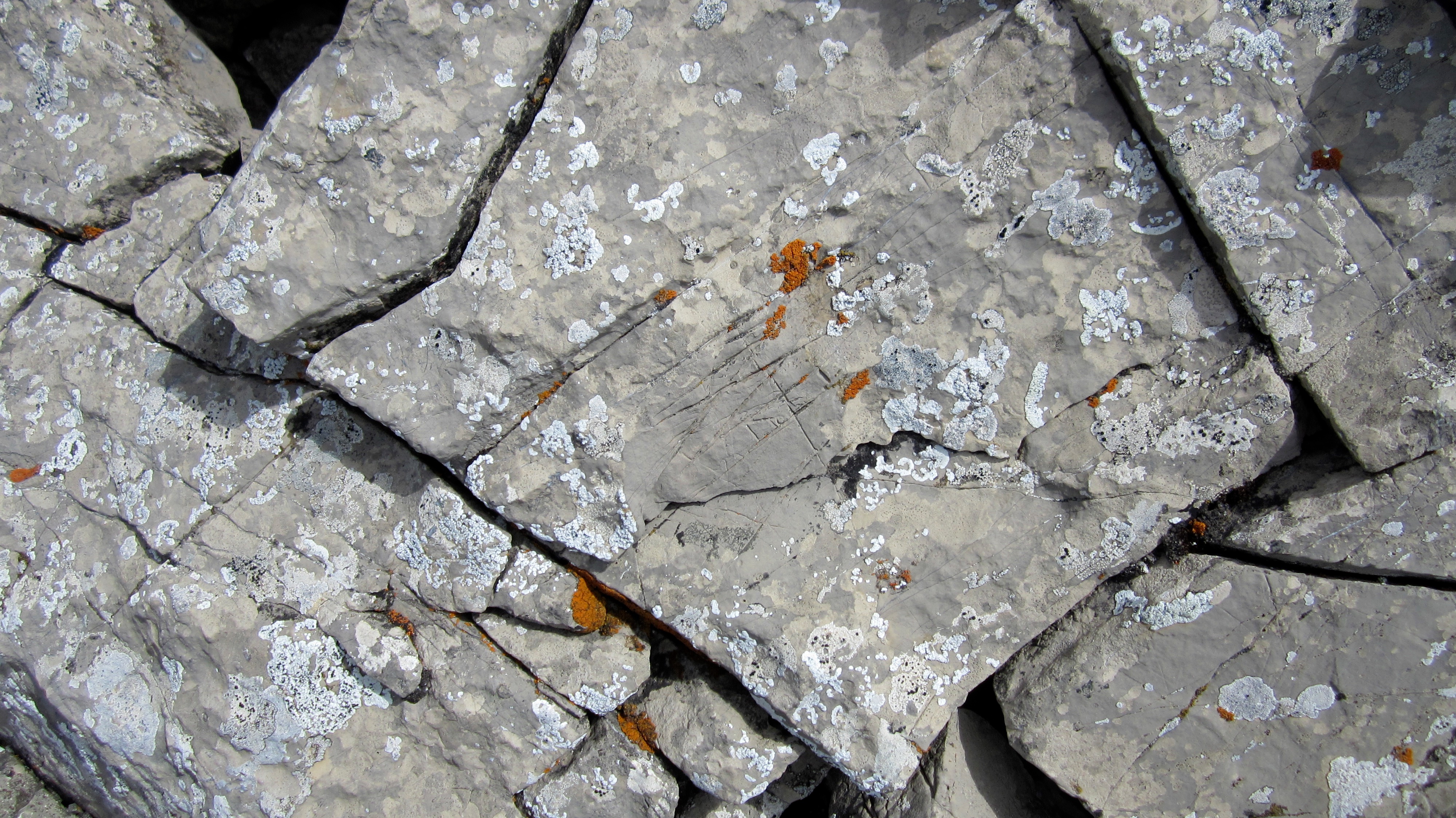
Somewhere along the ridge (I won’t say specifically where), my eyes were drawn to a rock that looked like it had been etched by human hands.
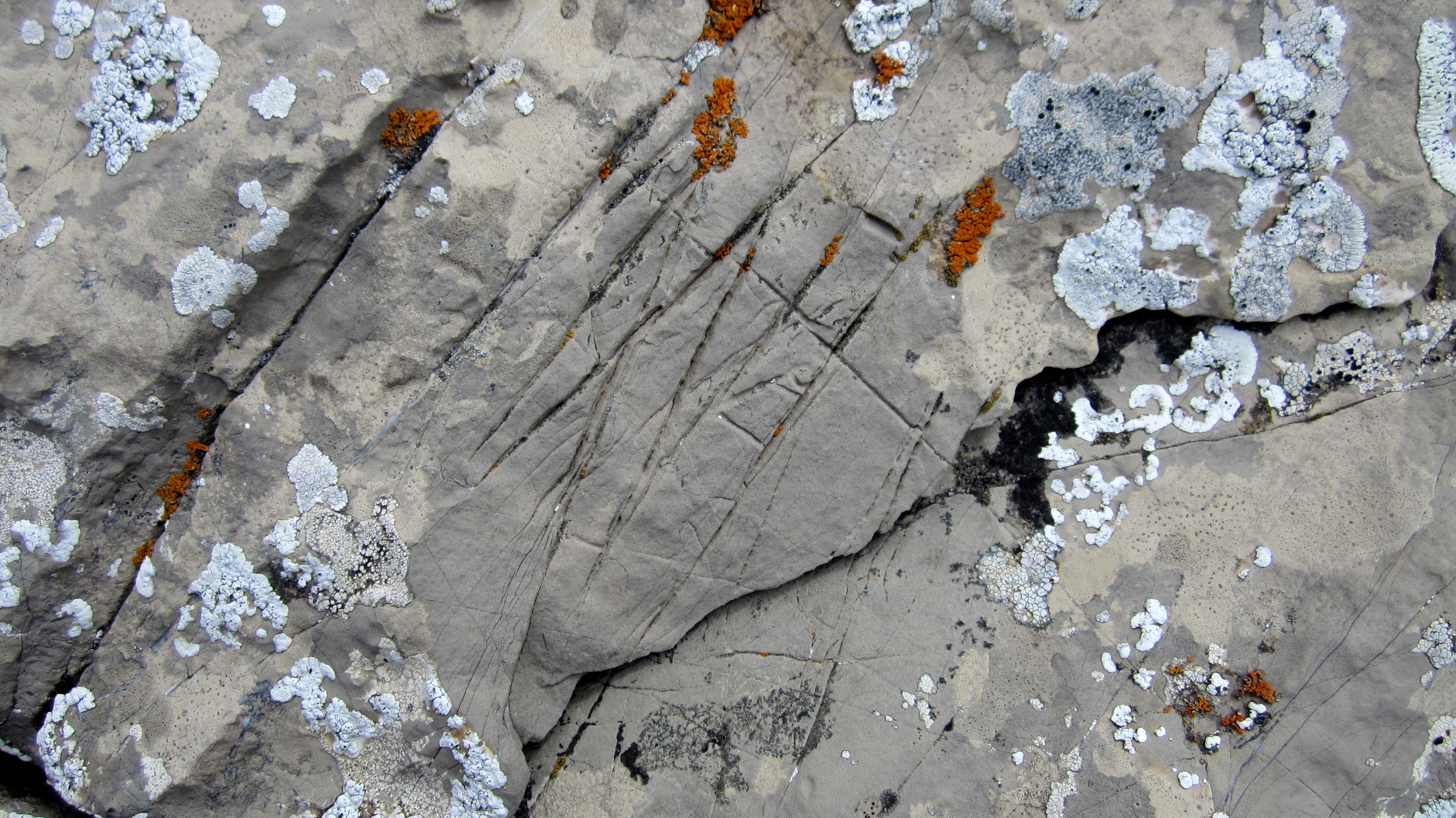
These markings did not fit with the other cracks in the rock and to me, it looked like it could be a petroglyph left by the First Nations – the clue being what appears to be the figure of a human on the right. I’ve sent this to the Alberta Archeological Survey and will update this post when I find out more information.
Edit 25 August 2016: A colleague thinks that this is might be an authentic petroglyph, but is not sure. I’m now waiting to find out if it has been officially documented by the Alberta Archeological Survey.
Edit 28 March 2017: Word has come back from the Royal Alberta Museum that this may not be humanly created, but rather, is an erosional feature in limestone called rillenkarren. In addition, though the human-like figure does have some similarities with petroglyph stick figures, it does lack features common to rock art in Alberta. I guess I bought that fedora and bullwhip a little prematurely… 😉
Back on the false summit and heading down.

Instead of sticking to the crest as we had done on our way up, we found it easier to use the scree ramps to skier’s left. Jeff can be seen walking along such a ramp between the cliffs and the trees on the right.

From the ridge we noticed a group of five fishermen trying their luck on Phillipps Lake.

Looking at Jeff – who appears to be doing some form of yoga 😉 – through the hole in an old tree.
Heading off of the southern ridge and back to our bikes.

Our bikes were located on the other side of the grove of trees between the two power lines.

Were we ever glad that we had brought the bikes! We had no need to peddle as we quickly coasted down the road to our vehicle. My top speed ended up being 44.4 km/hr which meant that we covered the ~2.6 km in mere minutes.

Back at the rest area in Crowsnest Provincial Park with the summit visible in the background. I’m so glad that we chose to ascend Phillipps Peak as it was the perfect destination for the day. Though reaching the false summit was fairly easy, the scrambling required to reach the true summit definitely got the blood pumping! Based on this experience, I would have to recommend that unless you are quite confident in your scrambling abilities, I would suggest holding off from attempting to reach the summit. The false summit itself is an enjoyable hike or even reaching the summit ridge before the crux. However, if you have the experience and are confident, it’s definitely an exhilarating little section to scramble!
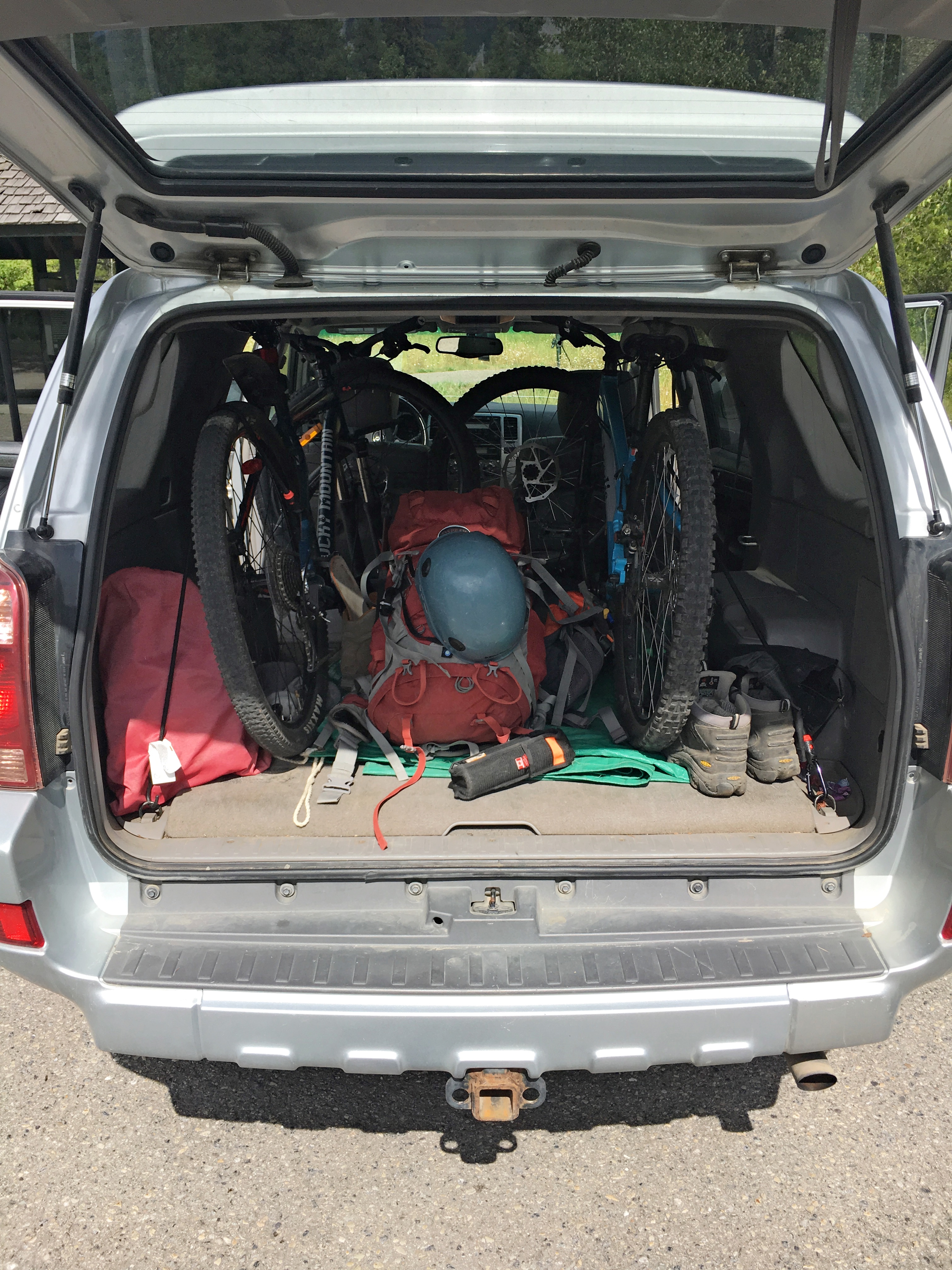
Oh and reason #222 why I love my ’03 4Runner – you can fit 2 mountain bikes and your hiking gear inside with room to spare – that and after 343,000 km – it has yet to develop even a small rattle. #ilovemy4runner
I think that was the funnest scramble we’ve done for quite some time! The great terrain for gaining the summit ridge coupled with a little bit of tricky technical scrambling at the top was a blast!
I agree!