
⚠️ Hiking and scrambling are inherently dangerous activities. Please read my Disclaimer. ⚠️
Back in 2017, I had hoped to get to Font Mountain and Mount Matkin as part of a multi-day Alpine Club of Canada (ACC) excursion that was venturing from Southfork Lakes to Paahtómahksikimi (Waterton National Park) along the Great Divide Trail (GDT). Unfortunately, we had to pivot prior to reaching La Coulotte Peak and our journey ended on the shores of Grizzly Lake.
Then in 2020, Cornelius Rott of Spectacular Mountains, posted a two-day adventure that included Jutland Mountain, Mount Matkin, Font Mountain, and Sage Mountain. His masterful description rekindled my desire to get back to this area of Tatsiki-Miistáki (Castle). It obviously inspired others, because in August of that same year, Jonathan Alston ascended Jutland via La Coulotte Ridge and then in July 2022, Andy summited Font Mountain (and also “Sage Senior” and “Sage Pass Peak”) as a 10.5-hour bike & hike from Red Rock Canyon.
Two months later, when Andy and I were gearing up at the trailhead for Jutland Mountain, we happened to meet Brandon Boulier, who was setting off to repeat Cornelius’ two-day loop. After watching Brandon leave the summit of Jutland for Matkin – and seeing the vastness of the terrain – I knew that if I wanted to get to Matkin and Font, it would have to be a backpacking trip.
Fortunately, three days after Andy and I were on Jutland, Vern Dewit also repeated Cornelius’ route; bolstered by fresh information from Brandon. As usual, Vern’s description was thorough and his photos were inspiring. So, with all this information at hand – thanks everyone! – I envisioned a route that would utilize Andy’s approach for Font and Cornelius’ route up Matkin. If there was time, I’d include Sage Mountain, but since I live in Lethbridge, it would not be a huge hassle to return for it at a later date – if a way could be found to do it as a day trip… Thus, the only remaining question was: when could I put the plan into action?
As it turns out, having vacation time to use before the end of the fiscal year is helpful. It’s also important to have that vacation time fall within an amazing three-day weather window. Finally, having a good friend like Brad be able to join me was crucial, for as much as I try to be more introverted, having to solo camp with just me, myself, and I would be WAY too much of a leap into quantum solitude. 😂 So, with all three factors aligned, it was finally time to accomplish what I had hoped for back in 2017.
Of course, the added bonus with Andy’s approach, is the inclusion of a couple peaks that we would have undoubtedly bypassed in 2017 due to the routing of the GDT. These are: “Sage Pass Peak” and “Sage Senior”. Andy describes them in his 2022 report, but these were both second ascents for him, with his initial descriptions coming in 2020. Though they are unofficial, both offer surprisingly great views were well worth the inclusion.
Indeed, why “Sage Senior” is not an official peak is a bit of a mystery. Towering prominently over Lost Lake at 2430 m, it is higher than both Matkin and Font, not to mention nearby, Sage Mountain and Avion Ridge. Its east face is an impressive sight from the Snowshoe trail not to mention from neighbouring mountains. Oh well. ‘Tis another of life’s great mysteries – much like how the chick pea is neither a chick nor a pea. Discuss. 😂
All in all, this ended up being an outstanding mountain adventure. The alpine terrain surrounding Font and Matkin was especially noteworthy and completely by chance – and I didn’t realize it until I got back – the spectacular site where we camped at the base of Font, was the same one used by Vern on his trip. We stumbled onto it after descending the north side of Font. We had begun searching for water and couldn’t see anything immediately visible near Matkin, so we followed a small drainage off of Font in search of a spring. After veering slightly to the north and towards the GDT, we came across a small clearing that featured a bubbling brook and fantastic views of Matkin and Font. Undoubtedly, this was the perfect spot to camp.
Thanks to everyone for providing their information and especially to Brad for his company – and for letting me win yet again, at ice axe golf! 🙂 It was a decidedly memorable trip.
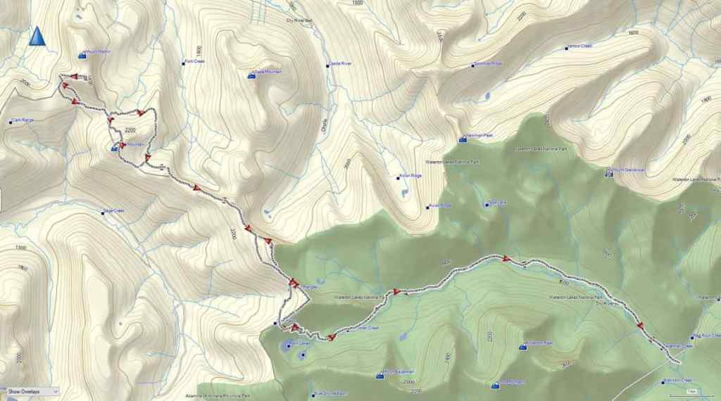
To get to our starting point, we drove to the Red Rock Canyon parking lot where we accessed the Snowshoe trail. From the trailhead we biked for ~8.5 km (1 hour; 287 m elevation gain) until we reached the end of Snowshoe and the start of the Twin Lakes trailhead. From here, we hiked for 3 km (220 m elevation gain) until we reached the trailhead for Sage Pass. We then turned onto Sage Pass trail and followed it for 1.4 km (160 m elevation gain) until we arrived on Sage Pass.
Instead of following the Great Divide Trail (GDT) north from the Pass, we headed to climber’s right and up and along the gentle ridge towards “Sage Pass Peak”. By following the mostly open slopes for ~920 m (160 m elevation gain), we soon arrived on the summit and were surprised by how good the views were. For reference, it took us 3 hours and 20 minutes and ~13.8 km (837 m elevation gain) from Red Rock Canyon to reach the summit.
From the summit of “Sage Pass Peak” we descended ~530 m (76 m elevation loss) to the col with “Sage Senior” where we joined the GDT. We followed the GDT up and along the ridge towards “Sage Senior” for about 690 m before leaving it to regain the ridge proper. We then followed the ridge for another ~600 m to the summit. In total, from the summit of “Sage Pass Peak”, it took us 1 hour to cover the ~1.9 km (224 elevation gain) distance to the summit of “Sage Senior”.
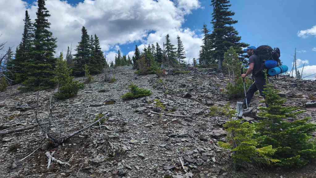
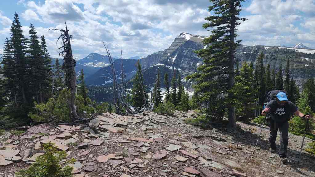
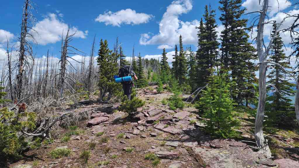
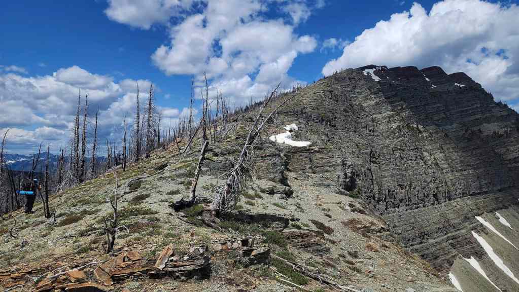
After a quick lunch on the summit, we set off toward toward Font Mountain. An easy downhill hike for ~500 m (74 m elevation loss) brought us back to the GDT which we then followed for ~2.5 km until it began to trend to climber’s right around a large high point shortly before Font. In hindsight, perhaps we should have left the GDT and followed the ridge, but we continued along the trail for another ~1 km; leaving it to regain the ridge on the other side of the high point when it began to descend toward Font Creek. In reality, we only had to regain ~270 m (50 m elevation gain) to reach the ridge, so it wasn’t a big deal.
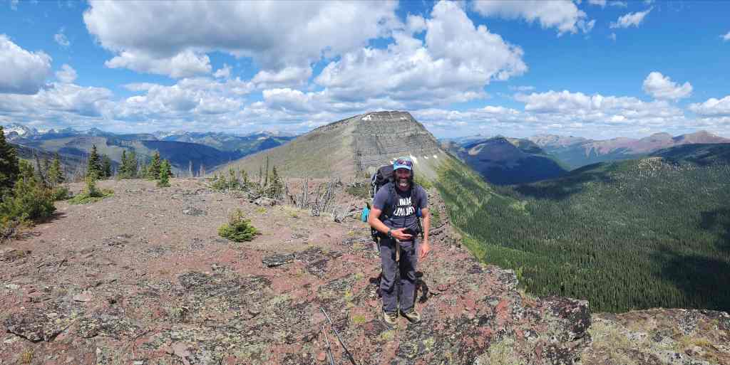
Once back on the ridge, Font was directly in front of us and a further ~550 m of hiking brought to the base of the summit. Following Andy’s route, we traversed to climber’s right for ~400 m until we gained the col with its subpeak. From the col to the summit, it was a ~280 m scramble (94 m elevation gain) to reach the summit. For reference, from the summit of “Sage Senior” it took us 2 hours and 45 minutes over ~5.5 km (315 m elevation gain; 384 m elevation loss) to reach the summit of Font (6 hours and 45 minutes from the Red Rock Parking lot). Once back on the col, we descended Font’s north side for ~870 m (200 m elevation loss) to reach our campsite.
The following day, we left our campsite and followed the GDT for ~870 m towards Matkin, until we came to a large open slope. As this was the closest the GDT came to the mountain, we decided to make a traverse to gain elevation until we joined Cornelius’ scramble route around the west side of the mountain. From the trail to the west end beneath the cliffs, it was a ~760 m traverse / scramble (210 m elevation gain).
Once on route, we picked our way around the base of the west-facing cliffs for ~200 m until we rounded the corner and could look east and up the entire drainage. Staying high to not lose elevation, we traversed for ~640 m (121 m elevation gain) until we were directly beneath the summit. A ~170 m scramble (58 m elevation gain) over loose rubble and boulders, brought us onto the summit. For reference, from our campsite to the summit it took us 1 hour and 45 minutes over 2.6 km (444 m elevation gain).
After enjoying the views, we returned the way we came, save for a more direct descent route back to the GDT. Once back at camp, we gathered our packs and set off on the GDT towards Sage Pass. The GDT skirts the east side of Font and as it descends, the trail forks, with the right fork being the GDT and the left fork continuing into the valley. Making a mistake here would be costly.
After hiking for 1 hour over a distance of ~2.7 km (180 m elevation gain; 130 m elevation loss), we arrived at the spot where we had left the trail to summit Font. We then followed the GDT trail all the way back to Sage Pass, bypassing both “Sage Senior” and “Sage Pass Peak”. For reference, it took us 3 hours and 20 minutes to cover the ~9.1 km (505 m elevation gain; 417 elevation loss) distance from our campsite to Sage Pass.
Once on Sage Pass, we descended the ~1.4 km to Twin Lakes trail, and from there, hiked for another ~3 km back to our bikes at the trailhead. Finally, we rode our bikes for ~8.5 km back to the Red Rock Canyon parking lot. For reference, from our campsite to the Red Rock parking lot, it was a total distance of ~22 km (581 m elevation gain; 1092 m elevation loss) that we covered in 5 hours and 10 minutes.
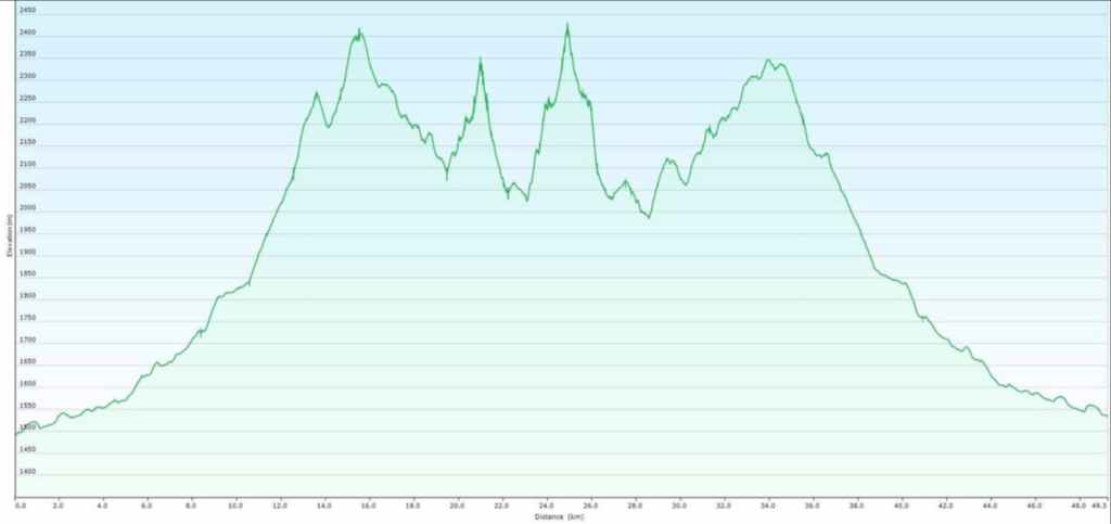
Our total distance travelled over the two-day adventure came in at ~51 km with a total elevation gain of 2605 m.
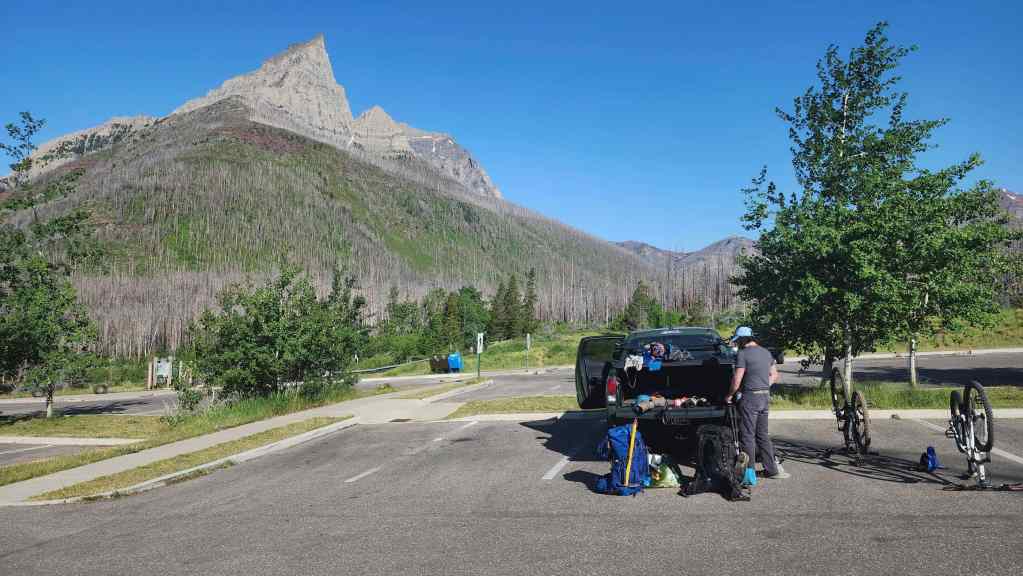
Gearing up at Red Rock Canyon on a gorgeous morning. This was day two of a three-day weather window that was forecast to slam shut with a multi-day deluge of rain – in fact, the most rain that southern Alberta has received from one system in several years. As they say, “timing is everything”. 🙂
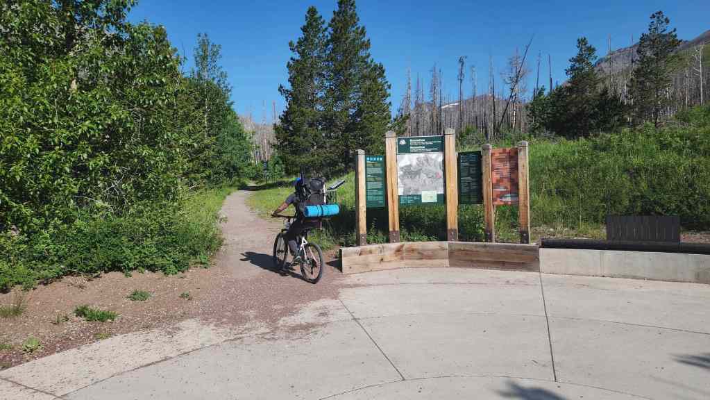
Starting off along the Snowshoe trail. Bikes are the secret weapon to making this approach work.
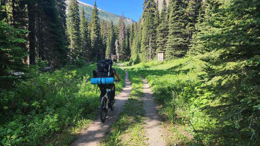
Arriving at the Twin Lakes trailhead 1 hour and ~8.5 km after starting. Note that we are using human-powered bikes, so an e-bike would have a much quicker time. Moreover, as I’ve covered the scenery along the Snowshoe trail in previous posts, I chose not to include any photos from the ride in.
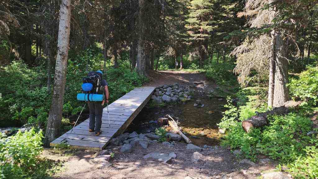
After stashing our bikes, we set off on foot up the Twin Lakes trail.
As with the Snowshoe trail, I’ve previously posted many photos from the Twin Lakes trail; however, this one of Kishinena Peak (centre) is always a keeper. 🙂
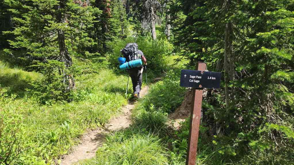
Approximately 3 km from the Twin Lakes trailhead, we came to its junction with the Sage Pass trail. We would follow this trail for ~1.4 km to reach Sage Pass.
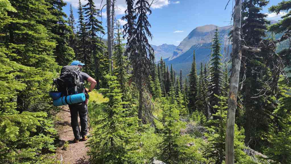
The long switchbacks made for easy hiking.
A great view over to Kishinena Peak (centre) and Upper Twin Lake.
On Sage Pass and getting our first good look at “Sage Senior”.

Instead of following the GDT, we would head up the lightly treed slopes toward “Sage Pass Peak”.
Easy and enjoyable hiking.
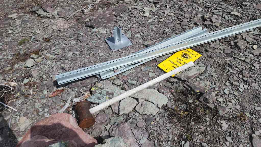
I hope the Parks Canada employee who had to haul up that sledge was paid extra. 😯
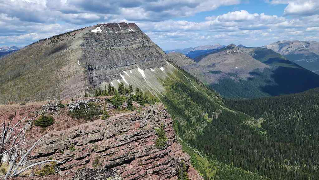
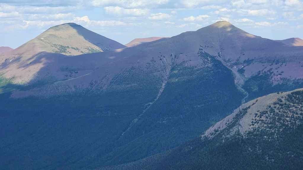
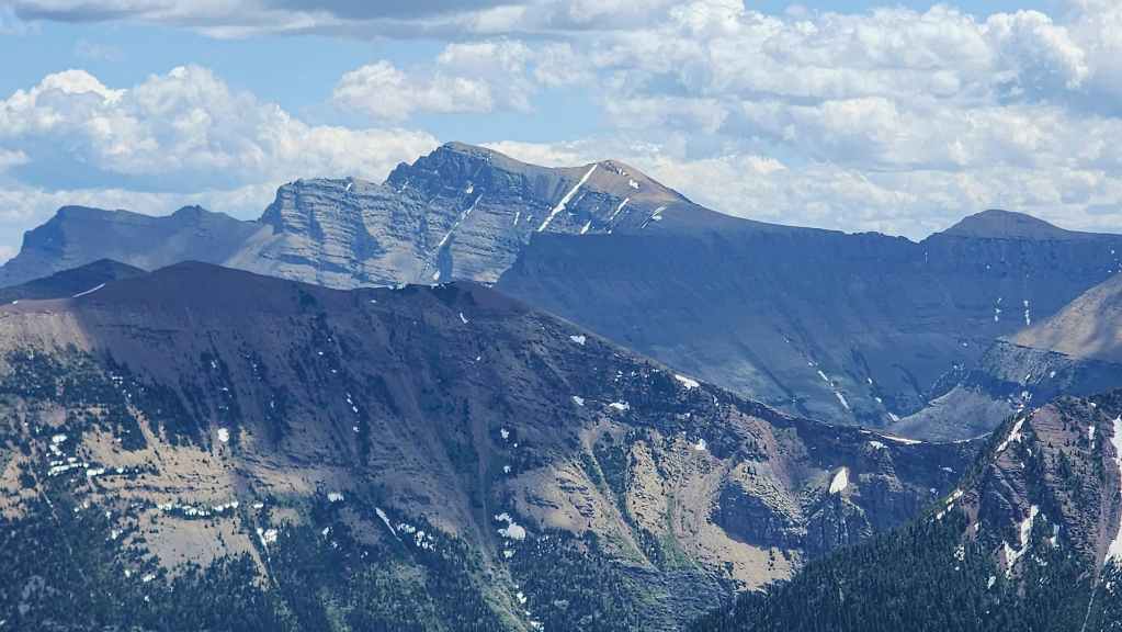
Another look at “Sage Senior” (far right) but now with Font Mountain and Mount Matkin (left) in the distance. Why do they look so far away? 😂
The views improve as we gain elevation.
We could now see both Kishinena Peak (right) and Festubert Mountain (left of centre).
One more look at “Sage Senior” before reaching the summit.
Almost there! From Sage Pass, it’s a ~920 m (160 m elevation gain) hike to reach the summit.
To be fair, I was not expecting the views to be this good.
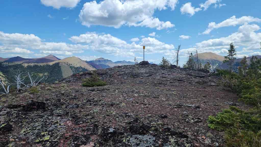
The summit of “Sage Pass Peak” (2280 m).
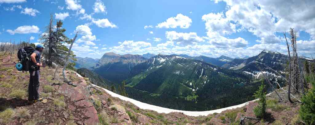
A pano to the northeast…
And then one to the east.
A pano to the south…
And finally one to the west.
“Sage Senior” looks more impressive from this vantage.
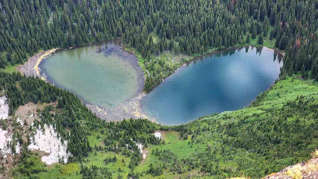
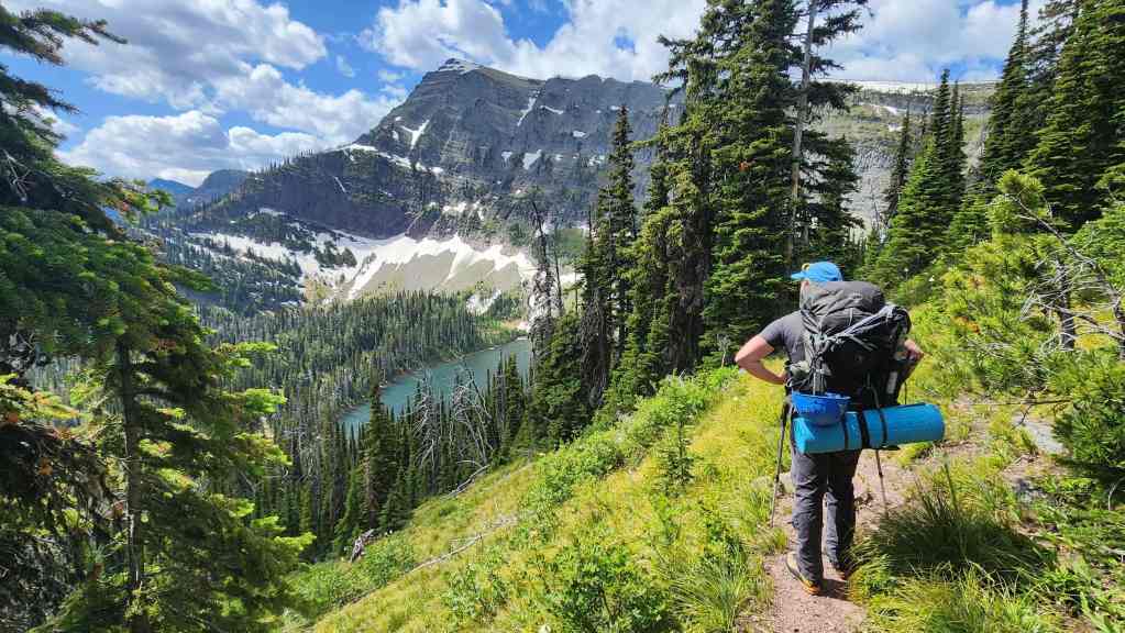
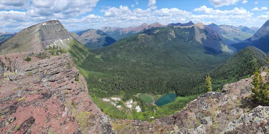
Lost Lake sits directly below the summit.
The summit offers a great view of the Twin Lakes.
Brad on the summit. For reference, it took us 3 hours and 20 minutes over ~13.8 km (837 m elevation gain) to reach the summit from Red Rock Canyon.
Descending to the col with “Sage Senior”
We will join the GDT on the col.
Looking back at “Sage Pass Peak” as we gain elevation.
Following the GDT. However, we’ll soon leave it to follow the ridge to the summit.
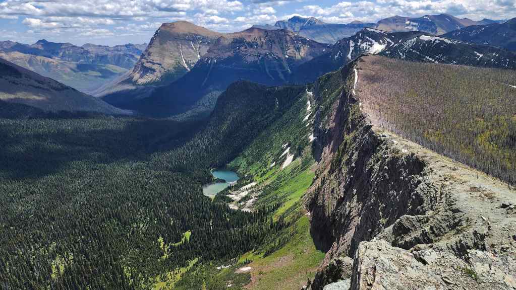
The ridge offers great views of Lost Lake.
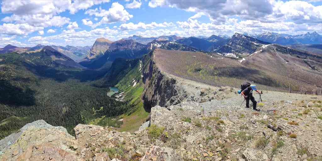
A pano of the previous photo.
More of the same.
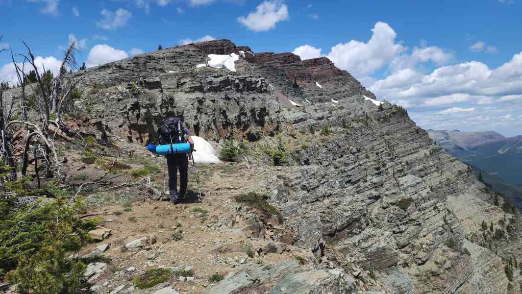
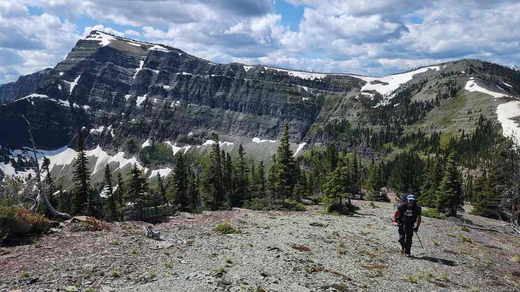
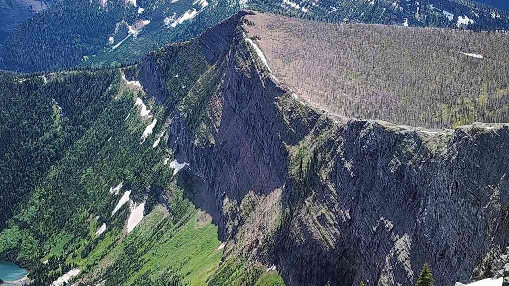
“Sage Senior’s” impressive argillite cliffs.
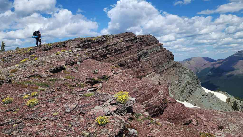
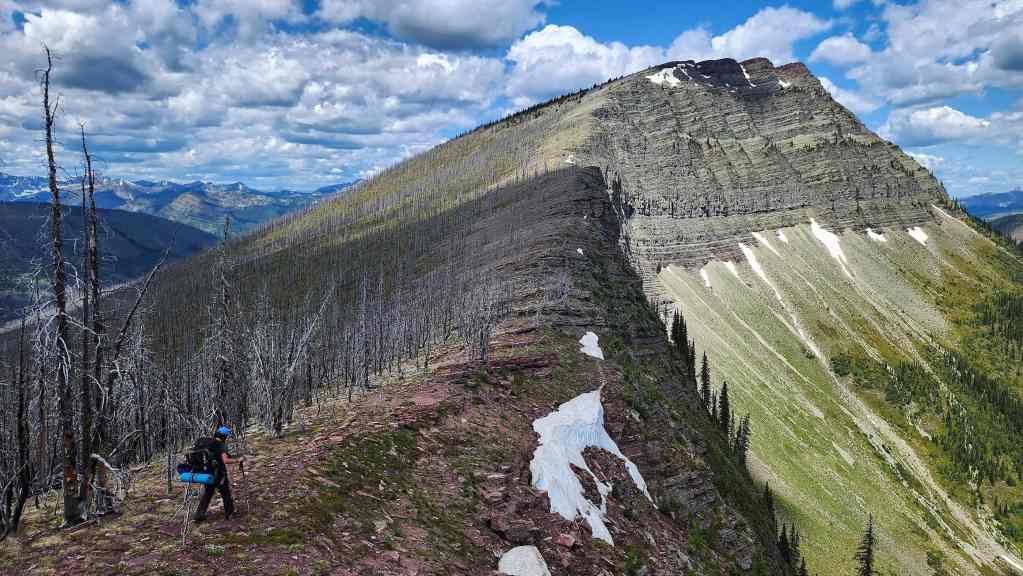
Nearing the summit.
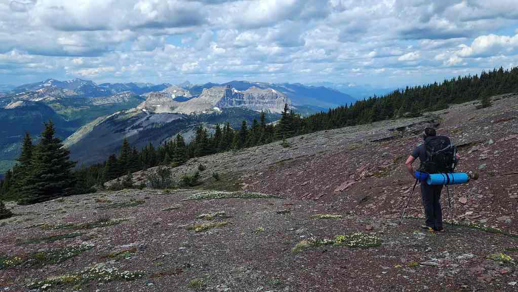
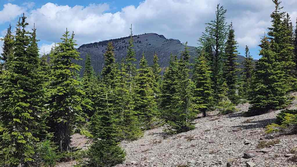
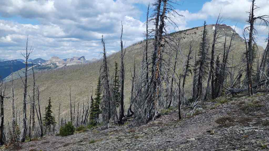
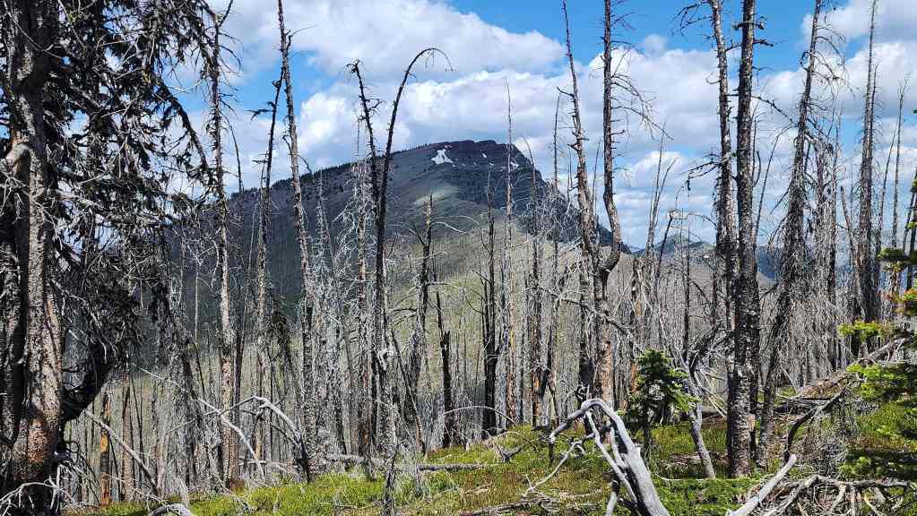
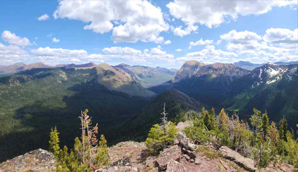
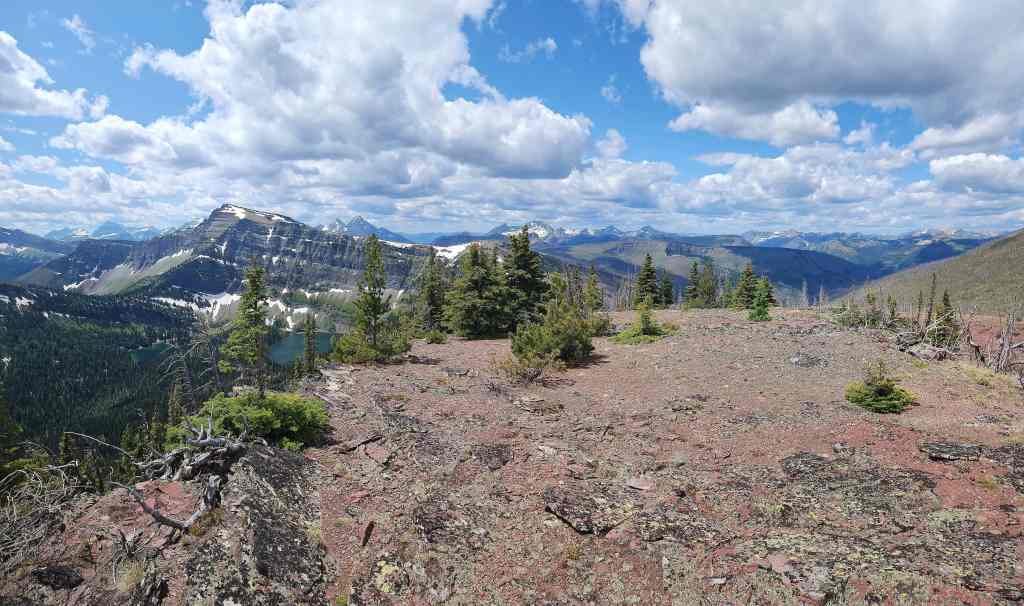
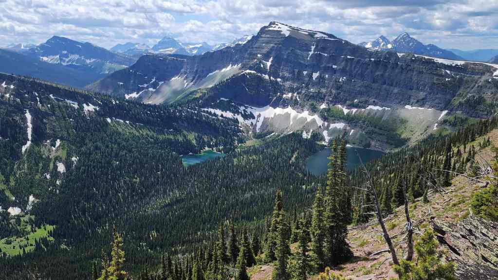
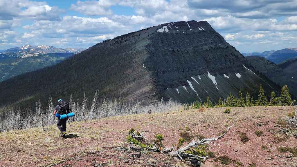
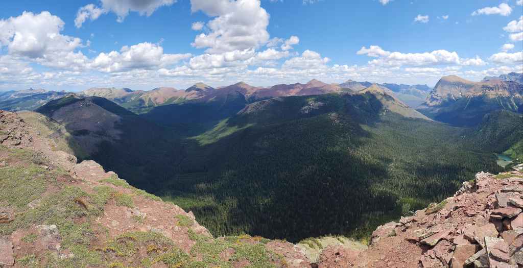
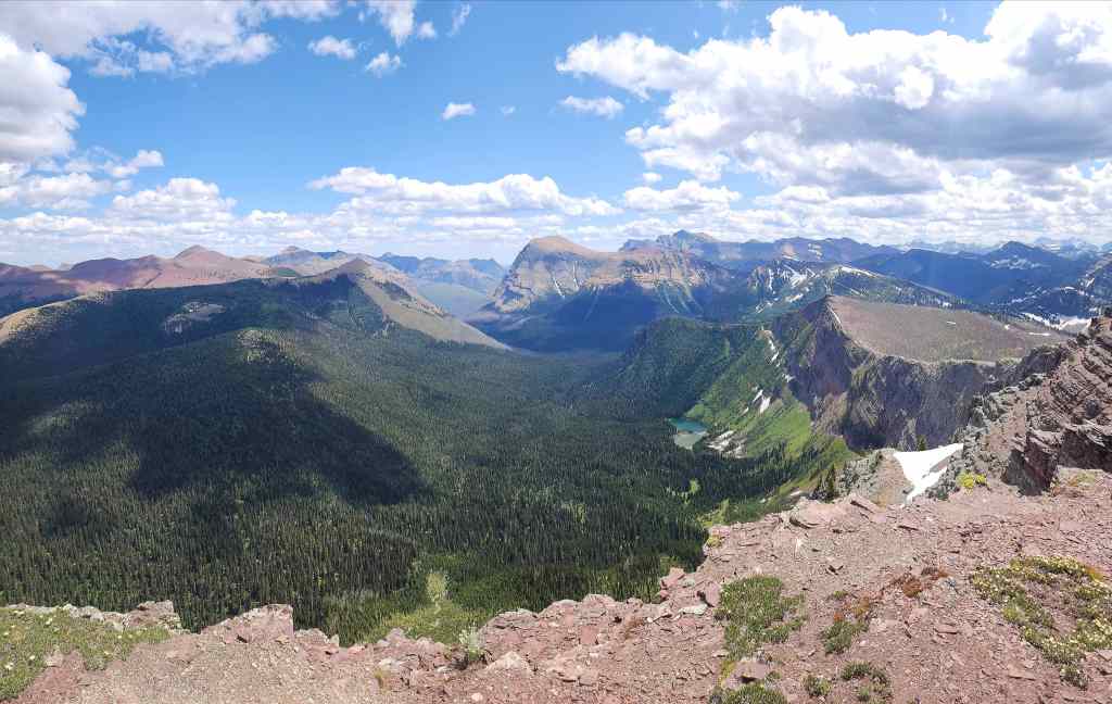
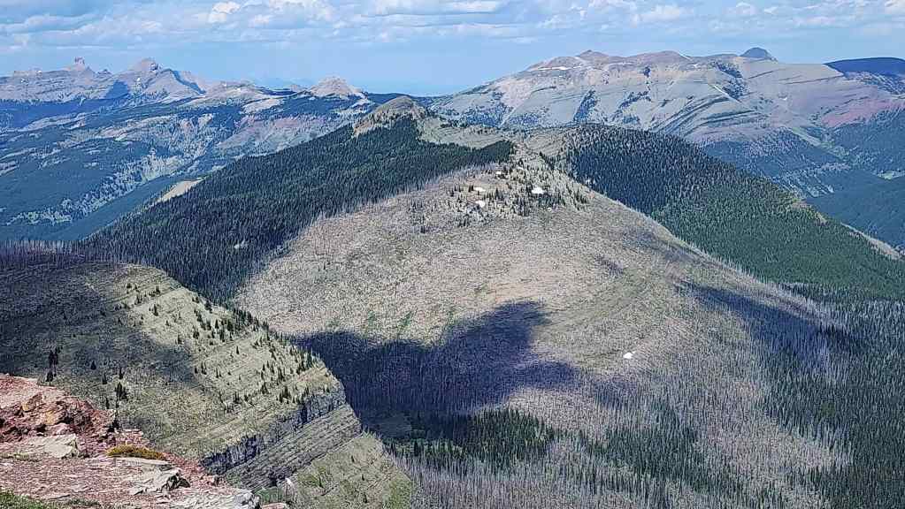
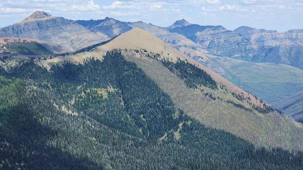
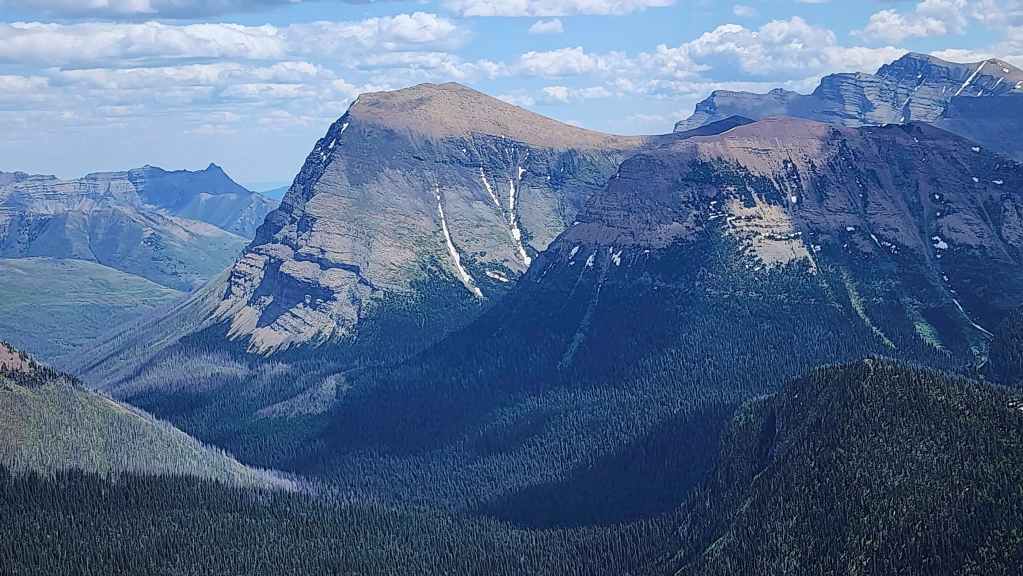
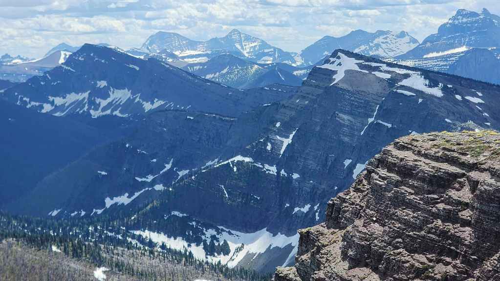
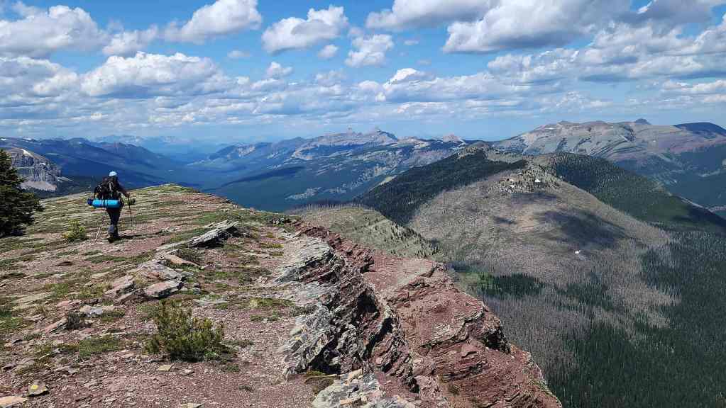
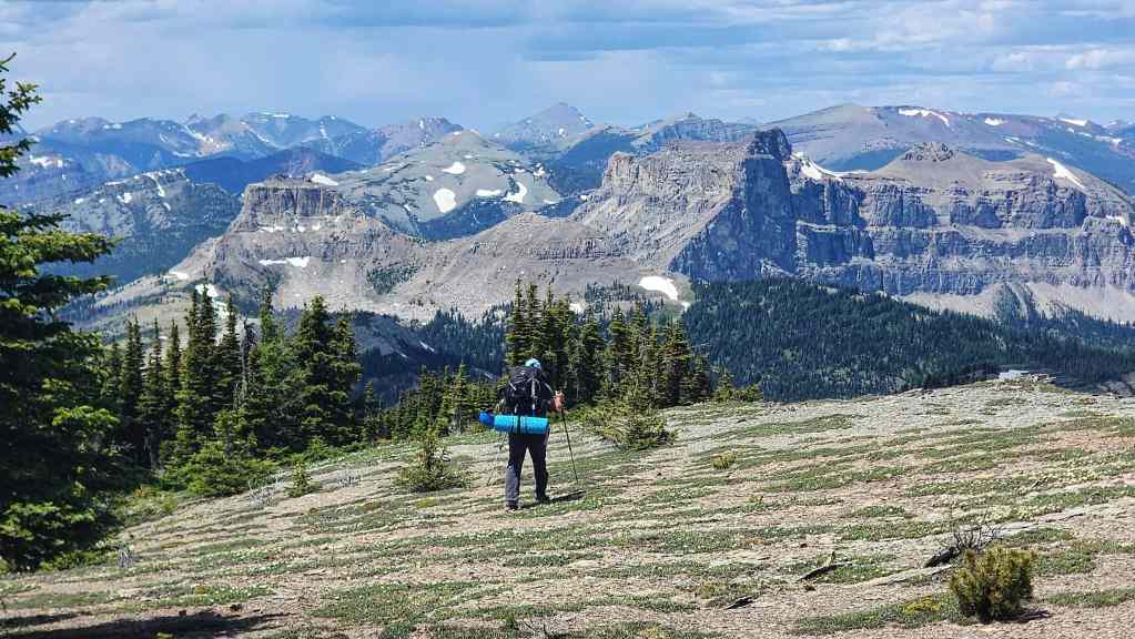
Gazing over to Font and Matkin (centre).
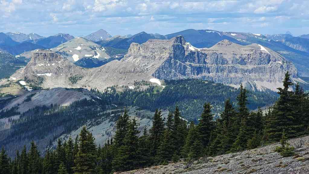
A telephoto of Font (left) and Matkin (right of centre).
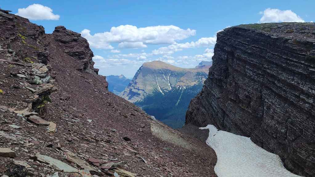
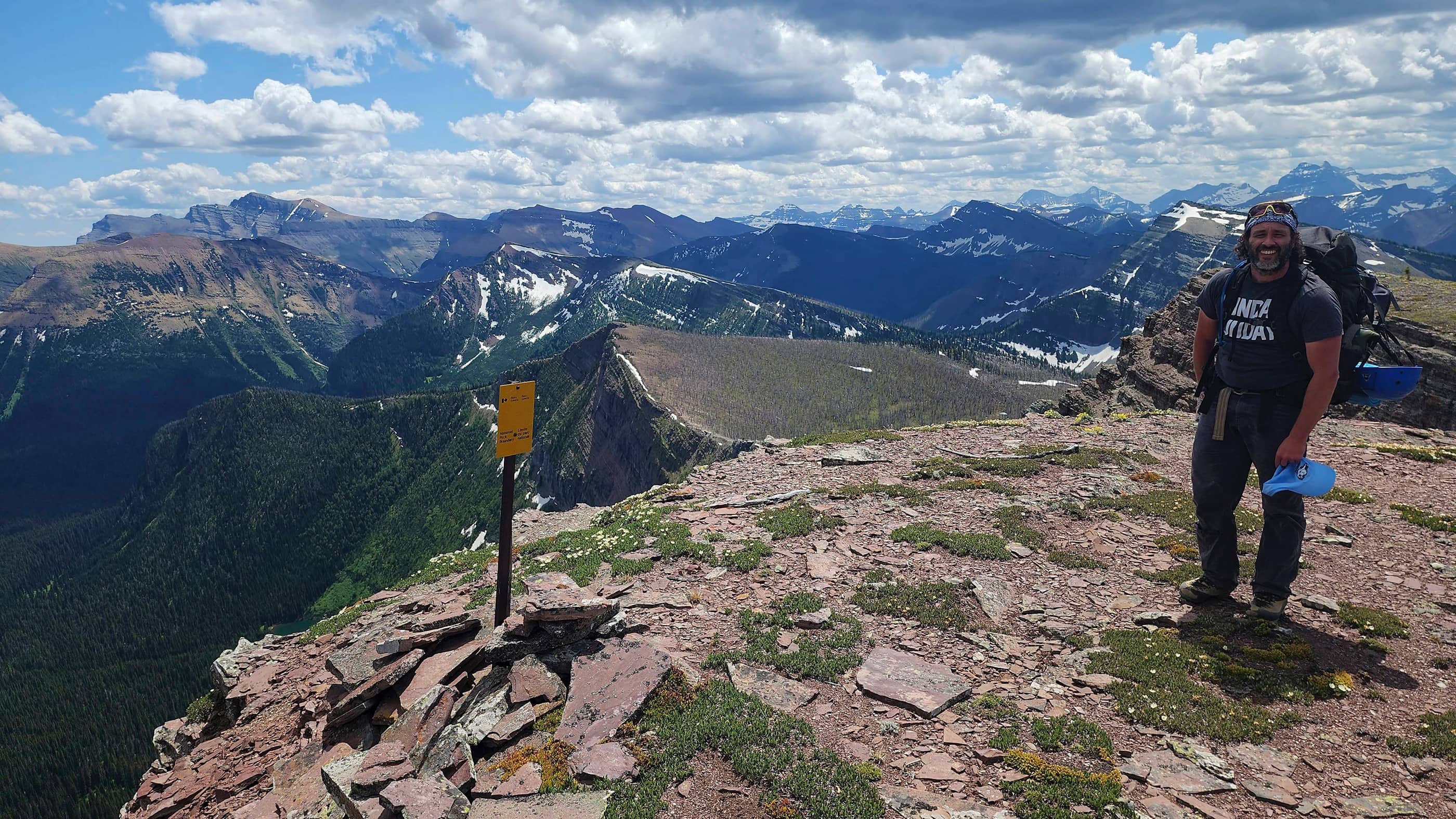
We had to cross a large fissure just prior to reaching the summit. The view from inside the fissure lines up nicely with Anderson Peak (centre).

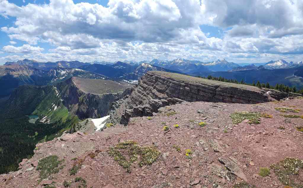
The summit of “Sage Senior” (2430 m).
Gazing to the northeast…
And then to the east.
Looking to the south…

And then to the west.
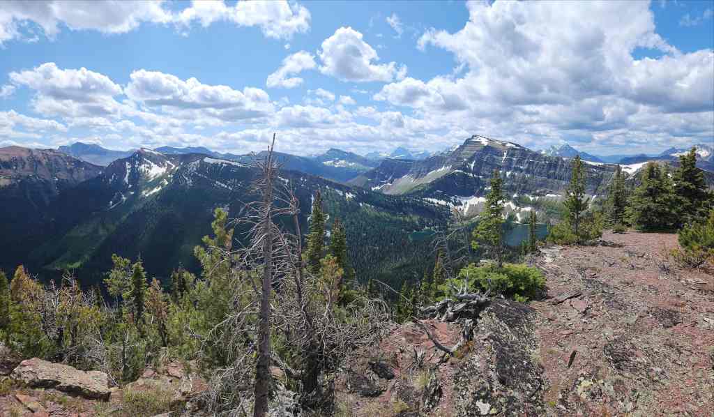
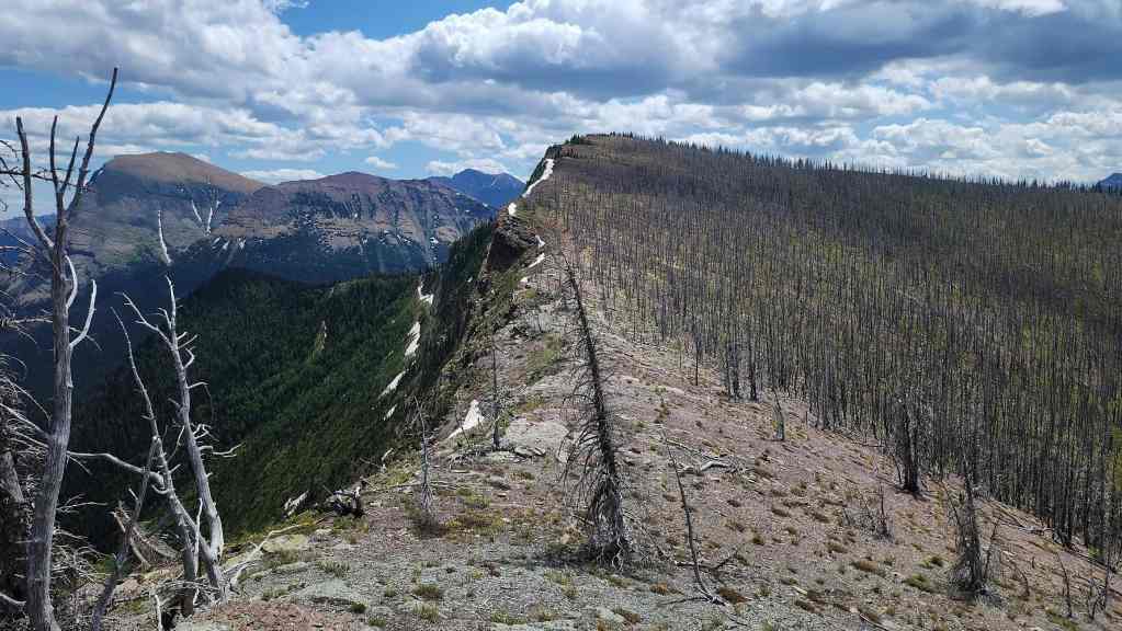
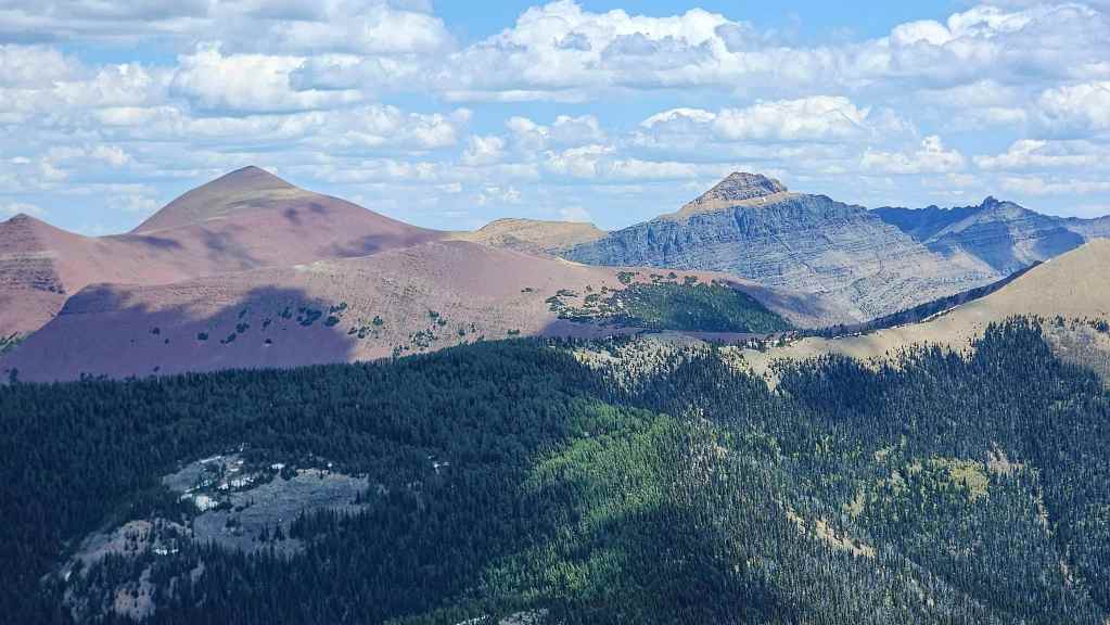
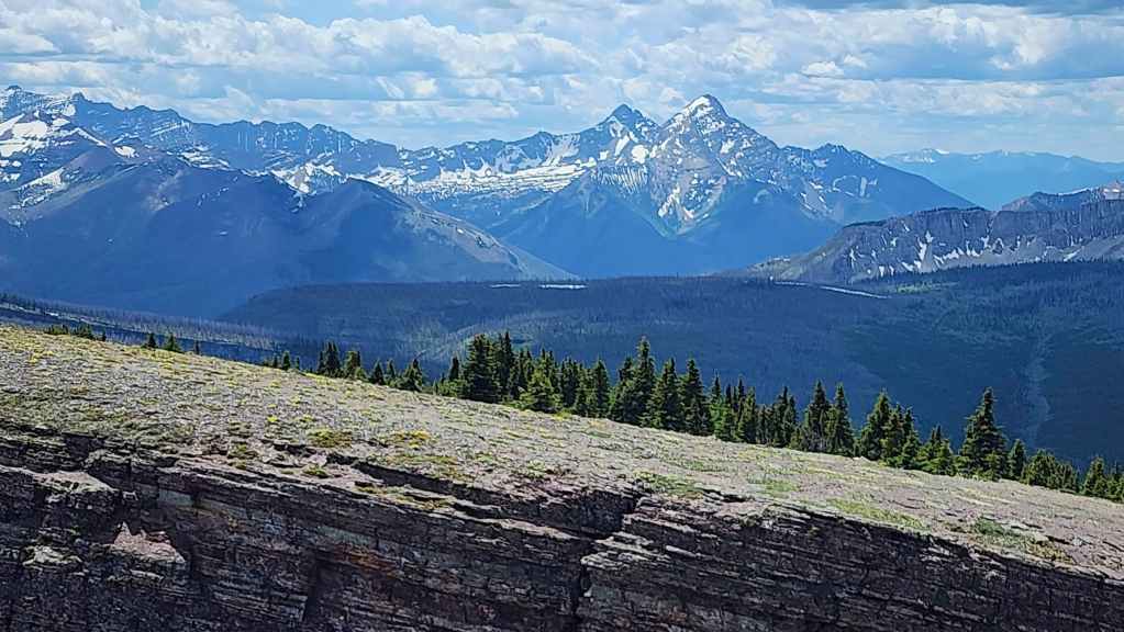
We’ll have to come back for Sage Mountain (centre) another time. Edit: Done! 🙂
Loaf Mountain (left) and Spionkop Ridge (right). It’s been a VERY long time since I was last on those peaks.
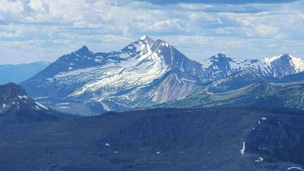
The view towards Newman Peak (far left), “Newman Senior” (left) and Mount Glendowan (right). In 2022, Andy and I experienced a sudden and scary weather change on “Newman Senior”.
Looking across the valley at Avion Ridge (foreground centre) with Mount Glendowan (left), Cloudy Ridge (left of centre), and Mount Dungarvan (right) behind it.
The view over to Anderson Peak (centre) with Galwey North (left) and Mount Galwey (left) in the distance.
Gazing towards Piinaquiium / Ahkoinimahstakoo (Mount Blakiston). Recent scholarship by Dr. Ninna Piiksii (Mike Bruised Head / Chief Bird) has uncovered that the Blackfoot had two names for this mountain. The first is Piinaquiium or “seen from afar mountain” and the second is Ahkoinimahstakoo or “pipestone mountain”.
Glancing back to “Sage Pass Peak”.
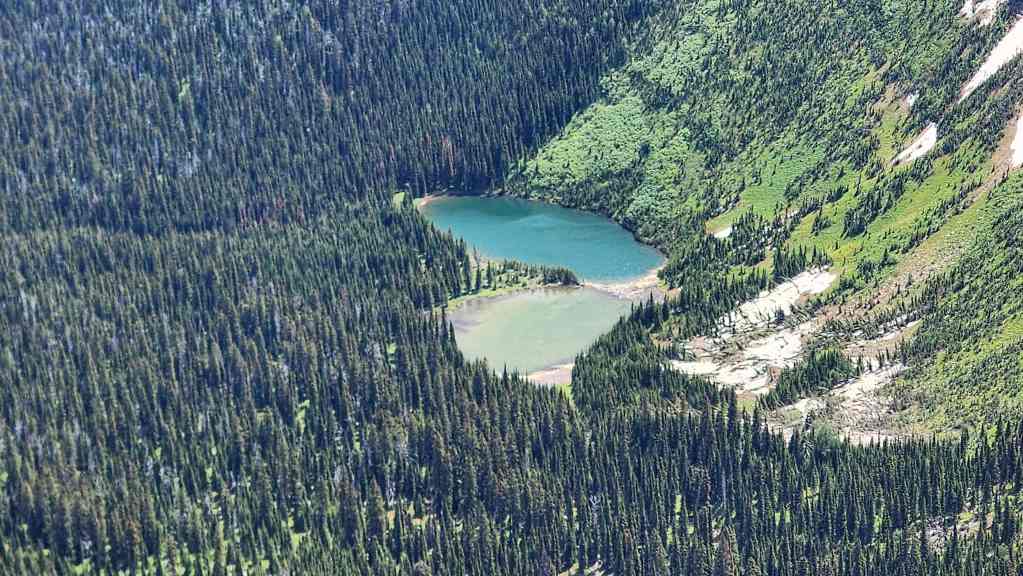
A closer look at Lost Lake.
Zeroing in on Festubert Mountain (left) and Kishinena Peak (right).
King Edward Peak (right) and Starvation Peak (right) standout to the southwest.
As do Kenow Mountain (centre) and Miskwasini Peak (left).

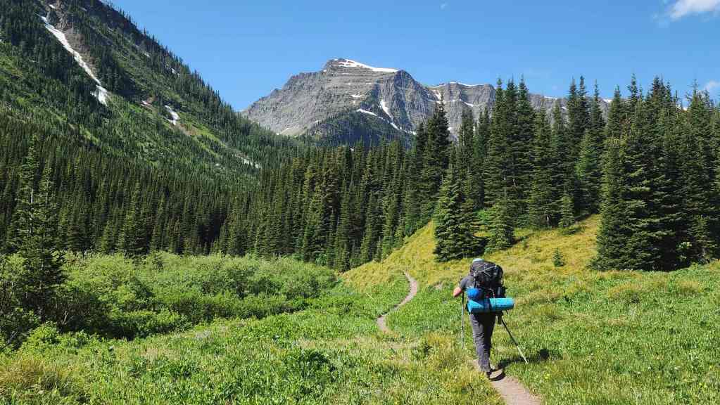
So far, our adventure is off to a great start!
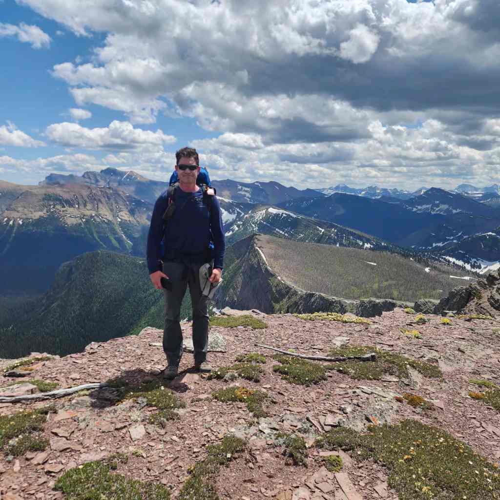
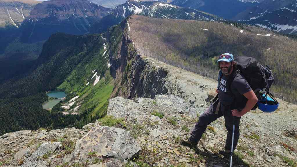
Me on the summit. (Photo by Brad Wolcott)
After a quick lunch, it was time to continue our journey.


Leave a Reply