

⚠️ Hiking and scrambling are inherently dangerous activities. Please read my Disclaimer. ⚠️
After enjoying the views and a quick lunch on top of “Sage Senior”, Brad and I set off for Font Mountain. A quick ~500 m descent along the ridge brought us back to the Great Divide Trail (GDT). Though it looked far off, the trip to Font is mostly downhill – which is great when you’re headed there, but somewhat disconcerting when you know that you’ll have to regain the elevation on your way back.
Fortunately, the designers of the GDT knew what they were doing, and throughout our trip, both Brad and I were impressed that most of the elevation gains felt less than they appeared. Coupled with this, the trip from “Sage Senior” to Font and Matkin moves through impressive terrain that includes high alpine meadows and unique geological features. Indeed, the change in rock from the pre-Cambrian argillite of “Sage Senior” to what appears to be Palaeozoic limestone on Font and Matkin is noticeable. My guess is that both mountains are part of a klippe, much like Windsor Mountain and Omahkai’stoo (Crowsnest Mountain); however, I’m not a geologist so I could be entirely wrong.
Speaking of mountain features, the history behind Font’s name is opaque. The only information that I can find is from the Alberta Geographical Names Webmap. It states, “There is a font-like formation immediately west of the mountain, and it may be for this feature that the mountain is named. The name was approved [federally] by 1928.” A search of the BC Geographic Names Office indicates that the name originates from surveys done in 1915 and that it first appeared on maps in 1917. (source) Of course, the Alberta / BC Boundary Survey was active in the area in 1915, so these may be the surveys that are referred to.
Now here’s the interesting thing, there’s actually a rock feature on the mountain that looks remarkably like a baptismal font – at least for us Anglicans. However, it’s not on the west side of the mountain. It’s actually at the base of the southeast side and not only can it be seen from along the ridge, it’s actually possible to see it by zooming in on Google Earth. I’m fairly certain that this feature is the origin of the name and that the west reference may be in error – unless it’s referring to the collection spires near the summit, but as far as I could see, nothing looks as close to a font as the southeastern rock feature.
Anyway, after a short scramble to the summit, we returned to the col where our immediate priority became locating a campsite near a source of water. After scanning the meadows beneath Matkin where Cornelius and Brandon had camped and not seeing any promising leads, we turned our attention to the area between Font and Matkin. As we descended from the col, we began to follow a small drainage in search of flowing water, but no luck. However, after angling further to the north, we found the headwaters of a small stream and an ideal location to camp right at the base of Font. Mission accomplished!
After setting up camp and eating supper, we quickly determined that we were too bagged to attempt Matkin that evening. Instead, it was time for a round of ice axe golf! To be honest, I was tired and the insidious thought of skipping Matkin creeped into my mind; however, a good sleep in the fresh air of the high alpine did wonders, and by the next morning, I was refreshed and ready to tackle Matkin. 🙂
Click to follow us to Mount Matkin
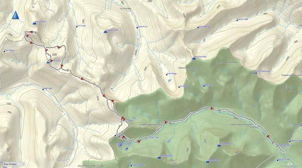
To get to our starting point, we drove to the Red Rock Canyon parking lot where we accessed the Snowshoe trail. From the trailhead we biked for ~8.5 km (1 hour; 287 m elevation gain) until we reached the end of Snowshoe and the start of the Twin Lakes trailhead. From here, we hiked for 3 km (220 m elevation gain) until we reached the trailhead for Sage Pass. We then turned onto Sage Pass trail and followed it for 1.4 km (160 m elevation gain) until we arrived on Sage Pass.
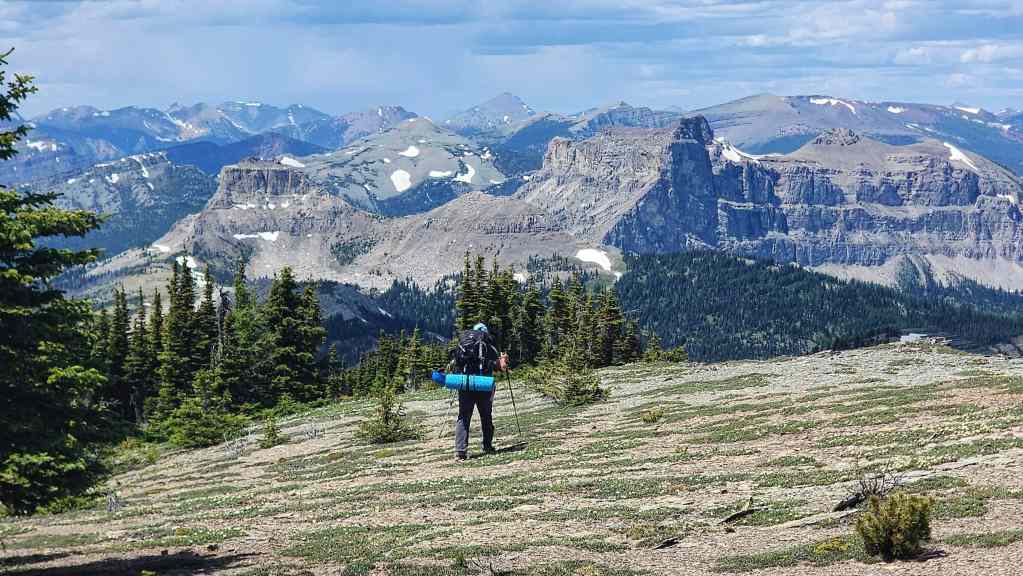
Instead of following the Great Divide Trail (GDT) north from the Pass, we headed to climber’s right and up and along the gentle ridge towards “Sage Pass Peak”. By following the mostly open slopes for ~920 m (160 m elevation gain), we soon arrived on the summit and were surprised by how good the views were. For reference, it took us 3 hours and 20 minutes and ~13.8 km (837 m elevation gain) from Red Rock Canyon to reach the summit.
From the summit of “Sage Pass Peak” we descended ~530 m (76 m elevation loss) to the col with “Sage Senior” where we joined the GDT. We followed the GDT up and along the ridge towards “Sage Senior” for about 690 m before leaving it to regain the ridge proper. We then followed the ridge for another ~600 m to the summit. In total, from the summit of “Sage Pass Peak”, it took us 1 hour to cover the ~1.9 km (224 elevation gain) distance to the summit of “Sage Senior”.
After a quick lunch on the summit, we set off toward toward Font Mountain. An easy downhill hike for ~500 m (74 m elevation loss) brought us back to the GDT which we then followed for ~2.5 km until it began to trend to climber’s right around a large high point shortly before Font. In hindsight, perhaps we should have left the GDT and followed the ridge, but we continued along the trail for another ~1 km; leaving it to regain the ridge on the other side of the high point when it began to descend toward Font Creek. In reality, we only had to regain ~270 m (50 m elevation gain) to reach the ridge, so it wasn’t a big deal.
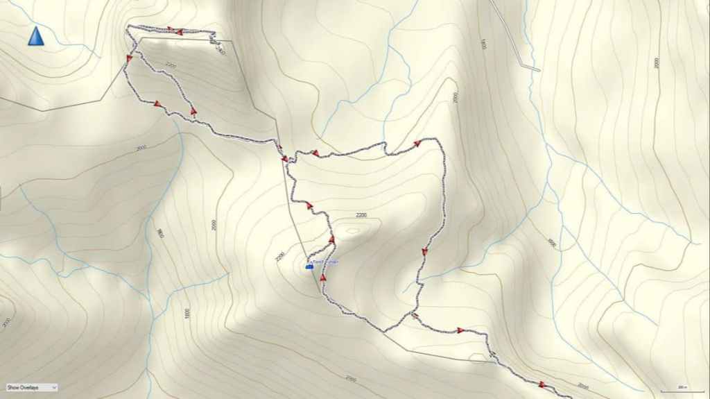
Once back on the ridge, Font was directly in front of us and a further ~550 m of hiking brought to the base of the summit. Following Andy’s route, we traversed to climber’s right for ~400 m until we gained the col with its subpeak. From the col to the summit, it was a ~280 m scramble (94 m elevation gain) to reach the summit. For reference, from the summit of “Sage Senior” it took us 2 hours and 45 minutes over ~5.5 km (315 m elevation gain; 384 m elevation loss) to reach the summit of Font (6 hours and 45 minutes from the Red Rock Parking lot). Once back on the col, we descended Font’s north side for ~870 m (200 m elevation loss) to reach our campsite.
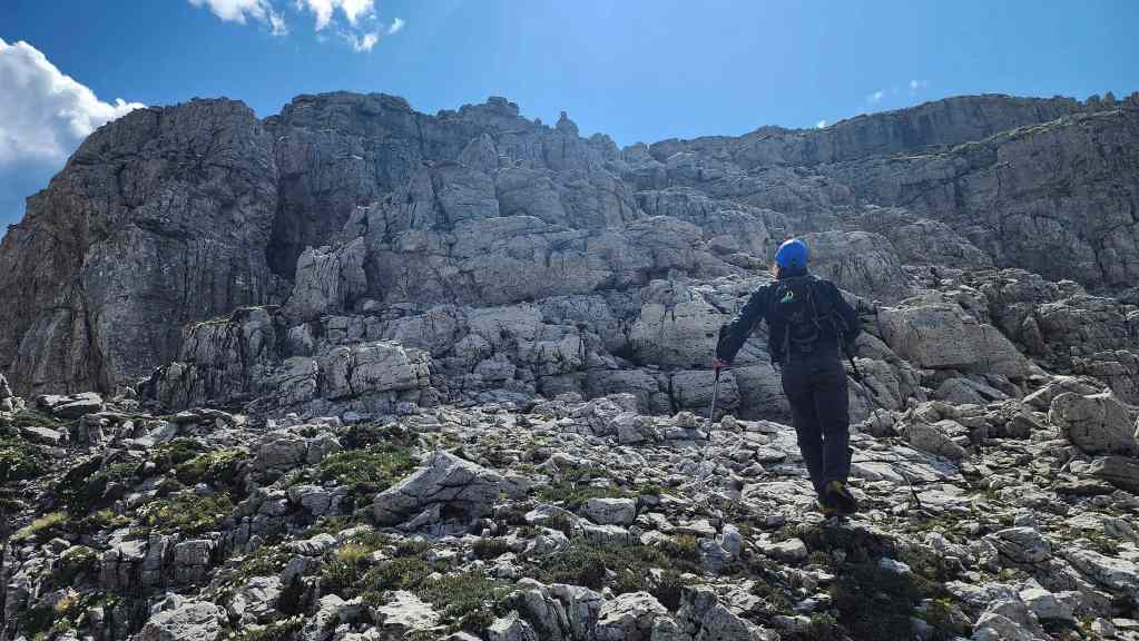
The following day, we left our campsite and followed the GDT for ~870 m towards Matkin, until we came to a large open slope. As this was the closest the GDT came to the mountain, we decided to make a traverse to gain elevation until we joined Cornelius’ scramble route around the west side of the mountain. From the trail to the west end beneath the cliffs, it was a ~760 m traverse / scramble (210 m elevation gain).
Once on route, we picked our way around the base of the west-facing cliffs for ~200 m until we rounded the corner and could look east and up the entire drainage. Staying high to not lose elevation, we traversed for ~640 m (121 m elevation gain) until we were directly beneath the summit. A ~170 m scramble (58 m elevation gain) over loose rubble and boulders, brought us onto the summit. For reference, from our campsite to the summit it took us 1 hour and 45 minutes over 2.6 km (444 m elevation gain).
After enjoying the views, we returned the way we came, save for a more direct descent route back to the GDT. Once back at camp, we gathered our packs and set off on the GDT towards Sage Pass. The GDT skirts the east side of Font and as it descends, the trail forks, with the right fork being the GDT and the left fork continuing into the valley. Making a mistake here would be costly.
After hiking for 1 hour over a distance of ~2.7 km (180 m elevation gain; 130 m elevation loss), we arrived at the spot where we had left the trail to summit Font. We then followed the GDT trail all the way back to Sage Pass, bypassing both “Sage Senior” and “Sage Pass Peak”. For reference, it took us 3 hours and 20 minutes to cover the ~9.1 km (505 m elevation gain; 417 elevation loss) distance from our campsite to Sage Pass.
Once on Sage Pass, we descended the ~1.4 km to Twin Lakes trail, and from there, hiked for another ~3 km back to our bikes at the trailhead. Finally, we rode our bikes for ~8.5 km back to the Red Rock Canyon parking lot. For reference, from our campsite to the Red Rock parking lot, it was a total distance of ~22 km (581 m elevation gain; 1092 m elevation loss) that we covered in 5 hours and 10 minutes.
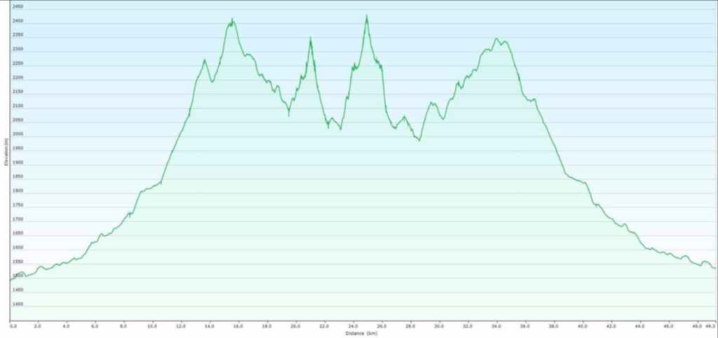
Our total distance travelled over the two-day adventure came in at ~51 km with a total elevation gain of 2605 m. For reference, from the summit of “Sage Senior” it took us 2 hours and 45 minutes over ~5.5 km (315 m elevation gain; 384 m elevation loss) to reach the summit of Font (6 hours and 45 minutes from the Red Rock Parking lot).
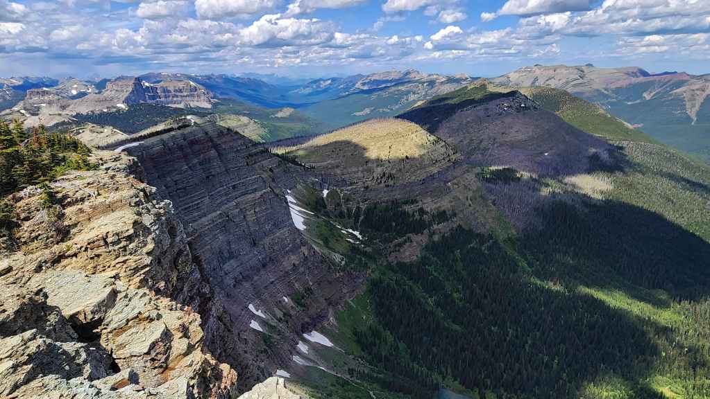
Leaving the summit of “Sage Senior” for Font Mountain (left) and Mount Matkin (right).
The impressive cliffs between “Sage Senior” and Sage Mountain (right).
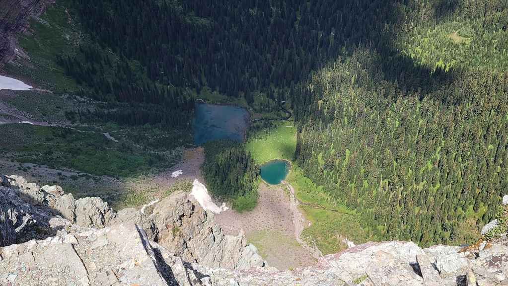
A small tarn sits at the base of “Sage Senior”
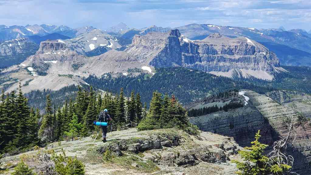
The ridge offers some grand views
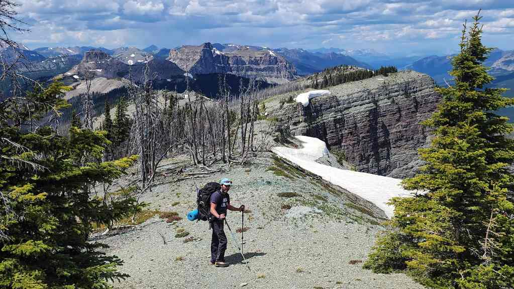
Back on the GDT.
The view back to “Sage Senior” from the GDT.
Getting closer but still a ways to go!
A big sky pano.

We’ll come back for Sage Mountain at a later date.

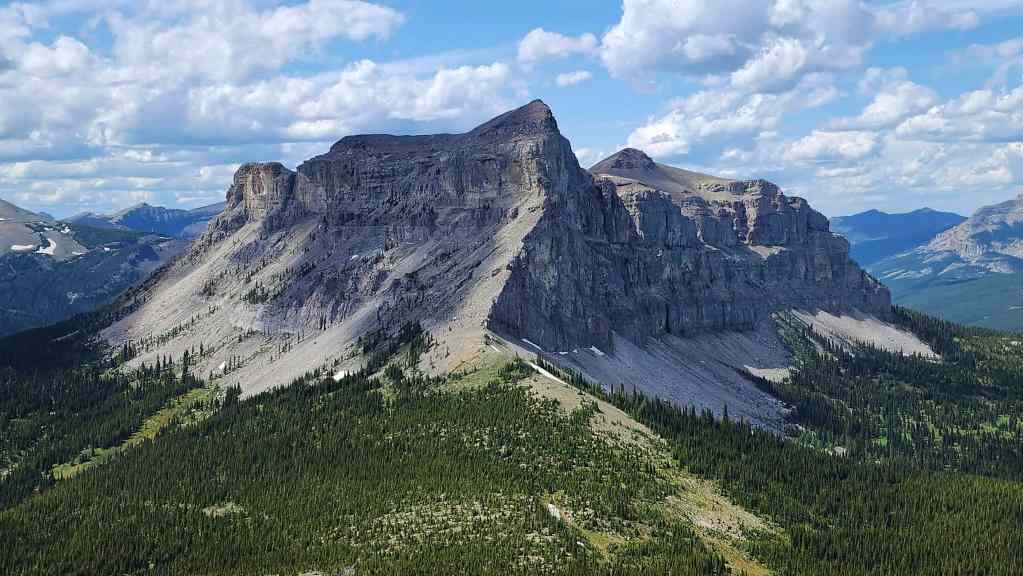
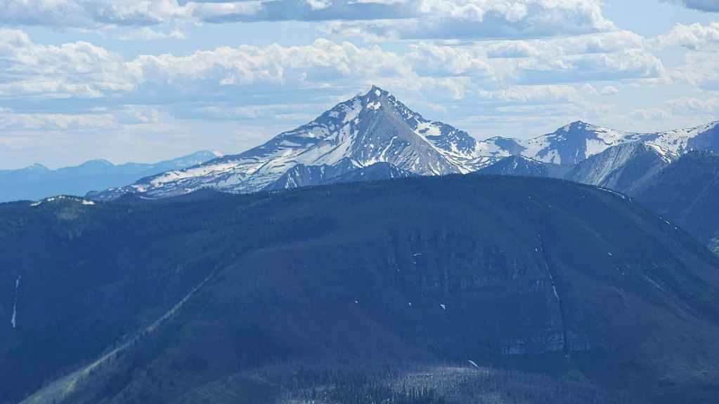
A good view of Castle Peak (centre) and Windsor Mountain (right).

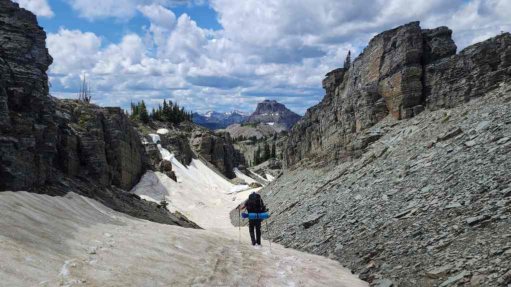
Shortly before Font, the GDT runs through a canyon-like depression along the ridge. (Photo by Brad Wolcott)

My view back as we enter this interesting feature.
Inside the formation with the summit of Font in the centre.
Brad’s view back to me. (Photo by Brad Wolcott)

Rippled rock along with some huge chunks of snow that had broken loose from above.

The view back and along the canyon-like depression.
In hindsight, perhaps we should have left the GDT and stayed on the ridge at the next high point (left); however, by following the trail a little further, we didn’t lose much distance and we may have even saved some elevation.

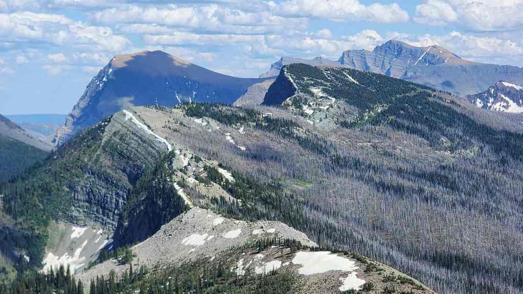
The GDT will keep to the right of the high point in the centre.

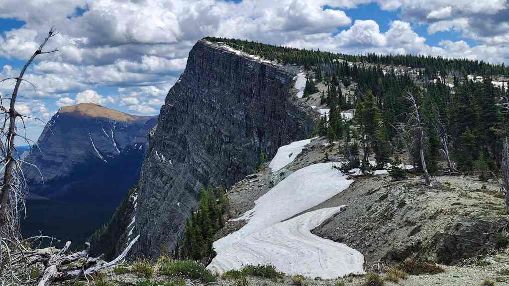
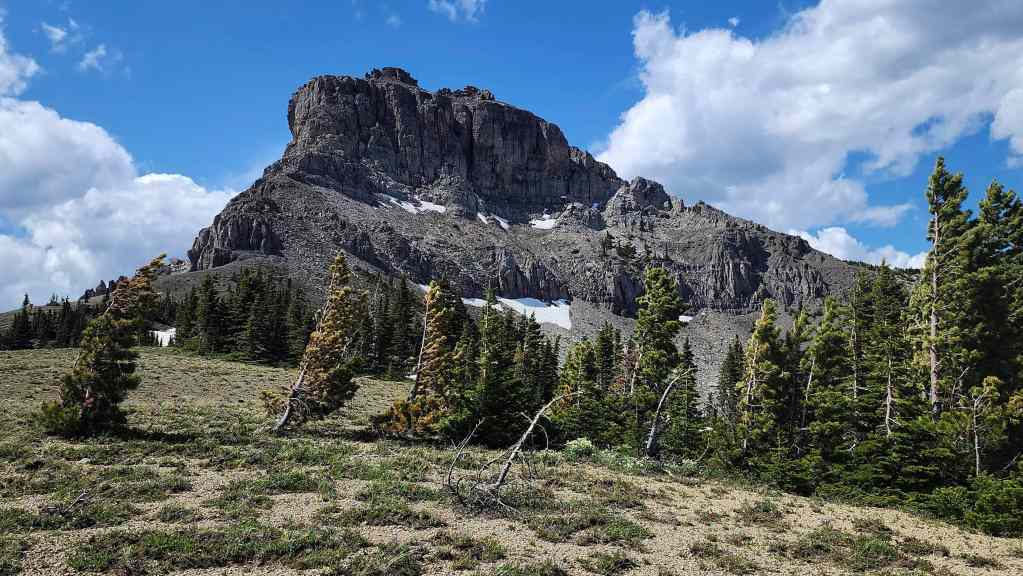
A really good look at Font Mountain with the small font-like rock feature clearly visible at the base on the far left.
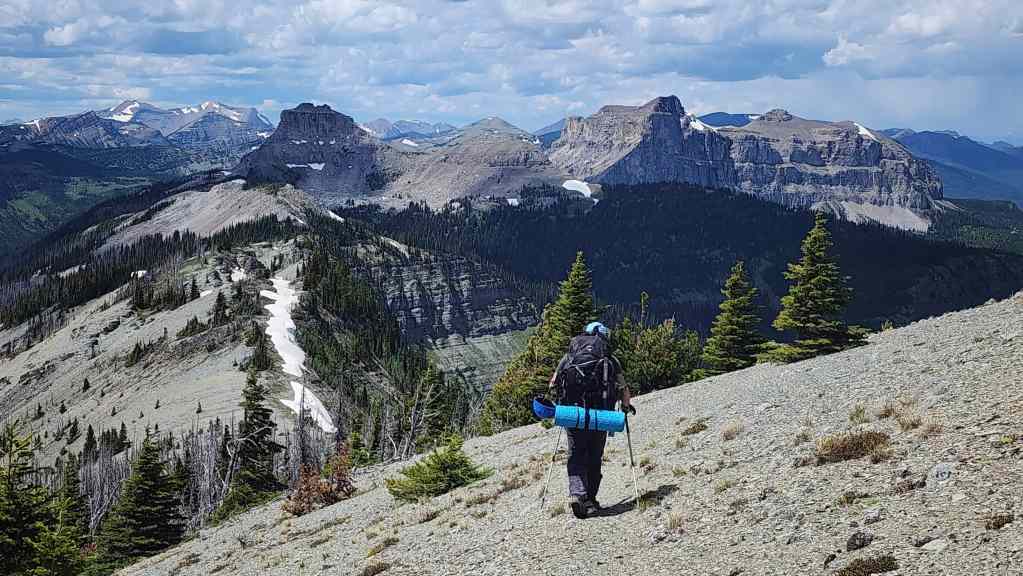
Another view back and along the ridge.
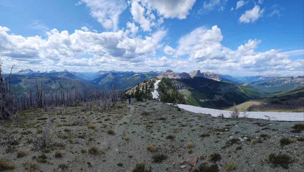
Bypassing the high point by following the trail…
And then leaving the GDT when it begins to lose elevation when it drops to Font Creek. From here it will only be a short hike to regain the ridge.

Back on the ridge.
Closing in on the base of Font.

Looking back at the high point we avoided. Yup, I definitely think we saved some elevation.

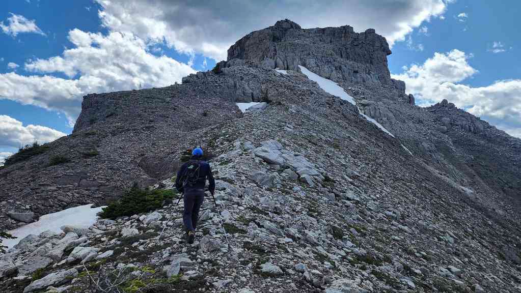
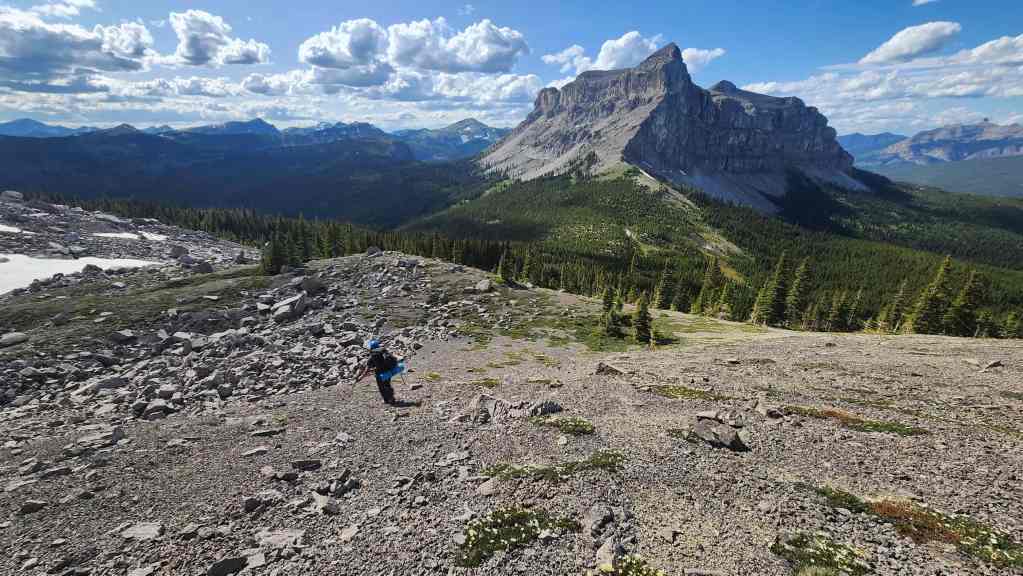
Font’s not far away now.
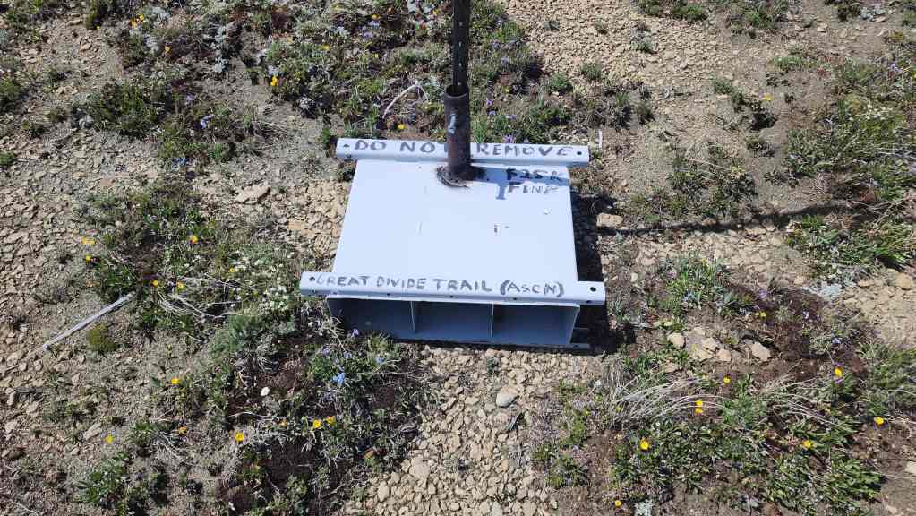
A GDT trail marker – with an ominous warning – sits far away from the actual trail.
Approaching the font-like rock feature.
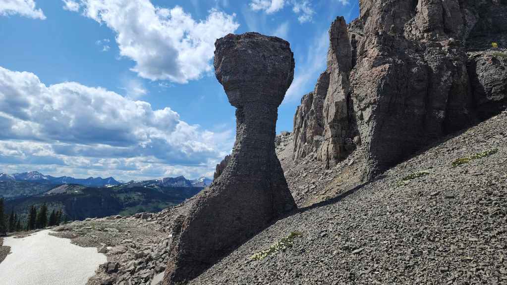
This might be the origin of the mountain’s name.

From the font-like rock, we’ll follow Andy’s example and traverse over to the col (centre).

Looking back as we make our traverse.
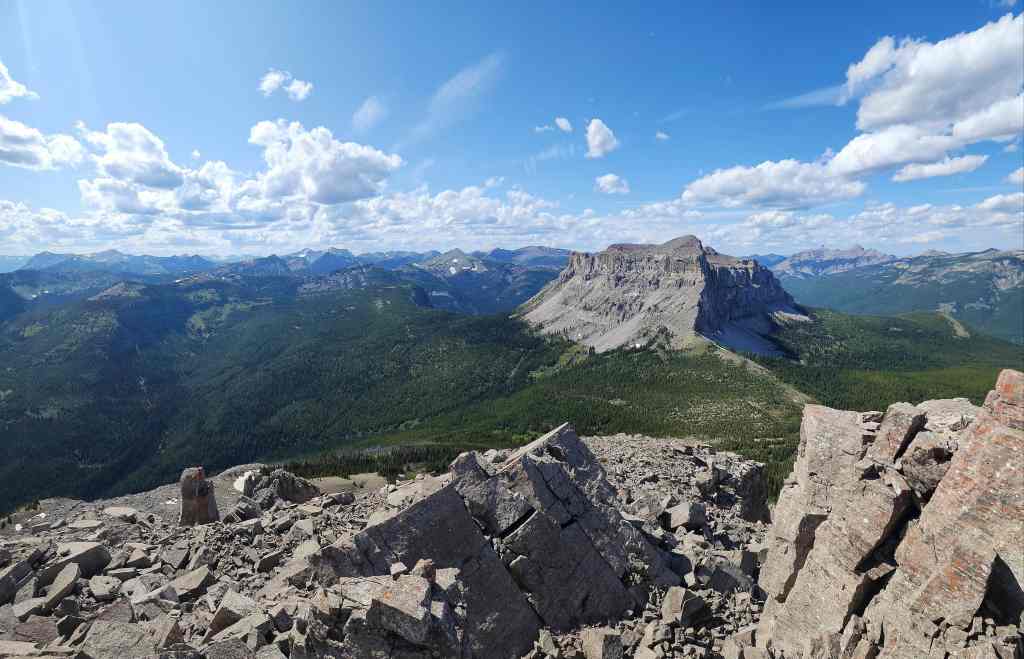
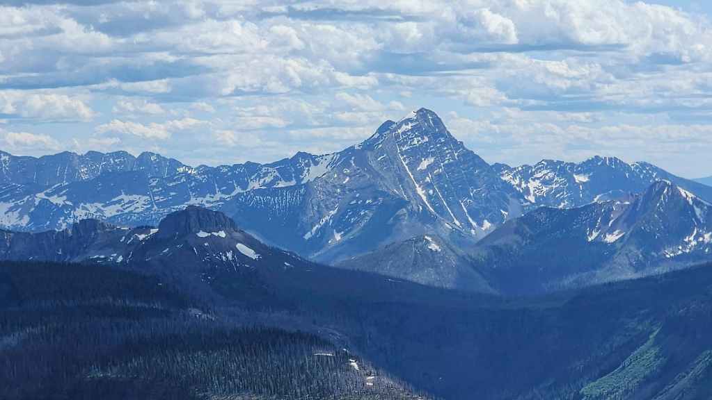
On the col and admiring the impressive view of Mount Matkin.
Leaving our packs at the col, we head up to the summit.
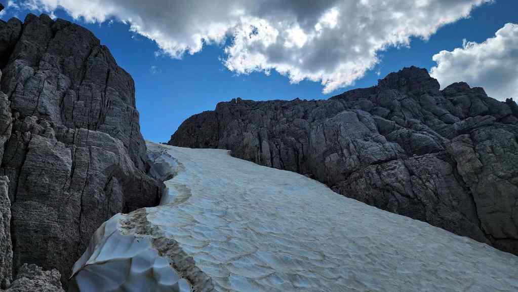
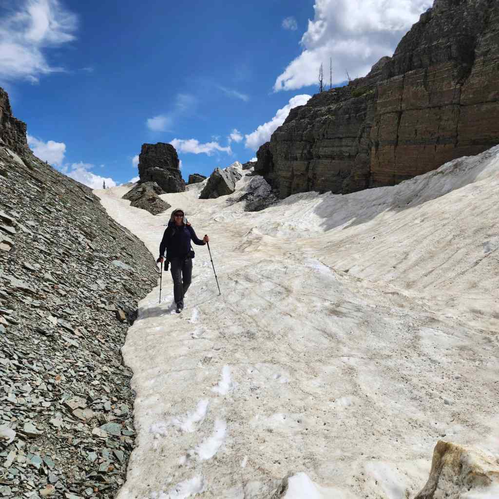
We came to a deep – and steep – snow slope that extended further down the mountain. We either had to cross it or ascend it…
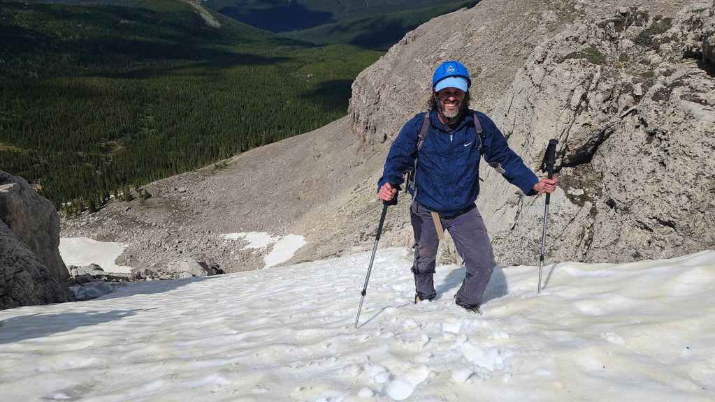
Thankfully, the snow was in perfect condition to ascend. Of course, we’d left our ice axes back in the col. Doh!
Looking back to the col from above the snow patch.
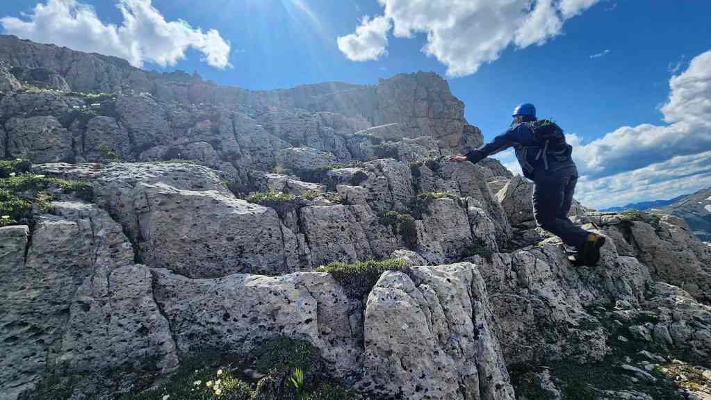
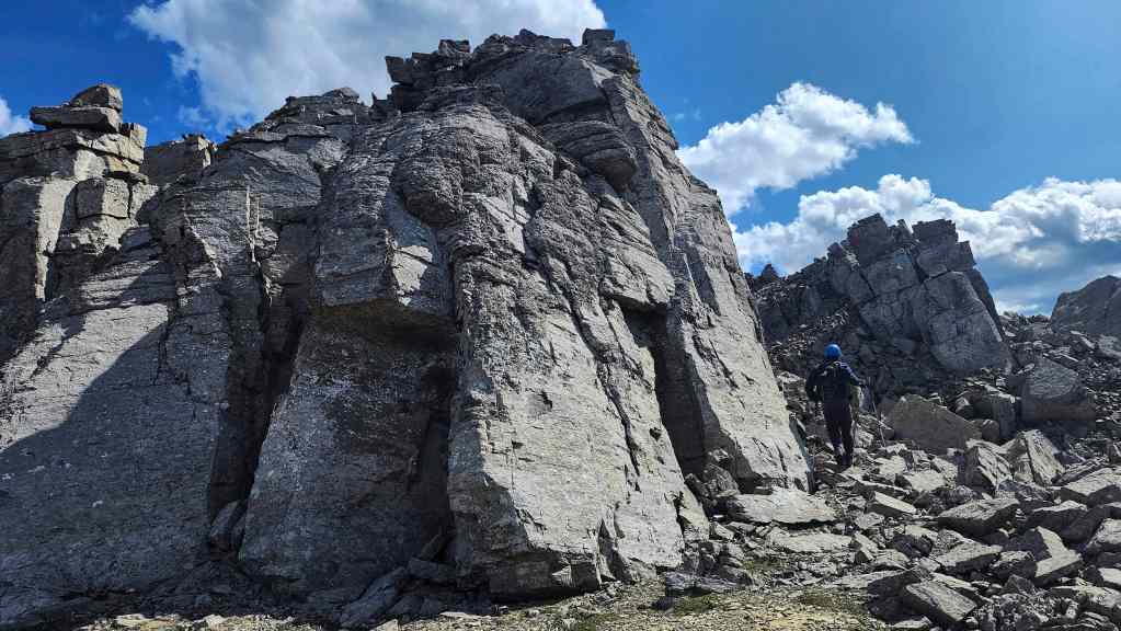
Brad scrambles up a short section of rock.
Approaching another section to scramble. Nothing on our trip to the summit was difficult, but we did have to be aware of loose rocks.
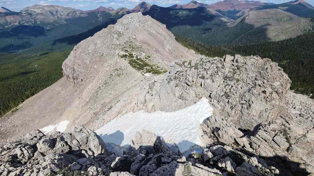
The summit (far right) is now directly in front of Brad.
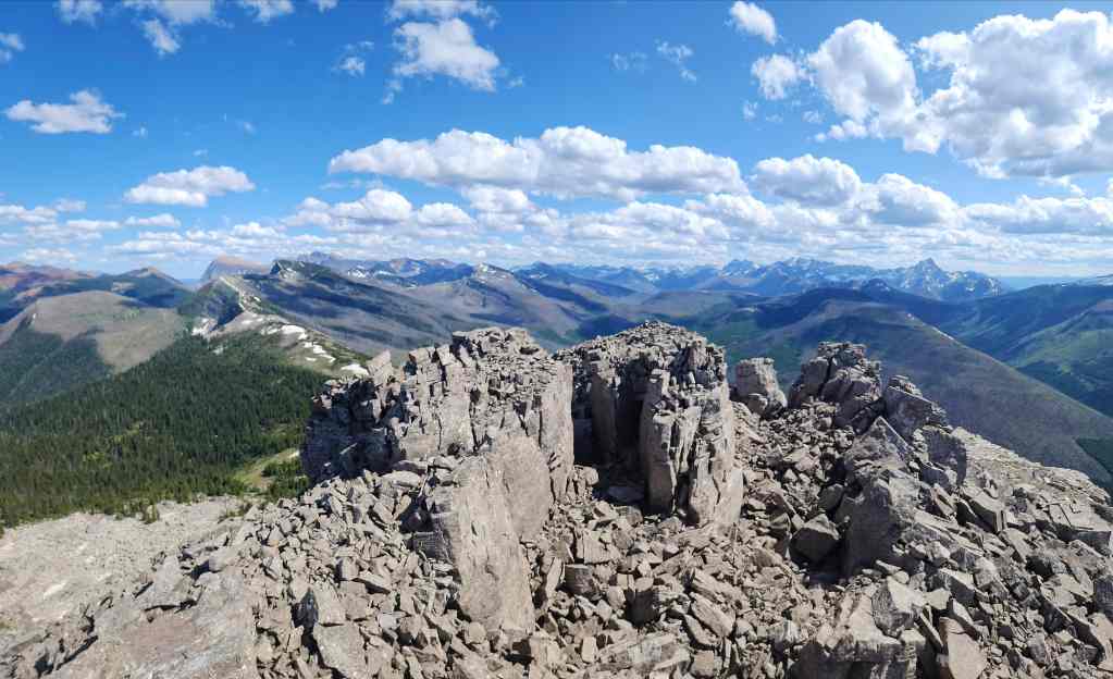
On the summit of Font Mountain (2353 m) and looking to the southeast.

A pano to the southwest…
Then one to the west.
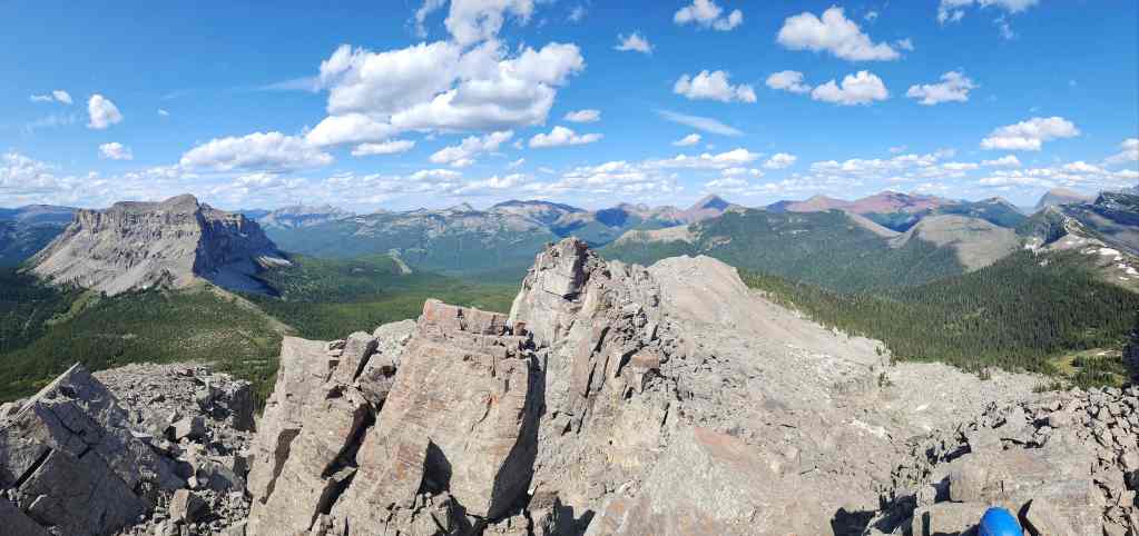
Finally, a pano to the north.

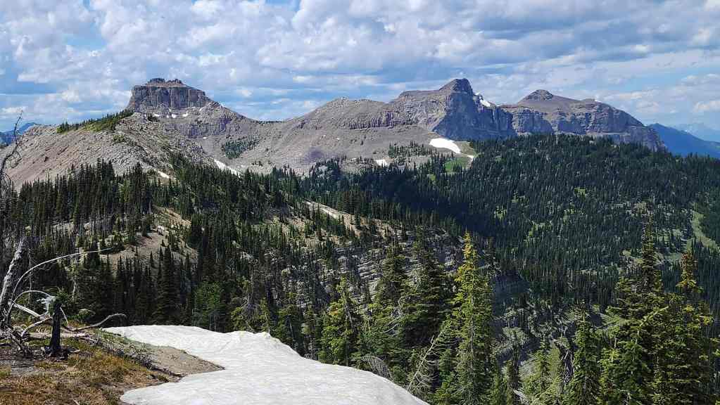
Tomorrow’s objective: Mount Matkin.
Gazing over to Jutland Mountain.

We’ll have to get to La Coulotte Ridge (right) in the near future.
The view towards Kenow Mountain.
Now looking at Starvation Peak (right).
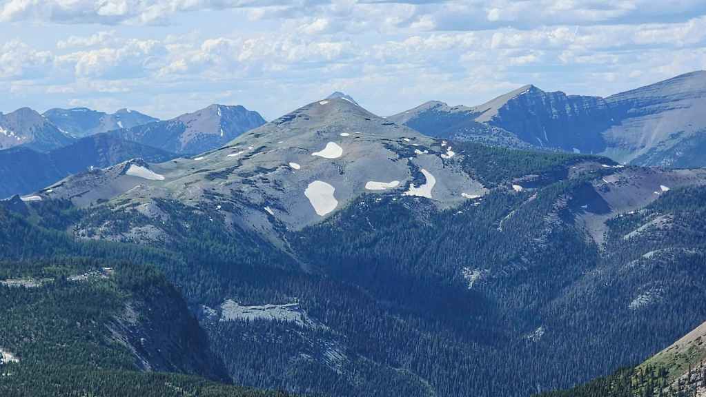
A good view of our approach that includes Anderson Peak (left), “Sage Senior” (right), and Piinaquiium / Ahkoinimahstakoo (Mount Blakiston) (far right).

A closer look at Avion Ridge (centre).

Some red argillite beauties: Spionkop Ridge (left), Newman Peak (right of centre), and “Newman Senior” (right).

The summit of Sage Mountain (foreground right) and Loaf Mountain (centre).

A nice view over to Drywood Mountain (right ) that also includes the Southwest Summit of Drywood (centre), and “Little Bo-Peak” (left of centre foreground).
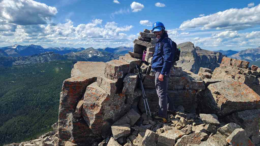
The first of our two primary objectives complete!

Descending from the summit.

Font’s outlier and the col.

Descending the snow slope.

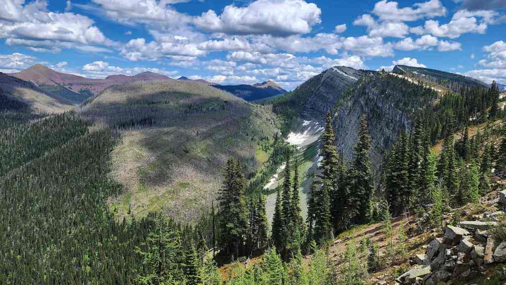
Heading down from the col towards Matkin.
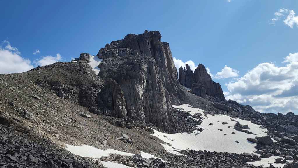
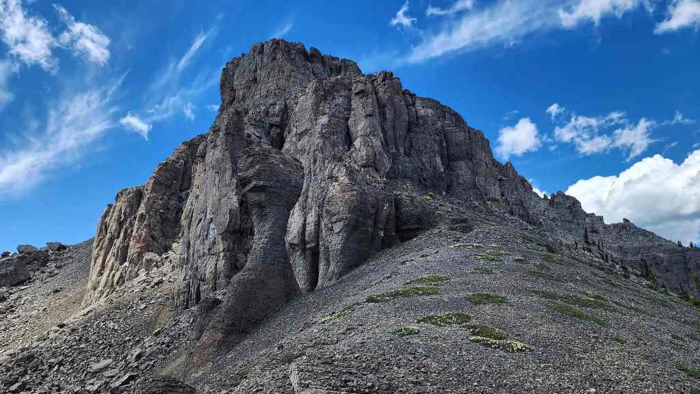
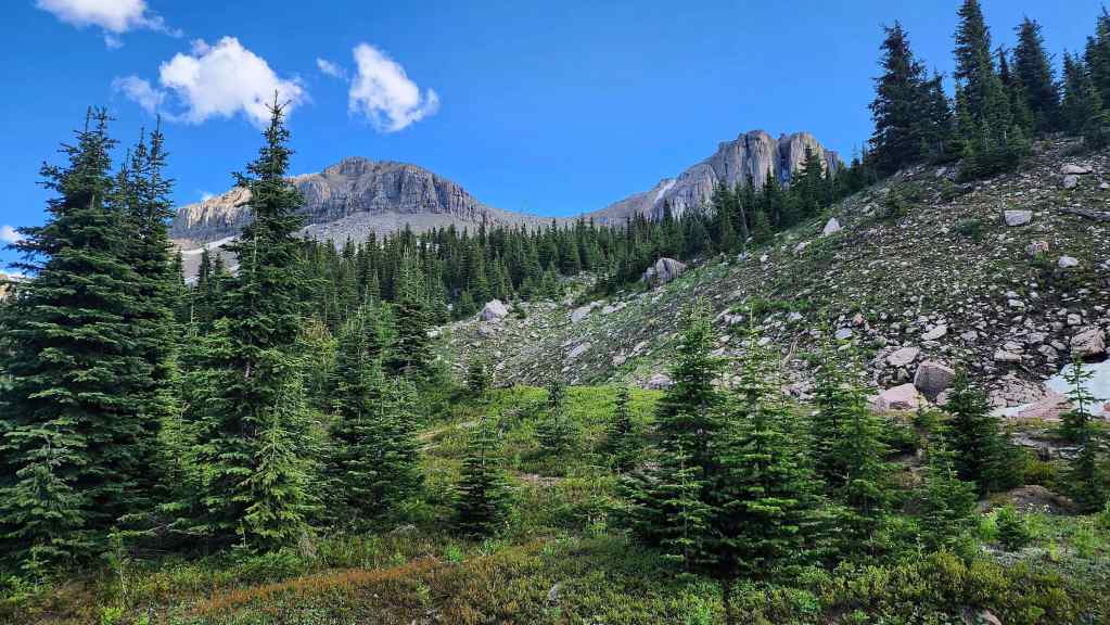
Font has numerous unique rock formations.
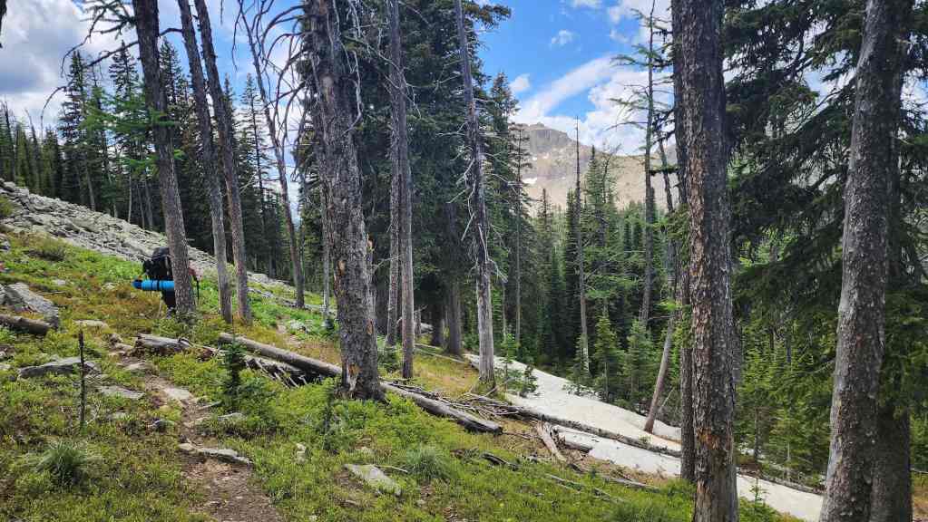
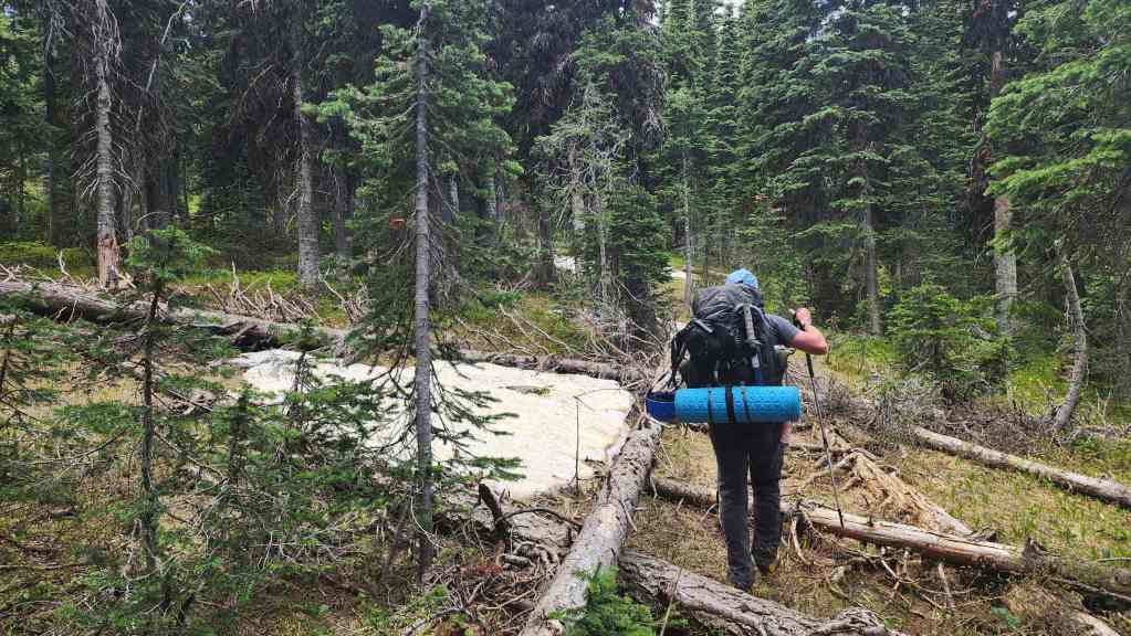
Brad begins searching for water.
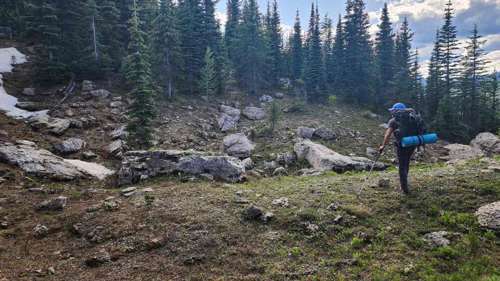
Following another small drainage in search of water.
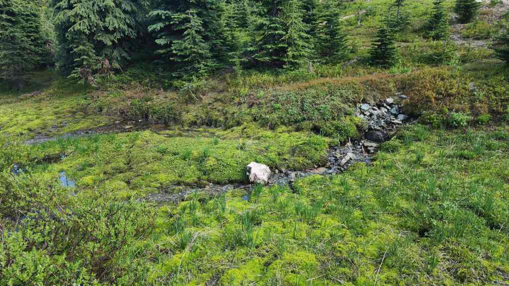
Finally, by trending to the north side of the mountain, we came to this amazing brook bubbling out of the ground.
It was also the perfect place to camp!

We didn’t know it until after we’d returned, but this is where Vern also camped. (Photo by Brad Wolcott)
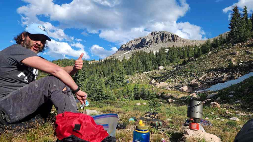
Suppertime!
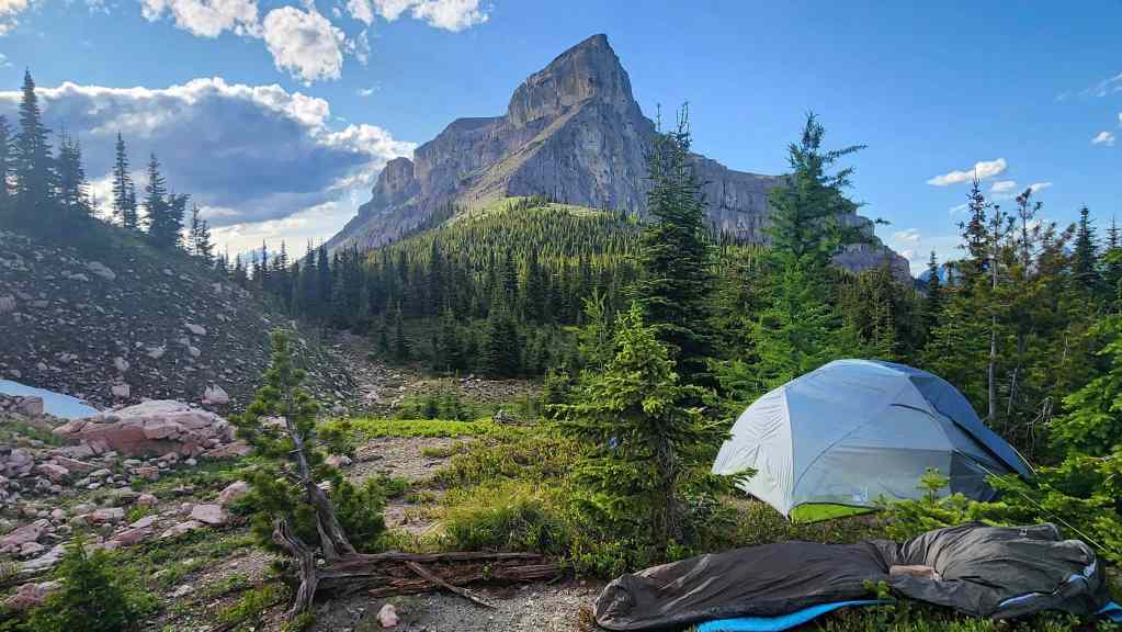
Mount Matkin provides a majestic backdrop. How Brad is able to sleep in a bivy sack and not wig-out from claustrophobia is beyond me.

The real reason we brought our ice axes!
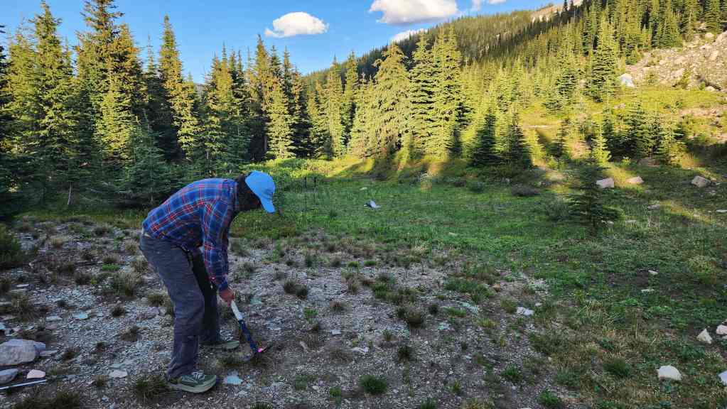
Brad tees off at the fourth hole.
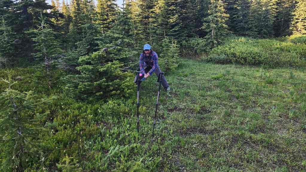
He needed to hit the pole to force a tiebreaker – and he did! However, I would ultimately triumph.
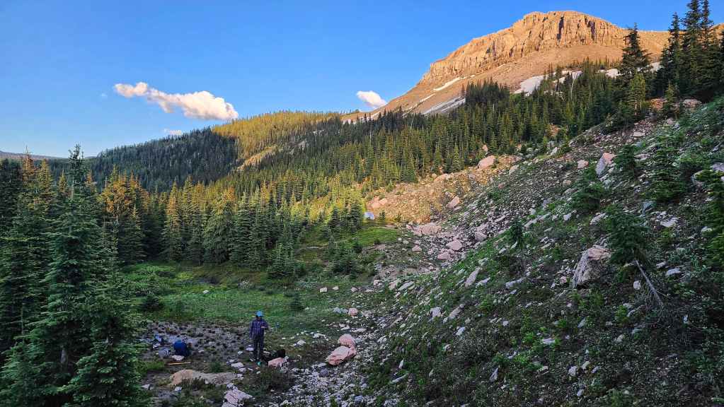
An overview of our campsite. Click to follow us to Mount Matkin.