

⚠️ Hiking and scrambling are inherently dangerous activities. Please read my Disclaimer. ⚠️
After enjoying our ascent along the south ridge, it was time to leave “Kootenai Brown Peak” and head over to Lost Mountain. As mentioned before, my Anderson Peak trip was done under horrible conditions with no thought of even trying to tag Lost. Our priority was simply to get off the mountain and away from the blizzard that was ravaging its upper slopes.
Lost is another one of those peaks that highlight the randomness of mountain names. Why it has an official name but “Kootenai” does not, or why other high points on ridges are named and even higher ones on the same ridge aren’t, has always baffled me. Moreover, if a high point is going to have an official name and others aren’t, at least choose one that isn’t as generic as Lost Mountain. That’s like naming a mountain, ‘Dave’. 😂
Anyway, Lost was the second peak on our loop and it was great to finally stand on its summit after being so close in 2020. It was also great to be able to descend directly from the summit and into the bowl we started from in less than 30 minutes. In another 40 minutes we would be back on the trail and making the easy hike back. I wish all descents could be that straightforward. 😁

To get to “Kootenai Brown Peak” and Lost Mountain, we drove to the Red Rock Canyon parking lot where the Blakiston Valley trail begins. From the trailhead, we hiked for ~6.3 km before leaving the trail and heading towards the bowl between Lost and “Kootenai”.
After ~550 m of hiking we reached our first obstacle: a prominent limestone band. Fortunately, there were several weaknesses to exploit and it didn’t take us long to get past it. From the top of the band, we enjoyed a pleasant ~730 m hike through the trees until we were at the entrance to the bowl.
From here, we chose to scramble an obvious couloir on the east side of “Kootenai’s” south ridge. It looked gnarly from a distance but it laid back nicely once we were beneath it. A quick scramble brought us onto the start of the south ridge, which we then followed for ~800 m until we arrived on the high point just prior to the summit of “Kootenai”. Another ~420 m of hiking brought us to the summit. For reference, it took us 4.5 hours from the trailhead with a total elevation gain of 1068 m.
After enjoying the views, we then set off for Lost. It was a ~700 m (163 m elevation loss) to reach the col plus another ~833 m (182 m elevation gain) to reach the summit. For reference it took us about an hour from summit to summit.
To descend, we then dropped down the west side of Lost until we were back in the bowl, a feat that took us only 25 minutes. From the bowl we retraced our route back to the trail (approximately 40 minutes) and then back to the trailhead.

Our total roundtrip distance was 21 km with a total elevation gain of 1319 m. Our total roundtrip time came in at 8 hours and 24 minutes.

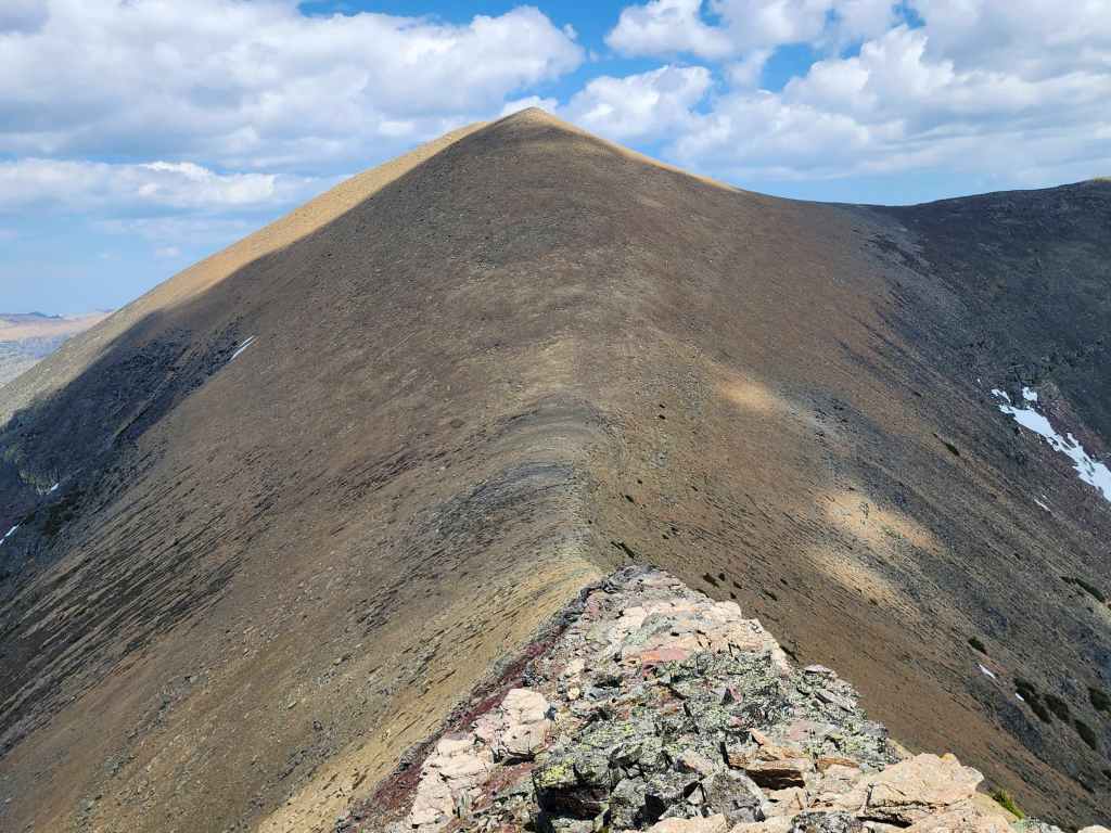
After enjoying the views on top of “Kootenai Brown” it was time to head towaards Lost Mountain.

It’s a ~700 m (163 m elevation loss) hike to reach the col plus another ~833 m (182 m elevation gain) to reach the summit of Lost. For reference it took us about an hour to go from summit to summit.

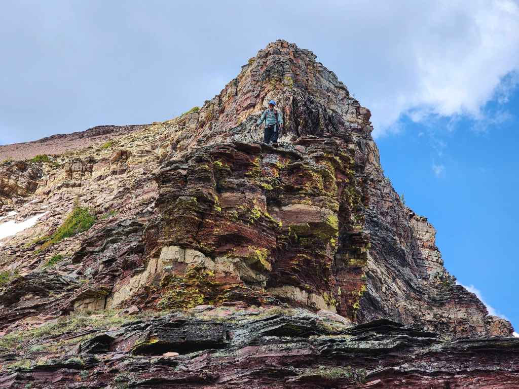
The rock beneath the summit of “Kootenai” is super colourful.

Heading down. (Photo by Andrew Nugara)
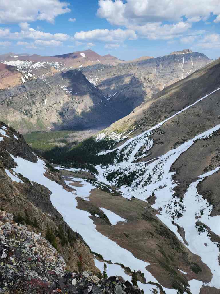
Looking into the valley on the opposite side of the ridge.

Andrew (centre) admires the impressive northwest face of Lost.

Red argillite and lichen. Still my favourite recipe for mountain scenery.
Andrew in his natural argillite environment. 😂

Getting closer to the col. (Photo by Andrew Nugara)
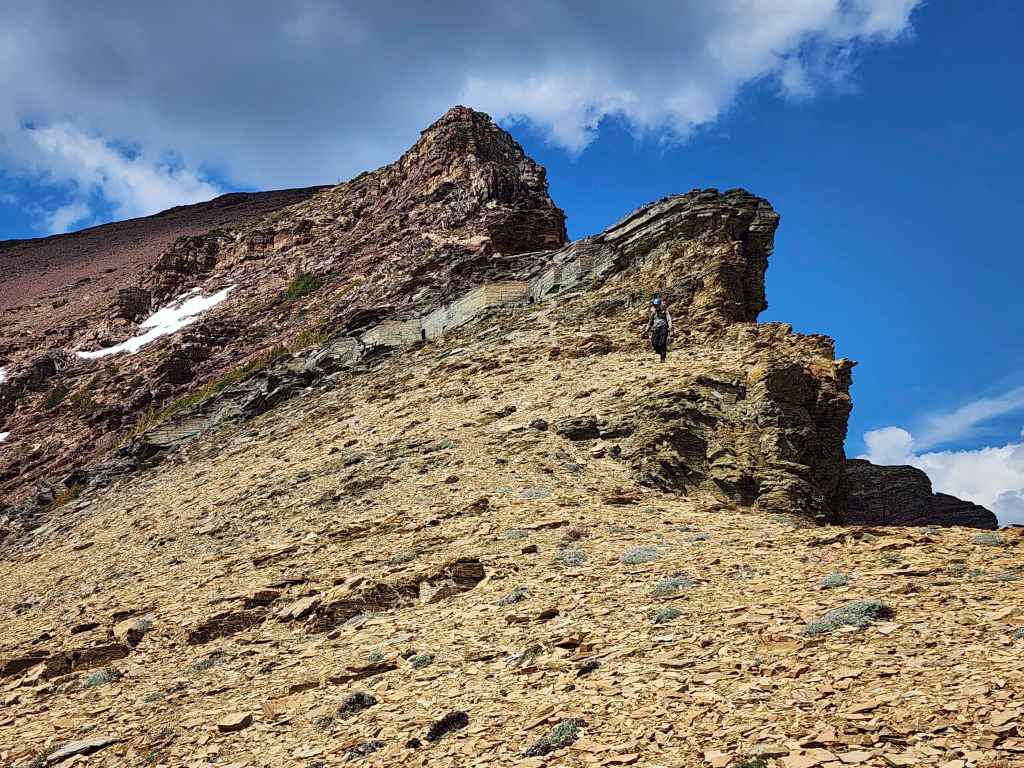
Looking back at some colourful steps.

From the col it will be a 182 m elevation gain over ~833 m to reach the summit.

Glancing back.

The scree will soon turn into rubble and small rock bands.

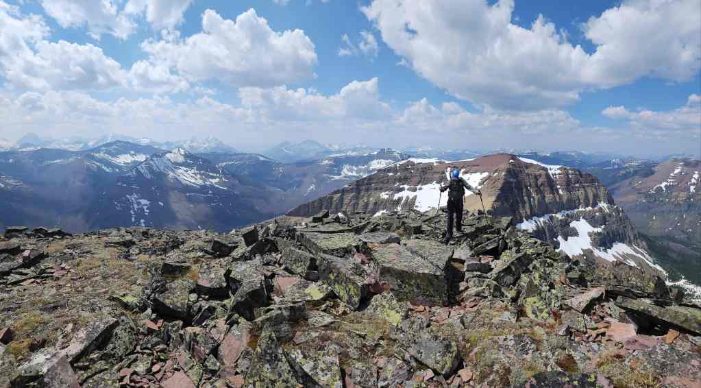
Another look back at the summit of “Kootenai” and the high point (centre) at the top of the south ridge.

An interesting argillite formation…

That we could walk right up the centre of.

Almost there…

The summit of Lost Mountain (2509 m).

A pano to the east…

And then to the southeast.

Looking south…
Then west…

And finally to the north.
A closer look at Anderson Peak.

Gazing over and back to “Kootenai Brown Peak”.

Looking past “Kootenai” to Kishinena Peak (centre).

Lone Mountain in the foreground with King Edward Peak and Starvation Peak in the background.

Miskwasini Peak on the left and Kenow Mountain in the centre.

A good view of Castle Peak and Windsor Mountain.

“Newman Senior” or should I say, “Newman ‘C’enior”? 😂

Spionkop Ridge (left) and Loaf Mountain.

Gazing over to Mount Hawkins.

Mount Lineham poking over the ridge.

One last look at “Kootenai”.

The cairn held one of Ephraim’s signature registers. 😂

Andrew on the summit.

After bypassing Lost due to blizzard-like conditions on Anderson in 2020, it felt good to finally stand on the summit. 😊 (Photo by Andrew Nugara)

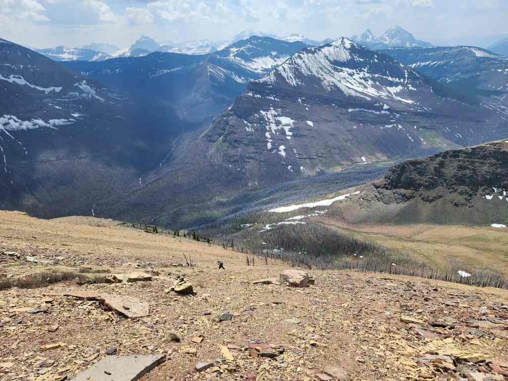
We will descend directly into the bowl we started from.
It was quick while the scree lasted…

But things slowed down once we were in the trees.

A small rock band was the only obstacle we faced.

Good snow for descending.

Andrew’s view back to me. (Photo by Andrew Nugara)
Almost at the bottom.

Arriving back where we started. It only took us 25 minutes to reach this point from the summit.

Retracing our route back.

One last look at the summit of “Kootenai Brown”…

And then one back up to Lost.

Getting close to the limestone band…

Which presented no problem to get through.

It was a clear route to the trail (centre) from here.

The lower we went, the hotter it became.

Looking back at the limestone band.
Glad to be back on the trail! We thought the temperature on the mountain was hot, but it was downright oppressive at trail level.

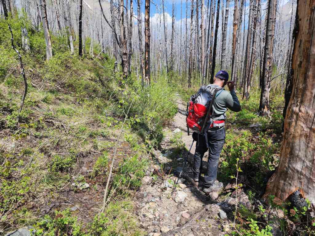
Making the ~6.3 km hike back under sweltering conditions.

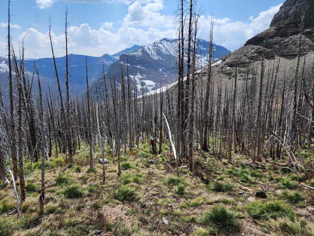
Another look at the new growth emerging after the 2017 Kenow wildfire.

Outside of the section near Blakiston Falls, we didn’t see any other hikers on the trail.
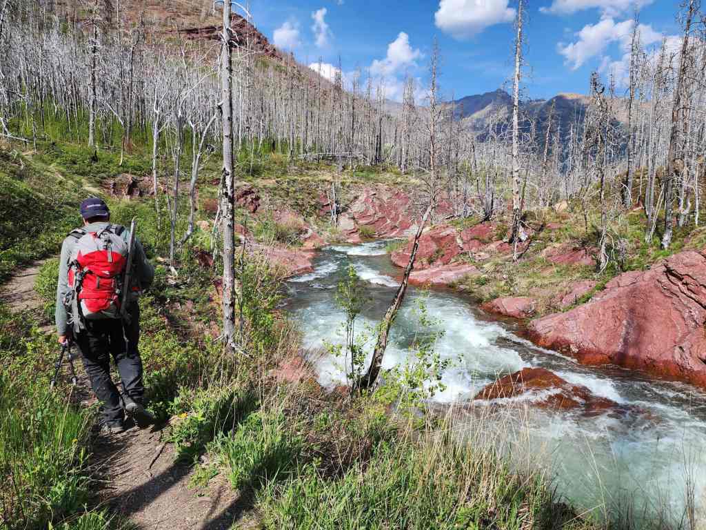
Gorgeous red argillite alongside Blakiston Creek.

Andrew’s photo from the same location.

Nearing the trailhead and the long weekend crowds enjoying Red Rock Canyon.

Arriving back at my truck 8 hours and 24 minutes and 21 km after starting. Now that Lost and “Kootenai” are off my list, I look forward to returning for Lone Mountain, Mount Baurman, and Kishinena Peak. As always, a HUGE and MASSIVE thanks to Andrew for another fantastic day in the mountains! 😊


Leave a Reply