
⚠️ Hiking and scrambling are inherently dangerous activities. Please read my Disclaimer. ⚠️
My ascent of Anderson Peak in September 2020 was interesting to say the least. Accompanied by Brad, Dave, Keanan, and Mark, the day started out okay but soon devolved into blizzard-like conditions. The insane wind and lack of visibility meant that our summit stay lasted less than 5 minutes before we made a hasty retreat down the mountain – with no one even pausing to suggest that we should continue on towards Lost Mountain (2509 m), that under normal circumstances would be a quick trip.
Since then, I’ve wanted to go back and tag Lost along with the other two peaks on the ridge: “Kootenai Brown Peak” (2470 m) and Mount Bauerman (2409 m). I’d thought about redoing Anderson and then following the ridge as so many have done before (e.g. Vern’s report or Andrew’s report) or even just starting from Lost and going from there. At any rate, one of my goals for 2023 is to finally visit these peaks.
That brings me to this morning when Andrew and I were trying to decide on an objective while we were driving to the mountains. Not knowing the snow situation, I suggested Lost Mountain and “Kootenai Brown Peak” to which Andrew readily agreed – even though he’d done them before. However, we decided to hold off on this decision until we arrived at Red Rock Canyon and could see how much snow was in the area.
The Victoria Day weekend is infamous for bad weather and often, there’s a ton of snow on the mountains and trails near the Continental Divide. Yet, that was far from reality today. We were shocked to see that most of the mountains were free from snow and to top it off, the forecast called for temperatures near 30 C. Yikes! This is not good this early in the year. 😳
Making the decision to head to Lost, I felt bad that Andrew would be doing a repeat, so I suggested we look for a new route. That’s when Andrew proposed a loop using the south ridge of “Kootenai” for ascent before heading over to Lost. From there, we could descend to the intervening bowl and follow our route back to the trail. This sounded like a great plan to me – and it was!
The route worked perfectly and we thoroughly enjoyed the entrance to the bowl between “Kootenai” and Lost, where a series of waterfalls hurried through a meadow of glacier lilies. The fresh water also proved invaluable as we could replenish our supply before venturing onto the ridge where the heat was stifling, making it feel like it was July or August and not the middle of May.
I doubt many – or for that matter, any hikers will be interested in this route as it doesn’t make sense to piecemeal the ridge when you could do it all in one trip. However, it was the ideal choice for today and it allowed me to cross two of the three peaks off my list. Now I just have to visit Bauerman, which Andrew suggests that I approach from the Snowshoe Trail using my bike. This will save energy and also allow me to tackle Kishinena Peak at the same time. That sounds good to me! EDIT: Done and done! 😀
Be sure to read Andrew’s awesome trip report!

To get to “Kootenai Brown Peak” and Lost Mountain, we drove to the Red Rock Canyon parking lot where the Blakiston Valley trail begins. From the trailhead, we hiked for ~6.3 km before leaving the trail and heading towards the bowl between Lost and “Kootenai”.
After ~550 m of hiking we reached our first obstacle: a prominent limestone band. Fortunately, there were several weaknesses to exploit and it didn’t take us long to get past it. From the top of the band, we enjoyed a pleasant ~730 m hike through the trees until we were at the entrance to the bowl.
From here, we chose to scramble an obvious couloir on the east side of “Kootenai’s” south ridge. It looked gnarly from a distance but it laid back nicely once we were beneath it. A quick scramble brought us onto the start of the south ridge, which we then followed for ~800 m until we arrived on the high point just prior to the summit of “Kootenai”. Another ~420 m of hiking brought us to the summit. For reference, it took us 4.5 hours from the trailhead with a total elevation gain of 1068 m.
After enjoying the views, we then set off for Lost. It was a ~700 m (163 m elevation loss) to reach the col plus another ~833 m (182 m elevation gain) to reach the summit. For reference it took us about an hour from summit to summit.
To descend, we then dropped down the west side of Lost until we were back in the bowl, a feat that took us only 25 minutes. From the bowl we retraced our route back to the trail (approximately 40 minutes) and then back to the trailhead.

Our total roundtrip distance was 21 km with a total elevation gain of 1319 m. Our total roundtrip time came in at 8 hours and 24 minutes.

Before I go any further, I want to introduce our new granddaughter, Elliott, who like her big cousin, Oliver, is a scrambler in the making. 😁 I really hope that one day I can stand on some summits with these two. Granted, they will probably have to carry me, but I’m good with that. 😂

Starting off at the Blakiston Valley trailhead.

The weather was unusually hot for May with a forecasted high of 30 C. Thankfully, the smoke from the fires in northern Alberta had subsided, but it was still hazy.

Looking off to our right at Andrew’s alternate route up Anderson Peak.

Andrew stops to photograph a scenic waterfall on Blakiston Creek…

And here’s the photo he took! 😊 (Photo by Andrew Nugara)

Approximately 4.7 km from the trailhead, we came to the start of the usual route up Anderson Peak and Lost Mountain (centre). Be aware that everything is foreshortened from the trail.

The trail was hot and dusty but there was significant new growth in the aftermath of the Kenow wildfire in 2017.

Lone Mountain (left) comes into view.

Approximately 5.6 km from the trailhead we came to a clearing on the south side of Lost. We debated using this gully for ascent, but decided to continue further along the trail until we could see a way to access the bowl between Lost and “Kootenai Brown”.

Lone Mountain looked tempting to me, but Andrew warned that it’s a much longer trip than it appears.

Approximately 6.3 km from the trailhead and 1.5 hours of hiking, we came to the point where we could see the bowl (centre) between both peaks. This is where we left the trail.

A patch of arnica soaks up the sun.

Following a gully through the forest. (Photo by Andrew Nugara)

Standing on the head of an Uruk-hai. 😂 (Photo by Andrew Nugara)

Heading towards the limestone band that guards the entrance to the bowl. (Photo by Andrew Nugara)

Looking back at Andrew with Lone Mountain in the background.

We instinctively headed towards what looked to be, a scenic waterfall.

Getting closer…

And closer.

Andrew follows me up.

Another great photo by Andrew!

It was incredibly hot, so we took advantage of the opportunity to resupply.

From the waterfall we headed climber’s left to look for a weakness through the band.

Fortunately, there were a couple good options. (Photo by Andrew Nugara)

Andrew makes his way up.

The terrain above the band had an easier grade.

While I headed directly through the trees, Andrew decided to follow the creek above the waterfall.

Boy did I miss out on some spectacular scenery! (Photo by Andrew Nugara)

More waterfalls… (Photo by Andrew Nugara)

And more waterfalls. (Photo by Andrew Nugara)

Meanwhile, I near the entrance to the bowl…

And find myself in a very beautiful spot.

Lost Mountain was the backdrop for this pretty locale.

Continuing our way up with the south ridge of “Kootenai Brown” on the left. (Photo by Andrew Nugara)

Gazing back to Piinaquiium / Ahkoinimahstakoo (Mount Blakiston) (left) and Mount Hawkins (right).

Yet another waterfall.

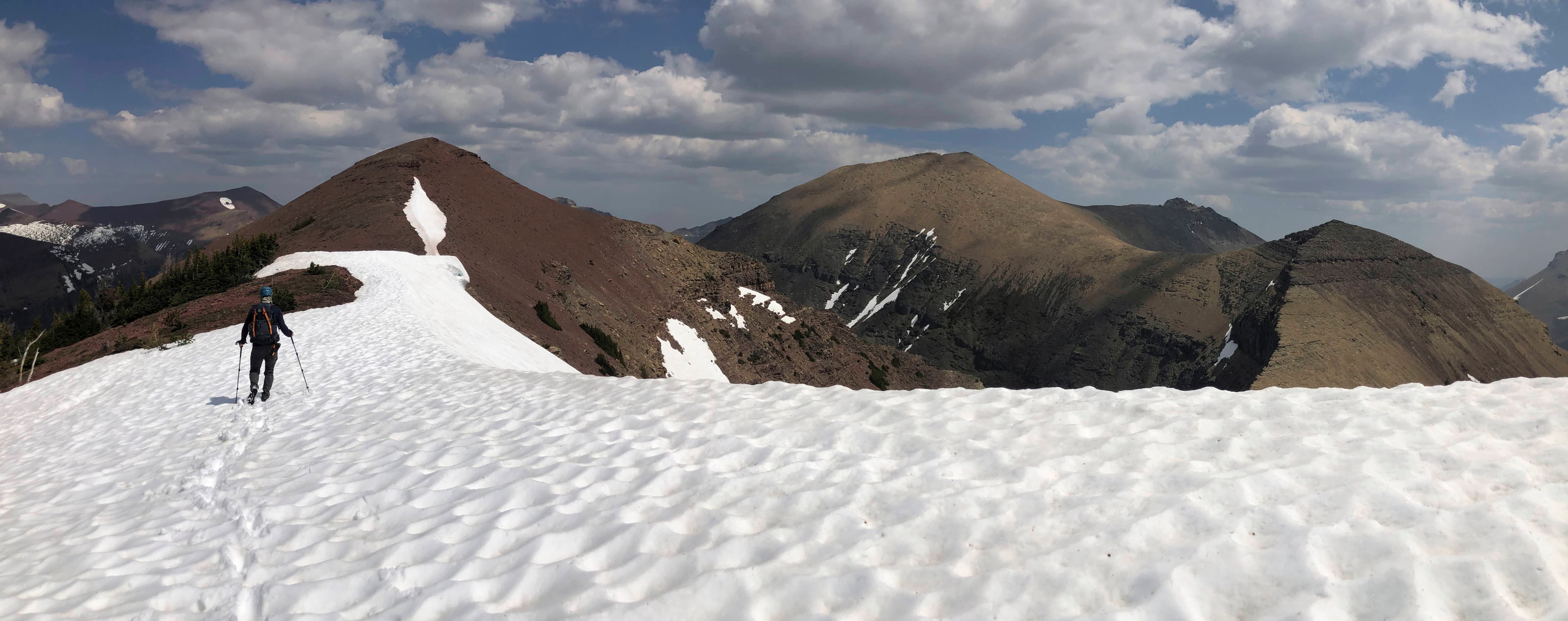
Taking advantage of the remaining snow.

Arriving inside the bowl with the south ridge of “Kootenai Brown” on the left and Lost Mountain on the right.

A closer look at the start of the south ridge…

Then at the col between “Kootenai” and Lost…

And finally at Lost. Our descent route will come down the snow patch in the centre.

Another look back.

Heading towards the south ridge. The summit of “Kootenai” is directly above me. (Photo by Andrew Nugara)

I contemplate some potential routes. We would end up using the couloir located to my left. It looked gnarly from a distance, but it laid back nicely on approach. (Photo by Andrew Nugara)

Heading up to the couloir. (Photo by Andrew Nugara)

Standing beneath the couloir. (Photo by Andrew Nugara)

The couloir was way easier than we thought it would be.

Andrew scrambles over a small step.

I lead the way up to the ridge. (Photo by Andrew Nugara)

My view back to Andrew.

Finally on the ridge and looking towards the summit of “Kootenai Brown” (right of centre).

Andrew navigates a narrow section of the ridge.

Another view of the same section.

After the initial narrow section, the ridge broadened. In the background are Piinaquiium / Ahkoinimahstakoo (Mount Blakiston) and Mount Hawkins (right).

Heading toward a section of easy scrambling. (Photo by Andrew Nugara)

Up and over. (Photo by Andrew Nugara)

My view back from the previous photo.

Getting closer…

Gazing across to Lost Mountain with Anderson Peak in the background.

The south ridge was turning out to be a great route!

It’s hard from the photo, but the snow was a good 3 m thick.

Yet another look back.

Passing alongside a massive cornice. (Photo by Andrew Nugara)

It was hard to not keep looking back.

Nearing the top of the ridge. (Photo by Andrew Nugara)

A small cairn sits on top of the high point at the end of the ridge. It looked like it once held a register, but all that remained were pieces of paracord. The actual summit of “Kootenai” is in the background.

On more view back. 😊

A pano that includes “Kootenai Brown” (left), Anderson Peak (centre), and Lost Mountain (right).

Looking west…

And then to the south.

Andrew joins me on the high point.

A good look at Mount Bauerman. I will return for it hopefully later this year. Edit: Done! 😊

Zooming past Bauerman to Kishinena Peak. At the suggestion of Andrew, I will look at combining both of these into one trip. EDIT: Done! 😀

Looking to the northwest at “Sage Senior”.

From the top of the high point it is a ~420 m hike to the summit. (Photo by Andrew Nugara)

Glancing back to the high point.

There’s a 42 m elevation gain from the col to the summit.

Almost there. (Photo by Andrew Nugara)

The summit of “Kootenai Brown Peak” (2470 m). Though it’s an unofficial peak, the name has been used locally for many years.

A pano to the east… (Photo by Andrew Nugara)

And then to the south.

Looking west…

And finally, to the north.

Anderson Peak looks much better than when I was there in 2020. 😂

Looking over at Lost Mountain.

Dr. Ninna Piiksii has uncovered that there were two Siksikaitsitapi names for Mount Blakiston. The first is Piinaquiium or “Seen From Afar Mountain” and the second is, Ahkoinimahstakoo or “Pipestone Mountain”. I’ve chosen to include both when referring to the mountain and to put the original names ahead of the colonial name.

The summit of Mount Lineham (right of centre) can be seen poking over the ridge.

Gazing across to Mount Hawkins.

Zooming in on Kinnerly Peak.

A closer look at King Edward Peak (left) and Starvation Peak (right).

Miskwasini Peak on the left and Kenow Mountain in the centre.

Mount Bauerman with Kishinena Peak behind it.

Glancing over to “Sage Senior” (centre) with Mount Makin on the right.

Two more peaks I need to visit: Lone Mountain (Edit: done!) and Festubert Mountain (Edit: done!).

Despite the haze, we could see over to Castle Peak and Windsor Mountain.

Yet another one to do: Avion Ridge. Edit: Done!

Looking over to Loaf Mountain, Spionkop Ridge, Avion Ridge, and Newman Peak. Andrew and I had quite the adventure on Newman last year.

Mount Glendowan is a fun scramble.

As is “Cloudowan Peak”. 😀

A pano showing the bowl between Lost and “Kootenai”.

The cairn had a couple pens but no registry.

One of my favourite humans!

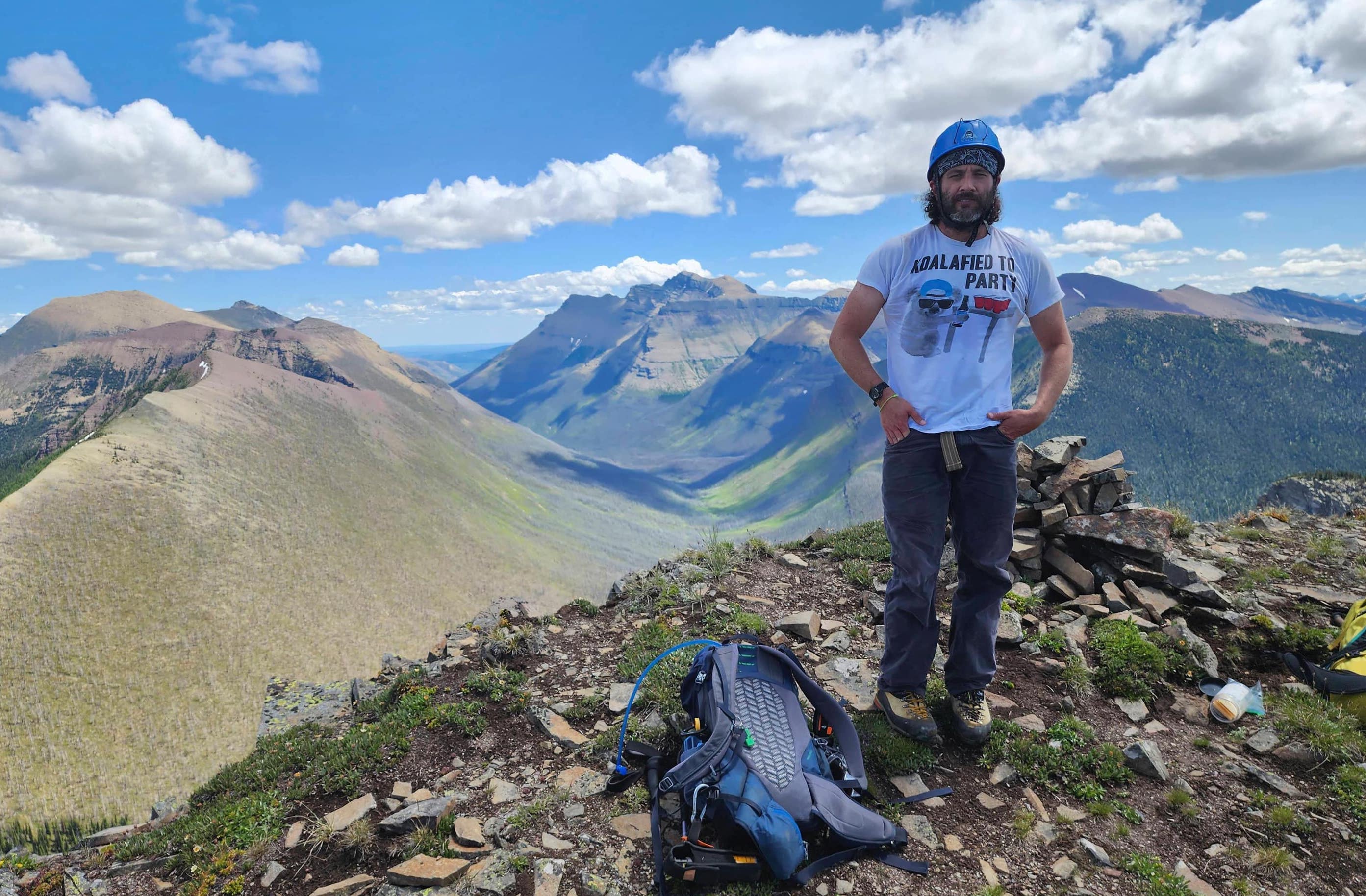
Grandpa Dave. 😂 I’m not gonna lie, it feels good to have two grandkids and still be able to bag peaks. (Photo by Andrew Nugara)


Leave a Reply