⚠️ Hiking and scrambling are inherently dangerous activities. Please read my Disclaimer. ⚠️
Having been under-the-weather over the November long weekend and in turn, bailing on Brad for a trip, I was determined to get out for any kind of solo trip I could. During our trip up North Drywood Ridge last February, I had a chance to scout a small, treed bump sheltered on the north side of Drywood’s summit. I’d looked at this a few times over the years and thought that it would make a nice destination for a windy winter or shoulder season day. In keeping with all the nicknames that I’ve given to spots on Drywood, I started calling it, “The Twig”.
Fast forward to this weekend, and just when I thought I was heading out on a solo trip, Andrew decided to make a last-minute trip down south to join me. I would guess that he, Brad, and I are among the very few who find hiking up small, weird bumps a good way to spend the day, but I absolutely love it. Then again, I can’t think of a mountain that I didn’t love… 😂
As the wind was strong and biting (quelle surprise), we opted to follow a more easterly track through the trees, leaving the road just behind the pump house located at the start of the North Drywood Falls trailhead. This provided a sheltered ascent with minimal bushwhacking as we gained steady elevation. Near the top, we were treated to some stellar views of Pincher Ridge, Drywood Mountain, and the North Drywood valley. Once on the open summit, the views remained with the summit of Drywood towering high above us.
Impressed by this little bump and noting that it only took us 1.5 hours to reach the top, we then decided to make our trip into a loop, by ascending the Northeast End of Drywood and then descending the ridge on the opposite side of the drainage from where we started. This was a very smart decision that we thoroughly enjoyed. Even better, we ended up right back where we started, which was more-or-less the trailhead. It’s been a while since I’ve done what I call a ‘park-n-climb’, so it was nice to have such a minimal approach.
Again, this trip is probably of interest only to those who like these obscure, blink-and-you-miss-them spots, but that’s okay. We had a great time and I’d have no problem repeating this trip at some point when the weather has limited our choices. Thanks Andrew for a great day! 🙂
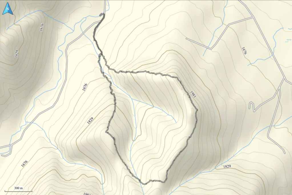
To get to “The Twig” we drove south from Pincher Creek on Highway 6 until we reached the Shell Waterton Complex Road (Township Rd. 43A). We then turned onto the road and drove west for ~9.1 km until we came to a junction with a gravel road near to the entrance of the plant. Here, we turned left and onto the gravel road where we continued for ~3.9 km until we reached Butcher Lake. We then turned left and onto another gravel road immediately prior to the Lake, following this road for ~1.4 km until we came to a junction where we could either turn left or keep going straight. We kept going straight for another ~610 m and arrived at a locked gate and a parking area. This is the trailhead for North Drywood Falls and our starting point.
From the trailhead, we walked several hundred metres until we came to a small pump house. Here is where we entered the trees. After walking beside the drainage for a short time, we realized that it quickly became canyon-like and so we crossed the small creek and started up the other side. Once in the trees it was a pleasant hike with some easy bushwhacking and navigable deadfall. From the trailhead to the summit it was a 410 m elevation gain over 2.45 km.
After enjoying the views from the summit, we then side-sloped our way for ~1 km (162 m elevation gain) onto the NE end of Drywood via a small connecting ridge. From there we simply followed the ridge for another ~1.35 km until we came to where it descended next to the same drainage we had started from. We then followed this for ~1.65 km until we were back at the pump house where we started. We then enjoyed the short walk back to the trailhead.
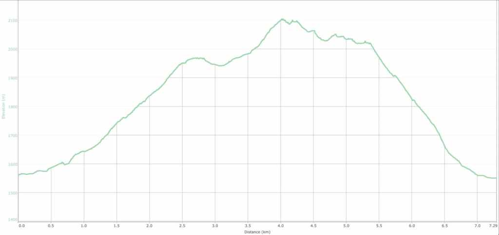
Our total roundtrip distance was 7 km with a total elevation gain of 616 m. Our total roundtrip time was 4 hours even. For reference, it took us 1.5 hours over 2.45 km and a 410 m elevation gain to reach the summit of “The Twig” from the trailhead.

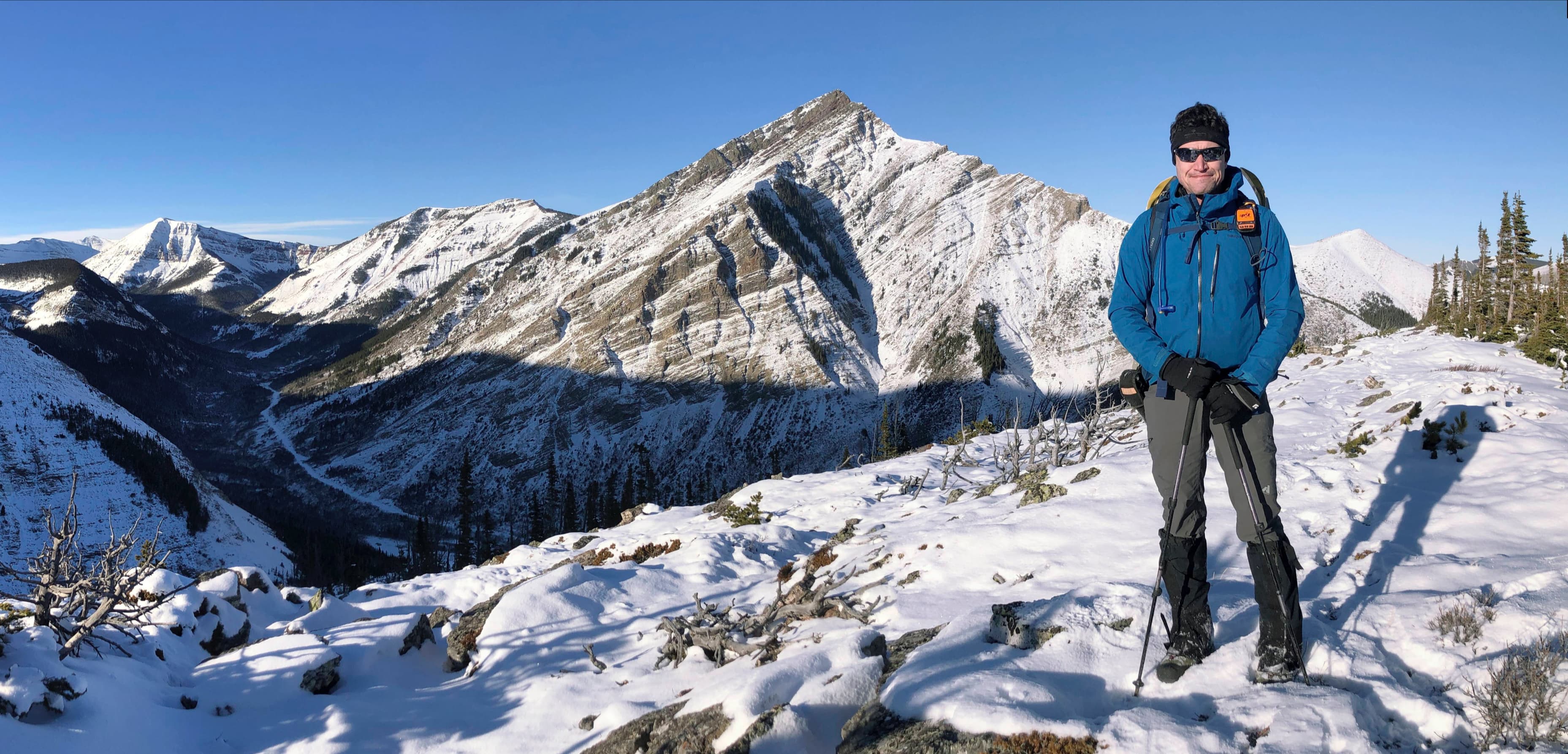
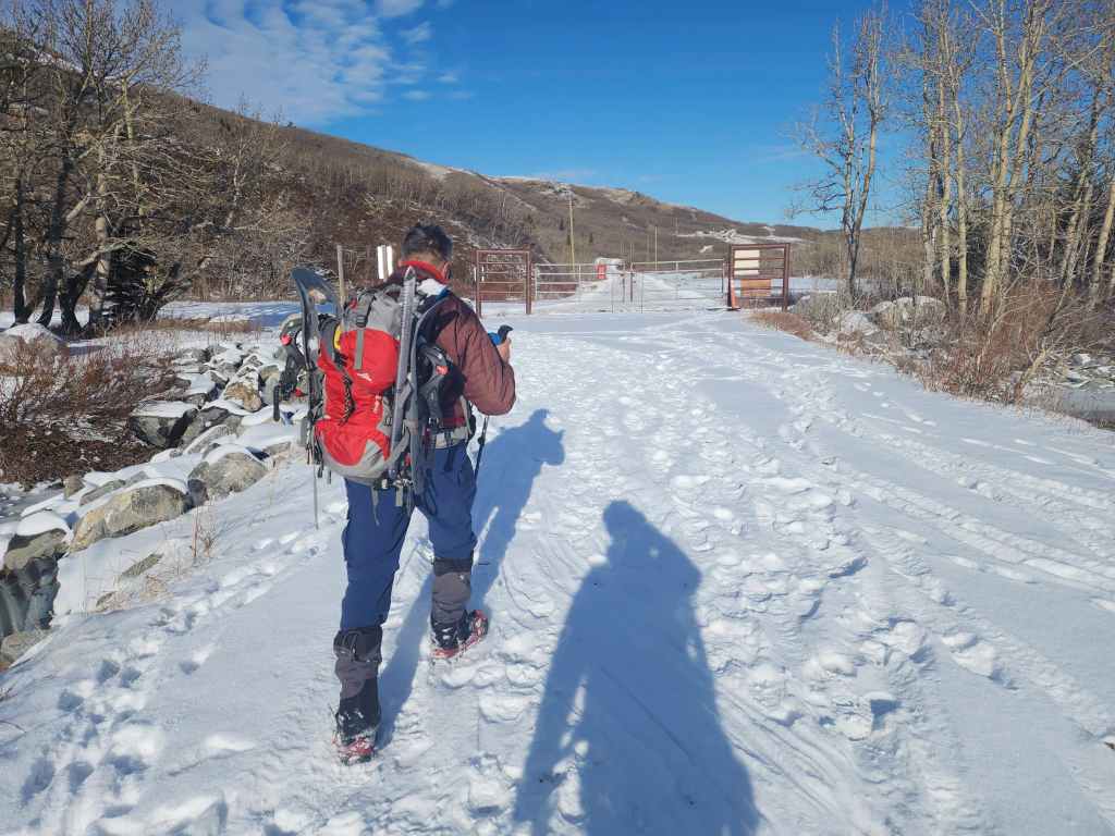
Gearing up at the North Drywood Falls trailhead on a clear, but windy morning. “The Twig” is the treed hill in the background.

Starting off.

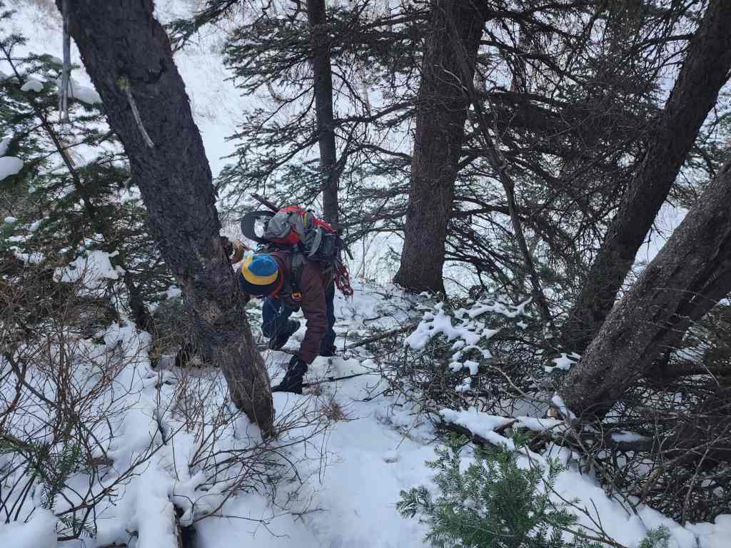
A few hundred meeting down the trail, we kept to the left until we were behind the small pump house. Here is where we entered the trees.

The drainage (right) between “The Twig” and the ridge off the NE end of Drywood turns into a canyon quite quickly. As a result, we had to double-back a short way and cross the creek before the bank became too steep.

Crossing a small creek.

Making the short, but steep climb up the bank of the drainage.
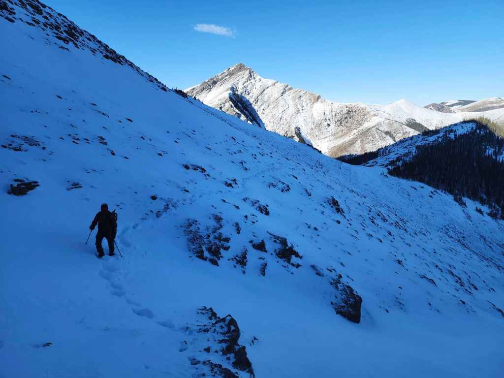
Almost there…

Enjoyable hiking from here on. We chose a treed approach because of the wind and it ended up being a wise decision – at least earlier in the day. Later on, the wind would die down.

There were a few sections of deadfall to navigate, but nothing that wasn’t easily skirted or stepped over.
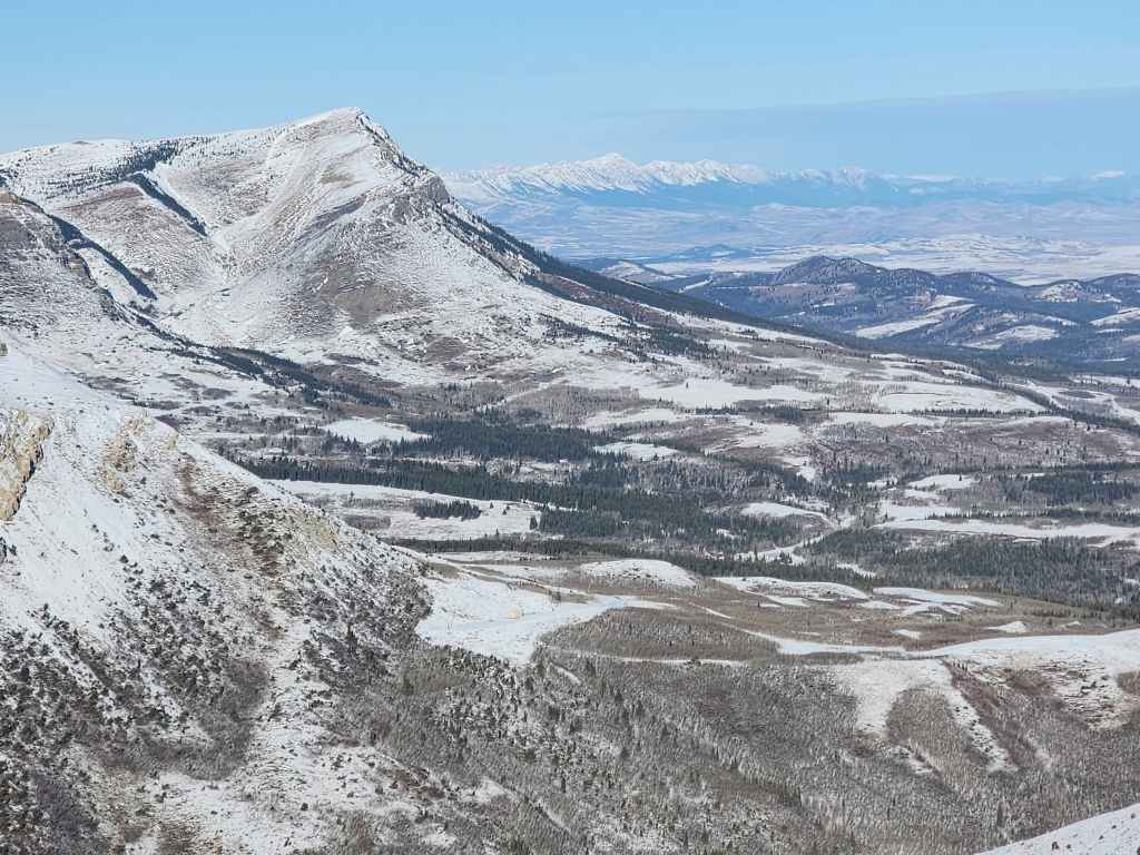
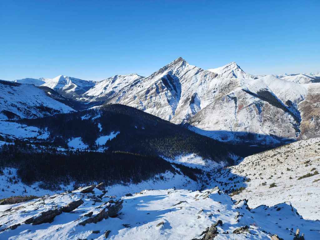
Pincher Ridge would be front and centre all day long.

What a gorgeous morning!

We brought our snowshoes. but ended up not needing them.
The views open as we get closer to the top. (Photo by Andrew Nugara)

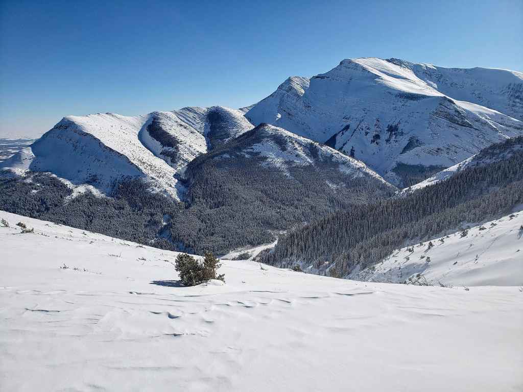
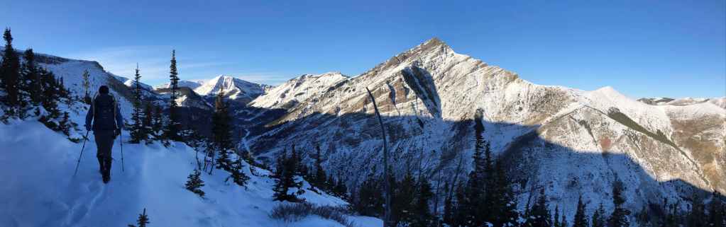
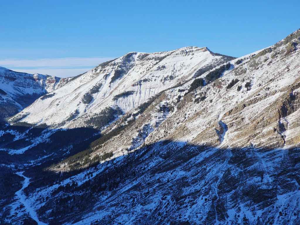
Pincher Ridge (left) with “Bridle Peak” (centre) and “Cinch Hill” (right) as its own, fun winter destinations.
Looking down the valley towards Pincher Ridge’s South Peak (centre) with “North Drywood Ridge” in the foreground on the left.

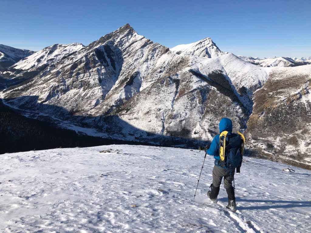
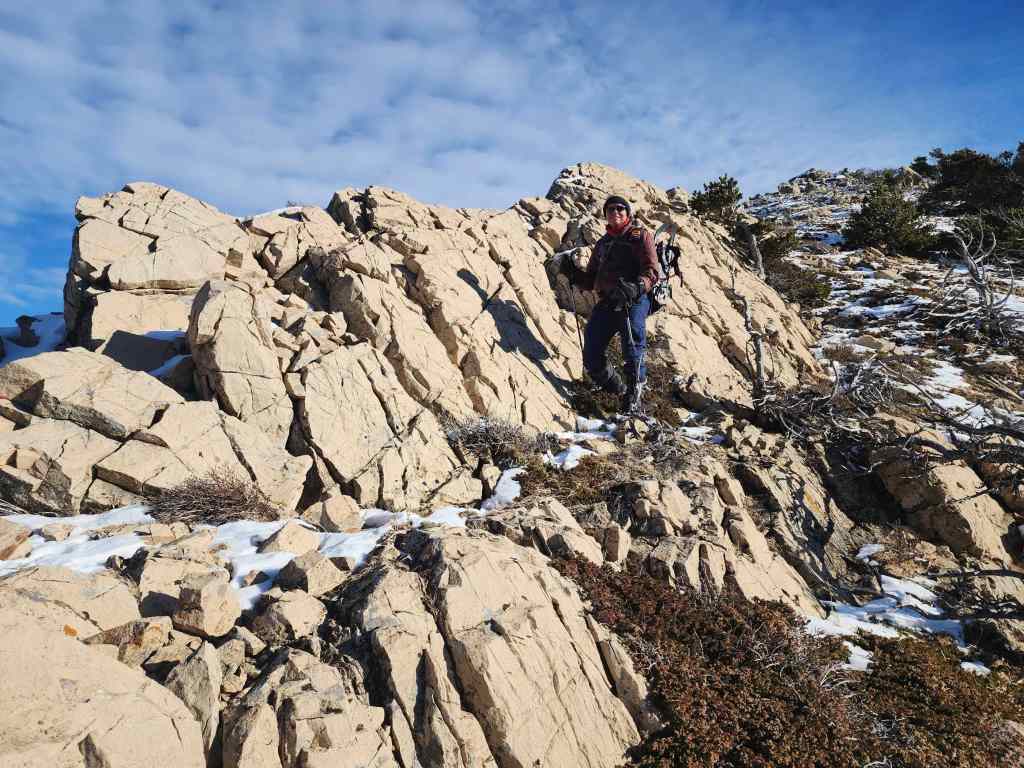
Nearing the summit.

Andrew’s view back. (Photo by Andrew Nugara)
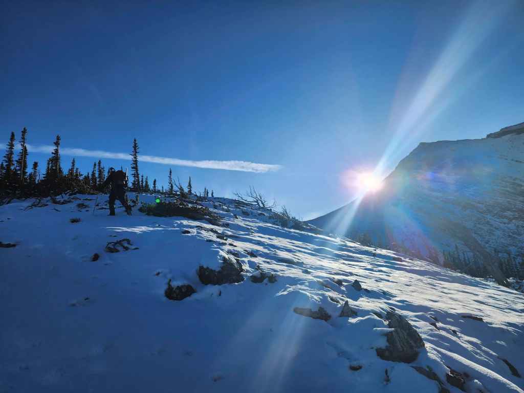
A few more metres to go…

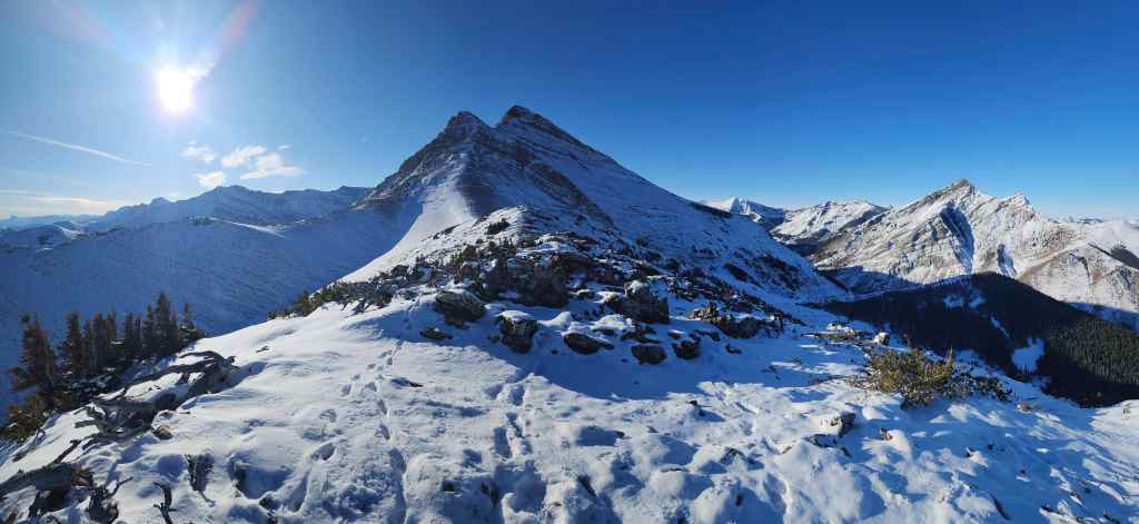
The summit of the “The Twig” (1965 m)

It may be small, but it has some great views! (Photo by Andrew Nugara)

Looking to the west.

Another look at Pincher Ridge.
Gazing over at Pincher’s Centre Peak.

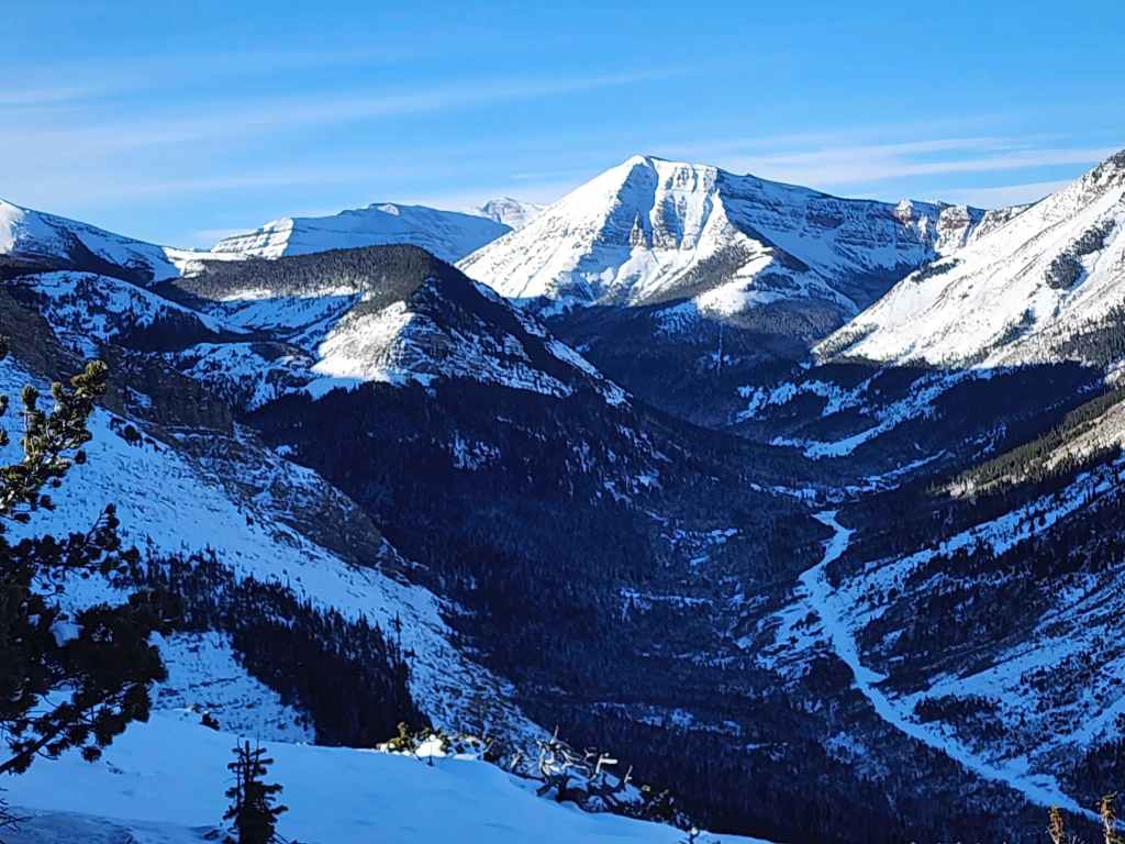
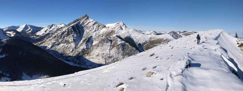
Pincher Ridge’s South Peak (centre) with “North Drywood Ridge” foreground on the left.

Zooming in on Victoria Ridge (centre).

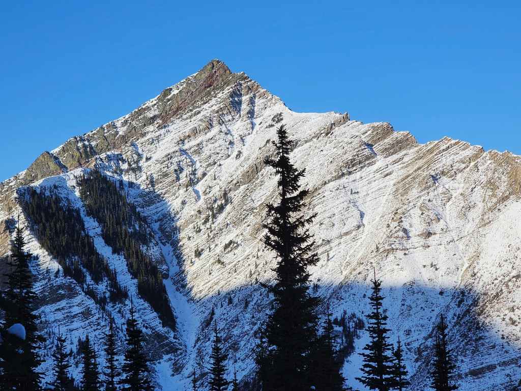
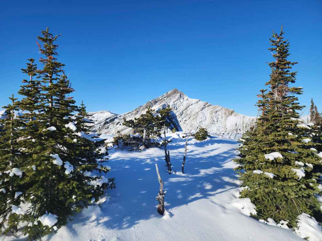
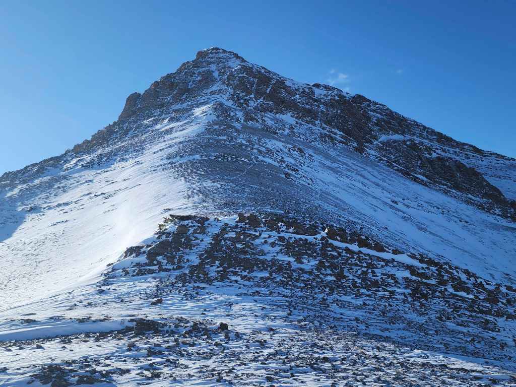
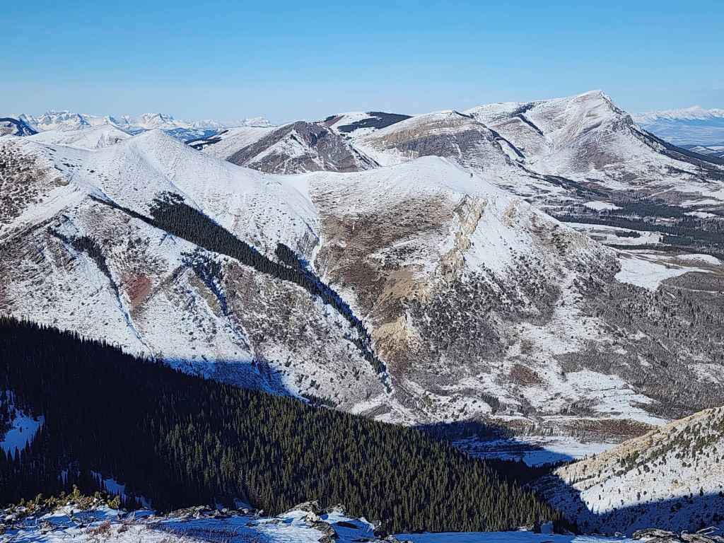
The summit of Drywood Mountain (centre) and “The Knot” (left) – another winter destination.
Being artsy and framing Pincher between some trees. 😂

Andrew on the summit…

Followed by me. (Photo by Andrew Nugara)

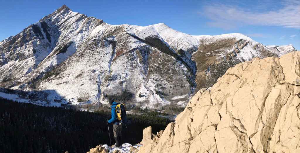
Heading to the NE end of Drywood. Hmmm…. if this is “The Twig” should “Woody” and “Barky” (both on the left) be renamed to “The Berries”? 😂 (Photo by Andrew Nugara)

Leaving the summit.

Looking back from the connecting ridge.

Andrew’s view of the previous photo. (Photo by Andrew Nugara)
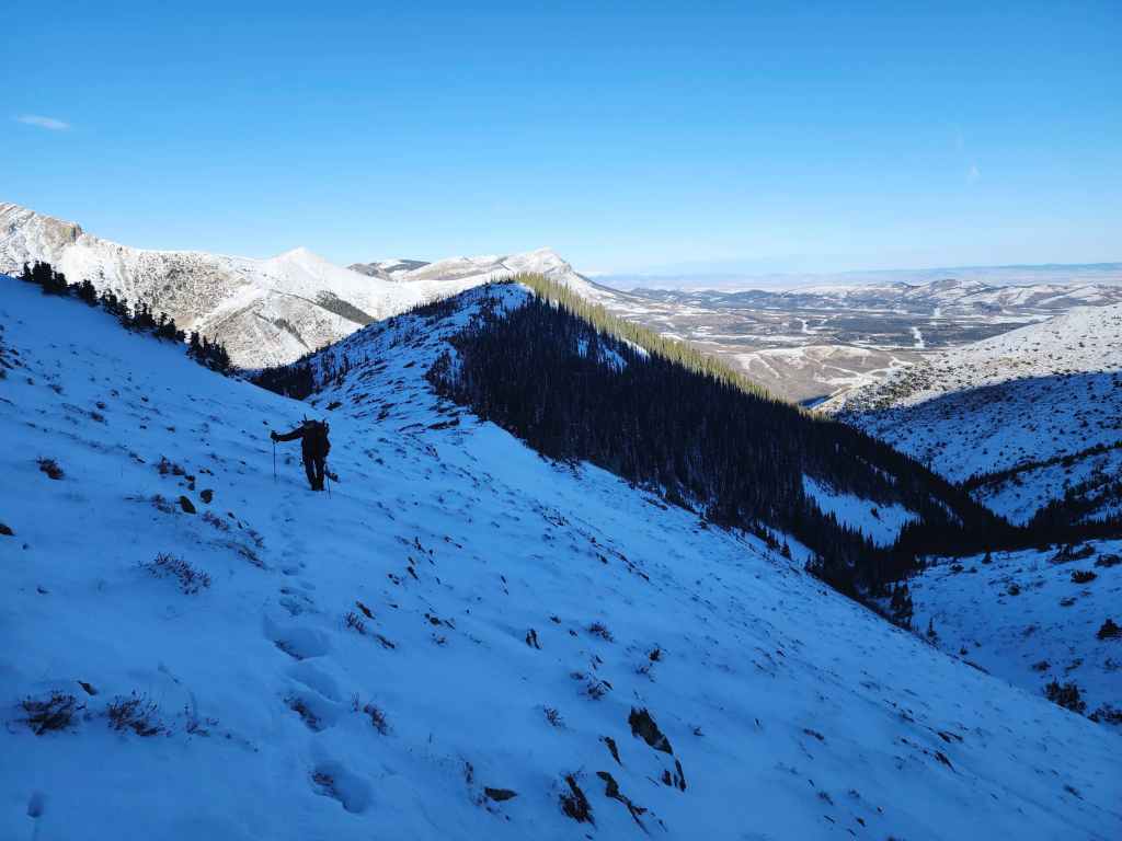
Side-sloping our way across.

“Woody” is a tiny bump on the NE end of Drywood.
Glancing back.

A bald eagle soars above us.
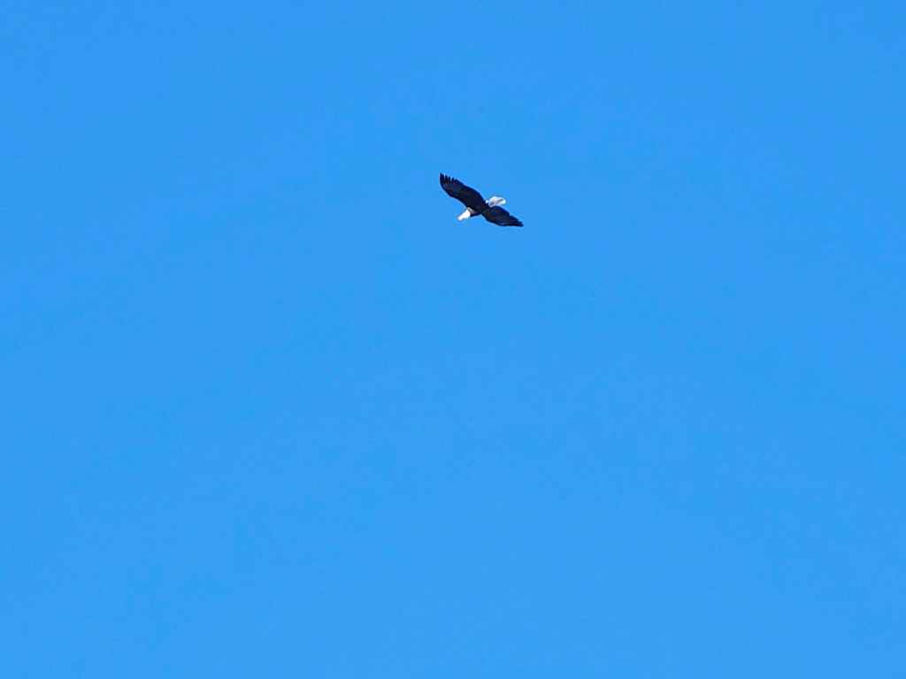
“I wanna fly like an eagle; To the sea; Fly like an eagle, let my spirit carry me; I want to fly like an eagle; ‘Til I’m free; Oh Lord, through the revolution” – The Steve Miller Band

Still looking back.

Nearing the NE ridge.
“The Knot” was a fun winter trip.
Heading to the top of “Woody”.

On top of ‘Ol Woody. 🤔

The wind was remarkably dying off.

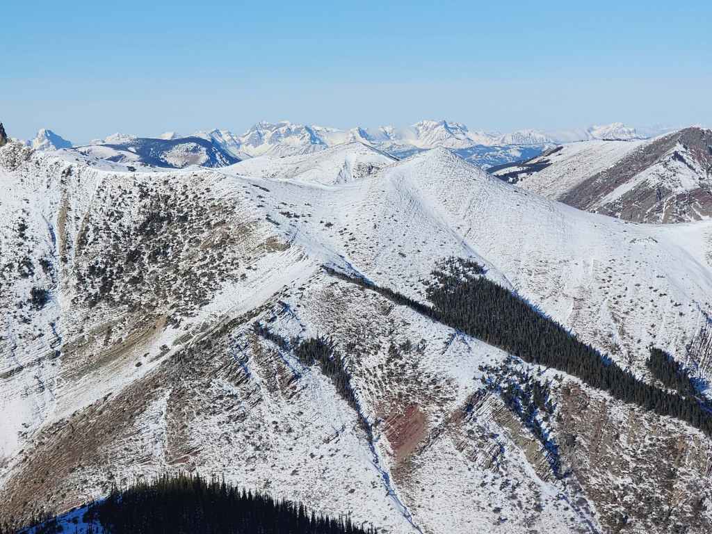
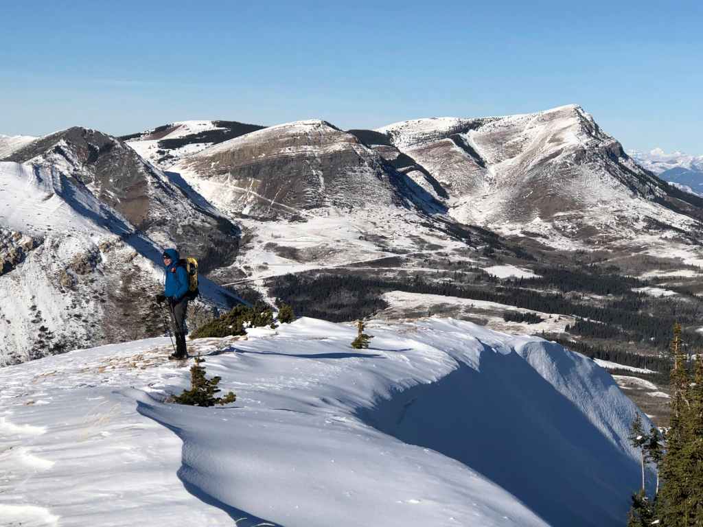
Looking across at “Stumpy” (left) with “Bakery Peak” in the background.

More of Pincher (left) but now with Prairie Bluff on the far right.
A closer look at Prairie Bluff with the Livingstone Range in the background. Tiny, Mount Albert, in Beauvais Lake Provincial Park is on the right.
Zooming in on the Flathead Range.
More of the same.

Looking towards Ninastako (centre).

The summit of Spread Eagle Mountain (right of centre).

Another fun trip was “Bakery Peak” on the NE of Loaf Mountain.

Me in front of “The Knot” and the summit of Drywood.

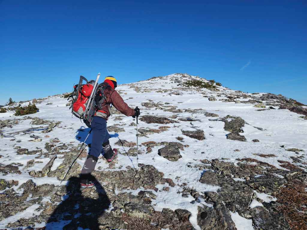
Heading towards “Barky”.

Where we just were: “The Twig”

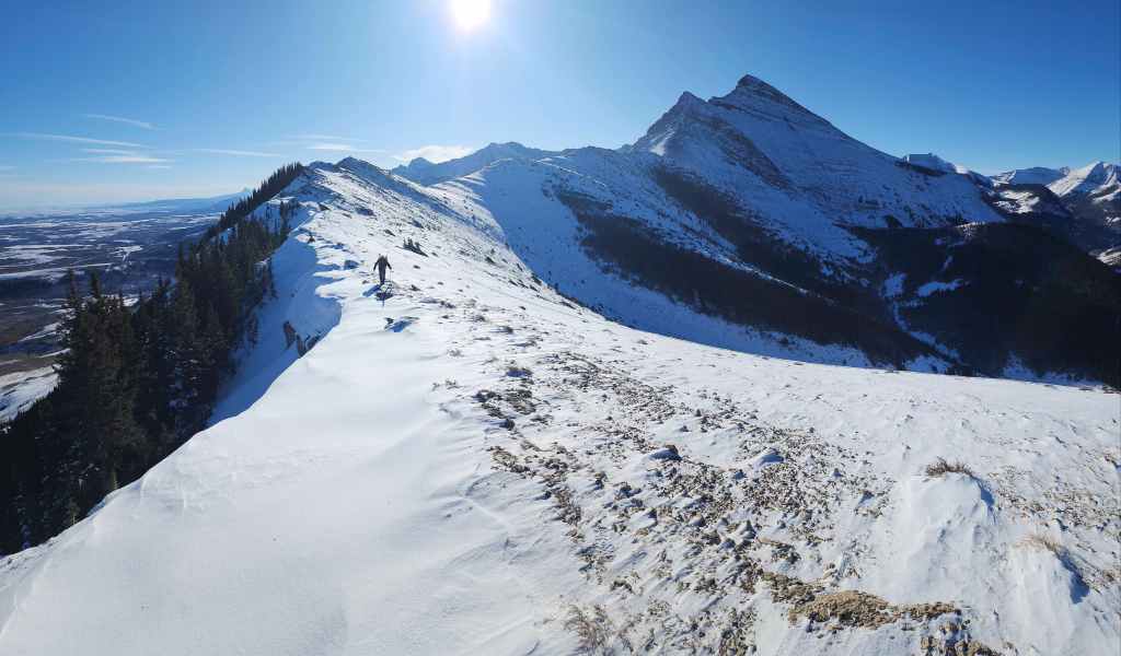
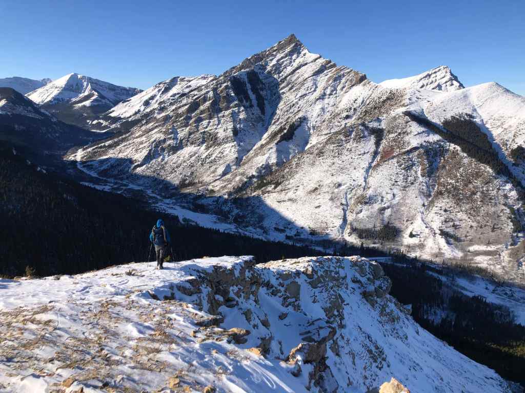
Looking along the entire ridge.

Glancing back. (Photo by Andrew Nugara)

On top of “Barky”.

Remarkably, the wind will die off by the time we reach the far end of the ridge. (Photo by Andrew Nugara)
Another look back. Such a gorgeous morning! 🙂
We will descend the ridge in the centre.

Winter is coming and with it, hopefully lots and lots of snow. We need a good snowpack and a slow melt this year to avoid water scarcity in the region. (Photo by Andrew Nugara)

Victoria Peak (right) makes an appearance behind Pincher Ridge (centre).
More great views as we near the end of the ridge. This was turning into a fantastic little loop!

Looking back. (Photo by Andrew Nugara)

Still going.

It was hard to stop taking photos!

Hey! Where did the wind go?
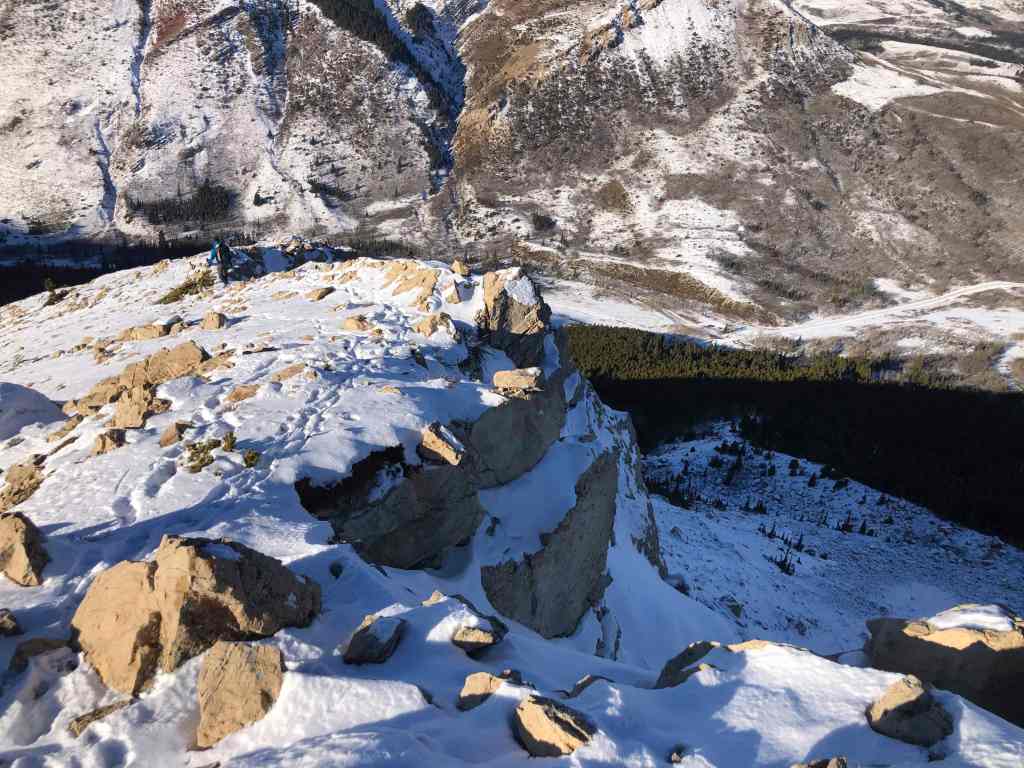
Approaching the end of the ridge. (Photo by Andrew Nugara)

A small cairn sits on top.
My view back.

Same as the previous.

“The Twig” was a surprisingly cool hill.

Gazing over at Christie Mine Ridge. I ascended this in 2021, but have never posted a trip report, in part, to maintain privacy for the landowner who gave us permission to hike. However…

Here’s a photo from my Christie Mine trip…

Along with one from its summit.
Now back to the present. (Photo by Andrew Nugara)
Heading down to close the loop. (Photo by Andrew Nugara)

It was such a great morning for photos!
More of the same. (Photo by Andrew Nugara)
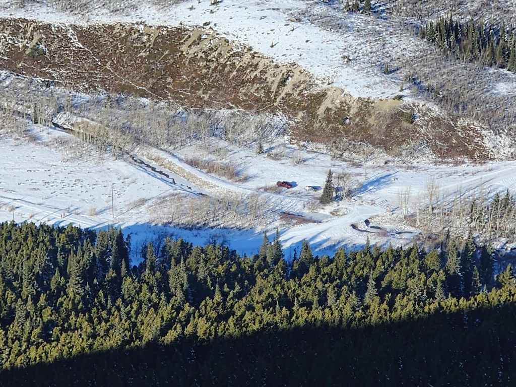
Our cars at the North Drywood Falls trailhead.

Looking back to Andrew.

From the ridge, I could see what looked to be a good-sized beaver dam on North Drywood Creek. I will have to come back in the summer with my fly rod… 🤔

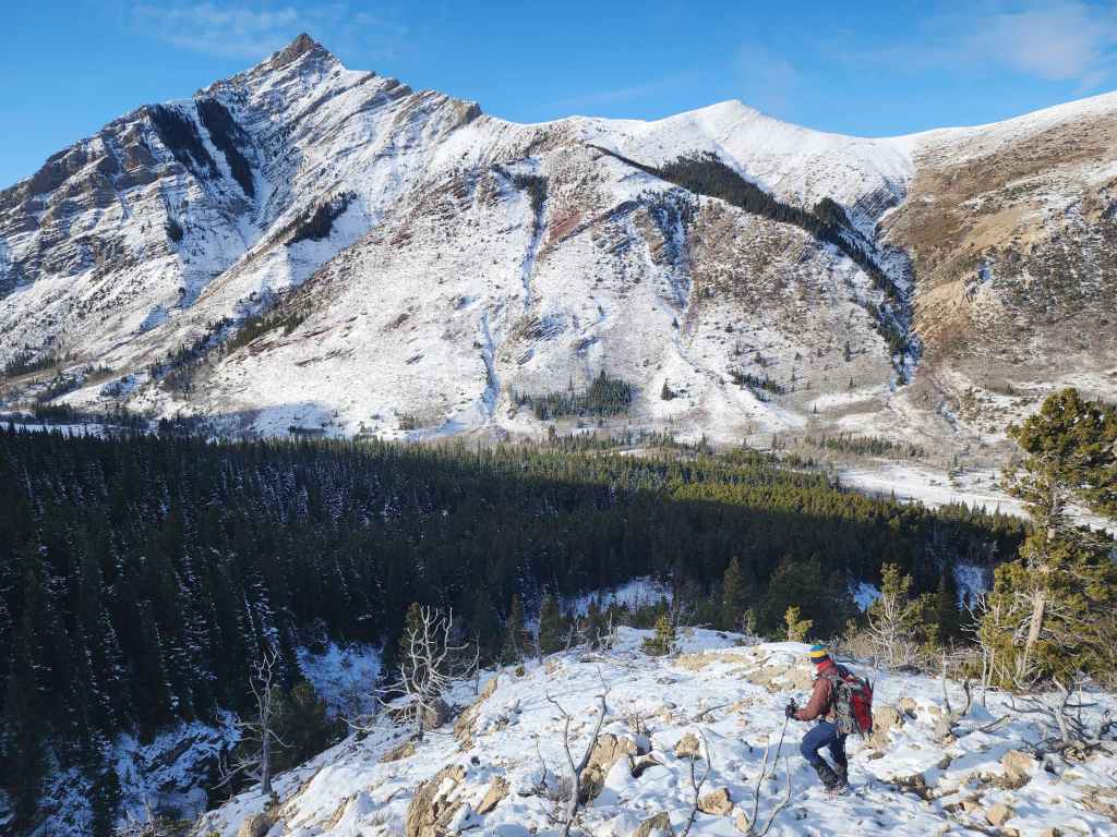
Closer to the bottom, the ridge becomes rocky.
The colour of the rock also changes. (Photo by Andrew Nugara)
The rock also had interesting patterns.
Continuing our descent. (Photo by Andrew Nugara)

Making a rock angel. 😂
Nearing the drainage that separates the ridge and “The Twig”.

Finally in the trees.

We will join up with our starting tracks shortly beyond the trees in front of Andrew.

Back on our tracks…

And arriving where we entered the trees behind the pump house.
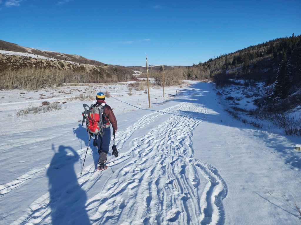
Enjoying the very quick walk back.
Arriving back at the trailhead exactly 4 hours and 7 km after starting. We chose “The Twig” in part because it was so windy to start the day. However, by the time we’d reached end of the ridge on Drywood, it was almost dead calm. Nevertheless, it was a great choice for the day and is a fantastic little loop for a winter / shoulder season trip. Thanks again to Andrew for the company as it was far, far more enjoyable than going by myself. 🙂

Yeehaw! We found ourselves as part of a cattle drive on the way out.


Leave a Reply