⚠️ Hiking and scrambling are inherently dangerous activities. Please read my Disclaimer. ⚠️
July was an intense month. It started with purchasing a new home and putting our current house for up for sale. When you’ve lived in a place for 18 years, getting it show home ready involves a bit of work, but it’s also a trip down memory lane as you reflect on all the great times you’ve had as a family coupled with the reality that time passes quicker than you expect.
Of course, the most exciting event this month was the birth of our third grandchild, Georgia. A baby sister for our granddaughter, Elliott, and a new cousin for our grandson, Oliver, we’re thrilled that Georgia arrived safe and sound. Melanie and I are incredibly fortunate that all of our kids live in Lethbridge, which means we get to see them and our grandkids on a regular basis. Being a grandparent and having your grandkids live in another city or even another country, would really suck, so we count ourselves blessed to have such close relationships.
Given all that’s gone on, visiting the mountains has obviously taken a backseat to life. That is, until today when things on the home front had quieted to a semblance of normalcy, and a trip to the mountains was a relaxingly possibility.
Back in September 2023, Brad Wolcott and Dave Fuller ascended Mount Parrish using a multi-pitch technical route that eventually merged with Rick Collier’s scramble route from September 2008. Coincidently, while they were on the mountain, they encountered Steven Noel and Xander Wilkie who were descending Parrish using a different route. Both men had ascended Parrish further to the east and had ventured closer to the ascending pair of Brad and Dave, before traversing back to the east. The entire encounter lasted only a few minutes as the parties were quite far apart. Nonetheless, as both Brad and Steven note, it was really surprising to see other climbers on this seldom-visited peak.
Named in 1962 after Sherman Parrish, “who pioneered in the district and resided a few miles north of the mountain” (2000 Place Names of Alberta, 142) the peak may not be huge, but it’s definitely formidable. Indeed, it may be one of the most difficult ascents in the area due to its steep slabs and ubiquitous exposure.
Prior to their 2023 ascent, Brad and Dave had consulted Andy Nugara who had made a harrowing descent off Parrish in July 2008. Andy’s egress followed roughly the same slabs that Brad and Dave used for their first two pitches. The difference however, was that Brad and Dave had pro while Andy did not, and a fall here – or on a myriad of other places on this mountain – would be devastating. I’m pretty sure that Andy still has nightmares about this experience, but in his defence, when he climbed it, he didn’t have the benefit of the information the rest of us now have. So thanks Andy for taking one for the team! 🙂
Still though, ever since Brad and Dave’s ascent – and their rave reviews of the route – I’ve wanted to try it for myself. Besides, as much as I’m confident in my scrambling abilities, there was no way that I was going to try this mountain without technical gear, so a proven route on good rock was the perfect solution. Even better, Brad willingly volunteered to reascend the mountain and climb lead, which was an amazingly generous offer.
With the framework set for an ascent, I was intrigued to see that Vern Dewit had recently scrambled Parrish using a variation of Devan Peterson’s September 2024 route; both avoiding the use of pro and both using a line much further to east than Brad and Dave’s route.
While these are incredibly impressive accomplishments, they did not dissuade me from wanting to utilize a technical ascent. Perhaps it’s because I’m grandpa-aged, but I’ve really come to appreciate the inclusion of pro for trips that push the boundaries of scrambling. For me, the time it takes to set an anchor is a small sacrifice compared to the security it offers when negotiating exposed and tricky terrain. That being said, I’m constantly amazed at the abilities of fellow scramblers and where I’d pull out a rope (and a diaper), others such as Vern and Devan, probably wouldn’t break a sweat.
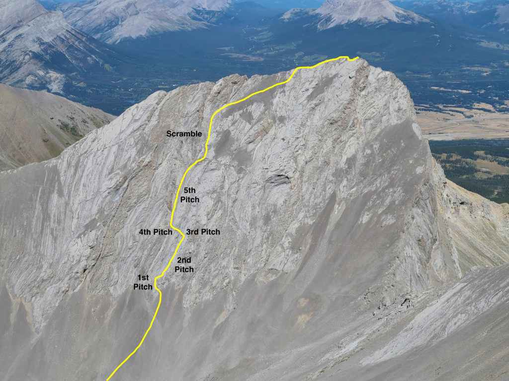
Anyway, with an ideal forecast at hand, Brad and I set off for Parrish. After 3.5 hours of biking and hiking, we found ourselves at the base of Parrish, staring up the face of an immensely steep slab. This was the start of what I’ve nicknamed, the Fullcott (FULLer / WolCOTT) route and since Brad was about to lead a verification ascent, it seemed only fitting.
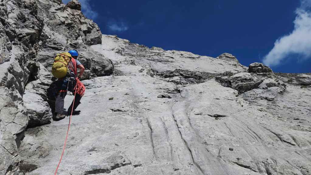
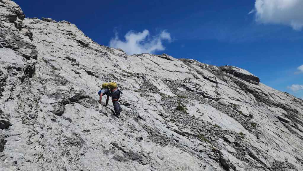
After gearing up, Brad led the way as we started up the short first pitch. A rope was not really needed, but we used one anyway. Besides the usual climbing gear, rock shoes were an absolute must on this trip as most of the terrain falls in the range of 5.3 to 5.4.
Once we were around a small corner and on a large ledge above our starting point, we started up the second pitch which follows a vertical line of ascent for approximately 60 m. In addition to being easy to grip, the rock featured small ledges that made it pleasant to climb. However, many of these ledges contain patches of loose rock which present a hazard to anyone below. Importantly, when combined with the steep grade of the rock, it makes down-climbing without pro, a decidedly sketchy endeavour.
Indeed, I was surprised when I looked down from the top of the second pitch at how effortlessly we had gained elevation and more importantly, how steep the grade actually was. It was a good reminder that Parrish requires a constant commitment to purpose and calculation because the climbing is so engaging that it’s easy to be distracted from the reality that you also have to get off the mountain at the end of the day. Unlike some ascents where a difficult climb or scramble is followed by an easy descent route, Parrish offers no reprieve. It has nothing but challenging terrain.
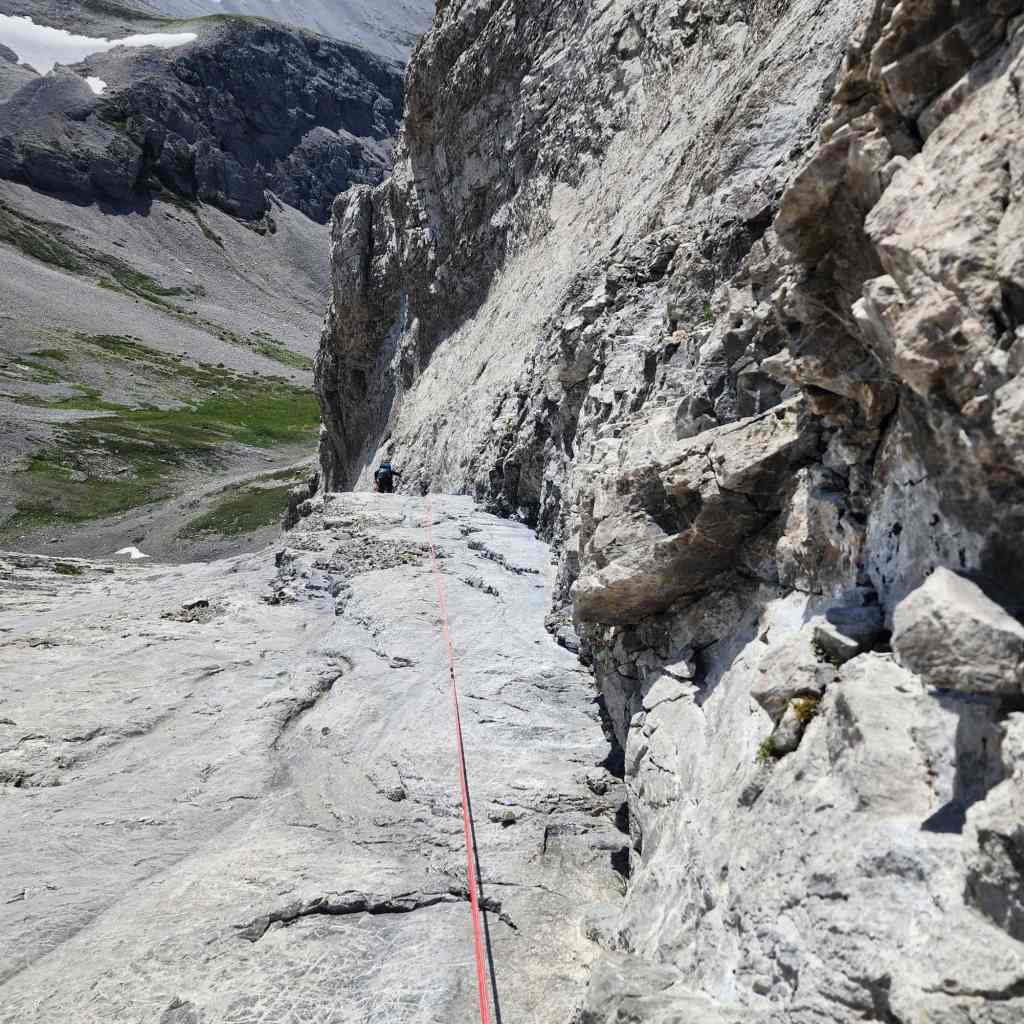
The third and fourth pitches comprise an angled traverse to the base of a large cliff that spans the vertical height of the mountain. Both required crossing two separate sections of Teflon-smooth rock that offered little in the form of holds but lots in terms of exposure. Fortunately, the sections are narrow and a small pinnacle provided a good base for an anchor.
The fifth pitch was the highlight of the trip and I believe it marks part of Collier’s eventual ascent route. A narrow shelf comprised of excellent, water-worn rock protrudes from the base of the cliff, offering a continuous line of ascent almost to the top of the mountain. The absence of loose rock coupled with solid holds made this a super fun endeavour. However, the shelf does narrow uncomfortably near the middle, and a few cautious moves are required to get past it. Fortunately, there are some strategic points where the shelf joins the cliff that allow for the placement of pro.
Once at the top of the fifth pitch, we left our climbing gear behind and tackled the remaining section before the scree slope as a scramble; though it too required great care as it bordered on class 4 terrain.
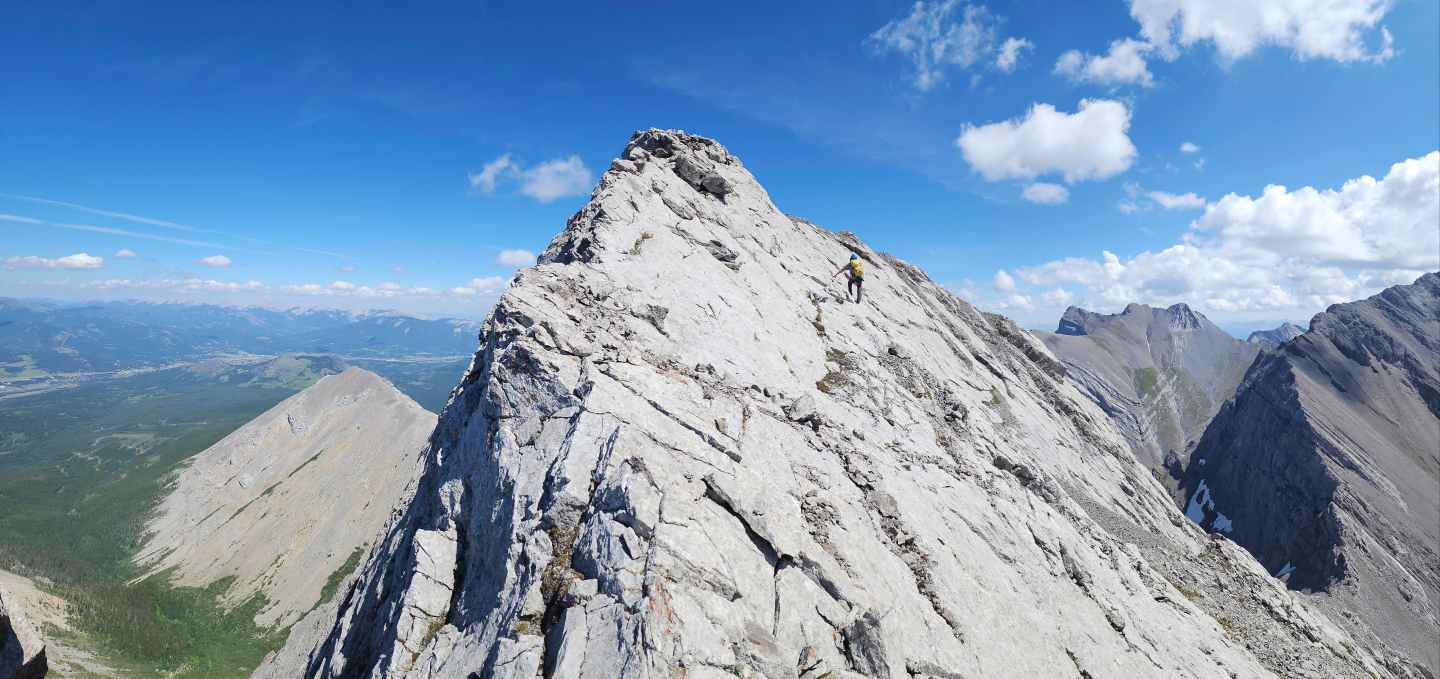
Traversing to the east across the upper scree slope was miserable, but we were soon on the summit ridge which we then followed a short distance to the actual summit. Again, this involved difficult scrambling coupled with a sphincter-clenching level of diligence.
After crowning Brad as Parrish champion for his second successful ascent, we returned the way we came, though we found a slightly easier route off the summit and back to the scree. We ended up using one rappel past the narrow section on the fifth pitch, and two rappels down the second pitch, because as delightful as it was to climb, it was far too exposed to risk a mistake.
A huge thanks to both Brad and Dave for putting up such a great route and again to Brad for not only volunteering to reascend the mountain, but doing masterful job as lead. Thank you! There aren’t many who have climbed this peak and I would guess the number of people who have climbed it twice is even smaller.
With a scramble route outlined by Vern and Devan, Fullcott is probably too time consuming for an era where speed and multi-peak days are the ultimate measure of success. However, for an old-school mountaineering adventure, it offers excellent climbing on rock that is uncharacteristically good for the Flatheads. Personally, I would still use pro on whatever route I chose for Parrish, but then again, I’m also a grandpa. 🙂

To get to Mount Parrish, we followed Highway 3 past Coleman towards the B.C. border. After driving 1.3 km beyond the rest area at the far west end of Crowsnest Lake, we turned left onto Coal Road. From here we drove ~3.2 km to our parking spot at the Ptolemy Creek trailhead. After wading across the stream at the trailhead (the first of many unbridged crossings), we then biked ~5 km (1 hour with a ~200 m elevation gain) until we reached a very large clearing/camping area.
Here is where the trail bifurcates, presenting the option to continue going straight – which will take you to the Promised Land – or to turn left, which will take you to Chinook Peak, Andy Good Peak, and Mount Parrish. We biked down the left trail for ~190 m until we came to a viewpoint where we stashed our bikes. From here, the trail drops into a creek bed before climbing steeply and continuing for another ~3 km to the Andy Good Basin and the point where we left the trail for Parrish. For reference, from the Ptolemy Creek trailhead it took us a total of ~8.8 km over a time of 2 hours and 40 minutes.
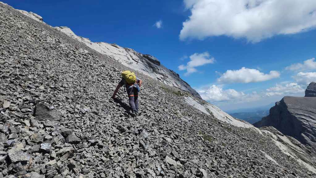
A further 35 minutes of hiking over ~940 m brought us to the base of Parrish. A miserable ~250 m ascent (15 minutes) of a scree apron led us to the start of the Fullcott route and the first pitch.
The first pitch is short and ends on a ledge around a small corner that is visible from the base. The second pitch goes straight up the slabs for another ~60 m until a traverse to the base of a large cliff band is obvious. This is start of the third pitch which begins an angled traverse to the west.
A small but noticeable pinnacle sits at the halfway point of the traverse and marks the start of the fourth pitch. There were two narrow and smooth sections of slab on either side of the outcrop that needed to be negotiated. Once across these, we arrived at the base of the cliff and the start of the fifth pitch.
The fifth pitch involves following a narrow shelf in a vertical line along the base of the cliffs. The rock is excellent and when pro was needed, a piton could be placed where the shelf joined the cliff. Once we reached the top of the fifth pitch, we left our climbing gear behind and continued our ascent as a scramble.
The scramble involved some class 3 and possibly class 4 terrain before reaching the edge of the scree field. A miserable angled slog of ~138 m to the east brought us to the summit ridge which we then carefully followed a short distance to the summit.
We returned the same way, except we found an ‘easier’ way off the summit and back onto the scree field. Once back at the base of the cliff, we down-climbed back to the top of the fifth pitch, and then down-climbed to a point above the narrowest section of the shelf. Here is where we made our first rappel, before down-climbing the remainder of the pitch.
After reaching the outcrop that marked the transition between the fourth and third pitches, we used it to set our first rappel down the second pitch. We had to make an additional but short rappel to get back to the start of the second pitch. From here we down-climbed the first pitch and then returned to Brad’s car the way we came.

Our total roundtrip distance was 23 km and our total roundtrip time was 13 hours and 45 minutes. Our total elevation gains came in at 1320 m. For reference, it took us 3.5 hours to climb from the base to the summit and just under 3 hours to climb back down. As this was a technical ascent that involved placing pro, the time commitment is WAY longer than most scramblers would like. However, it also mitigated many of the risks associated with a scramble and as a result, I found that I could settle in and enjoy the climb – and the mountain – without dreading the inevitable down-climbs.

Before I get to our actual trip, I’d like to introduce our newest grandchild, Georgia. If she’s anything like her sister, she will soon be climbing everything in sight. 🙂
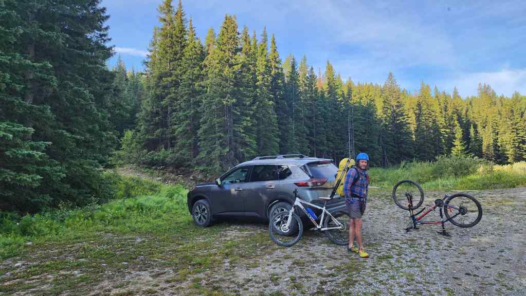
Starting off at the Ptolemy Creek trailhead.
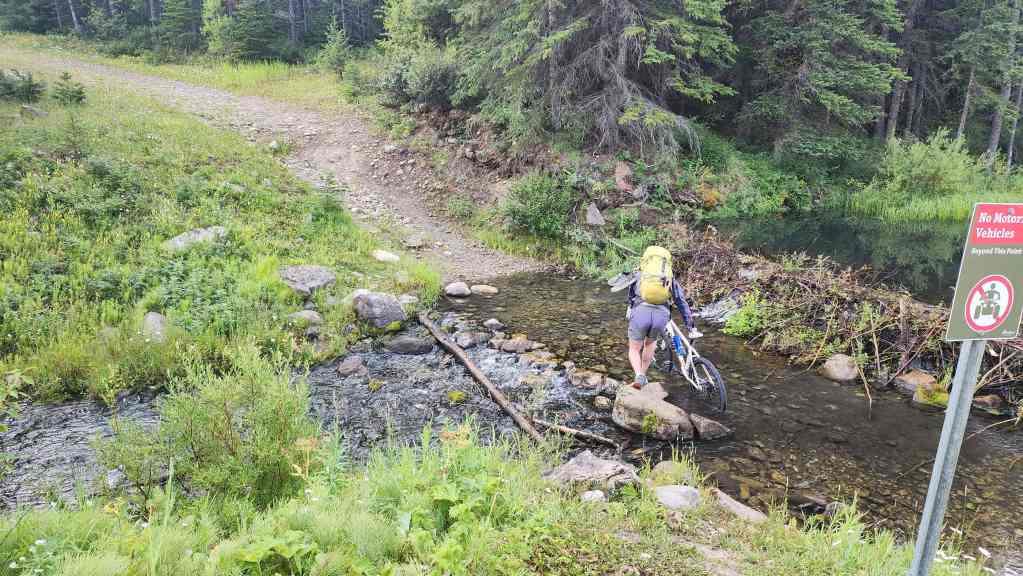
The first creek crossing occurs right at the trailhead so if you’re still sleepy from the early morning drive, this will definitely wake you up. 😳
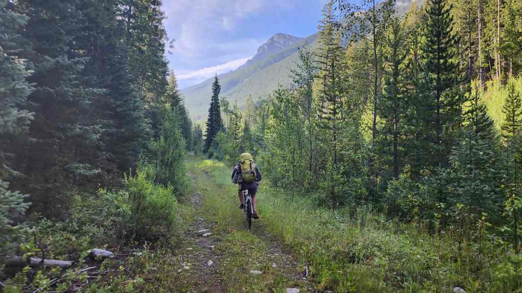
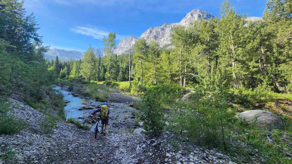
Enjoying the ride.
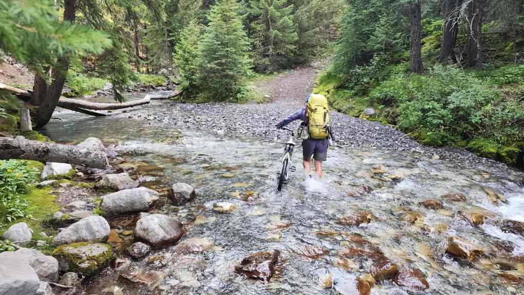
One of many crossings of Ptolemy Creek. Before the floods in 1995, there used to be seven bridges along this trail which is why many locals still call it the, ‘Seven Bridges Trail’.
The deepest crossing. If you aren’t awake by now, you may need to have your nervous system checked. 😂
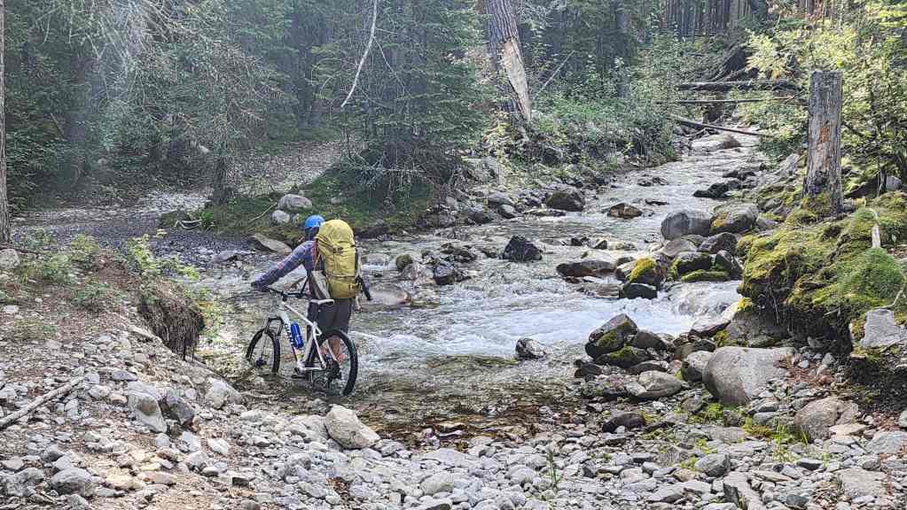
The last crossing of Ptolemy Creek before the campgrounds.
Yet another glorious day in the mountains! The Northwest Ridge of Ptolemy is in the background.

Approximately 5 km from the trailhead (1 hour on human-powered bikes), we came to the upper campground and a fork in the trail. We’d follow the left fork for a short distance (~190 m) before ditching our bikes.
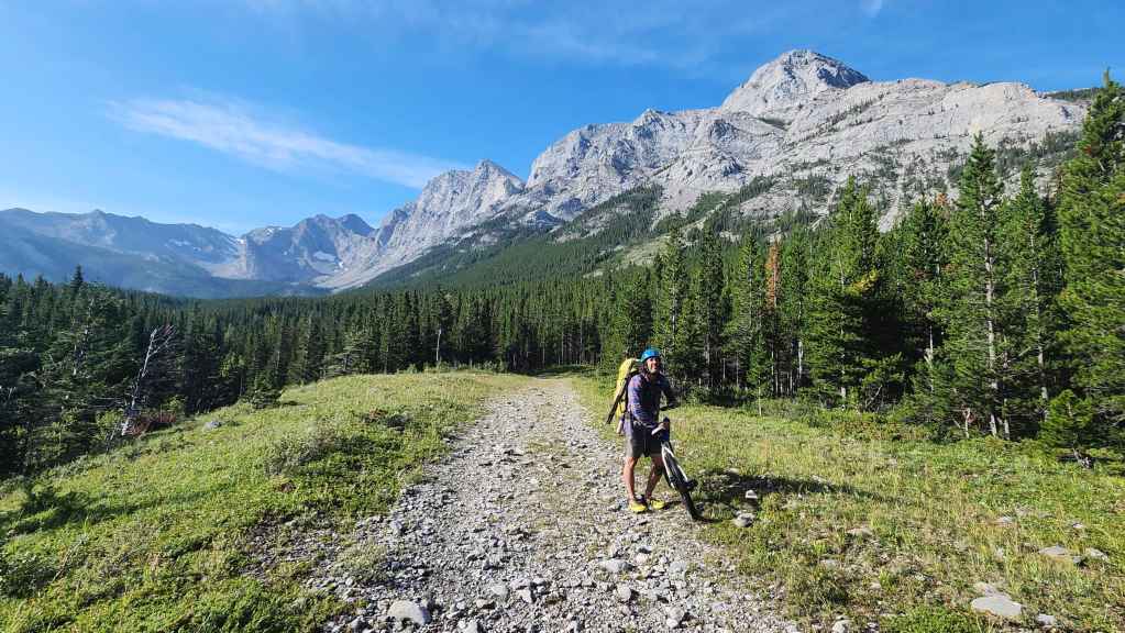
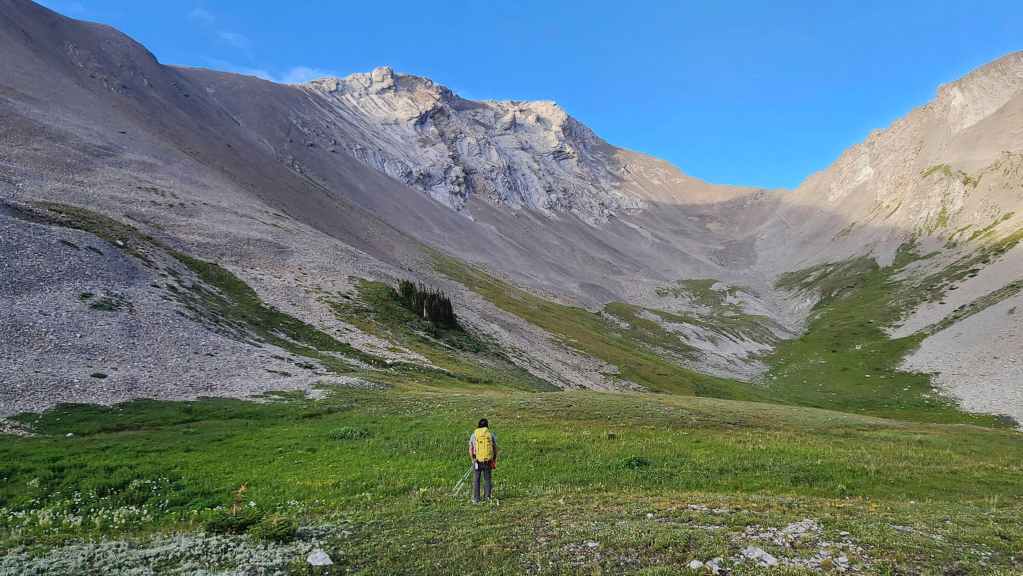
Looking up the valley as we set off on foot for the Andy Good Basin.
Looking back at the Northwest Ridge of Ptolemy after gaining some elevation.

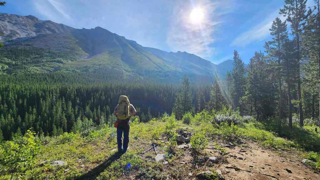
Gazing up at Chinook Peak from the same location as the previous photo.
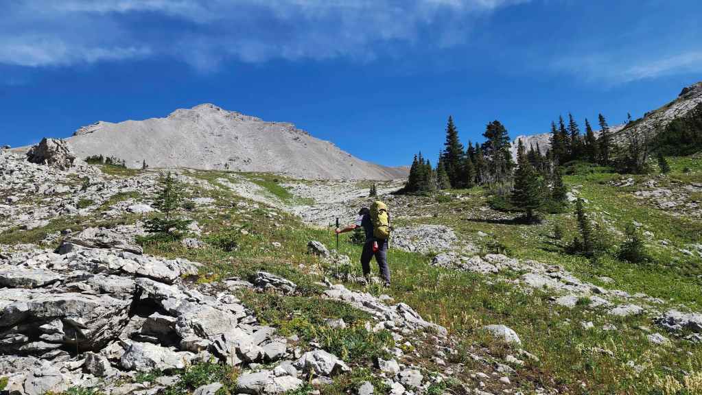
Continuing up the valley towards Andy Good Peak (centre)

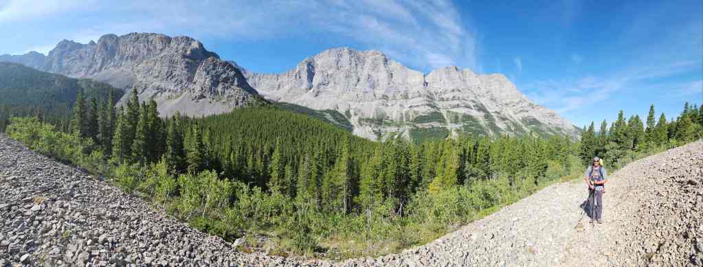
Another look back.

After hiking for ~3.5 km (1 hour and 40 minutes) from where we left our bikes, we arrived at the Andy Good Basin.

Leaving the trail as we head towards Parrish. For reference, from the Ptolemy Creek trailhead it took us a total of ~8.8 km over a time of 2 hours and 40 minutes.
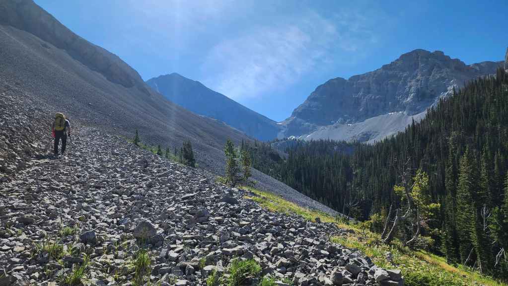
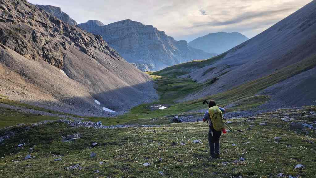
Heading towards the cirque between Mount Parrish and Andy Good Peak.
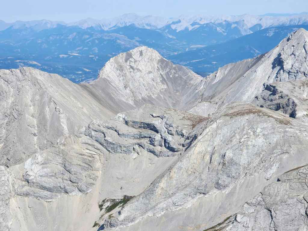
Mount Parrish finally comes into view. 😬

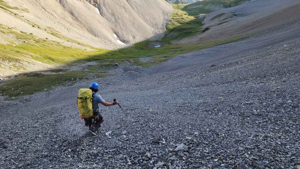
Descending into the cirque.
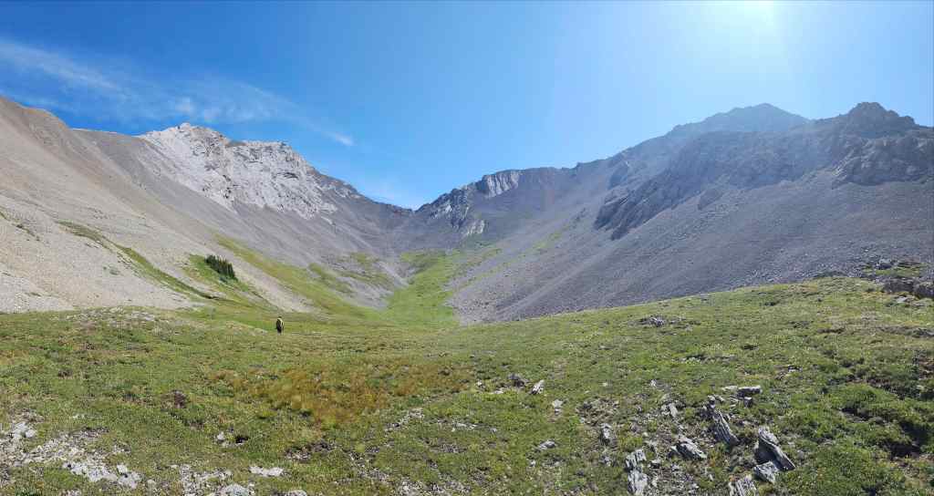
Much like the Andy Good Basin, this is a extremely beautiful location.
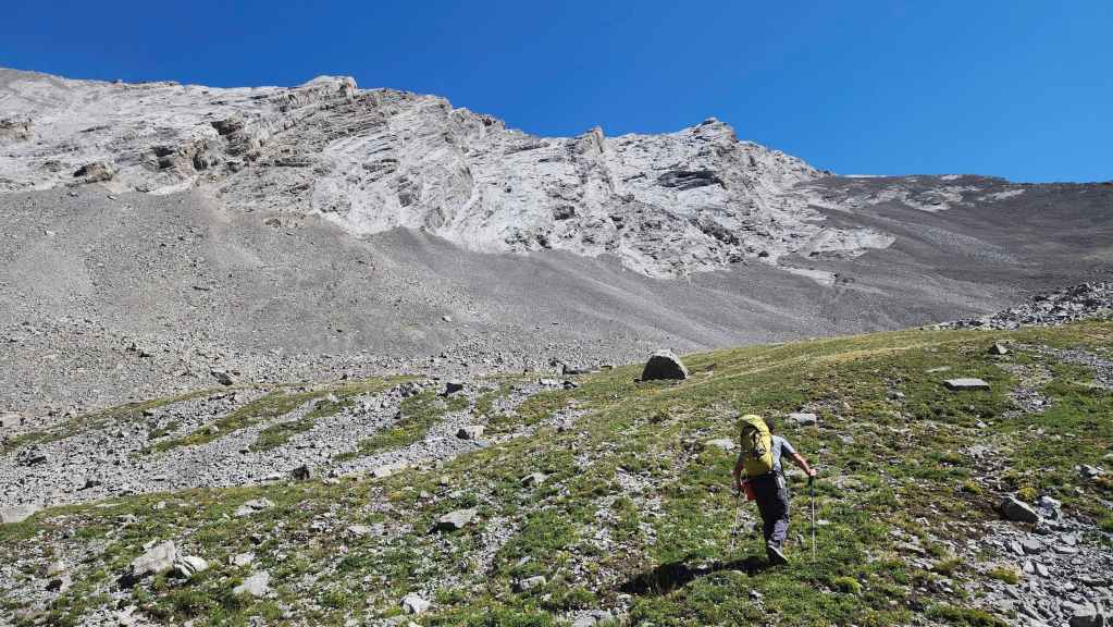
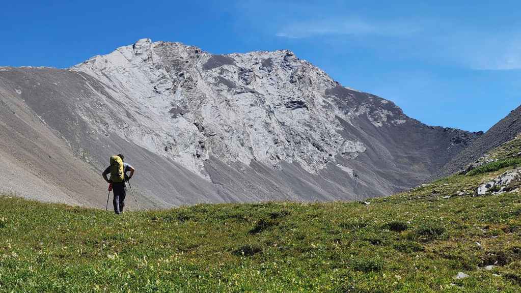
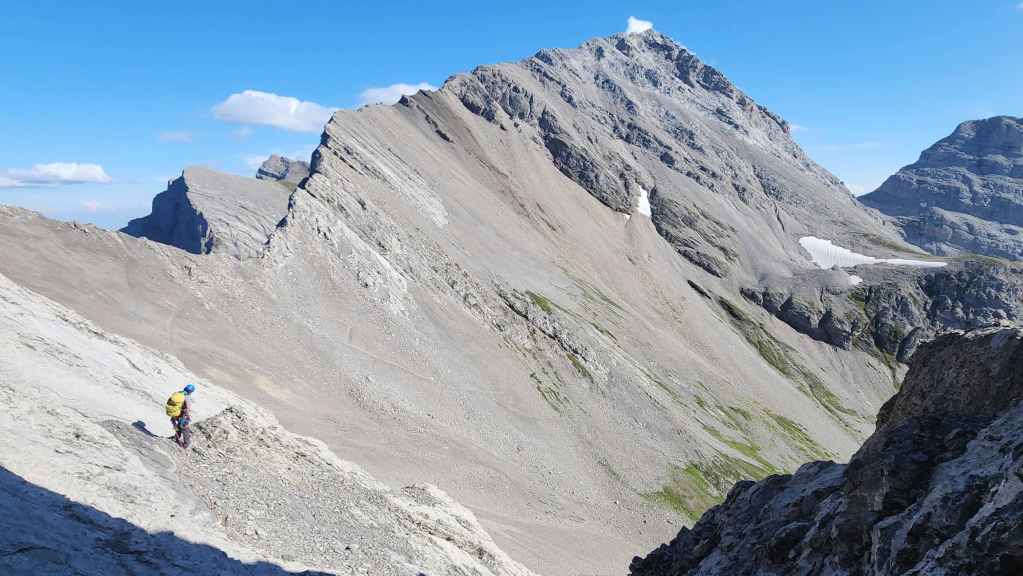
Getting closer to Parrish. The scree apron at the base is miserable to ascend.
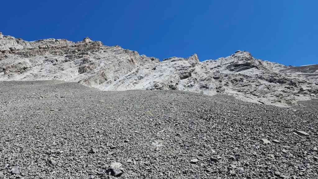
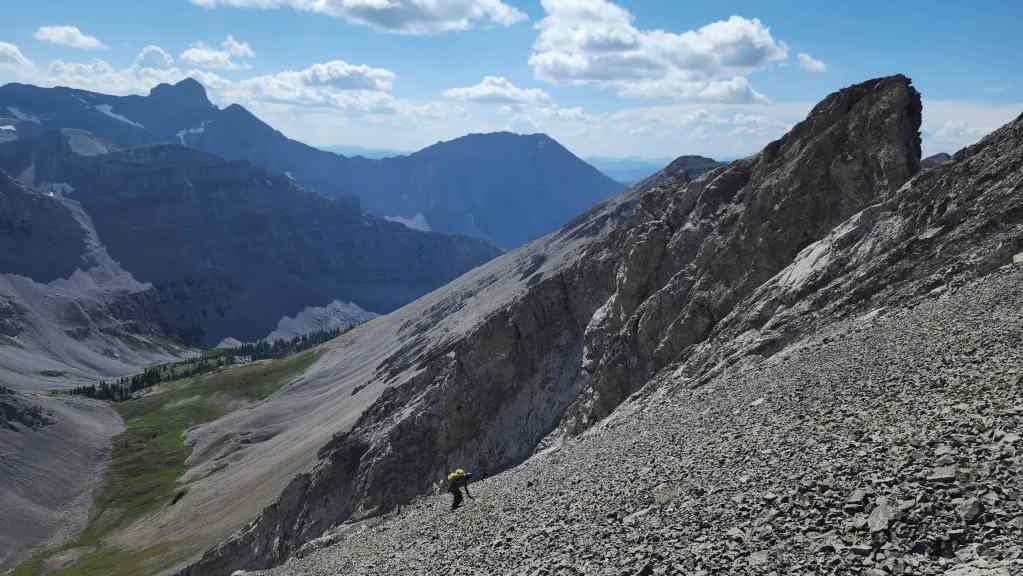
Slogging our way up the scree. The start of the Fullcott route is in the centre and it already looks intimidating. 😳

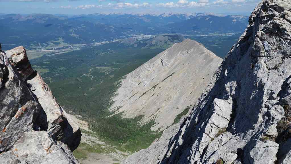
Looking back and along the cirque towards Mount Ptolemy (centre).
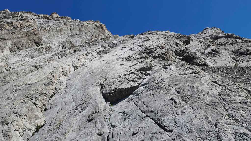
Standing at the base of Fullcott. For reference, it took us 50 minutes over ~1.5 km to get here from the Andy Good Basin.

Gearing up for the climb. Most of the route could be classed as 5.3 to 5.4.

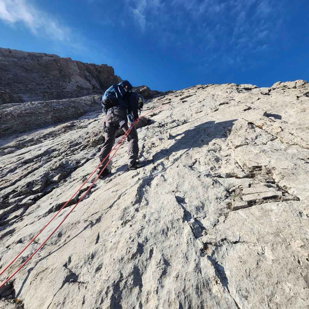
Brad starts up the first pitch. Rock shoes are essential for this route.
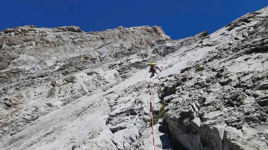
Though a rope is not really needed for the first pitch, we used one anyway.
Looking up to Brad as I climb the first pitch.
This is Brad’s second time ascending Parrish using this route. I’m not sure there are many who can claim more than one ascent of this mountain.

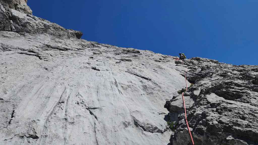
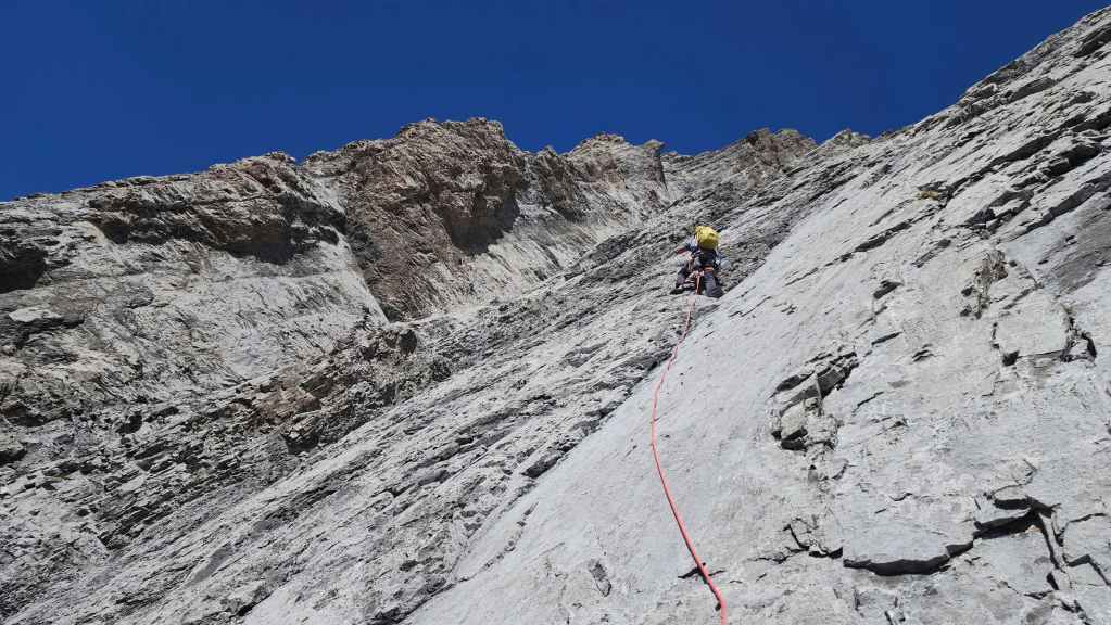
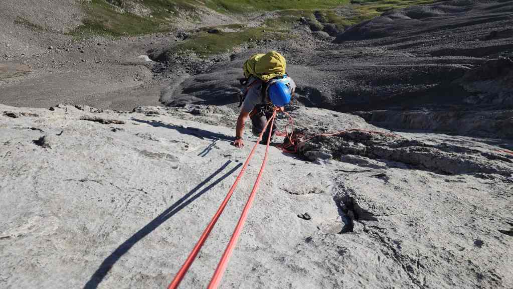
The second pitch follows a vertical ascent line for ~60 m and you definitely want pro for this.

My view as I prepare to climb the second pitch.
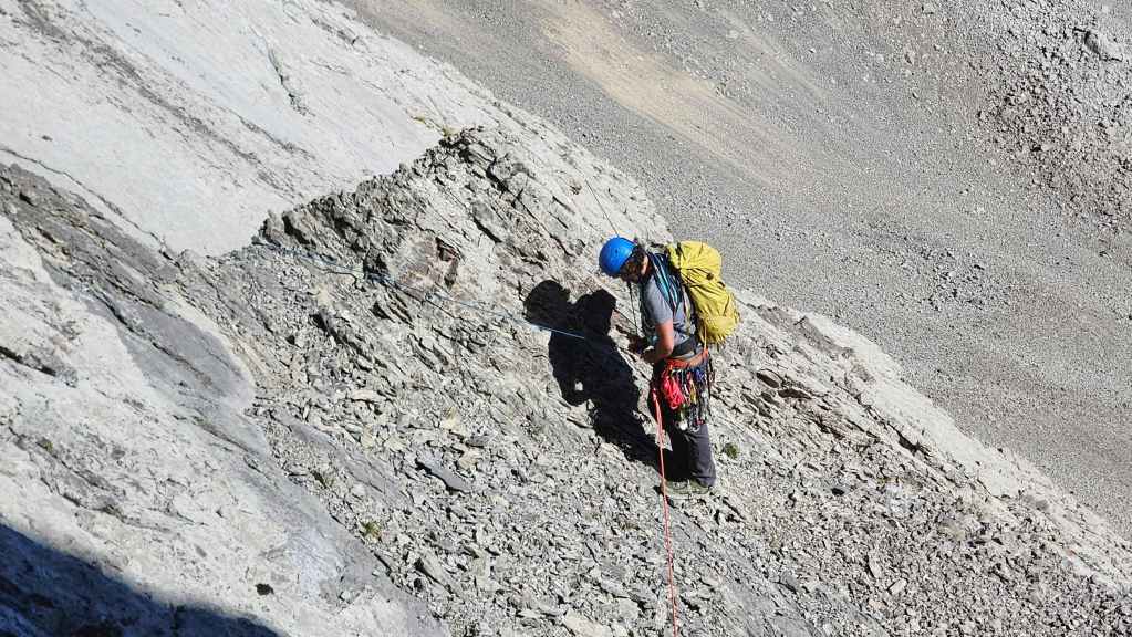
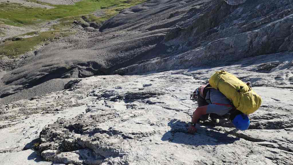
Brad’s view down to me. Numerous small ledges combined with grippy rock, make this a really enjoyable climb. However, the ledges also contain loose rock that presents a danger to anyone below. (Photo by Brad Wolcott)
Arriving at the top of the second pitch.
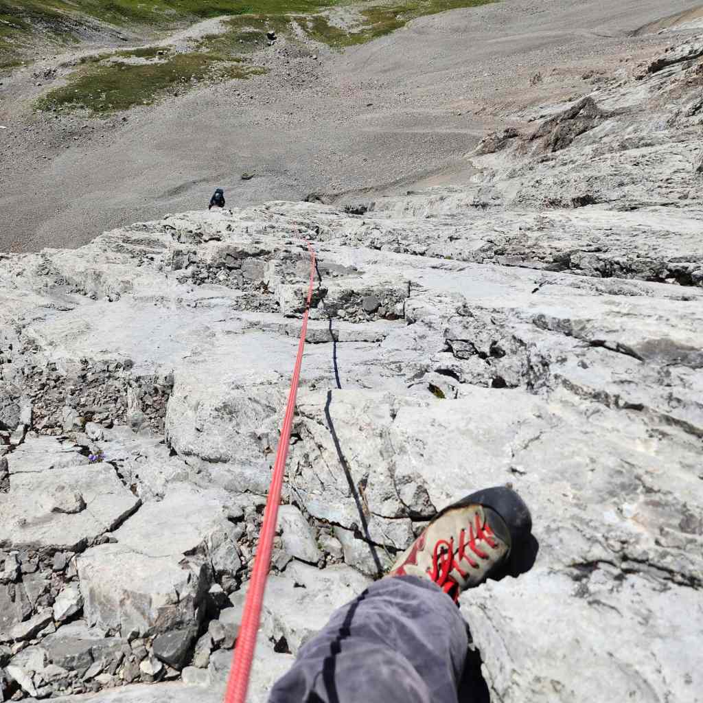
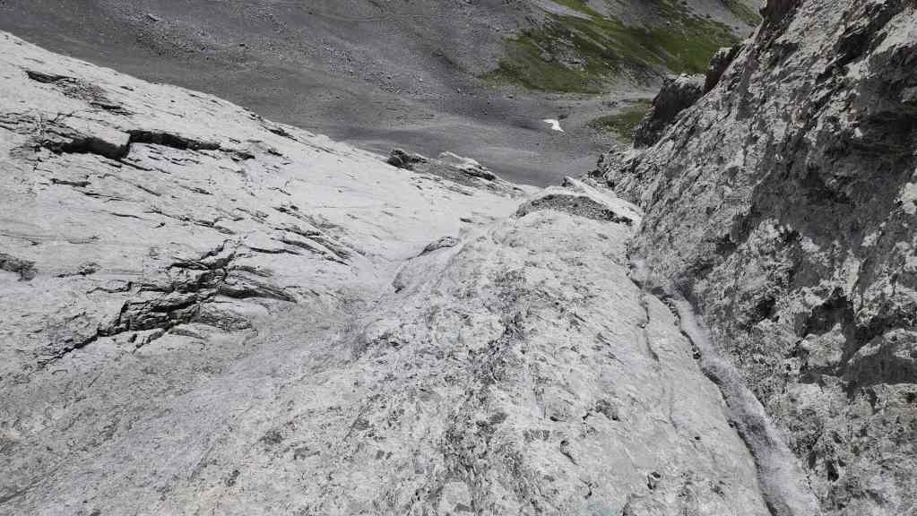
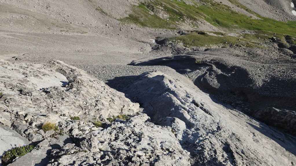
Gazing down from the top of the pitch. While it’s a delight to climb, it is not something I’d want to down-climb without pro.
The third and fourth pitches comprise an angled traverse towards the base of the cliff,
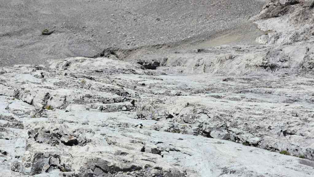
The smooth slab in the foreground is the crux on the third pitch.

Now on the fourth pitch, Brad prepares to cross another crux of smooth slab that is located just prior to the start of the fifth pitch.

Brad’s view back to the fourth pitch crux after arriving at the base of the cliff. (Photo by Brad Wolcott)

The fifth pitch is the best part of the route! 🙂

I think the upper section of this pitch is where Collier eventually ascended after being stymied on the summit ridge.

Brad places some pro as I prepare to climb.

The shelf is a solid and fun climb; however, there is one very narrow section that requires attention to detail.

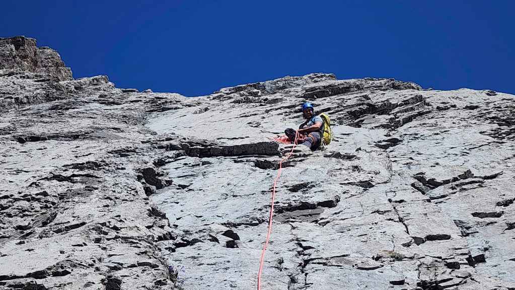
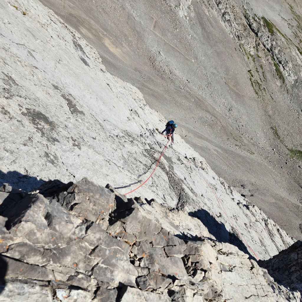
Brad nears the top of the pitch.
Looking back at the narrowing of the shelf (right of centre) which is the crux on this pitch. We will rappel it on the way back.
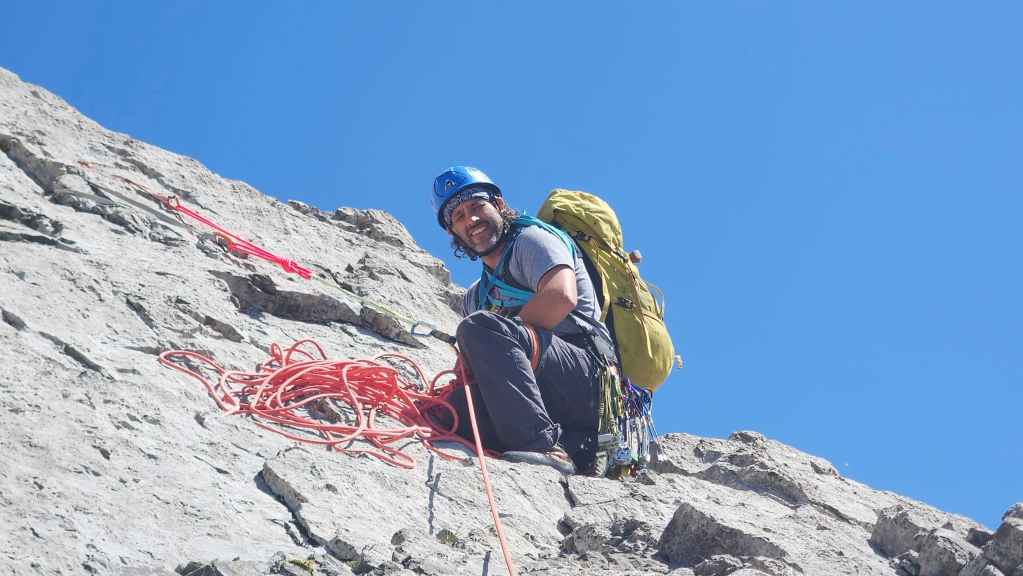
I arrive at the top of the fifth pitch. (Photo by Brad Wolcott)
We’ll leave our climbing gear on the shelf to Brad’s right.

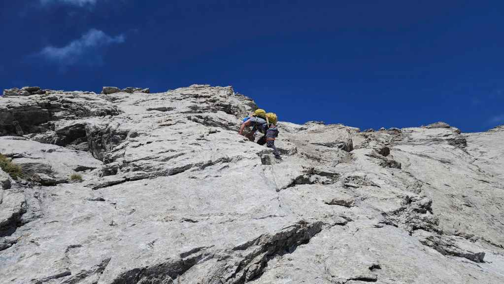
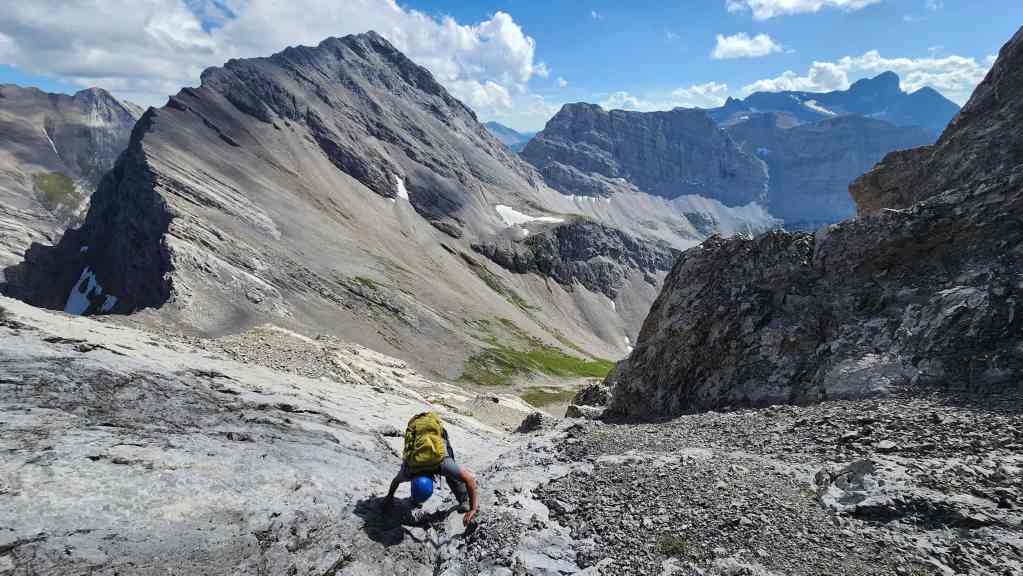
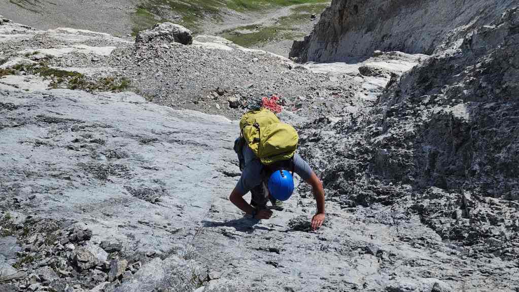
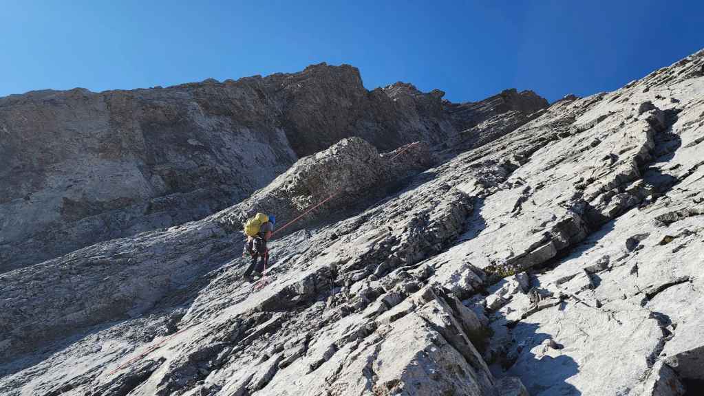
Brad scrambles up the final section before the scree field. In some spots it borders on class 4.
Glancing down at the shelf where we left our gear.
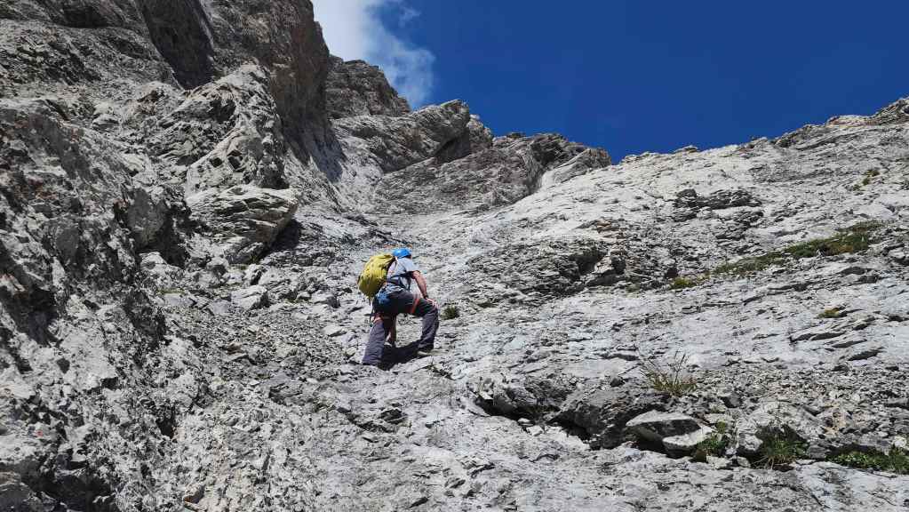
Continuing to make our way up.

Finally at the start of the scree field.
The scree on this mountain sucks!

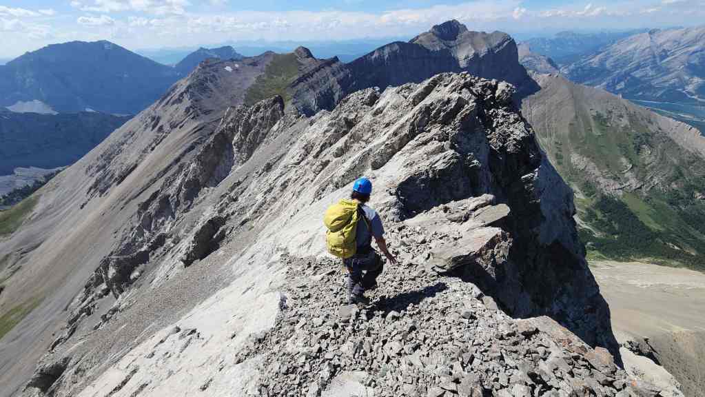
Heading up to the summit ridge.
Back on solid rock.

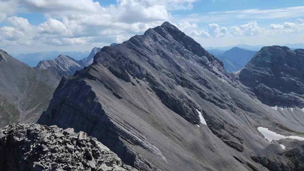
Brad scopes the ridge ahead.

A pano of the previous photo.
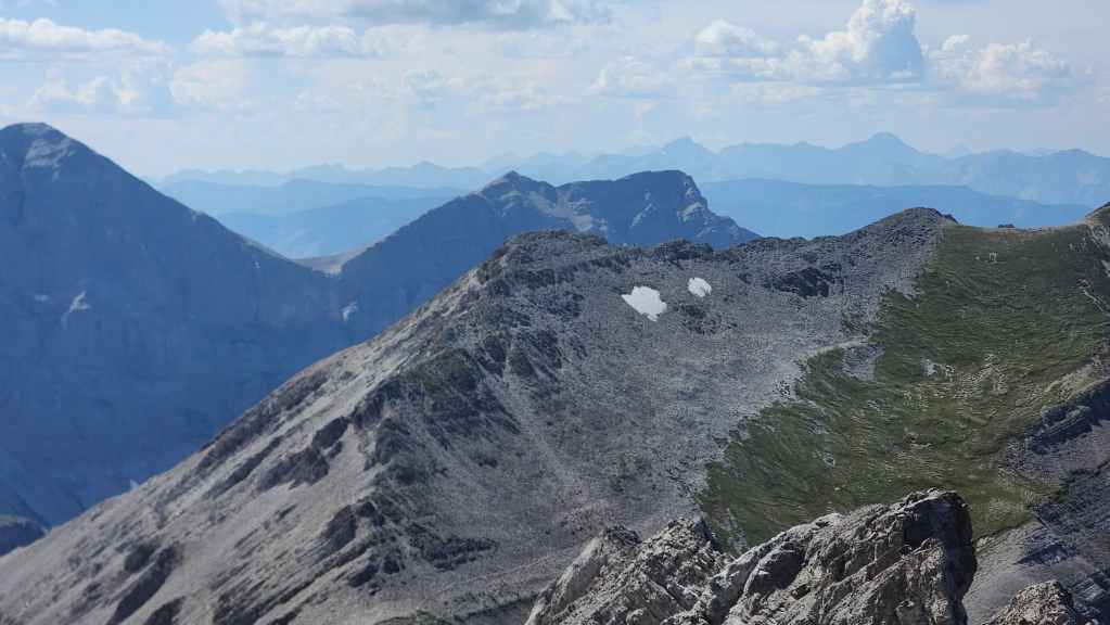
Gazing over the edge at Mount McLaren.
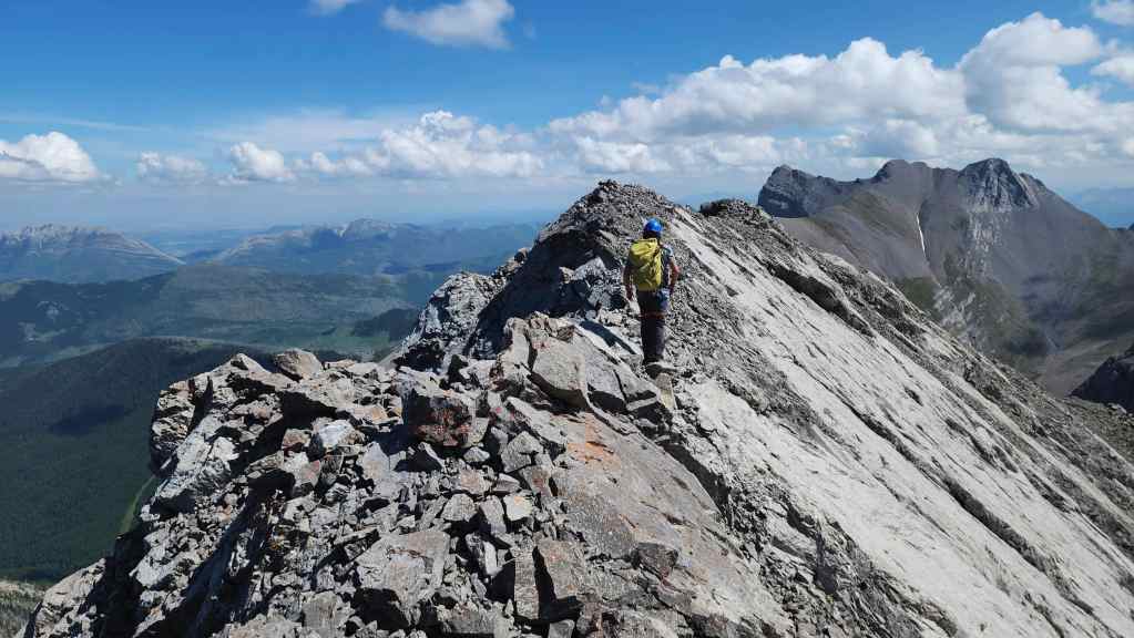
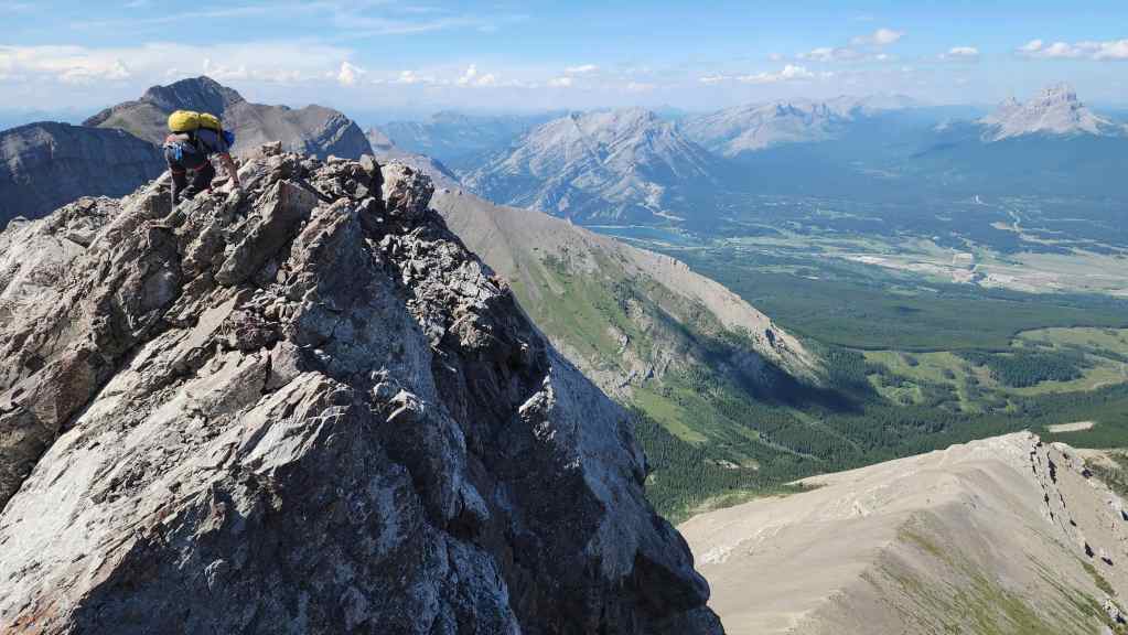
Following the ridge required some careful scrambling.

A wider view of the previous photo. I would not want to be on this mountain when there was snow or rain. 😳 Like Ptolemy, it is best left for the perfect forecast.

After generously prompting me to take the lead and reach the summit first, Brad follows me onto the top of Mount Parrish (2566 m). For reference, it took us 3.5 hours from the start of the first pitch – which was time well-spent if you ask me. 🙂

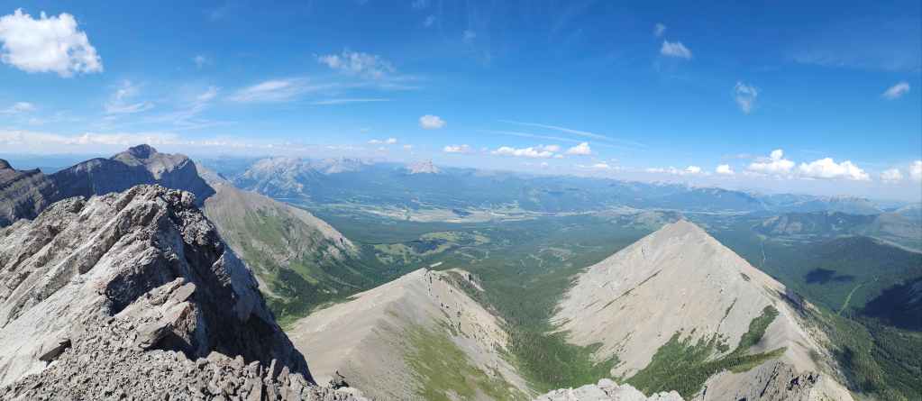
A pano to the south…

Followed by a pano to the west.
Looking north and across the Crowsnest Pass.

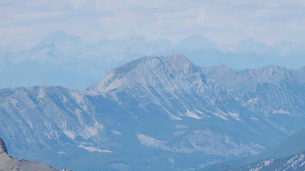
No matter what angle I look at it from, Mount Coulthard always looks like a hippopotamus to me. 😂
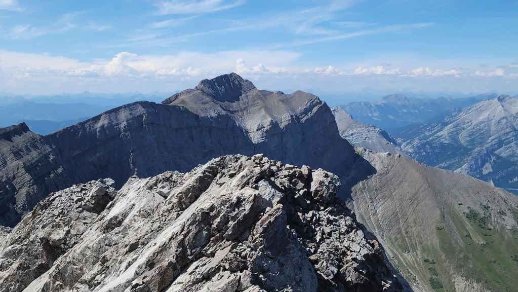
Andy Good Peak shares a col with Parrish.

The largest peak in the area is Mount Ptolemy. If I were to compare the two peaks in terms of difficulty. I’d say that Parrish is harder because the terrain never relents; however, the rock is excellent. For Ptolemy, the rock is terrible, but the main crux is a short 5.2 climb compared to the sustained 5.3 – 5.4 climbing on Parrish. Personally, I wouldn’t tackle either without bringing some along some technical gear, but again, that’s just me. 🙂

A closer look at “Pharaoh’s Peak” on the Northwest Ridge of Ptolemy.
The other two peaks on the Northwest Ridge of Ptolemy are “Anubis Peak” (centre) and “Mummy Mountain” (right of centre).
Chinook Peak (centre) sits immediately to the west.
Zooming in on Mount Erickson (centre).

A closer look at “Deadman Peak” (left of centre) and Allison Peak (right).

A wider view of the previous photo that features Phillipps Peak and Mount Tecumseh on the far left.
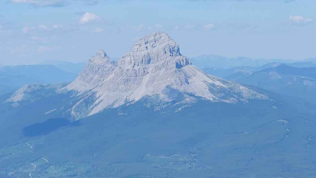
Mighty Omahkai’stoo (Crowsnest Mountain) (centre) and behind it, the Seven Sisters. If all goes well, the plan is to climb a couple of the ‘sisters’ this summer.

Bluff Mountain (foreground centre) is a larger massif than you’d think. Directly behind it are Morin Peak and Livingstone South. On the far right are Tallon Peak and Roberston Peak.

The mountain that moves: Turtle Mountain.

Hillcrest Mountain (right of centre) and Burmis Mountain (left).
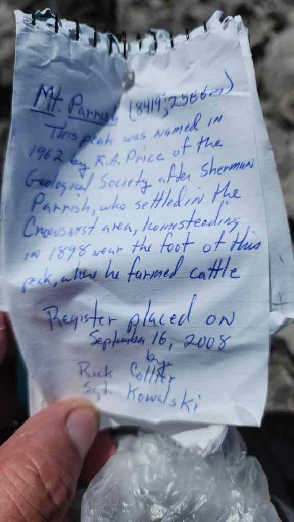
Rick Collier’s register from September 2008 is still on the mountain. In looking through the pages there are only a few recorded ascents: Steven Noel and Xander Wilkie (September 20023); Andrew Sproate (July 2025); Vern Dewit (July 2025), and of course, Brad and I.
Missing from the register is an entry from Brad and Dave (September 2023) who ascended Parrish on the same day as Steven and Xander. Also missing an entry are Devan Peterson (September 2024), and of course, Andy Nugara who was here before Collier even placed the register. 🙂 Still, in seventeen years, that’s not many visitors which speaks to the overall difficulty of this peak.
Of the few ascents Mount Parrish has seen, I would guess that Brad stands as one of the only people to have summited it twice. 🙂

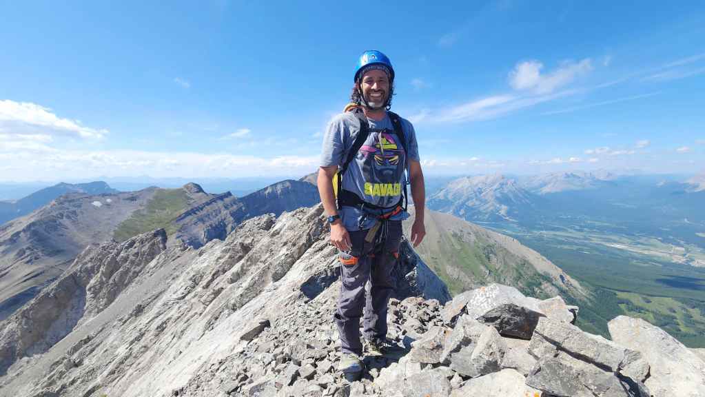
Being a grandpa and climbing mountains is a pretty good gig. 😂 (Photo by Brad Wolcott)
Heading back.
We’d follow the summit ridge for a short distance…
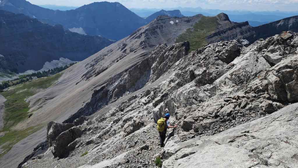
Before locating an easier way back to the scree field.
Still, the ‘easy’ way did require some careful down-climbing.
Back on that miserable scree.
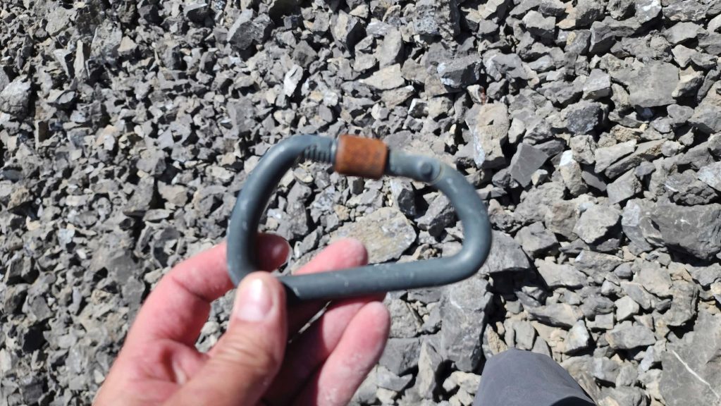
While crossing the scree field, I found a steel Stubai biner that must be several decades old – perhaps from the 1980s. I guess we should add ‘Anonymous’ to the register. 🙂

Thankful to be back to solid rock. (Photo by Brad Wolcott)
Brad down-climbs the section we scrambled.
Arriving back at our climbing gear.

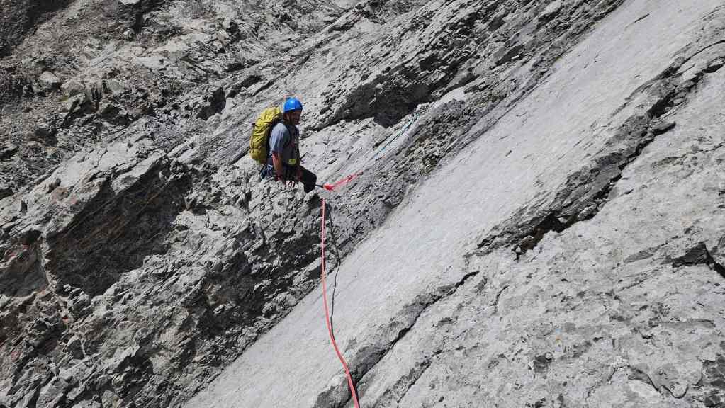
Starting a rappel past the crux on the fifth pitch. (Photo by Brad Wolcott)

Looking up to Brad as he approaches the crux.

Brad prepares to cross the crux on the fourth pitch.
Brad stops at the pinnacle that sits between the fourth and third pitches.
We’ll use the pinnacle to rappel the third pitch and a portion of the second.
I start my rappel down the third pitch… (Photo by Brad Wolcott)

Before heading down the second pitch. (Photo by Brad Wolcott)
Brad raps down the second pitch.
Brad starts to down-climb the lower section of the second pitch…
But then changes his mind and sets a rappel. This was fun to climb earlier in the day, but going down was a different story.
My turn to rappel. (Photo by Brad Wolcott)
Looking down the first pitch towards our starting point.

Brad follows me down to the base.

We did it! 😀 As much fun as the climb was, it sure felt good to be off the mountain.
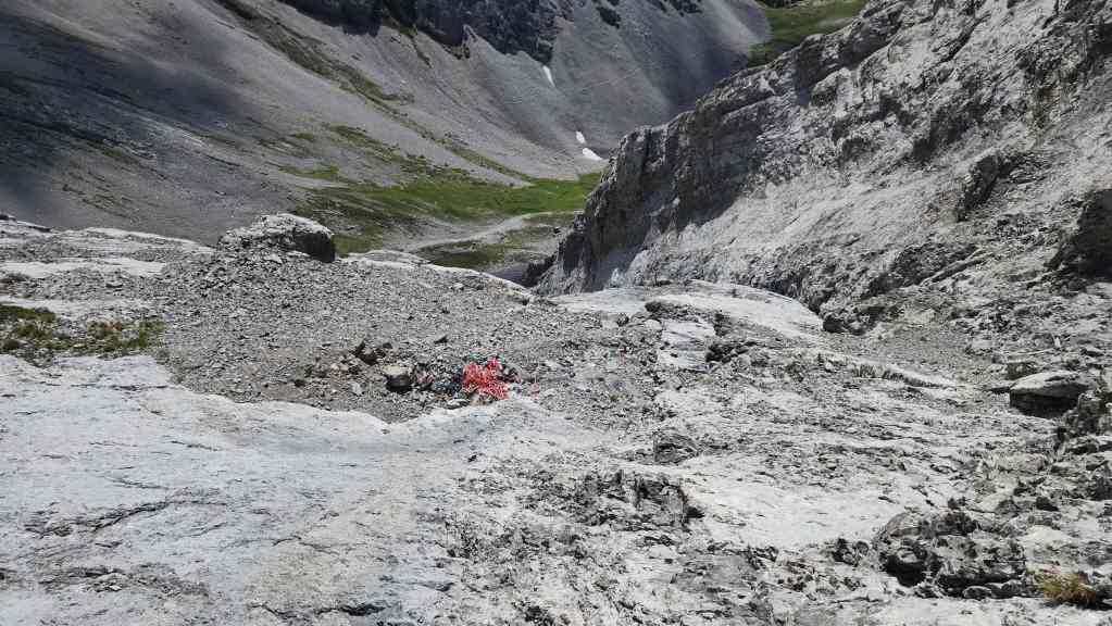
Descending the scree apron. While the loose rock made it miserable to climb, it also made it awesome to descend.
Back in the cirque.

Another look at the lower portion of the Fullcott route (centre).
Goodbye Mount Parrish. Thanks for the fun day!

A final look at Parrish.
Back on the trail in the Andy Good Basin.
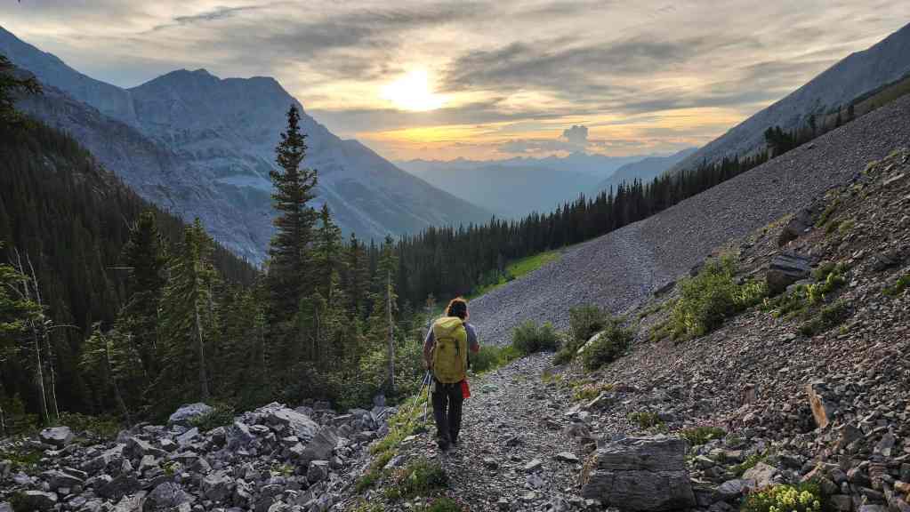
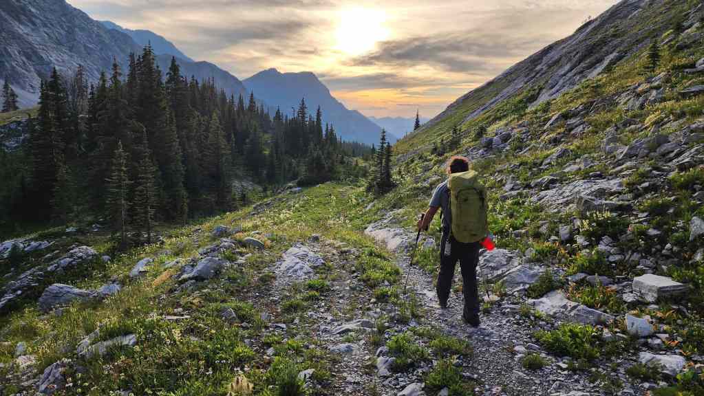
An awesome day on the mountain is capped off by a gorgeous sunset hike back to our bikes.

It will only take us 30 minutes or so to get back from here, but the sun has already disappeared…

So we’ll have to pull out our headlamps.

Back at Brad’s car 13 hours and 45 minutes after starting. This was a fantastic trip and a massive thanks to Brad for not only volunteering to reascend Parrish, but doing a masterful job as lead. 😀 A huge thank you also goes out to Dave Fuller for his role in pioneering the route with Brad – an old school technical ascent was the perfect way to get up Parrish! For many, the time this trip took is probably a turnoff, but for me, the great rock and overall climbing experience was totally worth it. As I said before, I’d personally bring pro with me on whatever route I chose for Parrish, even if it was never used. Then again, as a grandpa, I’m probably more sensitive than most when it comes to needing an adult diaper. 😂
Nice work Dave! We really enjoyed this one. Was quite a shock running into Brad and Dave that day.
Thanks Steven! And sorry for the really late reply! I know Brad and Dave were definitely not expecting to anyone else either. Well done on your ascent!!