 Hiking and scrambling are inherently dangerous activities. Please read my Disclaimer.
Greeted by wind-whipped flurries as I arrived in the parking lot of the Pincher Creek Walmart, it was obvious that nothing Andy and I had discussed as possible objectives for the day would work. The forecast had changed and there was little we could do, but roll with it. November is such an erratic time for weather and while I always have alternate objectives in my back pocket, it seems like this month in particular, requires a hiker to carry a George Costanza-like wallet of options.
The last time I was away from the mountains for this long, was back in 2020 when I had a thyroidectomy followed by cancer treatment in the early days of the pandemic. Thankfully, nothing that drastic has kept me away for the past 8 weeks, other than we’ve had had lots going on in life – and I guess that’s the great thing about hobbies like hiking. The mountains aren’t going anywhere and when hiking has to take a backseat to more important things, it makes you appreciate the chance to get back to nature, all the more. 🙂
As we loaded my truck with Andy’s gear, we knew that anything with elevation was a no-go for today. That’s when I suggested diminutive Ginger Hill – something that I’ve never gotten around to, but with the sketchy weather, it would be at least something to accomplish.
During our subsequent conversation, I discovered that in addition to Ginger Hill, Andy had also never been up Maverick Hill. This surprised me because there aren’t many mountains (or hills) in southern Alberta that Andy hasn’t climbed and to inadvertently stumble on two of them, was a great motivator.
Driving from Pincher, I suggested that if the weather allowed, we should consider a loop that also included Poker Peak (a multiple repeat for both of us). I’d never been on the southeast arm of Adanac Ridge that extends from Poker to Ginger Hill – and neither had Andy – so this would be new terrain for both of us. 🙂
I’d ascended Maverick Hill back in April 2016, but did so with Brad from a starting point along the Adanac Road. I then continued solo along the ridge to tag Poker for a second time, so I knew that the ~2.7 km ridge walk was easy. However, ascending Maverick from the east would be a new experience, and this only furthered my enthusiasm for a loop.
As we turned onto Township Road 64A from Highway 507, Andy pulled up Sonny Bou’s trip report from May 16, 2020 followed by Vern Dewit’s report from May 24, 2020. Sonny’s route up Ginger avoided private land and succinctly aligned with our proposed approach along the southeast leg of Adanac Ridge. Coupled with this, the trail Sonny, Zosia, and Shaun used for approach, would serve perfectly as our way back at the end of the day; elegantly closing our loop. For tackling Maverick, we‘d more or less follow Vern’s route as the way is very straightforward from the gas road that we’d use on approach.
So, by the time we’d reached our starting point, the weather had improved slightly; though we’d endure high winds and intermittent snow throughout the day. When the sun came out for an extended period after reaching the base of Maverick, this confirmed our plan was meant to be, for until this point, tackling the loop was still up in the air. All in all, this turned into an excellent day! 🙂
Be sure to read Andy’s awesome report!
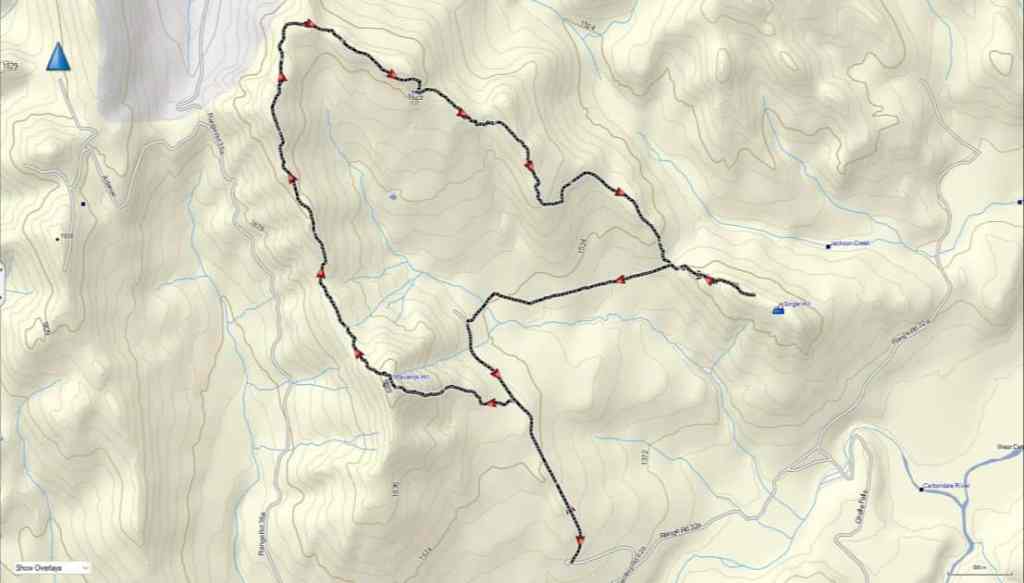
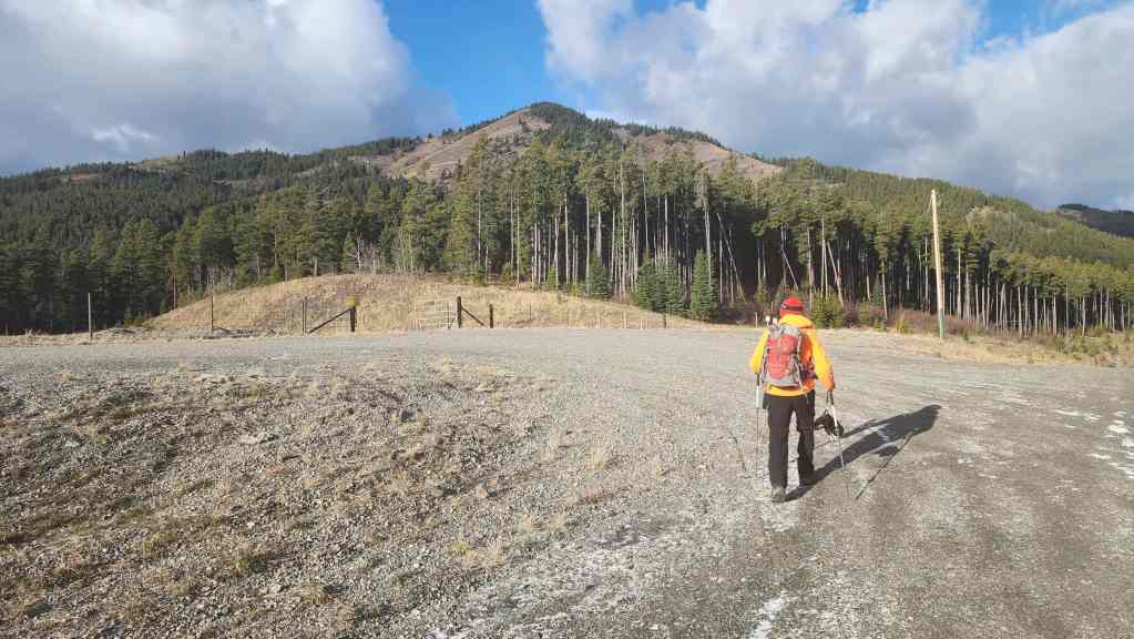
To get to our starting point for Maverick, Poker, and Ginger, we drove west from Pincher Creek along Highway 507 to the hamlet of Beaver Mines. At the T-intersection on the edge of town, we turned right (north) and continued on Highway 507 for ~5.2 km until we came to Township Road 64A. We then turned left (west) and followed the gravel road for ~13.7 km until we came to a side road on the right that led towards a Shell gas well. We turned onto the road and follow it for ~600 m until we came to a locked gate on a hairpin curve. This was our starting point.
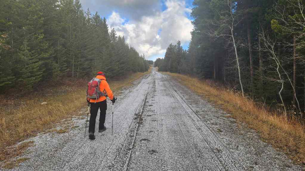
From my truck, we hiked along the gas road for ~1.4 km (137 m elevation gain) until we came to a gas well on our left. The well is situated at the base of Maverick and our route started at the north end of the large gravel clearing. An obvious path led onto the slopes of Maverick, but it soon disappeared. However, the route was super straightforward up mostly open slopes. It took us only 45 minutes to reach the summit (1875 m) from the road over ~1.2 km (302 m elevation gain).
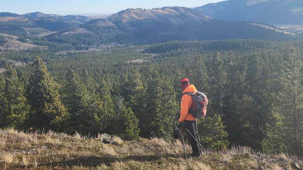
From Maverick, we then repeated my April 2016 trip along the ridge to Poker Peak (1935 m). This was an easy ~2.7 km hike that took us almost exactly 1 hour (284 m elevation gain / 206 m elevation loss). The terrain is open and we endured a constant west wind combined with intermittent flurries.
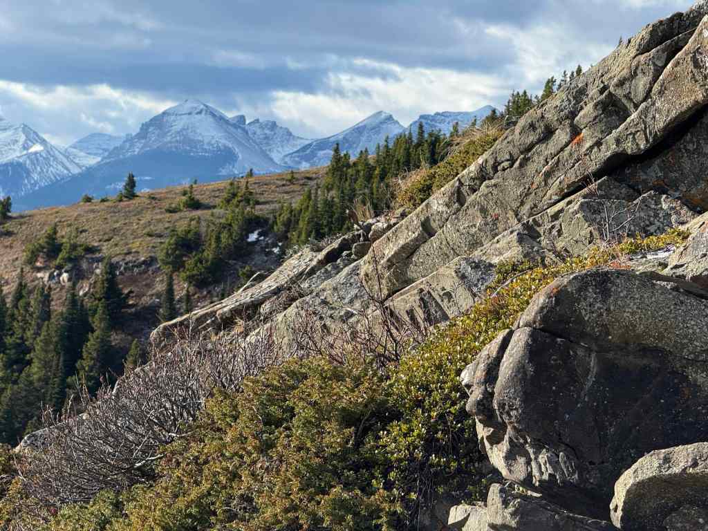
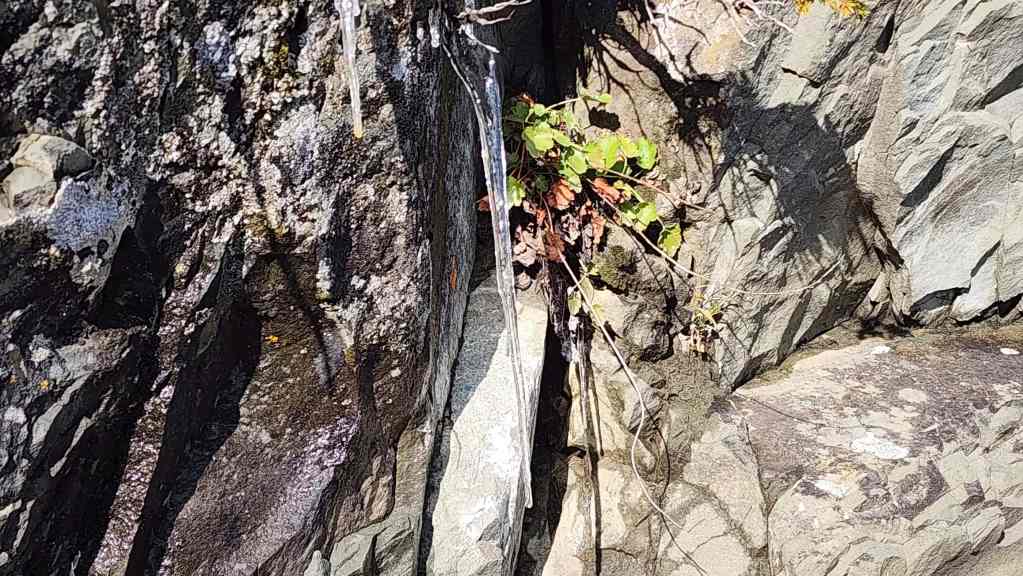
After a very brief stay on the summit of Poker, we set off for Ginger Hill (1611 m). The southeast arm of Adanac Ridge begins just to the north of Poker and connects with the main ridge at a common high point. The hike is interesting, in particular, the rock formation located beneath the highest point of the ridge. The two trickiest parts are: avoiding the deadfall in the small section of new growth just beyond the rock formation and; staying on course towards Ginger once you enter a larger section of forest. To avoid the deadfall, we kept as far to hiker’s right as possible, and to navigate in the trees we relied on our topo map to maintain a constant angle to hiker’s left. Arriving at and then following an old road brought completely back on track.
Once at the col for Ginger, it was a straightforward, 20 minute ascent over ~800 m (147 m) to reach the summit (1611 m). In total from Poker Peak, it was a ~6.3 km hike (310 m elevation gain / 662 m elevation loss) that took us 2 hours and 20 minutes.
Being blasted by wind and snow on the summit shortened our stay and we returned to the col where and the very obvious trail that Sonny and Vern had used. The ~1.8 km (110 m elevation gain) hike back to the road was easy thanks to the great trail and the elevation gain was negligible until the final 100 or so metres before reaching the road, where the trail climbed steeply. In total, it took us only 30 minutes to reach the road from the col.
An easy ~800 m walk along the road brought us back to our starting point for Maverick, and from there, we repeated the ~1.4 km walk back to my truck.
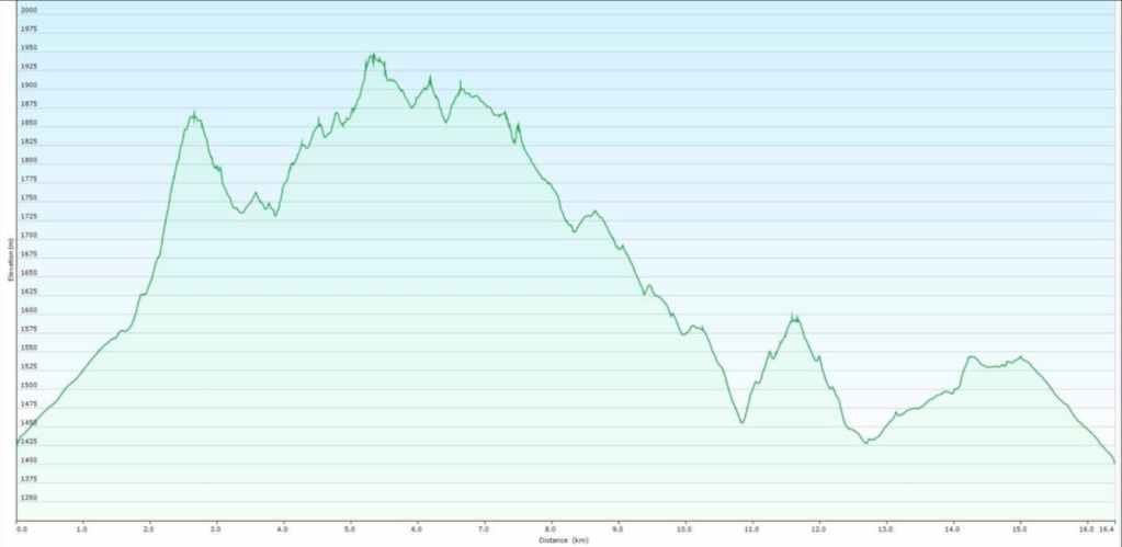
Our total roundtrip distance was 17.2 km and our total elevation gains were 1317 m. Our total roundtrip time was 5 hours and 56 minutes. For reference, from my truck it took us 1 hour and 10 minutes to reach the summit of Maverick Hill (~2.6 km / 439 m elevation gain).

Gearing up at the locked gate. It was windy and chilly!
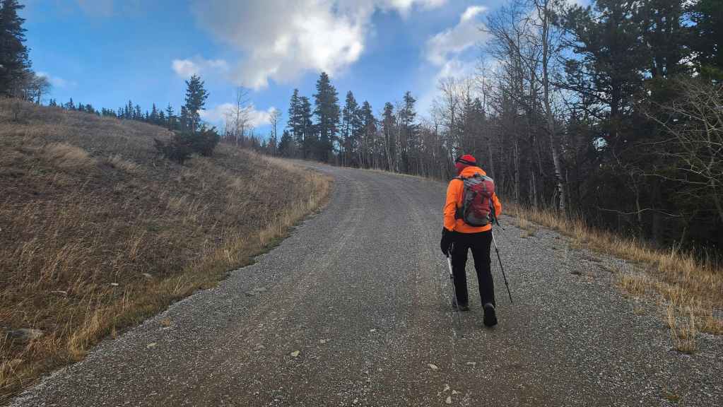
Starting up the gas road.
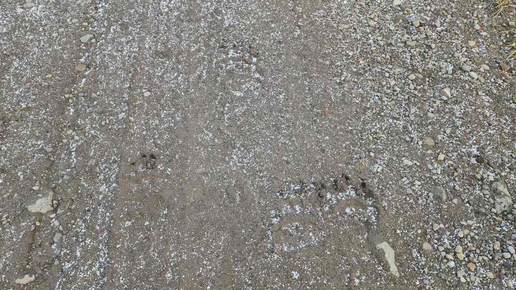
It wasn’t long until we came across a number of grizzly tracks…
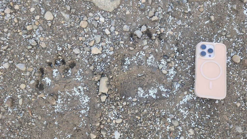
Grizzly’s don’t have pockets and sometimes they drop their phones. Score! 😂
Following the bear superhighway. Some bears went up and some bears came down. We were just hoping they had finished using it.
Approximately 1.4 km from my truck, we came to a well site at the base of Maverick Hill. From here, the route to the top is straightforward.
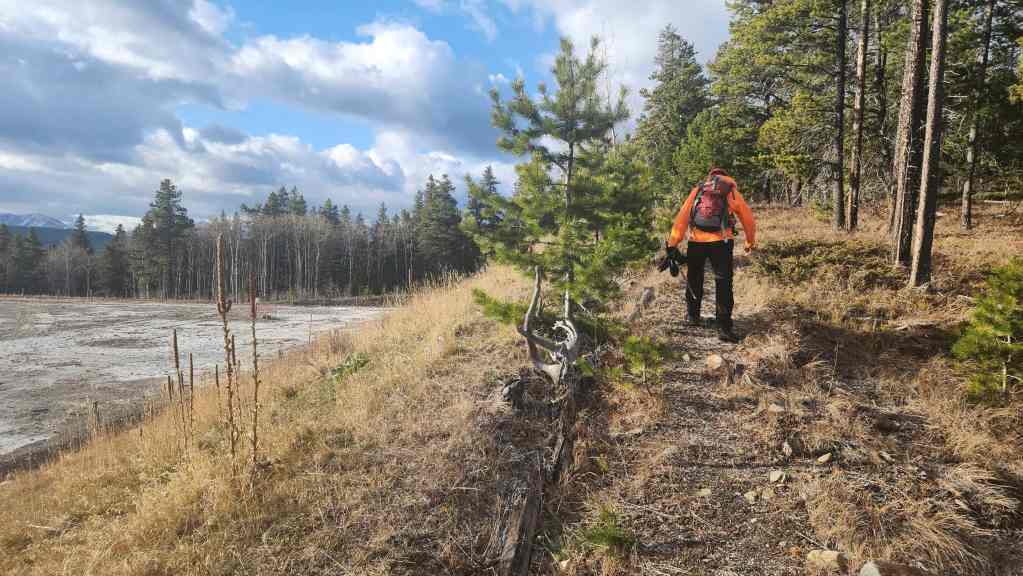
Starting off on a trail at the north end of the well site.

We would follow the trail until it disappeared.

Hiking past some interesting rock. (Photo by Andrew Nugara)
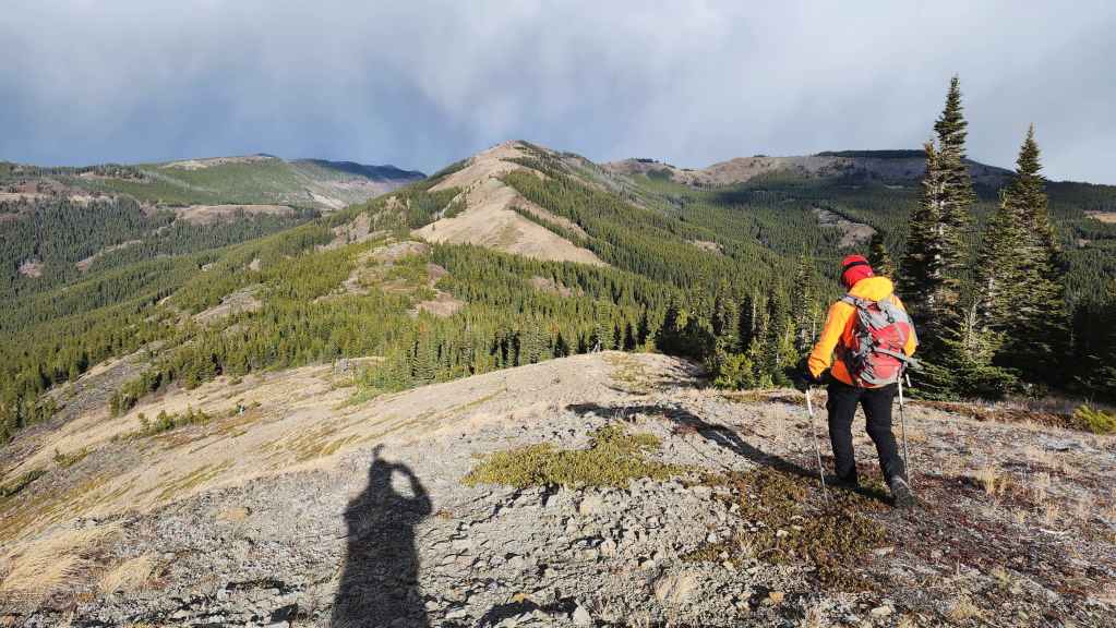
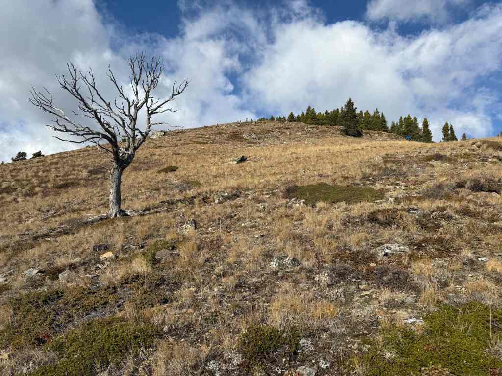
Gazing towards mighty Ginger Hill. 😂

We’d follow these easy, open slopes until we were just below the summit.

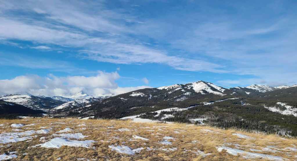
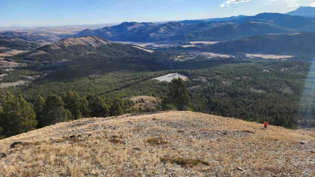
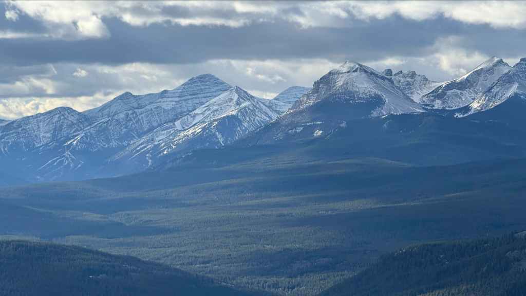
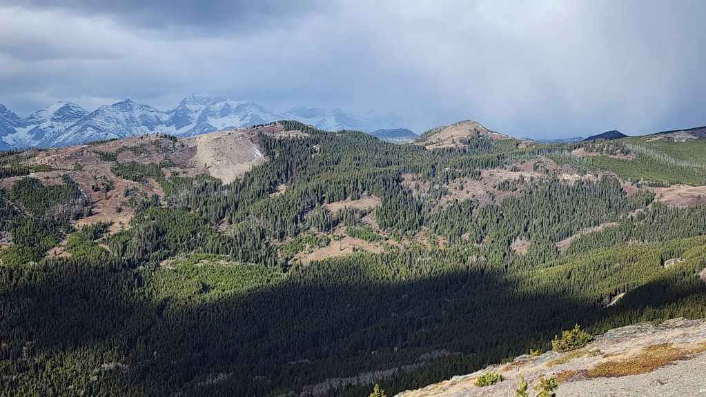
Looking back at Ginger Hill and the progress we’d made since leaving the well site (right of centre). “Blue Mountain” (centre) and “Screwdriver Ridge” (right of centre) are in the background.
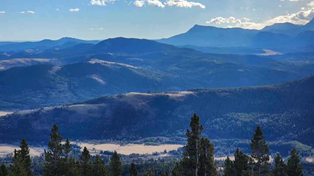
The view towards Syncline Mountain. The weather would turn for the worst after leaving the summit of Maverick, so these would be our best views of the day. (Photo by Andrew Nugara)

Ascending through a rock band.
Winter is not far off…

“Carbondale Ridge” (centre) and Carbondale Hill (right of centre) sit directly to the south of Maverick Hill.
Nearing the top. (Photo by Andrew Nugara)
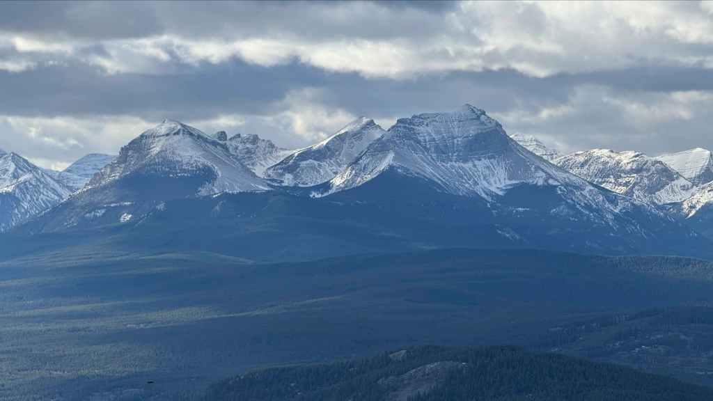
Another look back, this time with Mount Backus (far right) and Prairie Bluff (far right) joining the shot.

Entering a small stand of trees just prior to reaching the summit.

Andy arrives on the summit of Maverick Hill (1875 m).

A pano to the south…

Followed by one to the southwest.

Finally, a pano to the west.
Looking towards Mount Backus (centre) and Prairie Bluff (right of centre). Mount Baldy and Mount Albert are in the distance on the left.

Another look at “Carbondale Ridge” and Carbondale Hill.
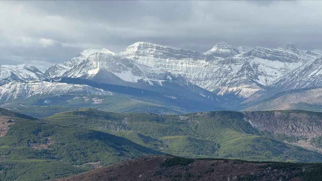
Mount Haig (left of centre), Gravenstafel Ridge (centre), St. Eloi (centre), and Syncline Mountain Peak 1 (right) and Peak 2 (far right). (Photo by Andrew Nugara)
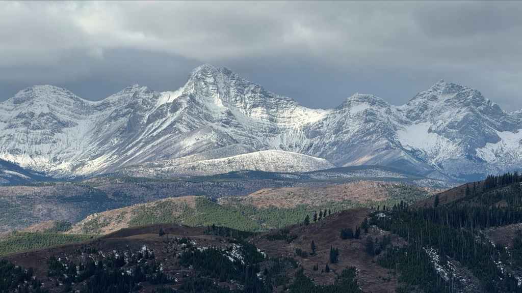
All three peaks of Syncline Mountain. (Photo by Andrew Nugara)
Centre E3 (left of centre), “South Flathead Peak” (left of centre and behind Centre E3), Centre SE1 (centre), Centre Mountain (right of centre), and Centre N1 (far right). (Photo by Andrew Nugara)
Next year, Darrah, next year… (Photo by Andrew Nugara)
Looking across the Adanac Road to Hastings Ridge (centre) and Clubs Peak (right of centre).

The view along Adanac Ridge towards Poker Peak – our next objective for the day.
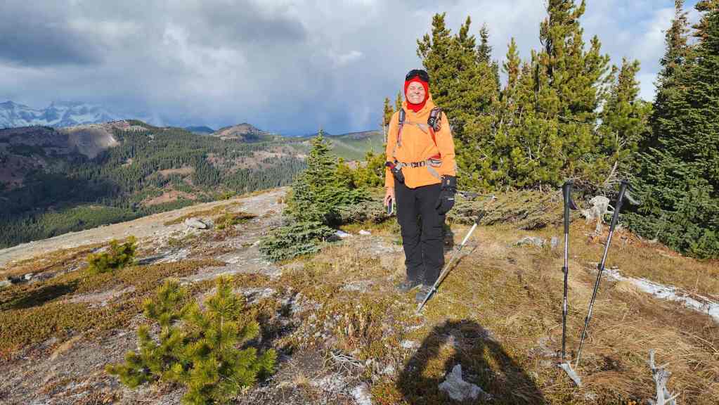
Andy’s first time on Maverick Hill…
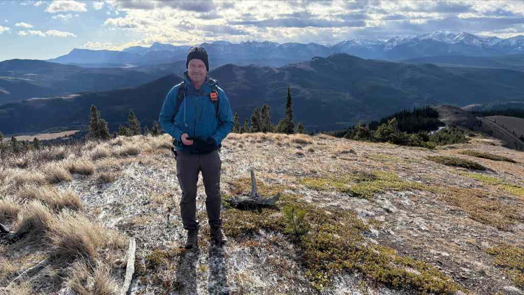
And my second time.