⚠️ Hiking and scrambling are inherently dangerous activities. Please read my Disclaimer. ⚠️
It wasn’t the peak we had hoped to ascend, but Sparwood Ridge was a decent consolation.
Our original goal was Scrubby Peak, which is a subpeak of Mount McGladrey that is located immediately behind the Corbin mine on the Flathead Range. After examining the depth of Andy Good Creek where it passes under the Corbin Road, Brad, Andrew, and I concluded that even if the water rose higher later in the day, it would still be crossable – and crossing Andy Good Creek is the key to avoid trespassing on the active mine site.
After gearing up near the start of the Andy Good Creek trail, it didn’t take us long to bike to the place where Devan Peterson had crossed on his ascent of Scrubby in June 2024. Unfortunately, the creek was a raging torrent and there was little chance that we could safely cross. Searching for alternate routes also proved futile and knowing that if we continued up the valley to find another objective, we’d have to cross the creek several more times just to stay on the trail, meant that we had to pivot to find a new objective.
As neither Brad or Andy had ascended Sparwood Ridge, I suggested this as our new goal for the day. It wouldn’t be quite the same as tackling the 5.4 pitch near the summit of Scrubby, but as we were already into mid-morning, it would settle the need for a summit. Besides, as Andy and I learned from our Marten Ridge trip, the logging roads underneath the summit of Sparwood Ridge were easily accessible and drivable. In fact, we could start quite far up the mountain and as we’d later learn, we didn’t even start at the highest point possible.
My first ascent of Sparwood Ridge was as a snowshoe in February 2022 with Raff and Bert. This was a long but highly enjoyable trip that started from the Corbin Road. Now that I knew that the seasonal gate into the Marten Ridge / Sparwood Ridge area was open, the route that we used today is by far, the saner option.
It took us exactly 2 hours to reach the summit from our vehicles and then only 1 hour to drop straight down the east slope, where we discovered that had we driven a bit further at the start of the day, we could’ve followed a side road up to a clearing that would have saved us ~200 m in elevation. Oh well. That extra bit of hiking was easy and was probably better for our health which is why we’re now ripped like Greek gods. 😂
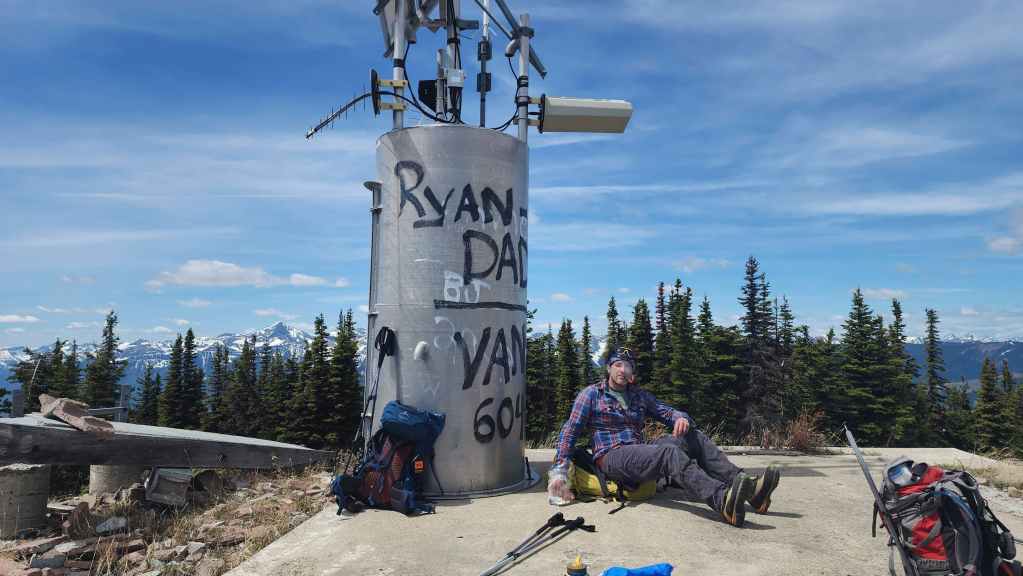
In, Fire Lookout Hikes in the Canadian Rockies, Mike Potter notes that the summit of Sparwood Ridge was once home to the Natal Fire Lookout, that was named “from a nearby village, which in turn was apparently named (around the turn of the [twentieth] century) after the British crown colony of Natal, then involved in the Boer War. (162) All that remains of the lookout now, is pieces of the foundation along with the ruins of a small staff residence that is located a short distance to the east from the summit.
Of course, one of the highlights of hiking with Brad is his enthusiasm for ice axe golf, and since our trip up Sparwood ended with time to spare, we were able to get in a round of golf once we were back at our vehicles. Big thanks to Brad and Andy for the day and all the laughs. 🙂

To get to Sparwood Ridge, we drove west on Highway 3 from the Crowsnest Pass until we came to the Corbin Road turnoff. We then turned onto Corbin Road and drove for another ~8.2 km until we came to a gated road on our right. This road is marked with signs from Teck Coal indicating that we were entering private property; however, it’s also clear that the public is allowed to use the road if we do so at our own risk; provided we avoid any areas marked as closed.
After turning onto the gated road, we followed it for ~800 m until we came to its junction with the Wheeler Creek Road on our right. We then turned onto Wheeler Creek Road and followed it for another ~3.8 km – crossing the creek over a newer bridge once – until we came to a second bridge at a junction with a road that leads to the right. We did not cross the second bridge, but instead followed the road to the right which began to lead us up the side of Sparwood Ridge.
After ~1.4 km, we came to a large pullout on the right side of the road at the junction of an older logging road that was signed as ‘SPUR B2’. We parked at the pullout and started up the old road. However, we did discover at the end of the day, that had we continued up the road for ~1 km past the SPUR B2 junction, we would have gained more elevation; eventually coming to a smaller road on the left that we could have driven ~1.9 km to the top of the clearing located at the entrance to the forest beneath the summit. Starting from here would make the trip that much quicker and would save a good 200 m in elevation.
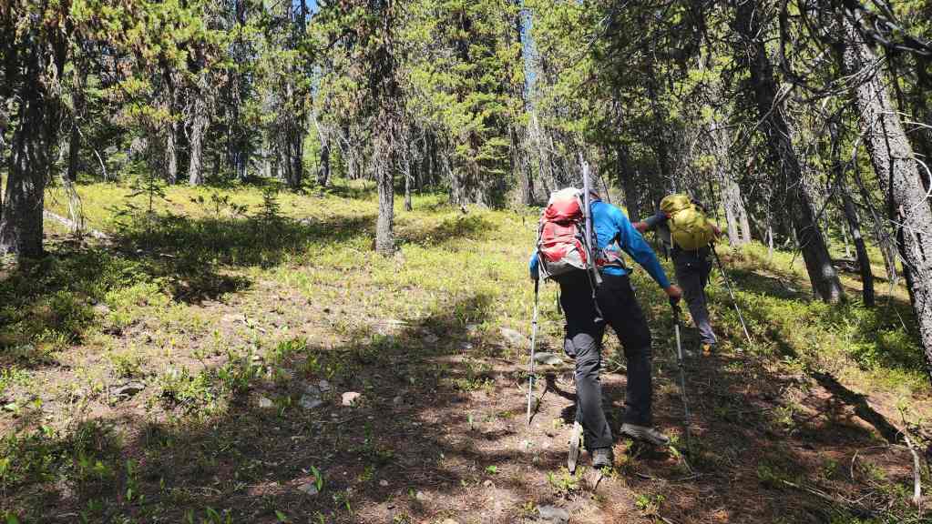
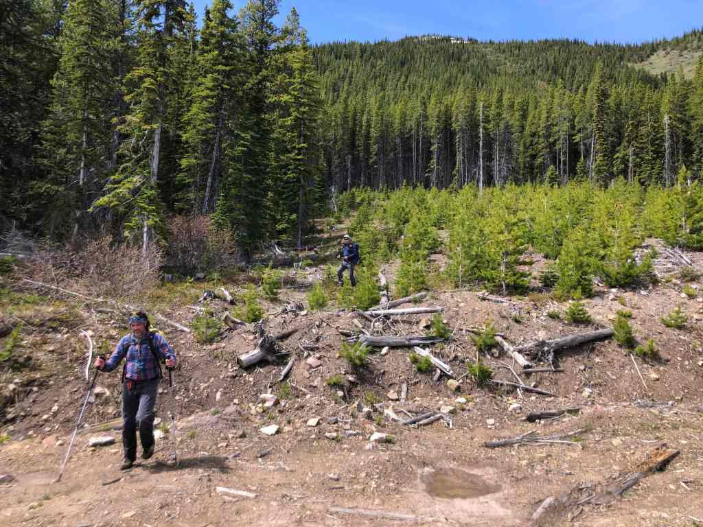
Anyway, from the start of the SPUR B2 logging road, we hiked for ~360 m until we came to a reforested clearing on our right. This is where we left the road to hike through the new growth. It didn’t take us long to gain elevation and travel the ~750 m to where we could see the road in the upper portion of the clearing that we could have started from. Oh well.
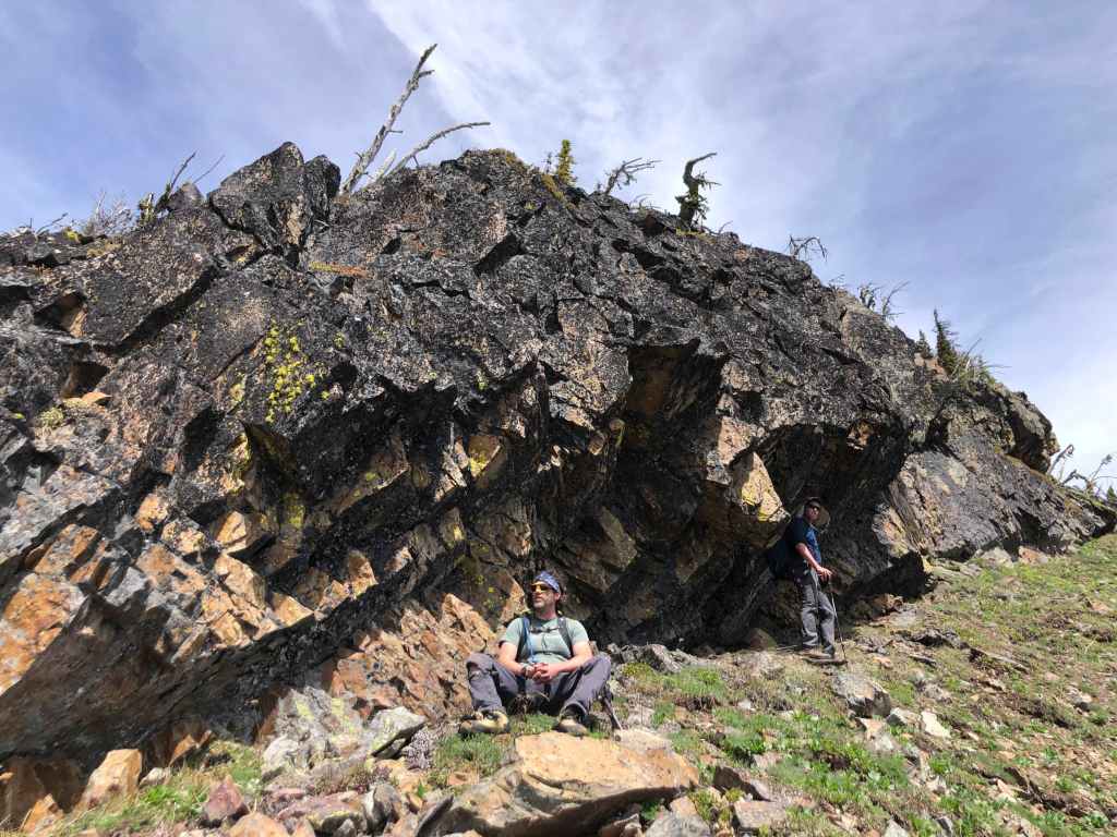
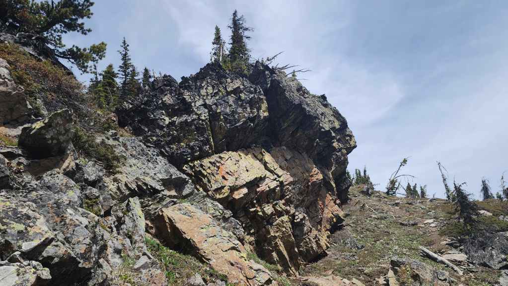
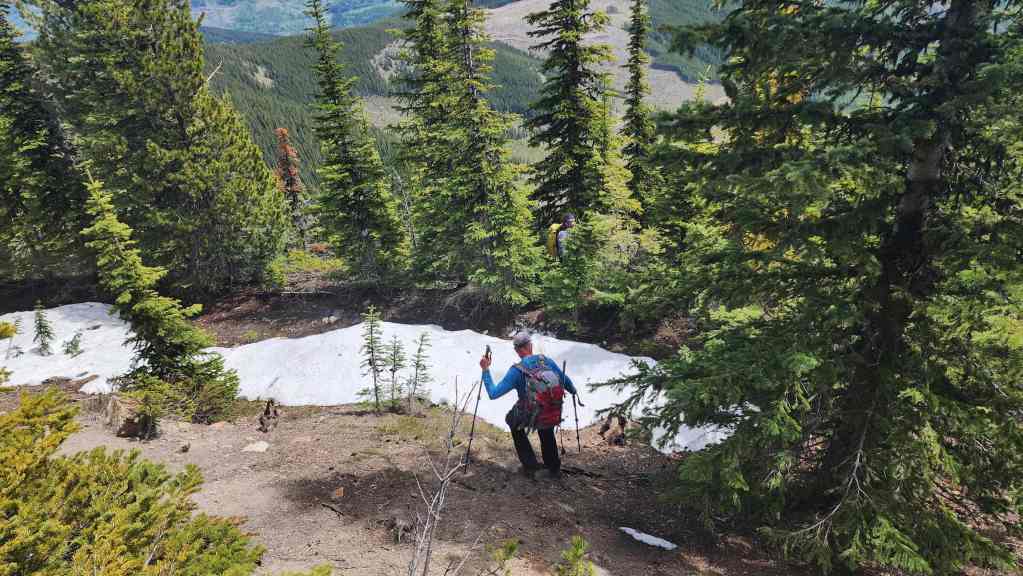
From the clearing, we entered into the trees and made our way onto Sparwood’s southeast ridge. The bushwhacking was light and once on the ridge crest, it became more open, with the occasional rock band to keep things interesting. We followed the ridge almost directly to the summit, with a slight detour to climber’s left to check out the large rock bands that sit to just to the south of the summit.
After relaxing for ~40 minutes on the summit, we dropped more or less straight down the east slope of Sparwood until we arrived in the clearing and on the road that we could have started from. To confirm that it led back to our vehicles, we followed it to where it joined with the main branch and then back to our starting point. So, yes, the clearing is the better place to start.
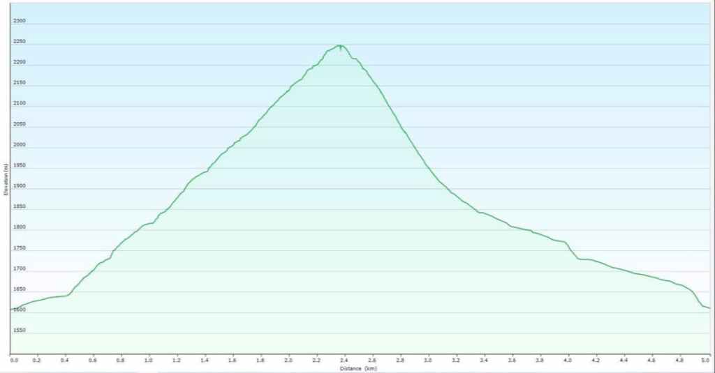
Our total roundtrip distance was 5.7 km with a total elevation gain of 642 m. For reference, it took us exactly 2 hours from our vehicles to the summit with an elevation gain of 640 m. Our total roundtrip time was 3 hours and 40 minutes.

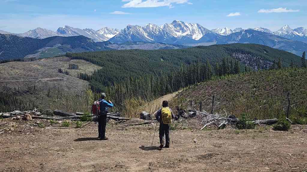
Our original objective for the day was Scrubby Peak (far right). However, after biking to the crossing point on Andy Good Creek, we quickly determined that there was way too much water to safely cross, and even if we did manage to get across, the water level would have been even higher when we returned later in the day.

Getting ready to bike to the creek crossing for Scrubby Peak (right of centre). Apparently there is a 5.4 pitch near the summit so we are loaded with technical gear. (Photo by Andrew Nugara)

Andy Good Creek was angry that day my friends. Like an old man trying to send back soup in a deli. 😂
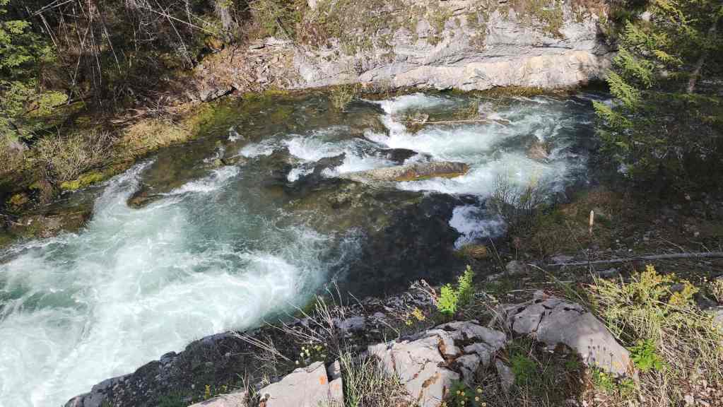
This would be the place to cross, but it was flowing too fast to attempt it. We scouted for other locations nearby and couldn’t find anything that worked.
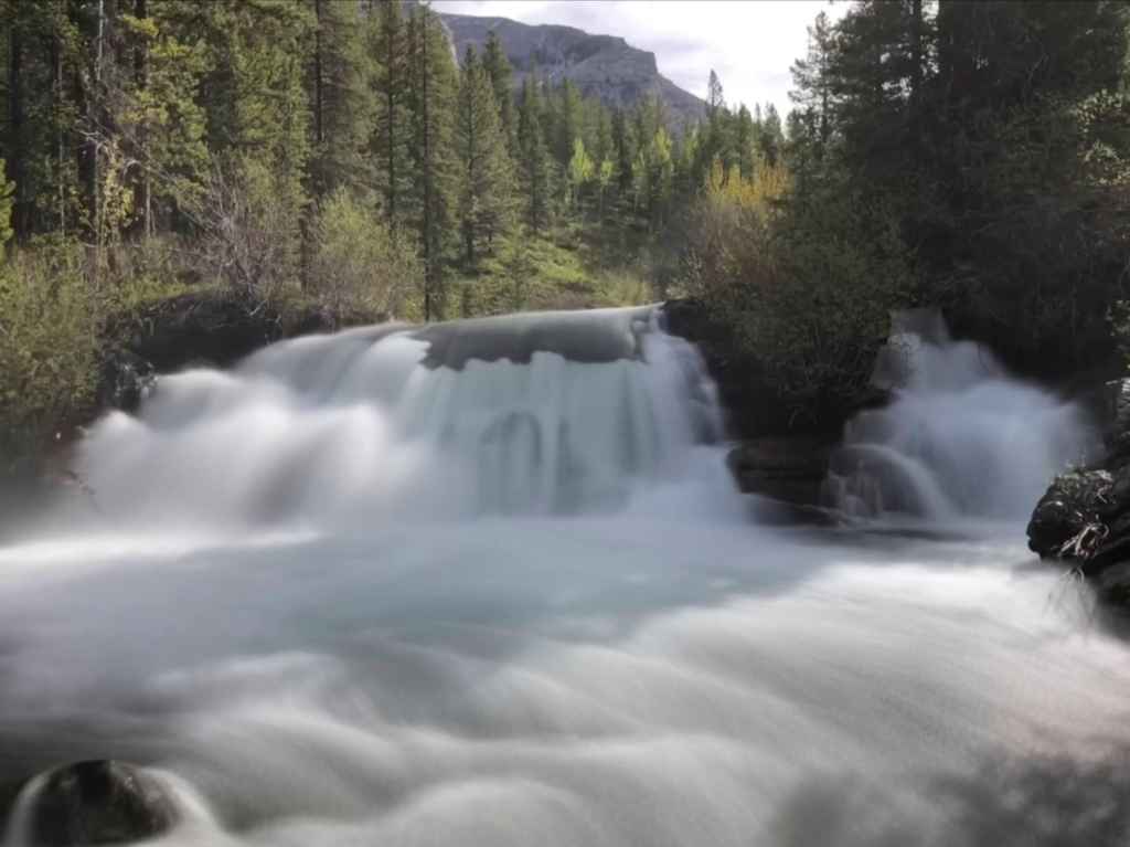
A more pastoral composition of Andy Good Creek. (Photo by Andrew Nugara)

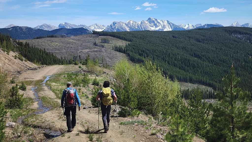
As it was already mid-morning, we opted to make the drive to Sparwood Ridge as neither Brad or Andy had made a previous ascent. This would be my second trip to the top, but my first using this route.

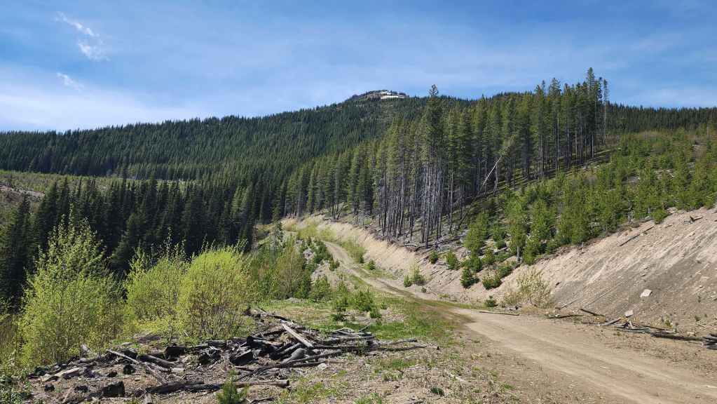
Starting up the SPUR B2 road. Had we driven another ~1 km up the road, we could have then turned onto a road on our left, that after another ~1.9 km of driving, would have taken us to the top of a clearing where we could have parked; saving us ~200 m in elevation gains. Oh well.
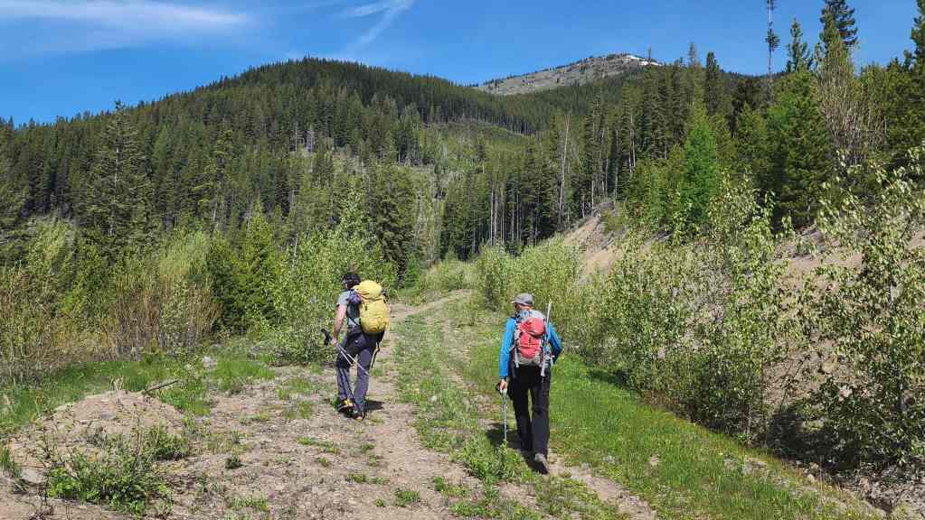
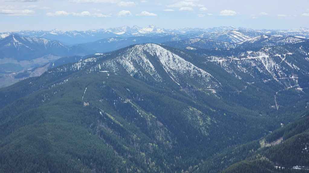
Hiking along the SPUR B2 road with the summit of Sparwood to the right of centre.

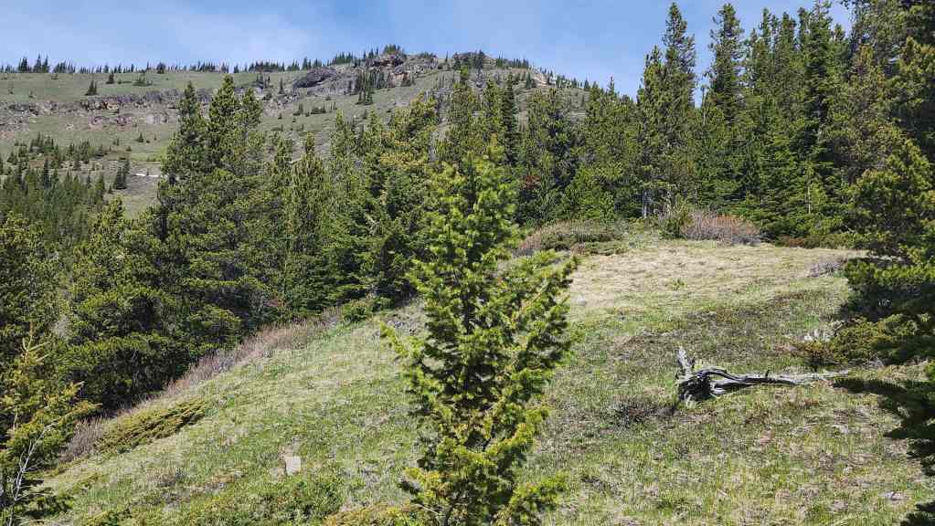
Approximately ~360 m from our vehicles, we’d leave SPUR B2 to ascend the reforested clearing in the centre.

Starting up the clearing. This is a branch of the same clearing that the other road leads to.
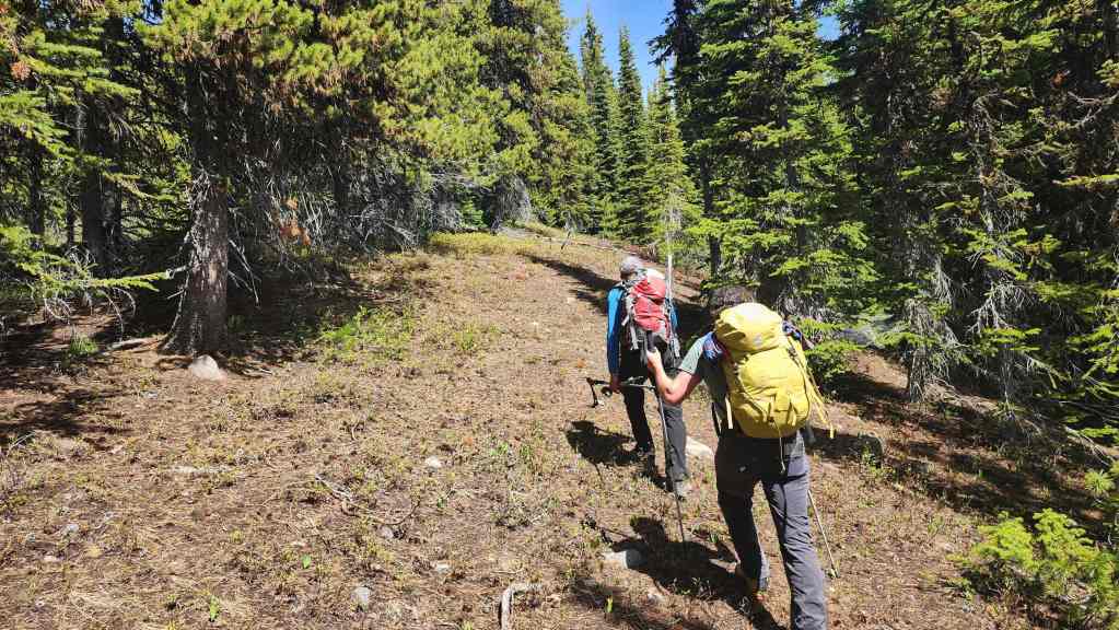
Easy hiking with very little in the way of deadfall or underbrush.
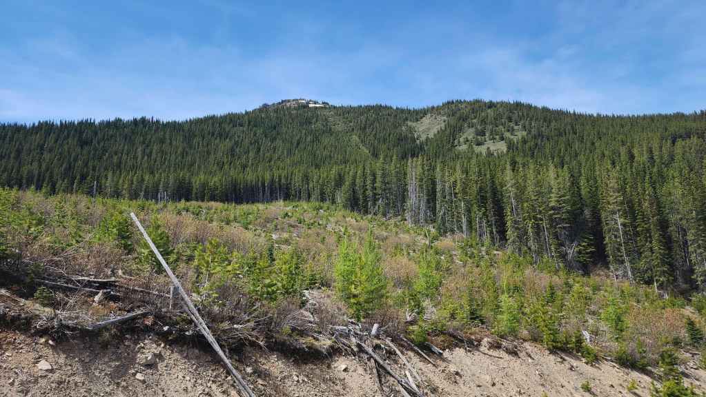
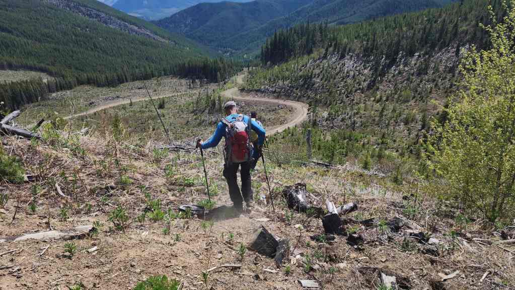
Nearing the top of the clearing with the summit dead ahead.

Zooming in on the summit.

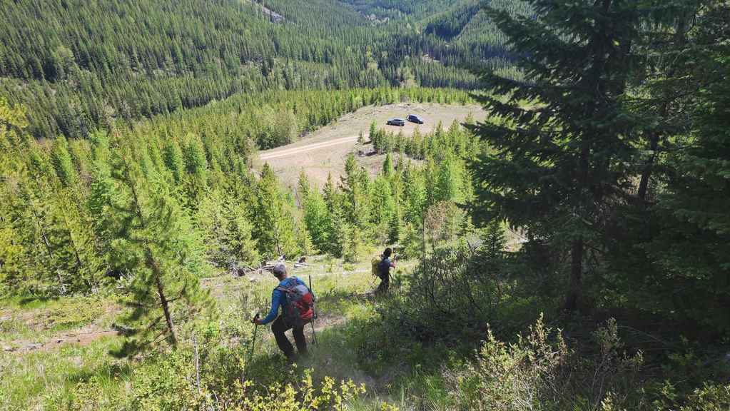
Andy’s view over to Brad and I. (Photo by Andrew Nugara)

Our view from the previous photo. The road that we will follow at the end of the day is in the background. This is where we should have started from.

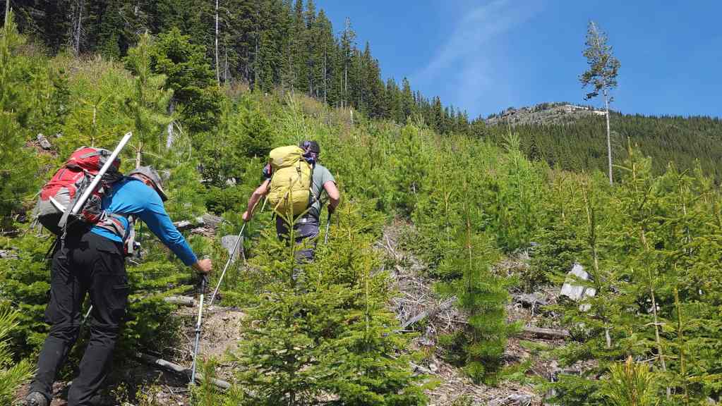
Leaving the clearing to head onto the southeast ridge.
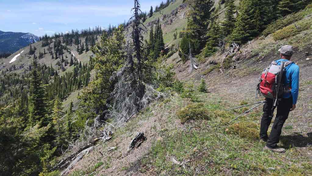
After some light bushwhacking on the lower section of the ridge, the terrain opens as we near the crest.

Arriving on the crest. From here, it will simply involve following the remainder of the ridge to reach the summit.
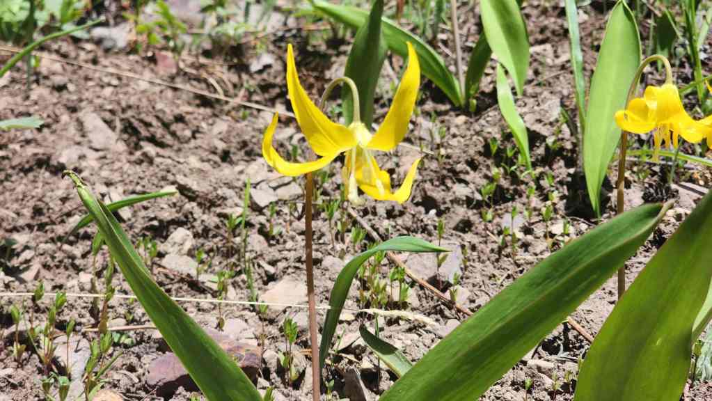
There were lots of glacier lilies in bloom.
Following the ridge.
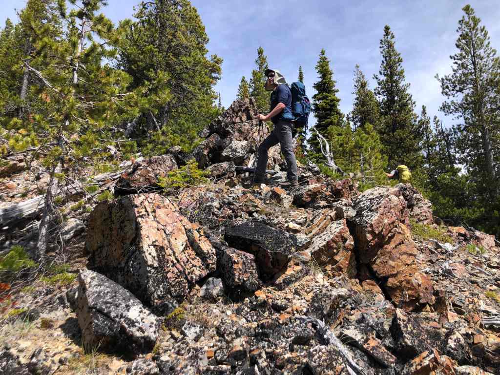
Brad climbs an easily avoidable rock band. (Photo by Andrew Nugara)
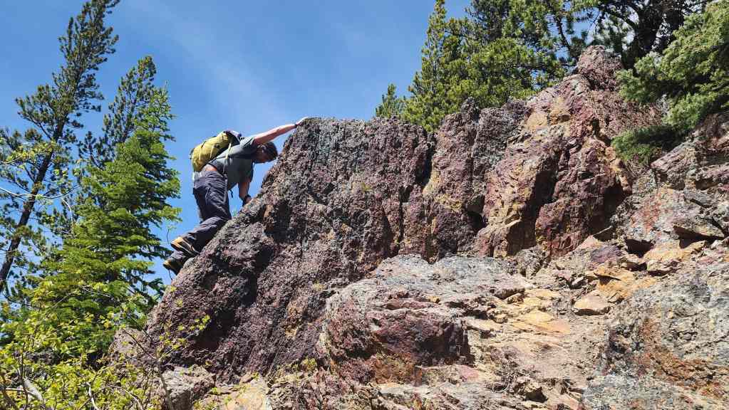
While Brad goes up…
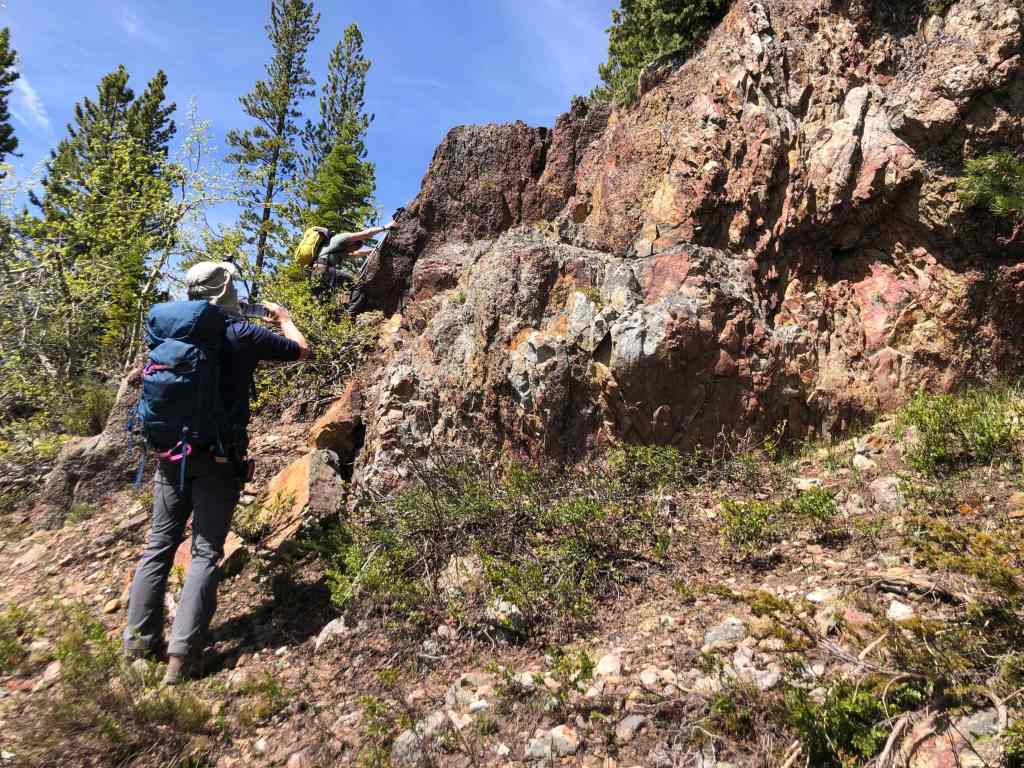
Andy photographs the rock.

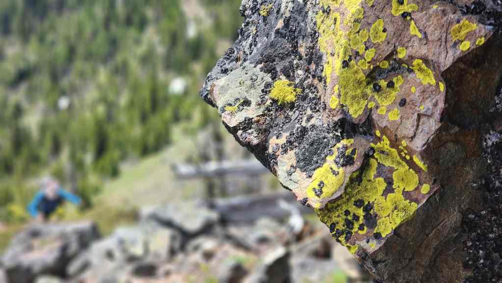
The rock was distinctive in colour. (Photo by Andrew Nugara)

More of the same. (Photo by Andrew Nugara)

Meanwhile, Brad reaches the top of the short section of crumbly conglomerate.

Brad’s view back to us. (Photo by Brad Wolcott)

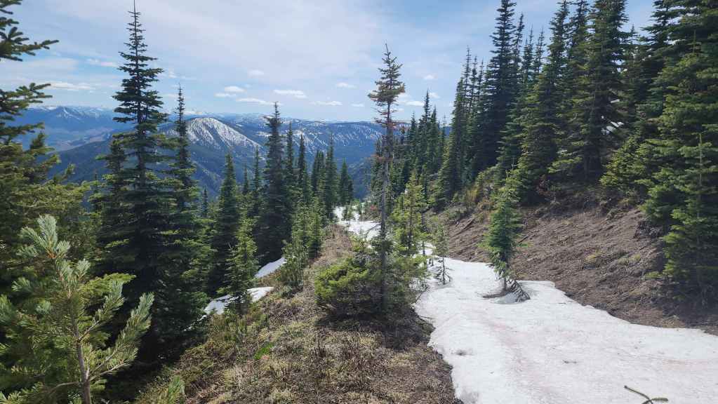
After the passing the initial band, the ridge becomes rockier.
An opening allows a good view to the summit. However, instead of going directly there, we’ll divert slightly to check out the rock bands on the left.

My view back from the previous photo. The summit of Marten Ridge is to the left of centre and the summit of Hosmer Ridge is on the far right.

The pinnacle of idiocracy. 😂 (Photo by Andrew Nugara)
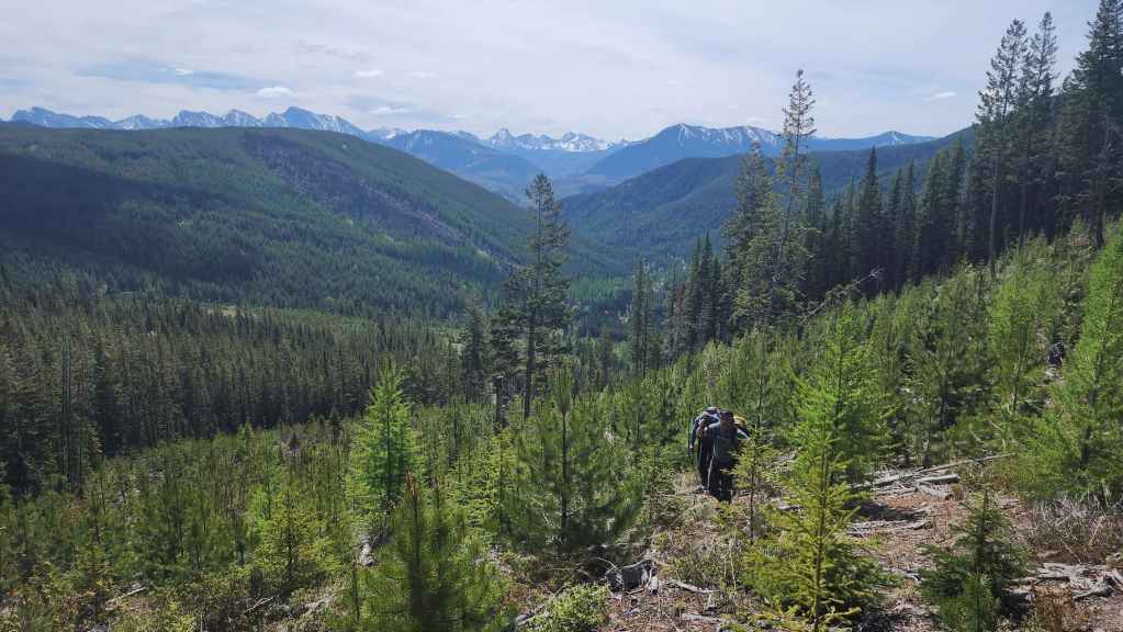
Looking east towards Loop Ridge (foreground).
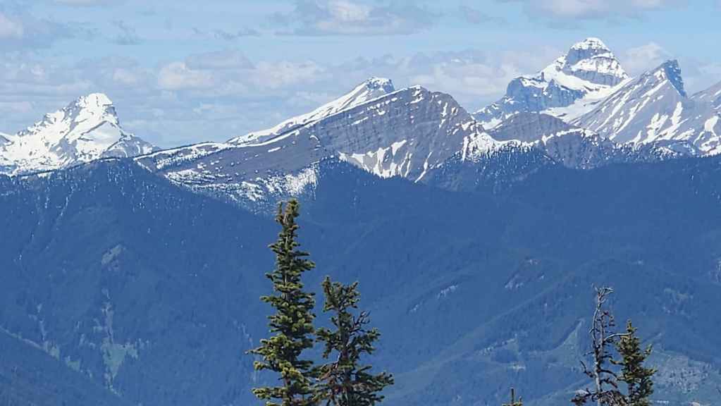
The three peaks on the Northwest Ridge of Ptolemy (left of centre) and Mount Ptolemy (right of centre).

Continuing along the ridge. (Photo by Andrew Nugara)
More rocky terrain. (Photo by Andrew Nugara)

It might not have been as exciting as Scrubby Peak, but my return to Sparwood was still a great trip. 🙂 (Photo by Andrew Nugara)

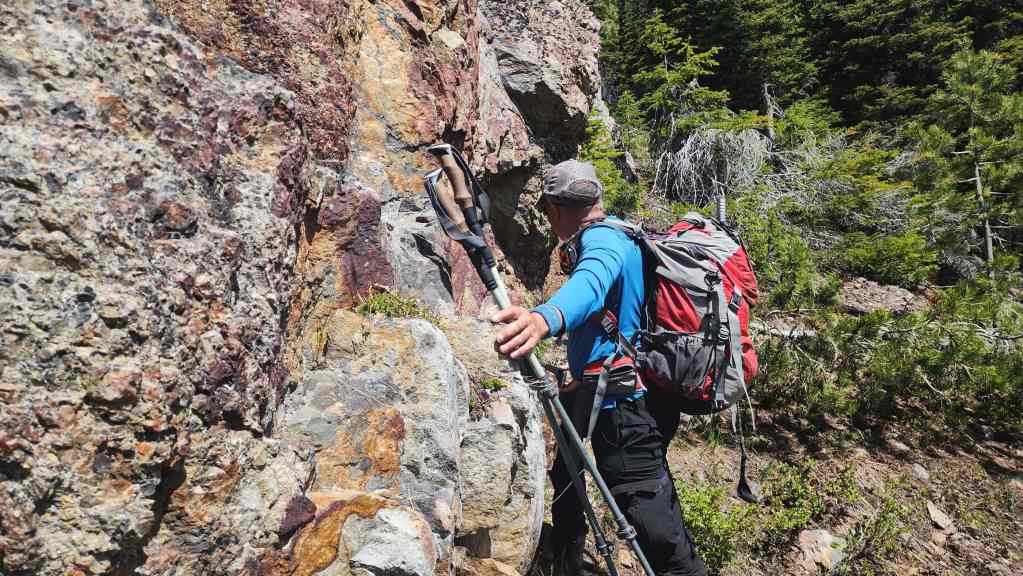
Diverting to the explore the rock bands on the left.
Arriving on a very old road. This was probably the access road for the Natal Fire Lookout that used to sit on the summit.

Almost at the bands.
Brad scrambles over the lower band.
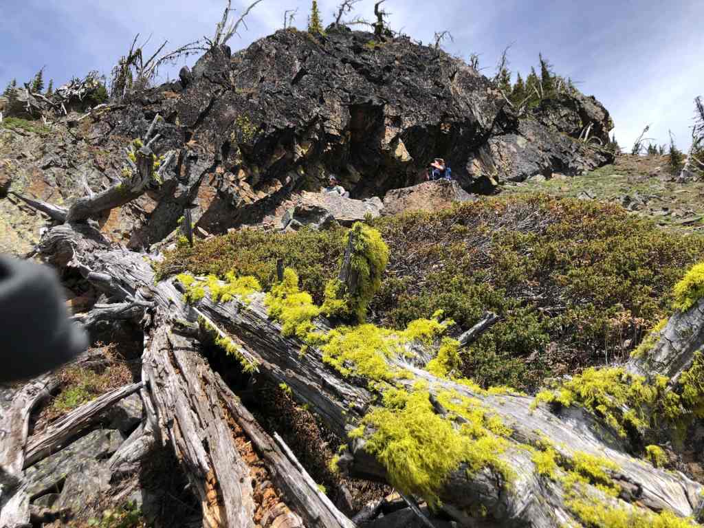
While we wait underneath an overhang, Andy approaches us from further down. (Photo by Andrew Nugara)
My view from the previous photo.
Andy arrives at the first overhang. (Photo by Andrew Nugara)
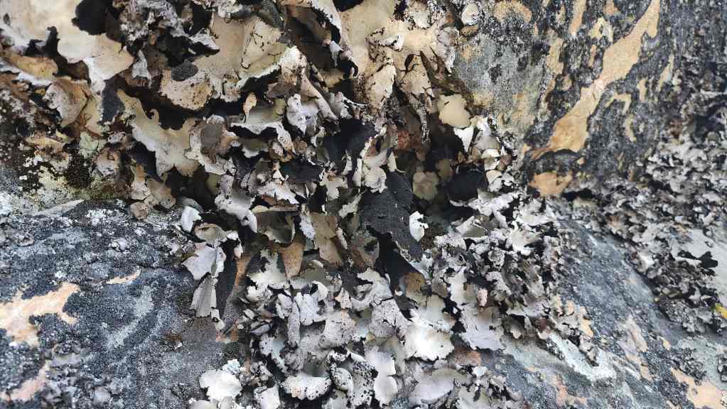
Interesting lichen hangs from the ceiling of the overhang.
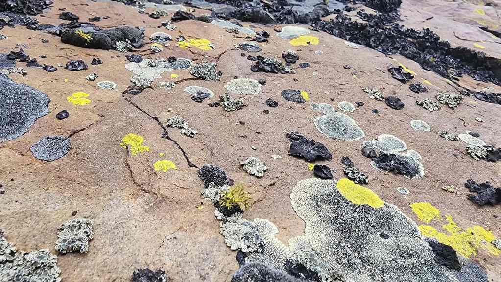
More lichen.

Following the base of the band. (Photo by Andrew Nugara)
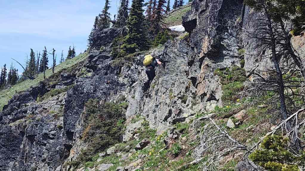
While the first overhang was cool, the second was more impressive.

Brad and I chose to climb to the top of the overhang, while Andy remained below. (Photo by Andrew Nugara)

The summit was located just beyond the overhang.
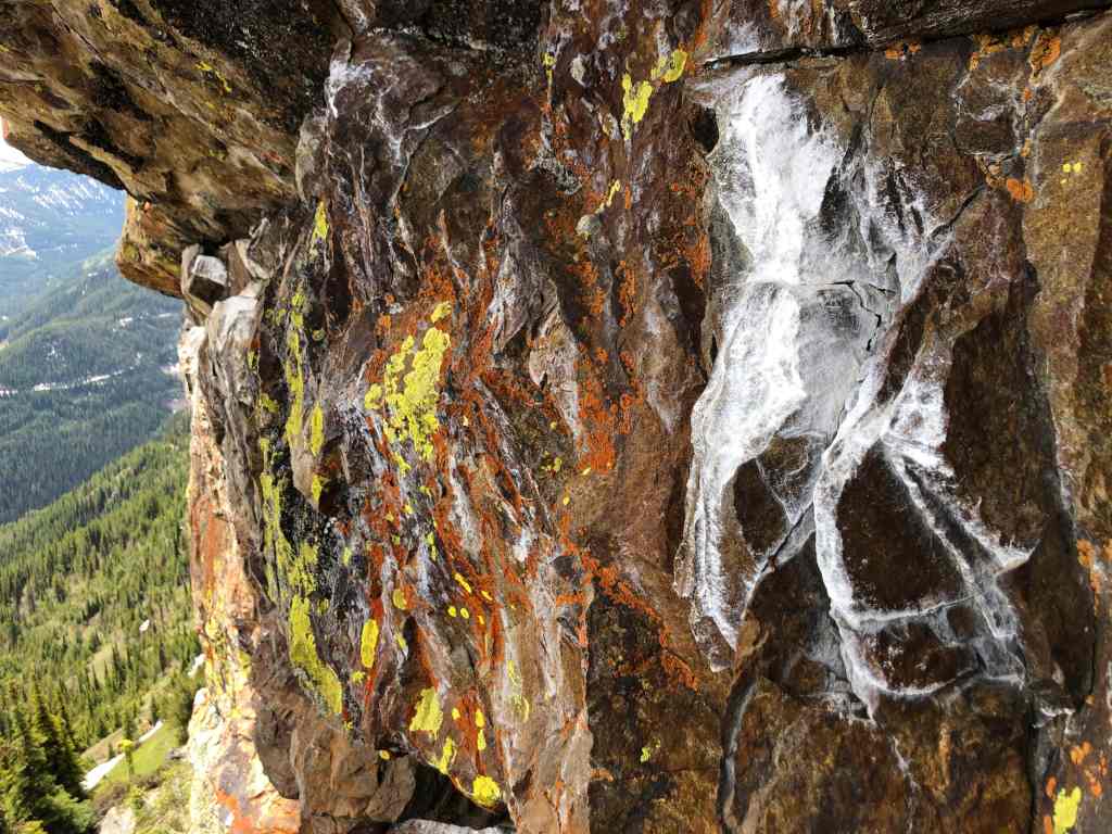
While Brad and I headed onto the summit, Andy continued to explore the colourful base of the band. (Photo by Andrew Nugara)
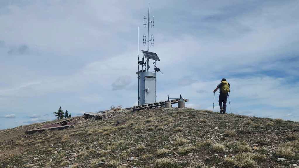
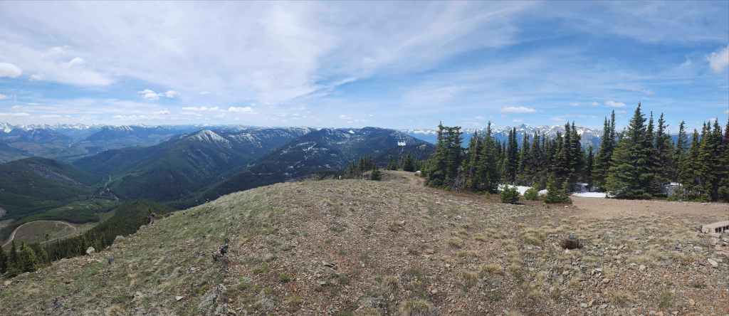
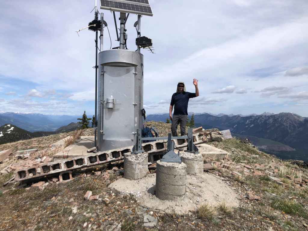
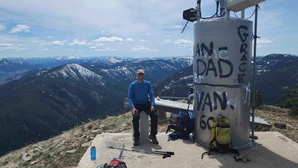
The summit of Sparwood Ridge (2260 m).

A pano to the north…
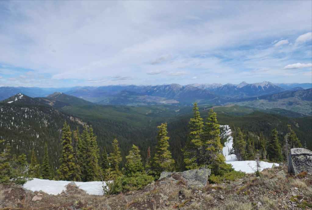
Followed by a pano to the northeast.
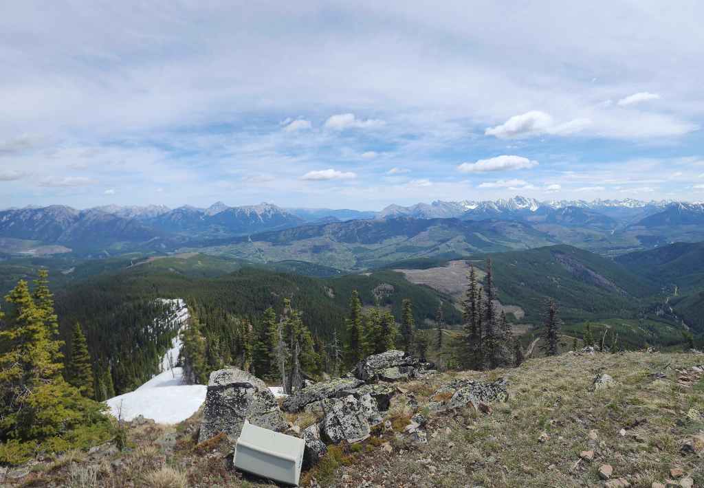
A pano to the east….
And then to the southeast.
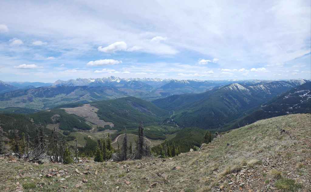
Finally, a pano to the southwest.
A closer look at Marten Ridge (centre) where Andy and I were a week ago.

We contemplated continuing to the summit of Hosmer Ridge (centre), but given the lingering snow, that would have been a long and laborious endeavour.

The Three Sisters (centre) is a peak that I still need to visit.

Looking over at the town of Fernie.

Two other intriguing peaks: Mount Hosmer (left of centre) and Mount Bisaro (centre).
Mount Kuleski (centre) and Mount Washburn (right).
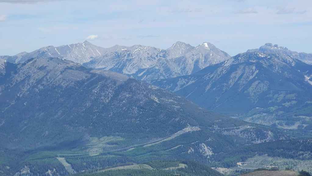
Gazing along the Elk Valley at Natal Peak (foreground) at Mount Lyne, Mount Salter, and Sheep Mountain (all left of centre) and also at Gaff Peak (right of centre).
The south end of the High Rock Range includes Allison Peak (left), “Deadman Peak” (right of centre), “Alexander Creek Mountain” (foreground right), and the Seven Sisters (right).
A closer look at the Seven Sisters. Brad, Andy, and I are hopefully going to attempt one of the technical routes this summer. 🙂 The summit of “Alexander Creek Mountain” is in the foreground.

Zooming in on Omahkai’stoo (Crowsnest Mountain).
The view from the summit allows you to look across the Crowsnest Pass to the Alberta side. The South Peak of the Livingstone (far left), Bluff Mountain (centre), and the summit of Crowsnest Ridge (left) are all visible.
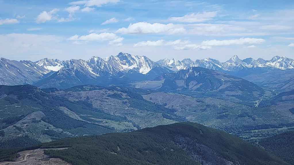
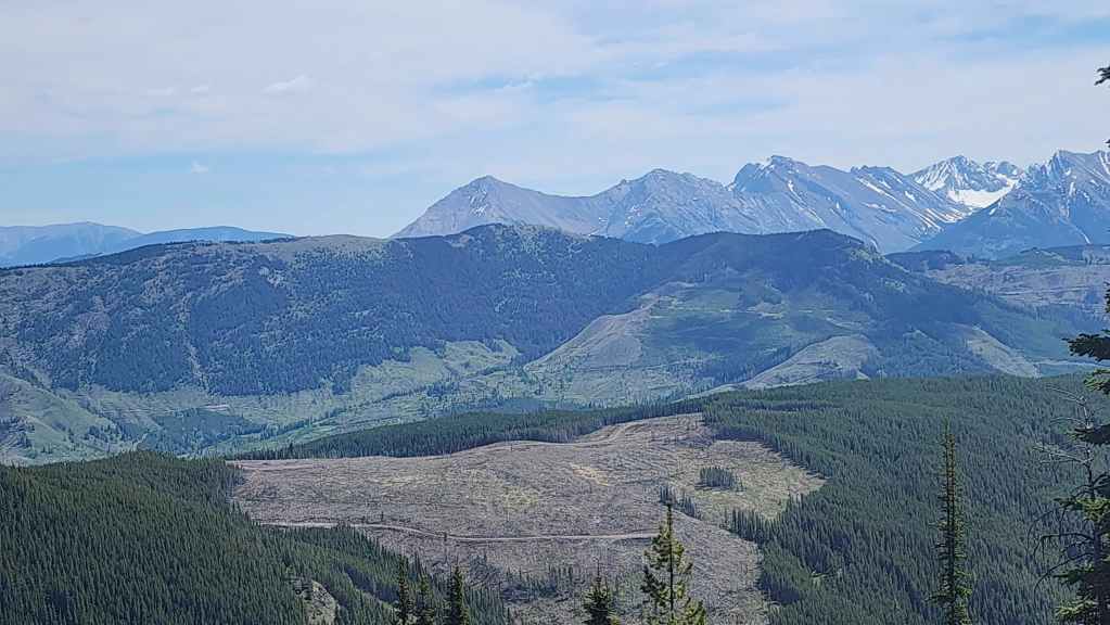
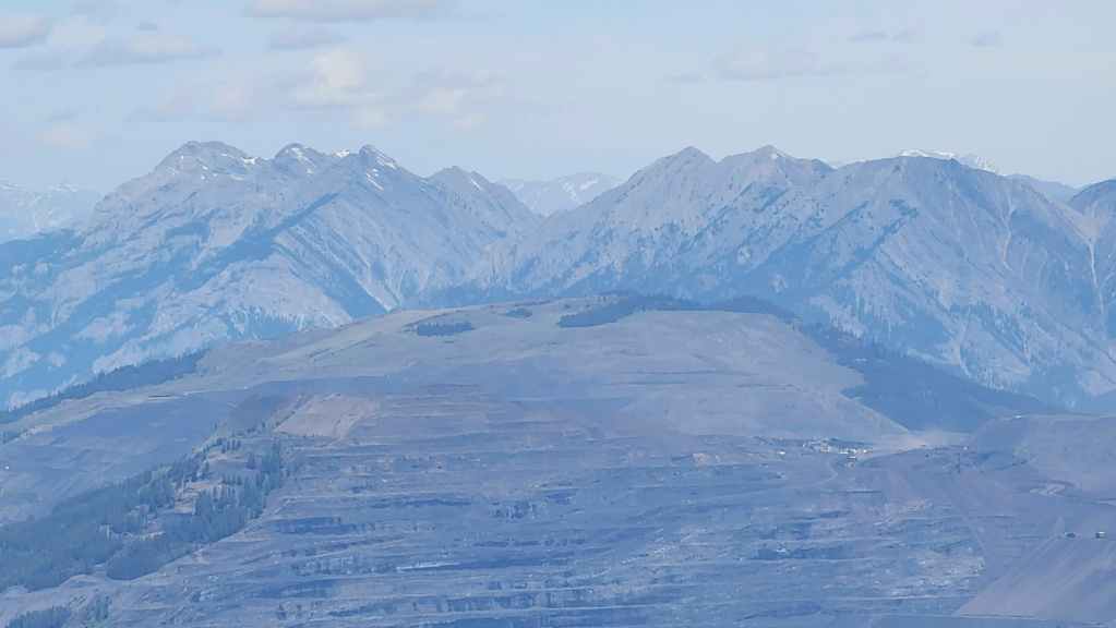
Looking across at the Flatheads.
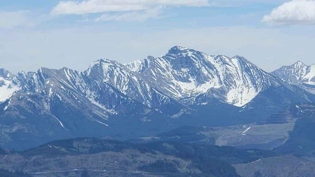
Another look at the three peaks on the Northwest Ridge of Ptolemy (left) and Mount Ptolemy (right of centre).

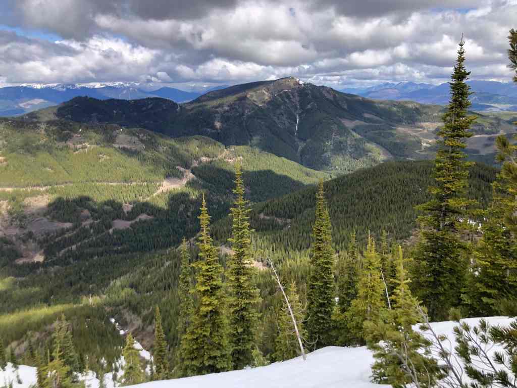
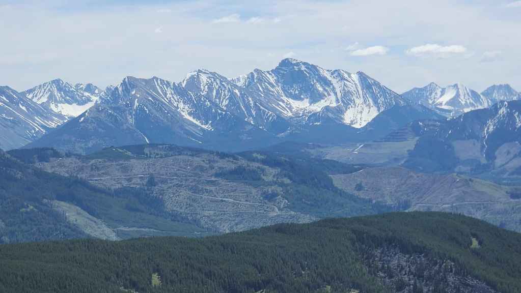
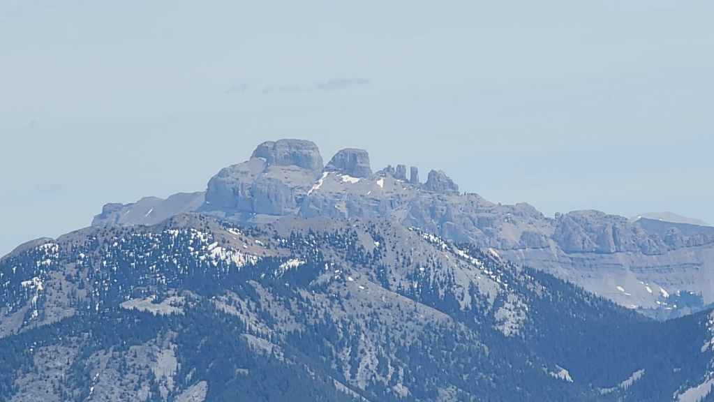
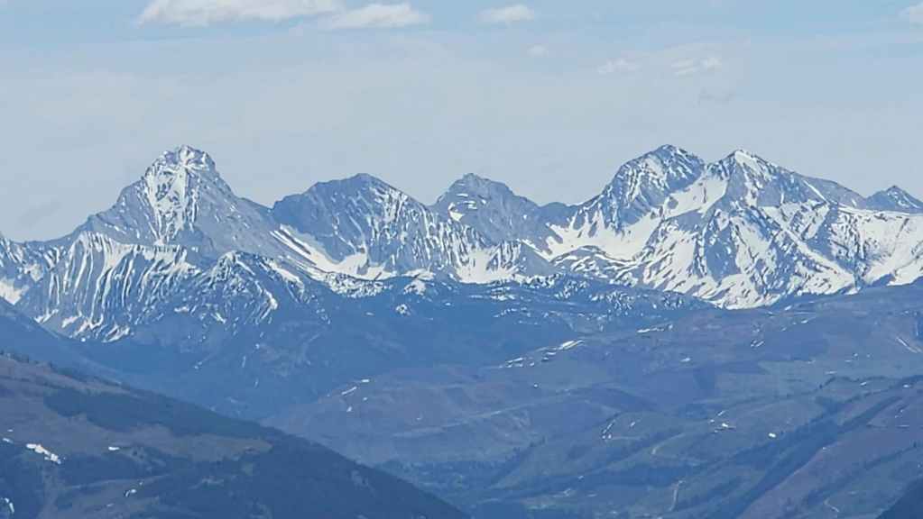
Zeroing in on the summit of Scrubby Peak (left of centre). This was our original objective for the day.
Brad and Dave F. are going to attempt an ascent of Mount Darrah (left) via the long and steep snow couloir on the south face. They leave this coming weekend for the two day trip and I wish them well! 🙂 A mountaineering climb up that snow couloir is probably a rare feat. Darrah S2 (right) is an old nemesis of myself and Andy.
I greet Andy as he arrives on the summit. (Photo by Andrew Nugara)
It only took us 2 hours to get to the top, so there was plenty of time to relax and enjoy the views.
Inspecting the ruins of the Natal Fire Lookout. (Photo by Andrew Nugara)

I use a cover that had broken off the radar antenna, to evolve into a human exclamation mark – or maybe I’m donning the cone of shame…? 😂 (Photo by Andrew Nugara)
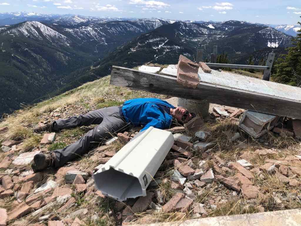
Too much fun with the broken cover. 😂 (Photo by Andrew Nugara)
Andy finds a more mature use for the cover.

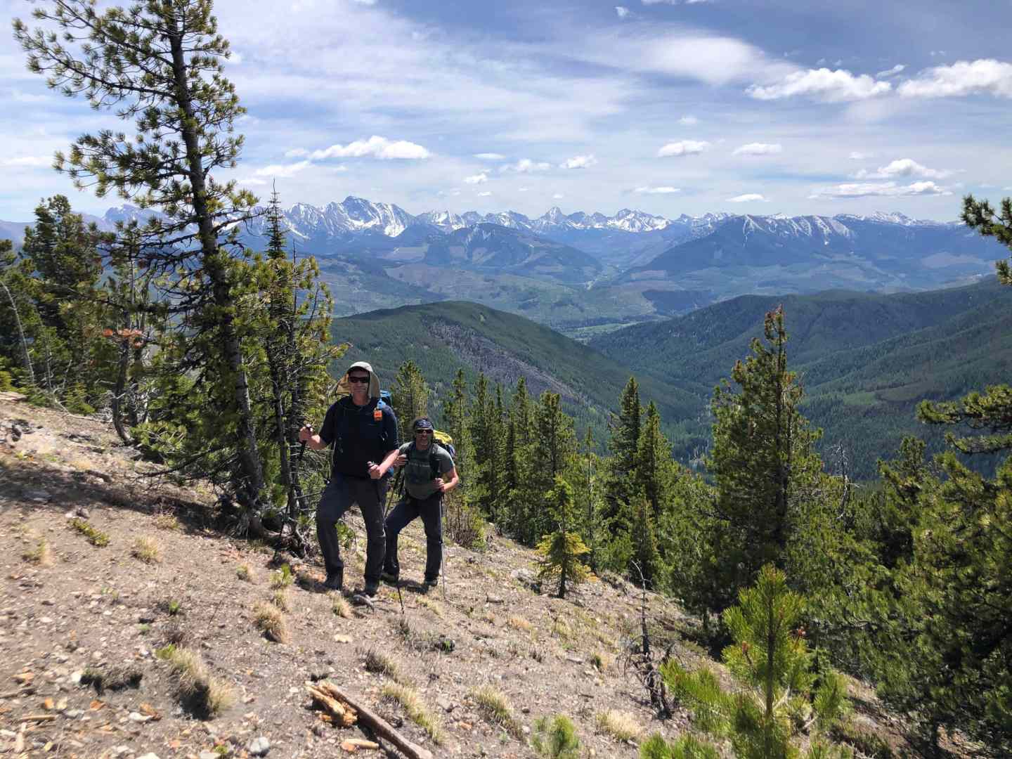
Two of the finest people I know, Andy and Brad.

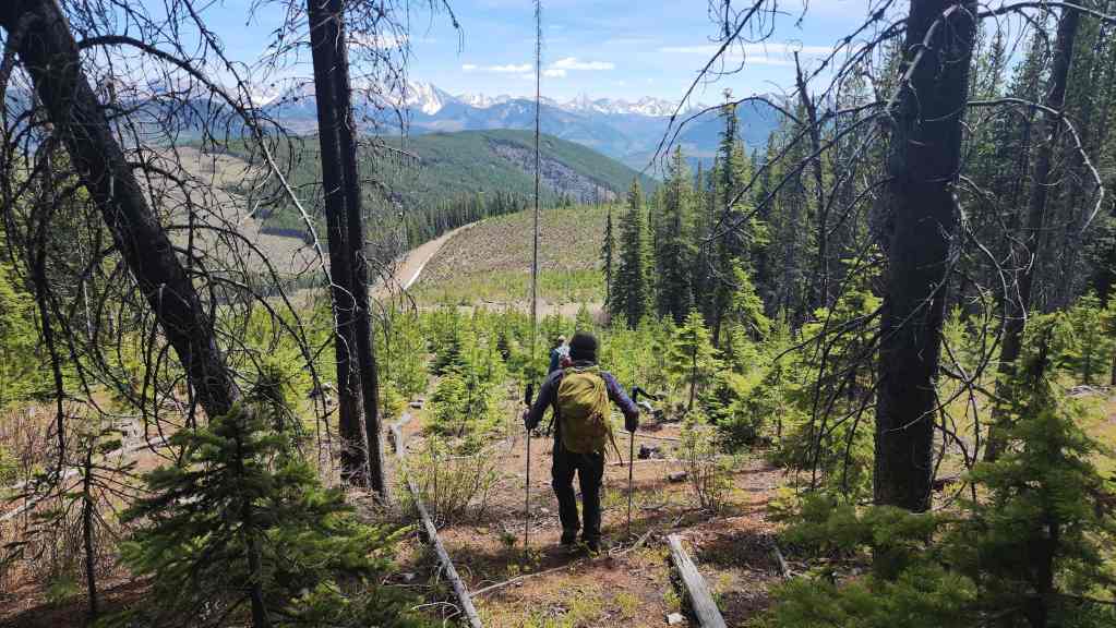
To descend, we decided to follow Sparwood’s east ridge for a short distance before heading straight down the southeast slope. Back in February 2022, Raff, Bert, and I snowshoed the east ridge as part of our ascent.

Descending like a Von Trapp. 😂 (Photo by Andrew Nugara)
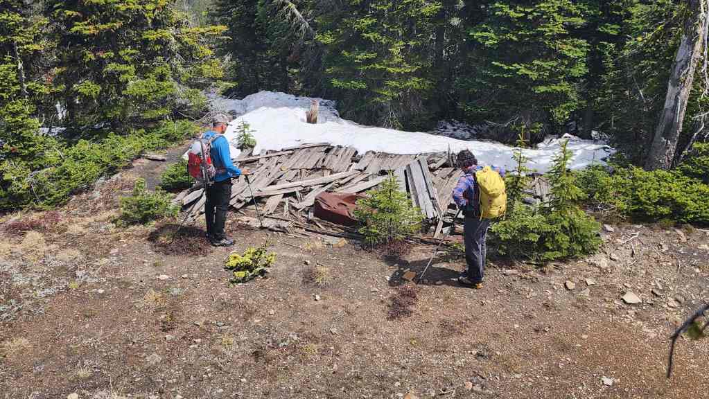
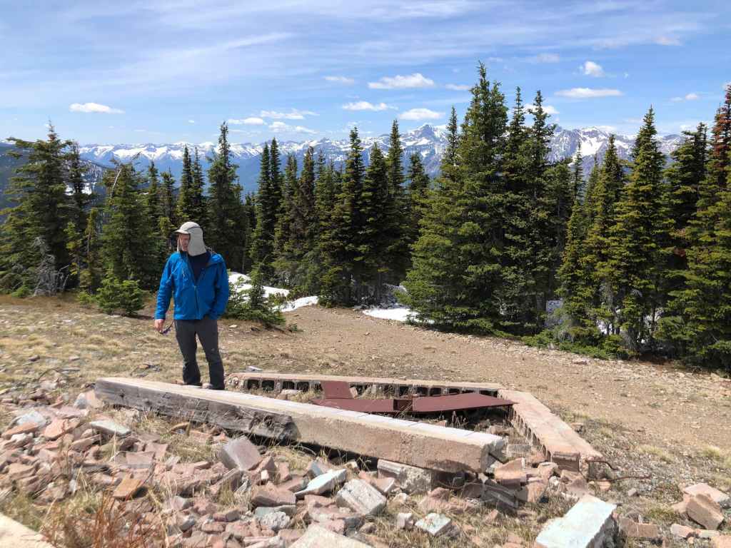
Brad and Andy inspect the remains of the lookout’s residence.
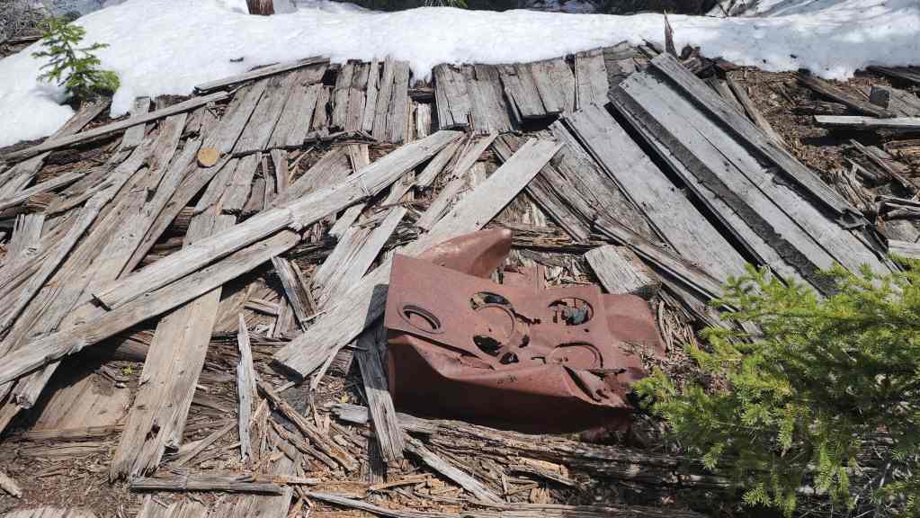
An old stove is the most notable artifact.

Leaving the crest of the east ridge. We will descend directly to the clearing to the left of centre. This is where the road ends and where we could have parked. (Photo by Andrew Nugara)
Coming to the old access road.
Looking along the road towards Marten Ridge.

The bushwhacking wasn’t too bad, but it was worse than the route we used when heading up.
Emerging onto the clearing.
The view back to the summit from the road. (Photo by Andrew Nugara)
Deciding to follow the road back rather than retrace our steps through the clearing.

Bypassing a big loop in the road.
Another look back at the summit.
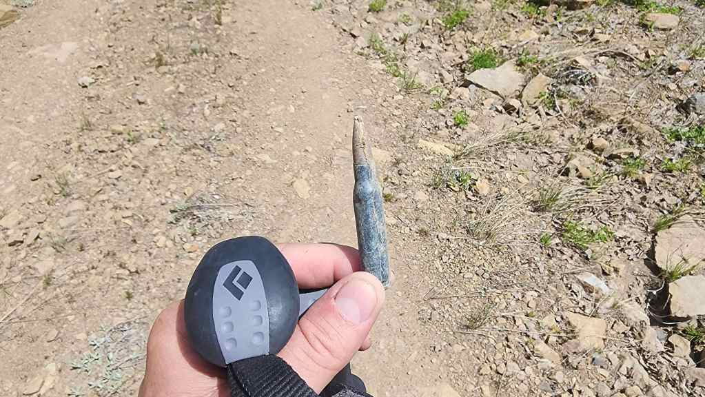
I found a .308 that was just hanging out and having fun.

What we passed shortly after finding the bullet.
Heading down the road from the clearing.
Yet another look back at the summit.
Bypassing another switchback.

Arriving at the junction with the main road. From here and by sticking to the road, it would be a ~1 km walk back to our vehicles.

However, we once again decided to avoid a large switchback by descending directly down…
And rejoining the road where we had started the day.
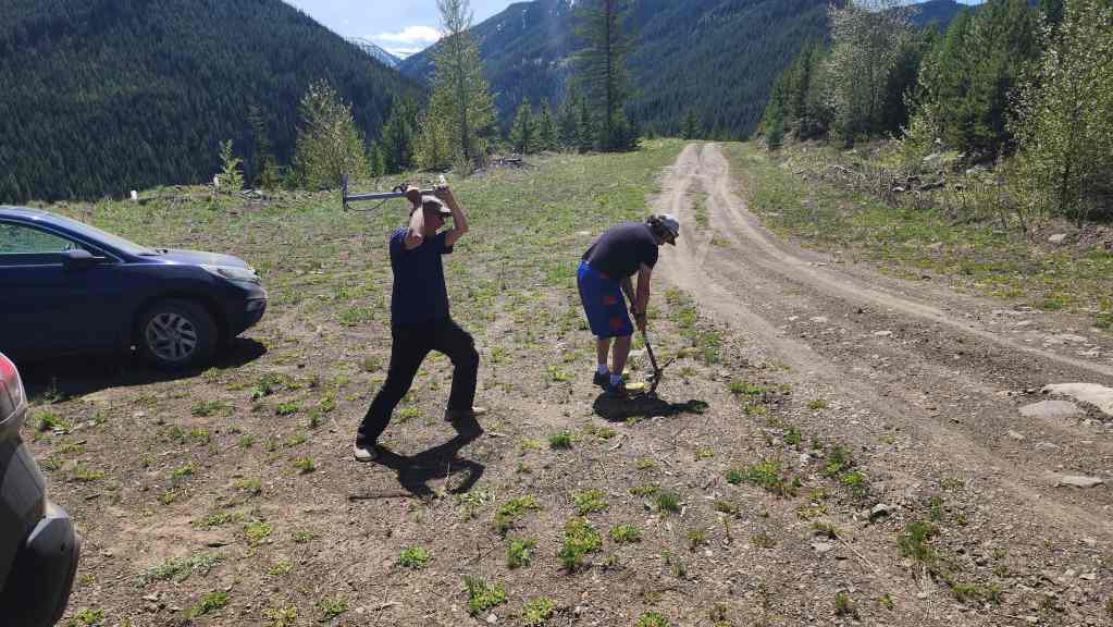
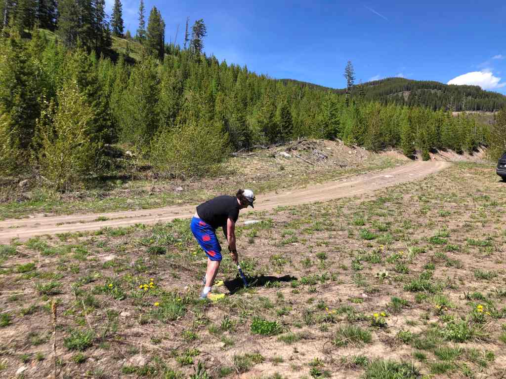
Andy’s a little competitive when it comes to ice axe golf. 😂

Don’t hit your car with your tee shot Andy…
About as close as you can get to not hitting the car. 😂

Playing from an unusual rough.

Brad shows off his famous ‘flipper’ technique that has won him accolades from across the pro circuit. 😂

Andy plays the short game at the fourth hole – which is the SPUR B2 sign.

The tee box on hole 5.
With Brad and I tied for first, a playoff hole (large flat rock in the centre) was needed to determine the winner.
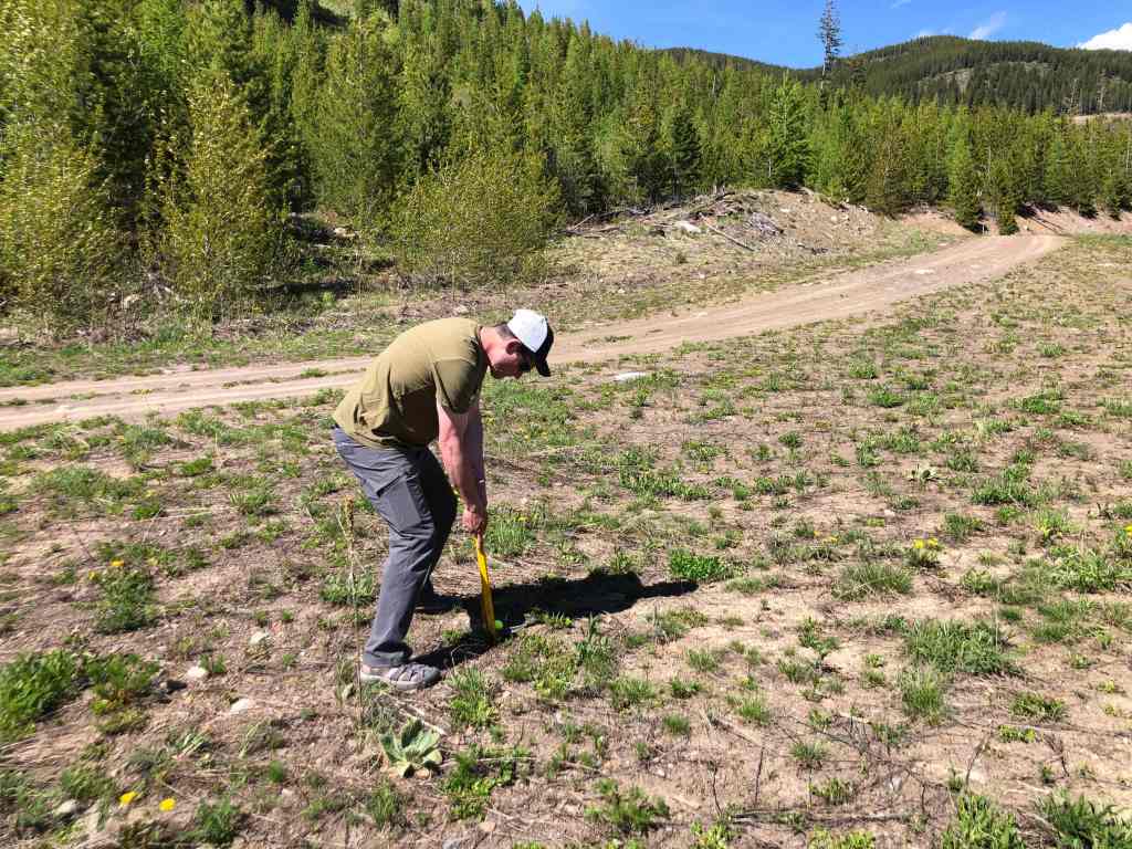
My turn to tee off.

I ended up winning by one shot. 🙂 Though we all wished that we could have been on Scrubby Peak rather than Sparwood Ridge, it still ended up being a fabulous day. Now that I know the logging roads in the area are seasonally accessible to the public (at your own risk according to the sign), this route makes way more sense for a summertime ascent of Sparwood. To be fair, I will have no problem coming back later in the summer and driving to a point where I can easily access the summit of Hosmer Ridge. A huge thanks again to Brad and Andy for yet another awesome adventure in the mountains! 🙂