
⚠️ Hiking and scrambling are inherently dangerous activities. Please read my Disclaimer. ⚠️
It has been 13 years since I was last on the official summit of Drywood Mountain. In that time, I’ve explored many other features of the massif, but a return to the summit felt overdue. Back in 2012, Jeff and I used an approach from the northwest that involved slogging up an insanely steep slope to gain the ridge that would lead us to the summit. I always figured that when I returned, I would use Andy’s route that starts at the northeast end of the mountain and incorporates some unofficial features such as “Woody”, “Stumpy”, and “The Knot”.
However, in January 2023, Andy documented an even better route; one that that not only favours early season ascents but also highlights some of Drywood’s striking cliffs and colours. So, knowing that we had an amazing forecast for the day, Andy suggested that we repeat his 2023 route and of course, I was all for it. 🙂
Andy’s route ascends the southeast ridge all the way to the summit and then descends a gentle slope and drainage located a little further to the south. What makes this route perfect for early season trips, comes from its consistent exposure to the sun which means that the rock dries quickly and you can enjoy the overall warmth that comes with it.
The crux comes when you arrive at the limestone band, but there are two good routes to choose from for scrambling over it. My favourite part of the trip was the large snow field that led to the summit. I absolutely love ascending snow, and its overall condition today was ideal for making solid bucket steps. The other cool part of this route is the immensity of the cliffs along the ridge. The sheer drop means you wouldn’t want to be too close to the edge on a windy day – or when its heavily corniced – but the dramatic views when looking down are decidedly sphincter-clenching.
Getting off the mountain using the drainage was straightforward and fast. We stayed off of the snow in the lower section because it was soft and there was running water beneath it. Fortunately, the scree alongside it was ideal for descending and before long, we were back on the gas road and enjoying a leisurely walk back to our vehicles.
This was an amazing day in mountains! Not only was the weather outstanding, but so was the route and the company. A huge thank you to Andy for suggesting a repeat of Drywood. I’d happily use this route again as it was an ideal way to the top. 🙂
Be sure to read Andrew’s excellent trip report!

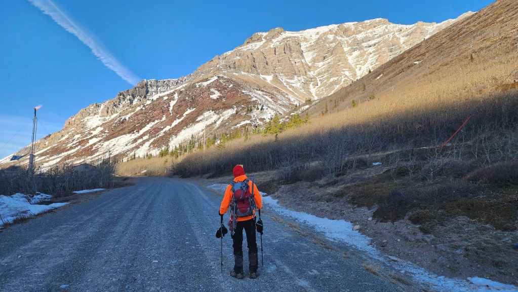
To get to Drywood Mountain, we drove ~19.5 km south from Pincher Creek on Highway 6 until we reached the Shell Waterton Plant Road (Township Rd. 43A). We then turned onto it and drove west for ~9.1 km until we came to a junction with a gravel road near to the entrance of the plant. Here, we turned left and onto a gravel road where we continued for ~3.9 km until we reached Butcher Lake. We then turned left and onto another gravel road immediately prior to the Lake and followed this road for ~1.4 km until we come to the junction with another road on our left. We turned here and followed it for ~5 km until we arrived at a T-intersection. Here, we turned right and ~230 m later, arrived at the Bovin Lake trailhead.
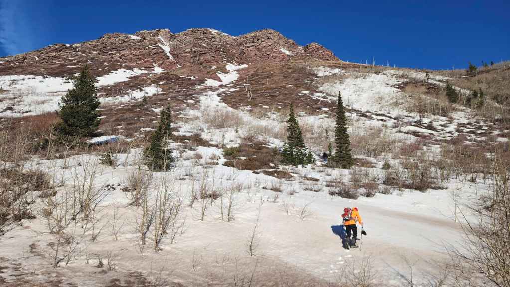
From the trailhead, we walked for ~3 km along the gas road until we came to large drainage on our right. Shortly beyond this, we arrived at the base of the southeast ridge that we would follow all the way to the summit. The route was self-evident and straightforward once we were above the first argillite cliff band. Getting above the first cliff band involved a ~550 m hike / scramble (230 m elevation gain) from the road. From there it was an enjoyable ~1.6 km (646 m elevation gain) scramble to the summit. There were bypass routes whenever we needed them and there are two distinct ways to get above the limestone band which is the crux. For reference, from the trailhead to the summit it was a distance of ~5.2 km (960 m elevation) that took us 4:14 hours. A bike approach along the road would cut a huge chunk of time off.
From the summit we returned the way we came except once we were below the limestone band, we followed the south slope / drainage all the way back to the road where we emerged ~630 m away from where we had left it earlier in the day. It was then an easy hike back to the trailhead.
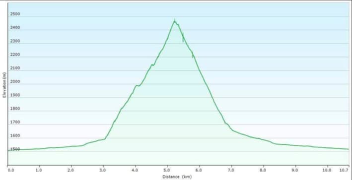
Our total roundtrip distance was 10.7 km and our total roundtrip time was 6 hours and 50 minutes. Total elevation gains came in at 994 m.

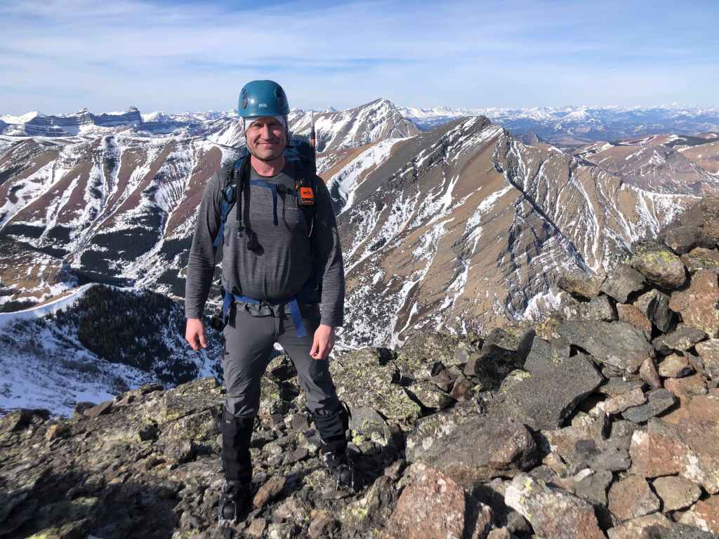
Gearing up at the Bovin Lake trailhead with Drywood Mountain in the background.
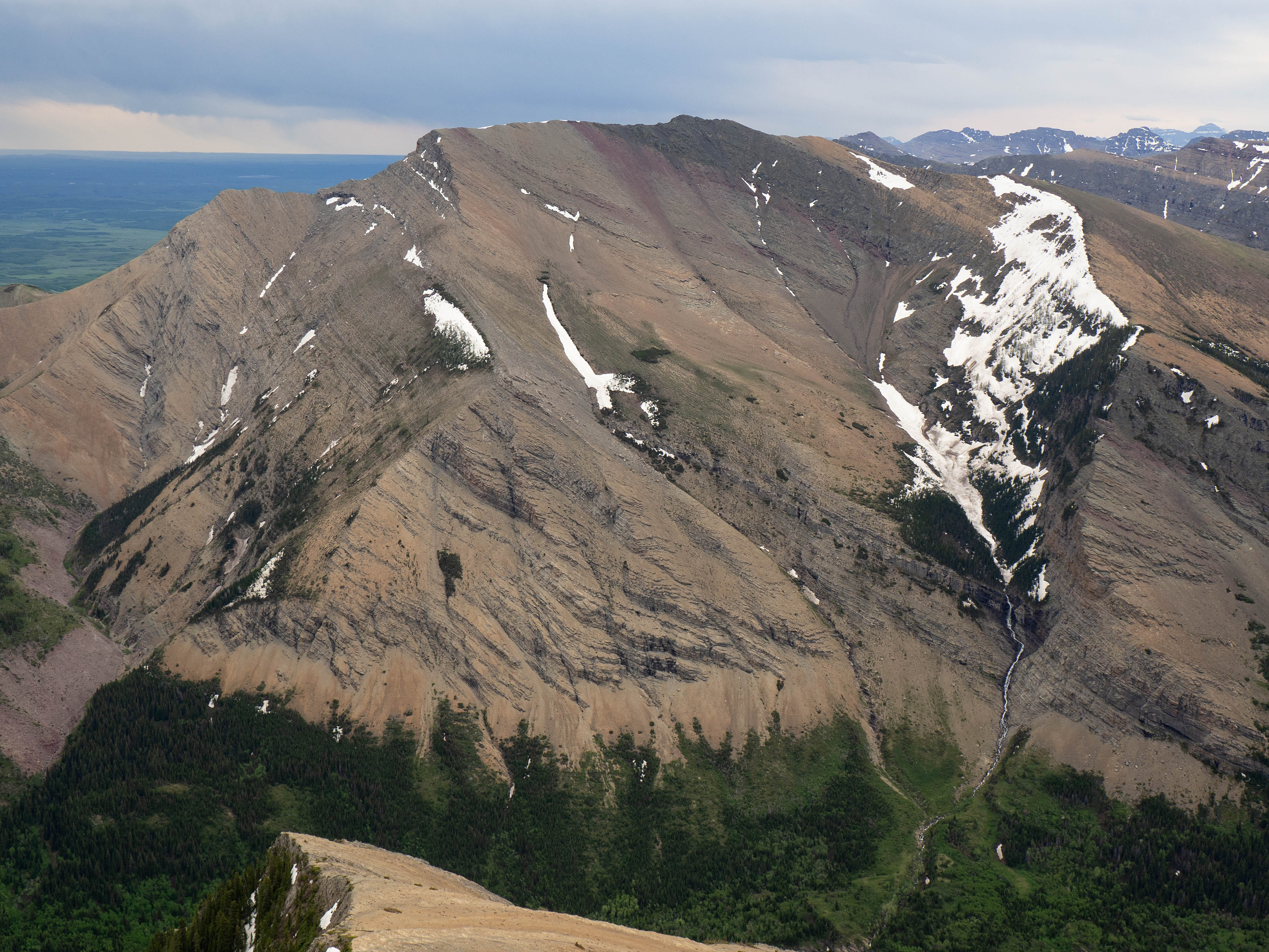
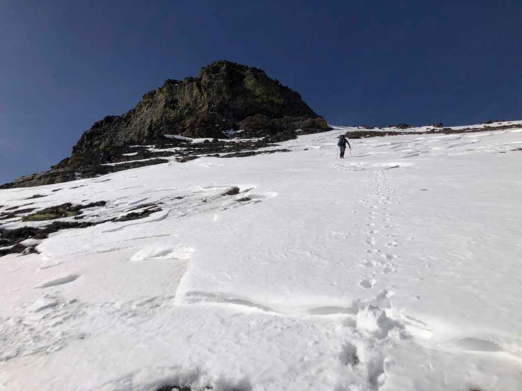
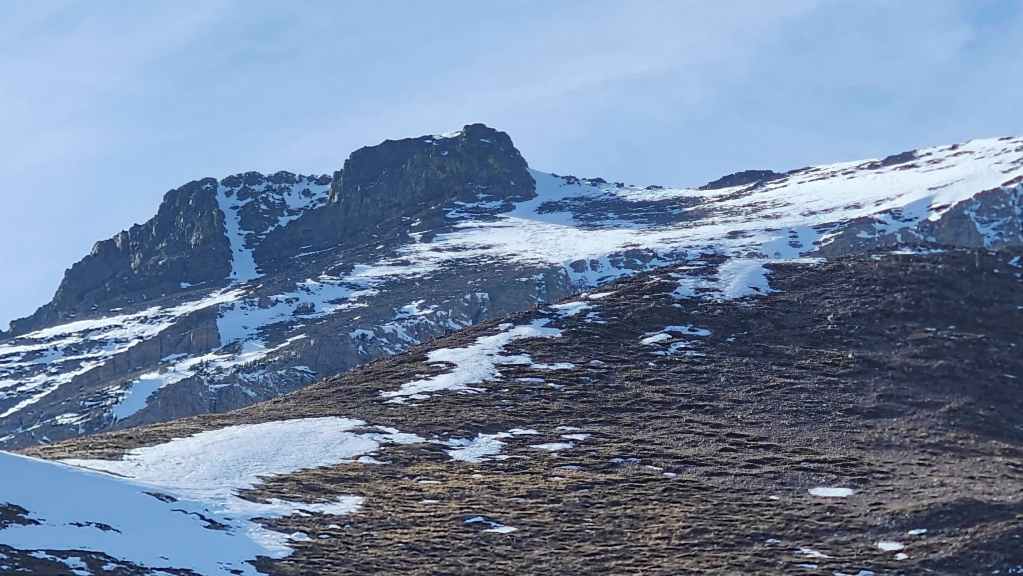
Our first good look at the southeast ridge (centre) and the summit (top centre) of Drywood. We’ll start our ascent where the ridge meets the road.

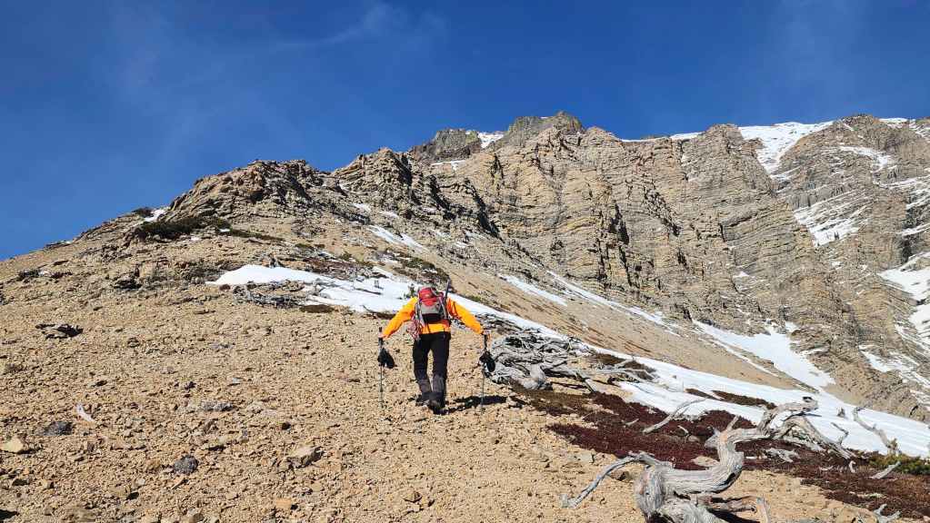
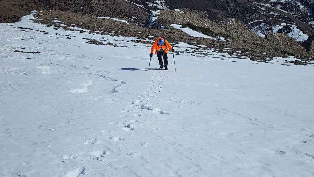
Shortly after passing a large drainage, we came to the start of the southeast ridge. Our route will take us through that argillite cliff band (top centre).
Andy leads us up from the road.

Exploring an argillite outcrop just prior to reaching the cliff band. (Photo by Andrew Nugara)

Looking over to “Pastry Peak” (top left of centre), “Ciabatta” (right of centre), and “The Breadsticks” (right) on the northeast end of Loaf Mountain. The impressive ice climbs (left of centre) that we passed underneath of and above back in April 2024 are practically non-existent.

My view back to Andy from the outcrop.

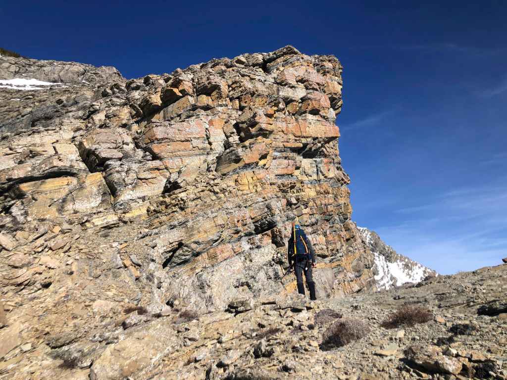
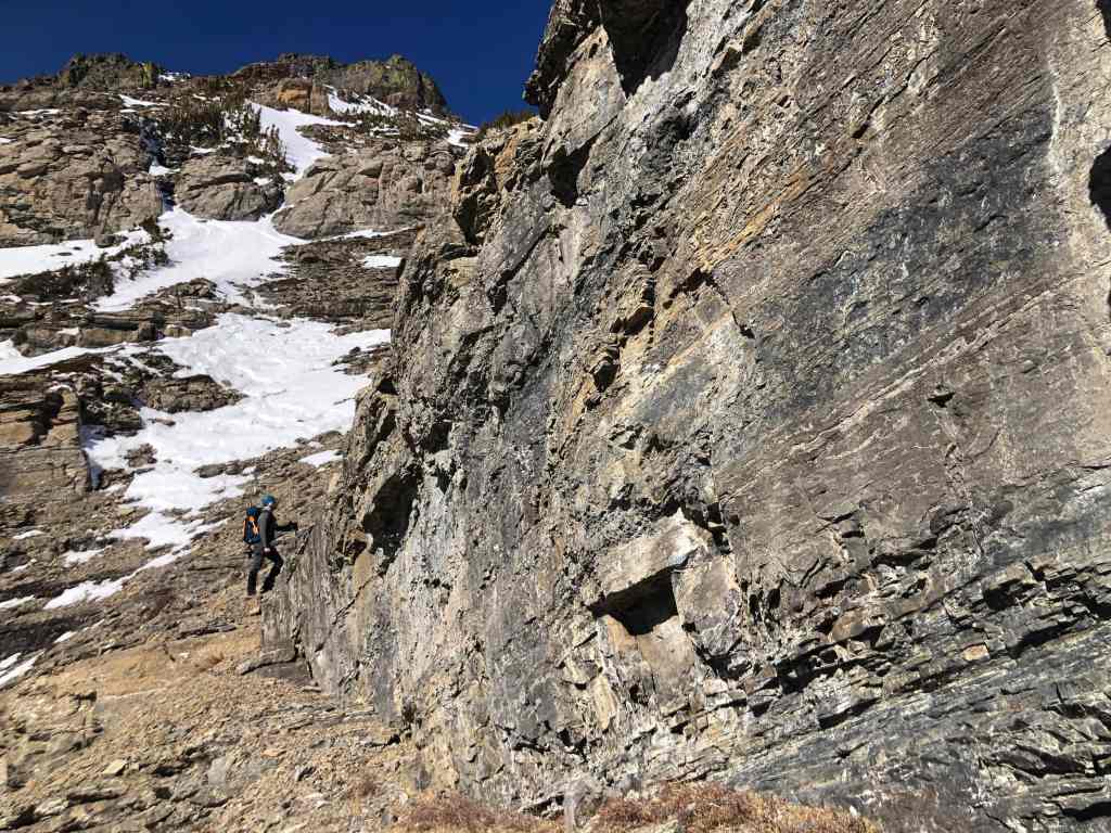
The cliff band is higher than it looks from the road. (Photo by Andrew Nugara)

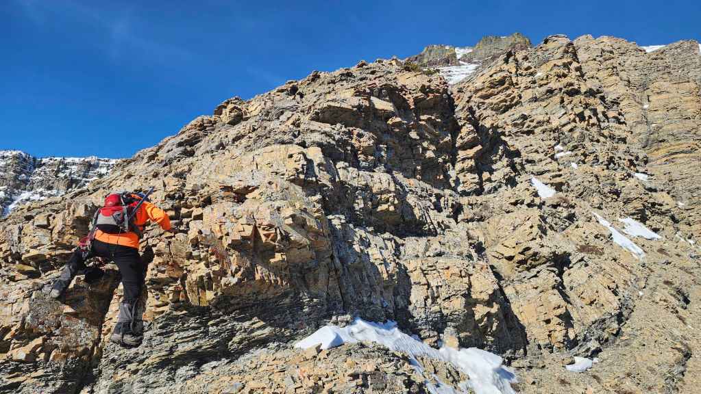
I (top right) search for a weakness through the cliffs. (Photo by Andrew Nugara)
At first, I thought the couloir in the centre looked tempting, but I found an even easier route to climber’s right. (Photo by Andrew Nugara)

Andy follows me up.

The camera angle makes it look like I’m leaning in sync with the rock – or maybe this is what living in windy southwestern Alberta does to your posture. 😂 (Photo by Andrew Nugara)

More weird leaning and some cool old trees. (Photo by Andrew Nugara)
Looking back and across to “Bakery Peak” (centre) from the top of the cliff band.

Andy looks along the ridge toward the summit (left).
The summit of Drywood (centre) framed by drywood.

Oh deer! 🙂
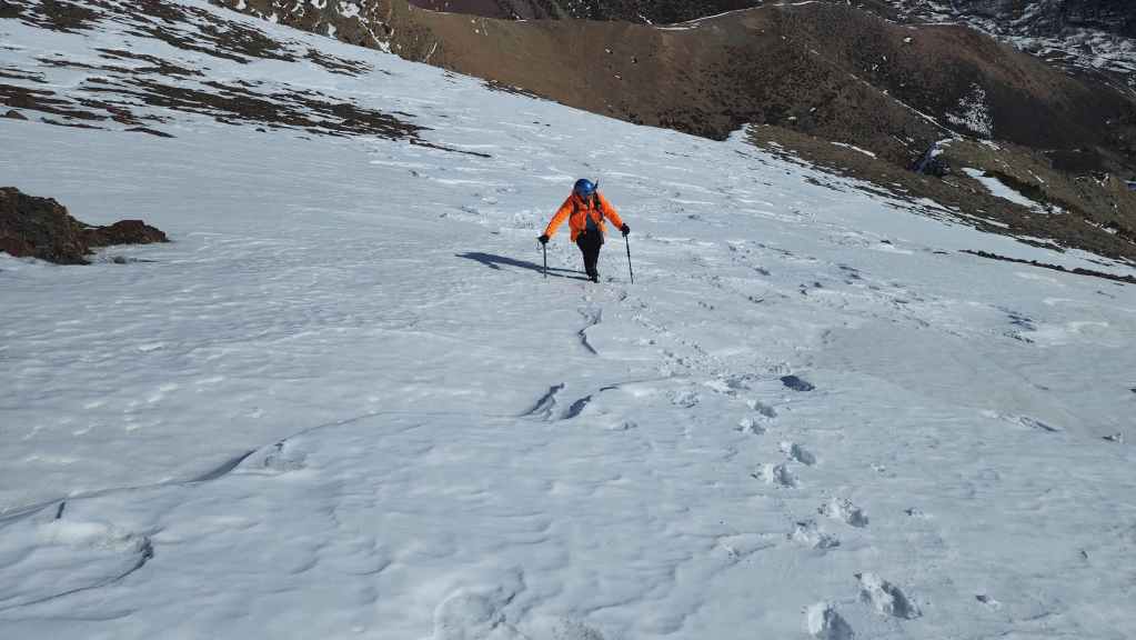
Following the ridge.
We begin our scramble along the ridge crest.
To save time, we decided to traverse towards Drywood’s south slope. (Photo by Andrew Nugara)

The south slope that we will use for descent. However, we will regain the ridge (right) to continue our ascent.
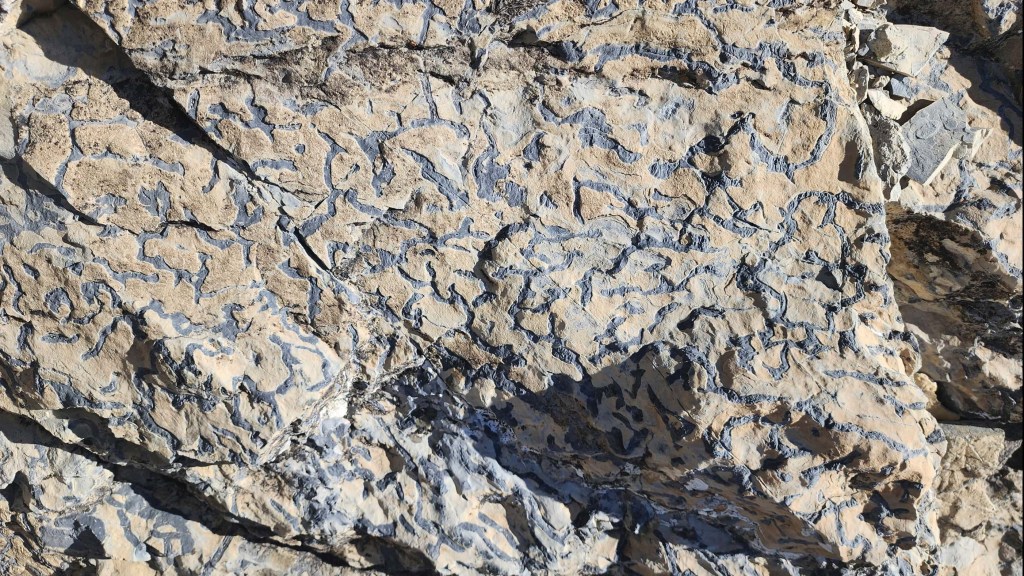
Interesting rock.

Scrambling back to the ridge crest. (Photo by Andrew Nugara)

Andy follows close behind.
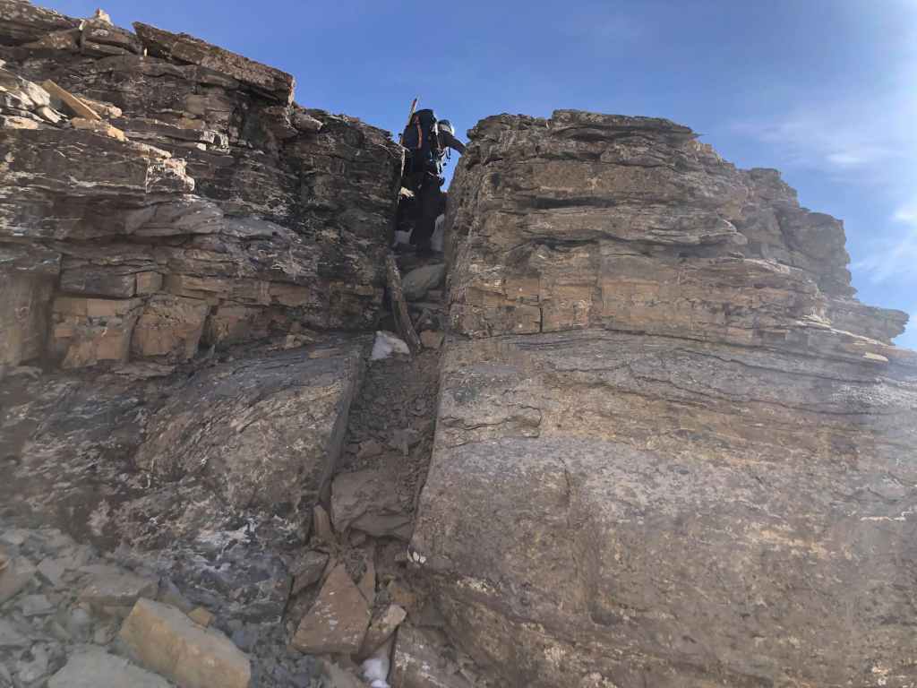
A tight squeeze. (Photo by Andrew Nugara)
Back on the crest.
No wind, warm temperatures, and bright sunshine made this an absolutely gorgeous day to be on a mountain. 🙂

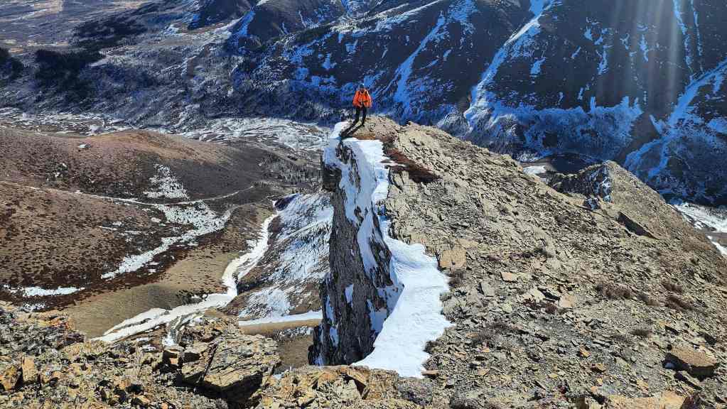
I peer over the edge… (Photo by Andrew Nugara)
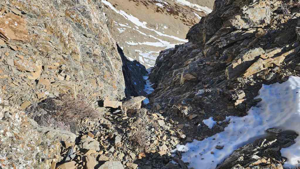
And down this massive couloir.

Andy stands atop a massive overhang.

Same vantage as the previous photo but with the summit of “Bakery Peak” in the background.

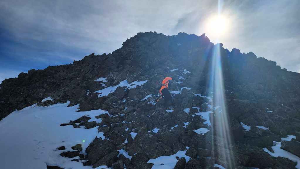
Continuing to head up and along the ridge. (Photo by Andrew Nugara)

Andy scrambles up.

Searching for way up… (Photo by Andrew Nugara)

Found one! (Photo by Andrew Nugara)

My view down to Andy.
Following a ledge…
Until we find a way back onto the crest. (Photo by Andrew Nugara)
Another spectacular drop off.

A pano of the previous photo…
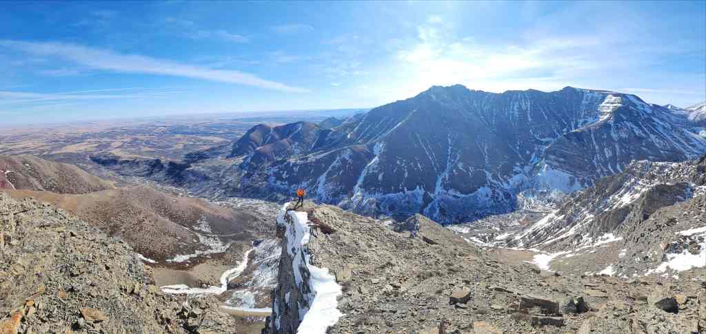
Followed by an even wider pano.

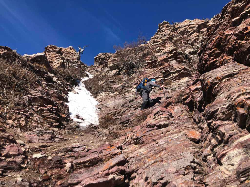
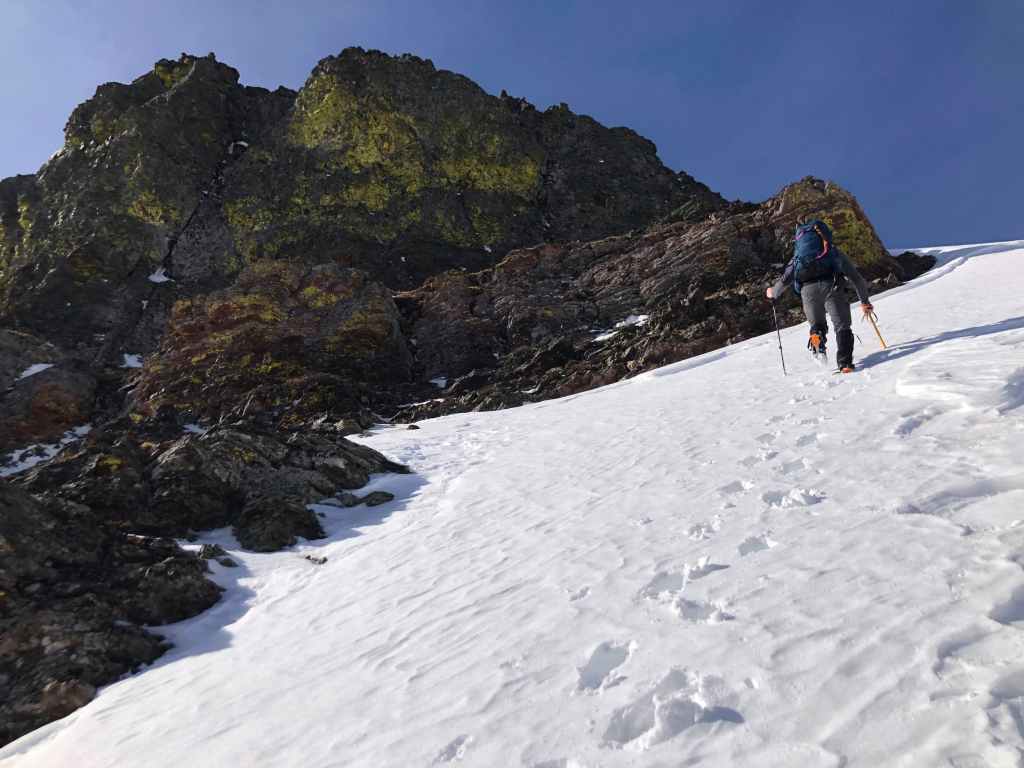
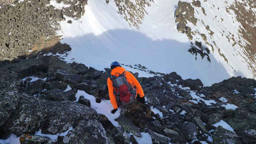
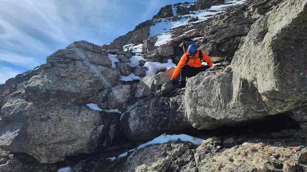
Nearing the limestone band and the crux. (Photo by Andrew Nugara)

Arriving at the base of the crux. (Photo by Andrew Nugara)

I (lower left) put my poles away as I prepare to climb the crux. In January 2023, Andy found a different route to get above the limestone band, but since it was located further to the south, I suggested we try this route first. (Photo by Andrew Nugara)

Climbing up the lower section. So far, so good. (Photo by Andrew Nugara)

I prepare to climb over the final section. There was one slightly tricky move required, but otherwise, this route wasn’t too bad at all. 🙂 (Photo by Andrew Nugara)

On top and looking down to Andy.

Andy tackles the crux like a pro.

Above the crux and looking toward the summit. (Photo by Andrew Nugara)

A similar photo to the previous, but a little further along the ridge.
Peeking over the edge. The drop offs continue to be impressive.

Still admiring the fabulous cliffs.

It was really hard to stop looking over the edge. (Photo by Andrew Nugara)

More of the same but with the sun hitting some of the colourful rock. (Photo by Andrew Nugara)

And still more. (Photo by Andrew Nugara)

My view back to Andy from the previous photo. We stayed far away from any hanging cornices. 😯

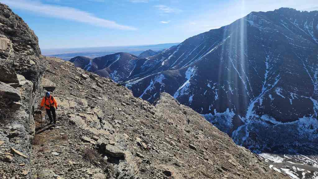
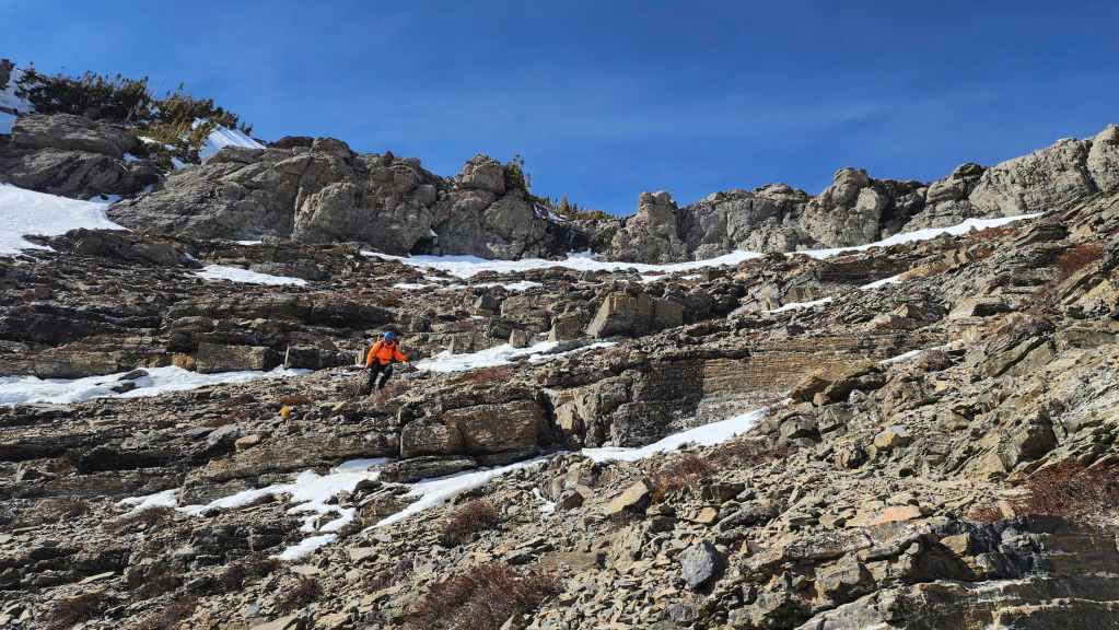
Passing by more colourful rock as we make our way closer to the summit. (Photo by Andrew Nugara)

My view back from the previous photo. You can clearly see our route up and along the southeast ridge.

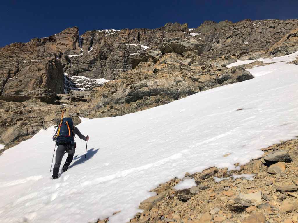
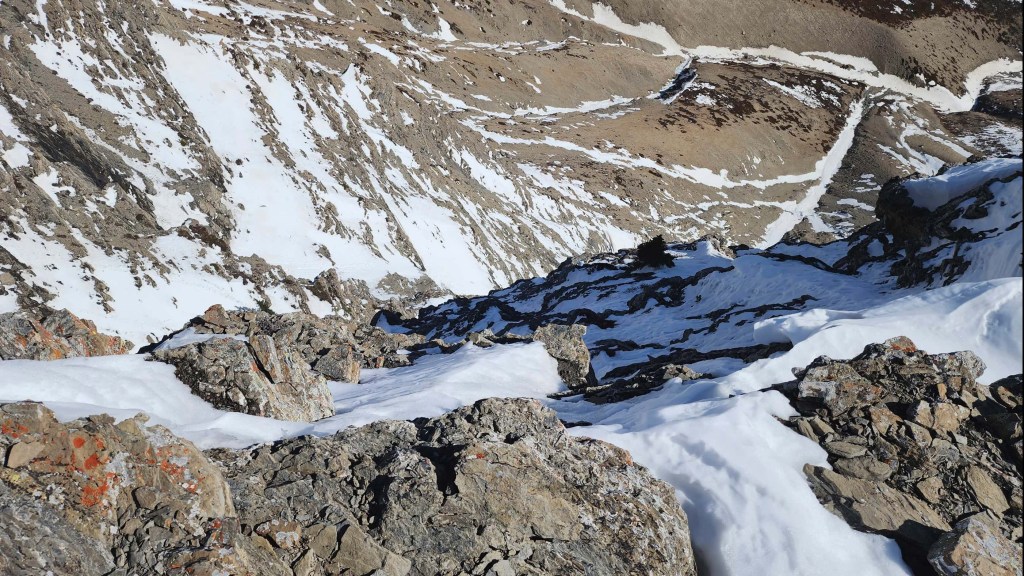
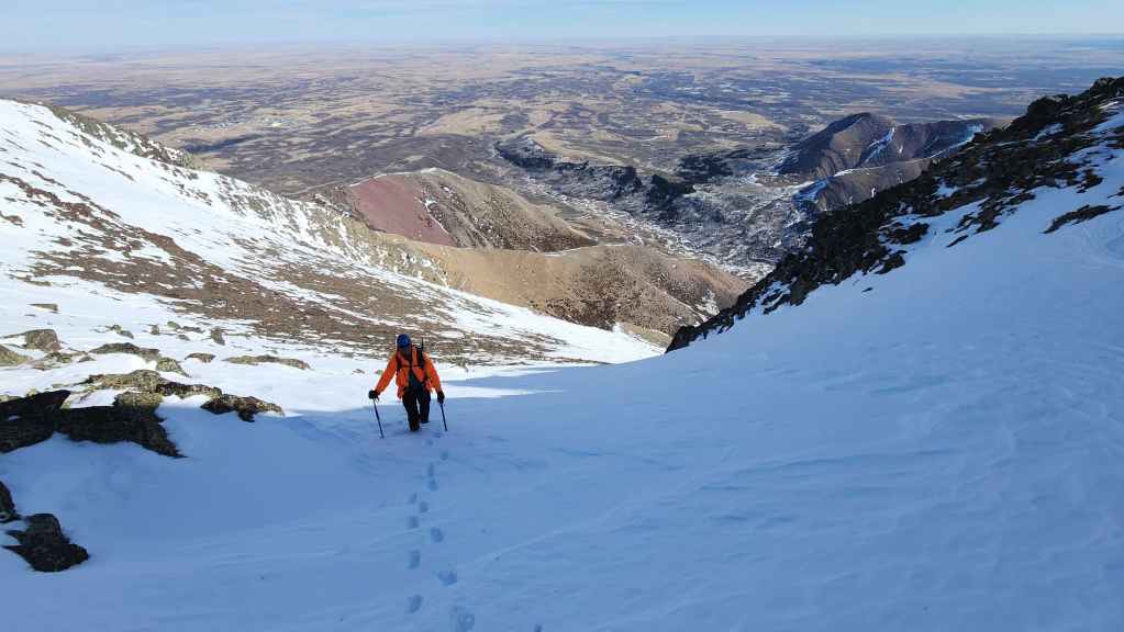
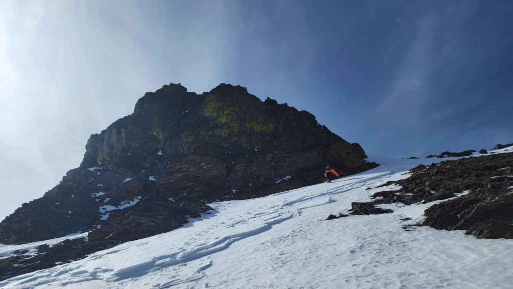
Arriving at the snow field beneath the summit.
Andy follows my bucket steps as we continue toward the summit. This section is a little longer and a little steeper than it appeared from below.
Excellent snow conditions made for a great ascent. (Photo by Andrew Nugara)
Another view back to Andy.

Nearing the summit. I absolutely love using good snow to gain elevation. 🙂 (Photo by Andrew Nugara)
Passing under the summit block. (Photo by Andrew Nugara)

Blue sky, crisp snow, and colourful rock. What a fantastic day to be on a mountain! 🙂 (Photo by Andrew Nugara)

Almost there! (Photo by Andrew Nugara)
Another look back. I loved this section of the trip. 🙂

Arriving on the summit ridge.
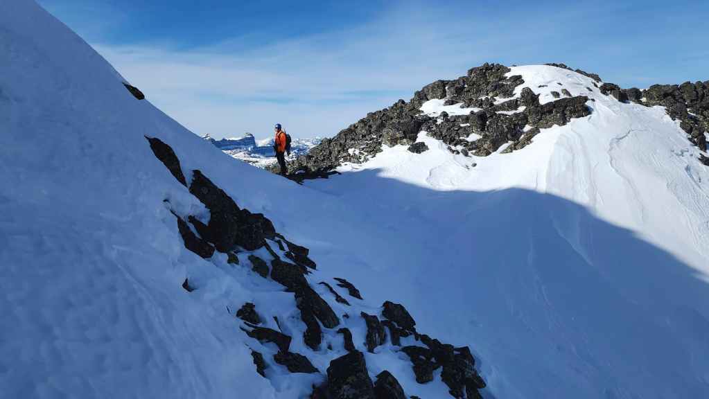
Andy checks out the views before scrambling up to the summit.

From here, we would each take a slightly different route to the summit.
Andy’s view from the previous photo. (Photo by Andrew Nugara)
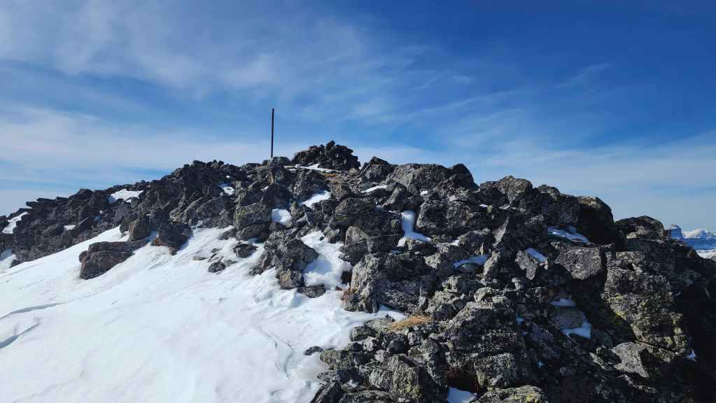
The summit of Drywood Mountain (2464 m).
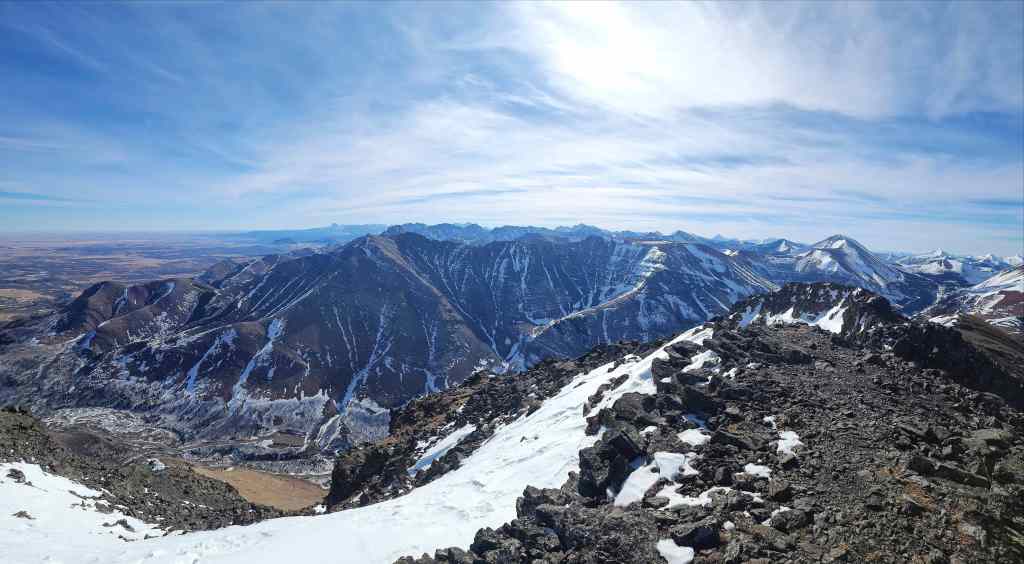
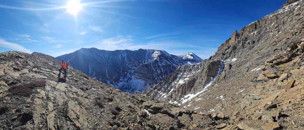
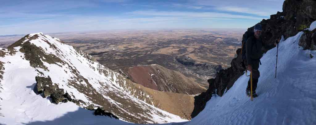
A pano to the southeast…

Then a pano to the southwest.

Gazing to the west…
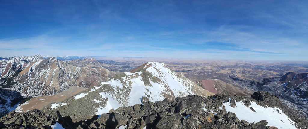
And finally to the northeast.
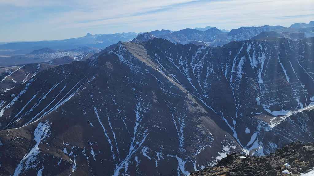
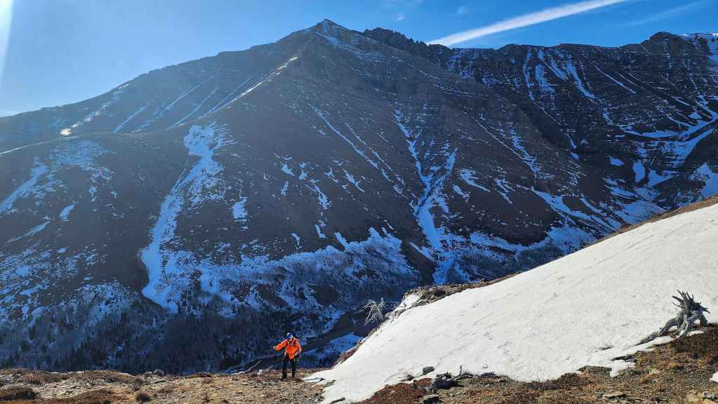
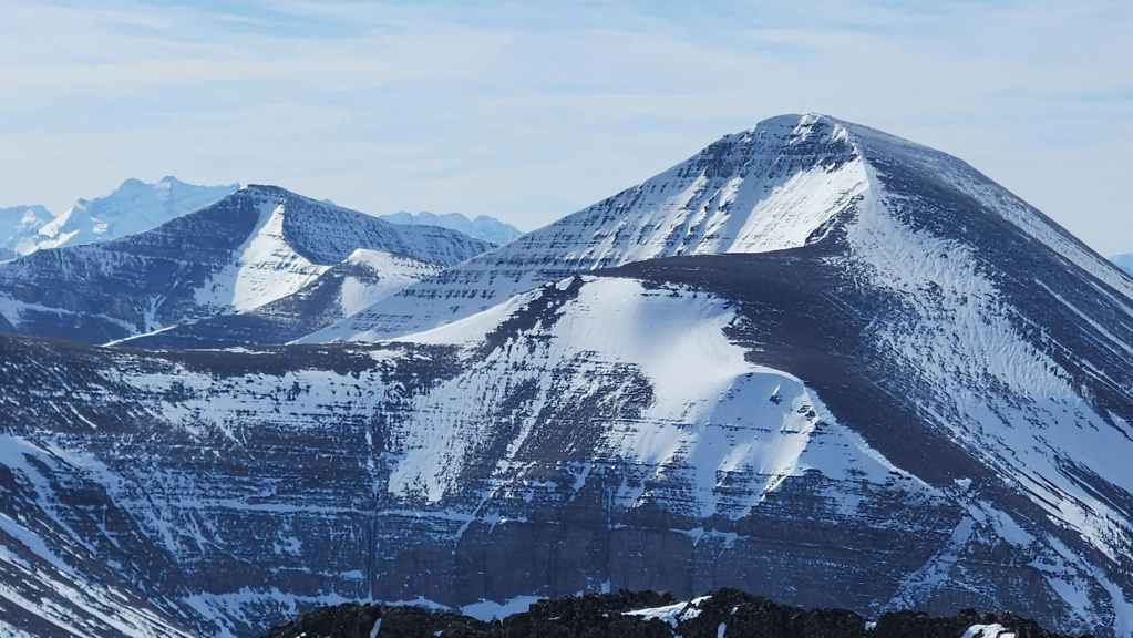
A closer look at “Bakery Peak” (centre) located on the northeast end of Loaf Mountain.
Still looking along Loaf, this time to “Pastry Peak” (centre).

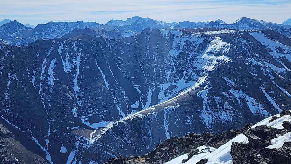
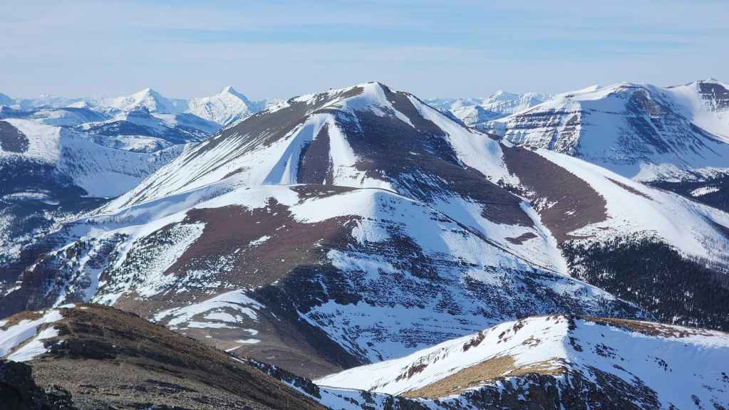
Looking between “Bakery” and “Pastry” at Mount Dungarvan (left), “Cloudy Junior” (centre), and Cloudy Ridge (right of centre).

Still looking past “Pastry”, this time at “Newman Senior” (centre), Niitaaspiitaa (Mount Cleveland) (right), and Newman Peak (far right).
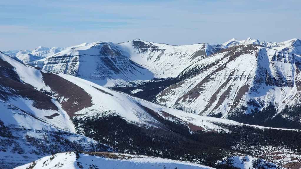
It has also been 13 years since I last visited Spionkop Ridge (left) or Loaf Mountain (right). I’d say I’m due to go back. 🙂
The “Southwest Summit of Drywood” was also an excellent trip.
Looking over at Victoria Ridge (centre) and Pincher Ridge’s South Peak (far right).

Comprised of younger rock than all the mountains that surround it, the massif featuring Windsor Mountain (centre) and Castle Peak (right of centre) always grabs your attention.

Victoria Peak (centre) and Pincher Ridge (right of centre).

Prairie Bluff (right of centre) and of course, some of the Prairie Bluff family of fun peaks! (“Prairie Fire”, “Prairie Sky”, “Prairie Storm”, and “Prairie Oyster”).
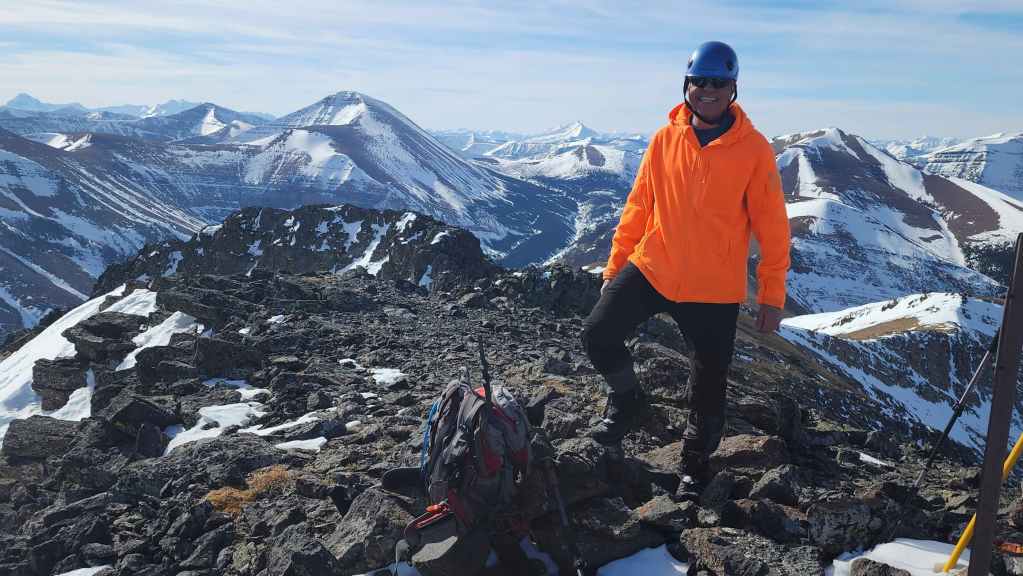
Andy celebrates his 7th time on Drywood.
My 2nd time on Drywood with my first visit way back in 2012. (Photo by Andrew Nugara)
Andy descends from the summit as we head back.
Looking back to the summit.

Backing our way down the snow field. (Photo by Andrew Nugara)

Andy’s view down… (Photo by Andrew Nugara)
And my view back up to him.

I wait for Andy at the bottom of the snow field.

Following the ridge back to the crux.
Andy expertly tackles the upper part of the crux…

And then uses a stem move as he starts down the remainder of the crux.
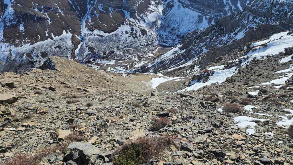
Once we were below the limestone band, we could see our easy descent route back to the road.

Andy checks out the route he used in January 2023 to get over the limestone band.
As the rock was mostly dry, climbing down over all the ledges wasn’t a problem.

Most of the wet areas were easily avoided.

We tried descending the snow in the drainage, but it became too soft and too deep further down the mountain. (Photo by Andrew Nugara)

My view back from the previous photo.

Heading over to the easy scree beside the drainage. (Photo by Andrew Nugara)
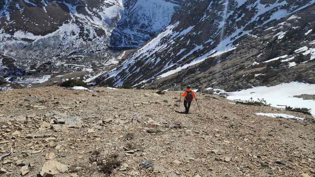
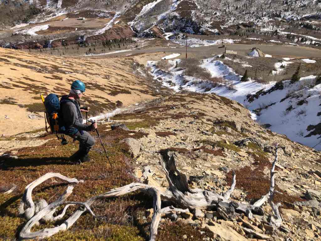
Making quick time now!

This descent route was the cat’s meow.
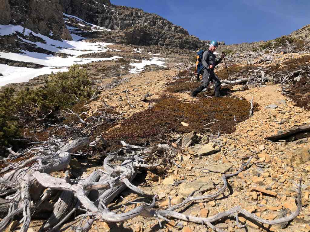
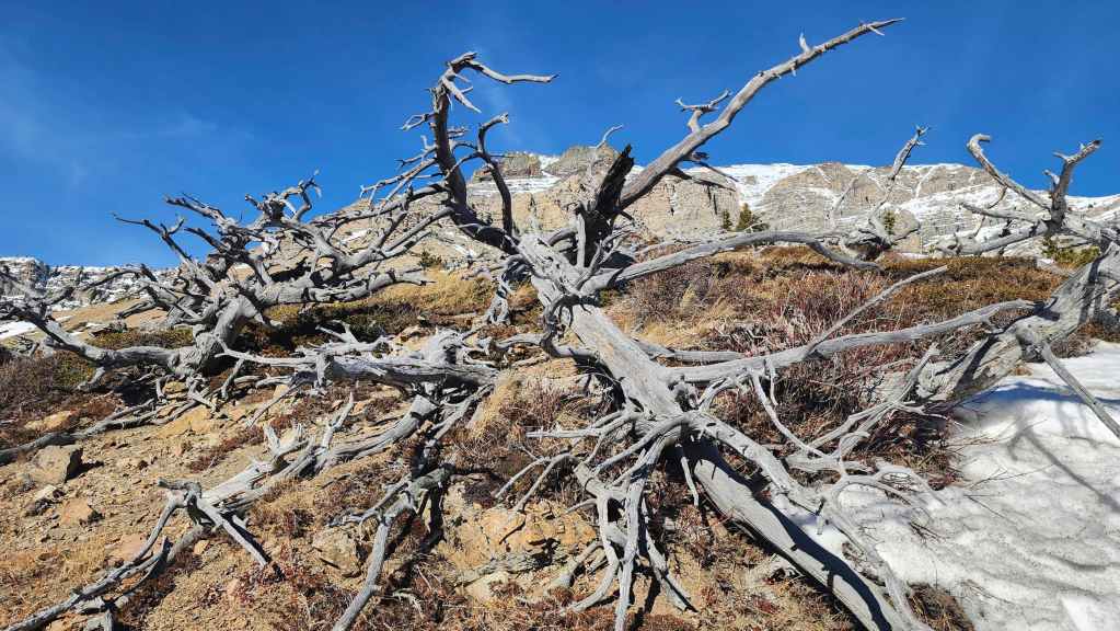
Drywood and some deadwood. 😂 (Photo by Andrew Nugara)
Almost back at the road. (Photo by Andrew Nugara)
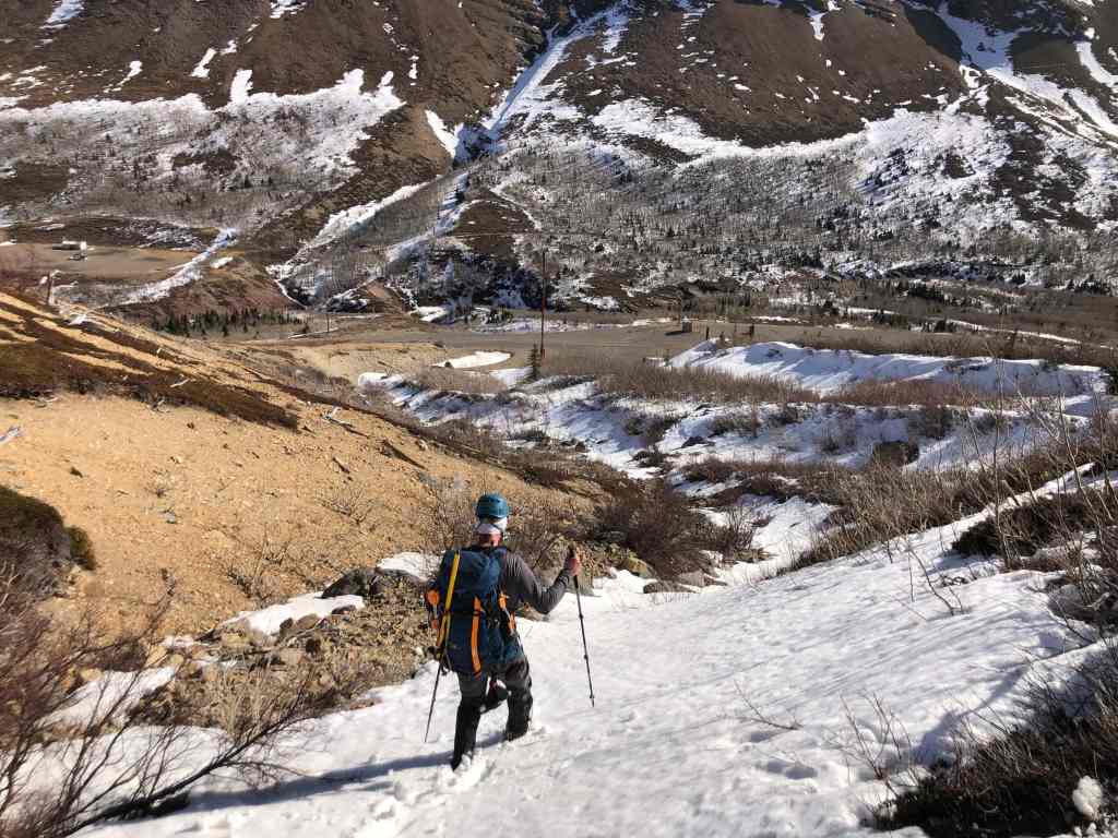
I tempt fate by trying my luck on the snow… (Photo by Andrew Nugara)

It wasn’t a good idea. 😂 (Photo by Andrew Nugara)

Arriving back at the road.

We popped onto the road ~630 m away from where we had left it to ascend.

I stop to check out our ascent route from earlier in the day. (Photo by Andrew Nugara)
Zooming in on the summit as we walk back along the road. That snow field was so fun and if I ever come back, I’d like to try ascending the snow couloir that runs up the middle of the summit block. I bet Brad would be all over this! 🙂

Arriving back at the trailhead after 6 hours and 50 minutes on the mountain. Everything was amazing about this day! The weather, the route, and especially the company. Hats off to Andy for pioneering this route and for his willingness to repeat it. 🙂