
⚠️ Hiking and scrambling are inherently dangerous activities. Please read my Disclaimer. ⚠️
With the entirety of July spent under an oppressive heat wave, today’s forecast finally called for rain. However, we weren’t sure when it was going to arrive as initial reports called for moderate rainfall in the morning before tapering off in the afternoon. This seemed to change by the hour, and by this morning, the forecasted rain had been pushed to the afternoon.
Therefore, looking for a quickish trip to fit this window, Andrew and I settled on Galwey North, which is one of the few peaks in Paahtómahksikimi (Waterton National Park) that I’d yet to visit; though for Andrew, it would be his fifth trip. Interestingly, despite not being recognized as an official summit, Galwey North is slightly higher than Mount Galwey and is included as an extension to Galwey in Alan Kane’s, Scrambles In The Canadian Rockies (Third Edition).
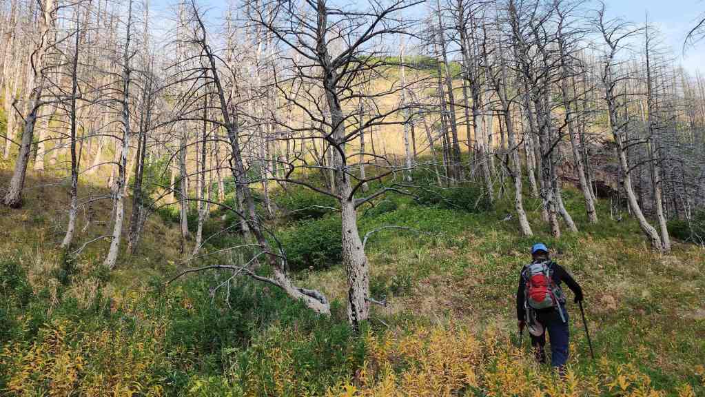
Leaving from the Coppermine Creek parking lot without a firm route established, we followed the creek for several hundred metres before deciding to use Andrew and Mark’s Galwey North decent route from 2004. This involved the simple task of crossing the creek and then ascending the south arm of Galwey North’s west ridge. Once on the south arm, we merely had to follow it as it curled onto the west ridge and from there, it was a short but enjoyable hike to reach the mountain. A relatively quick scramble brought us onto the summit ridge where Andy chose to tackle the summit block from the west, while I chose the east.
Though the cloudy sky occasionally threatened us with rain, it held off, and when combined with a small breeze, it actually created the optimal temperature for hiking. This was most welcome unlike a couple of weeks ago, when we roasted under the blazing sun on Darrah SE4.
In short, Galwey North was the perfect choice for today, allowing us to get up and down an interesting peak before the weather turned. A huge thanks to Andy for his willingness to make a fifth trip so that I could make my first. 🙂
Be sure to read Andrew’s excellent trip report! [link coming]
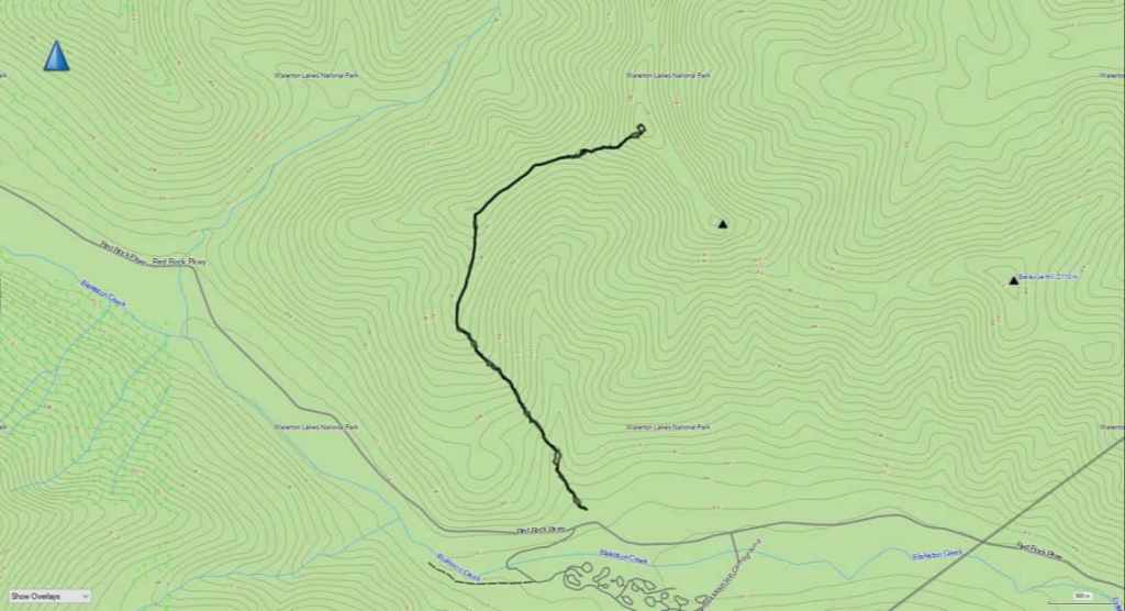
To get to Galwey North we drove 7.8 km along the Red Rock Parkway until we came to the Coppermine Creek picnic shelter. This is where we parked. We then followed a small trail behind the picnic shelter alongside the creek until it disappeared. We continued traversing the bank until we eventually found ourselves across the creek from a natural ascent route onto the south arm of Galwey North’s west ridge. For reference, this was ~550 m from the picnic shelter.
After crossing the creek, we ascended to the crest of the south arm (~1.85 km with a 486 m elevation gain) which we followed for ~ 860 m (149 m elevation gain) until we came to the top of a high point that marked the south arm’s junction with the west ridge. From the high point, it was a ~935 m trip (53 m elevation gain) along the west ridge to reach the mountain. We avoided all the major obstacles along the ridge by sticking to climber’s right.
To ascend to the summit, we trended to climber’s right and scrambled up a series of scree-covered ledges until we were beneath the summit block. While Andrew used the sane way onto the block by scrambling up a weakness on the west side, I tried a more difficult route on the east side. For reference, from the west ridge to the summit it was a 248 m elevation gain. After enjoying a leisurely 30 minute lunch on the summit, we returned the way we came.
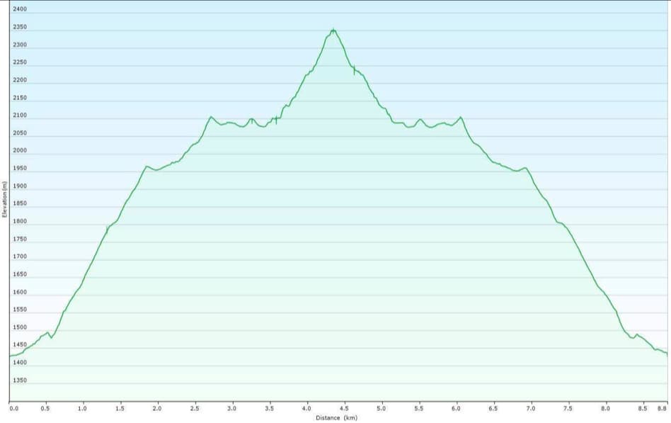
Our total roundtrip distance was 8.8 km with a total roundtrip time of 6 hours. For reference, it took us 3 hours and 15 minutes to reach the summit from the parking lot (~4.4 km with a 998 m elevation gain). Total elevation gains came in at an even 1100 m.
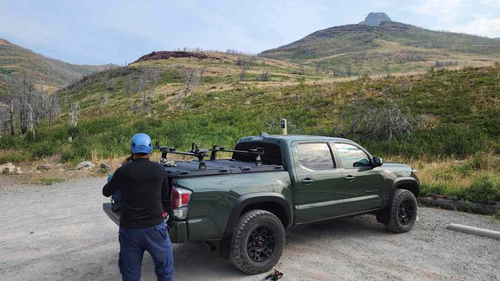
Gearing up at the Coppermine Creek picnic shelter. The summit of Mount Galwey is on the right; however, Galwey North is not visible.

Starting up the trail alongside Coppermine Creek.

Andrew decides to call it a day. 😂
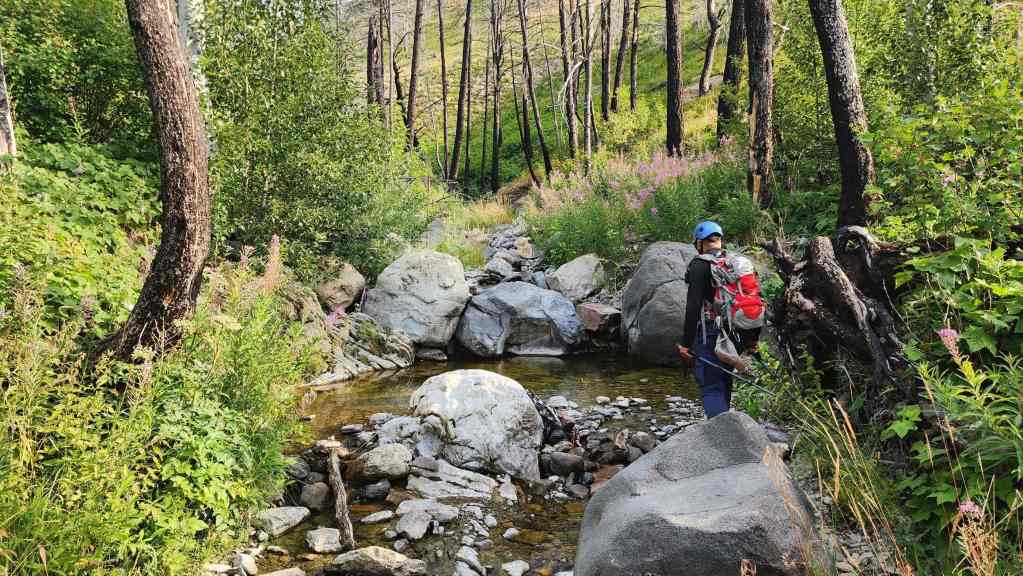
Following the creek.
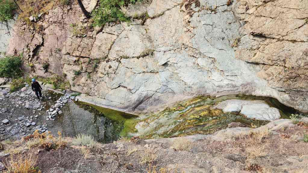
While I followed a rough trail high onto the bank, Andrew stayed below to check out a waterfall.
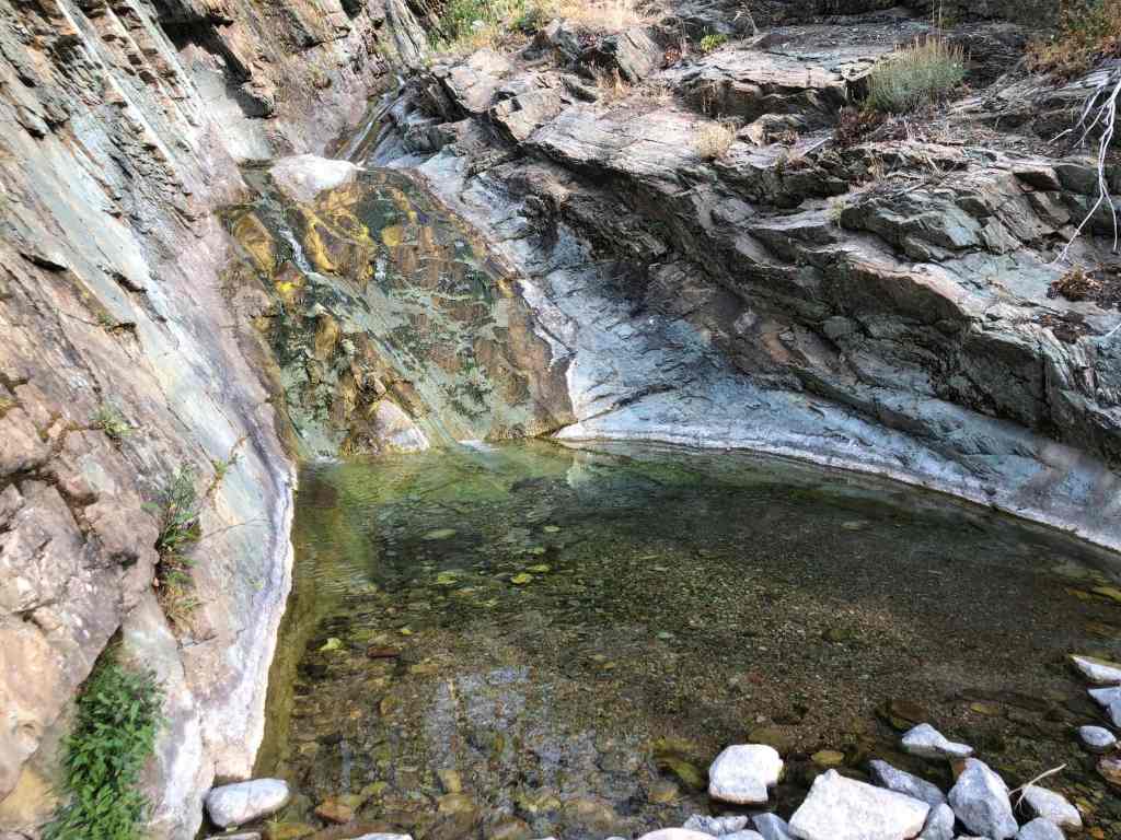
Andrew’s view from the previous photo. To see what the creek looks like when it’s full of water, read Andy’s April 2024 trip report. (Photo by Andrew Nugara)
The view back shortly after starting.

I scope out the route that we’ll use to ascend onto the south arm (left). On the right and above me, is the summit of Galwey North. (Photo by Andrew Nugara)
My view of Galwey North (centre) from the previous photo.

A better look at our route onto the south arm.

Descending to the creek.
Making the easy creek crossing. (Photo by Andy Nugara)

On the other side of the creek, we came across the remains of a ram. We’d leave the horns where we found them. (Photo by Andrew Nugara)
Heading up.

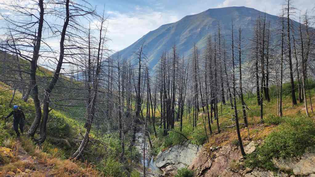
Glancing back as we gain elevation. Mount Crandell (left) and Buchanan Northeast (right of centre) are in the background.
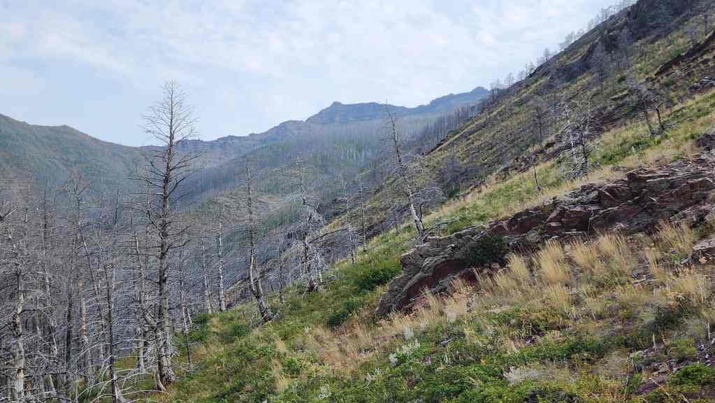
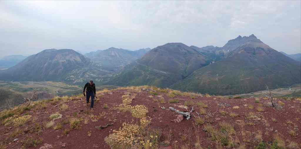
Getting our first good look at Galwey North (left) and the connecting ridge with Mount Galwey (centre).

Approaching an interesting tree sitting on top of an argillite outcrop.

A closer look at the tree.
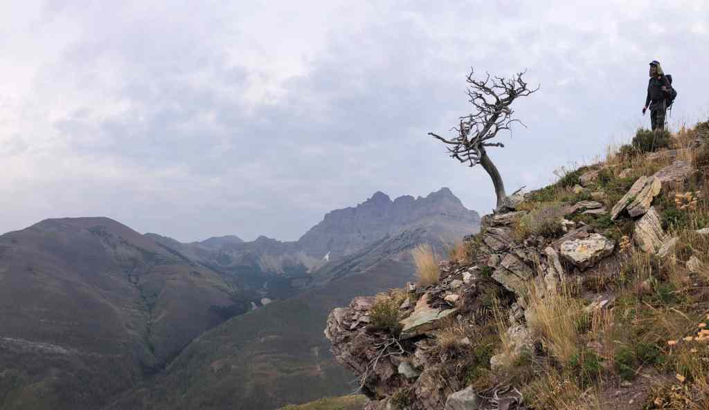
A gnarly old tree and a gnarly old hiker. 😂 (Photo by Andrew Nugara)
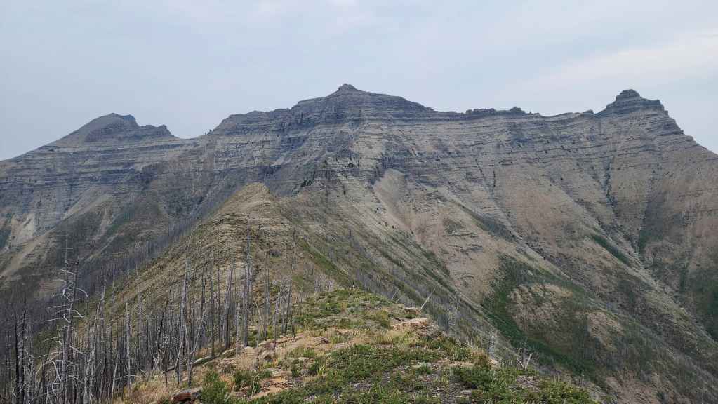
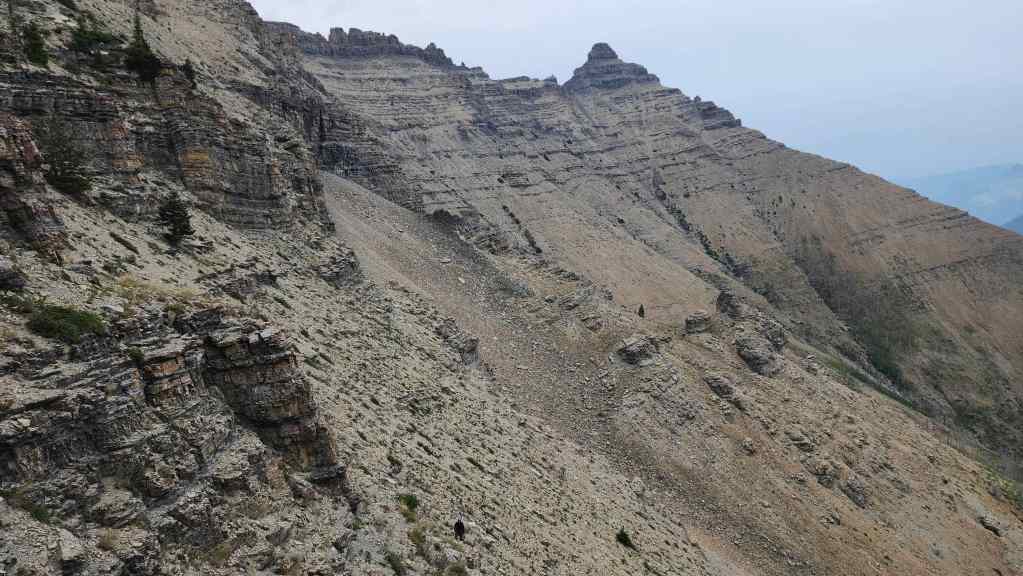
A better look at our objective. From here, Galwey North does not look higher than Mount Galwey, but it is.
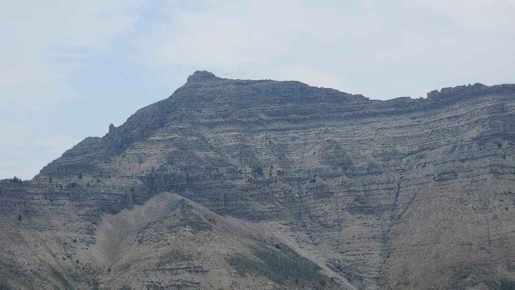
Zooming in on Galwey North.
Continuing to make our way along the south arm.

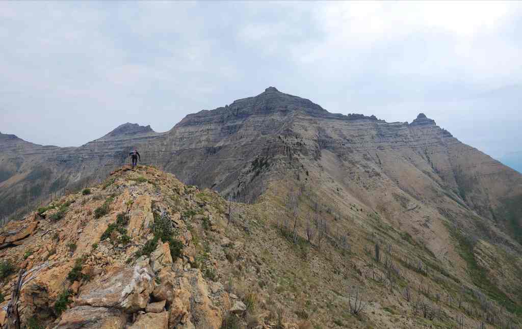
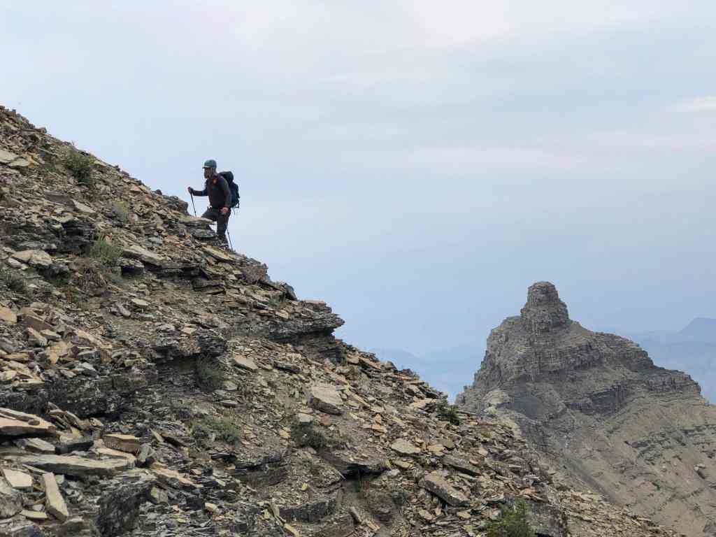
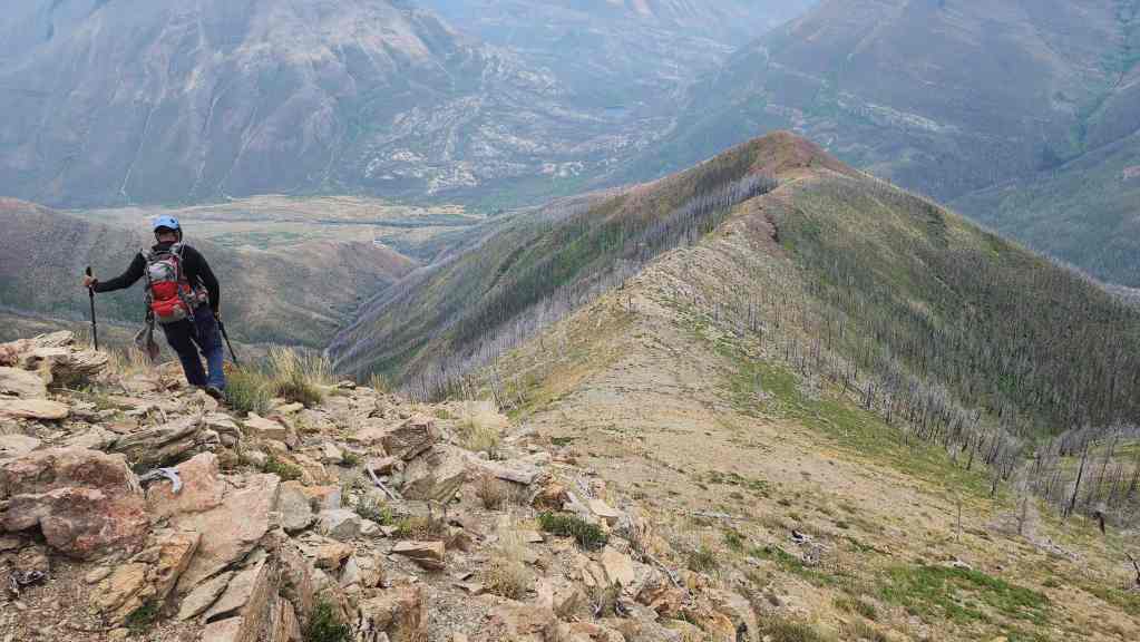
From the top of a high point, we could clearly see our route. This would end up being an enjoyable ridge walk. 🙂
Looking back from the same high point. We kept an eye out for any incoming rain.
Looking west from the same vantage.
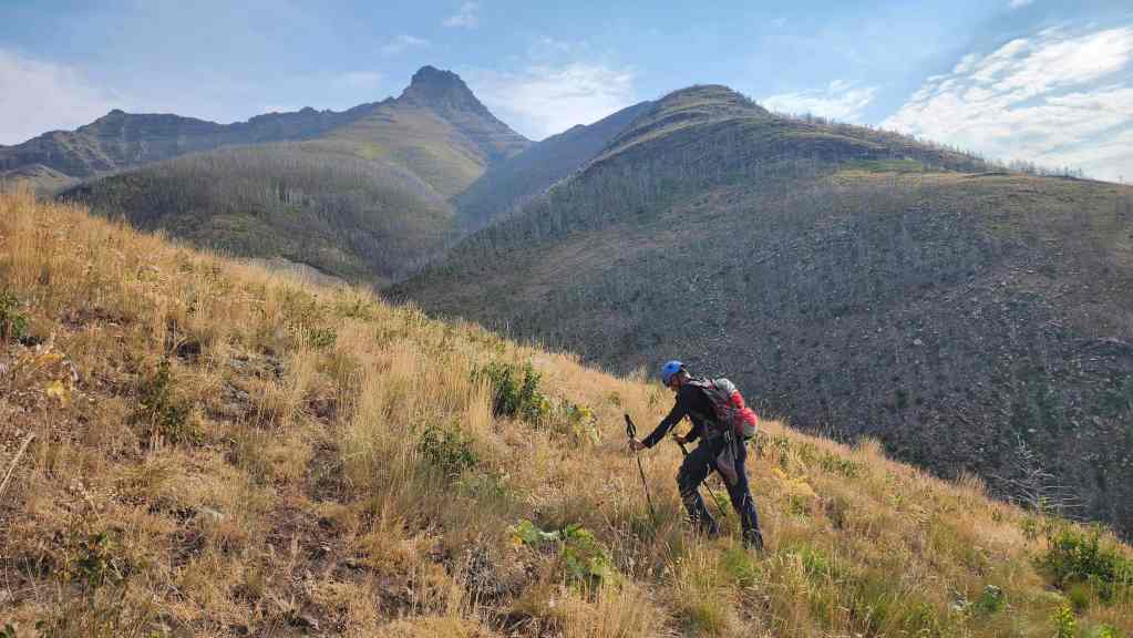
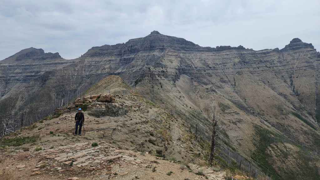
Continuing towards the next high point and the junction with Galwey North’s west ridge.
The view back as we head onto the high point.

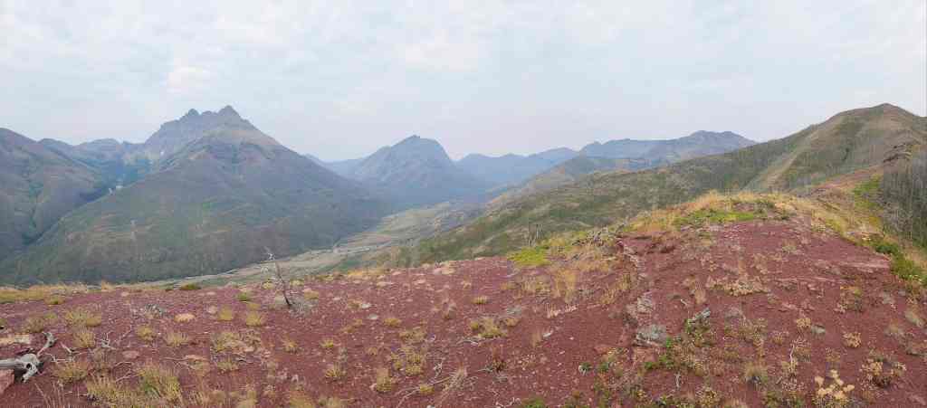
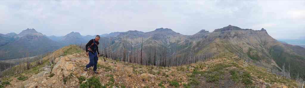
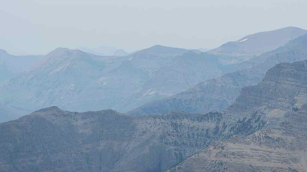
A pano towards Galwey North (centre) from the high point. Mount Dungarvan is on the left.
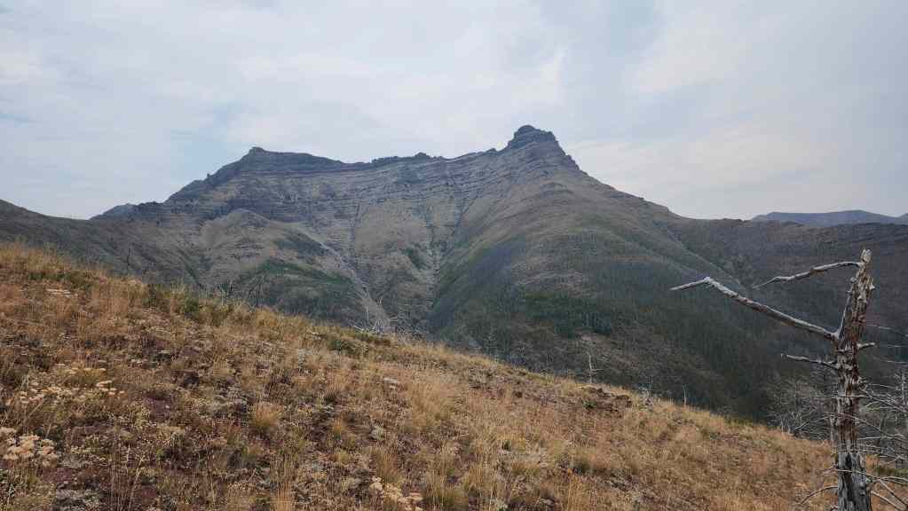
From left to right: “Rogan Peak”, Galwey North, and Mount Galwey.

A closer look at Galwey North.

One more pano from the high point. (Photo by Andrew Nugara)
Okay, I lied. Here’s another one. 🙂

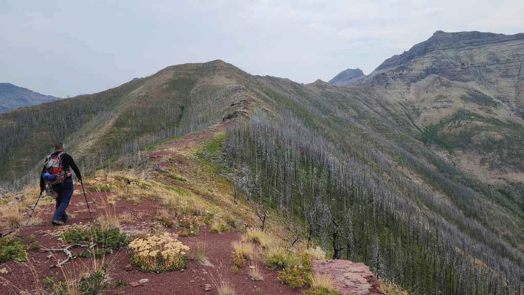
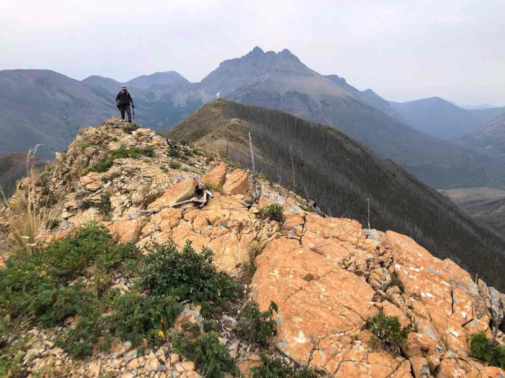
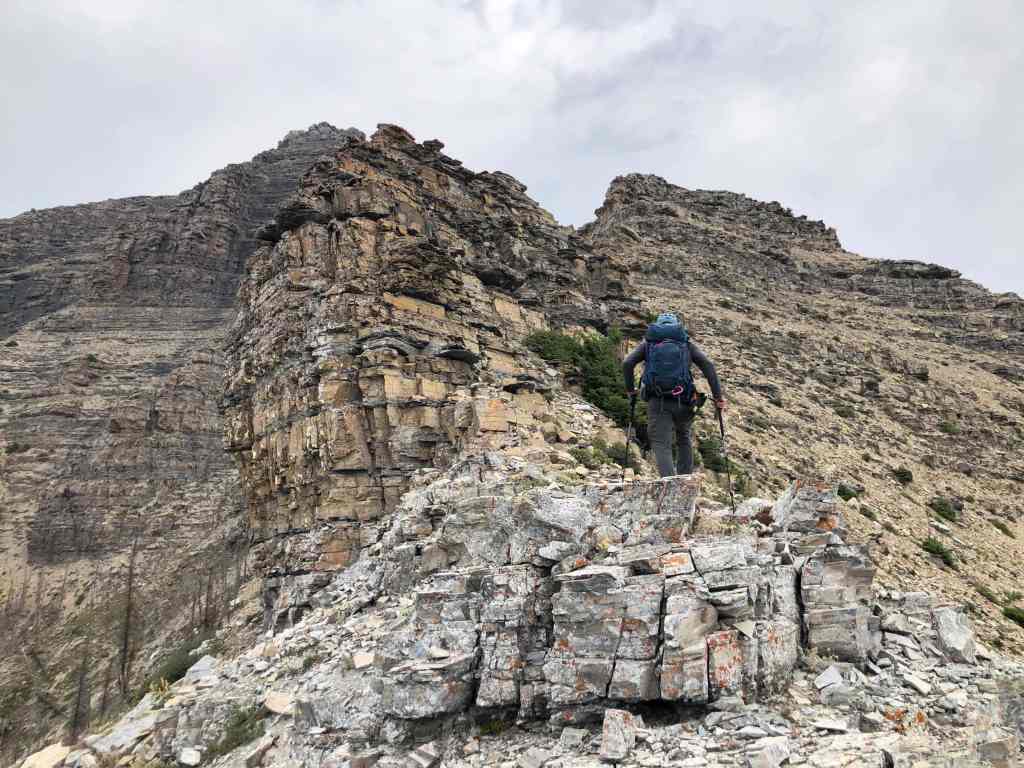
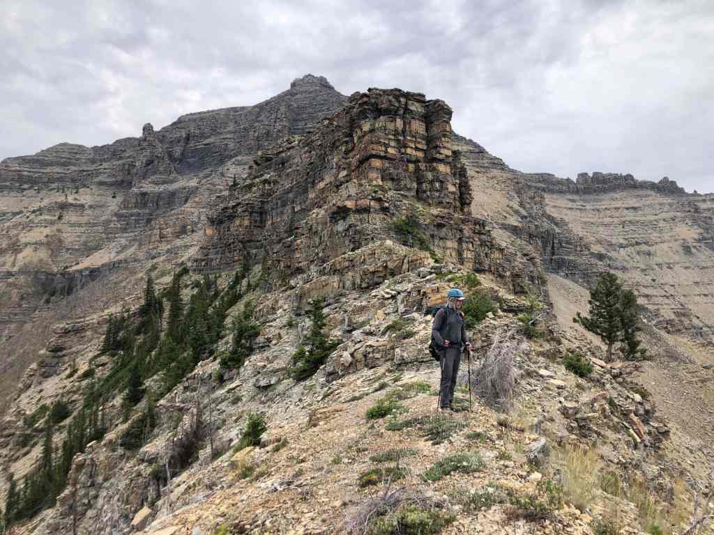
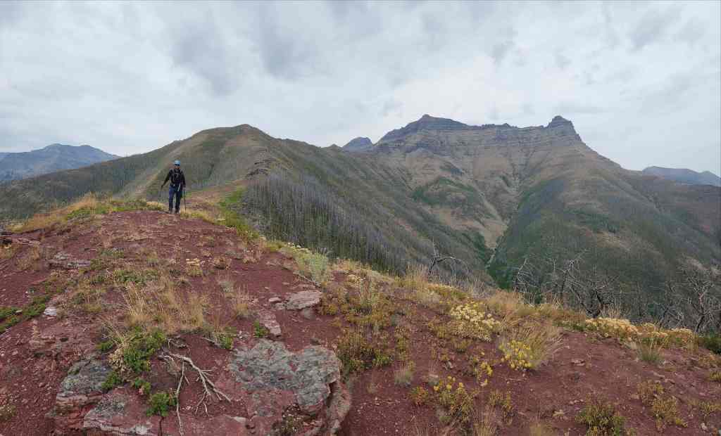
Heading along the west ridge.
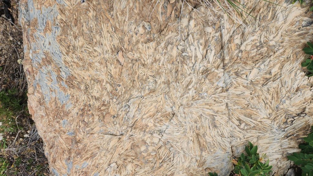
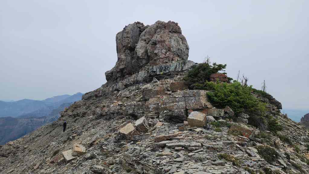
We soon came across this unique-looking rock.
A closer look at the rock. (Photo by Andrew Nugara)
Making our way along the ridge.
Andy’s view back from the previous photo. (Photo by Andrew Nugara)

Approaching our first obstacle: the giant rock step in the centre.

We would bypass this by heading to climber’s right. (Photo by Andrew Nugara)
While Andrew (centre) found an easy bypass by losing elevation, I kept following a small ledge.
I’m hard to see in the centre, but I’m about to scramble over a partially exposed section as I make my way along the ledge. Once above this, it was smooth sailing along the remainder of the ledge; however, on the way back, we would follow Andrew’s route because down-climbing this small section could be tricky. (Photo by Andrew Nugara)
My view down to Andy after scrambling over the obstacle on the ledge. Before scrambling, I had waited for him to go on ahead and confirm that I could keep going along the ledge. Otherwise, it would’ve sucked to backtrack.

Andy’s view up to me (centre). (Photo by Andrew Nugara)

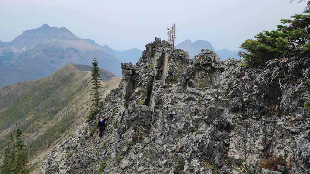
Back on the ridge.

Glancing back and along the ridge.
Coming to another obstacle… (Photo by Andrew Nugara)
That we could easily bypass by keeping to climber’s right.
The following step was also easy to avoid by sticking to climber’s right…
However, it was also fun to scramble over. (Photo by Andrew Nugara)

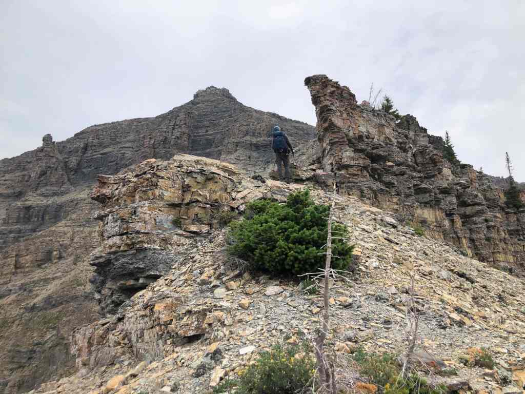
Glancing back as we arrive beneath the summit of Galwey North.

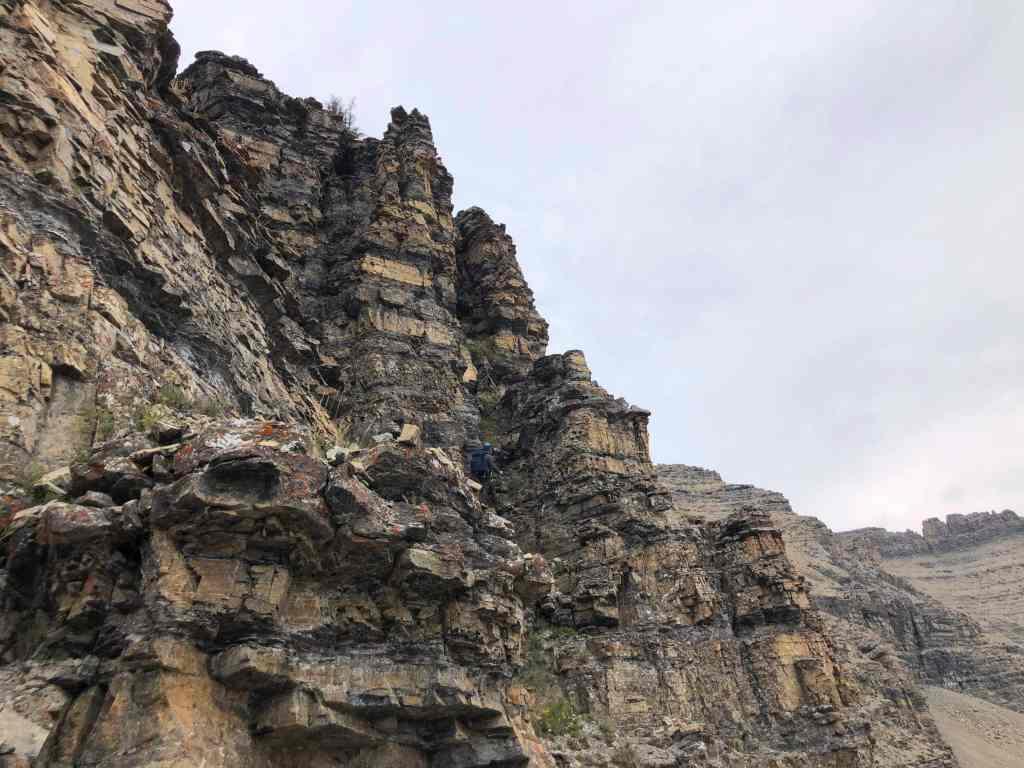
Our route would go up the scree-covered ledges on the right. (Photo by Andrew Nugara)

A better look at the terrain beneath the summit. Once we were above the large rock band (foreground), we trended to climber’s right before heading up the ledges.

Above the rock band and heading over to the ledges. (Photo by Andrew Nugara)

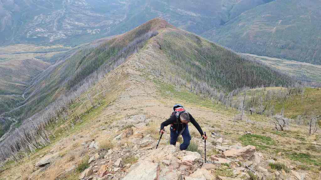
Andrew scrambles his way up.
Nearing the top. (Photo by Andrew Nugara)

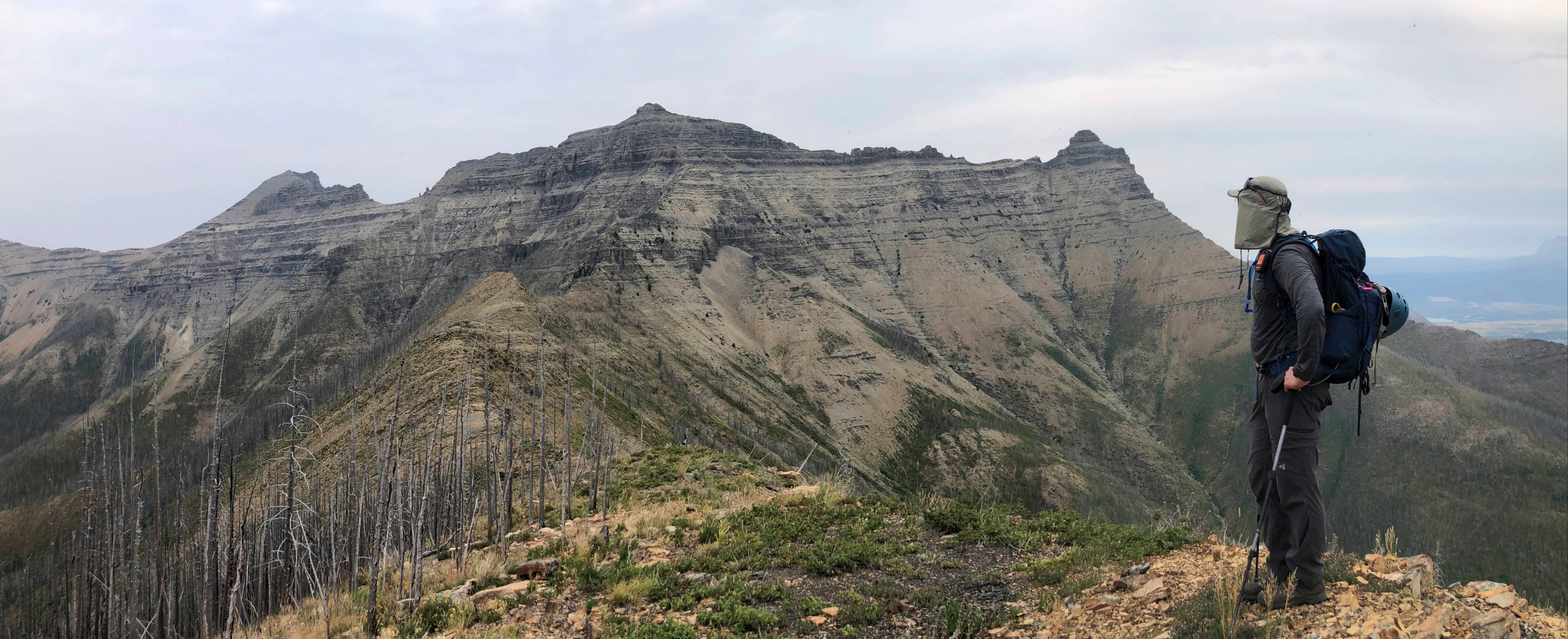
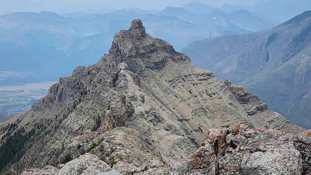
On the summit ridge and looking towards Mount Galwey.
The summit block. Andrew (left) would keep to climber’s left and use an easy weakness to reach the summit.

Andy’s view from the previous photo. (Photo by Andrew Nugara)
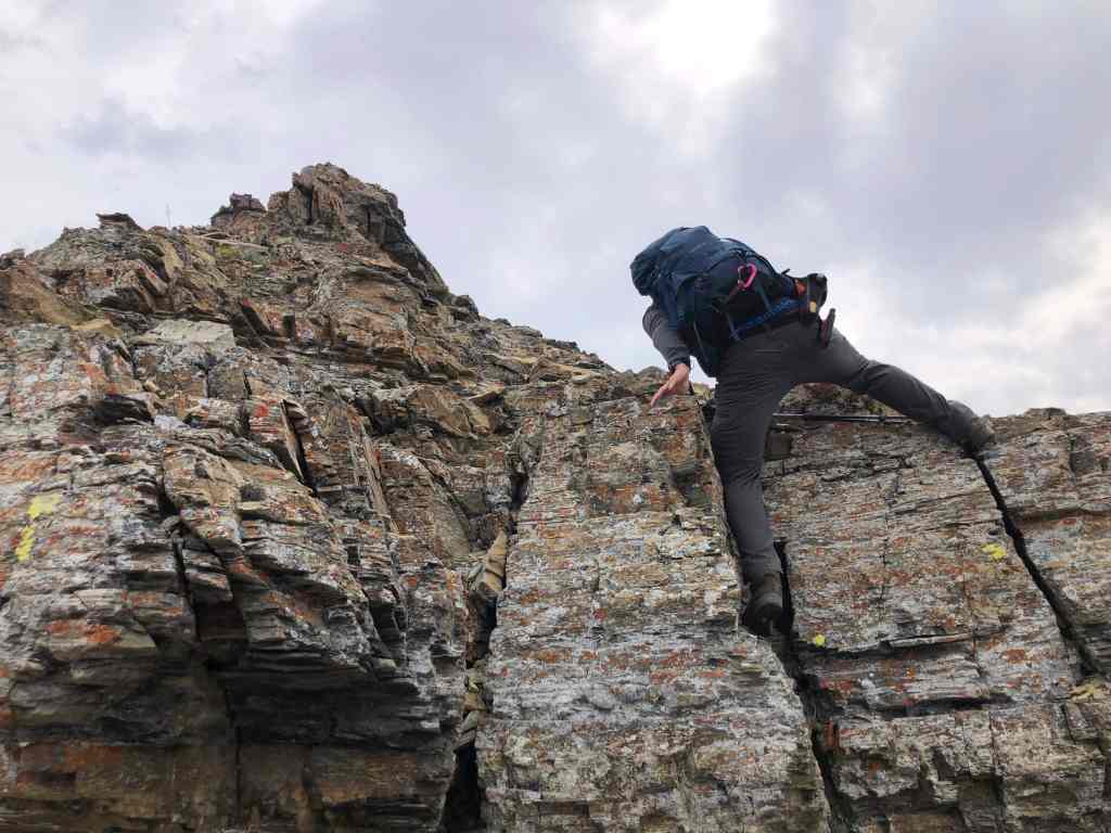
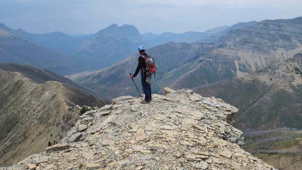
I would keep to climber’s right and ascend this slightly more challenging route onto the summit.
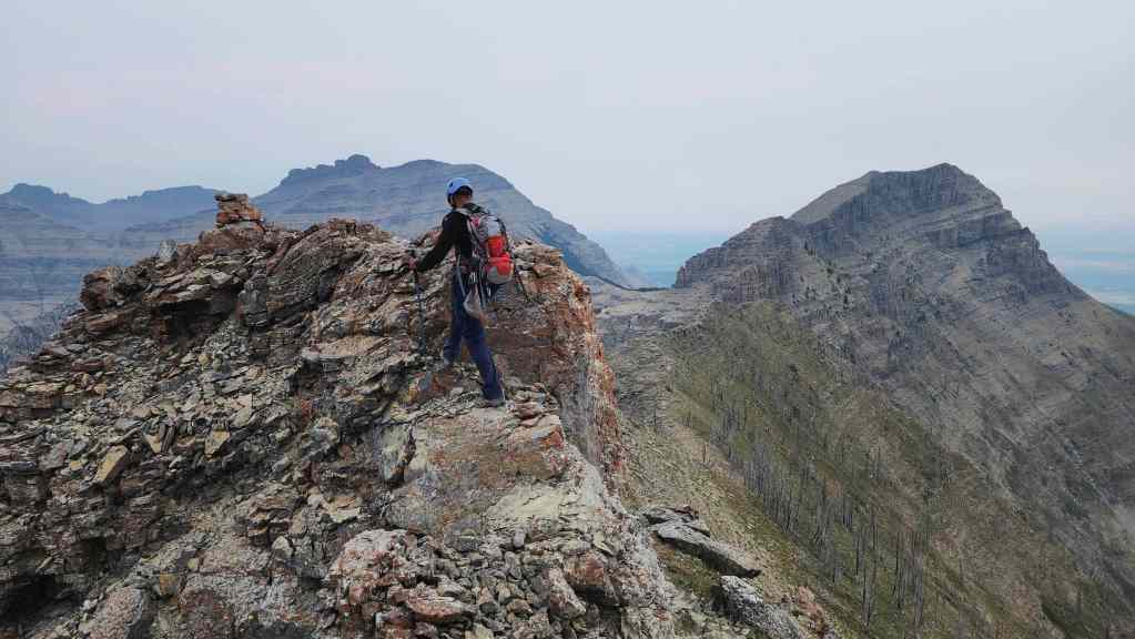
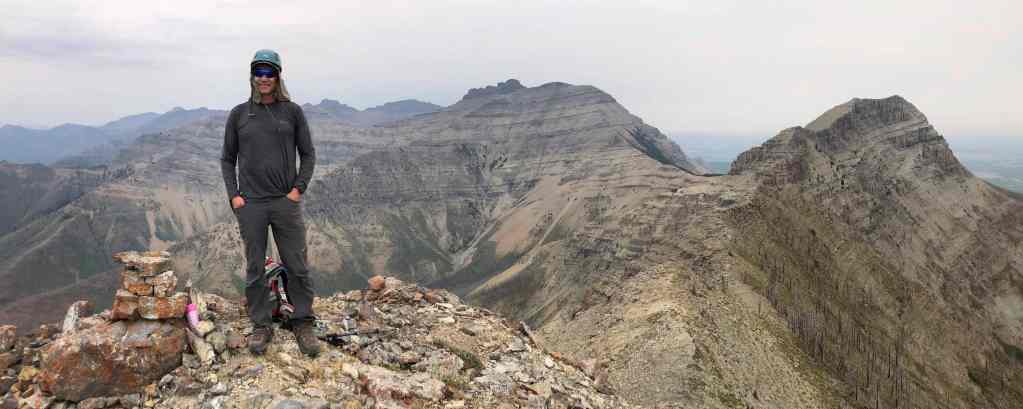
The summit of Galwey North (2384 m). Despite using different routes, we both emerged onto the summit at the exact same time. For reference, from the parking lot, it took us 3 hours and 15 minutes (998 m elevation gain) to reach the summit.

A pano to the south… (Photo by Andrew Nugara)
And then to the southwest.
Looking west…

And then to the northeast.

Despite the haze, all three peaks on Lakeview Ridge can be seen.

“Rogan Peak” sits immediately to the north.
Mount Dungarvan was a great scramble.

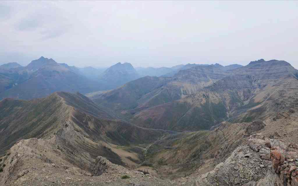
Looking over to “Dundy Peak” (foreground) with Cloudy Ridge (centre) and “Cloudy Junior” (right) behind it.

Zooming in on “Newman Senior” (left of centre), Mount Glendowan (right of centre), and “Cloudowan Peak” (right).
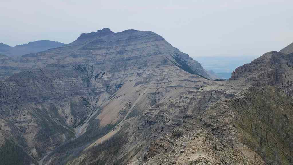
A very hazy Newman Peak (centre) and Avion Ridge (left).

Anderson Peak sits across the valley.
Zeroing in on a barely visible Lone Mountain.

Mighty Piinaquiium / Ahkoinimahstakoo (Mount Blakiston).

Looking across to Ruby Ridge and Mount Lineham (right).

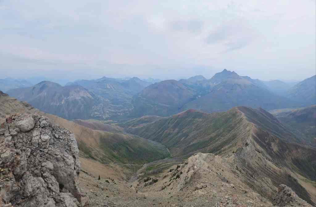
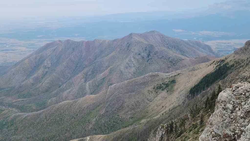
With Crandell Lake in the foreground, we could see Buchanan Northeast (left), Mount Alderson (behind Buchanan NE), “The Senator” (right of centre), Buchanan Ridge (right of centre), and Mount Carthew (right of centre).
Looking down on Mount Galwey.
Finally, a look over to Bellevue Hill.
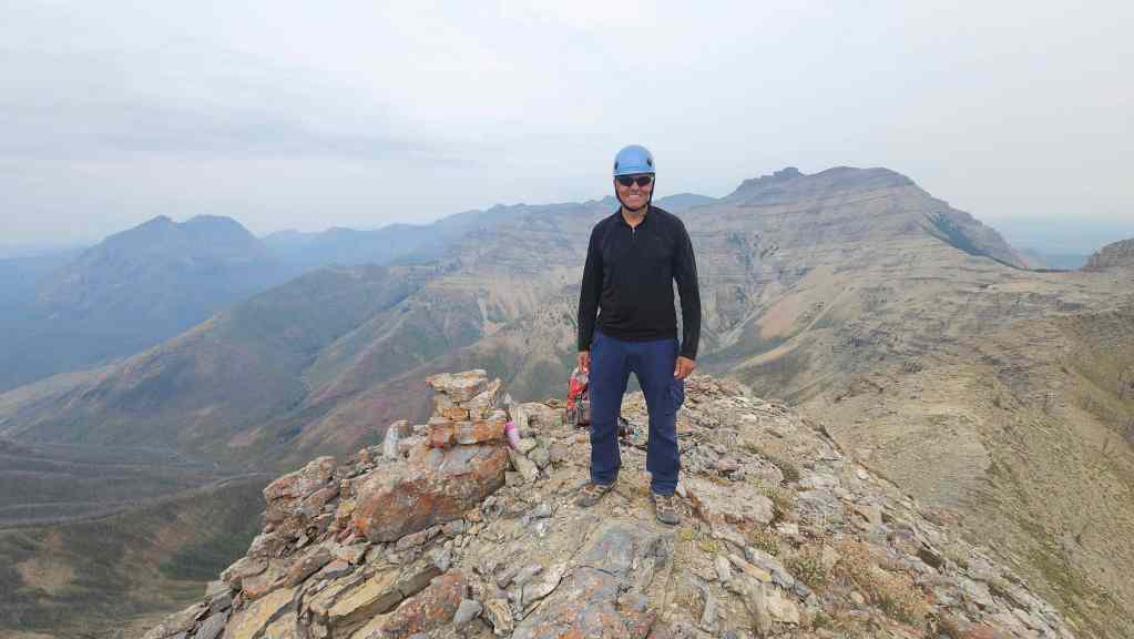
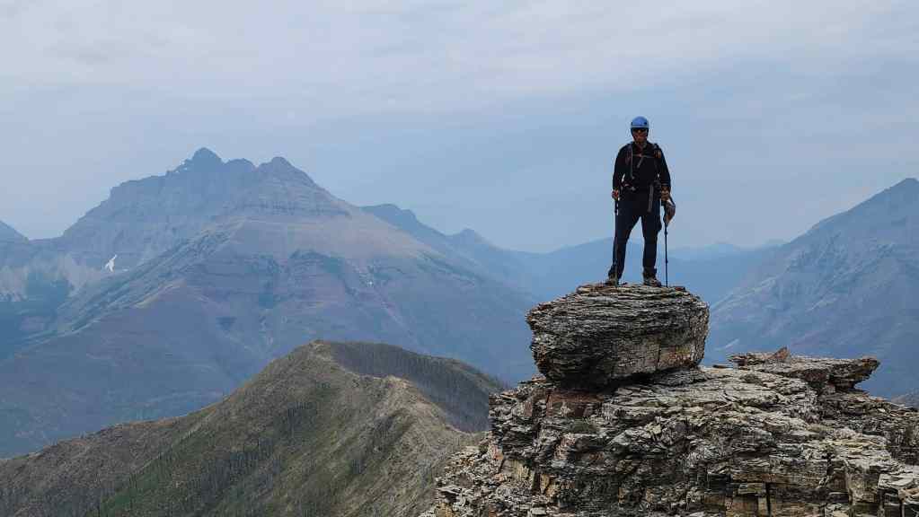
The all-time Galwey North Champ. 👏 This was Andy’s 5th time on the summit.
The last place participant. 😂
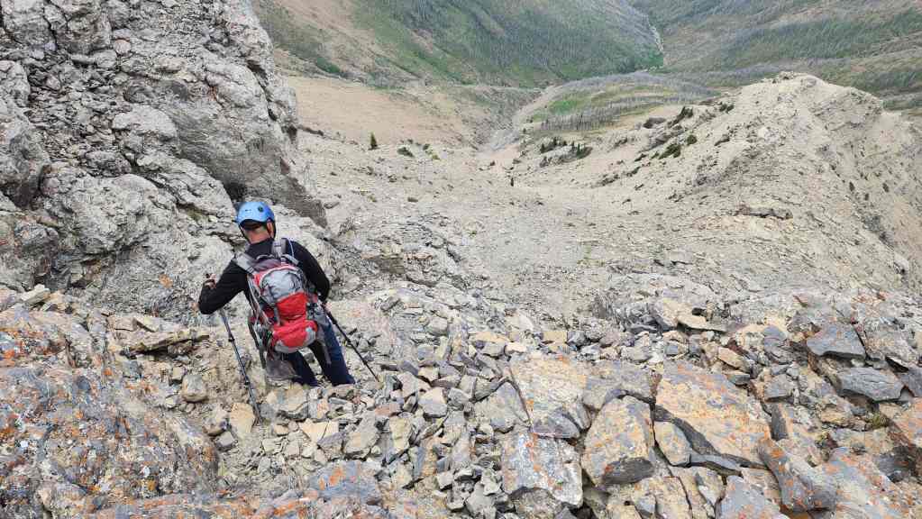
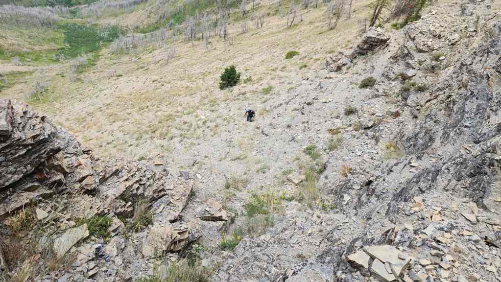
After enjoying a 30 minute lunch break, we headed down the weakness that Andrew used to get onto the summit block.

We would follow our same route to get back.

Andy carefully negotiates a narrow ledge.
Despite the terrain, it didn’t take us long to get back onto the west ridge.
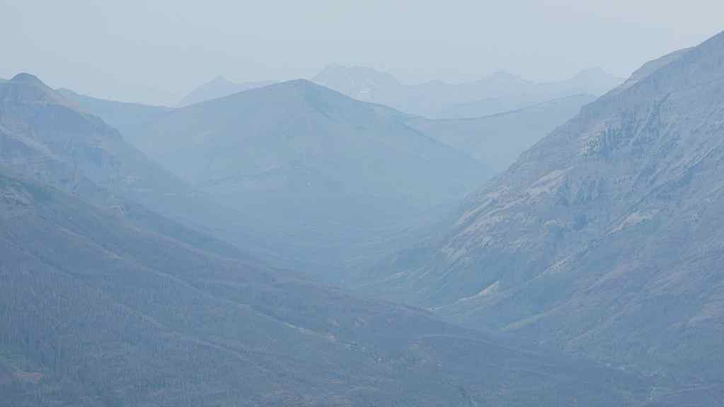
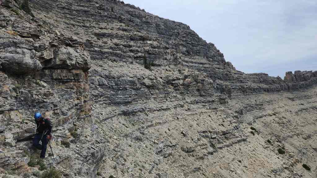
On a clear day, this trip would offer some great views.

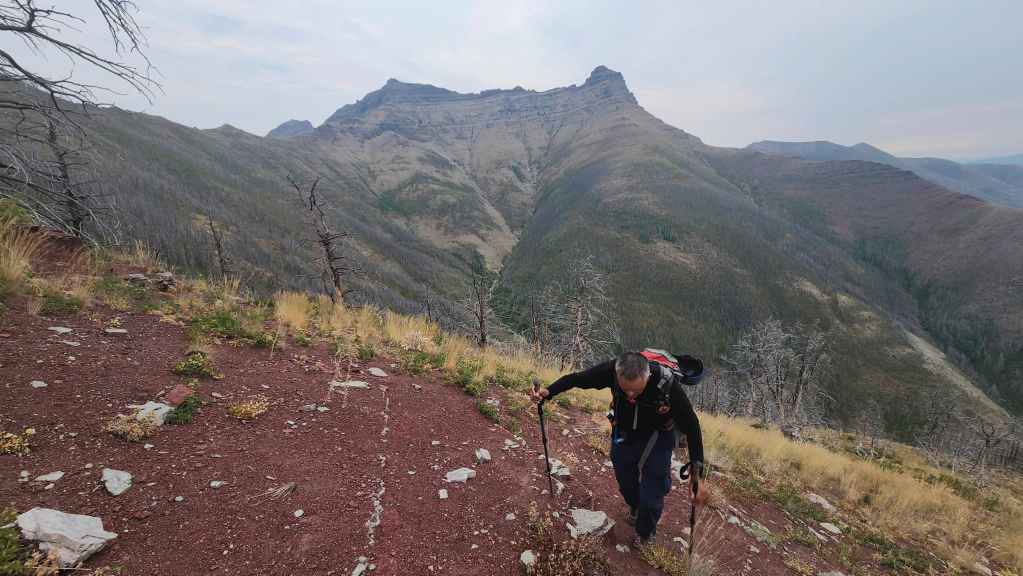
Retracing our steps along the ridge.
Andrew with Piinaquiium / Ahkoinimahstakoo (Mount Blakiston) in the background.

Looking back to the summit. (Photo by Andrew Nugara)
Another look back, this time after bypassing the first – and largest – step that we encountered. (Photo by Andrew Nugara)
Another look back.

Heading up the large high point…
And then down to the south arm.
Enjoying the ridge walk.

As dark clouds begin to roll in, we realized that we timed this trip nicely! (Photo by Andrew Nugara)

Passing beside the gnarled tree we inspected on the way up. (Photo by Andrew Nugara)

Heading down to the creek. Mount Crandell (centre) and Buchanan NE (right) are in the background.
Almost at the creek.
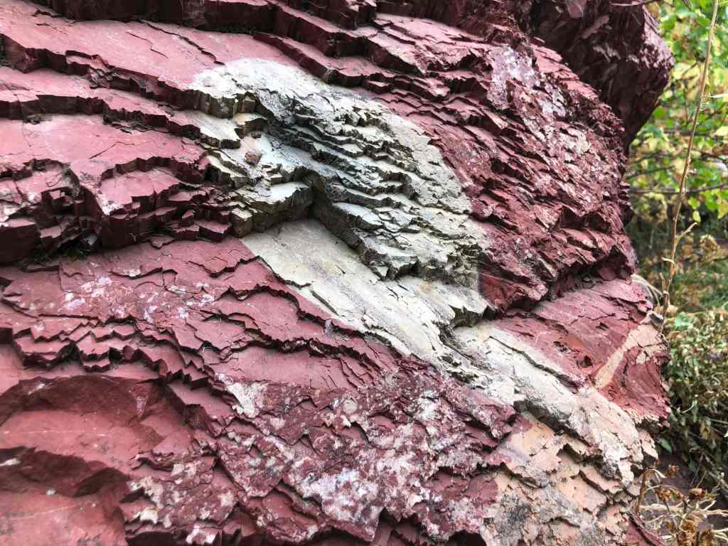
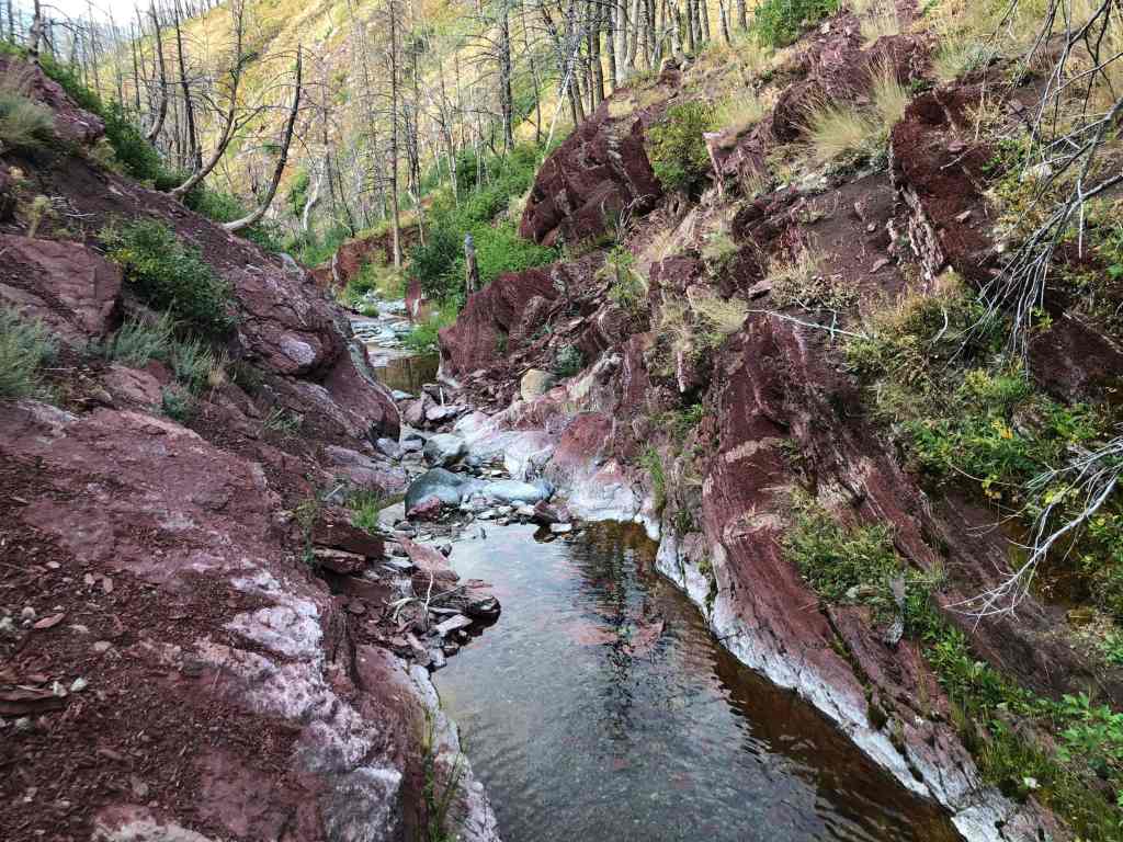
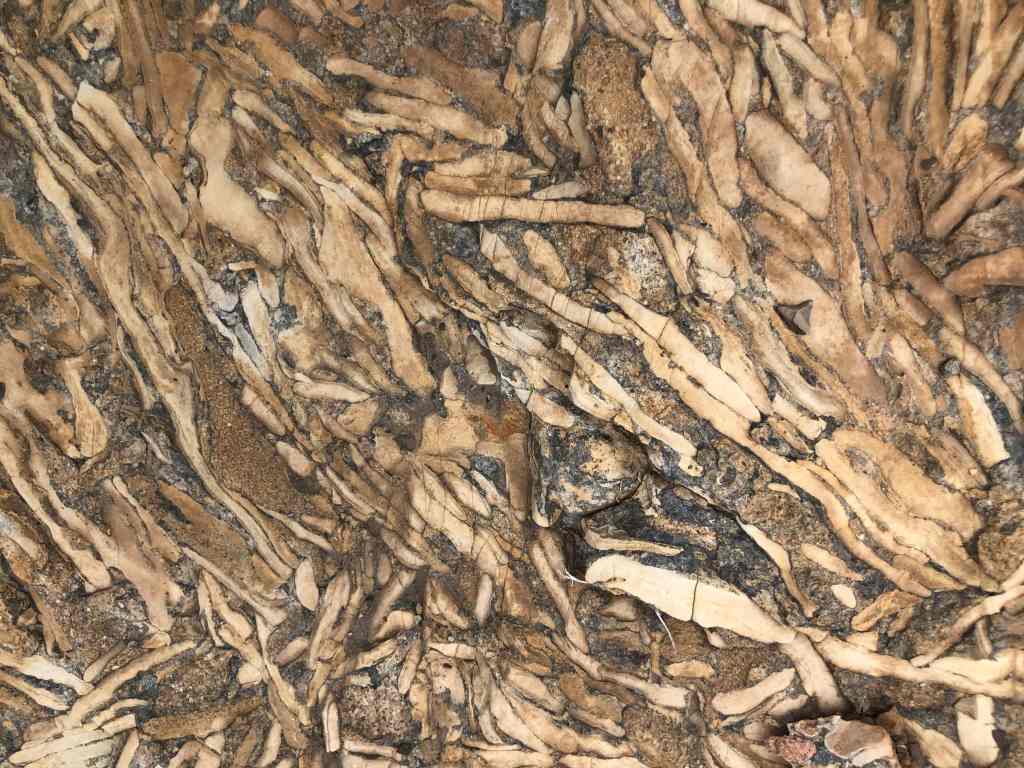
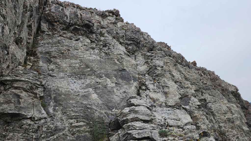
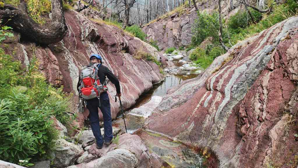
At the creek and surrounded by gorgeous argillite. (Photo by Andrew Nugara)

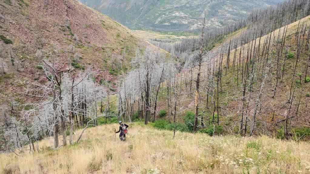
Instead of heading up the opposite bank, we decided to hike along the creek bed.
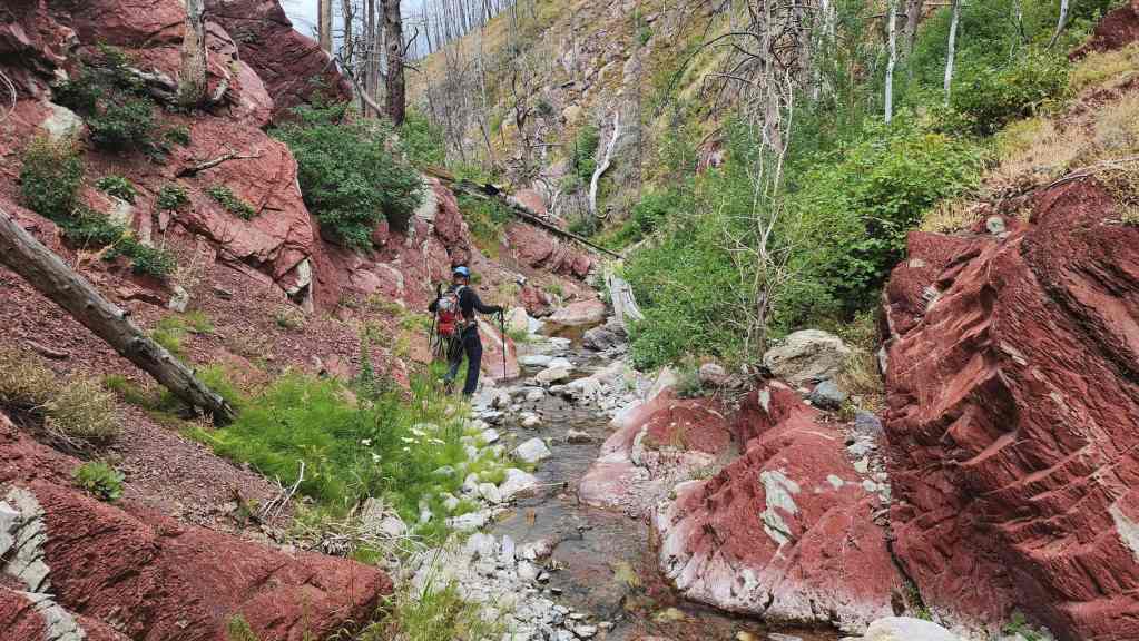
A crimson paradise,
More great scenery.

Arriving back at the Coppermine Creek picnic shelter six hours after starting. For a last minute decision based on the weather, Galwey North was the perfect choice. Using the long ridge for ascent and descent was also a good decision; though there are other routes such as what Andy used in: April 2024; May 2021; August 2021; August 2012; and August 2004. I’m definitely grateful that he was still willing to make another ascent today after so many repeats over the years. 🙂


Leave a Reply