

⚠️ Hiking and scrambling are inherently dangerous activities. Please read my Disclaimer. ⚠️
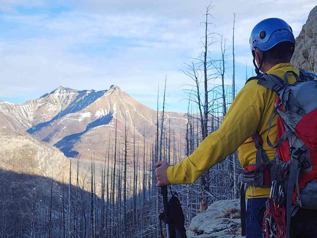
Finally! 😁 After years of planning to ascend the northeast end of Buchanan Ridge as a shoulder season or winter hike – and then backing off because of weather – I finally caught a break. An unseasonably warm and windless day allowed Andrew and I the chance to ascend this prominent (2424 m) peak under enjoyable, but concerningly snowless conditions.
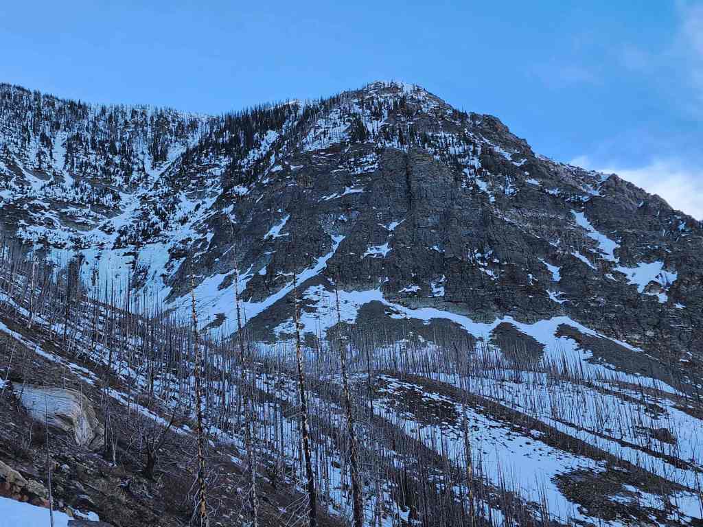
Back in January I noted the minimal snowpack during our trip up, “The Horn”, on the front range of Tatsiki-Miistaki (Castle). Someone upstairs must have been listening, because shortly thereafter, the area received a decent one-time snowfall. However, a couple weeks of unseasonably warm weather made short work of this and as of today, the entire area is largely devoid of snow.
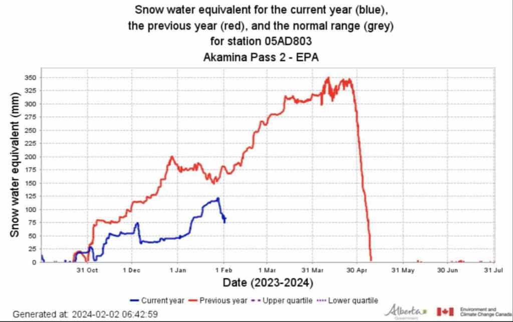
Since southern Alberta relies on snowmelt for its water supply, this is very concerning. Moreover, the publicly available data from the Akamina Pass snow pillow, validates this. This snow pillow along with the Flattop Mountain pillow are used by the Province of Alberta to help forecast water for the upcoming year. Data from the morning of February 2, 2024 demonstrates that we are significantly behind last year’s snowpack, and last year was a dry year. Unless we have a dramatic rally of precipitation over the next few months, we will undoubtedly experience water restrictions. On the hiking side, the upcoming dry conditions may be enough for the government to limit backcountry travel due to fire risk, but that’s just speculation on my part. The bottom line is that we need a lot more snow combined with a slow spring melt.
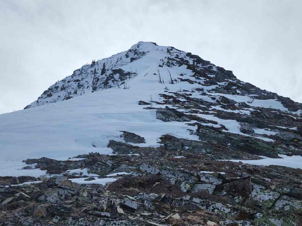
Anyway, the trip itself was fantastic, and I was shocked at how good the views were. 🙂 The summit offers a nice 360 panorama of the entire area, including the Waterton townsite and portions of Upper and Lower Waterton Lakes. I’m so glad that I waited for near-perfect conditions, because if it were windy, there would be no opportunity – or chance – to enjoy the scenery. It would simply be miserable. One thing that I will say however, is that the summit is very foreshortened when viewed from the Akamina Parkway. I’d always assumed that it would be a fairly quick trip – and relatively speaking it was – but in the moment, it seemed like the ridge was not getting any closer as we slogged our way up. Then again, that could be because I haven’t been on many trips lately. 😂
There are lots of options for ascent and descent such as So Nakagawa’s 2012 trip, but we chose to use Andrew’s November 2020 route because we thought it would make for an easier loop. This saw us start from parking lot for the First Oil Well in Western Canada National Historic Site, and head more or less in a straight line to gain the ridge. We then descended directly from the summit onto a large, ramp-like cliff band near the Parkway. This cool natural feature, led us back to our starting point.
However, despite the overall lack of snow, it ironically ended up being a large section of deep snow that proved to be the crux. After being forced into a traverse while descending a gully, we had no choice but to tackle the snow head-on. As it was on a steep slope full of deadfall, I ended up down-climbing it by making handholds and footholds as I went, hoping that I didn’t suddenly sink onto a pointy stump – for if the Sword of Damocles hangs above, then the Sword of Testocles hides below. 😂 For his part, Andrew traversed even further to the northeast, but ended up doing pretty much the same thing. All in all, this added another 45 minutes to an hour onto the trip, but that’s totally okay.
Finally, a HUGE thank you to Andrew for humouring me by repeating a trip he has done several times before. As always, he is a fantastic friend to spend a day on a mountain with. 🙂
Be sure to read Andrew’s excellent trip report! [link coming]
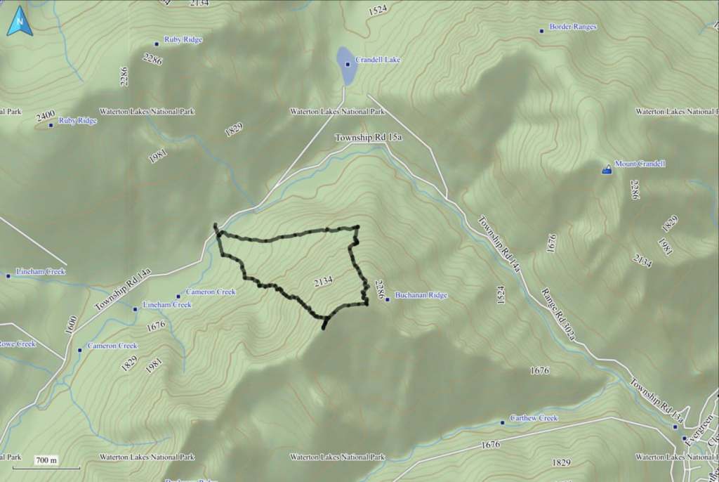
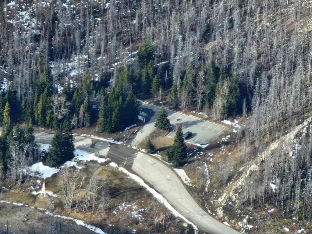
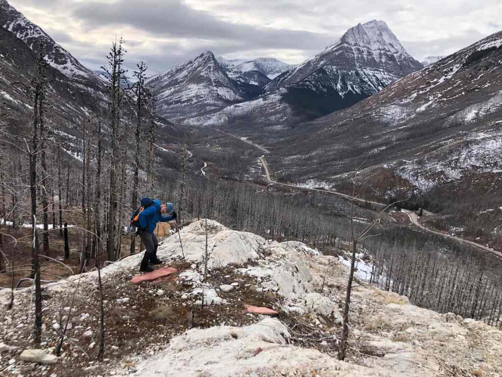
To get to Buchanan NE, we drove ~8km from the Waterton townsite along the Akamina Parkway until we arrived at the First Oil Well in Western Canada Historic Site. This was our starting point.
After crossing the Parkway from the parking lot, we then waded across Cameron Creek where it passes beside the oil well monument. We then crossed a second, smaller creek, before starting up a ridge on the NE side of a small bowl that we could see from the parking lot.
There were few obstacles and any scrambling could be easily avoided. For reference, from the parking lot, it was ~3.2 km combined with a 758 m elevation gain to reach the ridge. Once on the ridge, it was another ~660 m hike along with a 95 m elevation gain to reach the summit. In total, it took us approximately 3 hours to reach the summit, but this also included a secondary trip to the top of another high point along the ridge. Had we not done this, it would be a ~2.5 hour trip from car to summit.
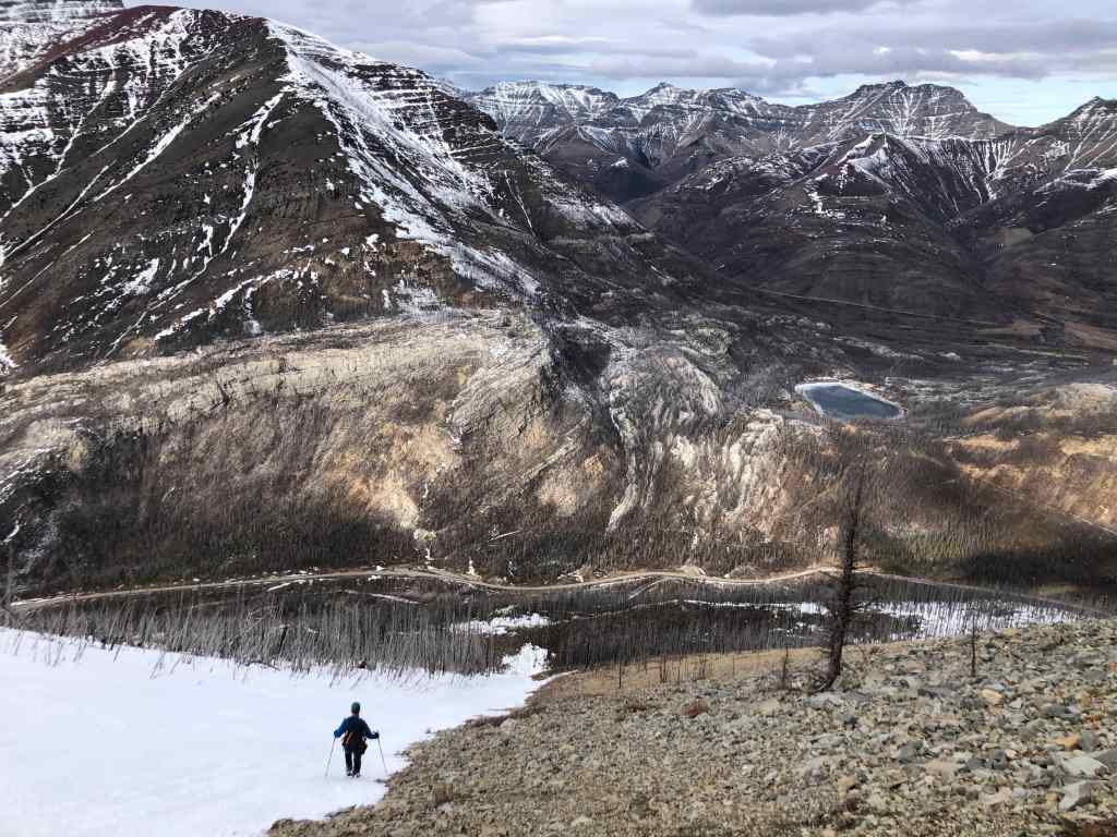
To descend, we dropped down the north slopes directly beneath the summit. In hindsight, we should have stayed as close to the end of the ridge as possible (skier’s right), because this would have allowed us to avoid a large cliff band. Once on the second cliff band, it was an enjoyable ~2 km hike along a natural ramp back to Cameron Creek and our vehicle.
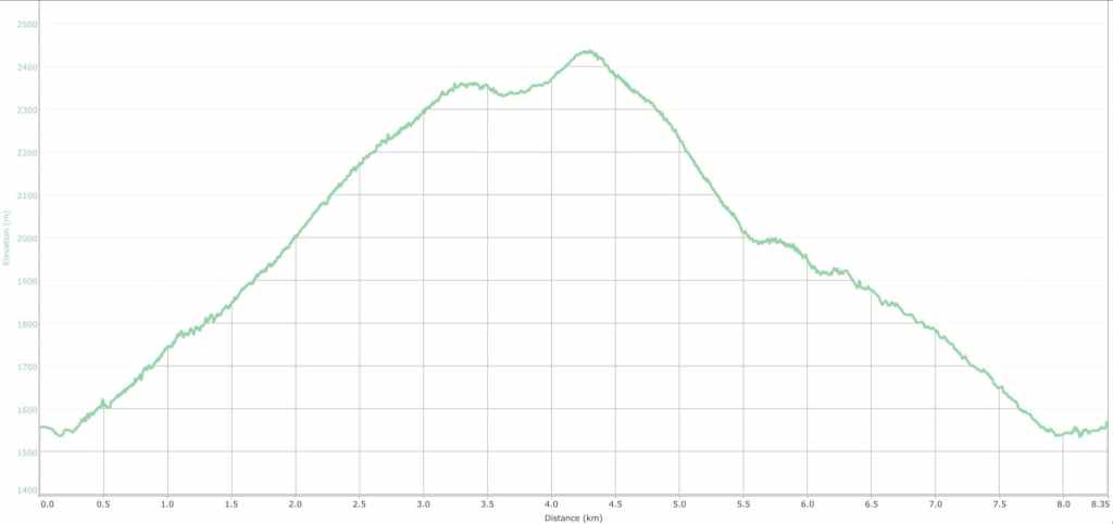
Our total roundtrip distance was 8.3 km with a total roundtrip time of 5 hours and 38 minutes. Our total elevation gain came in at 860 m.
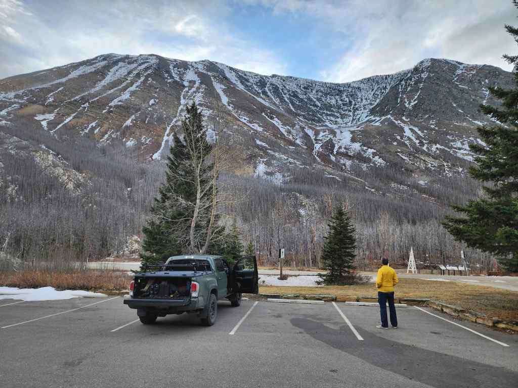
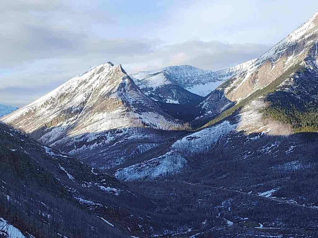
Sizing up our route from the parking lot of the First Oil Well In Western Canada National Historic Site. The summit is on the far left and from this vantage, is quite foreshortened.

A ram poses nearby while we gear up.
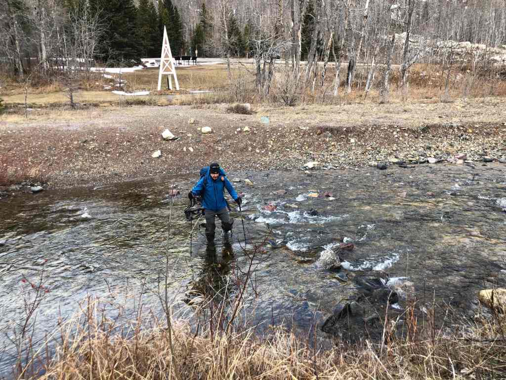
Crossing Cameron Creek… A big thanks to Mark Nugara for the hip waders. They may have been two sizes too small, but they did the trick. 🙂 (Photo by Andrew Nugara)
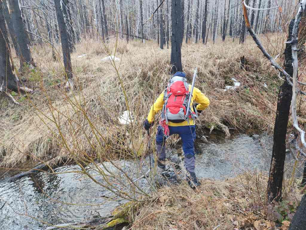
Andrew crosses the second creek.

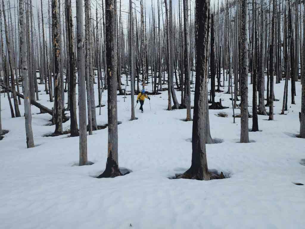
Once these trees begin to rot and fall, it will make getting to many peaks in Paahtómahksikimi (Waterton), rather tricky.

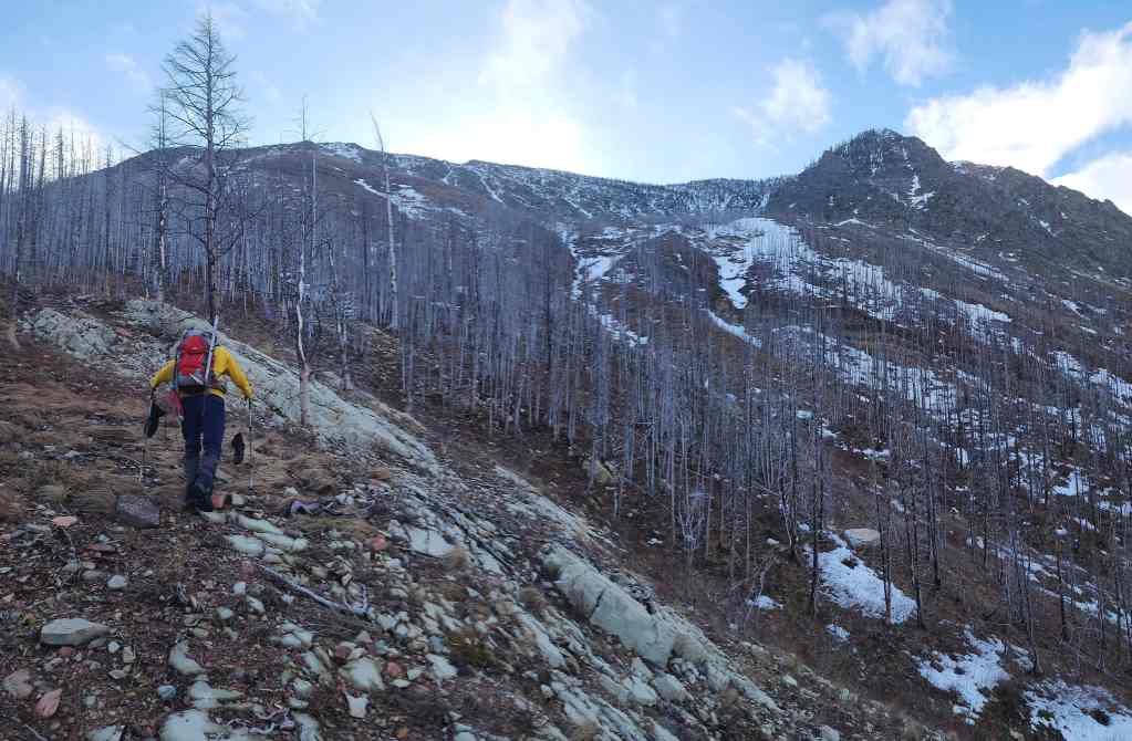
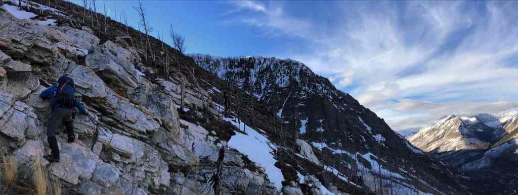
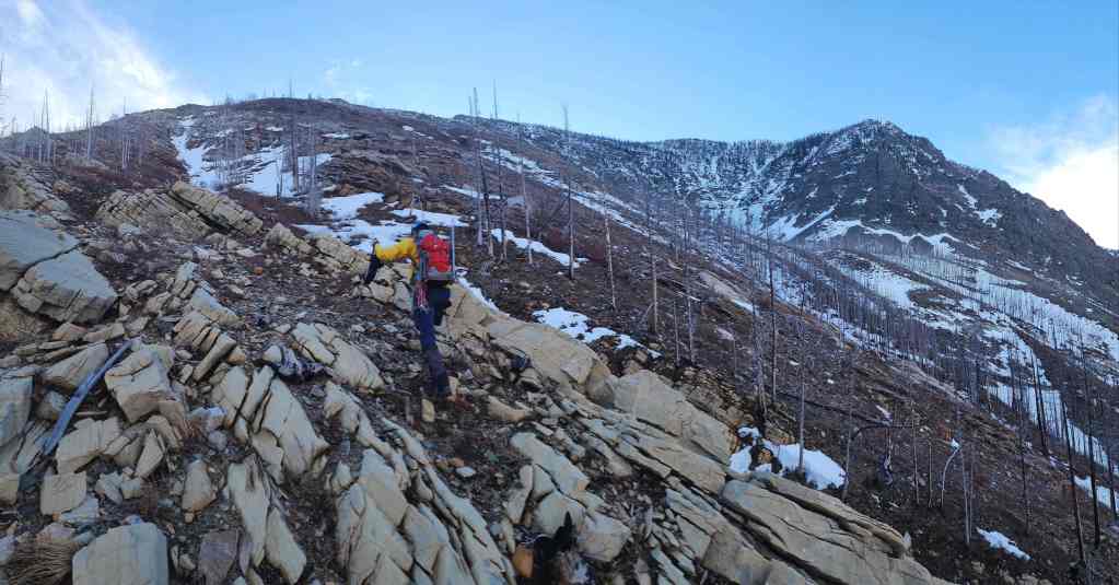
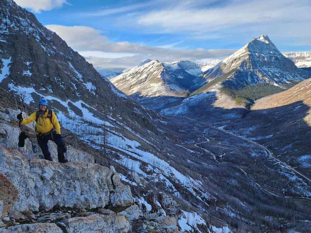
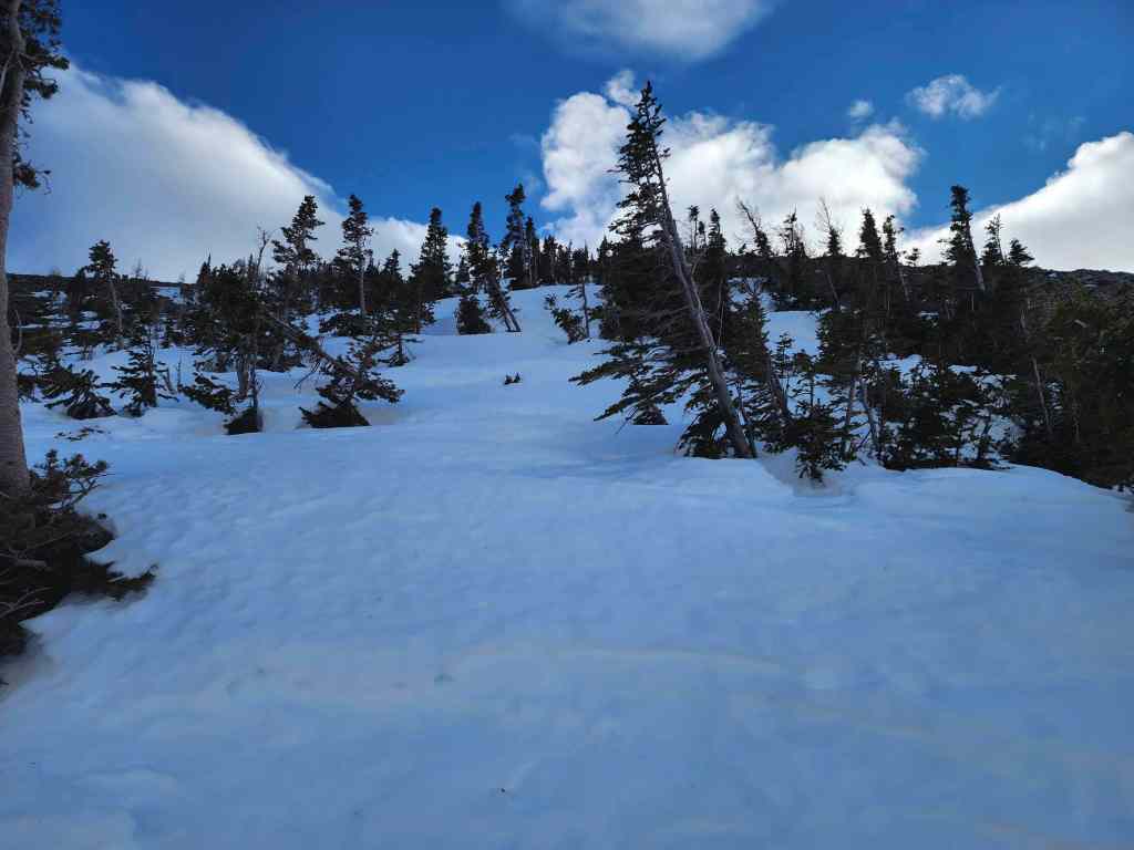
The slope is steep almost from the get-go.

Lots of new trees taking root.

We contemplated whether it was possible to scramble up that high point in the centre. 🤔 (Photo by Andrew Nugara)
However, our route for today would go up directly in front of Andrew.
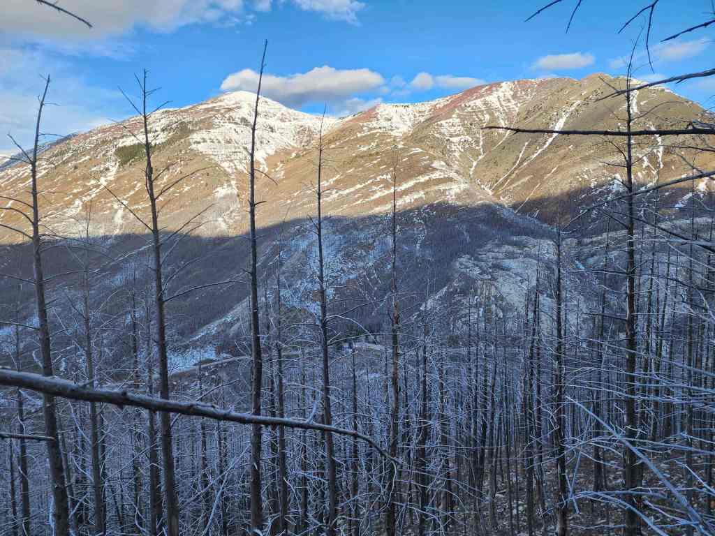
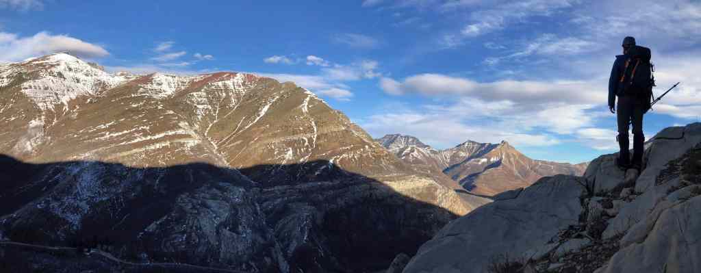
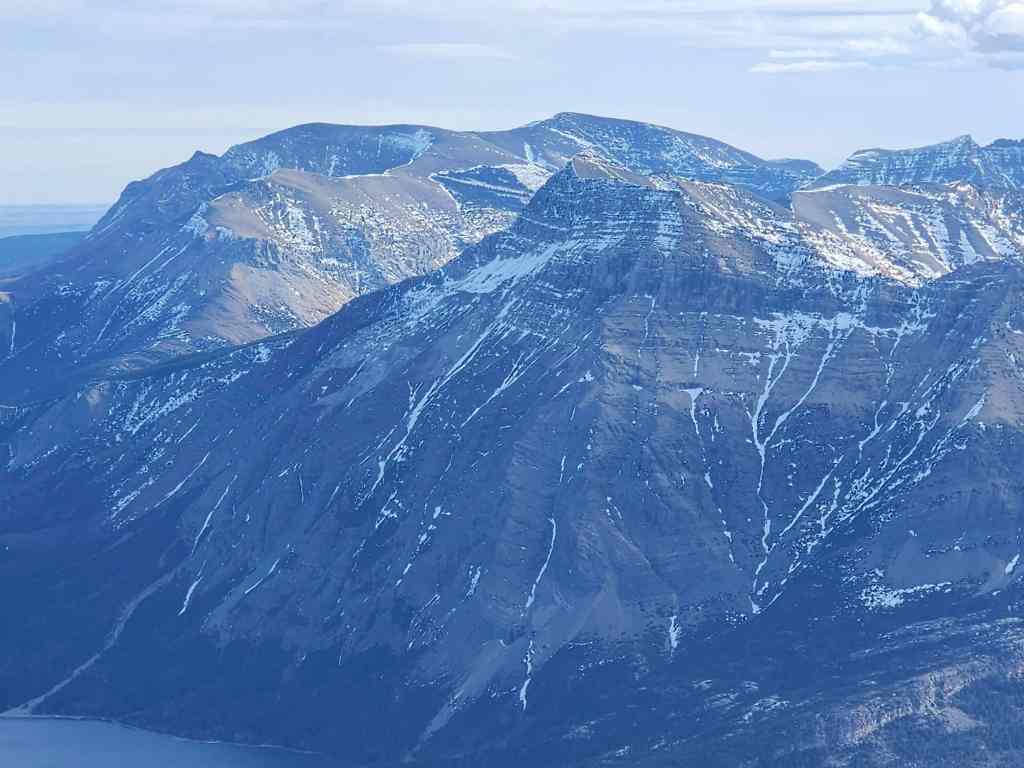
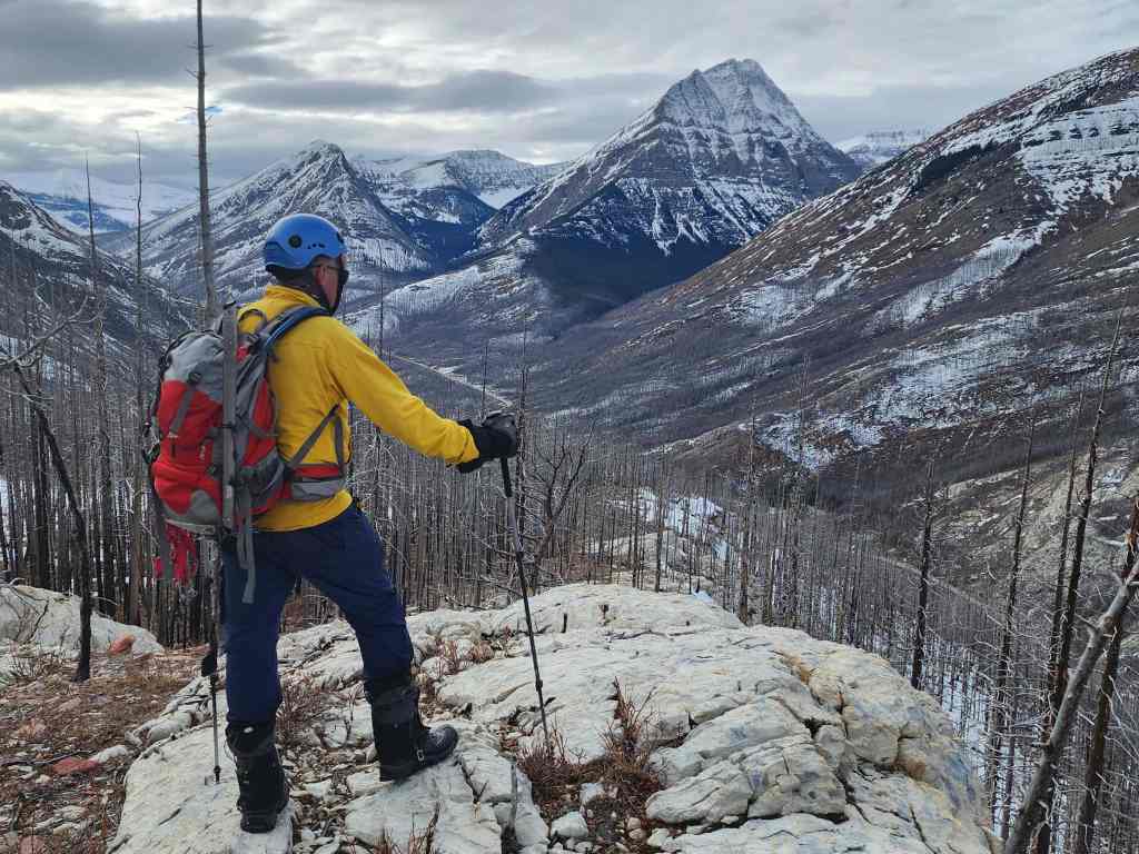
Looking across the valley to Ruby Ridge.

Though entirely avoidable, we decided to explore an inviting rock band. (Photo by Andrew Nugara)

Enjoying some minor scrambling. (Photo by Andrew Nugara)

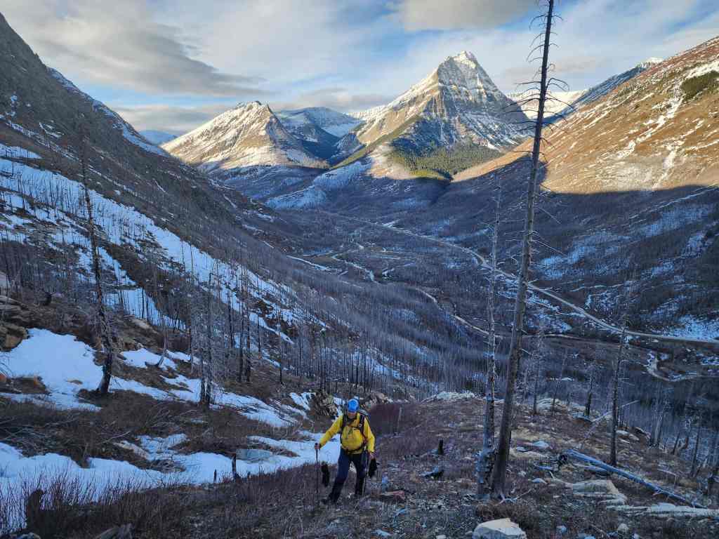
Now that the views were beginning to open up, it was hard to not take a bazillion photos. 😁 This is Mount Lineham…
Followed by Rowe East (foreground; left of centre).
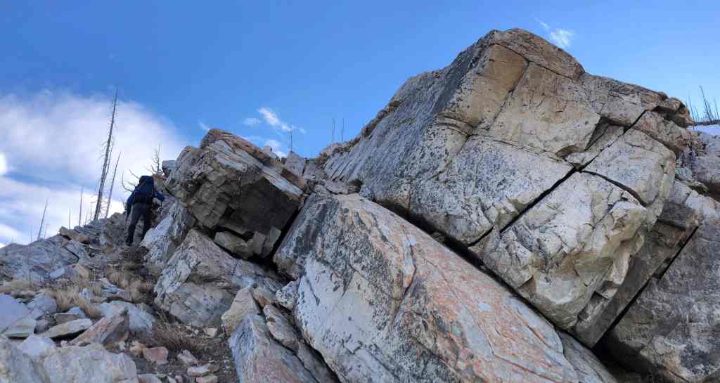
Enjoying our climb along the rock band. (Photo by Andrew Nugara)
Needless but fun scrambling. (Photo by Andrew Nugara)

Andrew follows me up.
It’s the beginning of February and there’s barely any snow. 😳
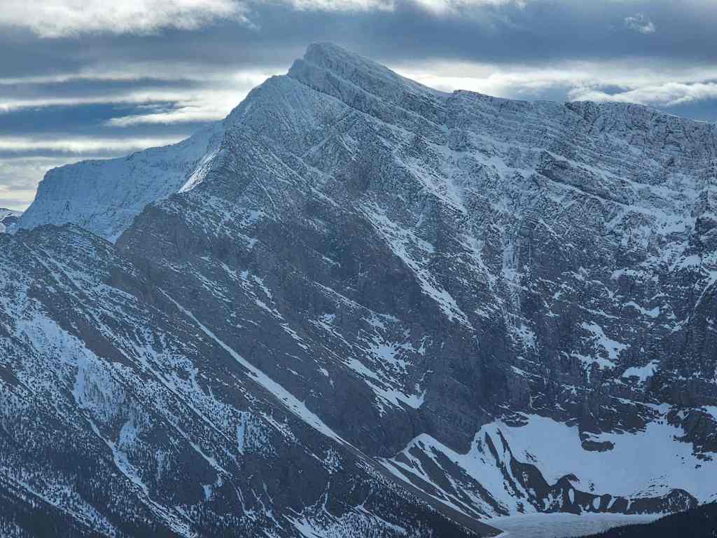
Andrew stops to admire Mount Galwey (centre) and “Rogan Peak” (left).
A closer look at the high point that sits on the other side of the bowl.

Zooming in on some frozen snow melt.
It’s straight up from here.
And yet another look back. 🙂

Andrew checks out the pinnacles on the high point.

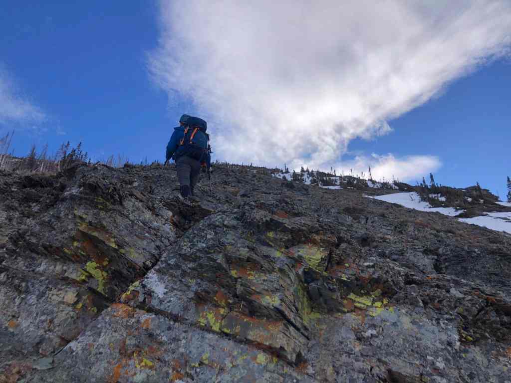
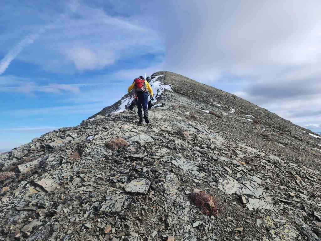
Nearing the end of our travel along solid rock.
What a gorgeous day! 🙂 The wind can rip through this valley and with little shelter on ascent and none on the ridge, it would definitely make this a miserable outing. This is why I’ve had to postpone this trip so many times.
The first of a couple cool shots by Andrew…. (Photo by Andrew Nugara)

And now the second. 🙂 (Photo by Andrew Nugara)

Arriving at the start of a snow gully…

Unfortunately, we could only use parts of it for ascent because it was mostly hardened ice.

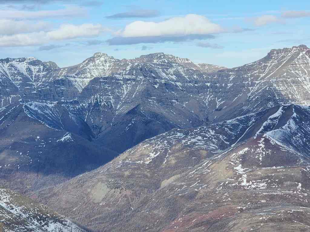
From left to right: “Dundy Peak”, Mount Dungarvan, “Rogan Peak”, and Mount Galwey. With the lack of snow, I’m sure most of these are ascendable.

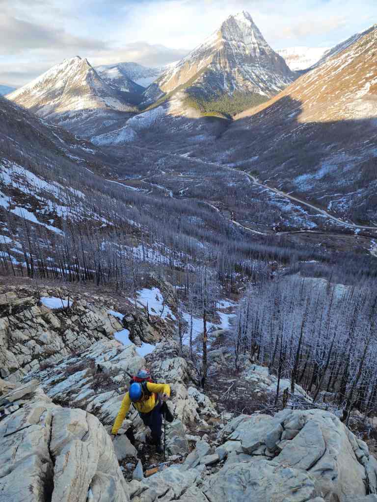
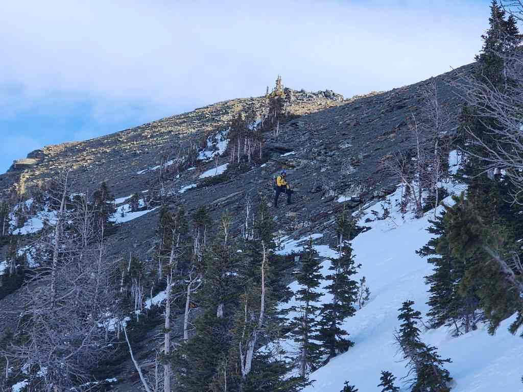
Loose scree will turn the upper portions of the slope into a slog. (Photo by Andrew Nugara)
Heading over a section of red argillite and yellow lichen. (Photo by Andrew Nugara)
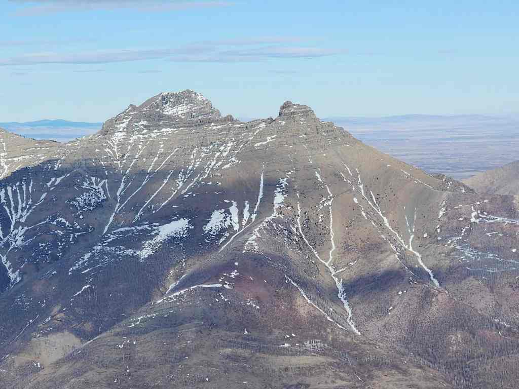
Looking over at the summit of the other unnamed peak on Buchanan Ridge. I’ve taken to calling it “The Senator” after Senator William Buchanan, though Andrew has used the witty, “Buchanan, The Middle Child”. Whatever, you want to call it, it’s a cool peak that I one day look forward to visiting. 🙂 Edit: Done! (Photo by Andrew Nugara)
While I have mixed success ascending the snow…
Andrew has better luck on the scree.

Almost on the ridge.
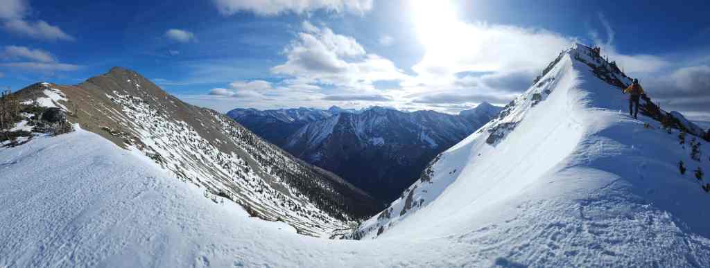
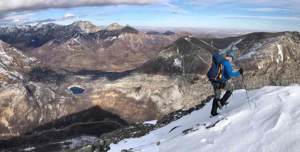
Awesome views from the ridge! (Photo by Andrew Nugara)

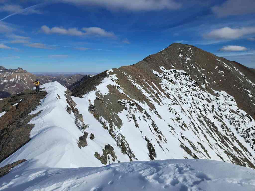
The summit of Buchanan Northeast is on the right. (Photo by Andrew Nugara)
I join Andrew on the ridge. (Photo by Andrew Nugara)
Before heading to the summit, we decided to check out the views from the top of a nearby high point (right).

Andrew leads the way.

There may not have been much snow, but I still managed to bury myself up to my chest. 😂

Nearing the top of the high point.
Andrew’s view back. (Photo by Andrew Nugara)

My turn to lead. (Photo by Andrew Nugara)

Fantastic views! (Photo by Andrew Nugara)
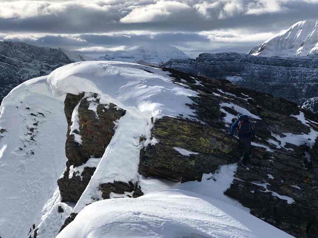
Scrambling onto the high point. (Photo by Andrew Nugara)
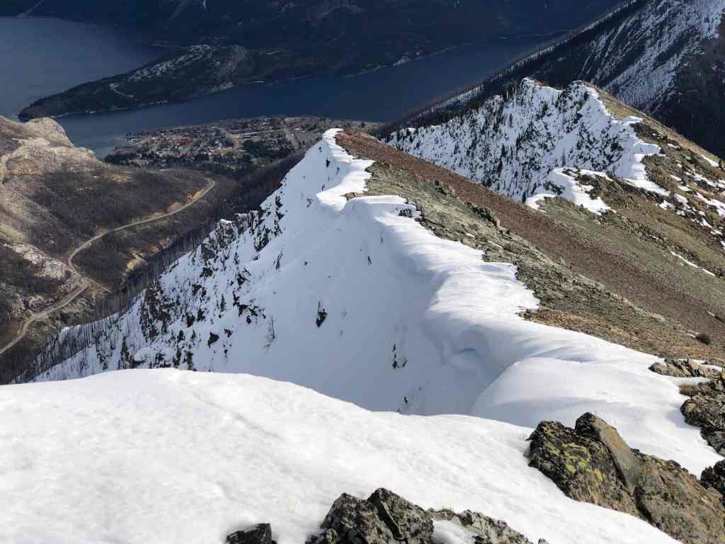
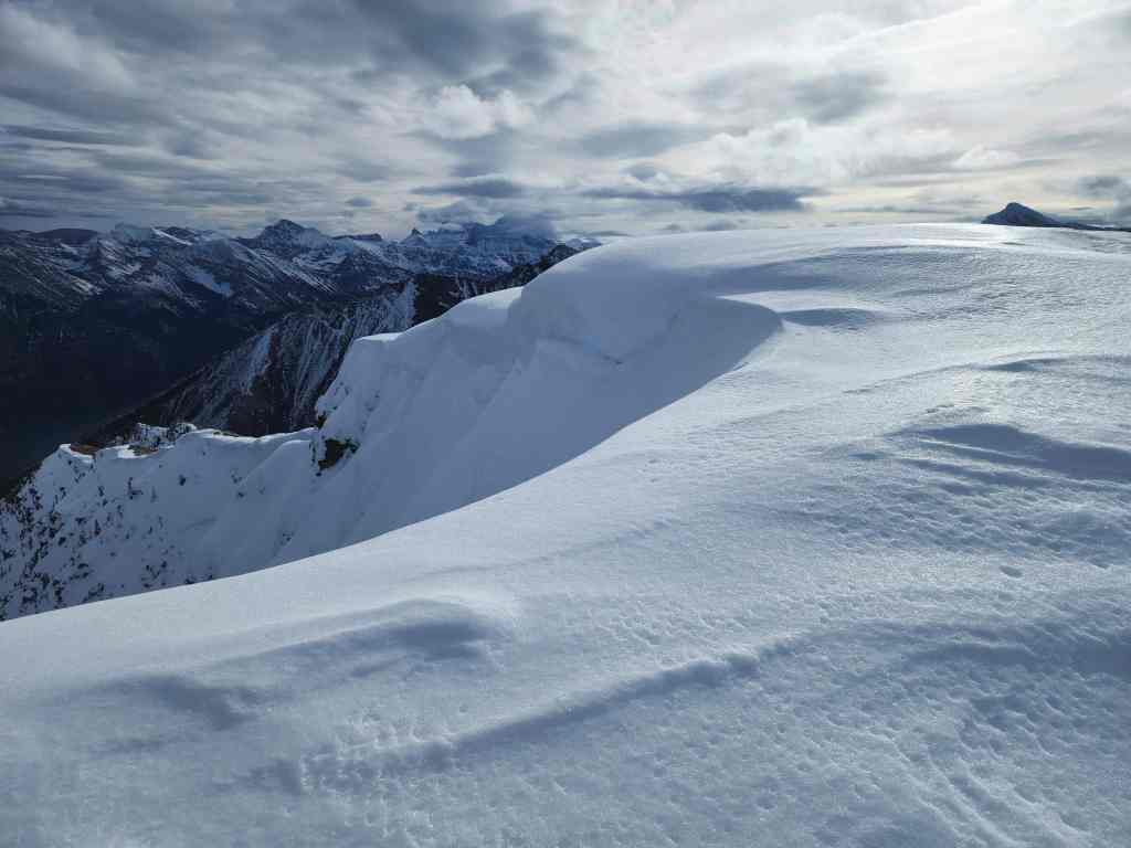
Standing next to a cool cornice. (Photo by Andrew Nugara)
My view back to Andrew.

Now a wider view…
And then another.

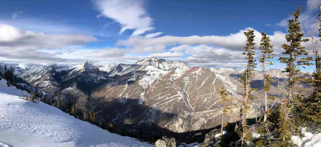
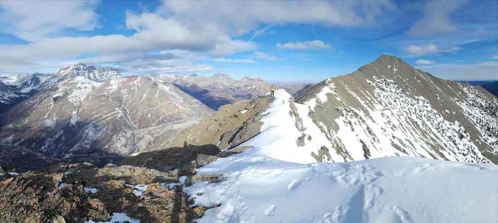
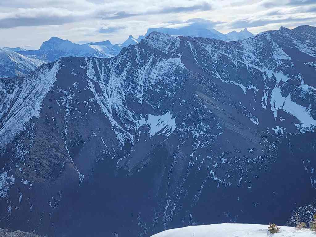
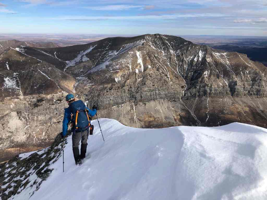
The view along the connecting ridge to “The Senator” (right). Behind it is the summit of Buchanan Ridge (centre) along with Mount Carthew (left).
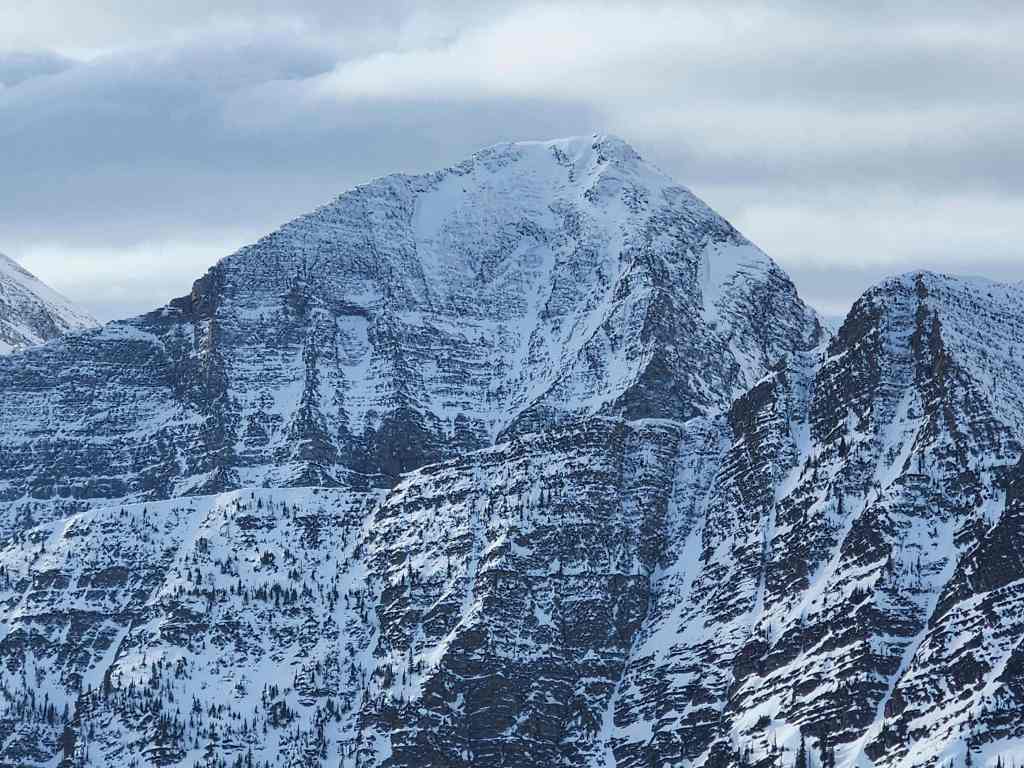
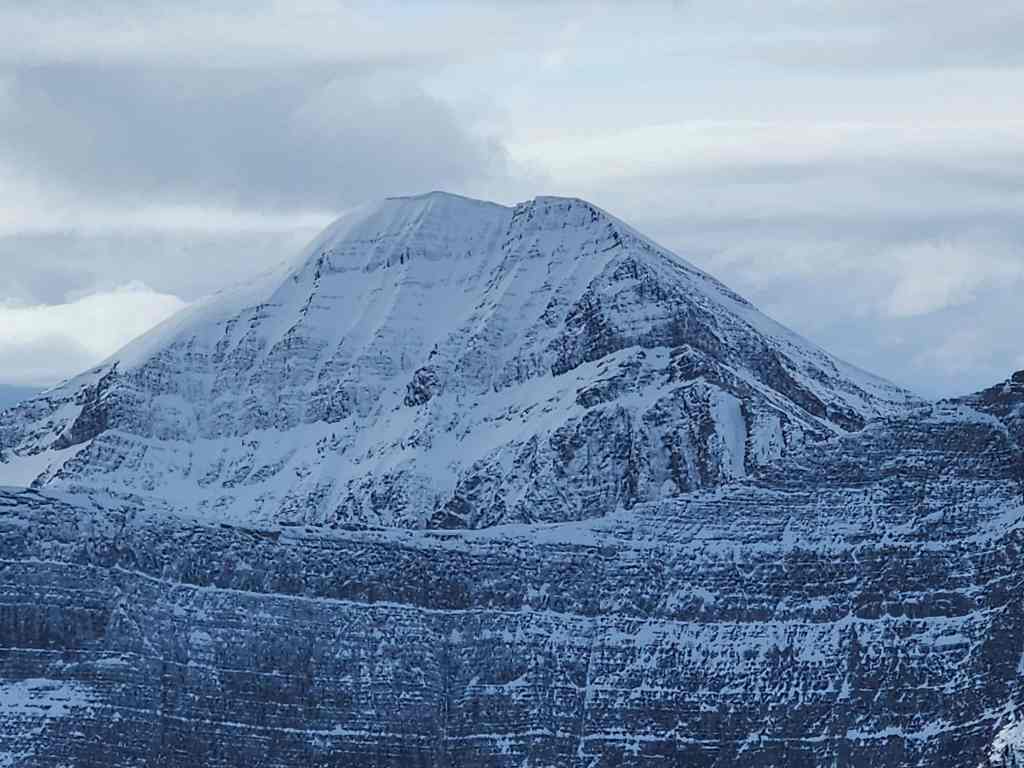
A closer look at the summit of Buchanan Ridge…
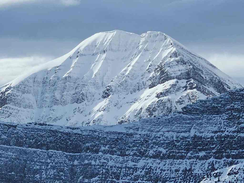
And then Mount Carthew.
Gazing over to Mount Alderson…
And then Akiiohtaikiistakoo (Bertha Peak).

At least Long Knife Peak has some snow. The only problem is that it sits on the other side of the Divide.

Looking over at Mount Rowe (left) with “Rowe East” in front of it.
Mount Lineham looks impressive.
Ruby Ridge (foreground) with Piinaquiium (Mount Blakiston) behind it.

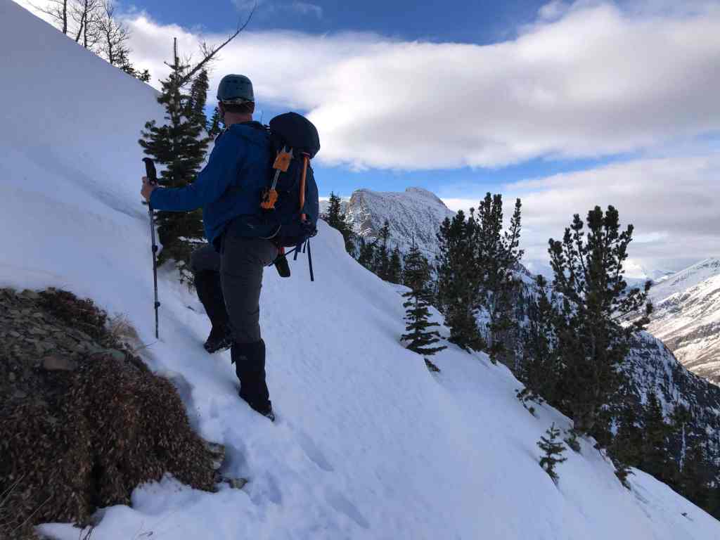
I ‘gracefully’ cross some snow as we leave the high point. 😂

I then make my way (lower centre) onto the col with the summit. (Photo by Andrew Nugara)
My view back to Andrew.

A wider view of the previous photo.

Andrew arrives onto the col.

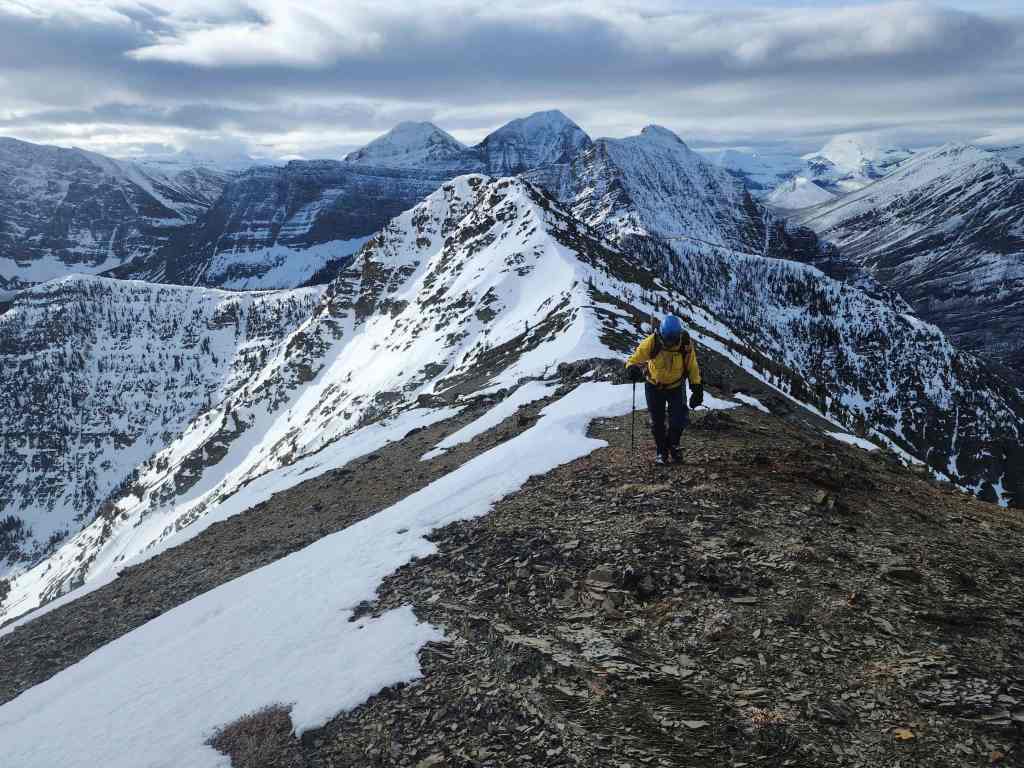
From the col, it’s an easy hike to the summit.

Andrew’s view back from the previous photo. (Photo by Andrew Nugara)
Now its my turn to look back.
Almost there.

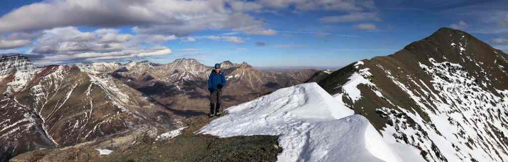
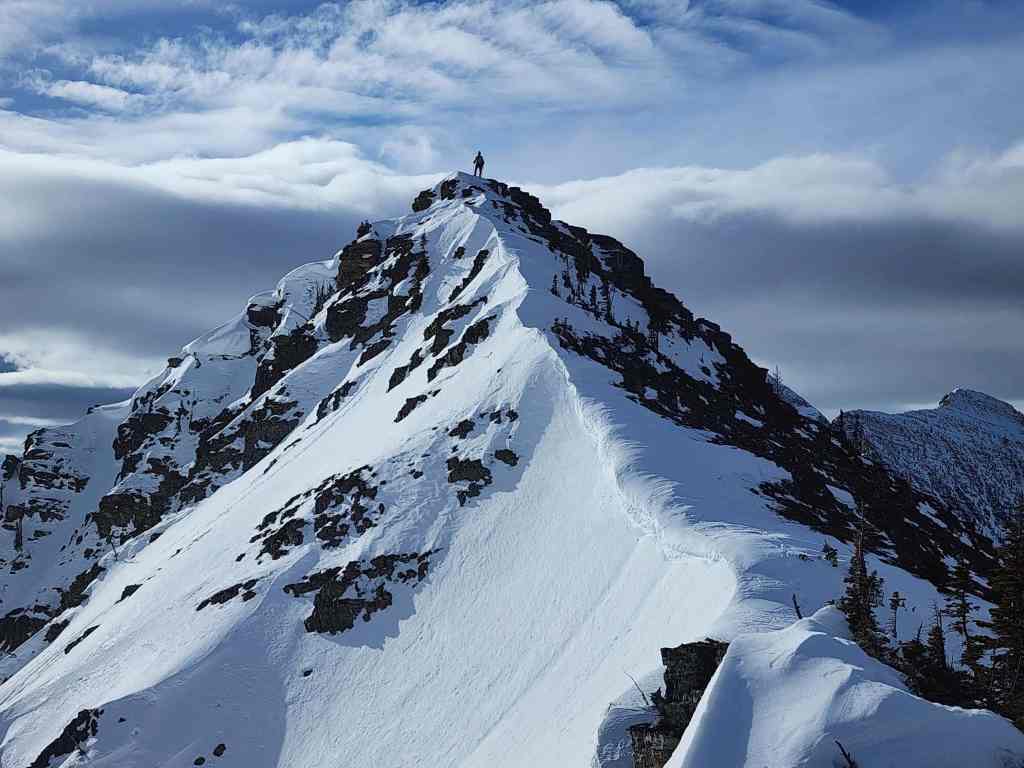
The summit of Buchanan Northeast (2424 mm). It’s also referred to as Buchanan East, but in reality, it sits more to the northeast of Buchanan Ridge than to the east. At the end of the day however, it’s really tomato (tomayto) versus tomato (tomahto) and you can call it what you’d like. 🙂

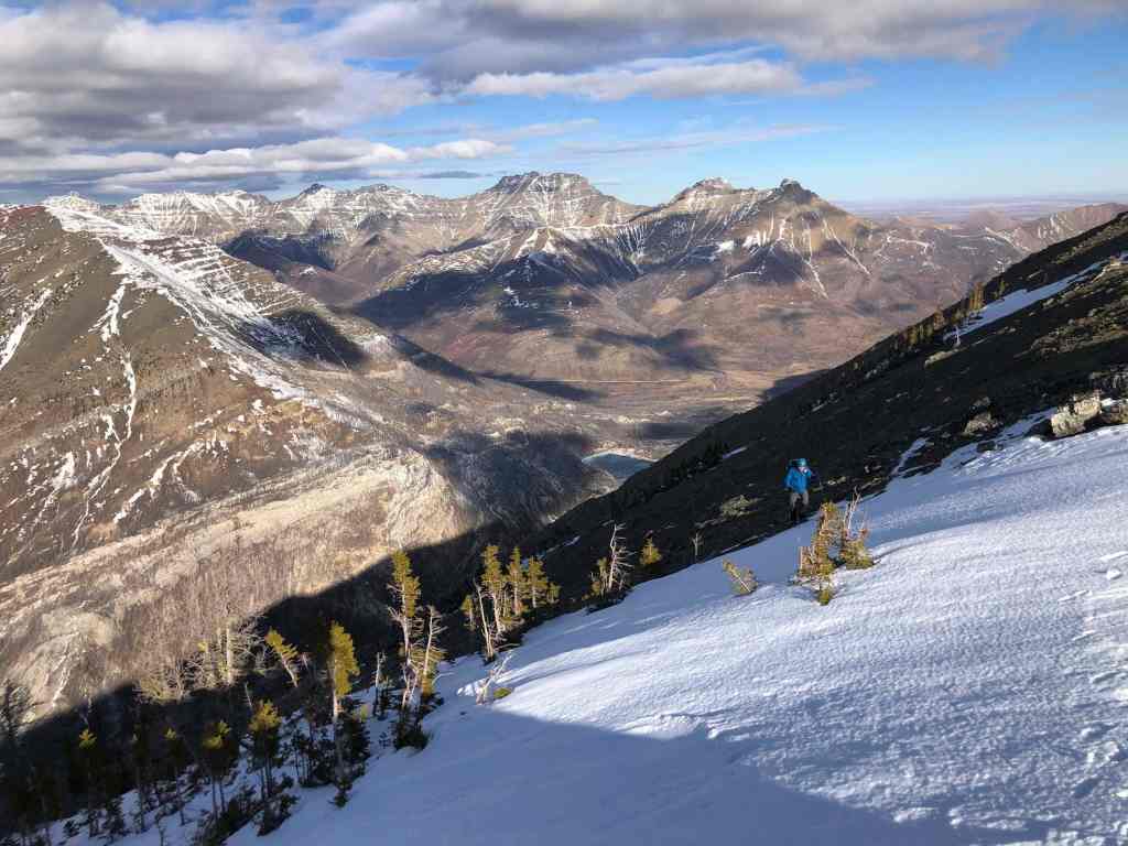
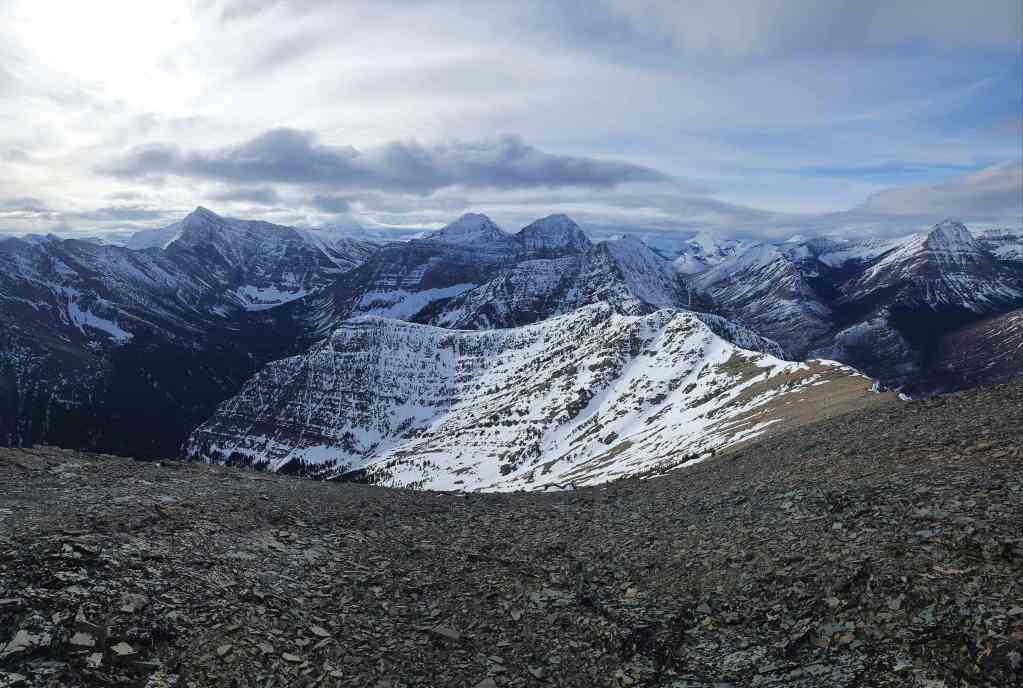
A pano to the the east…
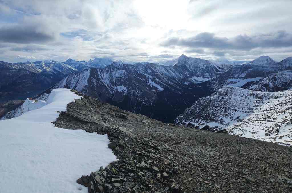
And then to the southeast.
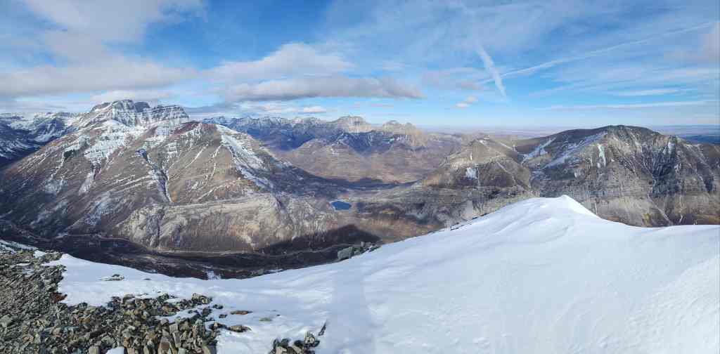
Gazing to the southwest…
And then to the west.
Looking to the north…
And then north again. 🙂

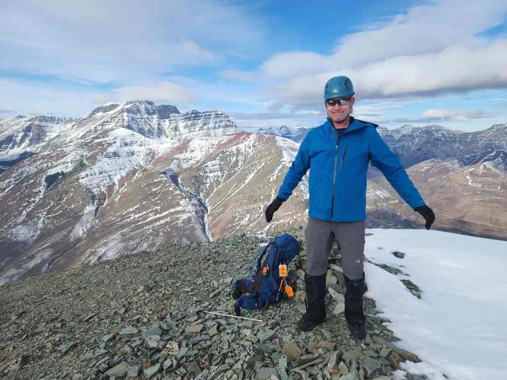
A beautiful day meant we could hang out and enjoy the views. (Photo by Andrew Nugara)

A closer look at Mount Crandell.

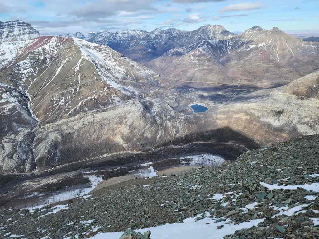
Looking down at the Waterton Lakes and townsite.
Zeroing in on Istiikoiistakoo (Sofa Mountain) and Saakiihmabii (Vimy Peak).
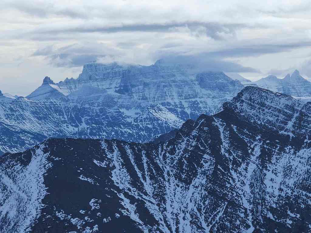
A beclouded, Niitaaspiitaa (Mount Cleveland), with Akiiohtaikiistakoo (Bertha Peak) in the foreground.

Mount Alderson and Alderson Lake.

Lots to look at in this photo including Mount Carthew (left), Buchanan Peak (left), Buchanan Ridge (centre), and “Senator Peak” (right).
My second time up Mount Carthew was an awesome snowshoe adventure with Andrew and Mark. 🙂

A closer look at Buchanan Ridge.

It would be very difficult to reach “The Senator” from Buchanan Northeast.

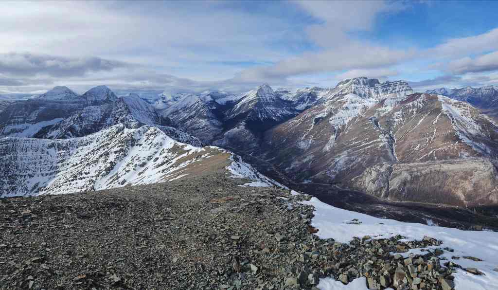
Looking over at Mount Rowe (left of centre).

Mount Lineham (left) with Mount Hawkins on the far right.

Ruby Ridge with Piinaquiium (Mount Blakiston) behind it.
Phew! That narcissistic ram didn’t steal my truck. 😂
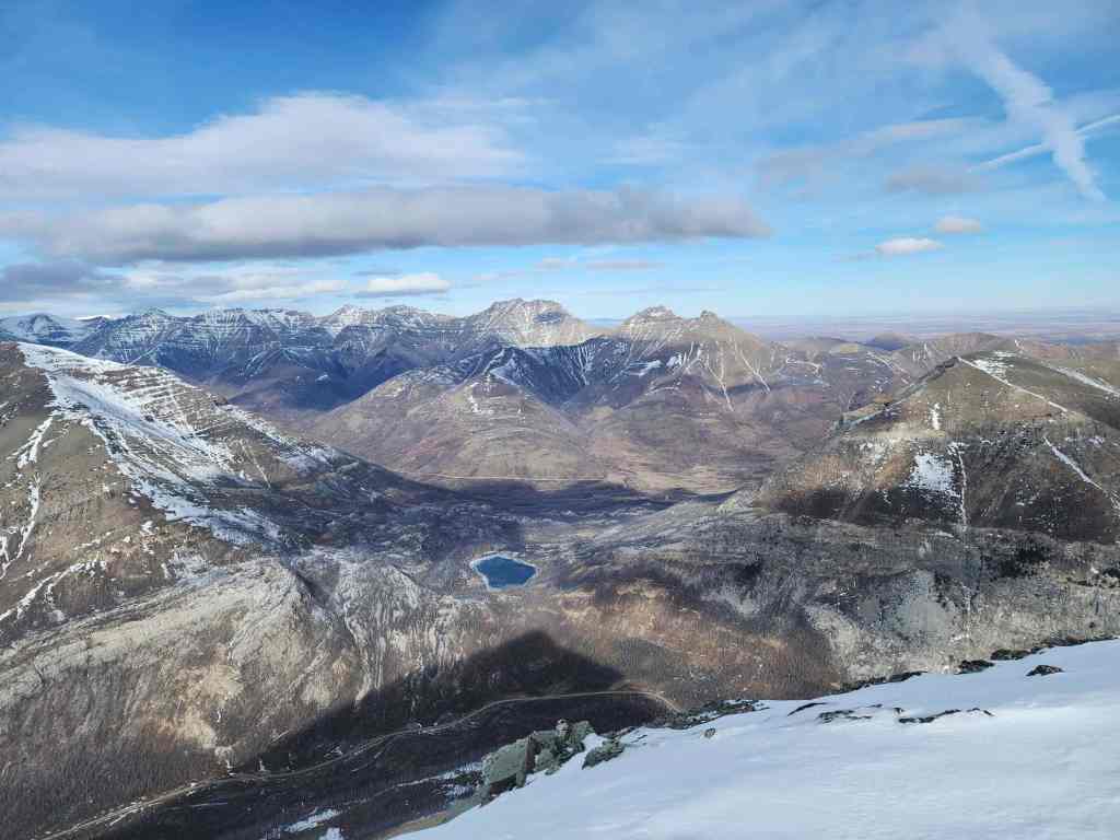
There are lots of fun peaks in this photo! From left to right: “Cloudowan Peak” (far left), Cloudy Ridge (left), “Cloudy Junior” (centre), “Dundy Peak” (centre), and Mount Dungarvan (far right).

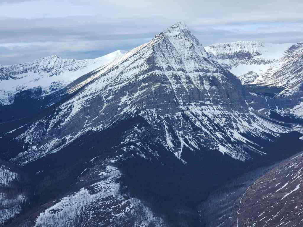
A closer look at Mount Dungarvan.
Galwey North, “Rogan Peak” and Mount Galwey.

Zooming in on Crandell Lake.

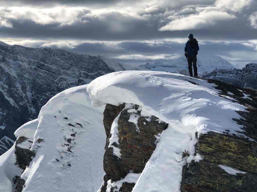
Another look to the east. (Photo by Andrew Nugara)
Cool cornices along the ridge. (Photo by Andrew Nugara)

I photograph Andrew while he photographs me. 🙂

The first of two photos he took. (Photo by Andrew Nugara)

And now the second. The crazy dude on the summit looks like he is talking to the cairn. 😂 (Photo by Andrew Nugara)

Andrew’s fourth(?) time on the summit…
I tried a few ‘jumping for joy’ photos but didn’t include them because it’s not good for anyone. 😂 (Photo by Andrew Nugara)
Time to head back. (Photo by Andrew Nugara)
We would descend the north slope directly beneath the summit. (Photo by Andrew Nugara)
One more look at the summit.

Carefully making our way down.
In hindsight, we should have kept as far to skier’s right as possible. This would have allowed us to avoid a cliff band along with the time it took to traverse above it.

The slope is steeper than it looks.
Glancing back to the summit.

Another look at the Waterton townsite.

Heading skiers left when we should’ve gone right.
The snow didn’t help as it was mostly ice. We followed this gully to the top of a large cliff band. (Photo by Andrew Nugara)

Traversing to skier’s right to bypass the cliff.

Yeah, okay… While Andrew climbed higher to try and avoid this obstacle, I traversed across it for about 50 m before down-climbing it by making hand and footholds as I went. If the Sword of Damocles hangs above, then the Sword of Testocles hides below. This was definitely my biggest concern! 😂

Almost down.

Admiring how I outsmarted the Sword of Testocles. 😂
Andrew, who also had his own adventure getting through the snow, rejoins me at the bottom.

Following the giant ramp that will take us back.

The cliff we avoided by traversing to skier’s right.
From here, it will be an enjoyable ~2 km hike back to the creek and our vehicle.
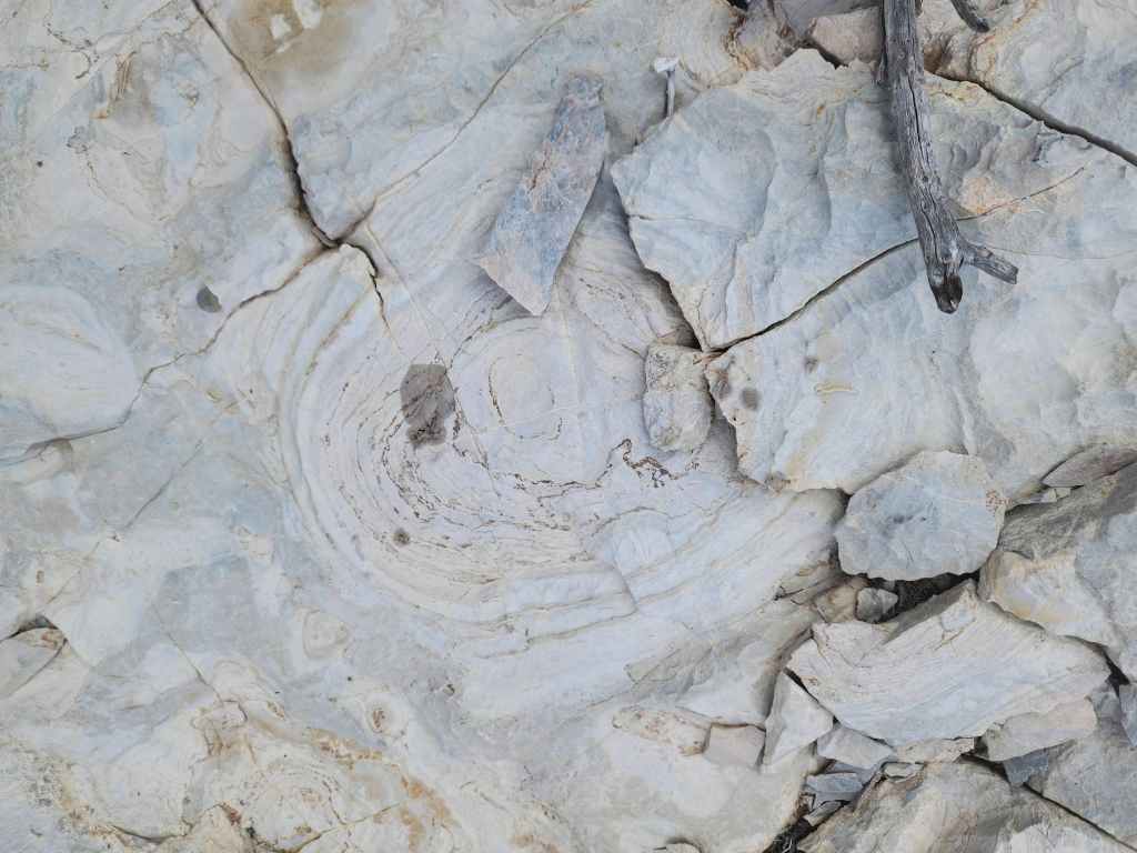
I think these are fossilized trees…
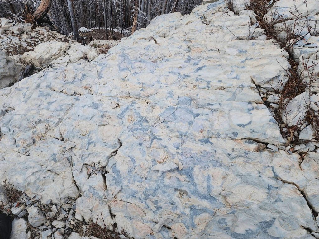
More of the same.

Still enjoying the views.

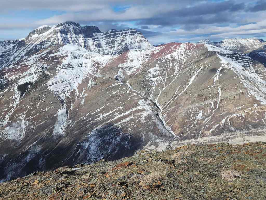
Looking towards Akamina Ridge.
Posing beside a lone chunk of red argillite. (Photo by Andrew Nugara)

The parking lot is directly in front of us.
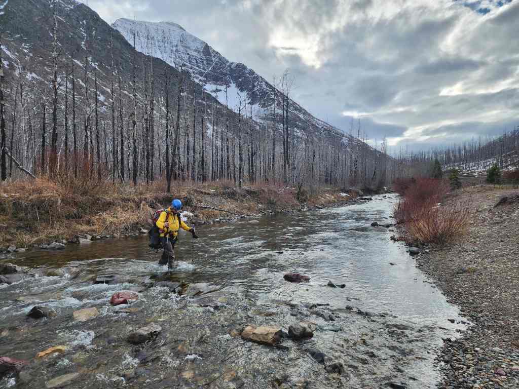
Crossing Cameron Creek.
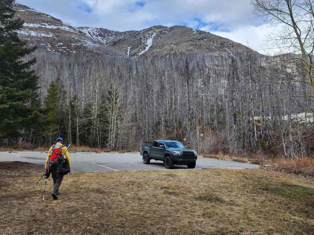
Arriving back at my truck 8.3 km and 5 hours and 38 minutes after starting. I’d waited a long time to find a perfect weather window for this peak, knowing it would be incredibly miserable if it were windy. Though it was more foreshortened than I had anticipated, the great views definitely made up for it. Thanks again to Andrew for repeating this trip and for another fantastic day on a mountain. 🙂